
The best hidden hill towns you can reach by train in Marche
Marche goes up quickly. Behind the long Adriatic beach the land folds into ridges of clay and limestone, and on top of them sit towns of warm brick, travertine doorways and towers built for looking down valleys. Autumn is the season the region is best at: white truffles dug in the woods above the Metauro, verdicchio from the vineyards around the Esino, plates of vincisgrassi that take a day to build. In winter the ridge towns get fog in the valleys below them and hard clear light on top.
Most visitors to the region stay on the coast, moving between Senigallia, Pesaro and the beach clubs of the Conero riviera, and in August the SS16 and the lidi are full. Those who do head inland tend to make one inland stop, then return to the sand by evening. It is an easy pattern, and it leaves the interior largely to people who live there.
The hills do not stop where the day trips do. The same valleys carry the Ancona to Rome railway and the Fano to Fabriano branch deep into the interior, past gorges, abbeys and brick hill towns that still have a station or a bus meeting the train. Fewer people go to these, and you can get to all of them without hiring a car.
Of the 63 communes we have mapped in Marche, 13 qualify as hill towns you can reach by train: each is an inland hill settlement, and we have confirmed each is reachable without a car. This list is the hidden ones, 10 in all, ordered smallest first. The smallest, Genga, has 1,682 residents.
Elsewhere in the catalogue: The best hill towns you can reach by train within 90 minutes of Ancona and The best hidden towns you can reach by train that eat well in Marche.
Genga
Why visit Genga
Genga sits at 322 meters on the Sentino river in the Apennine foothills of the Marche, seven kilometers downstream from Sassoferrato and twelve north of Fabriano. The commune is the ancestral seat of the della Genga, the noble family that gave the Catholic Church Pope Leo XII, born at the Castello della Genga in 1760.
The territory is best known for the Grotte di Frasassi, a thirteen-kilometer karst system whose entrance was found in 1971 and opened to visitors in 1974. The Abisso Ancona, a single chamber roughly 180 by 120 meters and nearly 200 tall, is large enough to hold the Milan cathedral.
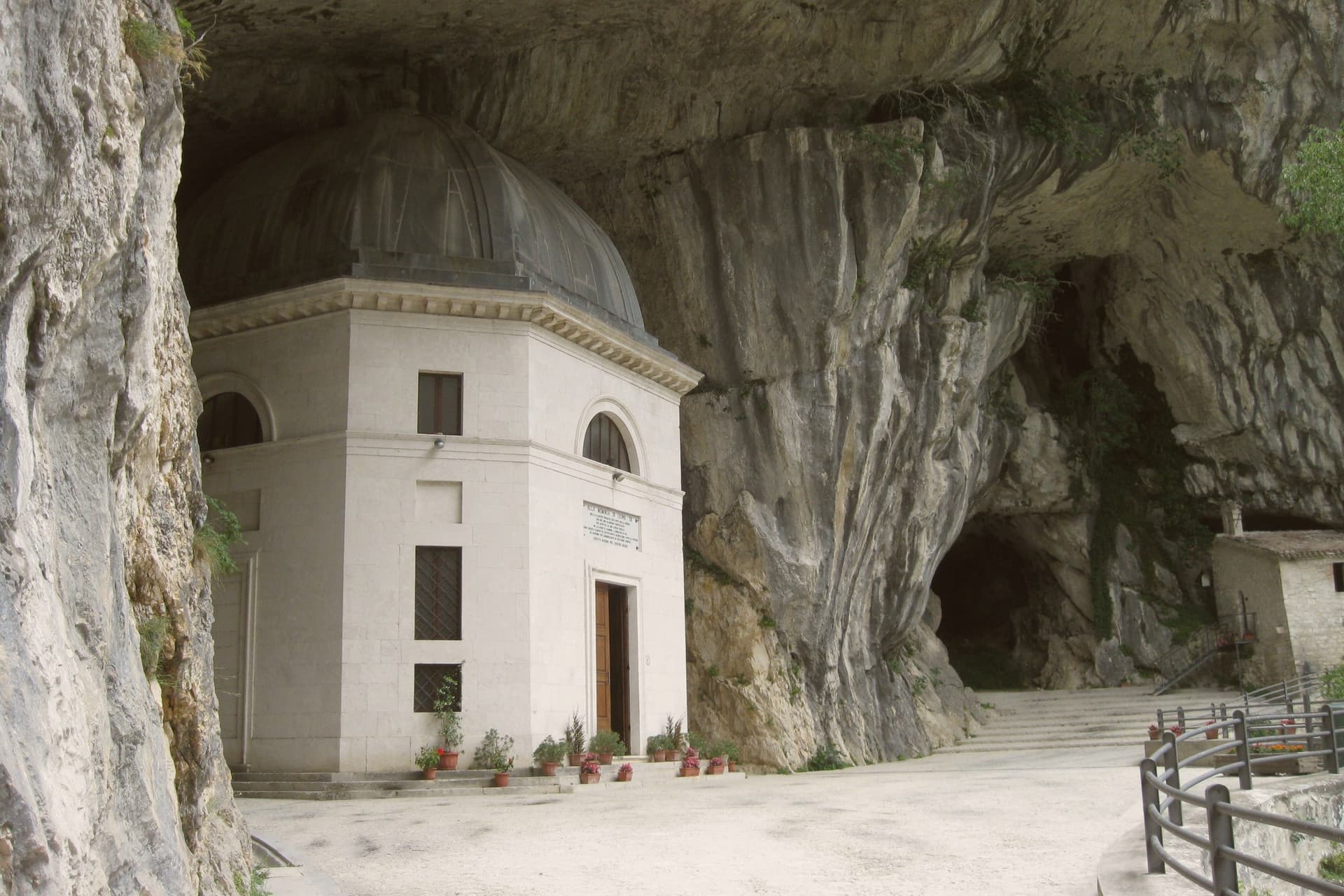
Above the cave entrance, the Tempio del Valadier, an octagonal neoclassical chapel set into a cliff wall, was commissioned by Leo XII from Giuseppe Valadier in 1828. The Abbazia di San Vittore alle Chiuse, a Romanesque Benedictine church on a Greek-cross plan, stands at the gorge mouth and dates to before 1080.
We confirmed you can reach this one by train.
What to see in Genga
- Grotte di Frasassi. Thirteen kilometers of karst passageways found in 1971 and opened in 1974, with the Abisso Ancona chamber 180 by 120 meters wide and 200 meters tall.
- Tempio del Valadier. Octagonal neoclassical chapel commissioned by Pope Leo XII from Giuseppe Valadier in 1828, built of travertine and set into the cliff above the gorge.
- Abbazia di San Vittore alle Chiuse. Romanesque Benedictine church on a Greek-cross plan with four columns, built of local limestone, attested before 1080 at the mouth of the Frasassi gorge.
How to get to Genga
There is a railway station in the town, so you can arrive without a car and never need one while you are here. Ancona is roughly 62 minutes away by road.
Our tip
April through June and September into October are the best months for Genga. The Sentino valley turns green from April, the limestone gorges hold the cool, and the woodland trails through the Gola della Rossa park stay open through autumn. The Frasassi caves run at a constant fourteen degrees year-round; a light jacket is needed even in August.
Serra San Quirico
Why visit Serra San Quirico
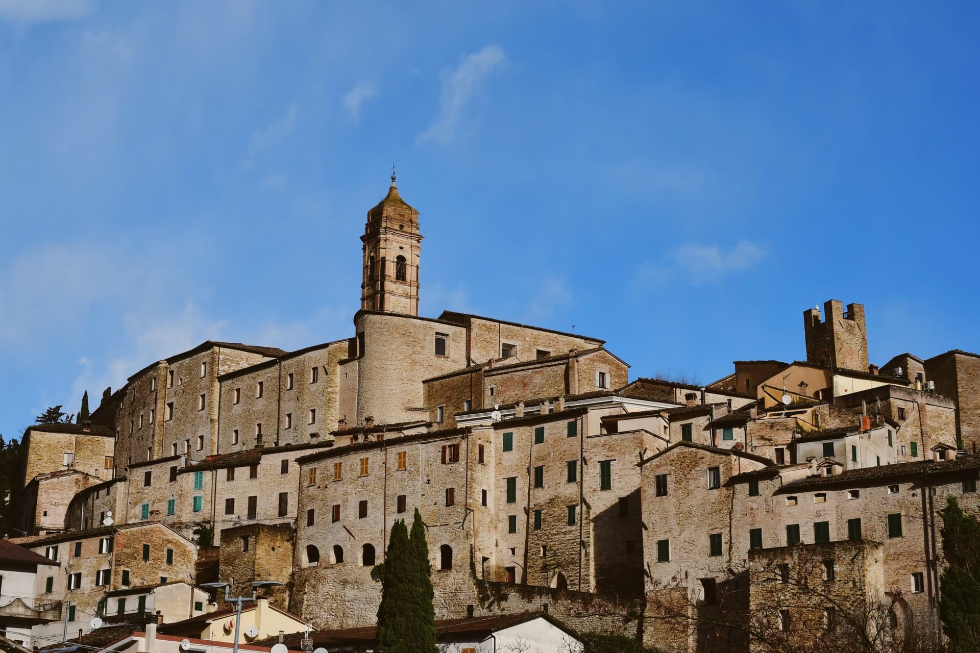
Serra San Quirico sits at 409 meters on the left bank of the Esino river, at the foot of Monte Murano and the entrance to the Gola della Rossa, forty-five kilometers from Ancona. Etruscan, Picene and Roman remains have been found in the area; the Romans established a military garrison that grew into the original village.
The medieval town is built almost entirely in stone and rock, ringed by walls dating to around 1300. Above those walls run the Copertelle, covered passageways that line the outer circuit, the true visual signature of the borgo.
The Santa Lucia complex, the former monastery in the centro storico, houses the headquarters of the Parco Naturale Regionale della Gola della Rossa e di Frasassi, the 9,167-hectare regional park that runs from Serra south to the Frasassi caves. The Chiesa di Santa Lucia, baroque inside with marble decoration and gold-leaf stucco, sits next door.
The Festa del Centro Storico in late July fills the stone lanes with theatrical reenactments.
We confirmed you can reach this one by train.
What to see in Serra San Quirico
- Le Copertelle. Covered passageways running above the medieval outer walls from around 1300, the true visual signature of the stone borgo.
- Chiesa di Santa Lucia. Baroque church in the centro storico, with marble decoration, gold-leaf stucco and a Pasqualino Rossi seventeenth-century altarpiece.
- Parco Naturale Gola della Rossa e di Frasassi. 9,167-hectare regional park with headquarters at the Santa Lucia complex in the centro storico, running south to the Frasassi caves.
How to get to Serra San Quirico
There is a railway station in the town, so you can arrive without a car and never need one while you are here. Ancona is roughly 49 minutes away by road.
Our tip
April through June and September into October are the best months for Serra San Quirico. The Esino valley turns green from April, the Gola della Rossa runs cool through the limestone walls, and the autumn light brings out the stone of the Copertelle along the outer ring. July and August touch the high twenties at 409 meters; the gorge stays cooler than the valley floor and the centro storico catches afternoon breezes off the ridge. Sagra del Coniglio in Porchetta falls in July.
Acqualagna
Why visit Acqualagna
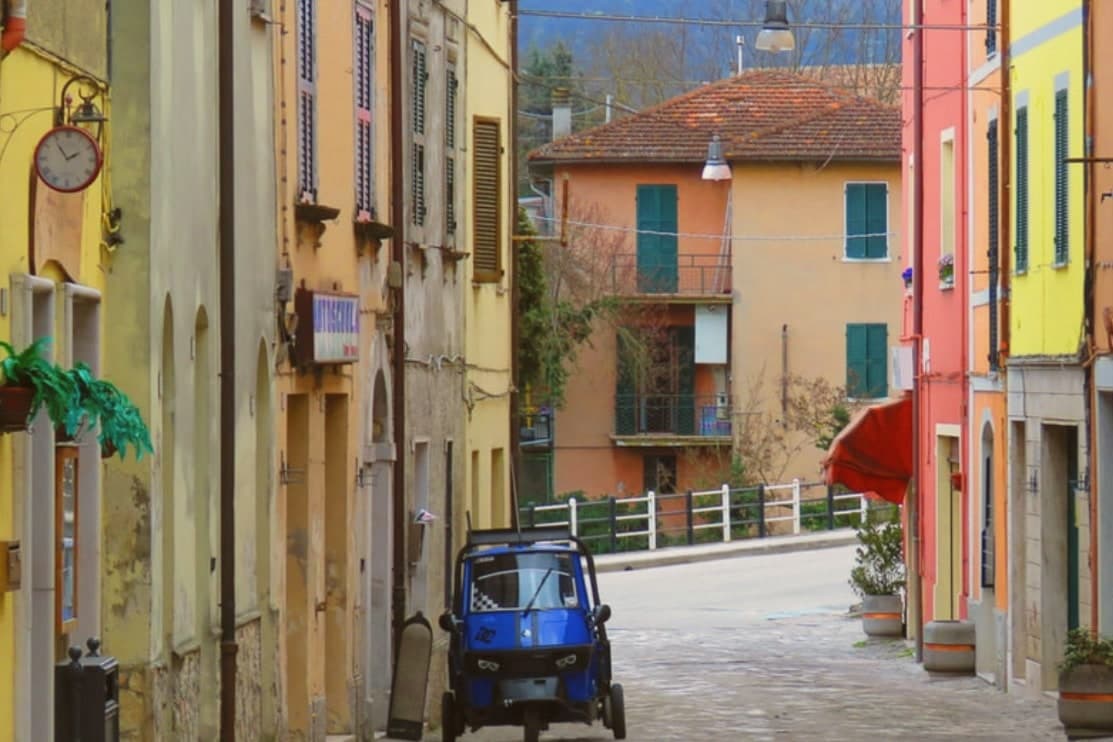
Acqualagna sits at 204 meters in the Metauro valley, twelve kilometers from Urbino, on the plain just downstream from the gorge cut by the Candigliano river. The Roman city of Pitinum Mergens stood nearby until Alaric's Goths destroyed it; the survivors founded Montefalcone, the castle from which today's village grew.
The name Acqualagna comes from Aqua Lanea, water of slaughter, after the sixth-century battle fought on that same plain. Three fairs anchor the year: black truffle on the last Sunday of February, summer black on the last Sunday of July, white truffle across the last weekend of October and the two that follow.
The town below and the gorge above read as one unit, a river valley that has carried Roman road traffic, monastic settlement and truffle trade in turn, each leaving its mark on the ground without erasing what came before.
We confirmed you can reach this one by train.
What to see in Acqualagna
- Gola del Furlo. The gorge narrows between Monte Paganuccio (977 m) and Monte Pietralata (888 m); the 38-meter Roman tunnel, cut in 76 AD, is still driven through by the Via Flaminia today.
- Abbazia di San Vincenzo al Furlo. Medieval Benedictine monastery set into the slopes above the gorge, counted among the oldest religious foundations in the Metauro valley.
- Riserva Naturale Statale Gola del Furlo. Nature reserve established in 2001, covering 3,600 hectares of woodland, grazing land and ridgeline above the river.
How to get to Acqualagna
There is a railway station in the town, so you can arrive without a car and never need one while you are here. Rimini is roughly 81 minutes away by road.
Our tip
April through June and September into October are the months for Acqualagna. The Metauro hills hold their green, the woods around Monte Paganuccio are open for walking, and summer truffle season turns the piazzas over to tasting tables in late July. July and August touch the high twenties; the gorge stays cooler than the valley floor. Fiera Regionale del Tartufo d'Estate falls in August.
Urbania
Why visit Urbania
Urbania sits at 273 meters on the upper Metauro, thirteen kilometers downstream from Urbino. The original Ghibelline village was destroyed in 1277 and rebuilt seven years later by the Provençal Cardinal Guillaume Durand, who renamed it Castel Durante.
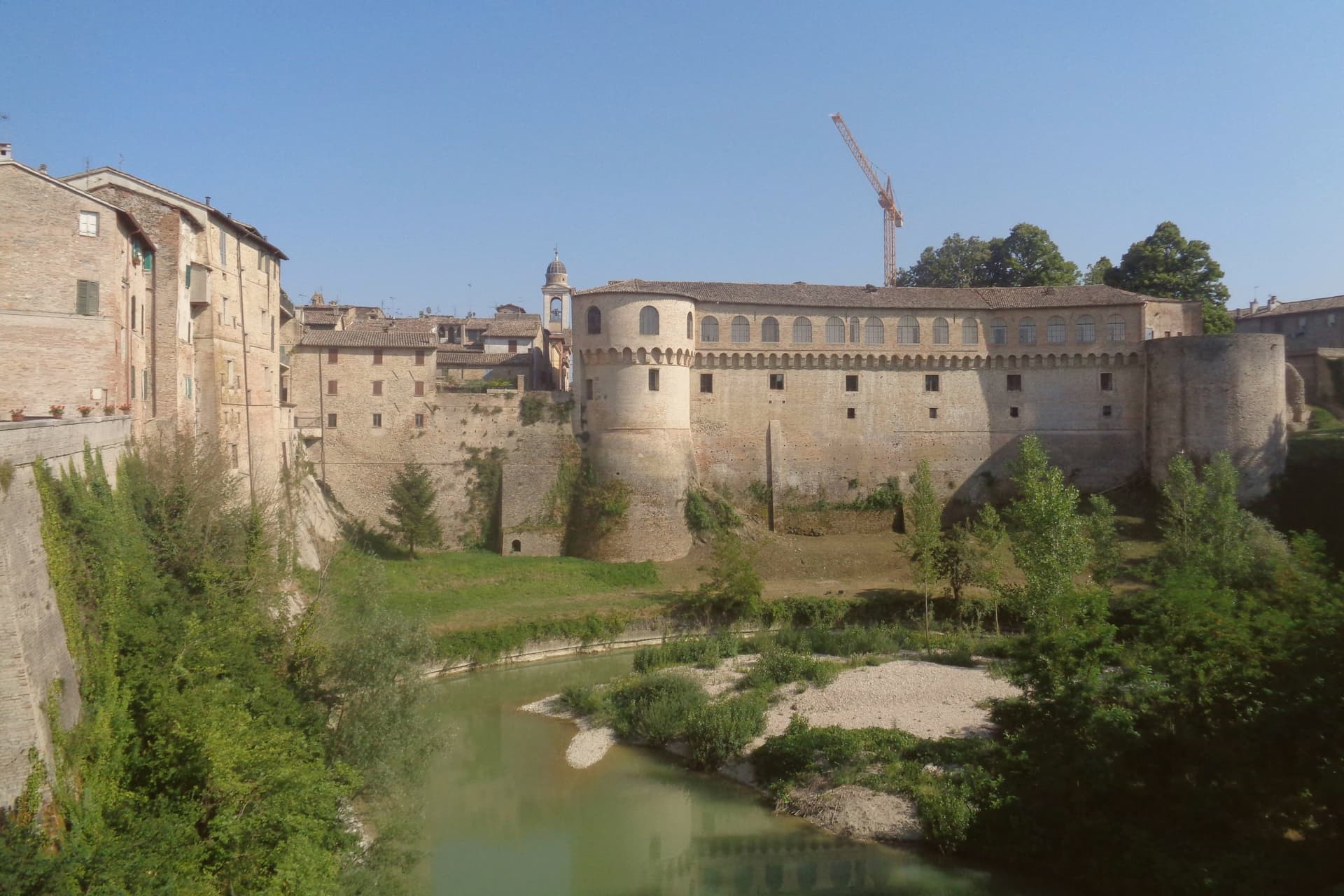
The town passed to the Brancaleoni family in the fourteenth century and to the Dukes of Urbino in the fifteenth, who converted the Brancaleoni fortress into a summer residence and set aside the river island as a hunting reserve, the Barco Ducale, fitted with a small church. Pope Urban VIII renamed the town Urbania in 1636 after his own name.
The centro storico runs along the river, with the cathedral, the Porta Parco and the Loggia dei Mercanti marking the medieval and Renaissance core, while the ducal palace stands apart as the seat built over the old fortress and the Barco as the separated hunting ground across the water. A short walk from the old center, the Chiesa dei Morti holds the mummified bodies moved there once the original graveyard was closed.
Through the sixteenth century the town's maiolica ranked with the work of Urbino and Pesaro, and that production is still carried on today in workshops that keep the same name the town wore before the pope's renaming. A place that changed its name once by papal decree, and kept working in the trade that made it famous under the old one.
We confirmed you can reach this one by train.
What to see in Urbania
- Palazzo Ducale. The older fortress is still legible beneath the ducal remodeling, and the palace was carried to completion by Girolamo Genga after Francesco di Giorgio Martini's original plans.
- Barco Ducale. Hunting estate of the Dukes of Urbino, built 1465 with an attached Church of San Giovanni Battista, expanded 1594-1596 by Francesco Maria II Della Rovere.
- Chiesa dei Morti e Cimitero delle Mummie. Former Cappella Cola, with a Gothic portal. The bodies were moved behind the altar after Napoleon's 1804 burial edict closed the church graveyard where they had originally been interred.
How to get to Urbania
There is a railway station in the town, so you can arrive without a car and never need one while you are here. Rimini is roughly 92 minutes away by road.
Our tip
April through June and September into October are the best months for Urbania. The upper Metauro stays green into early summer, the chestnut woods on the surrounding ridges turn in October, and the river island at the Barco Ducale is open for walking through both seasons. July and August touch the low thirties in the valley; the Palazzo Ducale courtyards stay cool, but afternoon shade is best sought in the porticoes of the centro storico.
Montecosaro
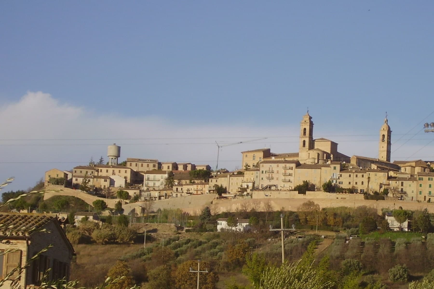
Why visit Montecosaro
Montecosaro sits at 267 meters on a hill above the lower Chienti valley, fifteen kilometers from Macerata and inland from the Adriatic at Civitanova. The first record of a monastery in the river plain dates to 936, when the abbot Ildebrando received the church of Santa Maria from Farfa.
The current Basilica di Santa Maria a Piè di Chienti was raised in 1125 by the Lombard abbot Agenolfo, on the left bank a few kilometers from the river mouth: a three-nave Romanesque church with a raised presbytery and a ring of apsidioles, holding among the strongest Cluniac architecture in central Italy. The hilltop borgo above grew from a medieval castle after 1200, walled in the fourteenth century inside an oval that culminates at the Cassero, the former fortress now a public garden.
The Augustinian convent and the church of Sant'Agostino in the upper town date from the same century, rebuilt in the late eighteenth.
We confirmed you can reach this one by train.
What to see in Montecosaro
- Basilica di Santa Maria a Piè di Chienti. Romanesque church rebuilt in 1125 by the Lombard abbot Agenolfo on a Farfa monastic foundation of 936, three naves with raised presbytery and apsidioles.
- Centro storico. Oval-walled medieval centro storico on the hill, with fourteenth-century walls and concentric streets climbing toward the Cassero.
- Cassero. Highest point of the walled borgo, where the medieval fortress once stood, now a public garden with views over the Chienti valley.
How to get to Montecosaro
There is a railway station in the town, so you can arrive without a car and never need one while you are here. Ancona is roughly 46 minutes away by road.
Our tip
April through June and September into October are the best months for Montecosaro. The Chienti valley turns green in spring and gold through the autumn harvest weeks, with mild afternoons on the hilltop and long views from the Cassero across to the Sibillini. July and August touch the low thirties; the hill catches more breeze than the river plain below, and the Basilica di Santa Maria stays cool through the day. Contesa dei Cento Ducati falls in August.
Matelica
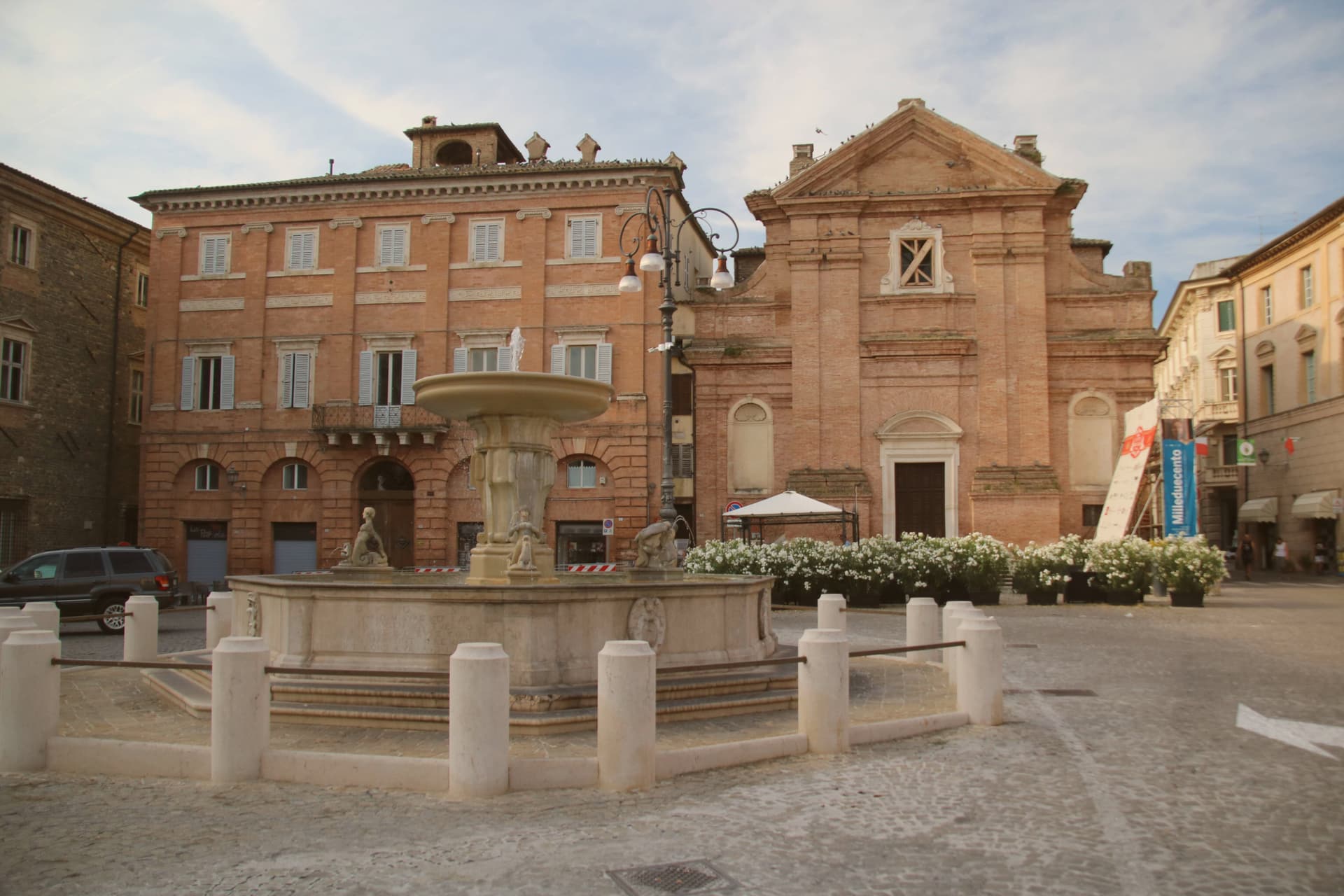
Why visit Matelica
Matelica sits at 354 meters in the upper Esino valley between Monte San Vicino at 1,479 meters to the west and Monte Gemmo at 719 meters to the east. The Picentes and Umbri settled here in the first millennium BC; Rome turned the town into a municipium around 70 BC under the name Matilica.
After the Lombard sack of 578 AD Matelica re-emerged as a free commune by 1160 under its bishop. Verdicchio di Matelica, DOC since 1967, is the smaller and higher-altitude of the two Verdicchio appellations: the closed mountain valley gives the wine a sharper mineral profile than the Castelli di Jesi version closer to the coast.
The Museo Civico Archeologico holds the Globo di Matelica, a thirty-centimeter Roman marble sphere from the second century AD, engraved with lines that may have been used for a sundial. Palazzo Ottoni, built in 1472 on the main piazza, and the Museo Piersanti, the collection of the eighteenth-century papal master of ceremonies, anchor the centro storico.
We confirmed you can reach this one by train.
What to see in Matelica
- Museo Civico Archeologico. Civic archaeology collection holding the Globo di Matelica, a Roman marble sphere of the second century AD engraved with reference lines, possibly a sundial.
- Palazzo Ottoni. Renaissance palazzo built in 1472 by the Ottoni family on the main piazza, now part of the civic administration.
- Museo Piersanti. Late fifteenth-century palazzo holding the collection of Monsignor Venanzio Filippo Piersanti, papal master of ceremonies from 1718 to 1761, with works by Bellini, Salvator Rosa and Carlo Maratta.
How to get to Matelica
There is a railway station in the town, so you can arrive without a car and never need one while you are here. Ancona is roughly 71 minutes away by road.
Our tip
April through October is the working window for Matelica. The Esino valley turns green from April, the Verdicchio vineyards at 400 meters on the surrounding slopes flower in June and color from late August, and the harvest runs through September. June through August touches the low thirties in the valley; the mountain breeze between Monte San Vicino and Monte Gemmo keeps the centro storico cooler than the lowland and the cellars below town hold their constant cellar temperature. Festa del Quartiere Regina Pacis falls in August.
Morrovalle
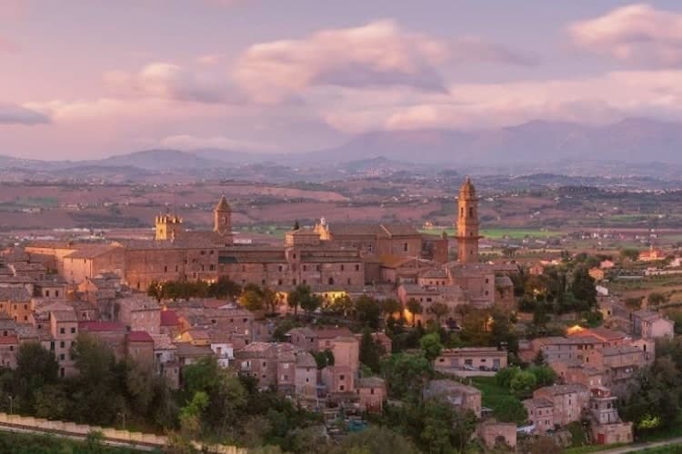
Why visit Morrovalle
Morrovalle sits eleven kilometers east of Macerata, on a hill above the lower Chienti valley. The Roman municipality of Pausolae stood nearby, but the present town grew in the early Middle Ages from a ministerium de Valle dependent on the bishop of Fermo, with a castle called Mor-ro on the hilltop that gradually freed itself from episcopal control.
That castle is the origin of the walled centro storico that still occupies the hilltop today, its layout and signage now recognized as an orange flag town. Just outside those walls stands the former convent, founded around 1290 and now serving as an auditorium.
On the night between 16 and 17 April 1560 a fire destroyed its conventual church, and clearing the high altar on 27 April revealed a consecrated host and a silver pyx intact in a wall cavity, an event a pope authenticated by bull that September. Works recovered from the burned church were later moved to the parish church in the centro storico, tying the hilltop town to the convent below it.
Below both, the slopes descend toward the Chienti, where the same hills that gave the town its defensive position now carry the vineyards of the surrounding wine commune.
We confirmed you can reach this one by train.
What to see in Morrovalle
- Ex Convento di San Francesco (Auditorium Borgo Marconi). Franciscan convent founded around 1290 just outside the walls, its conventual church the site of the fire that produced the Eucharistic Miracle. The building now serves as the municipal auditorium.
- Centro storico. Walled medieval hilltop layout with the signage and visitor route that earned the Bandiera Arancione recognition.
- Palazzo Lazzarini. Noble palace on Piazza Vittorio Emanuele, with a brick facade and a portal that frames the civic centre of the medieval borgo.
How to get to Morrovalle
There is a railway station in the town, so you can arrive without a car and never need one while you are here. Ancona is roughly 50 minutes away by road.
Our tip
April through June and September into October are the best months for Morrovalle. The Chienti valley turns green by late April and gold through August, the hilltop catches Adriatic breezes from the coast eighteen kilometers east, and the Sibillini stay visible on clear afternoons. July and August touch the low thirties, with the centro storico quietest between three and seven. Calici di Stelle falls in August.
San Severino Marche
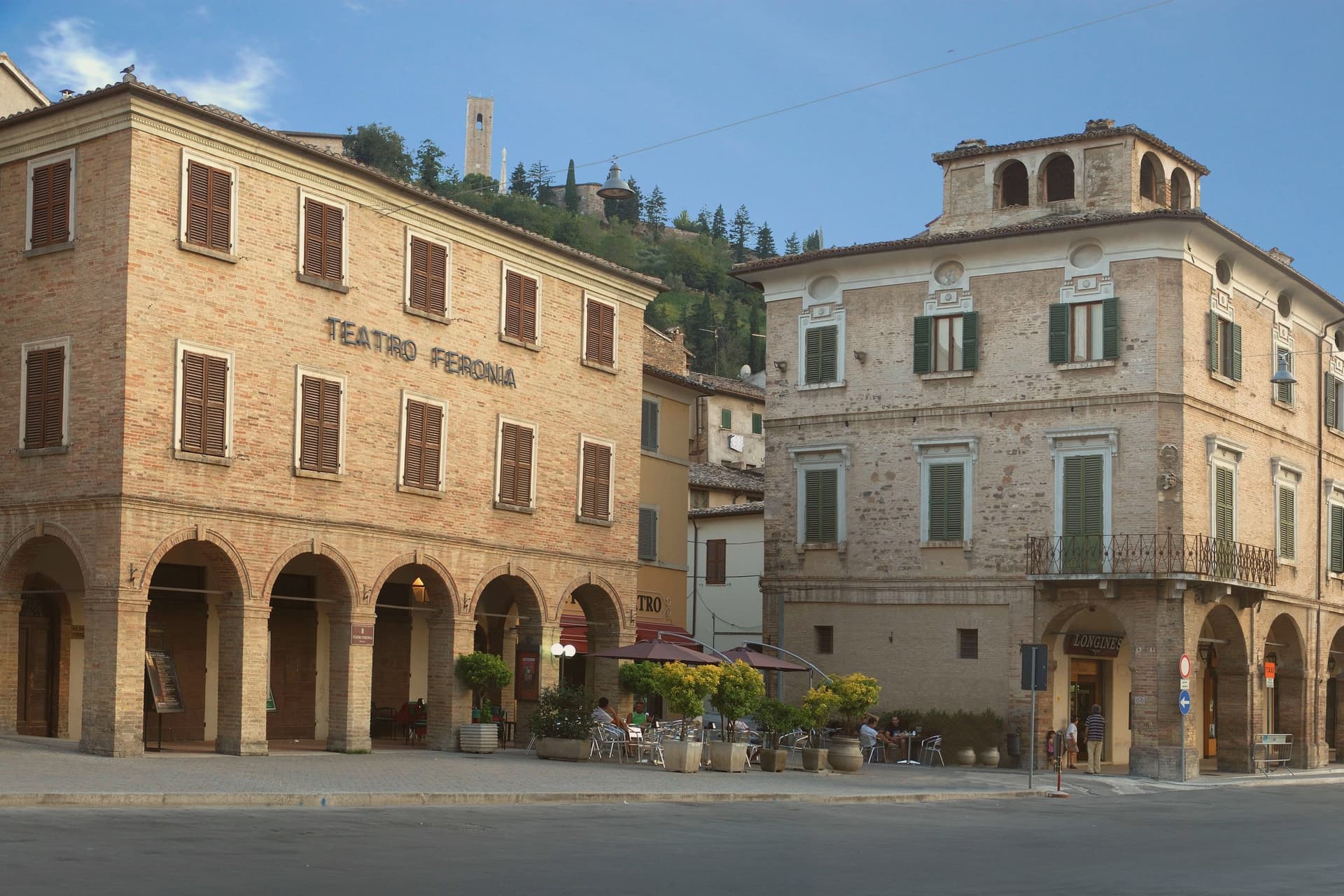
Why visit San Severino Marche
San Severino Marche sits at 235 meters in the Potenza valley, fifty kilometers southwest of Ancona, and the town is built in two distinct pieces rather than one continuous fabric. The medieval Castello occupies the hill above the town, still ringed by surviving city walls, while the Borgo below grew up around its own civic center on the valley floor.
The two parts do different jobs: the hill was governed and defended, walled and towered under the Smeducci dynasty through the fourteenth century, while the valley floor was built for markets and public life, organized around the wide colonnaded ellipse that still serves as the town's gathering space. The Salimbeni brothers, Lorenzo and Jacopo, were born in the town and worked across both halves of it, painting in a hilltop church and in a crypt-church alike, and their frescoes, along with a Vittore Crivelli polyptych, have since been gathered into a civic gallery in the lower town.
That movement of paintings from hill to valley mirrors the town's own shift in weight over time, from a fortified seat of government above to a civic and commercial center below, with the art now sitting closer to the square than to the walls that first sheltered it.
We confirmed you can reach this one by train.
What to see in San Severino Marche
- Piazza del Popolo. The elliptical square anchors the lower town, its porticoes running unbroken around the full curve, giving the Borgo a single continuous gathering space rather than a scattering of smaller squares.
- Duomo Vecchio. The bell tower and the raised setting on Monte Nero are what register first, the cathedral standing above the walls rather than among them. Inside, the chapel that once held the Salimbeni Saint John cycle is now empty, the frescoes moved elsewhere in town.
- Torre degli Smeducci. The tower is the only structure on the hill that reads as purely defensive, plain where the church nearby is decorated, and it still dominates the skyline of the upper town.
How to get to San Severino Marche
There is a railway station in the town, so you can arrive without a car and never need one while you are here. Ancona is roughly 71 minutes away by road.
Our tip
April through June and September into October are the working months for San Severino Marche. The Potenza valley turns green from April, the climb to the Duomo Vecchio holds its best light through the autumn afternoons, and the Palio dei Castelli on the second Sunday of June fills both city centers with neighborhood processions. July and August touch the low thirties; the elliptical Piazza del Popolo offers shaded porticoes through the hottest hours and the lower city empties between four and seven.
Monteprandone
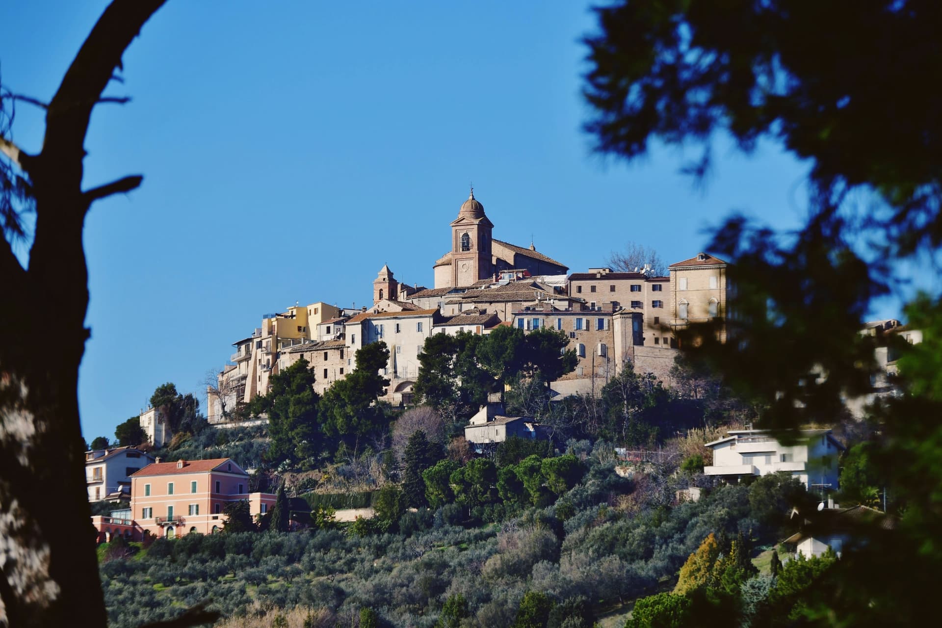
Why visit Monteprandone
Monteprandone sits at 266 meters on a hill above the left bank of the lower Tronto valley, twenty kilometers northeast of Ascoli Piceno and five from the Adriatic at San Benedetto. Tradition traces the founding to the ninth century and a knight from Charlemagne's court named Prandone, who built the first castle.
A papal bull of 13 May 1323 granted the village in perpetual fief to Ascoli Piceno. The walled center still shows this layered history: gates and stepped streets rise from the valley floor toward the summit, where the parish church stands over the plain and the sea beyond it.
The convent that anchors the town's fame sits within reach of that same climb, and the manuscripts once written for its friars now rest in a museum built to hold them. Upper and lower, castle-born and papally governed, the town's shape still traces the fief it became in 1323 and the hill it was built to defend.
We confirmed you can reach this one by train.
What to see in Monteprandone
- Santuario di Santa Maria delle Grazie e San Giacomo della Marca. The convent stands where its founder placed it, the body brought back in 2001 kept within walls that also hold paintings by Vincenzo Pagani and Cola dell'Amatrice.
- Museo Civico dei Codici di San Giacomo della Marca. The volumes are shelved together in the civic museum, pages once meant for the friars and scholars of the convent now under glass for anyone to see.
- Centro storico di Monteprandone. Walled hill village above the Tronto valley, with surviving gates and stepped streets that climb to the church of San Nicolò di Bari at the summit.
How to get to Monteprandone
There is a railway station in the town, so you can arrive without a car and never need one while you are here. Pescara is roughly 59 minutes away by road.
Our tip
April through June and September into October are the best months for Monteprandone. The lower Tronto valley turns green by spring and dry gold through the summer wheat harvest, with the Adriatic visible on clear afternoons and the Sibillini on the inland horizon. July and August touch the low thirties on the hill, with the centro storico quietest in the early afternoon. Festa di Sant'Anna e Sagra degli Spinosini falls in August.
Urbino
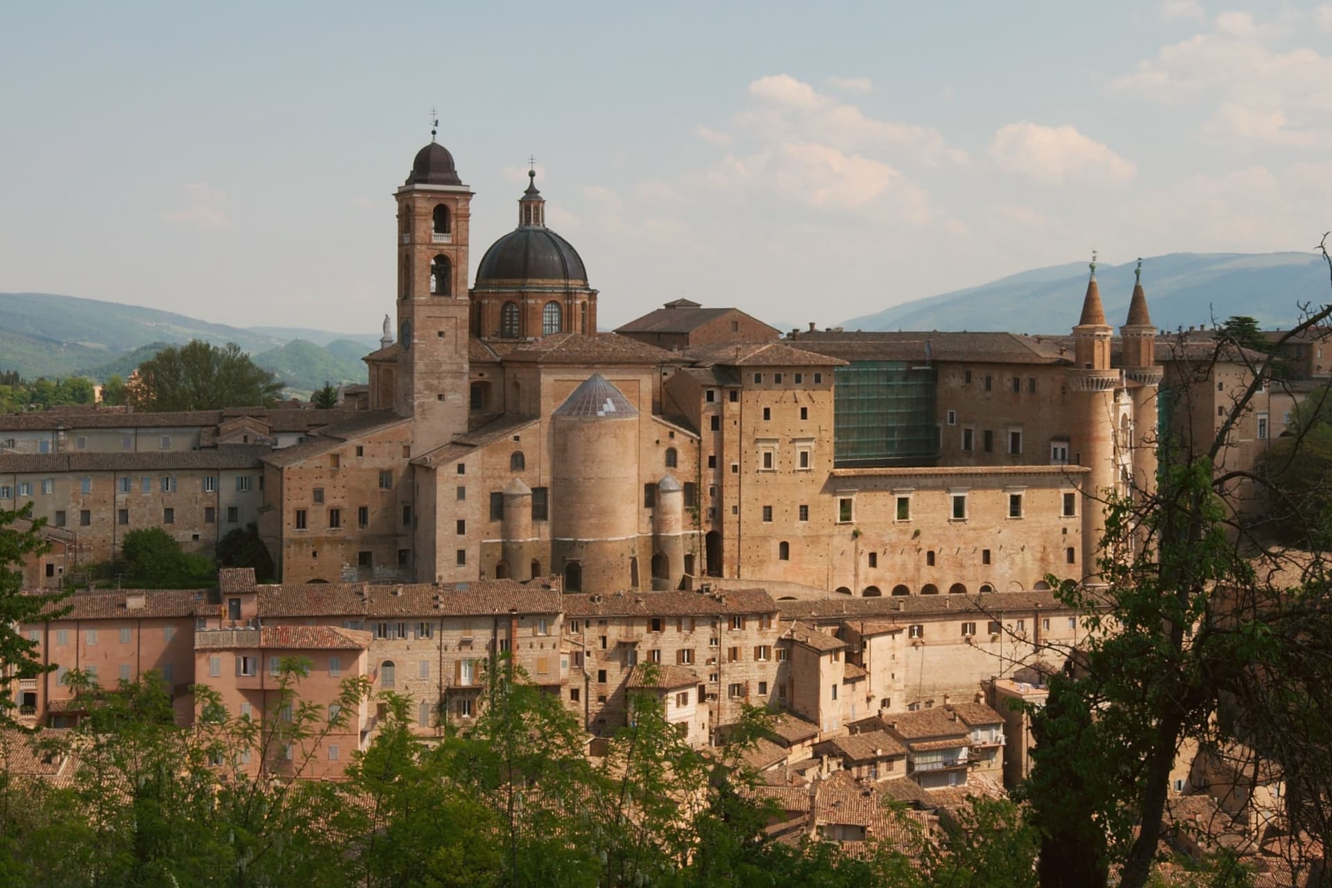
Why visit Urbino
Urbino sits at 451 meters in the Apennine foothills, seventy kilometers north of Perugia, its historic core spread across twin hills with the fortress on the higher of the two and the palace complex below on the other. Federico II da Montefeltro ruled from 1444 to 1482, and under him the town became one of the central courts of the Italian Renaissance: he was condottiere, diplomat, patron and humanist at once, and the building campaign he set running through the 1450s to the 1470s, first under Maso di Bartolomeo, gave the city the asymmetric silhouette that still defines it from a distance.
The university, founded in 1506, keeps that Renaissance investment active in the present rather than fossilized: the centro storico holds roughly 14,000 residents and around 14,000 enrolled students, so the old town runs on a population it did not have in the fifteenth century. The two hills, the ducal seat and the fortress above it, read as the same civic project seen from two elevations: one built to project a court outward, the other to hold the higher ground behind it.
What the 1998 inscription recognizes is that this pairing, court and citadel, survives largely as Federico left it.
We confirmed you can reach this one by train.
What to see in Urbino
- Palazzo Ducale. Federico da Montefeltro's Renaissance palace begun 1444, completed by Luciano Laurana with the twin torricini facade, now housing the Galleria Nazionale delle Marche.
- Galleria Nazionale delle Marche. One of the most important Renaissance painting collections in Italy, with Raffaello, Piero della Francesca's Flagellazione and Madonna di Senigallia, Paolo Uccello and Tiziano.
- Casa Natale di Raffaello. Fifteenth-century house on Via Raffaello where the painter was born in 1483 in the workshop of his father Giovanni Santi, now a museum of the early years.
How to get to Urbino
There is a railway station in the town, so you can arrive without a car and never need one while you are here. Rimini is roughly 65 minutes away by road.
Our tip
April through June and September into October are the best months for Urbino. The hills hold their green, the city's brick warms in afternoon light, and the long climb to the Fortezza Albornoz is bearable in mild weather. July and August touch the low thirties at 451 meters; the Palazzo Ducale stays cool inside, but the steep streets in afternoon sun are slow going.
More from Anywhere Italy
- The best hill towns you can reach by train within 90 minutes of Ancona
- The best hidden towns you can reach by train that eat well in Marche
- The 6 best hidden hill towns with a serious restaurant in Marche
 The 10 best hidden towns with a serious restaurant in Marche
- The best hill towns with a serious restaurant in Marche
 The 10 best hill towns that eat well within 90 minutes of Ancona