
Lazio · Latina
Terracina
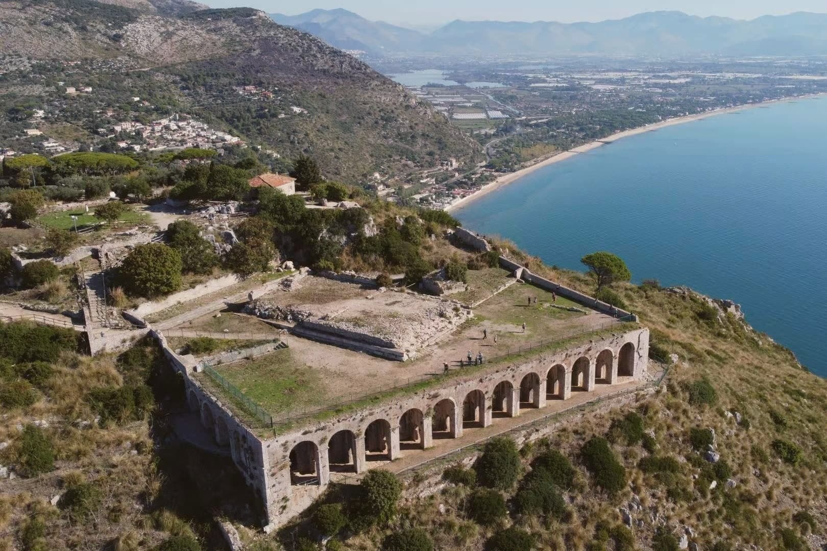
The Volscian Anxur, where a temple to Jupiter sits above a port cut through stone.
- Best time
- May–Sep
- By car
- 1 h 43 min from Rome
- Population
- 44,720
Known for
JUPITER ANXUR
Republican-era Corinthian temple of Jupiter on Monte Sant'Angelo at 227 meters, on twelve great arches over the port.
PISCO MONTANO
Trajan's 109 AD rock cut through the cliff on the Via Appia, CXX inscribed at maximum depth, opened the coastal road.
OLIVE COUNTRY
Città dell'Olio signed for the hill groves above the town and the Itrana cultivar typical of southern Lazio.
DOP ZONES
The commune lies inside the Colline Pontine and Oliva di Gaeta DOP production zones.
When to visit
Best · May–Sep
- J13°
- F15°
- M15°
- A18°
- M22°
- J27°
- J31°
- A31°
- S27°
- O22°
- N18°
- D15°
- Best
- Hot or crowded
- Quiet
- Mostly closed
Daytime averages, 2020–2024. The sea is warmest in August at 27° and coldest in February at 15°. Weather data by Open-Meteo.com.
Why come
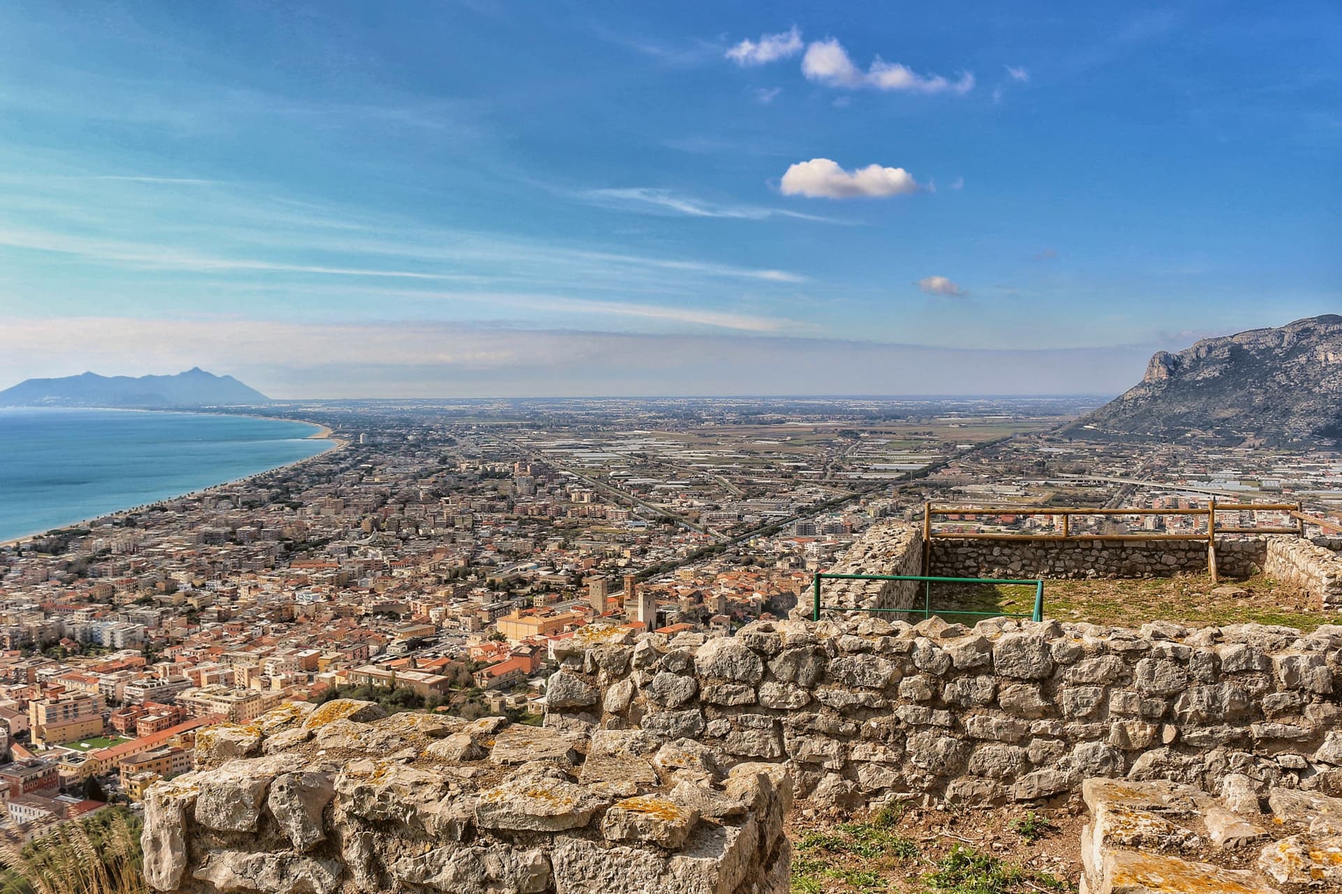
Terracina sits where the Lepini mountains meet the Tyrrhenian Sea, a hundred kilometers south of Rome. The Volsci called it Anxur, the name of the youthful Jupiter who was its tutelary god, and the temple crowning the summit above the port carries that name still. Below it the Roman town spread out along the coast road, its forum paved by a magistrate whose inscription remains underfoot, its capitolium later built over by the co-cathedral.
Where the road met a headland it could not go around, the rock itself was cut away to let it pass, a shelf sliced through stone rather than a path found around it. The upper town, on the mountain, and the lower town, on the plain and shore, read as two different solutions to the same site: one held the god and looked down, the other held the forum, the road, and eventually the harbor. What survives today, the beach, the working fishing port, the olive groves signed for their oil, is the plain continuing to do what it always did, at sea level, while the temple keeps its distance above.
The Sunday letter
Terracina is on our list. Its letter is still to come.
We are writing about all 1,000 of these towns, one at a time, in a free letter every Sunday: the photo, the food, the festa. That is our mission. Sign up and you will be there when Terracina comes up. By Peter & Sophia, from Pietrasanta.
Read on
Terracina in our articles
 The best towns inside a nature park that have a serious restaurant in Lazio6 towns, Terracina among them.
 The best beach towns in the province of Latina7 towns, Terracina among them.
 The best towns that eat well in the province of Latina7 towns, Terracina among them.
 The best towns with a serious restaurant that sit on a walking route in Lazio7 towns, Terracina among them.
How to get there
From Naples / Salerno (NAP), about 2 hours by car.
Rome (FCO) is about 2h 11m away.
By car from the centre of Naples 2h 11m or Salerno 2h 35m.
Coming by train into Latina? Terracina is about 42 minutes away by road.
What to see
Tempio di Giove Anxur
The temple on Monte Sant'Angelo stands on a vaulted substructure, thirty-five by twenty meters, the arcading still visible from below and, on clear days, the view running out past the port to the sea.
Foro Emiliano
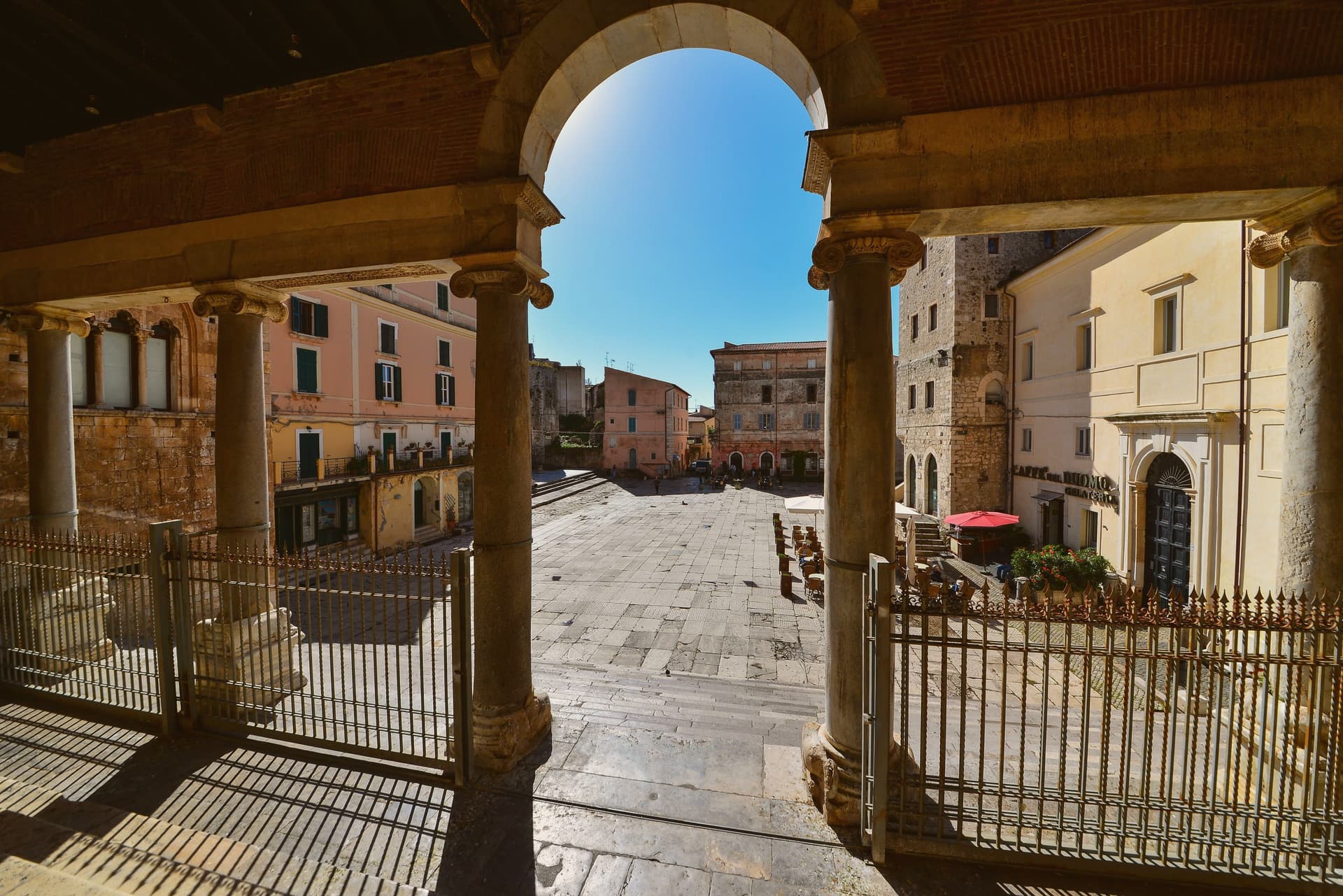
Original limestone-paved Roman forum, bronze-letter inscription of Aulus Aemilius still legible, eleventh forum along the Via Appia from Rome.
Cattedrale di San Cesareo
Co-cathedral consecrated 1074 on the ancient capitolium, Cosmatesque pulpit and pavement, twelfth-century bell tower and portico.
Pisco Montano
The cliff face rises thirty-eight meters straight from the roadside, the cut sheer enough to read as an act of engineering rather than erosion, the depth marking still legible in the rock.
Palazzo Venditti
Medieval-Cistercian palace overlooking the Foro Emiliano next to the Torre Frumentaria, twelfth century, probably the first town hall.
Spiaggia di Terracina
Long sand beach holding the Bandiera Blu, fishing port still active to its eastern end.
The slow-trip planner
Building a trip? Find where Terracina fits in a slow Italy circuit.
Answer five questions. We will shape a geographically coherent slow trip from the 1,000 Italian towns most travelers skip. Yours to save and share.
We recommend
Where to eat
Not our picks, but places the guides put their name to: a Michelin star, a Gambero Rosso fork, a Slow Food snail, a Michelin Key for the hotels. Worth a table, a counter, or a night when you pass through.
Il GranchioRistorante
Il Granchio carries a Gambero Rosso listing.
Locanda AltobelliRistorante
A spot in the Michelin Guide, at Locanda Altobelli.
Locanda RuggieriTrattoria
Locanda Ruggieri carries two Gambero Rosso prawns.
Living here
- Population 44,720
- Remotei
- Pharmacy in town
- High school within a 30-minute drive
- Nearest airport Naples / Salerno, 2 h 6 min drive
- Regional capital Roma, 1 h 43 min drive
Common questions
- What is Terracina known for?
- Terracina is the Volscian Anxur, where a temple to Jupiter sits above a port cut through stone.
- Where is Terracina?
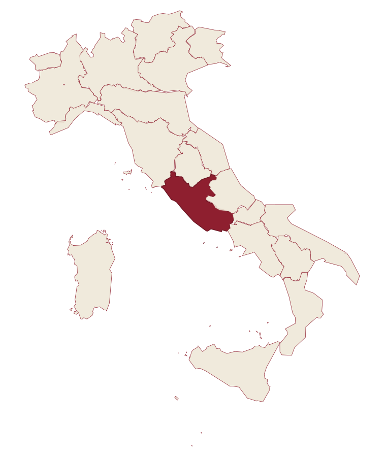
- Terracina is a comune in the province of Latina, in Lazio, at 24 meters above sea level.
- What is the nearest airport to Terracina?
- Naples / Salerno (NAP), about 2 hours by car.
- How long is the drive from Naples to Terracina?
- About 2h 11m by car.
- When is the best time to visit Terracina?
- Best in May–Sep. July is the warmest month, averaging 31 degrees, and November the wettest, with about 15 rain days.
- Which other towns are like Terracina?
- Agropoli, Massa Lubrense and Piombino.
- How many people live in Terracina?
- 44,720 at the 2023 count.
Tags & datadesignations · numbers · sources
The numbers
- Elevation: 24 m
- Population: 44,720
- Surface area: 136.59 km²
These figures were compiled from public directories: ISTAT, OpenStreetMap and Wikidata, and from the official listings of the guides named on this page. Town details change; verify with official sources before you travel.
Similar
Towns like Terracina
Agropoli
Province: Salerno
both on the Tyrrhenian coast · both over 10,000 people
Massa Lubrense
Province: Napoli
both on the Tyrrhenian coast · both over 10,000 people
Piombino
Province: Livorno
both on the Tyrrhenian coast · both over 10,000 people
Forio
Province: Napoli
both on the Tyrrhenian coast · both over 10,000 people
Monte Argentario
Province: Grosseto
both on the Tyrrhenian coast · both over 10,000 people
Procida
Province: Napoli
both on the Tyrrhenian coast · both over 10,000 people
🟦 Bandiera Blu
More Bandiera Blu towns in Lazio
Fondi
Province: Latina
The plain town between the Ausoni and Aurunci mountains where the Caetani built a castle in the middle of farmland instead of on a hill.
Gaeta
Province: Latina
The promontory port where a Bourbon kingdom fell in February 1861 and the south of Italy stopped existing as a state.
Minturno
Province: Latina
A coastal comune at the mouth of the Garigliano, built on the Roman colony of Minturnae.
Sabaudia
Province: Latina
A rationalist city built in 253 days on drained Pontine marshland, founded 15 April 1934 between Lago di Paola and the Tyrrhenian dunes.
San Felice Circeo
Province: Latina
A medieval borgo on the flank of a promontory that Homer made the home of Circe in the Odyssey.