
The 8 best towns inside a nature park that sit on a walking route in Lazio
90 towns visited, 910 to go. Follow along, free: Subscribe on Substack
Lazio outside Rome is built on volcanoes and limestone, and the difference shows underfoot. In the Castelli the ground is dark tufa, cut into blocks for house walls and hollowed out for wine cellars, with crater lakes below the rim and chestnut woods above. South toward the coast the rock turns pale, the hills carry olives and the flat land behind the dunes grows artichokes and buffalo mozzarella. Spring brings wild strawberries and broom on the slopes; autumn brings porcini, new oil and the smell of woodsmoke in stone alleys. The regional nature parks protect most of this, and the long walking routes, the Cammino di San Benedetto and the Via Francigena among them, thread through them stage by stage.
paragraphs are separate; this line is the second: Almost everyone arriving in Lazio goes to Rome and stays there, then takes a day trip to Tivoli for the Villa d'Este fountains and the ruins of Hadrian's Villa. Both deserve the attention, and both absorb coaches from morning until closing. The result is a region read entirely through its capital, with the countryside treated as a half-day excursion rather than a place to walk into. Trains and buses out of Rome are frequent, so the crowd concentrates in a handful of stops.
The same hills, lakes and coast carry on well past the day-trip radius, and so do the footpaths. Inside the park boundaries there are towns where the walking route is the main street, where pilgrims arrive on foot in the late afternoon and the bar stays open for them. They sit above crater water, under beech forest, or on a rock over the Tyrrhenian, and fewer people stop in them. This list gathers the ones that are both inside a regional nature park and a stage on a historic route.
Of the 60 communes we have mapped in Lazio, 8 qualify as towns inside a nature park on a walking route: each sits inside a regional nature park, and each is a stage on one of the long historic walking routes. The smallest, Orvinio, has 396 residents.
If you are still choosing, we have also written The prettiest villages inside a nature park within 90 minutes of Roma and The prettiest villages on a walking route in Lazio.
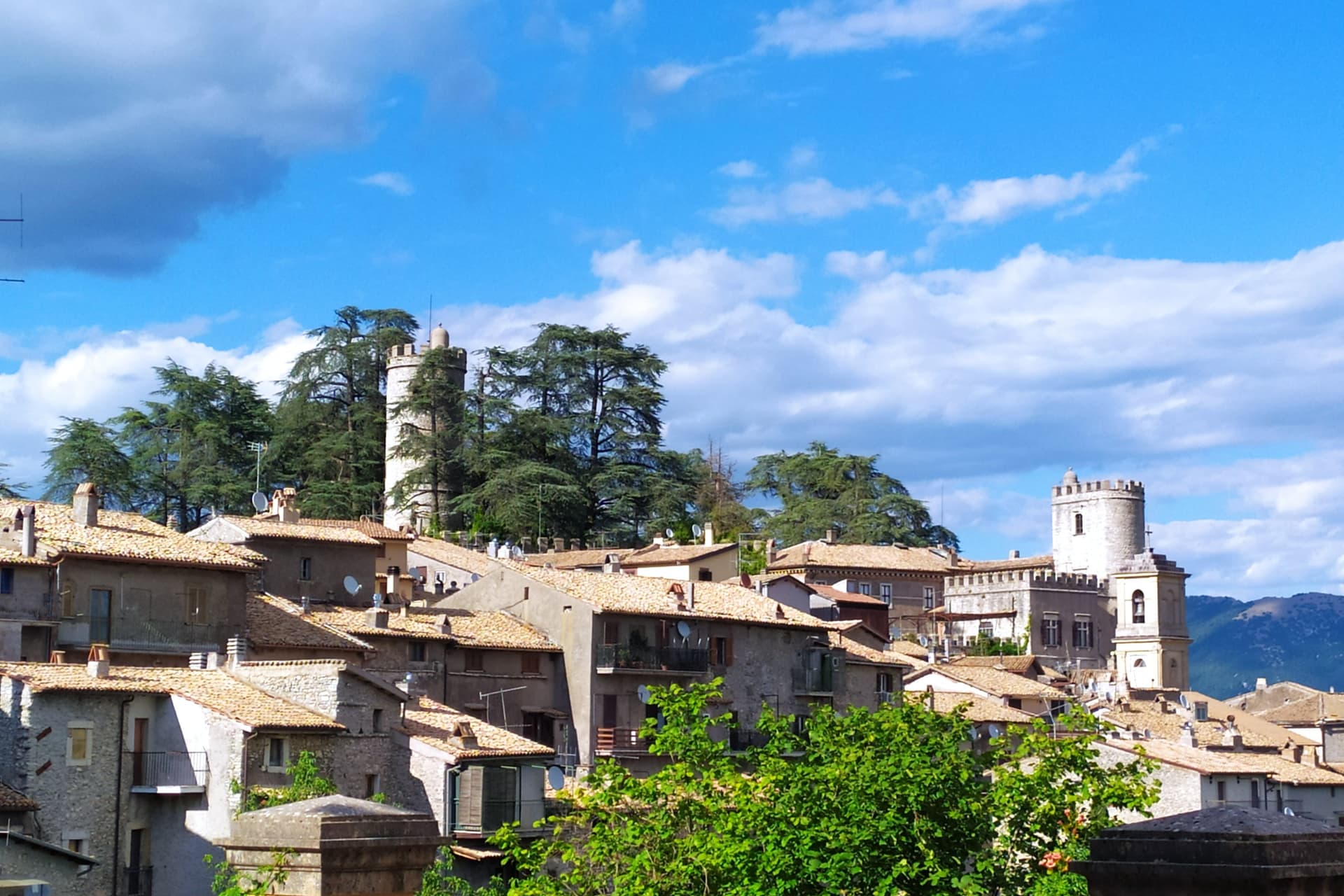
Why visit Orvinio
Orvinio sits on a saddle in the Monti Lucretili park, the last village before the slopes drop toward the Turano lake. The ancient settlement called Orvinium was destroyed before the year 1000, and the medieval town that grew up afterward took the name Canemorto, said to commemorate a Saracen defeat by Charlemagne's troops in 817.
The Orsini built the Granarone palace in the fifteenth century, before the Borghese took the fief in 1632. The village they governed still reads in two layers: stone houses running in tight loops below the ridge, and the Castello Malvezzi-Campeggi above them, the physical record of who held the place longest.
The Cammino di San Benedetto crosses this lower town on its way between Subiaco and Norcia, a reminder that the village has always been a point of passage as much as a seat of lordship. What remains is a settlement whose name changed twice and whose skyline did not: the castle above, the loops of houses below, unchanged in relation even as the village below it was renamed.
What to see in Orvinio
- Castello Malvezzi-Campeggi. Rebuilt by the Borghese in the nineteenth century, it dominates the village from the upper ridge, still visibly the seat of the family that held the fief the longest.
- Abbazia di Santa Maria del Piano. Benedictine abbey founded in the early Middle Ages, the original landlords of the territory before the Orsini took it.
- Centro storico. Stone houses in tight medieval loops below the castle, with vaulted passages and the original village gates preserved.
How to get to Orvinio
Roma is about 1 h away by road.
Our tip
May through September is the working window at 840 meters. The Lucretili woods open, the trails dry out and the village evenings stay cool when Rome forty-five kilometers downhill is hitting thirty-five. October still holds for the woods turning copper and for the Cammino di San Benedetto walkers passing through on the route between Subiaco and Norcia.
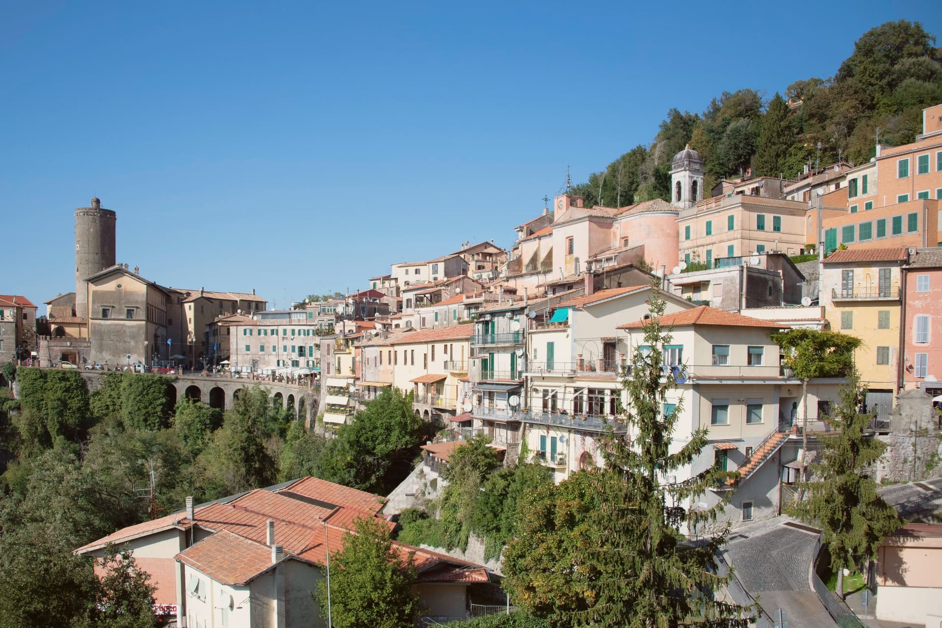
Why visit Nemi
Nemi sits at 521 meters on the rim of a volcanic crater, the smallest of the Castelli Romani and thirty kilometers southeast of Rome. The lake below was the Speculum Dianae, the mirror of Diana, with a sanctuary on its northern shore that covered around 45,000 square meters and drew pilgrims from across Latium.
Emperor Caligula built two ceremonial ships on the lake, ninety meters of timber and bronze that sat on the water until they sank. Mussolini drained part of the lake between 1929 and 1932 to recover them.
They were destroyed by fire in 1944, almost certainly by retreating German troops. The Museo delle Navi Romane, built in 1940 to hold them, now shows scaled reconstructions and salvaged fragments.
Palazzo Ruspoli, a ninth-century castle restored by Valadier, anchors the centro storico. The wild strawberries grown on the inner slopes of the crater are sold from stalls along Via Roma and celebrated each June at the Sagra delle Fragole.
What to see in Nemi
- Palazzo Ruspoli. Ninth-century castle of the Counts of Tuscolo, restored by Valadier, with cylindrical tower and hanging garden over the lake.
- Museo delle Navi Romane. Lakeshore museum built in 1940 for Caligula's two recovered ships, destroyed by fire in 1944, now housing scaled models and fragments.
- Santuario di Diana Nemorense. Remains of the federal sanctuary on the lake's northern shore, once 45,000 square meters of temple, porticoes and theater.
How to get to Nemi
Roma is about 52 min away by road.
Our tip
April through June and September into October are the dry months on the crater rim, when the wild strawberries ripen and the lake holds its color. The Sagra delle Fragole runs the first Sunday of June and draws thousands. July and August push the basin into the low thirties; the centro storico stays cooler at 521 meters than the coast or the city, but weekends fill with day-trippers from Rome.
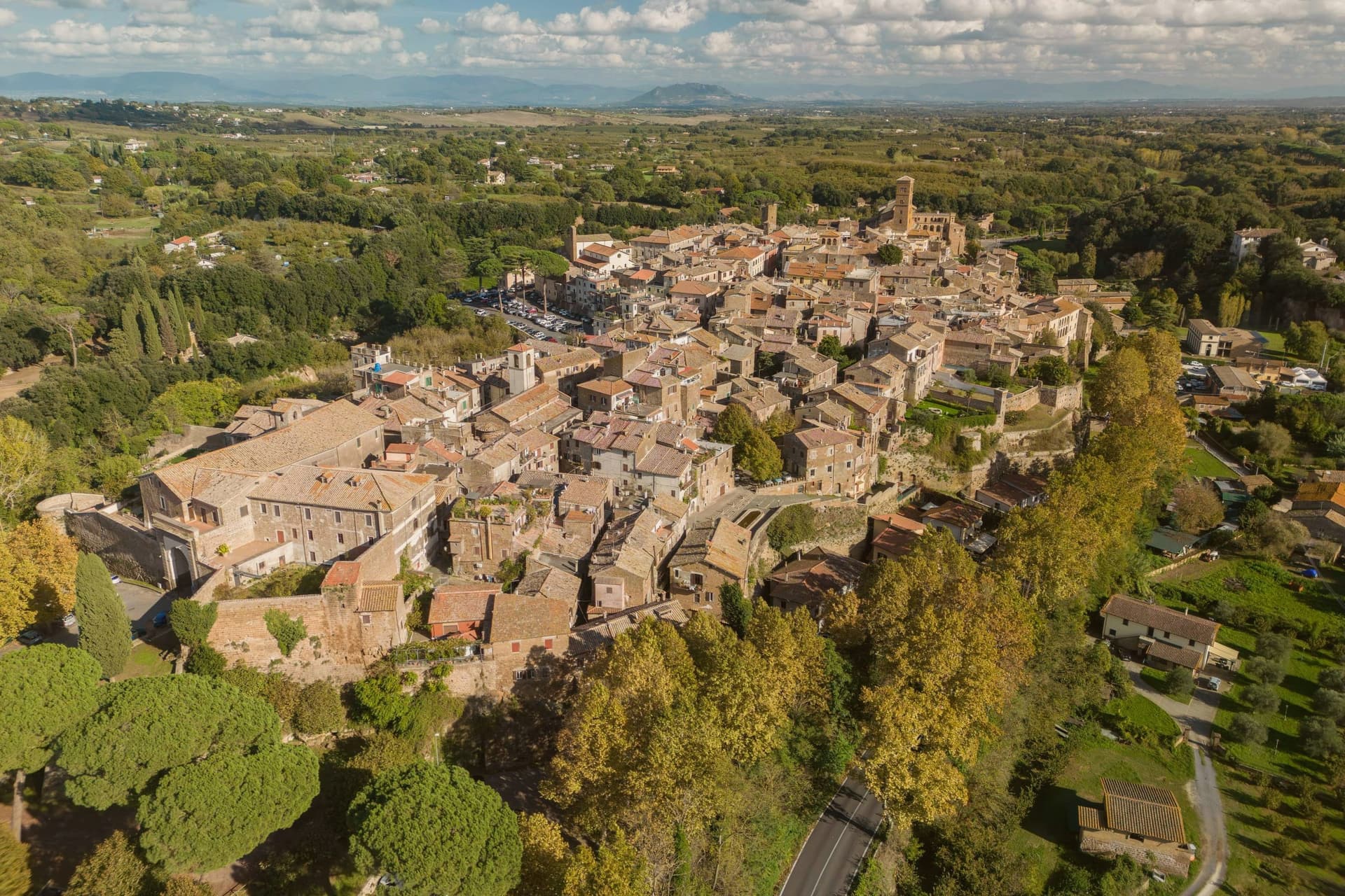
Why visit Sutri
Sutri sits at 291 meters on a narrow tuff spur, fifty kilometers north of Rome on the old road linking the two. The Etruscans held it before the Romans took it in the fourth century BC, and it was among the colonies that refused further military contributions to Rome during the Second Punic War in 209 BC.
The rock-cut monuments that define the town, the arena, the temple turned sanctuary, the chamber tombs, all come from the same tuff spur the town is built on, so the stone that gives Sutri its ground is also what its Etruscan and Roman residents carved into. The high ground above, where the eighteenth-century villa and its gardens sit, looks down over that older excavated town rather than sitting apart from it.
Local tradition ties the town's beans to Charlemagne, who passed through and was supposedly relieved of an attack of gout by Sutri's variety. What the place adds up to is a settlement where the town and its excavation are the same rock: nothing was built so much as removed.
What to see in Sutri
- Anfiteatro Romano. Elliptical amphitheater about forty-nine by forty meters, carved directly out of the tuff rock rather than built on it.
- Mithraeum / Madonna del Parto. Roman temple to Mithras hewn into the tuff and reused as a Marian sanctuary, accessed through the medieval rock-cut church.
- Necropoli rupestre. Etruscan necropolis with dozens of rock-cut chamber tombs in the cliff face along the Via Cassia.
How to get to Sutri
Roma is about 57 min away by road.
Our tip
April through June and September into October are the best months in the tuff country, when the amphitheater grass is green and the gardens of Villa Savorelli are open. July and August push afternoons into the mid-thirties; the rock-cut Mithraeum and tomb chambers stay cool and become the part of the visit that doesn't need to be timed. November through March is quiet.
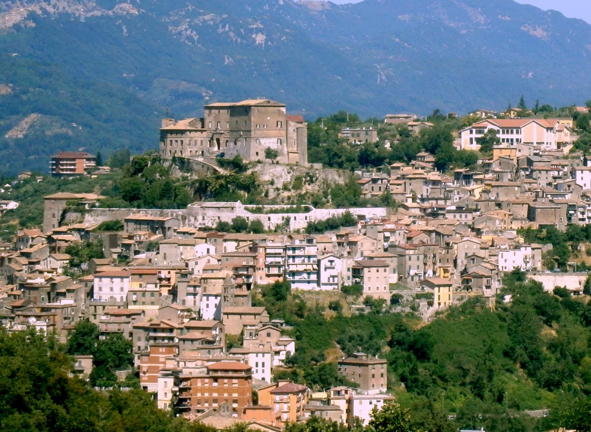
Why visit Subiaco
Subiaco sits at 408 meters along the upper Aniene, seventy-three kilometers east of Rome and forty from Tivoli. Nero built a villa here in the first century, damming the river into artificial lakes known as Sublaqueum, below the lake, and the name outlasted the villa and the emperor both.
The town that grew up here reads in layers going up the valley side: the river and the bridge at the bottom, the abbey partway up the hill, the fortress at the summit, and the cliff sanctuary further out along the cliff face that gave the hermit's cave its shelter, each one built at a different remove from the water and from the town center. What holds these layers together is a single life.
A man who came here as a young man to live alone in a cave gave his name to a monastery down the hill, and centuries later that same monastery's press put the first printed book on Italian soil into circulation. The fortress above answers to a different history, the abbots who ruled here as feudal lords, one of whom fathered a child who became one of the most written-about women of her age.
A river valley that supplied an emperor's pleasure lakes became, without much overlap, the ground where monastic life took its early shape.
What to see in Subiaco
- Monastero del Sacro Speco. Built into the cliff face of Monte Taleo, the sanctuary rises in tiers over the cave itself, and the frescoes by Conxolus and the school of Cimabue cover walls that follow the rock rather than a flat plan.
- Abbazia di Santa Scolastica. The only one of Benedict's twelve original monasteries still standing, sixth century in origin; its library holds three hundred manuscripts, including a copy of the Lactantius run off the abbey's own press.
- Rocca Abbaziale (Rocca dei Borgia). Set on the highest ground of the borgo, the fortress was raised by abbot Giovanni V in the twelfth century and later gave Lucrezia Borgia, daughter of the abbot Rodrigo Borgia, a birthplace in 1480.
How to get to Subiaco
Roma is about 1 h 10 min away by road. The full route from Rome.
Our tip
April through June and September through October are the months for Subiaco: the Aniene runs full, the cliff sanctuaries are open from morning, and the pilgrim road south fills with walkers on the Cammino di San Benedetto. July and August are warm in town and cool in the monasteries; the cave at the Sacro Speco holds twelve degrees year-round. November through March is the quiet pilgrim season, mist on the river and few coaches in the lots.
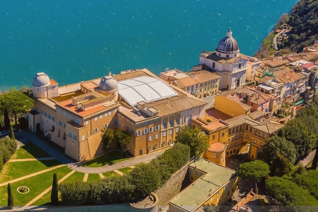
Why visit Castel Gandolfo
The town sits at 426 meters on the rim of the Lake Albano crater, twenty-five kilometers southeast of Rome among the Castelli Romani. It stands on the site of Alba Longa, the city Aeneas's son Ascanius is said to have founded.
The lake below was formed by the fusion of two volcanic craters and reaches 170 meters deep. The Villa Barberini stands adjacent to the palace, acquired by Taddeo Barberini in 1631, its gardens running down toward the water.
Pope Francis kept the palace as a museum after 2016; Leo XIV restored it to residential use in June 2025 and resides in the Villa Barberini next door, while the Borgo Laudato Si', created by Francis in 2023, carries ecological education across 55 hectares of the same estate. A town built on legend, given over for a time to public viewing, and returned to private residence: three uses of the same ground, laid one on top of the other without erasing what came before.
What to see in Castel Gandolfo
- Palazzo Apostolico. The palace Carlo Maderno raised between 1623 and 1626 stood open as a museum from 2016, its rooms given over to display cases and visitors. In June 2025 it returned to residential use, the museum arrangement dismantled to make way for a household again.
- Ville Pontificie e Giardini Barberini. Fifty-five hectares of papal villas and gardens running down to Lake Albano, with the seventeenth-century Villa Barberini at their center.
- Lago Albano. The crater lake sits at 293 meters above sea level and covers five square kilometers, its rim shared between this town and Albano Laziale.
How to get to Castel Gandolfo
It has its own railway station. Roma is about 35 min away by road. The full route from Rome.
Our tip
April through October is the open season for Castel Gandolfo, with the gardens open and the lake at swimming temperature from June. June and September are the calmer months and the historic papal-residence weeks. July and August fill with Roman day-trippers and Vatican tourists; the lake shore is busy.
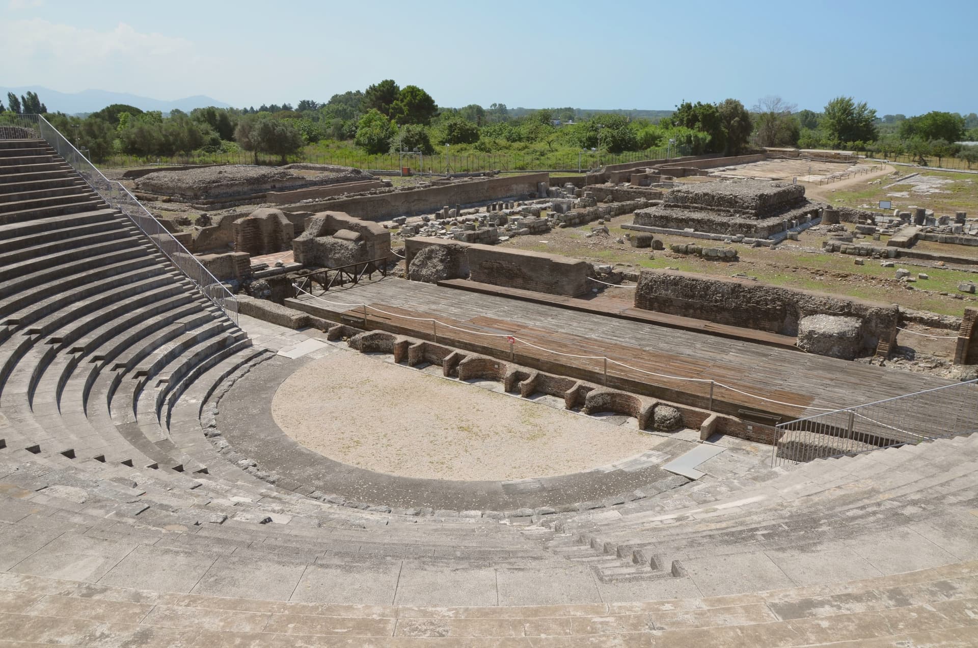
Why visit Minturno
Minturno sits on a hill at 140 meters above the right bank of the Garigliano, with the Scauri and Marina coast running down from it to the Tyrrhenian. The two halves of the comune answer different needs and different centuries: the river mouth held the Roman colony and its flat, engineered plain, while the hill above took over as the medieval settlement once malaria and Saracen raids made the lowland unsafe to live on.
The castle at the center of the upper town carries that shift in its own fabric, with a ninth-century core built up over time by later lords. The coast has its own separate history again, flattened in 1943-44 as a battlefield on the German defensive line and rebuilt afterward around the bathing village of Scauri.
Olive country runs inland behind all of this, and the comune belongs to the Città dell'Olio network. What the town amounts to, then, is three settlements stacked in time rather than one: a Roman river port, a medieval hill town built in retreat from it, and a rebuilt postwar coast, each still legible in its own part of the comune.
What to see in Minturno
- Parco Archeologico di Minturnae. Theater, forum, aqueduct and amphitheater standing together at the river mouth, on the stretch of the Via Appia that once ran through the colony.
- Castello Baronale. Hilltop castle in the centro storico, its core built in the ninth century and expanded in stages by the Caetani and the Carafa through the medieval period.
- Basilica di San Pietro Apostolo. Basilica in the upper town holding a cosmatesque pulpit and Easter candlestick, both worked in the twelfth and thirteenth centuries.
How to get to Minturno
It has its own railway station. Napoli is about 1 h 19 min away by road. The full route from Naples.
Our tip
May through September is the season on the Garigliano coast. June and September give the best balance of warm sea and emptier beaches; July and August fill with Roman and Neapolitan weekenders and the seaside road slows. October is still warm enough to swim on calm days, and the inland olive harvest in late October and November is the busiest moment in the upper town.
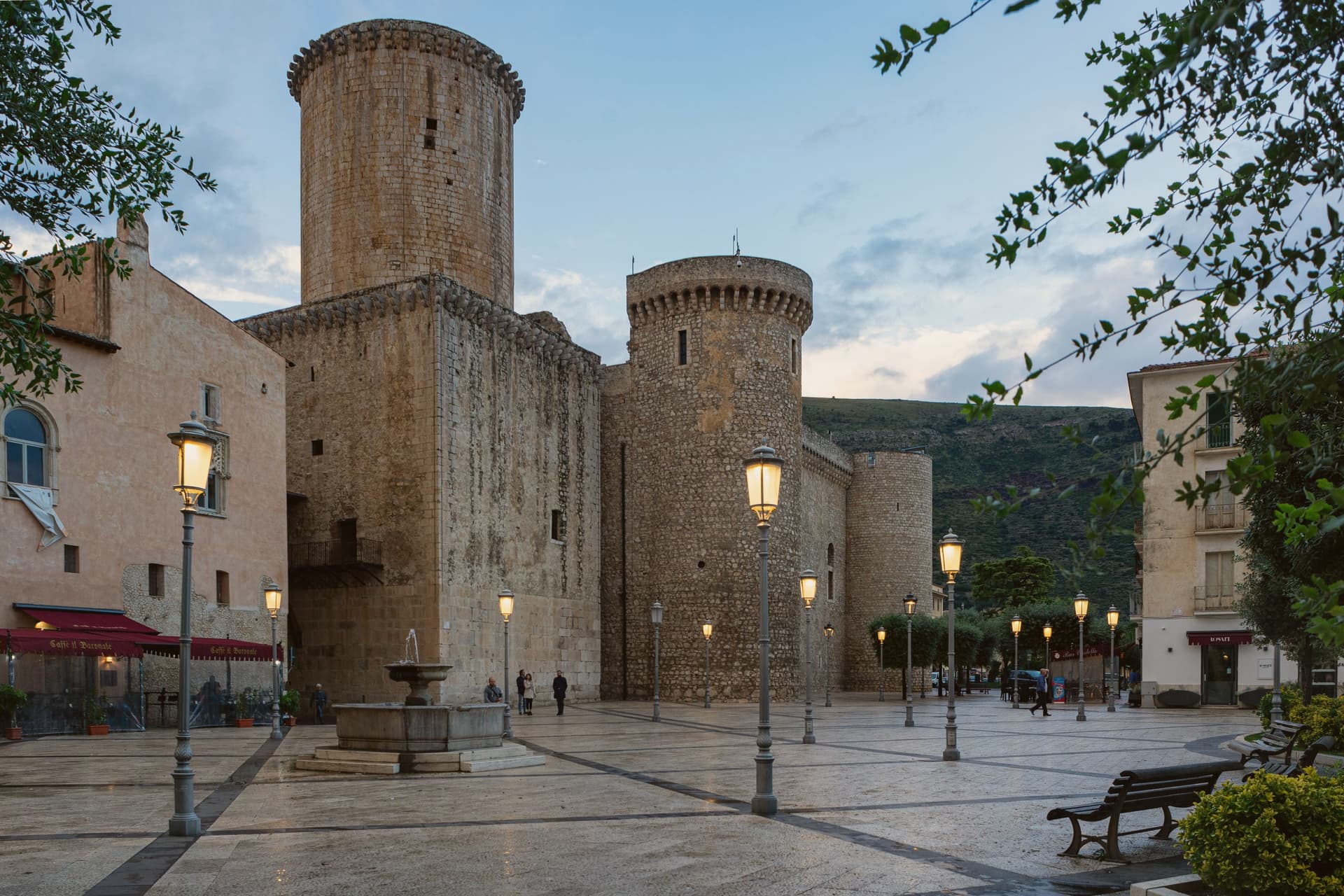
Why visit Fondi
Fondi sits in the middle of its own plain, the Piana di Fondi, a fertile basin between the Ausoni and Aurunci mountains halfway between Rome and Naples, with the Tyrrhenian only a few kilometers south. The Via Appia ran straight through it, and the town has been here since 338 BC, when its inhabitants gained limited Roman citizenship after the Latin War.
The old walls that once ringed the settlement still show at the base of the castle in the center, and inside those same walls sits the Giudea, the former Jewish quarter, so the medieval town and the Roman one occupy the same footprint rather than sitting apart. South of the built-up center the plain gives way to the Lago di Fondi, a brackish lake cut off from the sea by a sand bar and worked for fishing rather than farming.
The fields that surround all of this now feed the Mercato Ortofrutticolo, moving millions of tons of produce a year out of a basin whose flatness once made it easy to defend and now makes it easy to farm.
What to see in Fondi
- Castello Baronale Caetani. Round towers over 30 meters high in the centro storico, raised on Roman walls that still form part of the base.
- Palazzo Caetani-Colonna. Adjoining noble residence built into the castle complex, the seat of Giulia Gonzaga's court between 1526 and 1534.
- Cattedrale di San Pietro Apostolo. Romanesque-Gothic cathedral with a 13th-century pulpit and the throne where the antipope Clement VII was elected.
How to get to Fondi
It has its own railway station. Latina is about 1 h 8 min away by road. The full route from Naples.
Our tip
May through September is when the plain works best for visitors: the lake, the sea, and the centro storico all reachable in a single day, evenings warm enough for late dinners on the piazzas. July and August push past thirty-two degrees and the plain has no relief from heat until the sea breeze comes in. April, October and early November are dry and quiet, the citrus groves heavy, the wholesale market running at full pace.
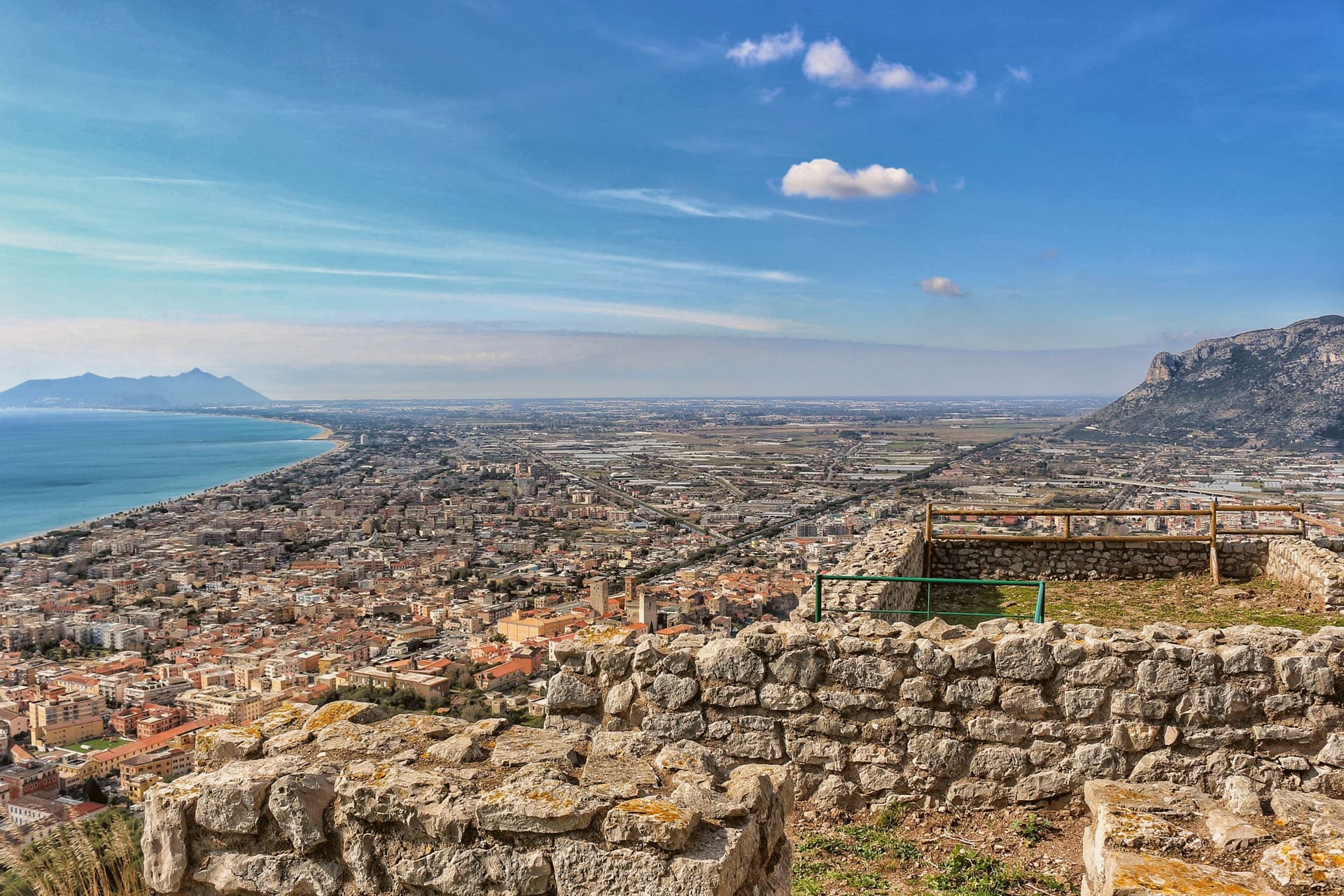
Why visit Terracina
Terracina sits where the Lepini mountains meet the Tyrrhenian Sea, a hundred kilometers south of Rome. The Volsci called it Anxur, the name of the youthful Jupiter who was its tutelary god, and the temple crowning the summit above the port carries that name still.
Below it the Roman town spread out along the coast road, its forum paved by a magistrate whose inscription remains underfoot, its capitolium later built over by the co-cathedral. Where the road met a headland it could not go around, the rock itself was cut away to let it pass, a shelf sliced through stone rather than a path found around it.
The upper town, on the mountain, and the lower town, on the plain and shore, read as two different solutions to the same site: one held the god and looked down, the other held the forum, the road, and eventually the harbor. What survives today, the beach, the working fishing port, the olive groves signed for their oil, is the plain continuing to do what it always did, at sea level, while the temple keeps its distance above.
What to see in Terracina
- Tempio di Giove Anxur. The temple on Monte Sant'Angelo stands on a vaulted substructure, thirty-five by twenty meters, the arcading still visible from below and, on clear days, the view running out past the port to the sea.
- Foro Emiliano. Original limestone-paved Roman forum, bronze-letter inscription of Aulus Aemilius still legible, eleventh forum along the Via Appia from Rome.
- Cattedrale di San Cesareo. Co-cathedral consecrated 1074 on the ancient capitolium, Cosmatesque pulpit and pavement, twelfth-century bell tower and portico.
How to get to Terracina
Latina is about 41 min away by road.
Our tip
May through September brings the beach and the port to full life: Bandiera Blu water, ferries to Ponza and Ventotene, fishermen unloading at the eastern mole. June and September are the calmer months. July and August fill with Roman day-trippers and touch thirty-five degrees on the seaward slopes.
More from Anywhere Italy
- The prettiest villages inside a nature park within 90 minutes of RomaNear Romeinside a parkwithin 90 minprettiest villages7 towns · smallest 219 residents · closest 35 min away
- The prettiest villages on a walking route in LazioLazioon a walking routeprettiest villages7 towns · smallest 266 residents
- The best towns inside a nature park that have a serious restaurant in LazioLazioinside a parkserious restaurant6 towns · smallest 6,663 residents
- The best towns with a serious restaurant that sit on a walking route in LazioLazioon a walking routeserious restaurant7 towns · smallest 5,266 residents
- The best towns that eat well in the province of LatinaLatina provinceeats well7 towns · smallest 704 residents
- The best beach towns in the province of LatinaLatina provinceclean beach7 towns · smallest 3,050 residents