
The best towns with a serious restaurant that sit on a walking route in Lazio
Lazio walks well. North of Rome the tufa country rolls in soft grey terraces, with beech woods above the crater lakes and roads cut down through rock the colour of ash, and the Via Francigena threads it all together on foot. South, the Appia runs dead straight between limestone hills and the sea, past lemon groves, olive terraces and towns built from pale local stone. The eating changes as you move: freshwater fish and pecorino inland, artichokes and buffalo mozzarella on the plain, olive oil that tastes of green tomato around the Ciociaria. Spring and early autumn are the months for it, when the stages are cool enough to cover before lunch and the kitchens are still working properly.
Almost everyone who comes to Lazio comes for Rome, and quite reasonably. The city holds the restaurants that get written about, the trattorie in Testaccio, the tasting menus in Parioli, and the crowds that go with them. Even the day trips out of Rome funnel into the same handful of places, Tivoli above all, where the villa gardens are packed from mid-morning through the afternoon. The result is that a region with several hundred communes gets read as one city plus a couple of excursions.
The routes carry on past all that. The Francigena continues north through the tufa towns towards the Tuscan border, and the Appia keeps going south to the sea and the marshes behind it, and along both there are towns where you can finish a stage, wash, and sit down to a meal that the most demanding of the guides has taken seriously. Fewer walkers get this far, and fewer drivers stop at all. These are the towns where the two things line up.
Of the 61 communes we have mapped in Lazio, 7 qualify as towns with a serious restaurant on a walking route: each holds a restaurant listed by the most demanding of the guides, and each is a stage on one of the long historic walking routes. The smallest, Acquapendente, has 5,266 residents.
Elsewhere in the catalogue: The best hill towns on a walking route in Lazio and The 9 best hill towns with a serious restaurant in Lazio.
Acquapendente
Why visit Acquapendente
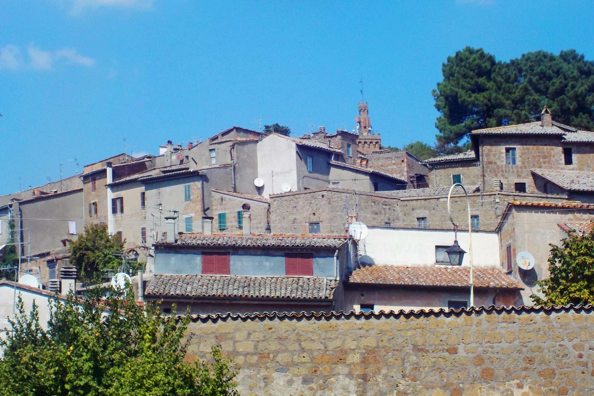
Acquapendente sits at the northern edge of Lazio, where the Paglia river marks the boundary with Tuscany. The name first appears in a document of Emperor Otto I dated 964, taken from the small waterfalls that drop the river toward the plain.
The town grew up along the pilgrim road that runs north to south through it, and the church at its center, with its Romanesque crypt and sacellum copying the tomb in Jerusalem, gave the settlement its old nickname, the Green Jerusalem. The built-up center holds the basilica and the streets that carry the floral mosaics each May, while outward from it the town's territory stretches to two very different edges: the frazione of Torre Alfina to the north, with its own restored castle and a listing among the country's most beautiful villages, and the forest of the Monte Rufeno reserve beyond that, nearly 3,000 hectares of oak and beech reached by marked trails.
A river border, a pilgrim route, and a nickname earned by a copied tomb: together they describe a town shaped less by what it produced than by what passed through it and what was built to receive those travelers.
La Parolina have been named by a guide.
What to see in Acquapendente
- Basilica Concattedrale del Santo Sepolcro. Twenty-four columns divide the crypt into nine naves. The sacellum sits carved into the rock at the center, a form pilgrims would have recognized as a copy of the tomb it names.
- Pugnaloni. Panels built from flower petals pressed into wooden frames, carried through the streets by each quarter of the town on the third Sunday of May.
- Castello di Torre Alfina. Neo-Gothic restored fortress in the frazione of Torre Alfina, itself listed among I Borghi più belli d'Italia.
How to get to Acquapendente
Terni is roughly 96 minutes away by road.
Our tip
April through June and September into October are the months for walking the Via Francigena and the trails of Monte Rufeno. The Pugnaloni festival fills the streets on the third Sunday of May and is the single best weekend in the calendar. July and August touch the mid-thirties in the Paglia valley; pilgrims start earlier and finish by mid-morning.
Sutri
Why visit Sutri
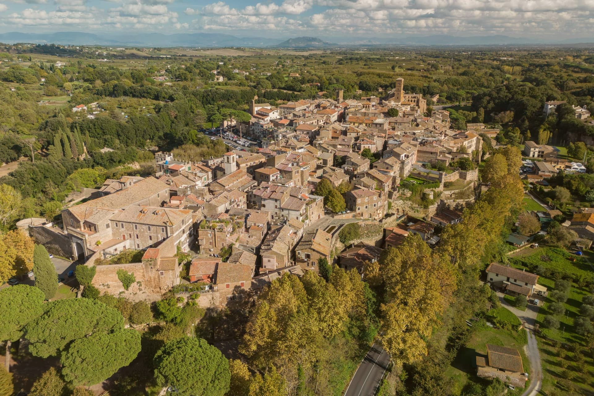
Sutri sits at 291 meters on a narrow tuff spur, fifty kilometers north of Rome on the old road linking the two. The Etruscans held it before the Romans took it in the fourth century BC, and it was among the colonies that refused further military contributions to Rome during the Second Punic War in 209 BC.
The rock-cut monuments that define the town, the arena, the temple turned sanctuary, the chamber tombs, all come from the same tuff spur the town is built on, so the stone that gives Sutri its ground is also what its Etruscan and Roman residents carved into. The high ground above, where the eighteenth-century villa and its gardens sit, looks down over that older excavated town rather than sitting apart from it.
Local tradition ties the town's beans to Charlemagne, who passed through and was supposedly relieved of an attack of gout by Sutri's variety. What the place adds up to is a settlement where the town and its excavation are the same rock: nothing was built so much as removed.
N'uovo Vino e Cucina have been named by a guide.
What to see in Sutri
- Anfiteatro Romano. Elliptical amphitheater about forty-nine by forty meters, carved directly out of the tuff rock rather than built on it.
- Mithraeum / Madonna del Parto. Roman temple to Mithras hewn into the tuff and reused as a Marian sanctuary, accessed through the medieval rock-cut church.
- Necropoli rupestre. Etruscan necropolis with dozens of rock-cut chamber tombs in the cliff face along the Via Cassia.
How to get to Sutri
Roma is roughly 57 minutes away by road.
Our tip
April through June and September into October are the best months in the tuff country, when the amphitheater grass is green and the gardens of Villa Savorelli are open. July and August push afternoons into the mid-thirties; the rock-cut Mithraeum and tomb chambers stay cool and become the part of the visit that doesn't need to be timed. November through March is quiet. Sagra del Fagiolo falls in August.
Arpino
Why visit Arpino
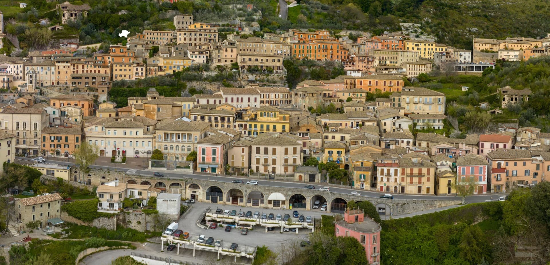
Arpino sits at 450 meters on two hills in the Liri valley, in the Ciociaria region of southern Lazio. The ancient city of Arpinum, on the upper hill now called Civitavecchia, was a Volscian-Samnite stronghold captured by Rome in 305 BC.
The lower hill is the medieval and modern town. Two Roman consuls were born here: Gaius Marius, the military reformer who fought the Cimbri and Teutones, and Marcus Tullius Cicero, the orator and senator killed in 43 BC.
The villa where Cicero was born stood just north, on the Liri, in what is now Isola del Liri. The upper acropolis is ringed by polygonal cyclopean walls of the sixth or fifth century BC, with the Arco a Sesto Acuto, a pointed-arch gate cut into the same stone work.
Arpino is on the Bandiere Arancioni list and on the Cammino di San Benedetto, the long pilgrim route from Norcia to Montecassino.
Mingone, La Perla have been named by a guide.
What to see in Arpino
- Acropoli di Civitavecchia. Pre-Roman upper city on the hill above modern Arpino, surrounded by cyclopean polygonal walls of the sixth or fifth century BC.
- Arco a Sesto Acuto. Pointed-arch gate cut into the cyclopean walls of the acropolis, the only known pre-Roman ogival arch in central Italy.
- Torre di Cicerone. Medieval tower on the acropolis, traditionally linked to Cicero by local memory though built more than a thousand years after his death.
How to get to Arpino
There is a railway station in the town, so you can arrive without a car and never need one while you are here. Latina is roughly 94 minutes away by road.
Our tip
April through June and September through October are the strong months. Spring brings green hills along the Liri and clear views from the acropolis; autumn is dry and gold. July and August push past thirty degrees in the valley, although Arpino's 450-meter position offers some relief in the upper town. Il Gonfalone falls in July.
Castel Gandolfo
Why visit Castel Gandolfo
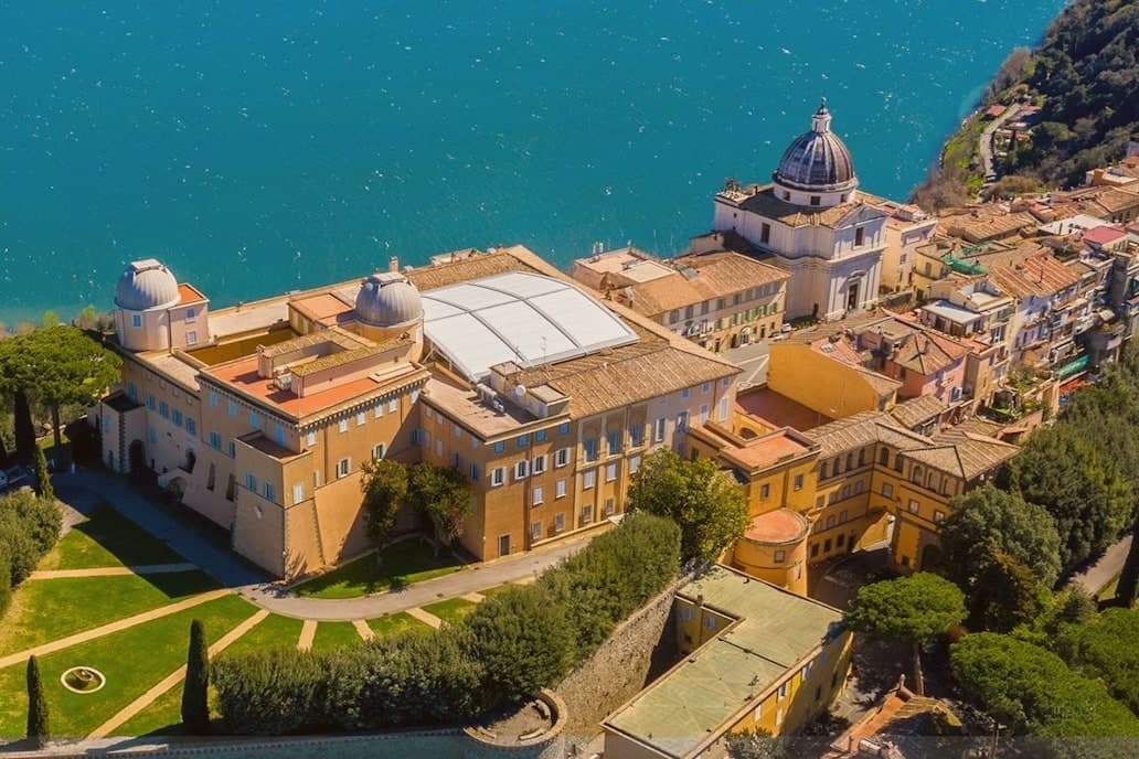
The town sits at 426 meters on the rim of the Lake Albano crater, twenty-five kilometers southeast of Rome among the Castelli Romani. It stands on the site of Alba Longa, the city Aeneas's son Ascanius is said to have founded.
The lake below was formed by the fusion of two volcanic craters and reaches 170 meters deep. The Villa Barberini stands adjacent to the palace, acquired by Taddeo Barberini in 1631, its gardens running down toward the water.
Pope Francis kept the palace as a museum after 2016; Leo XIV restored it to residential use in June 2025 and resides in the Villa Barberini next door, while the Borgo Laudato Si', created by Francis in 2023, carries ecological education across 55 hectares of the same estate. A town built on legend, given over for a time to public viewing, and returned to private residence: three uses of the same ground, laid one on top of the other without erasing what came before.
Tinello Bistrot, Antico Ristorante Pagnanelli have been named by a guide.
What to see in Castel Gandolfo
- Palazzo Apostolico. The palace Carlo Maderno raised between 1623 and 1626 stood open as a museum from 2016, its rooms given over to display cases and visitors. In June 2025 it returned to residential use, the museum arrangement dismantled to make way for a household again.
- Ville Pontificie e Giardini Barberini. Fifty-five hectares of papal villas and gardens running down to Lake Albano, with the seventeenth-century Villa Barberini at their center.
- Lago Albano. The crater lake sits at 293 meters above sea level and covers five square kilometers, its rim shared between this town and Albano Laziale.
How to get to Castel Gandolfo
There is a railway station in the town, so you can arrive without a car and never need one while you are here. Roma is roughly 35 minutes away by road.
Our tip
April through October is the open season for Castel Gandolfo, with the gardens open and the lake at swimming temperature from June. June and September are the calmer months and the historic papal-residence weeks. July and August fill with Roman day-trippers and Vatican tourists; the lake shore is busy.
Fondi
Why visit Fondi
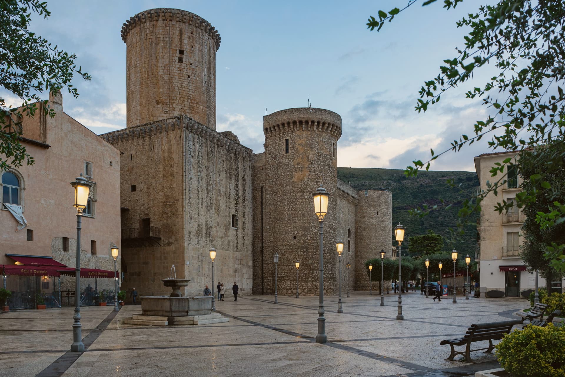
Fondi sits in the middle of its own plain, the Piana di Fondi, a fertile basin between the Ausoni and Aurunci mountains halfway between Rome and Naples, with the Tyrrhenian only a few kilometers south. The Via Appia ran straight through it, and the town has been here since 338 BC, when its inhabitants gained limited Roman citizenship after the Latin War.
The old walls that once ringed the settlement still show at the base of the castle in the center, and inside those same walls sits the Giudea, the former Jewish quarter, so the medieval town and the Roman one occupy the same footprint rather than sitting apart. South of the built-up center the plain gives way to the Lago di Fondi, a brackish lake cut off from the sea by a sand bar and worked for fishing rather than farming.
The fields that surround all of this now feed the Mercato Ortofrutticolo, moving millions of tons of produce a year out of a basin whose flatness once made it easy to defend and now makes it easy to farm.
Da Fausto, Riso Amaro have been named by a guide.
What to see in Fondi
- Castello Baronale Caetani. Round towers over 30 meters high in the centro storico, raised on Roman walls that still form part of the base.
- Palazzo Caetani-Colonna. Adjoining noble residence built into the castle complex, the seat of Giulia Gonzaga's court between 1526 and 1534.
- Cattedrale di San Pietro Apostolo. Romanesque-Gothic cathedral with a 13th-century pulpit and the throne where the antipope Clement VII was elected.
How to get to Fondi
There is a railway station in the town, so you can arrive without a car and never need one while you are here. Latina is roughly 68 minutes away by road.
Our tip
May through September is when the plain works best for visitors: the lake, the sea, and the centro storico all reachable in a single day, evenings warm enough for late dinners on the piazzas. July and August push past thirty-two degrees and the plain has no relief from heat until the sea breeze comes in. April, October and early November are dry and quiet, the citrus groves heavy, the wholesale market running at full pace. Mercato Settimanale Di Fondi falls in October.
Terracina
Why visit Terracina
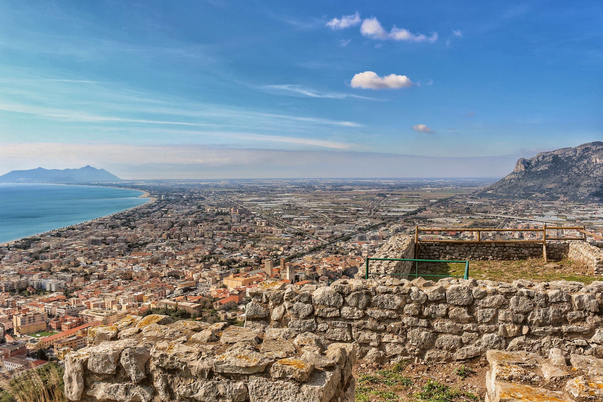
Terracina sits where the Lepini mountains meet the Tyrrhenian Sea, a hundred kilometers south of Rome. The Volsci called it Anxur, the name of the youthful Jupiter who was its tutelary god, and the temple crowning the summit above the port carries that name still.
Below it the Roman town spread out along the coast road, its forum paved by a magistrate whose inscription remains underfoot, its capitolium later built over by the co-cathedral. Where the road met a headland it could not go around, the rock itself was cut away to let it pass, a shelf sliced through stone rather than a path found around it.
The upper town, on the mountain, and the lower town, on the plain and shore, read as two different solutions to the same site: one held the god and looked down, the other held the forum, the road, and eventually the harbor. What survives today, the beach, the working fishing port, the olive groves signed for their oil, is the plain continuing to do what it always did, at sea level, while the temple keeps its distance above.
Locanda Altobelli, Il Granchio, Locanda Ruggieri have been named by a guide.
What to see in Terracina
- Tempio di Giove Anxur. The temple on Monte Sant'Angelo stands on a vaulted substructure, thirty-five by twenty meters, the arcading still visible from below and, on clear days, the view running out past the port to the sea.
- Foro Emiliano. Original limestone-paved Roman forum, bronze-letter inscription of Aulus Aemilius still legible, eleventh forum along the Via Appia from Rome.
- Cattedrale di San Cesareo. Co-cathedral consecrated 1074 on the ancient capitolium, Cosmatesque pulpit and pavement, twelfth-century bell tower and portico.
How to get to Terracina
Latina is roughly 41 minutes away by road.
Our tip
May through September brings the beach and the port to full life: Bandiera Blu water, ferries to Ponza and Ventotene, fishermen unloading at the eastern mole. June and September are the calmer months. July and August fill with Roman day-trippers and touch thirty-five degrees on the seaward slopes.
Rieti
Why visit Rieti
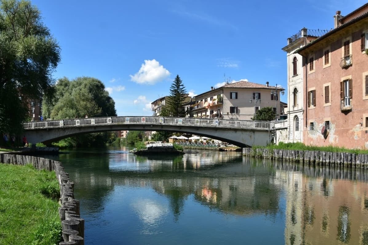
Rieti stands on a low rise at the edge of the Piana Reatina, the plain the Romans made when they drained the Lacus Velinus and sent its water over the cliff at Marmore. Medieval walls still close one side of the centro storico, and Via Roma runs down to the Velino and the stumps of the Roman bridge that carried the Via Salaria into town.
A marker in Piazza San Rufo stands for what Rieti has claimed for centuries: the umbilicus Italiae, the center of Italy. Popes stayed here often enough to build a palace beside the cathedral, and in 1234 Gregory IX canonized Saint Dominic inside it.
Saint Francis spent long stretches in the valley, which is why it is called the Valle Santa; the sanctuaries of Fonte Colombo and La Foresta are both in the comune. Above the plain, Monte Terminillo rises to 2,217 meters and is known as Rome's mountain.
In 2021 the town offered remote workers half their rent, up to 200 euros a month, to come and live here.
Bistrot have been named by a guide.
What to see in Rieti
- Cattedrale di Santa Maria Assunta. Romanesque outside and Baroque inside, built between 1109 and 1225 with a bell tower of 1252. Pope Gregory IX canonized Saint Dominic here in 1234.
- Palazzo Papale. The bishops' palace raised in 1283 for the papal court beside the cathedral, with a vaulted loggia at street level; it now holds part of the diocesan museum.
- Piazza San Rufo. A small square in the old town with a marker for the traditional center of Italy, the umbilicus Italiae.
How to get to Rieti
There is a railway station in the town, so you can arrive without a car and never need one while you are here. Terni is roughly 39 minutes away by road.
Our tip
April to October suits Rieti. Spring turns the plain green and fills the Velino; June is the Giugno Antoniano, which ends in the Processione dei Ceri, and late July brings the Palio della Tinozza, races in wooden tubs on the river. Summer is warm in town at 405 meters and cool on Terminillo, where the high trails open. Ottava de Santo Egidio falls in August.
More from Anywhere Italy
- The best hill towns on a walking route in Lazio
 The 9 best hill towns with a serious restaurant in Lazio
- The best towns inside a nature park that have a serious restaurant in Lazio
- The best towns you can reach by train that have a serious restaurant in Lazio
 The prettiest villages on a walking route in Lazio
 The best towns that eat well in the province of Latina