
The best ski towns in the province of Belluno
90 towns visited, 910 to go. Follow along, free: Subscribe on Substack
Belluno is the Veneto's Dolomite province, and winter here has a particular texture: pale limestone towers going pink at the end of the afternoon, larch woods stiff with frost, valley floors where the snow squeaks underfoot by mid morning. The villages are built of stone and dark weathered timber, with hay barns still standing at the edge of the pistes and church bells carrying across the valley when the lifts stop. Food is mountain food, cooked for people who have been outside all day: barley soup, casunziei filled with beetroot and dressed with poppy seed, polenta with mushrooms or with formaggio Piave, grappa afterwards. Ski areas run from long tree-lined descents to high open bowls under the Marmolada glacier, and most of them link into wider circuits that cross the province line.
Most skiers in the Dolomites end up on the Sellaronda, the circuit that loops through Val Gardena and Alta Badia in Alto Adige, and they end up there for good reason: the lift engineering is superb and you can ski a whole massif in a day. That also means Selva and Corvara fill their car parks by breakfast, that the mid-mountain refuges take bookings weeks ahead, and that a February half-term queue at the Dantercepies gondola can eat a serious part of the morning. The skiing is not worse for the crowds, but the villages have been shaped by them, and the price of a bed reflects it.
The same mountains keep going south and east into Belluno, where the same rock, the same snow record and the same cooking continue with fewer people in the lift line. These are towns with a ski area on their own territory, not resorts assembled around one, which is why the bar at the bottom station is still where the locals drink. Some sit on famous slopes and some on quiet ones, and a couple are within an easy drive of each other for a week that changes valley each day.
Of the 8 communes we have mapped in the province of Belluno, 6 qualify as ski towns: each has a ski area on its own territory. The smallest, Alleghe, has 1,100 residents.
Two more lists worth reading alongside this one: The best ski towns in Veneto and The 7 best small towns that eat well in Veneto.
Why visit Alleghe
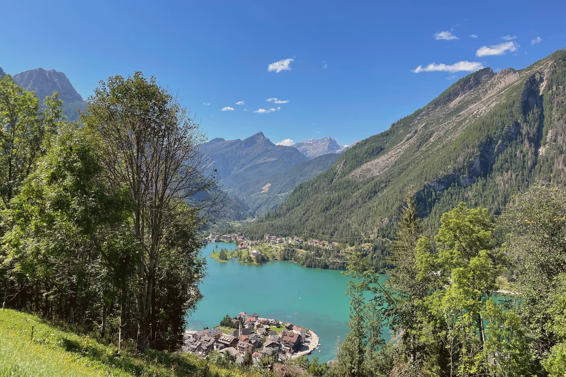
Alleghe sits at 979 meters in the Agordino, the deep Cordevole valley that cuts into the Dolomites south of Cortina. The valley funnels the river past steep slopes prone to fire and rockfall, which is why the parish church on the lakefront has been rebuilt more than once.
The lake itself is the town's defining feature and its stranger fact: this is a body of water that did not exist before 11 January 1771, when part of Monte Piz let go and dammed the Cordevole, burying the villages of Riete, Fusine and Marin. Alleghe as it stands today occupies ground that the slide created.
Four kilometers up the valley toward the Marmolada lies Caprile, which had been the commercial center of the Agordino before the slide and lost that standing once the lake formed and the newer settlement grew around it. The ski domain that carries the mountain's name opened to the public in the 1980s, linking Alleghe over the Forcella Staulanza to Zoldo and Selva di Cadore, and hockey has been the town's other pursuit, played for decades on the lake ice itself before the sport moved indoors.
What holds the place together is that geology, not settlement history, decided where the town would sit and what it would be called on to survive.
There is a mapped ski area on this commune, at 979 meters.
What to see in Alleghe
- Lago di Alleghe. The water sits over what used to be dry valley floor, fed by the Cordevole and still partly filled in by debris, shorter today than its original four-kilometer extent.
- Monte Civetta. The wall rises directly above the water, with the Tissi, Coldai and Vazzoler refuges strung along the Alta Via 1 trail beneath it.
- Ski Civetta. 80 km of slopes linking Alleghe, Zoldo and Selva di Cadore via lifts over the Forcella Staulanza; part of the Dolomiti Superski circuit.
How to get to Alleghe
Bolzano is about 1 h 45 min away by road.
Our tip
December through March is the working season: Ski Civetta opens, the lake freezes, and Alleghe runs at full capacity. January and February are the busiest months; the New Year week is when prices peak. June through September is the second season, walking on the Alta Via 1, swimming in the lake when air temperatures allow it, and refuge dinners on Coldai or Tissi.
Why visit Rocca Pietore
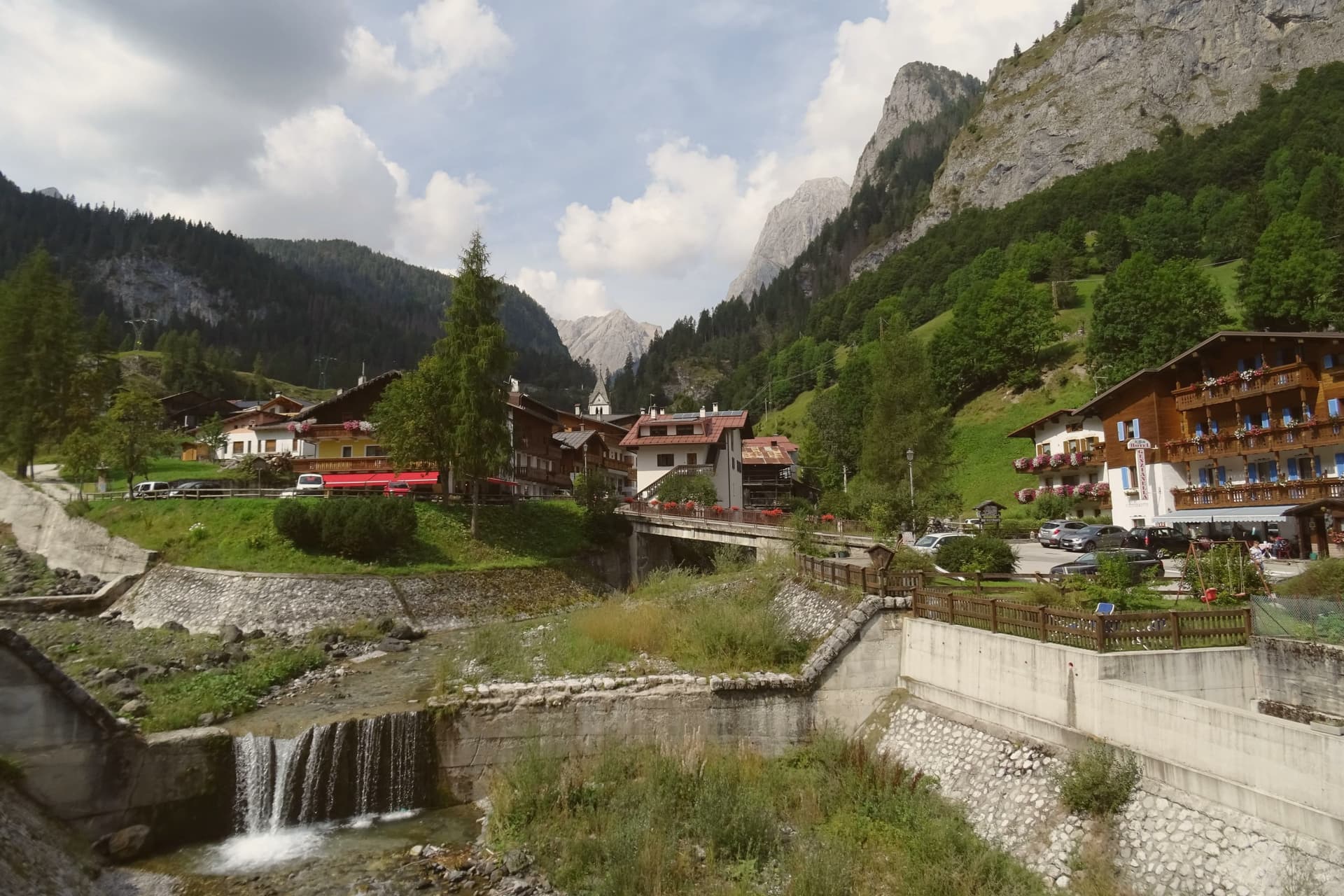
The Val Pettorina is the upper Agordino valley, running west from Belluno to the foot of the mountain the commune shares with Trentino. Rocca Pietore sits in it at 1,143 meters, a borgo that began as a Lombard military outpost before becoming, for nearly four centuries, the seat of a small republic under the County of Tyrol and the bishopric of Brixen, until Napoleon dissolved it.
The frazione of Sottoguda, higher up the valley at 1,250 meters, carries its own recognition as one of the Borghi più belli d'Italia, and the commune has held the Bandiera Arancione since 2018. The gorge that separates the village from Malga Ciapela has needed rebuilding twice this century, first after damage in 2018 and again in 2020, reopening only in stages from 2023.
The parish church stands on the rock above the borgo, the seat from which the old Tyrolean republic governed. What emerges is a valley shaped as much by repeated damage and repair as by the mountain looming over it: a small governing center under foreign rule for centuries, a gorge that keeps having to be rebuilt, and a glacier reached only by the single cable car that climbs above it all.
There is a mapped ski area on this commune, at 1143 meters.
What to see in Rocca Pietore
- Marmolada. Peak shared with Trentino, its glacier reached by cable car from Malga Ciapela to Punta Rocca at 3,269 meters, the only way up onto the ice.
- Serrai di Sottoguda. The gorge path runs between the village and Malga Ciapela, hemmed by rock on both sides, closed for years of repair after Storm Vaia before reopening to walkers.
- Sottoguda. Frazione at 1,250 meters joined to the Borghi più belli d'Italia in 2016, with the fifteenth-century Church of Saints Fabian, Sebastian and Roch.
How to get to Rocca Pietore
Bolzano is about 1 h 31 min away by road.
Our tip
December through March is the working season: the Marmolada glacier opens for skiing, the Bellunese run drops twelve kilometers from Punta Rocca to Malga Ciapela, and hotels in the village fill. June through September is the second season, walking the reopened Serrai, hiking on the Marmolada and the Padon ridge across the Fedaia, and visiting the First World War positions near the glacier. April, May, October and November are quiet.
Why visit Falcade
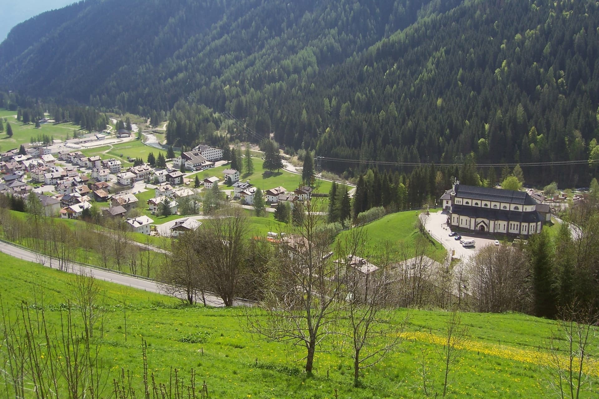
Falcade sits at 1,148 meters in the upper Biois valley, the southwestern corner of the Agordino, ringed by the Focobon group, the Pale di San Martino, the Marmolada and the Civetta. First settlers arrived between the tenth and eleventh centuries, and trade with the neighboring Fassa and Fiemme valleys built through the medieval period, carried over the col that still connects the Agordino to Trentino.
The village works as a hinge between two mountain worlds: the sharp Focobon spires and the broader Pale di San Martino to the west face each other across the valley, with the pass threading between them as it has since travelers first needed shelter there. Summer walkers follow the Alta Via 2 through this gap, between peaks that were shaped by the same geology the UNESCO listing recognizes.
The valley's long function as a crossing point, medieval trade route, refuge, ski link, explains why a settlement this size sits exactly where the Agordino gives way to Trentino.
There is a mapped ski area on this commune, at 1148 meters.
What to see in Falcade
- Focobon group. The massif rises directly north of the village, its spires visible from the valley floor. The Alta Via 2 threads past it toward the Forcella delle Comelle.
- Ski Civetta and Trevalli. Linked ski domain across the Falcade-Le Buse and Passo San Pellegrino-Alpe Lusia areas, slopes up to 2,500 meters.
- Passo San Pellegrino. 1,918-meter col into the Val di Fiemme, with a travelers' hospice documented from 1358 and now a working ski station.
How to get to Falcade
Bolzano is about 1 h 17 min away by road.
Our tip
December through March is the working winter: Ski Civetta and Trevalli open, the San Pellegrino pass runs as a ski station, and the village fills to capacity over Christmas and Carnival. June through September is the summer half, with walking on the Alta Via 2, the Forcella delle Comelle traverse to the Pale di San Martino, and refuge dinners on the Mulaz and the Bottari. April, May, October and November are the dead months.
Why visit San Vito di Cadore
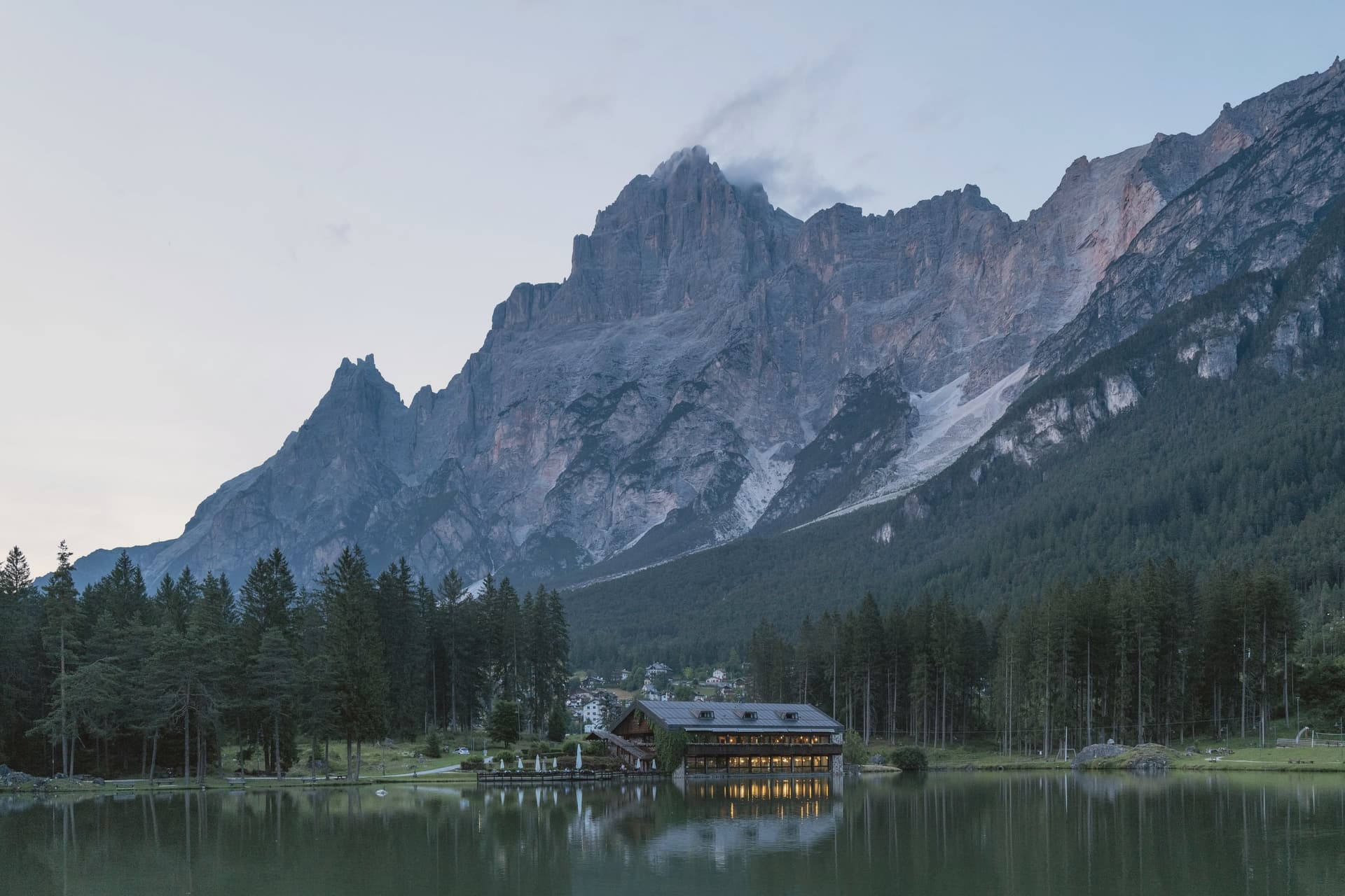
The village sits in the upper Boite valley, with the road from Belluno to Cortina running straight through the centro. Antelao closes the view to the east and the Pelmo faces it across the valley to the west, so the settlement reads as a single street pinned between two mountains rather than a place that spread outward on its own terms.
The commune appears in records from 1208, the date tied to the parish church, and the chapel at the south end of the village was added more than two centuries later, remodeled again in the sixteenth. Its altarpiece painter's family came from the next valley over, a detail that ties the church's decoration to the wider Cadore rather than to any outside workshop.
Tourism arrived in the mid-nineteenth century and grew steadily after the 1950s, and the marks of that later phase sit apart from the older core: Lago di Mosigo was cut from a marsh in 1929 and works as the summer center of the village, while the Lunga Via delle Dolomiti runs through the commune on a railway bed that stopped carrying trains and now carries the Greenways recognition. What holds the place together is the layering itself, a medieval religious core along the through road, a mountain on each side that never changes, and a twentieth-century lake and railway path built for people passing through rather than living there.
There is a mapped ski area on this commune, at 1011 meters.
What to see in San Vito di Cadore
- Chiesa della Madonna della Difesa. Late fifteenth-century Gothic chapel frescoed throughout, holding an altarpiece by Francesco Vecellio, Tiziano's younger brother. Stands at the village's south end.
- Chiesa dei Santi Vito, Modesto e Crescenzia. Parish church first documented in 1208, rebuilt in the eighteenth century with frescoed ceilings and wooden altars by local craftsmen.
- Lago di Mosigo. Artificial lake created in 1929 from a drained marsh, the village's summer center with a circular walking path and the Pelmo above it.
How to get to San Vito di Cadore
Venezia is about 2 h 8 min away by road.
Our tip
December through March is the winter season: skiing at San Vito and the connected Cortina domain, ice skating on the frozen Mosigo when it holds, and quiet evenings between hotels and the centro. The summer season runs June through September, walking in the Antelao and Pelmo basins, refuge dinners at Galassi and Venezia, and cycling the Lunga Via toward Cortina. April, May, October and November are the quiet months.
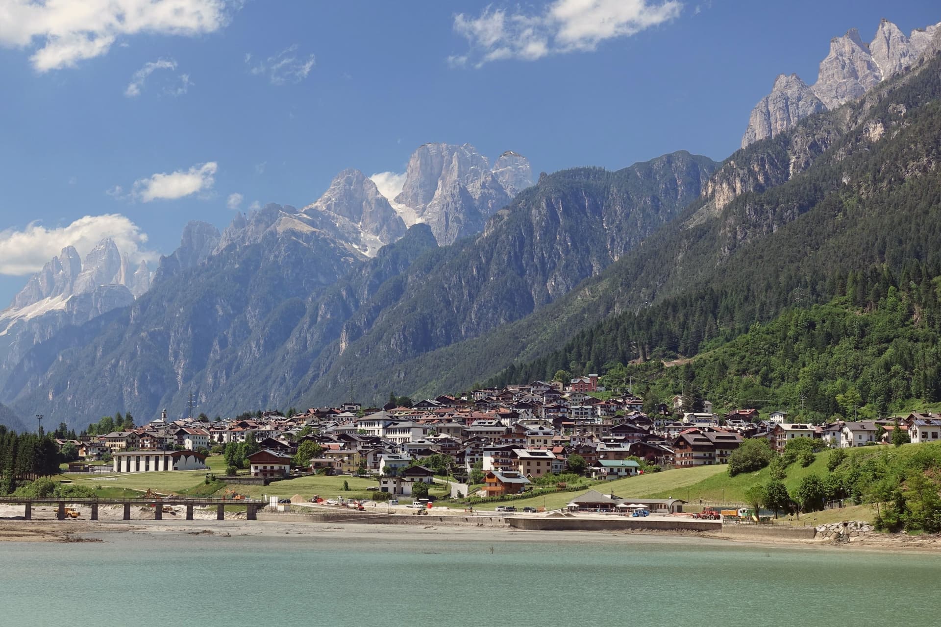
Why visit Auronzo di Cadore
The town sits at 864 meters in Centro Cadore, its five kilometers of ribbon shape owed to the dammed Ansiei: the river was closed off in 1930-32 to build a hydroelectric reservoir, and the settlement grew along the water it created. The municipal territory runs from that reservoir up through the surrounding peaks, taking in a high mountain lake to the north and the highest point in the territory to the south, a mountain that anchors one end of the same group ringing the lake.
The town itself, away from the water and the peaks, is workmanlike: hotels, a long lakefront, a small mid-nineteenth-century church in the Villapiccola frazione, and a working harbor for the small boats that cross the reservoir. The territory reads as two halves in balance: a functional, engineered lower town built for hydroelectric power and tourism traffic, and an upper world of high lakes and named summits that draws walkers for a single season each year.
The dam gave Auronzo its shape; the mountains around it gave the town its reason to be found.
There is a mapped ski area on this commune, at 864 meters.
What to see in Auronzo di Cadore
- Tre Cime di Lavaredo. Three battlement peaks rising to 2,999 meters, the symbol of the UNESCO Dolomites, with the classic loop trail from Rifugio Auronzo drawing walkers June through October.
- Lago di Misurina. Ringed by the Cadini, Sorapiss and Cristallo peaks, a high mountain lake used for respiratory therapy and reached as a trailhead.
- Lago di Santa Caterina. The lake the town runs along for its full length, with a working harbor for the small boats that cross the reservoir.
How to get to Auronzo di Cadore
Venezia is about 2 h 20 min away by road.
Our tip
May through October is the season. June, July and August fill the Tre Cime parking with cars from across Europe; the loop trail can hold a thousand walkers on a clear day. September is the most reliable month: stable weather, gold larches, fewer crowds at Rifugio Auronzo and Lavaredo.
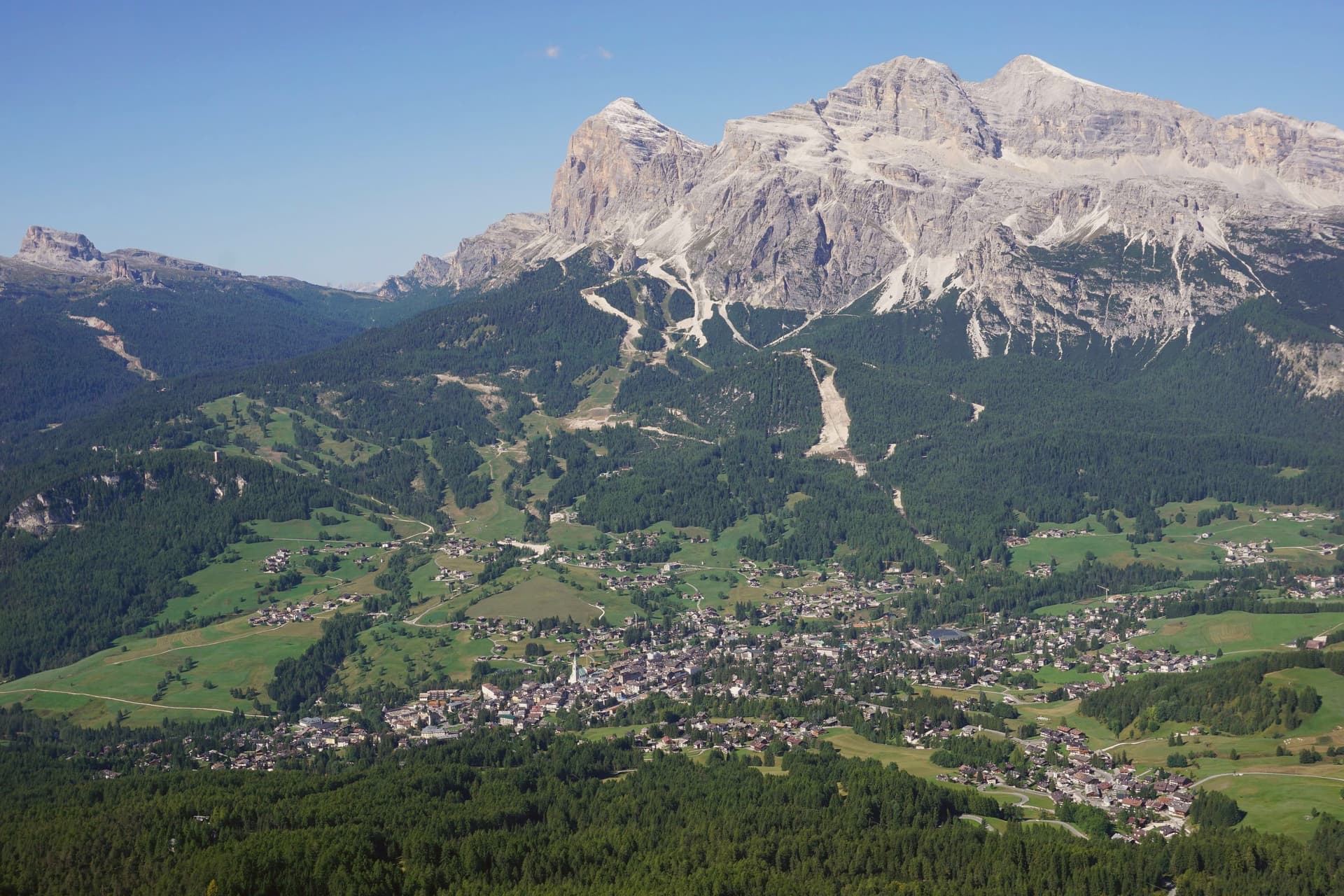
Why visit Cortina d'Ampezzo
The Ampezzo valley sits at 1,224 meters, closed in by a full ring of peaks: the Tofane to the west, Pomagagnon to the north, Cristallo to the northeast, Faloria and Sorapiss to the east, Croda da Lago and Cinque Torri to the south. The town takes its position from that ring, a flat basin with mountains rising on every side rather than a settlement that spread toward any one of them.
The valley's older identity runs through the Ampezzani, a Ladin-speaking community whose Regole assembly governed communal land through Habsburg rule and continued after the territory passed to Italy in 1919. That assembly still shapes how the surrounding forests and pastures are held, separate from the ski infrastructure and Olympic building laid over the same ground in 1956 and again for 2026.
Summer use of the valley extends outward on foot, with the Alta Via 1 running south to Belluno and a loop east to the Tre Cime. What the valley adds up to is a resort economy built inside a much older frame of land, language and self-government, the two rarely mentioned together but both still active in how the town is run and used.
There is a mapped ski area on this commune, at 1224 meters.
What to see in Cortina d'Ampezzo
- Tofana di Mezzo. Reached by the Freccia nel Cielo cable car from Corso Italia in three sections via Pomedes and Ra Valles, the ride climbing from the valley floor to open rock and long views over the Ampezzo basin.
- Basilica dei Santi Filippo e Giacomo. Parish church on Corso Italia with an 1858 façade and an 1860 campanile, the centro storico's principal monument and the anchor of its pedestrian street.
- Cinque Torri. Five rock towers south of Cortina at 2,361 meters, a climbing area with First World War open-air trenches restored as a free museum, the wartime positions still legible among the towers.
How to get to Cortina d'Ampezzo
Bolzano is about 1 h 56 min away by road.
Our tip
December through March is the Olympic season: the Dolomiti Superski lifts open, Tofana hosts the women's World Cup downhill on the Olympia delle Tofane in January, and the town runs at capacity through Carnival. June through September is the summer half: walking the Alta Via 1, climbing the Cinque Torri, and the via ferrata routes on Cristallo and Faloria. April, May, October and November are the dead months.
Read a sample letter
Todi | The Beverly Hills of Umbria
An unusually global town on a clay hill
Letters from the towns we visit. Free.
The button takes you to the letter's own page on Substack, where you leave your email. About the letter
More from Anywhere Italy
- The best ski towns in VenetoVenetoski area9 towns · smallest 1,100 residents
- The 7 best small towns that eat well in VenetoVenetoeats wellsmall7 towns · smallest 1,464 residents
- The 9 best high-altitude villages within 90 minutes of BolzanoNear Bolzanoabove 800 mwithin 90 min9 towns · smallest 1,396 residents · closest 43 min away
- The 10 prettiest hidden villages in VenetoVenetoprettiest villageshidden10 towns · smallest 742 residents
- The best small mountain towns within 90 minutes of BolzanoNear Bolzanomountainwithin 90 minsmall8 towns · smallest 1,086 residents · closest 41 min away
- The prettiest small villages in VenetoVenetoprettiest villagessmall6 towns · smallest 742 residents