
Lazio · Rieti
Rieti
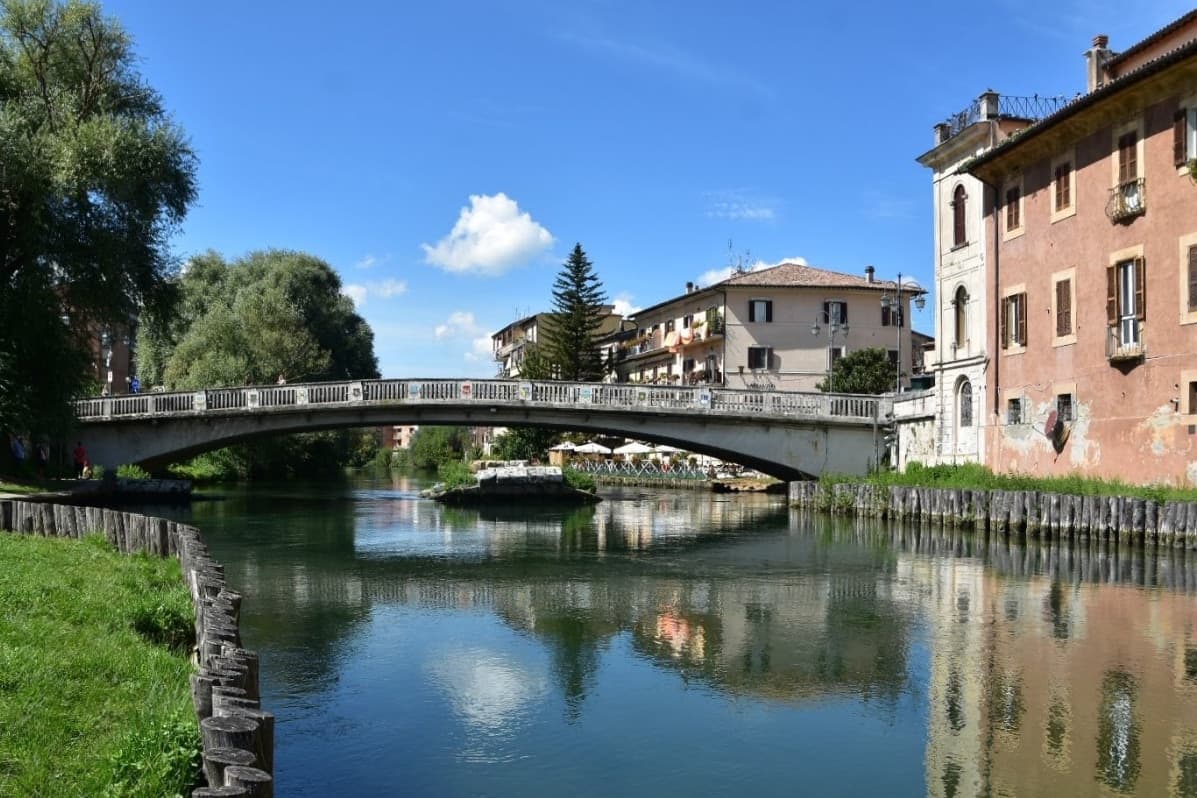
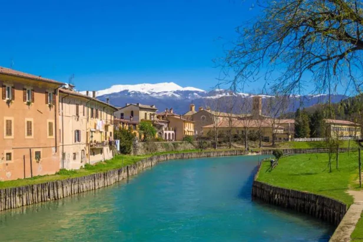
The Sabine capital on the Velino, claimed as the center of Italy, under Monte Terminillo and the Franciscan sanctuaries of the Valle Santa.
- Best time
- Apr–Oct
- By car
- 1 h 22 min from Rome
- By train
- Station in the comune
- Population
- 45,276
Known for
UMBILICUS ITALIAE
Rieti has long been held to sit at the geographic center of Italy, a claim marked in Piazza San Rufo.
PROCESSIONE DEI CERI
The Giugno Antoniano in honor of Saint Anthony of Padua ends in a procession of giant candles through the center in June.
RIETI SMART VILLAGE
The 2021 scheme that paid remote workers half their rent, up to 200 euros a month, to live in Rieti for at least three months.
PROSCIUTTO AMATRICIANO
The commune lies inside the Prosciutto Amatriciano IGP production zone.
- J11°
- F13°
- M14°
- A17°
- M22°
- J27°
- J32°
- A31°
- S25°
- O21°
- N16°
- D12°
- Best
- Hot or crowded
- Quiet
- Mostly closed
Daytime averages, 2020–2024. Weather data by Open-Meteo.com.
Why come
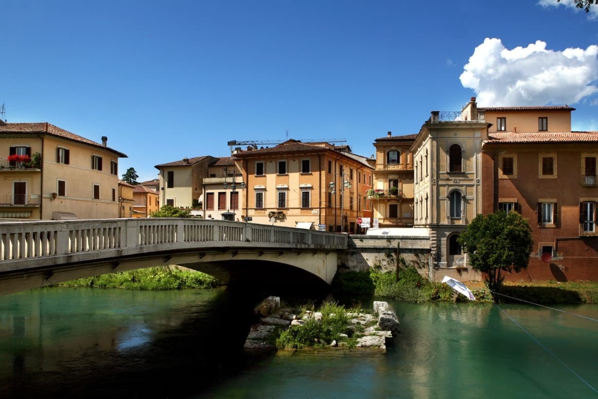
Rieti stands on a low rise at the edge of the Piana Reatina, the plain the Romans made when they drained the Lacus Velinus and sent its water over the cliff at Marmore. Medieval walls still close one side of the centro storico, and Via Roma runs down to the Velino and the stumps of the Roman bridge that carried the Via Salaria into town. A marker in Piazza San Rufo stands for what Rieti has claimed for centuries: the umbilicus Italiae, the center of Italy.
Popes stayed here often enough to build a palace beside the cathedral, and in 1234 Gregory IX canonized Saint Dominic inside it. Saint Francis spent long stretches in the valley, which is why it is called the Valle Santa; the sanctuaries of Fonte Colombo and La Foresta are both in the comune. Above the plain, Monte Terminillo rises to 2,217 meters and is known as Rome's mountain. In 2021 the town offered remote workers half their rent, up to 200 euros a month, to come and live here.
How to get there
From Rome Fiumicino (FCO), about 1 h 56 min by car.
Ancona (AOI) is about 2 h 55 min away.
By car from the center of Perugia 1 h 39 min or Pescara 2 h 6 min.
There is a railway station in the comune, so you can arrive without a car.
Coming from Rome?
Coming by train into Roma Termini? Rieti is about 1 h 23 min away by road.
Every town within reach of Rome Fiumicino airport.
First time driving in Italy? Read our complete manual.
What to see
Cattedrale di Santa Maria Assunta
Romanesque outside and Baroque inside, built between 1109 and 1225 with a bell tower of 1252. Pope Gregory IX canonized Saint Dominic here in 1234.
Palazzo Papale
The bishops' palace raised in 1283 for the papal court beside the cathedral, with a vaulted loggia at street level; it now holds part of the diocesan museum.
Piazza San Rufo
A small square in the old town with a marker for the traditional center of Italy, the umbilicus Italiae.
Ponte Romano
Remains of the third-century BC bridge that carried the Via Salaria over the Velino, lying on the riverbed beside the modern crossing.
Santuario di Fonte Colombo
Franciscan sanctuary in the woods above the plain, where Francis wrote the Rule of his order in 1223; a stage of the Cammino di Francesco.
Monte Terminillo
At 2,217 meters the third-highest peak in Lazio, largely inside the comune, with ski runs in winter and high trails in summer.
The slow-trip planner
Building a trip? Find where Rieti fits in a slow Italy circuit.
Answer six questions. We will shape a geographically coherent slow trip from the 1,000 Italian towns most travelers skip. Yours to save and share.
From the guides
Where to eat
Not our picks, but places the guides put their name to: a Michelin star, a Gambero Rosso fork, a Slow Food snail, a Michelin Key for the hotels. Worth a table, a counter, or a night when you pass through.
BistrotRistorante
Bistrot holds a spot in the Michelin Guide.
Before you sit down: how to order at a restaurant, how to spot a tourist trap, what aperitivo is and how the Italian bar works.
Living here
- Population 45,276, down 4.7% since 2015
- A local hubi
- Pharmacy in town
- High school within a 30-minute drive
- Train station in the comune
- A national health service hospital in the comune · how healthcare works in Italy
- Full fibre reaches 94% of homes
- Primary school in the comune
- Homes in the center: €800 to €1,150 per m² to buy, €5.50 to €8.00 per m² a month to renti
- Earthquake zone 2, medium hazard
- Rome Fiumicino airport, 1 h 56 min drive, the closest of the 15 airports we time
- Regional capital Roma, 1 h 22 min drive
Could you live here?
Rieti is a city.
- A city of 45,276 people, and a provincial capital: the services are here, not a drive away.
- A station of its own, so the rest of Italy is a train ride away.
The rules come from our series Where to Move in Italy, written from the places we have lived: Part 1, The End of the Road · Part 2, The Small Town · Part 3, The City · Part 4, The Postcard · Part 5, The Other Half. The towns we would pick are in Part 6, The Best Towns.
The button takes you to the letter's own page on Substack, where you leave your email. About the letter
Common questions
- What is Rieti known for?
- Rieti is the Sabine capital on the Velino, claimed as the center of Italy, under Monte Terminillo and the Franciscan sanctuaries of the Valle Santa.
- Where is Rieti?
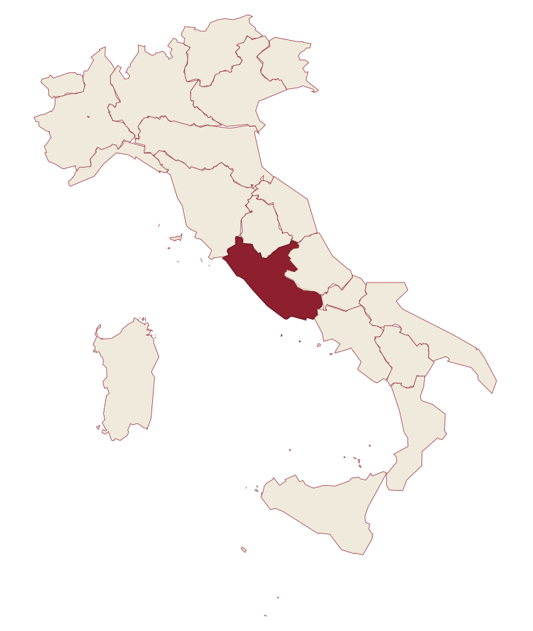
- Rieti is a comune in the province of Rieti, in Lazio, at 405 meters above sea level.
- Which of the airports we measure is closest to Rieti?
- Of the 15 airports we time the drive to, the closest is Rome Fiumicino (FCO), about 1 h 56 min by car.
- Can you get to Rieti without a car?
- Yes. There is a railway station in the comune, so you can arrive by train.
- How long is the drive from Perugia to Rieti?
- About 1 h 39 min by car.
- When is the best time to visit Rieti?
- Best in Apr–Oct. July is the warmest month, averaging 32 degrees, and December the wettest, with about 13 rain days.
- Which other towns are like Rieti?
- Velletri, Tivoli and Orvieto.
- How many people live in Rieti?
- 45,276 at the 2023 count.
- Is Rieti a good place to live?
- Rieti is a city of 45,276 people, the kind of place Part 3 of our Where to Move in Italy series is about. There is a national health service hospital in the comune. Full fibre reaches 94% of homes.
Tags & datadesignations · numbers · sources
Landscape
The numbers
- Elevation: 405 m
- Population: 45,276
- Surface area: 206.46 km²
These figures were compiled from public directories: ISTAT, OpenStreetMap and Wikidata, and from the official listings of the guides named on this page. Town details change; verify with official sources before you travel.
Similar
Towns like Rieti
What all six share with Rieti: inland, away from the coast · over 10,000 people · hill towns · have a railway station in the comune
The ranked lists
Lists Rieti appears in
- The best towns on the Cammino di San Benedetto in LazioLazioon a walking route6 towns · smallest 266 residents
- The best hill towns with a serious restaurant within 90 minutes of TerniNear Ternihill townwithin 90 minserious restaurant7 towns · smallest 3,433 residents · closest 33 min away
- The best towns with a serious restaurant that sit on a walking route in LazioLazioon a walking routeserious restaurant7 towns · smallest 5,266 residents
- The 8 best hill towns on a walking route within 90 minutes of TerniNear Ternihill townon a walking routewithin 90 min8 towns · smallest 446 residents · closest 18 min away
- The best towns you can reach by train that have a serious restaurant in LazioLazioby trainserious restaurant8 towns · smallest 6,684 residents
- The 9 best hill towns with a serious restaurant in LazioLaziohill townserious restaurant9 towns · smallest 3,433 residents
Our guide
Our nearest guide, 54 km away
Tuscia: the towns, when to go, how to get there
The Tuscia guide came out of the letter. Letters from the towns we visit. Free.
The button takes you to the letter's own page on Substack, where you leave your email. About the letter
Read the guide: The land Rome took twice. 16 towns, the drive and train times, the months, where to eat and sleep.