The best towns on the Cammino di San Benedetto in Lazio
The Cammino di San Benedetto follows the life of Saint Benedict from Norcia, where he was born, to Subiaco, where he first lived as a hermit, and on to Montecassino, where he founded his abbey and wrote his Rule. Most of its three hundred kilometers run through Lazio, down the Sabine hills, across the Aniene valley and into the Ciociaria, on mule tracks, farm roads and old pilgrim paths. It is a walk of monasteries and hill villages, with long days between them and a fountain in almost every piazza.
It is far quieter than the Via Francigena, which crosses the north of the region on its way to Rome and brings the hostels, the passport stamps and the crowds that come with them. Here the first stages start in Umbria, at Norcia and Cascia, and the early days in Lazio are spent in villages that see more shepherds than walkers. The abbey at Montecassino, rebuilt after its destruction in the war, is the finish, and many people reach it having met few other pilgrims on the way.
The towns in this list are the ones on the route worth more than a night. There is a provincial capital on the Velino whose cathedral saw a saint canonized, a stone village above a green reservoir lake, a hill town at the edge of the Monti Lucretili, the monasteries of the Aniene gorge, a town with a waterfall in its own center, and Cicero's birthplace high above the Liri valley. Walked in order they turn a long pilgrimage into a series of arrivals, each with a bed, a meal and a church worth the climb.
Of the 61 communes we have mapped in Lazio, 6 qualify as towns on the Cammino di San Benedetto: each is a stage on the Cammino di San Benedetto. The smallest, Castel di Tora, has 266 residents.
Elsewhere in the catalogue: The best hill towns on a walking route in Lazio and The prettiest villages on a walking route in Lazio.
Castel di Tora
Why visit Castel di Tora
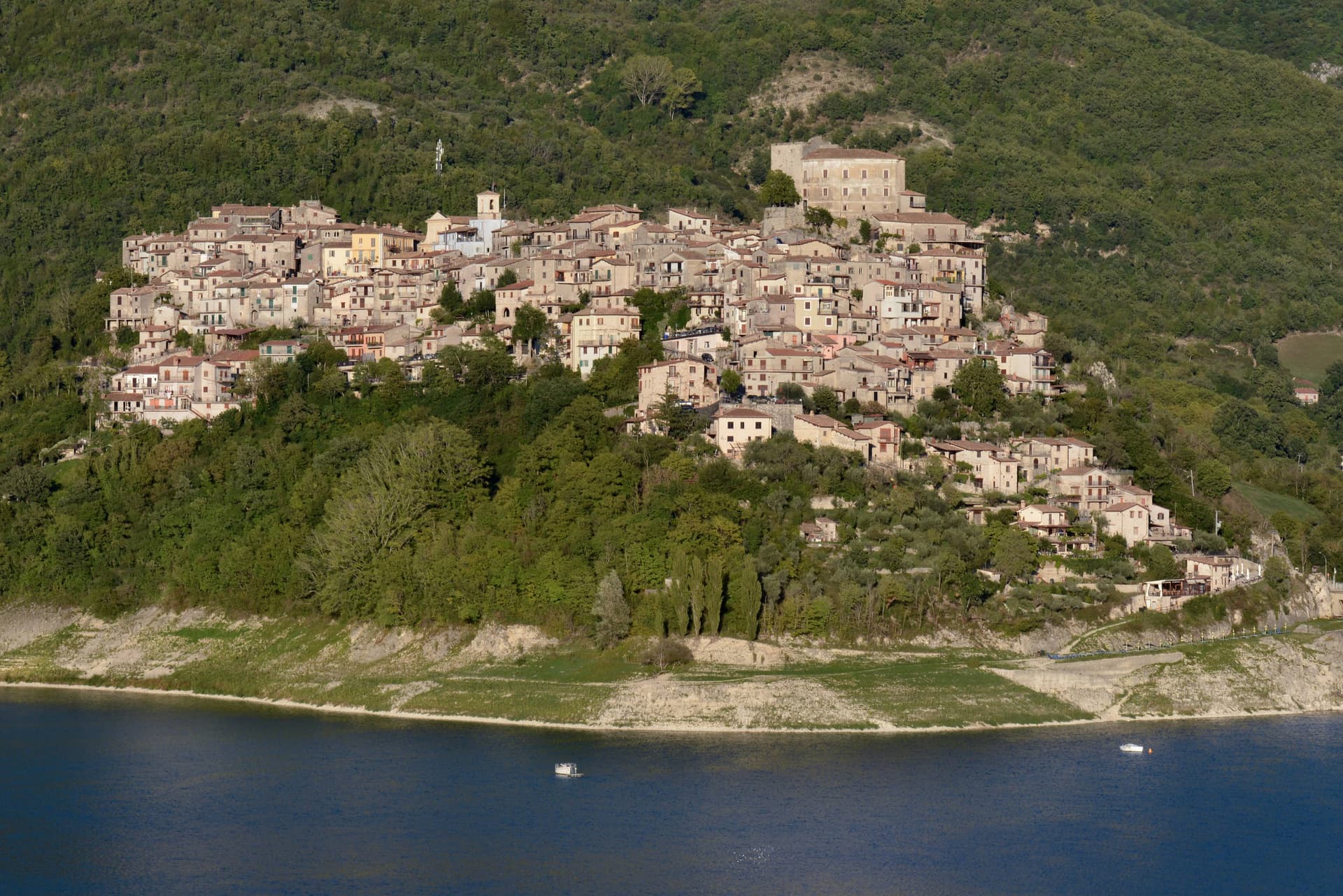
Castel di Tora sits at 607 meters on the northeast shore of Lago del Turano, in the upper Sabina, fifty kilometers northeast of Rome. The lake itself is artificial, dammed in 1936 for hydroelectric regulation of the Turano river; before then, two villages stood on the valley floor.
One of them, Antuni, gave up its houses and emptied. Today a small isthmus runs out to the Antuni promontory, where the fifteenth-century Palazzo del Drago, built with 365 windows for the days of the year, has been restored along with its garden labyrinth.
The medieval centro storico climbs the slope above the lake to a polygonal fortress tower of the eleventh century. The Monti Sabini close the western shore; the Carseolani close the eastern, rising to Monte Navegna at 1,508 meters.
Two hundred and sixty-six people live here year-round. The Cammino di San Benedetto passes through on its way from Subiaco to Rieti.
What to see in Castel di Tora
- Rocca medievale. Eleventh-century polygonal fortress tower on the cliff above the village, anchor of the original Castrum Vetus that gave the town its name.
- Antuni e Palazzo del Drago. Restored fifteenth-century palace with 365 windows for the days of the year, on the Antuni promontory across an isthmus, with a garden labyrinth.
- Lago del Turano. Artificial reservoir dammed in 1936 at 536 meters elevation, ten kilometers long, 60 meters deep, surrounded by the Sabini and Carseolani ranges.
How to get to Castel di Tora
Terni is roughly 72 minutes away by road.
Our tip
May through October is the season for Castel di Tora. The lake warms to swimming by late June, the Sabini stay green into August, and the chestnut woods on the slopes turn gold in October. July and August fill the lakeshore with day-trippers from Rome and Rieti, especially weekends.
Orvinio
Why visit Orvinio
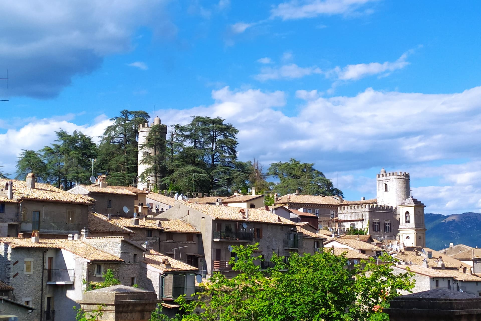
Orvinio sits on a saddle in the Monti Lucretili park, the last village before the slopes drop toward the Turano lake. The ancient settlement called Orvinium was destroyed before the year 1000, and the medieval town that grew up afterward took the name Canemorto, said to commemorate a Saracen defeat by Charlemagne's troops in 817.
The Orsini built the Granarone palace in the fifteenth century, before the Borghese took the fief in 1632. The village they governed still reads in two layers: stone houses running in tight loops below the ridge, and the Castello Malvezzi-Campeggi above them, the physical record of who held the place longest.
The Cammino di San Benedetto crosses this lower town on its way between Subiaco and Norcia, a reminder that the village has always been a point of passage as much as a seat of lordship. What remains is a settlement whose name changed twice and whose skyline did not: the castle above, the loops of houses below, unchanged in relation even as the village below it was renamed.
What to see in Orvinio
- Castello Malvezzi-Campeggi. Rebuilt by the Borghese in the nineteenth century, it dominates the village from the upper ridge, still visibly the seat of the family that held the fief the longest.
- Abbazia di Santa Maria del Piano. Benedictine abbey founded in the early Middle Ages, the original landlords of the territory before the Orsini took it.
- Centro storico. Stone houses in tight medieval loops below the castle, with vaulted passages and the original village gates preserved.
How to get to Orvinio
Roma is roughly 60 minutes away by road.
Our tip
May through September is the working window at 840 meters. The Lucretili woods open, the trails dry out and the village evenings stay cool when Rome forty-five kilometers downhill is hitting thirty-five. October still holds for the woods turning copper and for the Cammino di San Benedetto walkers passing through on the route between Subiaco and Norcia. Sagra della Polenta falls in August.
Arpino
Why visit Arpino
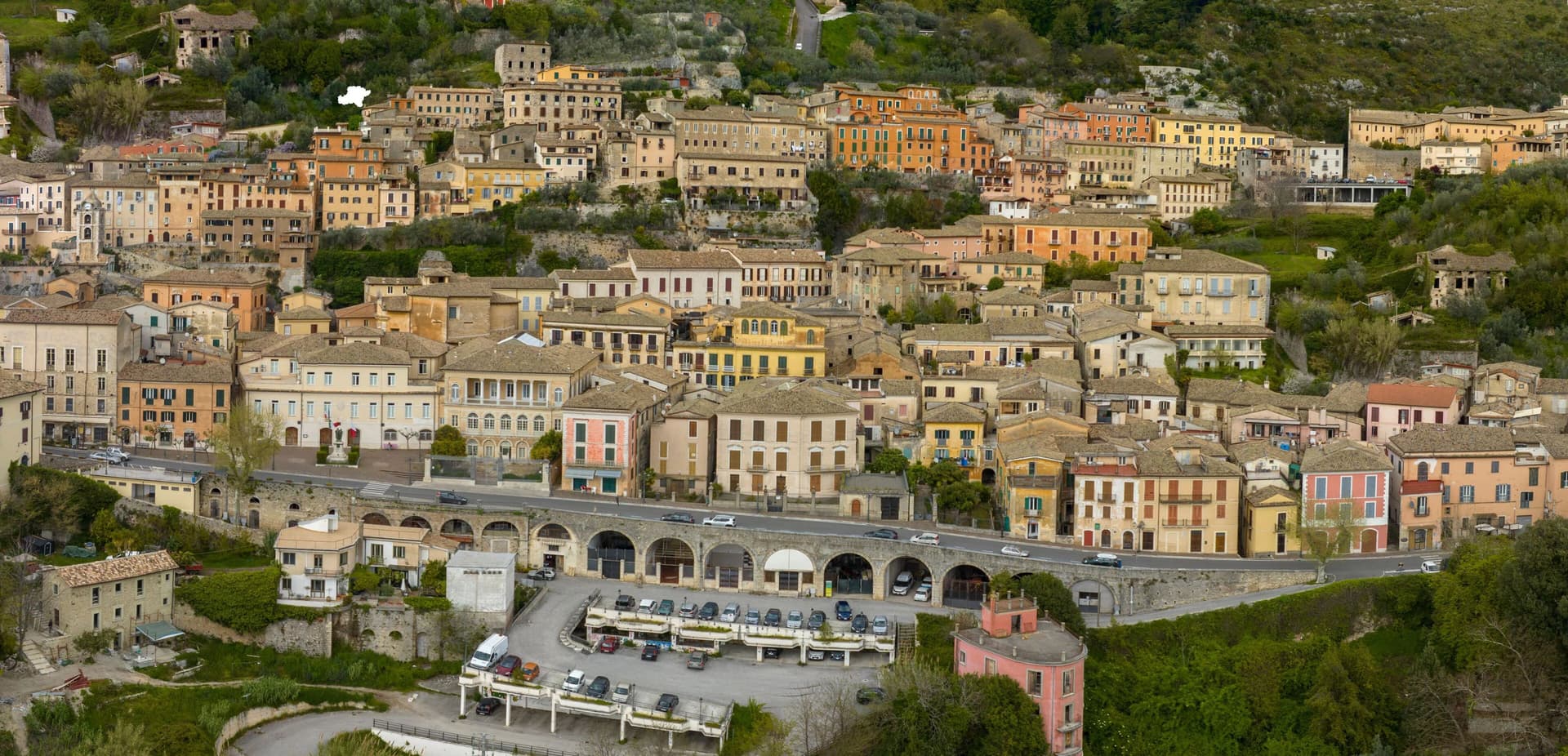
Arpino sits at 450 meters on two hills in the Liri valley, in the Ciociaria region of southern Lazio. The ancient city of Arpinum, on the upper hill now called Civitavecchia, was a Volscian-Samnite stronghold captured by Rome in 305 BC.
The lower hill is the medieval and modern town. Two Roman consuls were born here: Gaius Marius, the military reformer who fought the Cimbri and Teutones, and Marcus Tullius Cicero, the orator and senator killed in 43 BC.
The villa where Cicero was born stood just north, on the Liri, in what is now Isola del Liri. The upper acropolis is ringed by polygonal cyclopean walls of the sixth or fifth century BC, with the Arco a Sesto Acuto, a pointed-arch gate cut into the same stone work.
Arpino is on the Bandiere Arancioni list and on the Cammino di San Benedetto, the long pilgrim route from Norcia to Montecassino.
What to see in Arpino
- Acropoli di Civitavecchia. Pre-Roman upper city on the hill above modern Arpino, surrounded by cyclopean polygonal walls of the sixth or fifth century BC.
- Arco a Sesto Acuto. Pointed-arch gate cut into the cyclopean walls of the acropolis, the only known pre-Roman ogival arch in central Italy.
- Torre di Cicerone. Medieval tower on the acropolis, traditionally linked to Cicero by local memory though built more than a thousand years after his death.
How to get to Arpino
There is a railway station in the town, so you can arrive without a car and never need one while you are here. Latina is roughly 94 minutes away by road.
Our tip
April through June and September through October are the strong months. Spring brings green hills along the Liri and clear views from the acropolis; autumn is dry and gold. July and August push past thirty degrees in the valley, although Arpino's 450-meter position offers some relief in the upper town. Il Gonfalone falls in July.
Subiaco
Why visit Subiaco
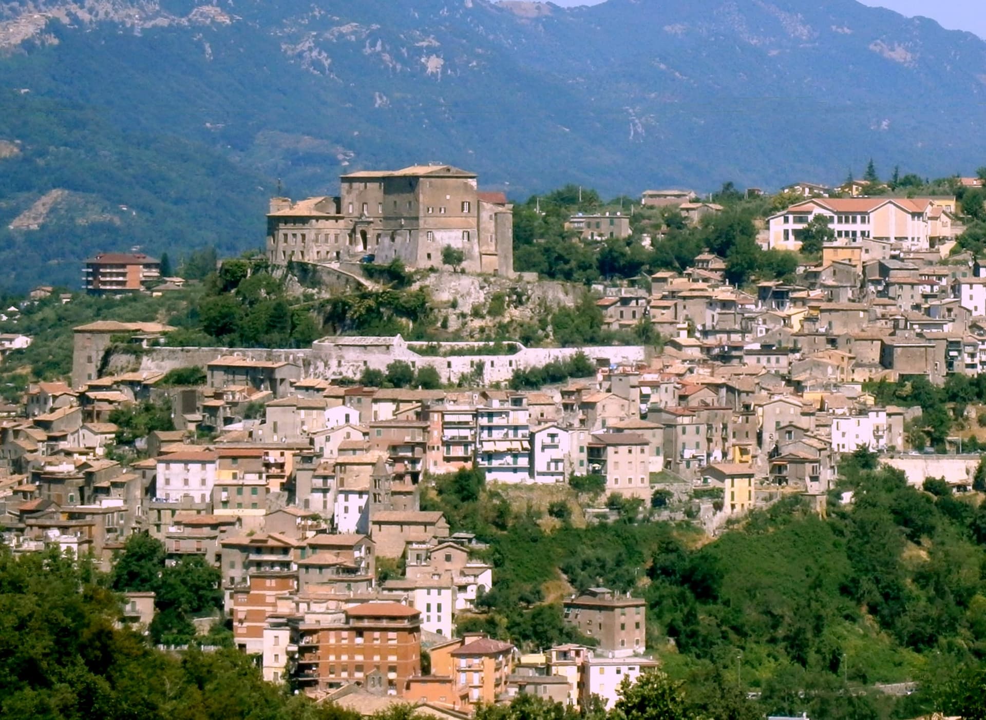
Subiaco sits at 408 meters along the upper Aniene, seventy-three kilometers east of Rome and forty from Tivoli. Nero built a villa here in the first century, damming the river into artificial lakes known as Sublaqueum, below the lake, and the name outlasted the villa and the emperor both.
The town that grew up here reads in layers going up the valley side: the river and the bridge at the bottom, the abbey partway up the hill, the fortress at the summit, and the cliff sanctuary further out along the cliff face that gave the hermit's cave its shelter, each one built at a different remove from the water and from the town center. What holds these layers together is a single life.
A man who came here as a young man to live alone in a cave gave his name to a monastery down the hill, and centuries later that same monastery's press put the first printed book on Italian soil into circulation. The fortress above answers to a different history, the abbots who ruled here as feudal lords, one of whom fathered a child who became one of the most written-about women of her age.
A river valley that supplied an emperor's pleasure lakes became, without much overlap, the ground where monastic life took its early shape.
What to see in Subiaco
- Monastero del Sacro Speco. Built into the cliff face of Monte Taleo, the sanctuary rises in tiers over the cave itself, and the frescoes by Conxolus and the school of Cimabue cover walls that follow the rock rather than a flat plan.
- Abbazia di Santa Scolastica. The only one of Benedict's twelve original monasteries still standing, sixth century in origin; its library holds three hundred manuscripts, including a copy of the Lactantius run off the abbey's own press.
- Rocca Abbaziale (Rocca dei Borgia). Set on the highest ground of the borgo, the fortress was raised by abbot Giovanni V in the twelfth century and later gave Lucrezia Borgia, daughter of the abbot Rodrigo Borgia, a birthplace in 1480.
How to get to Subiaco
There is a railway station in the town, so you can arrive without a car and never need one while you are here. Roma is roughly 70 minutes away by road.
Our tip
April through June and September through October are the months for Subiaco: the Aniene runs full, the cliff sanctuaries are open from morning, and the pilgrim road south fills with walkers on the Cammino di San Benedetto. July and August are warm in town and cool in the monasteries; the cave at the Sacro Speco holds twelve degrees year-round. November through March is the quiet pilgrim season, mist on the river and few coaches in the lots. Festa Madonna di Pompei Rione Colle falls in August.
Isola del Liri
Why visit Isola del Liri
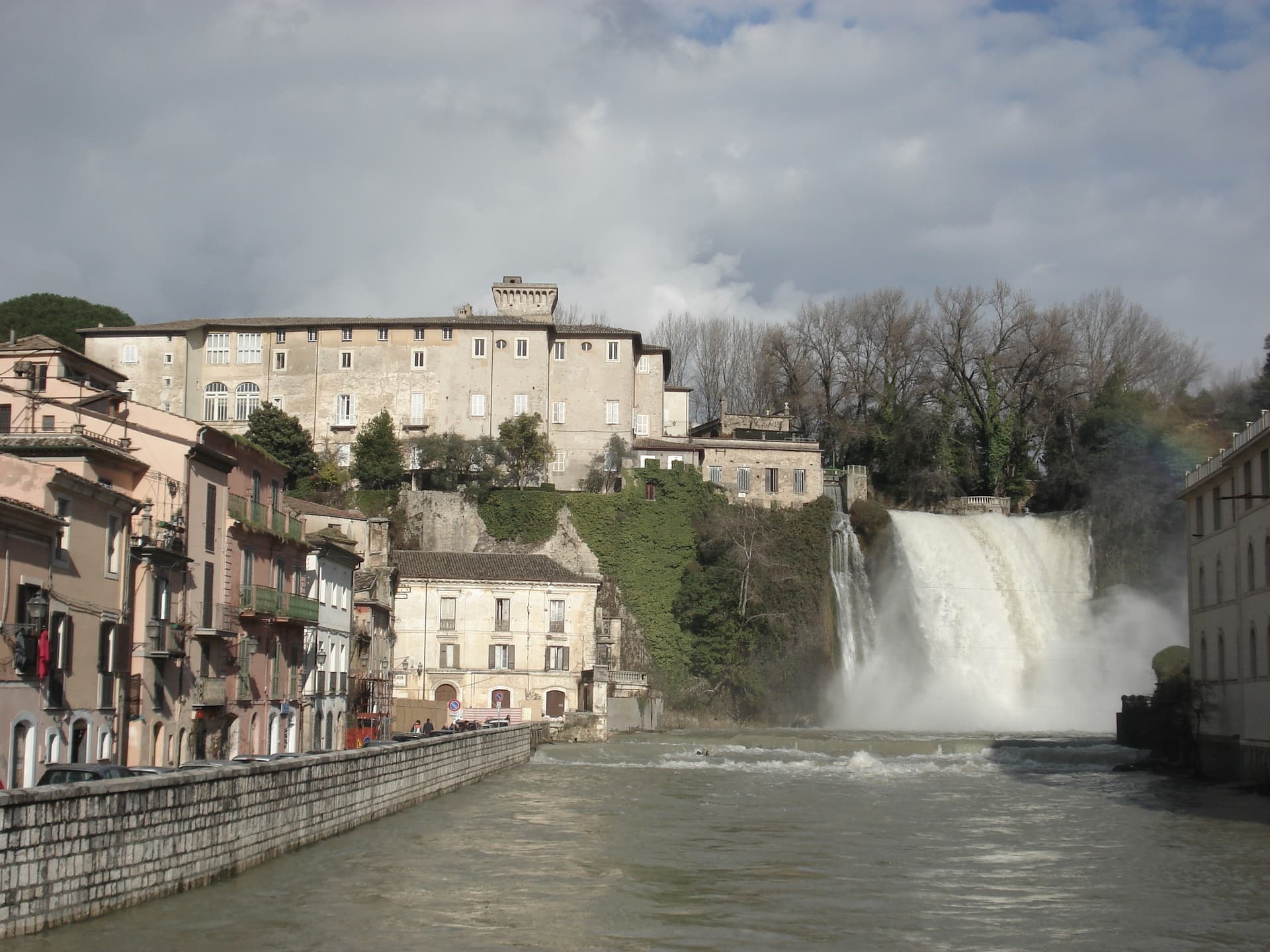
Isola del Liri is built on an actual island, where the Liri river splits into two arms and the two arms fall over a limestone shelf into the lower valley. The Cascata Grande is 27 meters high and lands inside the historic center, fifty meters from the Castello Boncompagni-Viscogliosi, the fortified palace above it.
The second fall, Cascata del Valcatoio, is partly diverted for hydropower. From the 19th century the river ran the paper mills, felt mills and wool mills that gave the town the name Manchester of Italy: the Fibreno-Lefebvre mill exported to North America.
The paper industry collapsed in the late 20th century. The town responded with the Liri Blues Festival, started in 1988 by a local businessman, Luciano Duro, to draw attention back to a place that had lost its trade; it became one of Europe's longer-running free blues festivals.
The Cammino di San Benedetto walking route passes through.
What to see in Isola del Liri
- Cascata Grande. 27-meter waterfall in the center of town, the Liri river dropping over a limestone shelf next to the castle.
- Cascata del Valcatoio. Second urban waterfall on the right arm of the Liri, partially diverted for hydroelectric production.
- Castello Boncompagni-Viscogliosi. Fortified palace from the 14th century above the Cascata Grande, residence of the Boncompagni-Ludovisi from the 16th century.
How to get to Isola del Liri
There is a railway station in the town, so you can arrive without a car and never need one while you are here. Latina is roughly 80 minutes away by road.
Our tip
April through June is when the Liri runs hardest after the spring melt and the Cascata Grande is at maximum volume. July is the festival month: the Liri Blues runs across several July evenings on stages in the centro storico and on the riverbanks. August stays hot in the Liri valley, the town thins out for the coast.
Rieti
Why visit Rieti
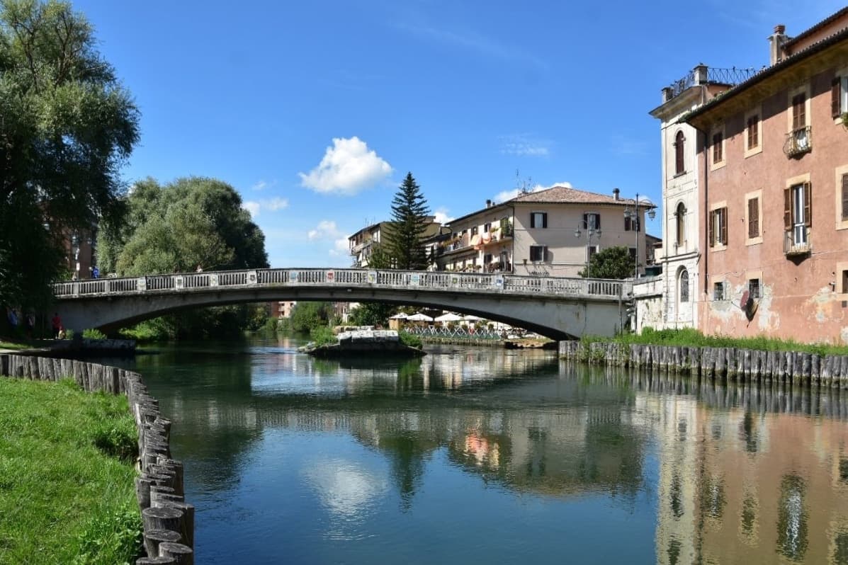
Rieti stands on a low rise at the edge of the Piana Reatina, the plain the Romans made when they drained the Lacus Velinus and sent its water over the cliff at Marmore. Medieval walls still close one side of the centro storico, and Via Roma runs down to the Velino and the stumps of the Roman bridge that carried the Via Salaria into town.
A marker in Piazza San Rufo stands for what Rieti has claimed for centuries: the umbilicus Italiae, the center of Italy. Popes stayed here often enough to build a palace beside the cathedral, and in 1234 Gregory IX canonized Saint Dominic inside it.
Saint Francis spent long stretches in the valley, which is why it is called the Valle Santa; the sanctuaries of Fonte Colombo and La Foresta are both in the comune. Above the plain, Monte Terminillo rises to 2,217 meters and is known as Rome's mountain.
In 2021 the town offered remote workers half their rent, up to 200 euros a month, to come and live here.
What to see in Rieti
- Cattedrale di Santa Maria Assunta. Romanesque outside and Baroque inside, built between 1109 and 1225 with a bell tower of 1252. Pope Gregory IX canonized Saint Dominic here in 1234.
- Palazzo Papale. The bishops' palace raised in 1283 for the papal court beside the cathedral, with a vaulted loggia at street level; it now holds part of the diocesan museum.
- Piazza San Rufo. A small square in the old town with a marker for the traditional center of Italy, the umbilicus Italiae.
How to get to Rieti
There is a railway station in the town, so you can arrive without a car and never need one while you are here. Terni is roughly 39 minutes away by road.
Our tip
April to October suits Rieti. Spring turns the plain green and fills the Velino; June is the Giugno Antoniano, which ends in the Processione dei Ceri, and late July brings the Palio della Tinozza, races in wooden tubs on the river. Summer is warm in town at 405 meters and cool on Terminillo, where the high trails open.