
The best small towns on a walking route in the province of Siena
Walking south from Siena the ground keeps changing under your boots. First the Crete Senesi, bare clay ridges the colour of wet cardboard in winter and pale straw after the harvest, then the Val d'Orcia with its cypress lines and travertine villages, then the dark volcanic soil of Monte Amiata under chestnut woods. The food follows the geology: pecorino from the sheep on the clay, pici rolled by hand, cinta senese pork, chestnut flour on the mountain, and thermal springs that come up hot enough to steam on a February morning. Spring and early autumn are the walking seasons, when the light is long and the tracks are dry, and the abbeys and pilgrim hospices that once fed people moving south are still standing along the way.
The obvious version of this is Siena itself, where the Campo fills up by mid-morning and the coach parks work through the summer, or a day trip down to Pienza and Montepulciano for cheese and wine with the rest of the buses. It is crowded for good reason. The city is one of the great medieval urban spaces in Europe and the wine hills south of it are worth the traffic. But most people see the province from a car park, on a loop that returns to the same hotel by evening.
The pilgrim road did not stop at the city gate. It ran south through the clay and over the volcanic hills, and the towns that fed and sheltered walkers on it are still spaced out at roughly a day's distance from each other, which is what makes them worth stringing together on foot. Fewer people go. These are the smaller stages, the ones with a fortress above a spa, a travertine church at a crossroads, or a chestnut wood at your back.
Of the 20 communes we have mapped in the province of Siena, 10 qualify as towns on a walking route: each is a stage on one of the long historic walking routes. This list is the small ones, 6 in all, ordered smallest first. The smallest, Radicofani, has 1,060 residents.
If you are still choosing, we have also written The best towns on a walking route in the province of Siena and The 10 best small hill towns in the province of Siena.
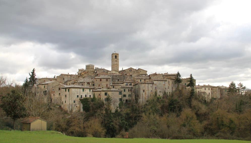
San Casciano dei Bagni
Why visit San Casciano dei Bagni
San Casciano dei Bagni sits at 582 meters at the southern edge of the province of Siena, above 42 hot springs that average 42 degrees Celsius. The baths were used continuously from Etruscan through Roman times and again from the Renaissance, when visitors came from across Europe.
In 2022, an excavation that began in 2019 at the ancient sanctuary turned up 24 bronze votive statues protected by mud, with around 6,000 coins in gold, silver and bronze. The find was the largest of its kind in fifty years; most surviving Etruscan votive material is terracotta.
The 1,500 residents live on a basalt outcrop above the Roman thermal complex, in a centro storico of stone houses and three small churches. The borgo joined the Borghi più belli network in 2014 and remains one of the smallest communes in Toscana to carry both that label and Bandiera Arancione.
What to see in San Casciano dei Bagni
- Santuario Ritrovato. Etruscan-Roman thermal sanctuary excavated since 2019, where 24 bronze votives and around 6,000 coins were recovered in 2022.
- Bagno Grande. The principal natural pool of the 42 hot springs, used from the second century BC through the Renaissance and reopened to the public.
- Collegiata di San Leonardo. Romanesque parish church in the centro storico, restored in the seventeenth century, with a baptismal font carved from local travertine.
How to get to San Casciano dei Bagni
Perugia is roughly 68 minutes away by road.
Our tip
The thermal pools make the calendar different here. Winter is the season many visitors prefer, when the 42-degree water steams against cold air and snow occasionally dusts the basalt outcrop. April through June and September into October are the most balanced months: warm hill light, the dry-stone walls of the borgo at their best, the sanctuary excavations open to guided tours. Sagra del Ciaffagnone di San Casciano dei Bagni falls in June.
Buonconvento
Why visit Buonconvento
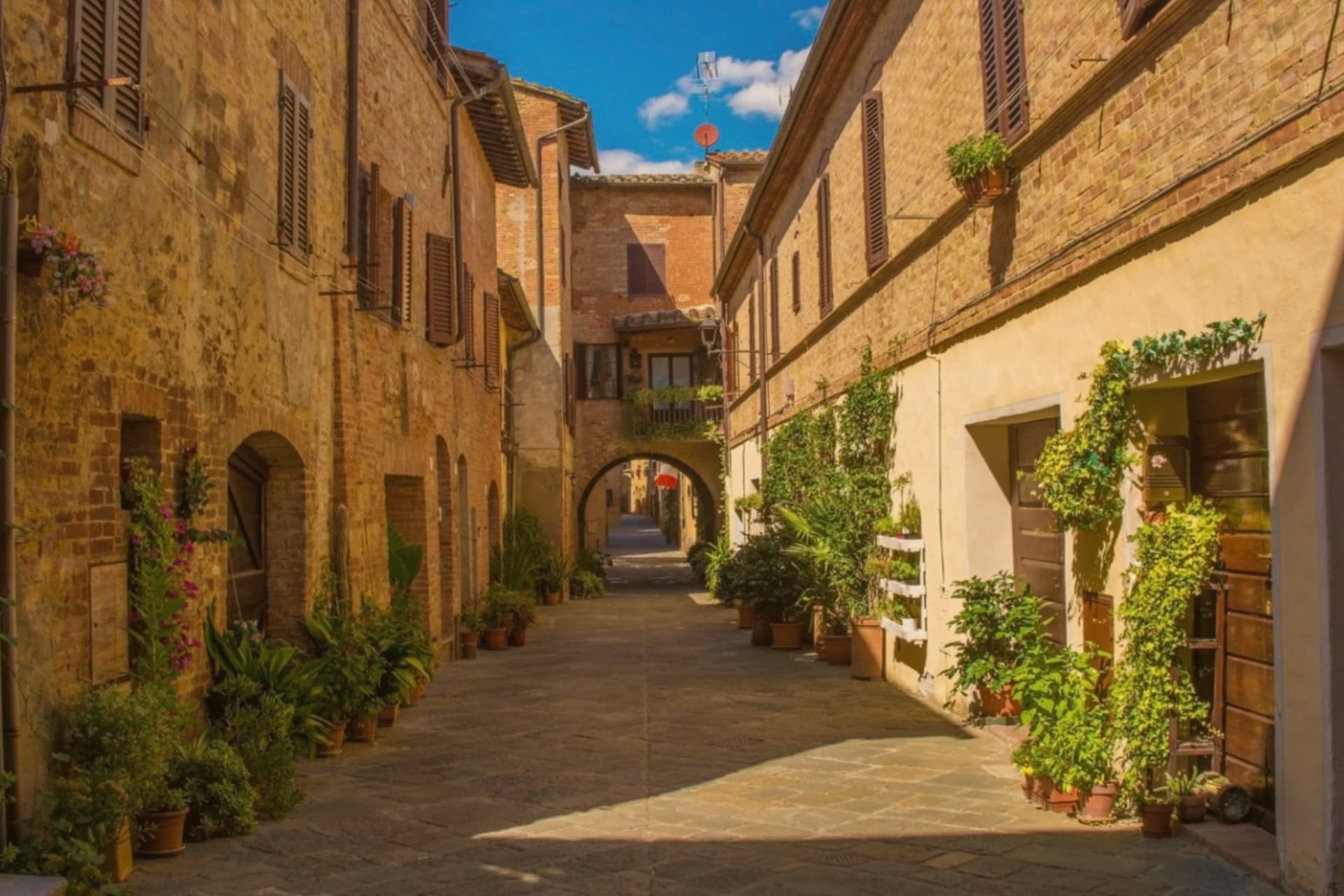
Buonconvento sits on the plain of the Via Cassia at 147 meters, where the Arbia meets the Ombrone, twenty-five kilometers south of Siena and the main town of the Crete Senesi. The name comes from bonus conventus, happy meeting place, recorded for the first time in 1100.
In August 1313 Emperor Henry VII of Luxembourg died here on his way to Rome, a death the Ghibellines blamed on poisoning. The Sienese walled the borgo in 1379: brick curtain walls with hanging arches, two gates called Porta Senese and Porta Romana.
Porta Romana was destroyed in 1944 by the retreating Germans, the same year the Allies came up the Via Cassia. The Palazzo Pretorio, fourteenth century, has twenty-five podestà coats of arms on its façade and a tower that echoes Siena's Torre del Mangia.
The Museo d'Arte Sacra della Val d'Arbia holds a Madonna by Duccio di Buoninsegna from the 1290s.
What to see in Buonconvento
- Palazzo Pretorio. Fourteenth-century brick palace with twenty-five podestà coats of arms on its façade and a slender tower modeled on Siena's Torre del Mangia.
- Mura di Buonconvento. Brick curtain walls with hanging arches built by Siena in 1379, with Porta Senese to the north (Porta Romana lost in 1944).
- Museo d'Arte Sacra della Val d'Arbia. Sacred art collection in Palazzo Ricci Socini covering the Sienese school from the 13th to 19th centuries, including a Duccio Madonna.
How to get to Buonconvento
There is a railway station in the town, so you can arrive without a car and never need one while you are here. Perugia is roughly 99 minutes away by road.
Our tip
April through June paints the Crete green and the spring wheat is at full height by May. September and October are the Crete at their most photographed: bare hills back in clay color, low sun, long shadows. July and August touch the high thirties in the plain; the walls hold heat into the night.
Piancastagnaio
Why visit Piancastagnaio
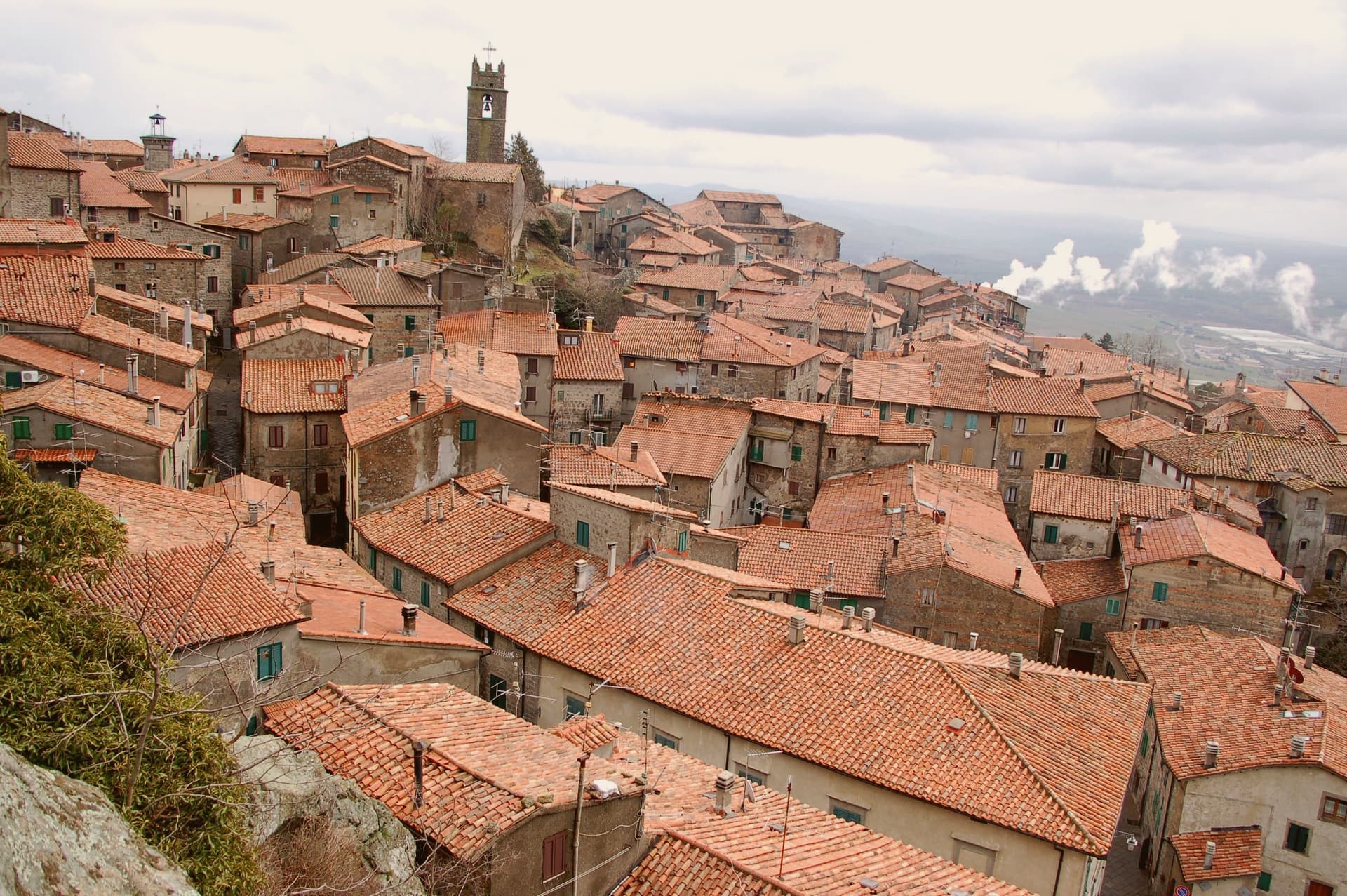
The name means plain of the chestnut, and the forest that still climbs the slope above the town is what fed it for most of its history: sweet chestnut, sessile oak, beech. The town itself sits at 772 meters, built around a twelfth-century keep that passed to Siena in 1418 and to the Medici in 1559, and the palazzo built into its old defenses in the sixteenth century reads as the Medici layer set directly against the Aldobrandeschi one.
Contrade named Borgo, Castello, Coro and Voltaia divide the centro storico for the August race, while the mining museum keeps the record of an industry, cinnabar and mercury, that ran on the mountain from Etruscan times until it closed in 1982 and that has otherwise left the town to the chestnut trade. What Piancastagnaio adds up to is a place where a volcano's slope has supplied, in turn, timber and food, ore, and a festival calendar, and where the built town still carries each of those histories as a separate, legible layer rather than a single blended one.
What to see in Piancastagnaio
- Rocca Aldobrandesca. Twelfth-century Aldobrandeschi keep at the heart of the centro storico, with a square tower and surviving curtain wall.
- Palazzo Bourbon del Monte. Sixteenth-century Medici-era palazzo built into the medieval defenses, with a courtyard loggia and ceremonial hall.
- Museo Minerario di Sant'Anna. Mining museum on the cinnabar and mercury extraction of Monte Amiata, active from the Etruscans until the mine closed in 1982.
How to get to Piancastagnaio
Perugia is roughly 135 minutes away by road.
Our tip
May through September is the season on the southern Amiata slope. The chestnut woods are open, the air at 772 meters stays cool against the Maremma heat below, and the trails to the volcano summit run from town. The Palio delle Contrade is the second weekend in August, the only date most outsiders know. Crastatone di Piancastagnaio falls in the season.
Radicofani
Why visit Radicofani
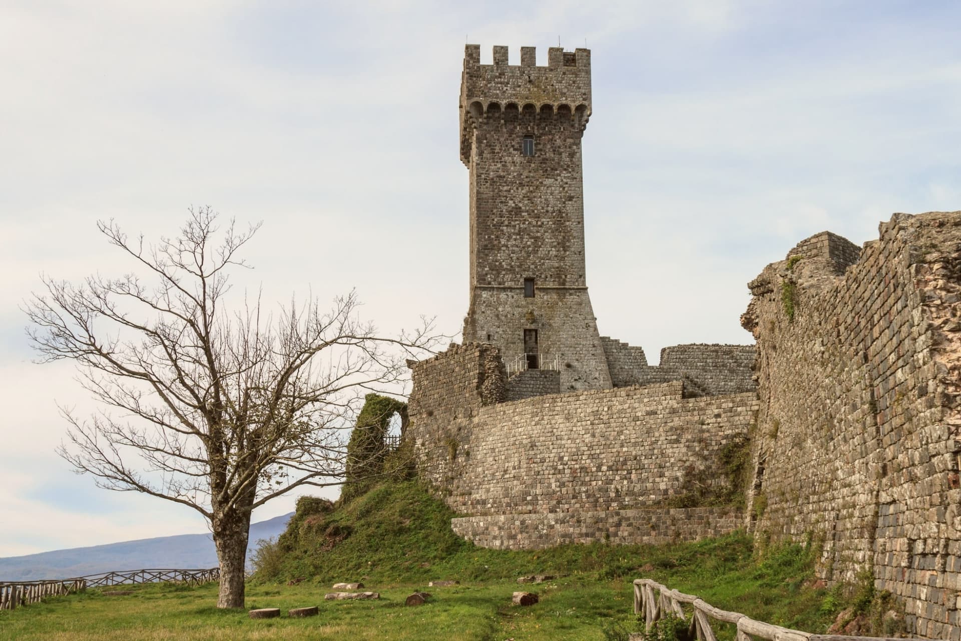
Radicofani sits where the rolling clay hills of the Val d'Orcia give way, abruptly, to a volcanic cone: the town rises straight off the plain rather than sitting among gentler slopes, which is why the rock is visible from Pienza, Montalcino, the Cassia road and points as far off as Lago Trasimeno, 60 km away, and why it reads as a landmark rather than a village from any distance. The medieval centro climbs in the same volcanic-basalt stone as the rock beneath it, narrowing as it rises, so that the streets themselves seem to funnel a visitor upward toward the fortress that caps the summit.
That fortress began under the Aldobrandeschi in the 12th century, was expanded by the outlaw and Ghibelline noble who made the rock his raiding base from 1297 to 1303, robbing pilgrims and churchmen on the road below and returning the richest captives to Pope Boniface VIII with gallows-humour notes attached, a story Dante folds into Purgatorio VI and Boccaccio into the Decameron's tenth day. The Sienese extended it again in the 14th century, the Medici in the 16th after Cosimo I bought the territory in 1556, and a powder-magazine explosion in 1735 took off the upper levels, leaving the restored lower fortress and its terrace standing today.
Below the village, at its foot rather than within its walls, sits the old stagecoach inn, a separate register of the town's history: not the fortress and its outlaw but the machinery of travel and hospitality that grew up beneath it to serve the pilgrim road running from Canterbury to Rome, hosting Montaigne, Dickens and Grand Tour travellers moving between Florence and Rome from 1500 to 1850. The town's church, the Romanesque Pieve di San Pietro, and its companion the Chiesa di Sant'Agata, with its Della Robbia altarpiece, belong to the centro itself rather than to the rock above it.
Surroundings widen the picture: Pienza, also UNESCO-listed, lies 30 km north, Montalcino 35 km northwest, and the extinct volcano immediately west offers a cooler, wooded counterpoint of chestnut and beech forest to the bare rock the town is built on, with thermal baths built around a pool 20 km north. The food follows the same Val d'Orcia line as its neighbors: pici with hare ragù, pecorino di Pienza, lardo di Colonnata and finocchiona, with Brunello di Montalcino and Vino Nobile di Montepulciano within easy reach.
The Festa Medievale in mid-July recreates the outlaw court that once ruled the summit, and the Festa del Fagiolo in early August celebrates the local cannellini bean. Like other Val d'Orcia hilltop villages, the population has fallen hard, from 2,800 in 1951 to 1,060 today.
The three marks the town carries together, UNESCO, Bandiera Arancione and the pilgrim route, are not separate honors so much as three ways of naming the same fact: a place built for defense and passage that has outlasted both purposes and now stands mostly for itself.
What to see in Radicofani
- Rocca di Radicofani. 12th-c Aldobrandeschi origin, expanded by the Sienese in the 14th century and by the Medici in the 16th, after Cosimo I bought the territory in 1556. A 1735 powder-magazine explosion destroyed the upper levels. The restored lower fortress and its panoramic terrace give the most expansive single view in southern Tuscany.
- Via Francigena + Posta Medicea. The inn stands at the foot of the village, on the pilgrim road from Canterbury to Rome, where it once put up travellers moving between Florence and Rome for three and a half centuries, among them Montaigne and Dickens.
- UNESCO Val d'Orcia centro. An intact medieval centro climbing in volcanic-basalt stone toward the fortress above it. The Pieve di San Pietro is Romanesque; the Chiesa di Sant'Agata holds a Della Robbia altarpiece.
How to get to Radicofani
Perugia is roughly 91 minutes away by road.
✷ We have written about Radicofani
“When the film industry needed a picture of heaven, of the fields a dead hero walks home to, they came and shot it here, and that is the truest thing anyone has ever said about the Val d'Orcia. It is not a place. It is the afterlife as imagined by people who lived in cities. It is how the country looks to men who never spent an hour in it, dreamed up by Florentine bankers five hundred years ago and maintained, beautifully, ever since.”
Read our piece on Radicofani →Val d'Orcia | The Postcard Is Constructed
Our tip
Radicofani is best May–September. The Festa Medievale mid-July (Ghino di Tacco pageant) + Festa del Fagiolo early August are the year's headline events. Summer is hot in the Val d'Orcia but the 814m altitude keeps Radicofani 5-7°C cooler than the lower valleys. Festa degli antichi mestieri a Radicofani falls in June.
Castiglione d'Orcia
Why visit Castiglione d'Orcia
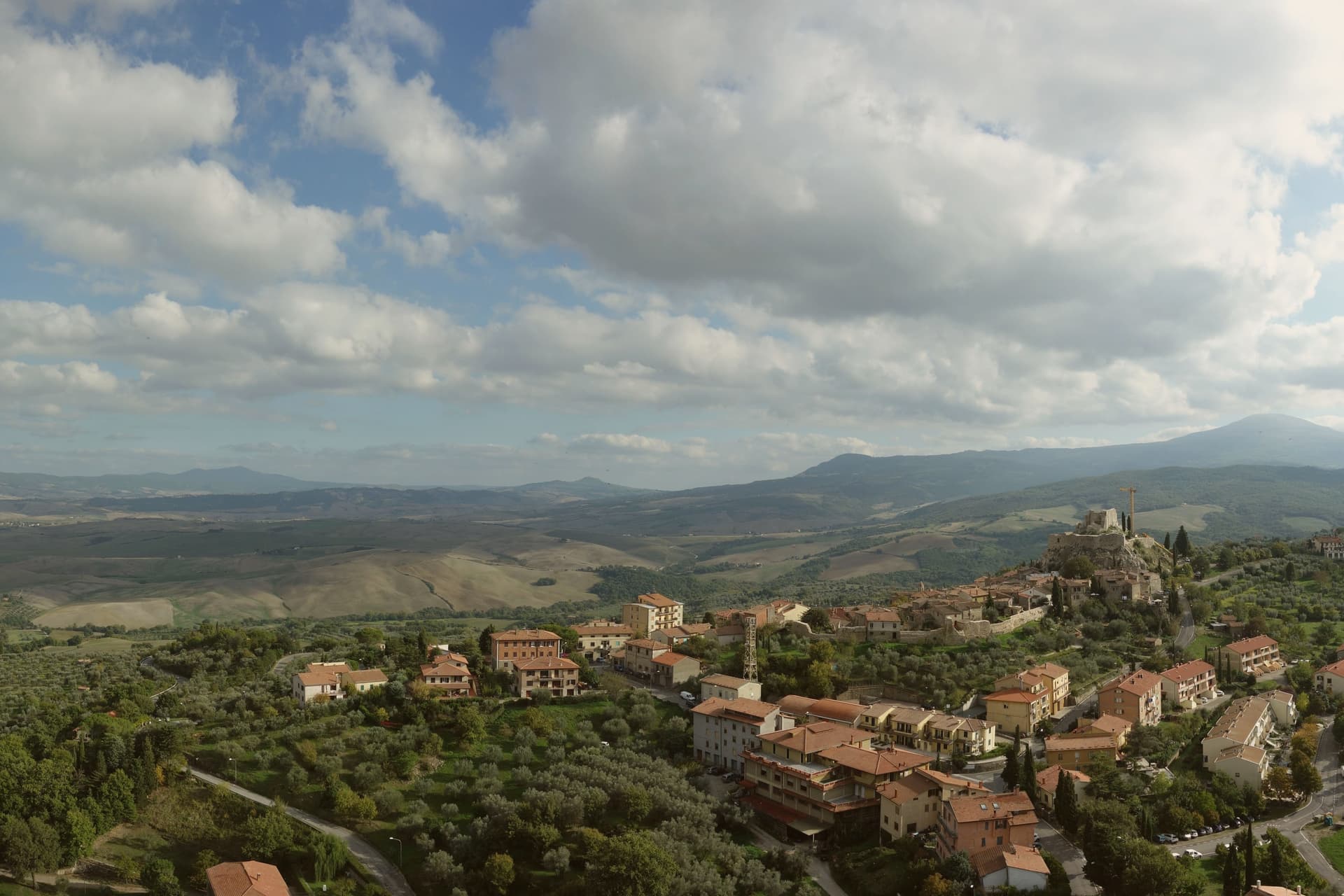
The village stands on a ridge where the land drops toward the Val d'Orcia, the agricultural landscape shaped by Sienese painters and Renaissance estate managers that stretches between Siena and the mountain to the south. First documented in 714, the settlement was then held by the Aldobrandeschi, who built the fortress above the village to hold the medieval road running between the mountain and the Via Francigena, the pilgrim route below.
Siena took the town in 1251 and passed control to the Salimbeni and later the Piccolomini, a shift that put a Sienese family in charge of the second fortress on the neighboring outcrop in the frazione of Rocca d'Orcia. The village center and its outlying frazione form two working parts of one settlement: the walled hill town with its civic square and parish church, and the fortified outcrop a short distance off that once policed the valley approach on its own.
The territory is one of three communes sharing the UNESCO inscription, a status that recognizes the whole valley rather than any single settlement within it. What the record shows, across all of it, is a place whose function was always defensive and administrative before it was scenic: two fortresses set to watch one road, a town divided between them, and a landscape that outgrew its original purpose to become the reason people look at it now.
What to see in Castiglione d'Orcia
- Rocca Aldobrandesca. Aldobrandeschi fortress above the village, documented from the eighth century, walls and keep open as an archaeological site.
- Rocca a Tentennano. Stronghold on a basalt outcrop in the frazione of Rocca d'Orcia, reached by a climb that still shows the defensive logic of the site, controlling the approach along the valley.
- Piazza Vecchietta. Small triangular civic square in the centro storico, the space that carries the painter's adopted name through the village center he left behind.
How to get to Castiglione d'Orcia
Perugia is roughly 152 minutes away by road.
Our tip
April through June and September into October are the months the Val d'Orcia photographers come for, the green hills and the gold stubble depending on the half. The borgo at 540 meters stays cool when the valley floor heats up. July and August push the lower fields into the mid thirties; afternoons thin out the centro storico but the ridge keeps a breeze.
San Quirico d'Orcia
Why visit San Quirico d'Orcia
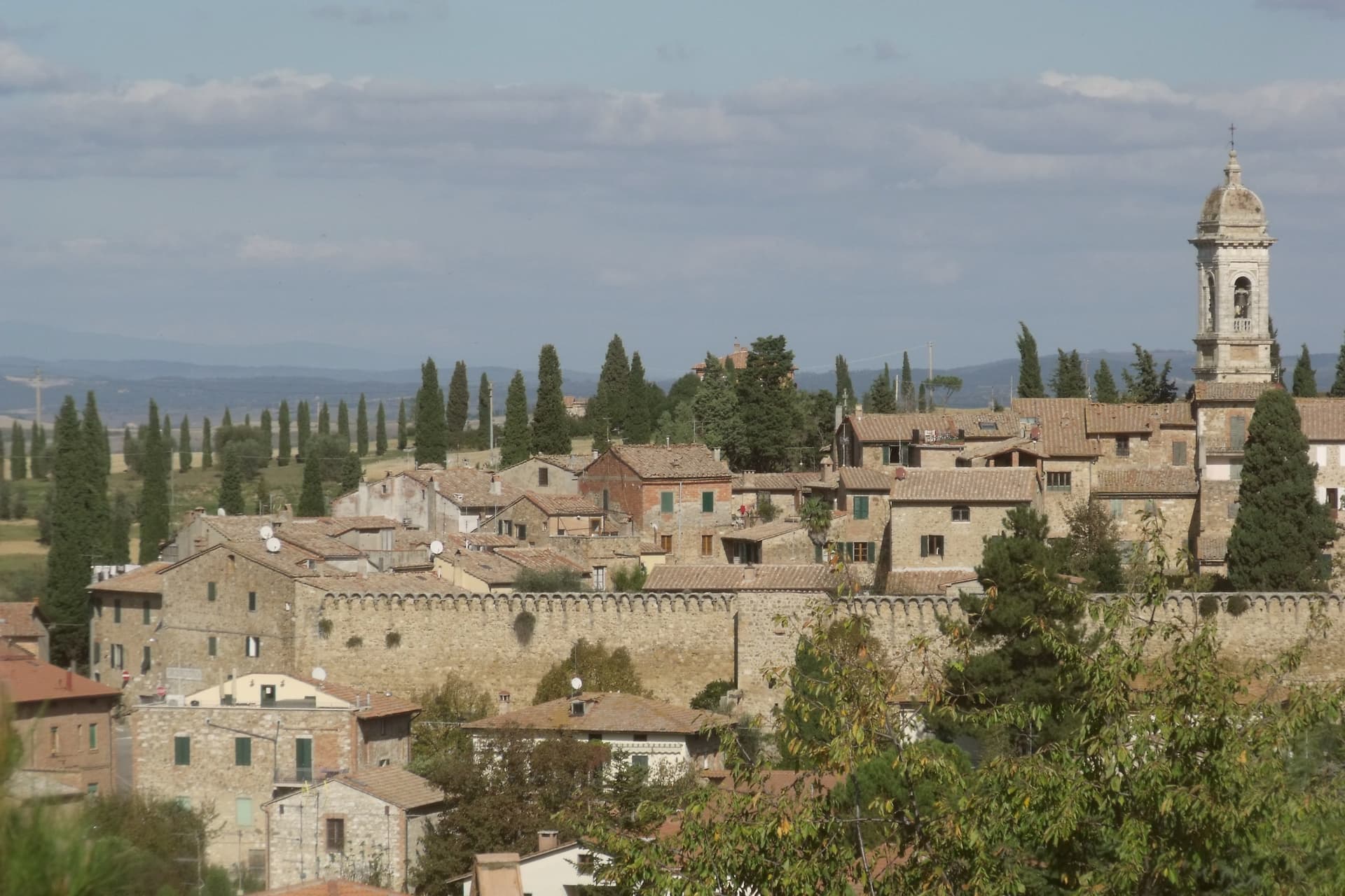
San Quirico d'Orcia sits at 409 meters on a low rise in the Val d'Orcia, the rolling clay-and-tufa landscape inscribed by UNESCO in 2004 as a cultural landscape shaped by fourteenth and fifteenth-century Sienese governance. The town was a stage on Sigeric the Serious's tenth-century Via Francigena from Canterbury to Rome and has remained a working stop on the route ever since.
The Collegiata dei Santi Quirico e Giulitta was built at the end of the twelfth century over an eighth-century baptistery; the lateral portal added in 1288 is attributed to Giovanni Pisano, then working on the Siena cathedral. The Horti Leonini, the geometric boxwood garden laid out by Diomede Leoni around 1580 inside the town walls, hosts the Forme nel Verde sculpture exhibition every summer since 1971.
Bagno Vignoni, the frazione five kilometers down the road, has a thermal pool at the center of its piazza, used since Etruscan times. Few comuni this small carry UNESCO, thermal and Francigena signals at once.
What to see in San Quirico d'Orcia
- Collegiata dei Santi Quirico e Giulitta. Romanesque parish church built late twelfth century over an eighth-century baptistery, with the 1288 lateral portal attributed to Giovanni Pisano.
- Horti Leonini. Italianate boxwood garden laid out by Diomede Leoni around 1580 inside the town walls, hosting the Forme nel Verde sculpture exhibition since 1971.
- Bagno Vignoni. Frazione five kilometers south, with a sixteenth-century thermal pool at the center of its piazza, fed by springs used since Etruscan times.
How to get to San Quirico d'Orcia
Perugia is roughly 96 minutes away by road.
Our tip
April through June and September into October are the gold months in the Val d'Orcia: green wheat in spring, ochre stubble by autumn, low light that defines the cypress ridges. The Festa del Barbarossa runs the third Sunday of June with archery, jousts and crossbow contests between the town quarters. July and August are hot and busy; the centro storico fills with day-trippers from Pienza and Montalcino. Festa del Barbarossa a San Quirico d'Orcia falls in June.
More from Anywhere Italy
- The best towns on a walking route in the province of Siena
 The 10 best small hill towns in the province of Siena
- The 9 best hidden hill towns on a walking route in Toscana
- The best small olive oil towns in the province of Siena
- The best hidden towns with a medieval festival in the province of Siena
- The best small towns with a medieval festival in Toscana