
The best towns you can reach by train within 45 minutes of Rimini
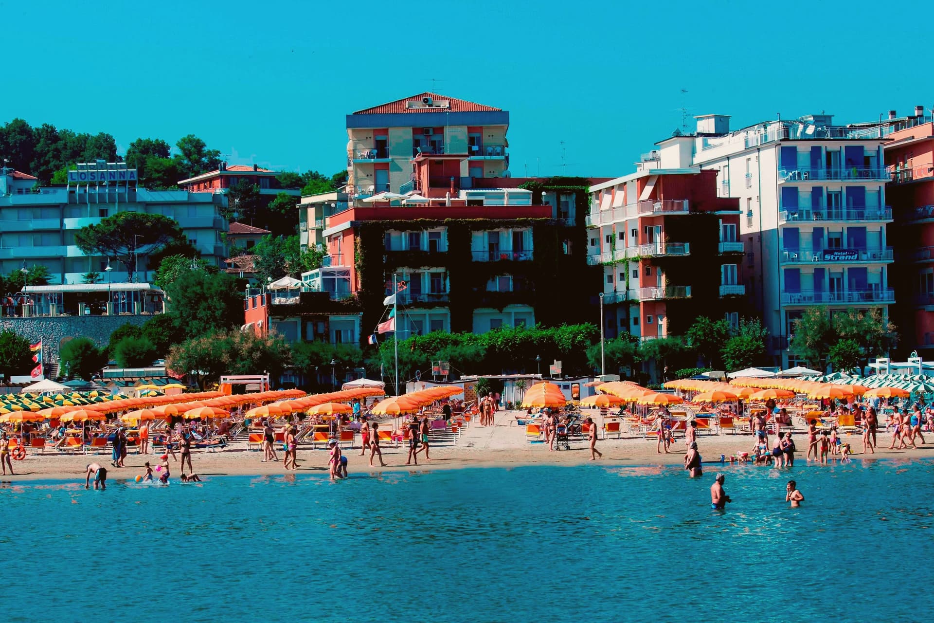
The stretch of coast and hinterland around Rimini is built for arriving without a car. Trains follow the Adriatic almost within sight of the water, and the inland lines climb towards hills of brick and sandstone where the towns sit on ridges above vineyards and fig trees. The food is Romagnolo and unfussy: piadina folded around squacquerone and rocket, grilled sardines and cuttlefish, tagliatelle with a ragu that has been on the stove since morning. Late spring and September are the good months, when the sea is warm, the beach clubs are open and the pinewoods behind the dunes give shade in the afternoon.
Most people arriving in the area go to Rimini itself, and in high summer the beach is a wall of parasols from the port canal to Miramare, with the nightlife strip at Marina Centro filling every night from June onwards. The Roman bridge and the Malatesta temple are worth seeing, and the Borgo San Giuliano lanes are good, but the station forecourt in August tells you what the ratio of visitors to residents has become. San Marino, up the road, absorbs another large share, coach by coach.
The same railway keeps going in both directions, and the same hills keep going inland. North and south along the coast are working fishing towns with canal harbours, salt pans and long pinewood beaches; a short way up from the plain are hill towns with Malatesta fortresses, theatre traditions and views back down to the sea. Fewer people get off at these stops, though the journey from Rimini is short enough to do before lunch. These are the towns where we have confirmed a station you can arrive at.
Of the 15 communes we have mapped in a 45-minute drive of Rimini, 8 qualify as towns you can reach by train: we confirmed a station you can arrive at. The smallest, Gabicce Mare, has 5,496 residents.
Elsewhere in the catalogue: The best towns with a serious restaurant that eat well within 90 minutes of Rimini and The best coastal towns within two hours of Bologna.
Gabicce Mare
Why visit Gabicce Mare
Gabicce Mare sits on the Adriatic at the northernmost point of the Marche, sixteen kilometers north of Pesaro and bordering Cattolica in Emilia-Romagna's province of Rimini. South of the beach, the cliffs of Monte San Bartolo rise abruptly, the only stretch of high coast between Trieste and the Conero, so the town marks the hinge where a long flat sand shore gives way to headland.
Sixteenth-century maps placed the Romagna border further south than it runs today, taking in the upper hamlet inside what is now the park. The archaeological record on the headland runs from the Neolithic at Monte Castellaro through a Roman site on the Via Flaminia to a lost Greek-origin port below the cliffs, layers of settlement stacked on the same few kilometers of high ground.
The town is really two places joined by geography rather than one: a beach that belongs to the sand coast running north, and a cliff and ridge system that belongs to the rock coast running south. Nowhere else on this shore does the flat Adriatic strip end so abruptly against high ground.
We confirmed you can reach this one by train.
What to see in Gabicce Mare
- Spiaggia di Gabicce Mare. Sand beach at the southernmost extension of the Riviera Romagnola strip, the family beach end of the upper Marche coast, backed by the town rather than the cliffs.
- Parco Naturale del Monte San Bartolo. Cliffs, ridge and a run of Renaissance villas above the sea, with fossil fish embedded in the rock face.
- Gabicce Monte. The hamlet climbs above the seafront rather than sitting on it, so the same stretch of coast reads differently from up here, the beach town below, the cliff line running south.
How to get to Gabicce Mare
There is a railway station in the town, so you can arrive without a car and never need one while you are here. Rimini is roughly 26 minutes away by road.
Our tip
May through September is the window for Gabicce Mare. The Adriatic warms by mid-May, the beach reaches full Bandiera Blu service through summer, and the San Bartolo cliff trails are open and dry. July and August touch the low thirties on the sand and the resort runs at peak with the Riviera Romagnola crowds from Rimini and Cattolica spilling south.
Longiano
Why visit Longiano
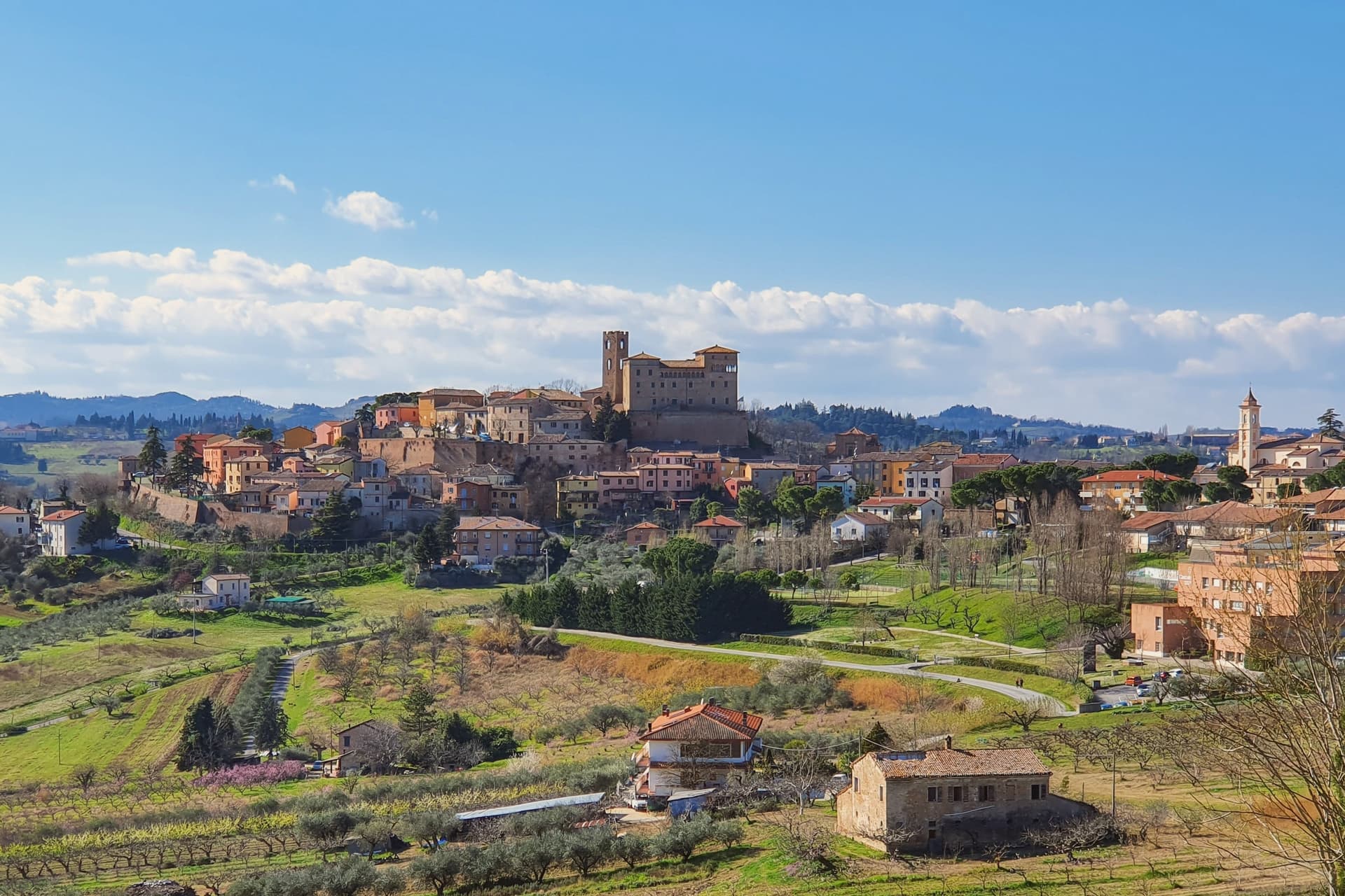
Longiano sits at 179 meters on the first hill line between Cesena and Rimini, eleven kilometers inland from Cesenatico and within sight of the Adriatic. The town shifted from the plain to the hill in the seventh and eighth centuries, when the local population moved up to escape Lombard raids, and the settlement that resulted is the hilltop borgo still walled today, with the castle at its center and the theater just below it.
Longiano passed to the Church in 1581 and stayed under papal rule until unification, before the castle came to the commune in 1989. The sanctuary stands apart from this hilltop cluster, built around its painted crucifix and held by Franciscan presence for over seven centuries, a separate thread of the town's history running alongside the Malatesta line and the civic one.
What ties the parts together is the hill itself: a defensive move made in the seventh and eighth centuries left Longiano with a compact center where a former ruling family's fortress, a nineteenth-century theater and a walled medieval borgo all sit within reach of each other, while the sanctuary's much older devotional history runs on its own separate track nearby.
We confirmed you can reach this one by train.
What to see in Longiano
- Castello Malatestiano. Fortified hilltop seat of the Malatesta of Rimini, later passing to the Church and then the commune. Its rooms now hold the Fondazione Tito Balestra, so the walls that once housed a ruling family now hold paintings, drawings and sculpture.
- Teatro Petrella. Sits just below the castle. Restored in 1986, it is known today for its acoustics inside the horseshoe-shaped hall.
- Santuario del Santissimo Crocifisso. Franciscan sanctuary built around a thirteenth-century painted crucifix on oak panel, with continuous Franciscan presence for over seven centuries.
How to get to Longiano
There is a railway station in the town, so you can arrive without a car and never need one while you are here. Rimini is roughly 30 minutes away by road.
Our tip
April through June and September through October are the months for Longiano. The hilltop catches a breeze the coastal plain below does not, and the views run from the Apennines to the Adriatic on clear days. July and August touch the low thirties and the centro storico empties between two and five; many visitors come up from Cesenatico and Cervia in the late afternoon for the cooler air and the castle. Crocetta 30 in Festa falls in August.
Verucchio
Why visit Verucchio
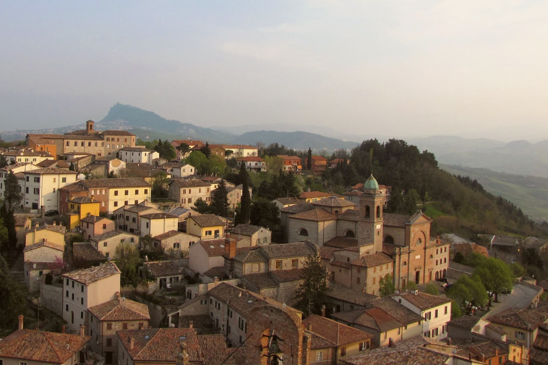
Verucchio sits on a 330-meter spur over the lower Marecchia valley, eighteen kilometers from Rimini and within sight of the Adriatic plain. A Villanovan settlement occupied this ridge from the twelfth to the seventh century BC and left a necropolis whose chamber tombs, amber, bronze, and worked wood form the Museo Civico Archeologico collection now housed in the former Augustinian convent.
The town is also the home ground of the Malatesta, named for Malatesta da Verucchio, founder of the lordship that would rule Rimini, Cesena, Pesaro, Fano and Fossombrone for two centuries; his Rocca Malatestiana, also called Castel del Sasso, is one of the largest and best-preserved Malatesta fortifications and his birthplace. A second fortress, the Rocca del Passerello, holds the lower end of the ridge.
The commune extends to the frazione of Villa Verucchio, where the cypress planted by Saint Francis of Assisi during a 1213 visit still grows in the convent cloister.
We confirmed you can reach this one by train.
What to see in Verucchio
- Rocca Malatestiana. Twelfth-to-sixteenth-century fortress on the highest point of the ridge, birthplace of Malatesta da Verucchio and one of the largest Malatesta fortifications surviving.
- Museo Civico Archeologico. Villanovan archaeology museum in the former Augustinian convent, holding amber jewellery, bronze armour and a wooden throne from the seventh-century BC necropolis.
- Rocca del Passerello. Second Malatesta fortress at the lower end of the ridge, smaller than the Sasso but built into the same defensive system in the fourteenth century.
How to get to Verucchio
There is a railway station in the town, so you can arrive without a car and never need one while you are here. Rimini is roughly 27 minutes away by road.
Our tip
April through October are the strongest months in Verucchio. Spring brings green slopes and clear views down the Marecchia to Rimini; September and October are the dry months when the Sangiovese harvest begins on the surrounding hills. July and August can touch thirty-four degrees on the ridge but the spur catches the Adriatic breeze the coastal flat does not.
Mondolfo
Why visit Mondolfo
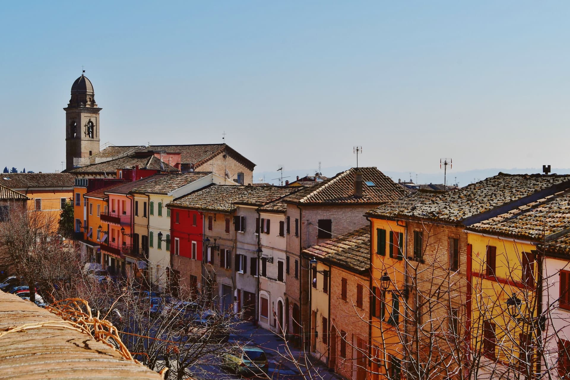
Mondolfo sits at 144 meters on a ridge above the Adriatic between Pesaro and Senigallia, with the coastal frazione on the beach four kilometers below. A Byzantine castle stood here in the sixth and seventh centuries, and the present settlement formed around it in the early eleventh, when the Montoffo feudal family gave the town its name.
The Malatesta took the castle in the fourteenth century, then Sigismondo Pandolfo Malatesta lost it to Pope Pius II in 1463, at which point the walls and bastion that still anchor the southwest corner were rebuilt. The friary and church at the heart of the old town were rebuilt twice, first by Antonio di Pietro da Vercelli in 1466 and again under Domenico da Como in 1593.
Mondolfo joined the Borghi più belli d'Italia and holds recognitions for both its coast and its farmland. The town is a single history in two elevations: the ridge held the castle and later the fortified center, while the shore below, reached across the four kilometers of farmland now recognized for its management, grew into the seafront community that carries the coastal recognitions today.
What began as a Byzantine strongpoint and passed through Malatesta and papal hands still reads as a hill town looking down at its own beach.
We confirmed you can reach this one by train.
What to see in Mondolfo
- Mura Roveresche. Roughly 600 meters of fifteenth-century walls and the south-west bastion, redesigned by the Della Rovere for early artillery defense after 1463.
- Complesso Monumentale di Sant'Agostino. Augustinian friary and church from the late thirteenth century, rebuilt in 1466 and again in 1593, now home to the civic museum and the Sant'Agostino complex.
- Centro storico. Walled hill borgo with narrow streets, the Palazzo del Comune and the Chiesa di Santa Giustina at the heart of the perimeter.
How to get to Mondolfo
There is a railway station in the town, so you can arrive without a car and never need one while you are here. Ancona is roughly 44 minutes away by road.
Our tip
May through September is the main window for Mondolfo. The Marotta seafront opens from late spring, the Bandiera Blu lido water clears from June, and the hill borgo above stays a few degrees cooler than the beach. July and August fill the lungomare with the worst of the coast traffic; the walled borgo above keeps quieter. Festa del Mare falls in August.
Santarcangelo di Romagna
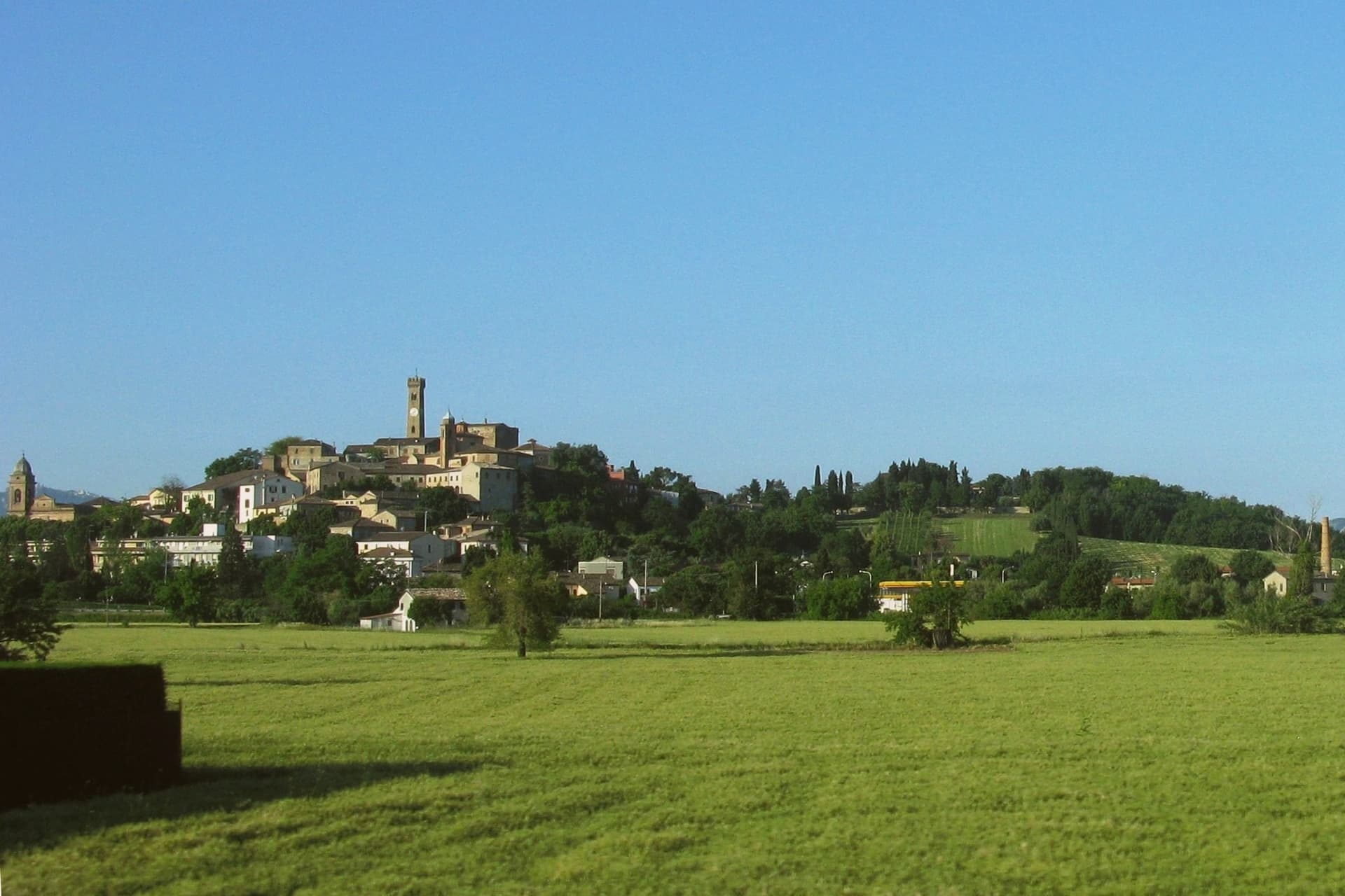
Why visit Santarcangelo di Romagna
Santarcangelo di Romagna sits at 42 meters on a low hill between the Marecchia and the Uso rivers, eleven kilometers northwest of Rimini on the Via Emilia. Roman in origin, named Pagus Acervolanus, the town grew under the Malatesta of Rimini, who fortified the hill in 1386 with the Rocca Malatestiana that Carlo Malatesta built and contemporaries called an eighth wonder of the world.
Under the centro storico, over 150 man-made caves on eight levels cut into the soft tufa rock form an underground city: pagan place of worship, burial chambers, wine cellars, and in 1944 air-raid shelters that saved most of the population. The town gave the world two dialect poets, Raffaello Baldini and Tonino Guerra, whose verses earned Santarcangelo the title capital of Romagnolo dialect poetry.
Guerra, also Fellini's screenwriter, designed the Strada delle Meridiane that runs through the centro. The Festival Internazionale del Teatro in Piazza, founded in 1971, fills the streets every July.
We confirmed you can reach this one by train.
What to see in Santarcangelo di Romagna
- Rocca Malatestiana. Hilltop fortress built by Carlo Malatesta in 1386, with the surviving keep, walls, and the Torre del Campanone over the centro.
- Grotte Tufacee. Over 150 man-made caves on eight levels cut into the tufa under the centro storico, used as pagan sanctuaries, wine cellars, and 1944 air-raid shelters.
- Piazza Ganganelli. Central square named for Pope Clement XIV (Giovanni Ganganelli, born here in 1705), with a triumphal arch from 1779.
How to get to Santarcangelo di Romagna
There is a railway station in the town, so you can arrive without a car and never need one while you are here. Rimini is roughly 17 minutes away by road.
Our tip
April through June and September through October are the working months on the Marecchia plain. Spring brings clear evenings on the hill and water in the underground grottos; autumn dries the surrounding fields and brings the wine and olive presses back to work. July fills the streets with the Festival del Teatro in Piazza, with companies performing in the piazze, the Rocca courtyard, and the lavatoio. Fiera di San Michele falls in September.
Cesenatico
Why visit Cesenatico
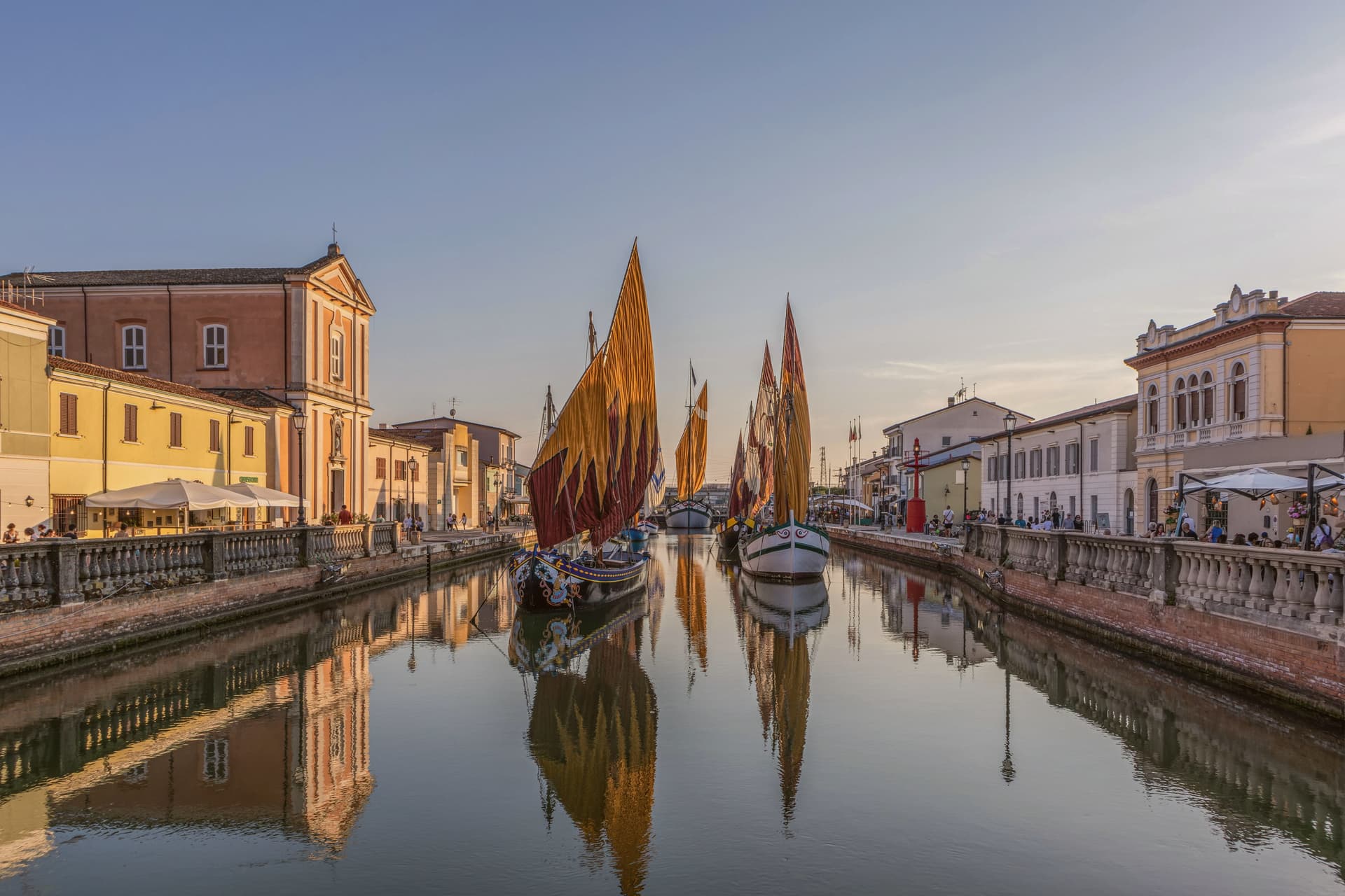
Cesenatico sits at three meters on the Adriatic, fifteen kilometers east of Cesena. The town grew around a canal port begun in 1302 by the Malatesta of Cesena to give the inland city its outlet to the sea, and the canal still runs through the centro storico as the town's working spine.
Leonardo da Vinci arrived in 1502 at the request of a Borgia patron to survey and redraw the port; his sketch, preserved in the Codex L, corresponds to the harbor layout today. Garibaldi embarked from this port in August 1849, fleeing the failed Roman Republic on commandeered fishing boats with about two hundred followers.
The canal separates and joins the two halves of the old town, its banks lined with the pastel facades of fishermen's houses, and it is this same stretch of water that carries the floating section of the Museo della Marineria, sails hoisted through the summer. Cesenatico is also the home town of the cyclist Marco Pantani, marked inland by the Nove Colli ride each May.
The beach carries Bandiera Blu. What holds the town together is the canal itself: a fifteenth-century engineering commission that outlasted the port's original purpose and became the frame for everything Cesenatico later added, from Garibaldi's escape to the moored boats of the maritime museum.
We confirmed you can reach this one by train.
What to see in Cesenatico
- Porto Canale Leonardesco. Canal port begun in 1302 by the Malatesta, running through the centro storico and lined with the pastel facades of fishermen's houses. Leonardo da Vinci's redrawn layout from 1502 still corresponds to the harbor as it stands.
- Museo della Marineria. Maritime museum with a floating section of historic Adriatic sailboats moored in the canal, their sails hoisted daily in summer.
- Spazio Pantani. Museum near the railway station dedicated to the cyclist, tracing his career including the 1998 Giro and Tour double.
How to get to Cesenatico
There is a railway station in the town, so you can arrive without a car and never need one while you are here. Rimini is roughly 28 minutes away by road.
Our tip
May through September is the working season on the Cesenatico coast. June and the first half of July hold the best balance of warm sea and lighter crowds. Late July and August are the Italian beach peak, when the seven kilometers of sand fill up and the Porto Canale evening passeggiata runs until midnight.
Cervia
Why visit Cervia
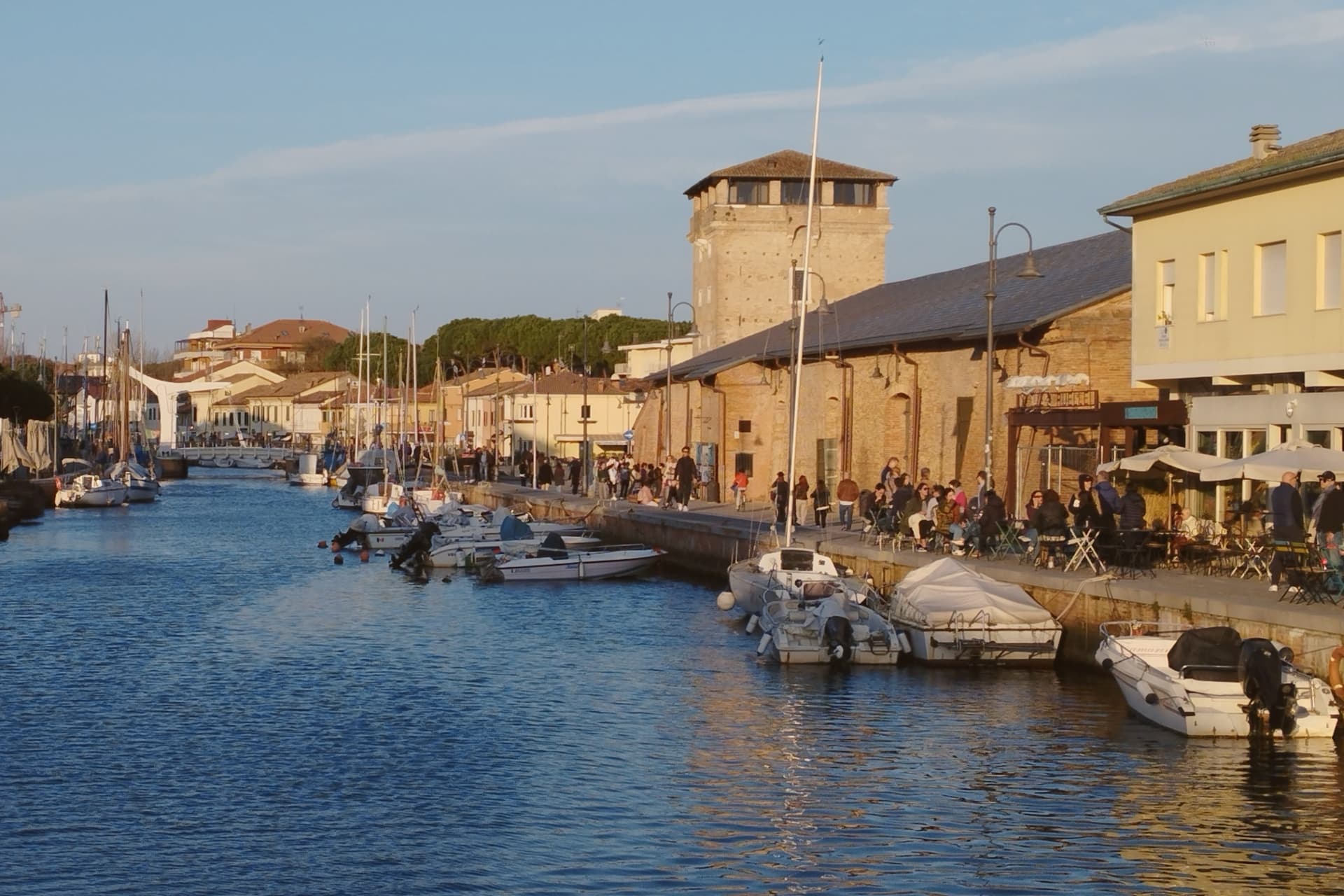
Cervia sits at sea level on the Adriatic, twenty kilometers south of Ravenna, between the pine forest of Milano Marittima and the salt pans that have given the town its identity since Roman times. The original settlement, Ficocle, stood inside the saline itself; the move to the coast in 1697 put the grid of workers' housing where it now stands, closer to the water and to the canal port that the tower on its north side was built to guard.
The two halves of the municipality read as a pairing of extraction and leisure: the saline and the old grid town to the south, worked continuously and still yielding salt by hand at one basin, and the planted pine forest to the north, laid out as a garden-city resort in the following century. The museum inside the old salt warehouse holds two thousand years of the tools and records that connect the two eras.
The beach carries Bandiera Blu recognition along nine kilometers of coast. What holds the town together is that its shape was dictated by salt long before tourism arrived: the grid, the tower, the canal and even the forest to the north all trace back to the working of the saline, with the resort at Milano Marittima grown from land the salt industry had left standing.
We confirmed you can reach this one by train.
What to see in Cervia
- Saline di Cervia. Working salt pans covering 827 hectares, the northernmost in Italy, with the Camillone basin still harvested by hand using nineteenth-century methods.
- Torre San Michele. Defensive tower built in 1691 to protect the salt warehouses and control the canal port, on the north side of the harbor.
- MUSA - Museo del Sale. Salt museum inside the Magazzino del Sale Torre, with tools, documents and photographs gathered from former salt workers.
How to get to Cervia
There is a railway station in the town, so you can arrive without a car and never need one while you are here. Forlì is roughly 29 minutes away by road.
Our tip
May through September is the Cervia season. Late May and June hold the best balance of warm sea and quiet beach, before the Italian holiday peak. July and August bring full beach and full pine forest, with thirty-degree afternoons broken by the evening sea breeze. Festa di San Lorenzo falls in August.
Pesaro
Why visit Pesaro
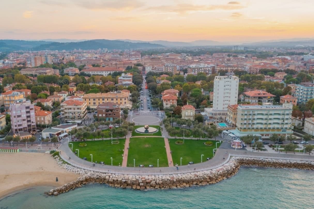
Pesaro sits at the mouth of the Foglia river on the Adriatic, founded as the Roman colony of Pisaurum in 184 BC on the Via Flaminia and held in turn by Montefeltro, Sforza and Della Rovere lords through the Renaissance. The city was Italian Capital of Culture in 2024.
The centro storico is bookended by two poles: the Rocca Costanza holds one end, a fortress built to defend the town, while the beach runs north from the port along the other, the source of the city's working summer economy rather than its history. Inland and above, on the Monte San Bartolo hills, the Della Rovere and Sforza built their summer villa away from the density of the port town below, a separation of ruling residence from civic center that still marks the geography.
The Palazzo Mosca, in the center, gathers what the town has made and collected: paintings, a modern audio amphitheater, and the maiolica that gave Pesaro its recognition as a city of ceramics. Together the fortress, the villa, the beach and the palazzo describe a town shaped by defense, hillside retreat, coastal work and civic collection, each occupying a different piece of ground rather than competing for the same one.
We confirmed you can reach this one by train.
What to see in Pesaro
- Rocca Costanza. Renaissance fortress commissioned by Costanzo Sforza in the 1470s, four corner bastions and a moat, anchoring the eastern edge of the centro storico.
- Musei Civici di Palazzo Mosca. Civic museum in the former Mosca residence, holding paintings, the Pesaro maiolica collection and the Sonosfera audio amphitheater by David Monacchi.
- Teatro Rossini. Nineteenth-century opera house restored after the 1873 reconstruction, filled for two weeks each August when the Rossini Opera Festival takes over, alongside the Vitrifrigo Arena, for the run of performances.
How to get to Pesaro
There is a railway station in the town, so you can arrive without a car and never need one while you are here. Rimini is roughly 40 minutes away by road.
Our tip
May through September is the Pesaro window: the Velvet Beach opens its bagni from late May, the Rossini Opera Festival fills the second half of August, and the September sea stays warm through the start of school. July and August touch the low thirties with humid Adriatic evenings; the festival nights and the seafront passeggiata draw the largest crowds of the year. April, May and October are cooler, calmer months for the Villa Imperiale guided tours and the museum circuit through Palazzo Mosca. Fiera di San Nicola falls in September.
More from Anywhere Italy
 The best towns with a serious restaurant that eat well within 90 minutes of Rimini
 The best coastal towns within two hours of Bologna
 The best towns known for what they grow within an hour of Rimini
 The best towns known for what they grow within two hours of Ancona
- The best coastal towns you can reach by train in Marche
 The best towns with a serious restaurant in the province of Pesaro e Urbino