
The best towns known for what they grow within two hours of Ancona
This is farming country with paperwork to prove it. The Sibillini basins grow small lentils that cook without soaking, harvested in high summer when the fields go from flowering to bare in a matter of weeks. Further down, the Romagna plain does peaches, nectarines, apricots and shallots, and the coastal strip behind the lagoons turns out onions and salt. Houses are brick where the clay is good and grey stone where the mountains start, and the food follows the same line: piadina and grilled fish near the water, pecorino and pork and lentil soup once the road climbs.
Most visitors to this stretch of the Adriatic head for Rimini, and the reasons are obvious: sand by the kilometre, umbrellas in rows, a train station that delivers people straight onto the seafront. In August the beach clubs run at capacity and the restaurant menus flatten out into the same fried mixed plate. It is a good place to swim and a poor place to eat anything grown nearby.
The fields do not stop where the resorts do. Behind the coast the same soil runs up into the hills of Romagna and on into the Apennines and Umbria, and the towns there are where the produce actually comes from, sold in shops that close at lunch and cooked in kitchens that name the grower. Fewer people go, partly because none of them are on the beach. They are worth the drive inland.
Of the 93 communes we have mapped in a 120-minute drive of Ancona, 9 qualify as towns known for what they grow: each sits inside the production zone of a protected fruit or vegetable. The smallest, Visso, has 961 residents.
Two more lists worth reading alongside this one: The best towns known for what they grow within an hour of Rimini and The best towns known for what they grow within 90 minutes of Perugia.
Visso
Why visit Visso
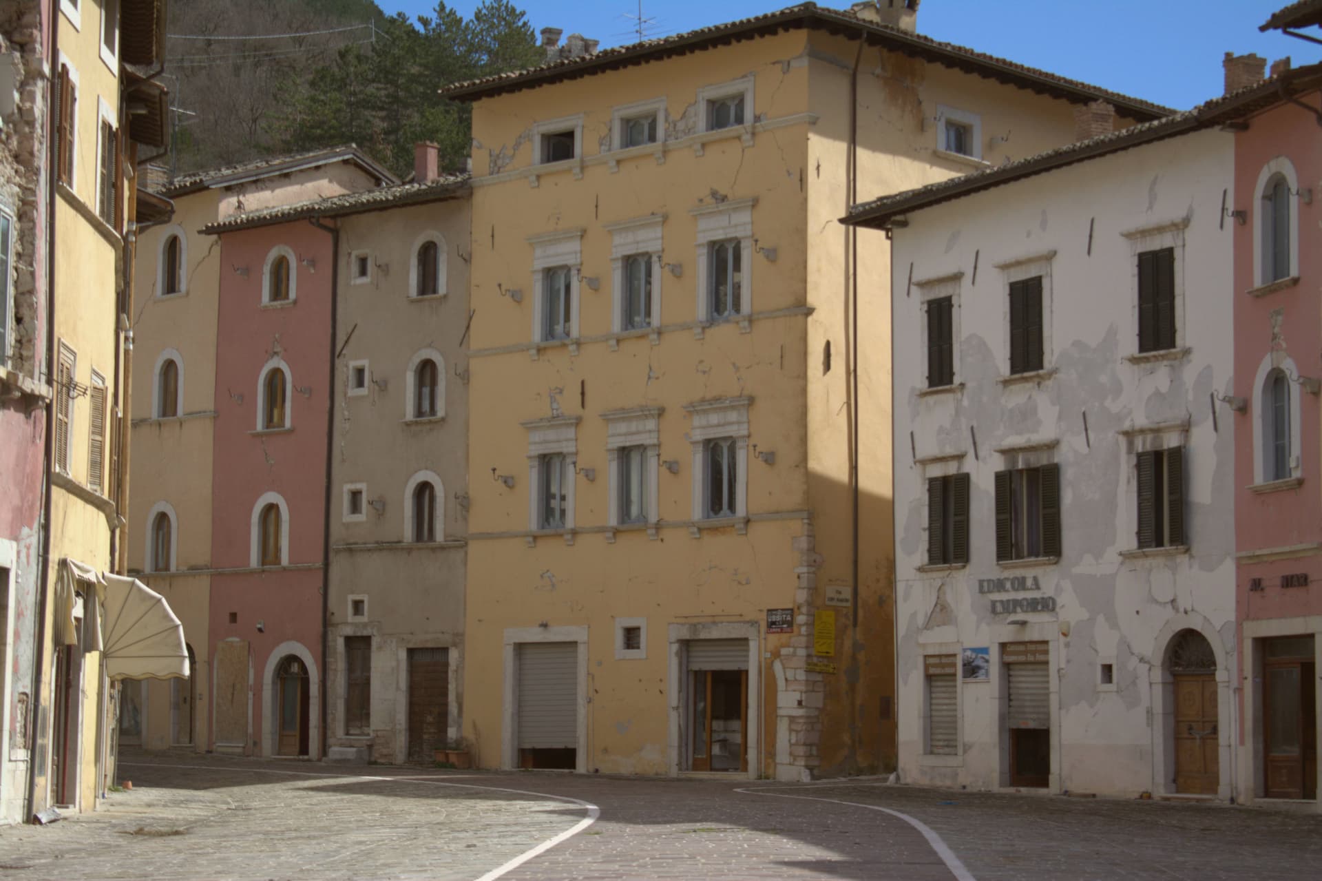
Visso sits at 607 meters at the confluence of the Nera and the Ussita, on the Umbrian border in the northern Sibillini. The village is the seat of the Parco Nazionale dei Monti Sibillini and the northern gateway commune to the high ridges.
A settlement called Vicus Elacensis stood here in pre-Roman times. The Piazza dei Martiri Vissani is bordered by elegant fifteenth and sixteenth-century palazzi; the Collegiata di Santa Maria, twelfth century in Romanesque-Gothic form, closes one side with an Annunciation frescoed in the lunette by Paolo da Visso.
The former church of Sant'Agostino, fourteenth century, holds the Museo Civico Diocesano with about 200 sacred works and the Leopardi manuscripts: six idylls including one of the two existing copies of L'Infinito, five sonnets, the Epistle to Carlo Pepoli, and fourteen letters from 1825 to 1831. The 2016 earthquakes severely damaged the centro storico; reconstruction is slow and many buildings remain closed.
What to see in Visso
- Piazza dei Martiri Vissani. Central square at the confluence of the Nera and the Ussita, bordered by fifteenth and sixteenth-century palazzi and closed at one end by the Collegiata.
- Collegiata di Santa Maria. Twelfth-century Romanesque-Gothic collegiate church, with a portal lunette frescoed by Paolo da Visso showing the Annunciation, medieval artworks inside.
- Museo Civico Diocesano. Housed in the former Sant'Agostino, with around 200 sacred works from the territory and the autograph Leopardi manuscripts including one of the two existing copies of L'Infinito.
How to get to Visso
Perugia is roughly 100 minutes away by road.
Our tip
May through October is the window for Visso. The Sibillini meadows turn green by late May, the Nera and the Ussita run cold and clear through summer, and the trail network opens fully from June. July and August are mild at 607 meters and cooler above; the high pastures hold their flowers into early August.
Nocera Umbra
Why visit Nocera Umbra
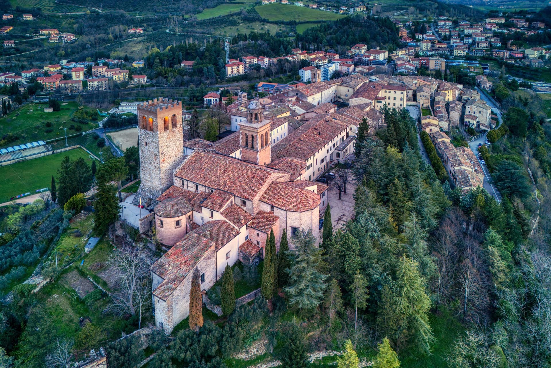
Nocera Umbra sits fifteen kilometers north of Foligno. The Romans called it Nuceria; the town has held its own bishopric since the early Middle Ages and was contested between Perugia, Spoleto and the Trinci of Foligno through the medieval period, a tug of war between larger powers that left it walled and defensible on its slope rather than absorbed by any one of them.
The centro storico climbs to a summit where the tower, the cathedral and the former Rocca stand together, the civic and the religious and the military crowded onto the same high ground. Below, five kilometers down from that core, the springs form a separate pole of the town's life, functional rather than defensive, drawing visitors for water rather than for stone.
The Bandiera Arancione recognition was reconfirmed after reconstruction, a marker that the rebuilding did not just replace what fell but held the town to the standard it met before the quake.
What to see in Nocera Umbra
- Campanaccio (Torre Civica). Eleventh-century square tower at the highest point of the borgo. Only part of one side remained standing after 1997; the rest is reconstruction, stone matched to stone.
- Pinacoteca e Museo Civico. Civic gallery in the deconsecrated Chiesa di San Francesco with works by Niccolò Alunno, Matteo da Gualdo, and the school of Cimabue.
- Cattedrale di Santa Maria Assunta. Cathedral at the summit of the centro storico, partially damaged and restored, set beside the tower and the former Rocca.
How to get to Nocera Umbra
There is a railway station in the town, so you can arrive without a car and never need one while you are here. Perugia is roughly 57 minutes away by road.
Our tip
April through June and September into October are the months locals prefer. The slopes around the centro storico hold light well into the evening and the Bagni di Nocera springs are at their easiest to walk. July and August push temperatures into the low thirties, manageable at this elevation; the Pinacoteca and the cathedral stay cool through the afternoon. Palio dei Quartieri falls in August.
Longiano
Why visit Longiano
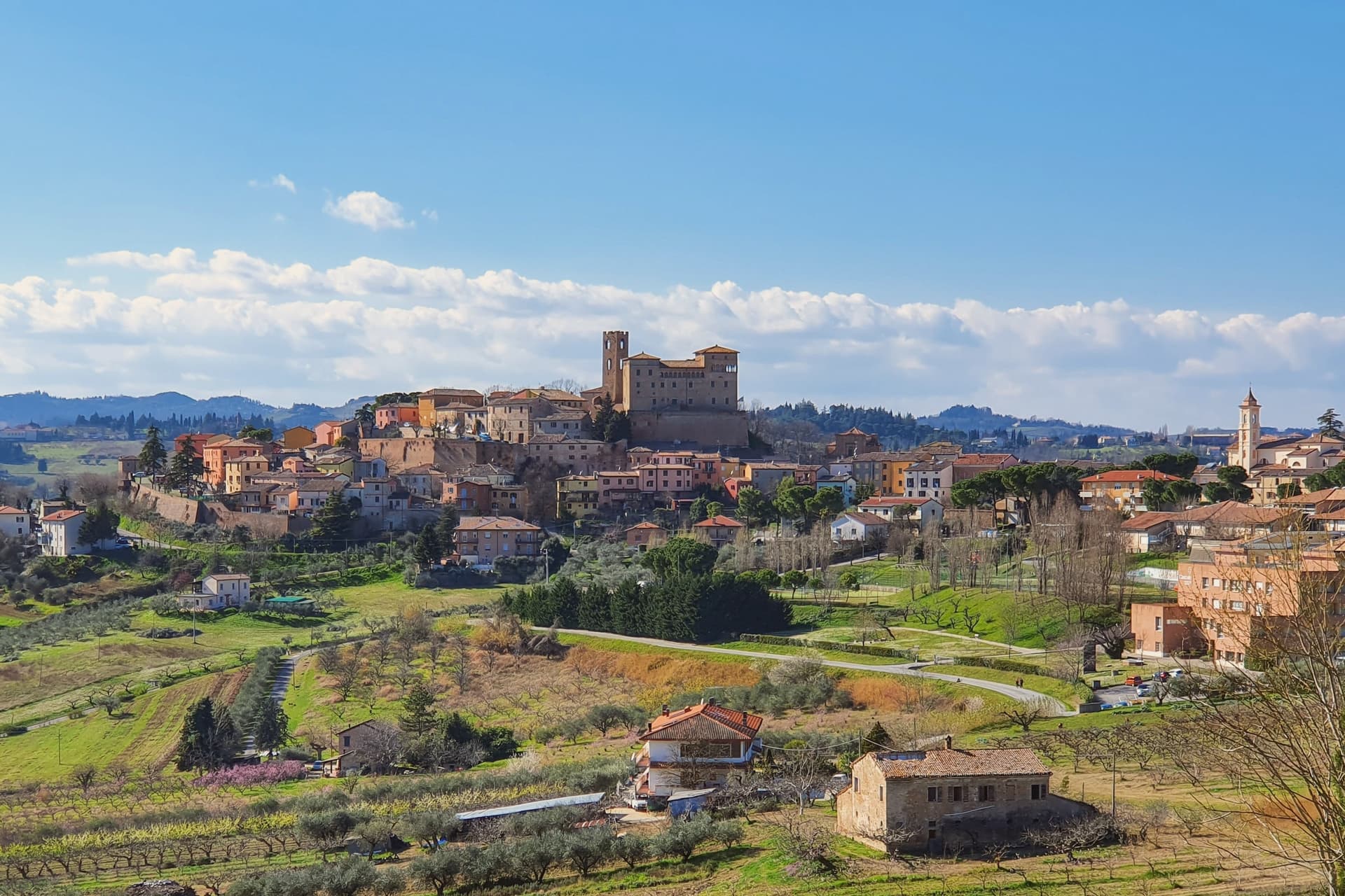
Longiano sits at 179 meters on the first hill line between Cesena and Rimini, eleven kilometers inland from Cesenatico and within sight of the Adriatic. The town shifted from the plain to the hill in the seventh and eighth centuries, when the local population moved up to escape Lombard raids, and the settlement that resulted is the hilltop borgo still walled today, with the castle at its center and the theater just below it.
Longiano passed to the Church in 1581 and stayed under papal rule until unification, before the castle came to the commune in 1989. The sanctuary stands apart from this hilltop cluster, built around its painted crucifix and held by Franciscan presence for over seven centuries, a separate thread of the town's history running alongside the Malatesta line and the civic one.
What ties the parts together is the hill itself: a defensive move made in the seventh and eighth centuries left Longiano with a compact center where a former ruling family's fortress, a nineteenth-century theater and a walled medieval borgo all sit within reach of each other, while the sanctuary's much older devotional history runs on its own separate track nearby.
Magnolia, Dei Cantoni, Terre Alte have been named by a guide.
What to see in Longiano
- Castello Malatestiano. Fortified hilltop seat of the Malatesta of Rimini, later passing to the Church and then the commune. Its rooms now hold the Fondazione Tito Balestra, so the walls that once housed a ruling family now hold paintings, drawings and sculpture.
- Teatro Petrella. Sits just below the castle. Restored in 1986, it is known today for its acoustics inside the horseshoe-shaped hall.
- Santuario del Santissimo Crocifisso. Franciscan sanctuary built around a thirteenth-century painted crucifix on oak panel, with continuous Franciscan presence for over seven centuries.
How to get to Longiano
There is a railway station in the town, so you can arrive without a car and never need one while you are here. Rimini is roughly 30 minutes away by road.
Our tip
April through June and September through October are the months for Longiano. The hilltop catches a breeze the coastal plain below does not, and the views run from the Apennines to the Adriatic on clear days. July and August touch the low thirties and the centro storico empties between two and five; many visitors come up from Cesenatico and Cervia in the late afternoon for the cooler air and the castle. Crocetta 30 in Festa falls in August.
Bertinoro
Why visit Bertinoro
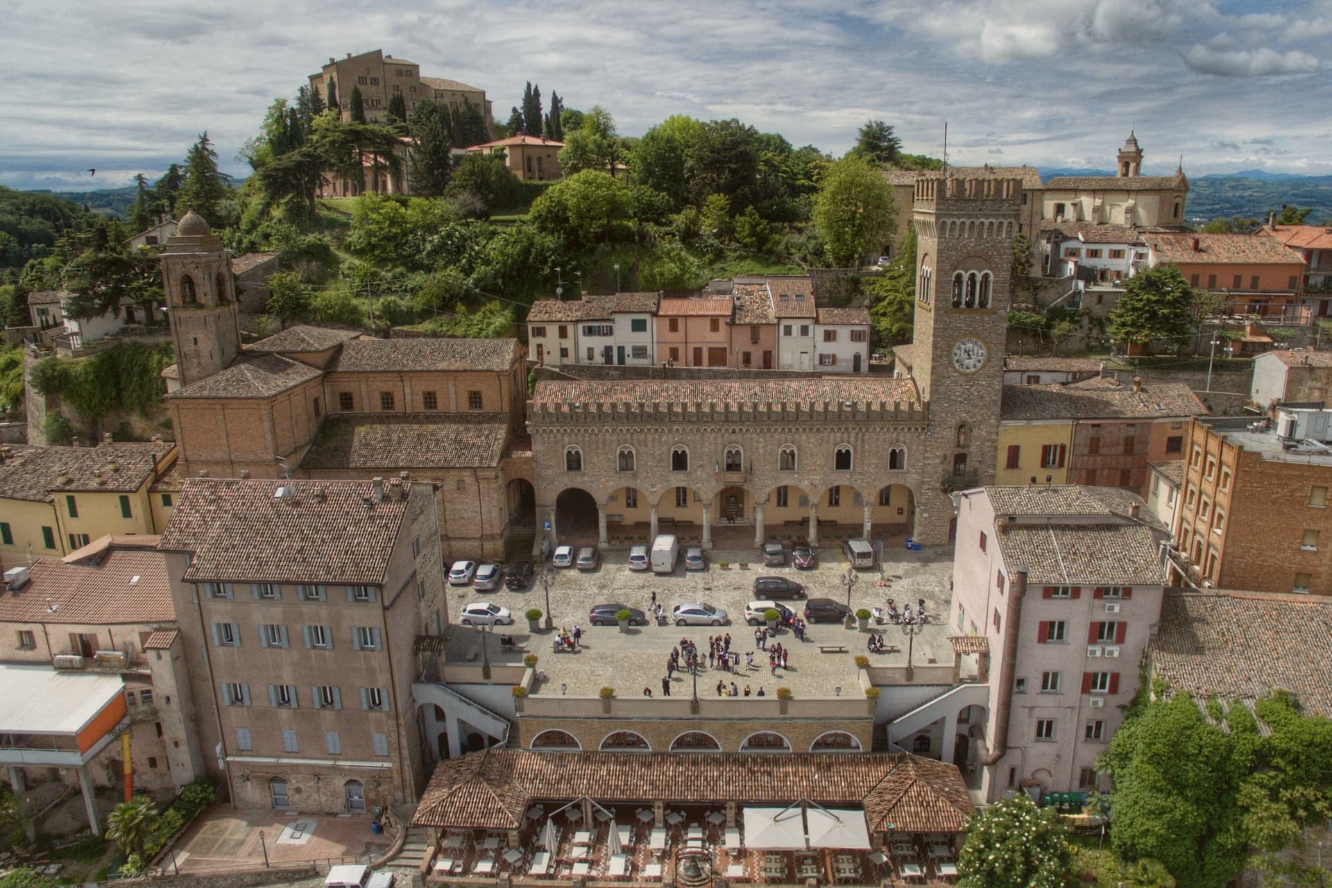
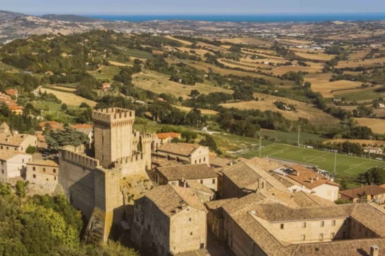
Bertinoro sits at 254 meters on Mount Cesubeo, a few kilometers south of the Via Emilia between Forlì and Cesena, the Romagna hills rolling toward the Adriatic on a clear day visible from the panoramic balcony locals call the Belvedere. The town's signature object is the Colonna delle Anella in Piazza della Libertà, a white-stone column with twelve iron rings, erected in 1300 by the noble families of the borgo so visitors arriving from the Via Emilia could tie their horse to a ring and be hosted by the family it belonged to.
The Albana grape grown on the surrounding slopes became, in 1987, the first Italian white wine to receive DOCG status; the artist Guerrino Bardeggia's Campana dell'Albana still rings to mark the opening of the harvest. Bertinoro joined the Borghi più belli d'Italia network in 2025.
The municipality holds two institutional signals: Borghi più belli, Città del Vino. Population 11,026.
What to see in Bertinoro
- Colonna delle Anella. White-stone column with twelve iron rings, erected 1300 in Piazza della Libertà so visitors could tie their horse to the ring of the family who would host them.
- Rocca Vescovile. Tenth-century fortress on the summit of Mount Cesubeo, expanded by the Ordelaffi and Malatesta and used as the bishop's residence from the sixteenth century.
- Cattedrale di Santa Caterina. Sixteenth-century cathedral on the upper part of the borgo, rebuilt over an earlier Pieve dedicated to Saint Catherine of Alexandria.
How to get to Bertinoro
Forlì is roughly 20 minutes away by road.
Our tip
April through June brings green hills, mild evenings, and the first events in Piazza della Libertà. September and October are the strongest months: the Albana harvest runs through late September, and the Festa dell'Ospitalità on the first Sunday of September re-enacts the old ring ritual, drawing visitors paired by lottery to twelve host families. July and August touch thirty-two degrees but the 254-meter elevation cools the borgo earlier than the plain below.
Santarcangelo di Romagna
Why visit Santarcangelo di Romagna
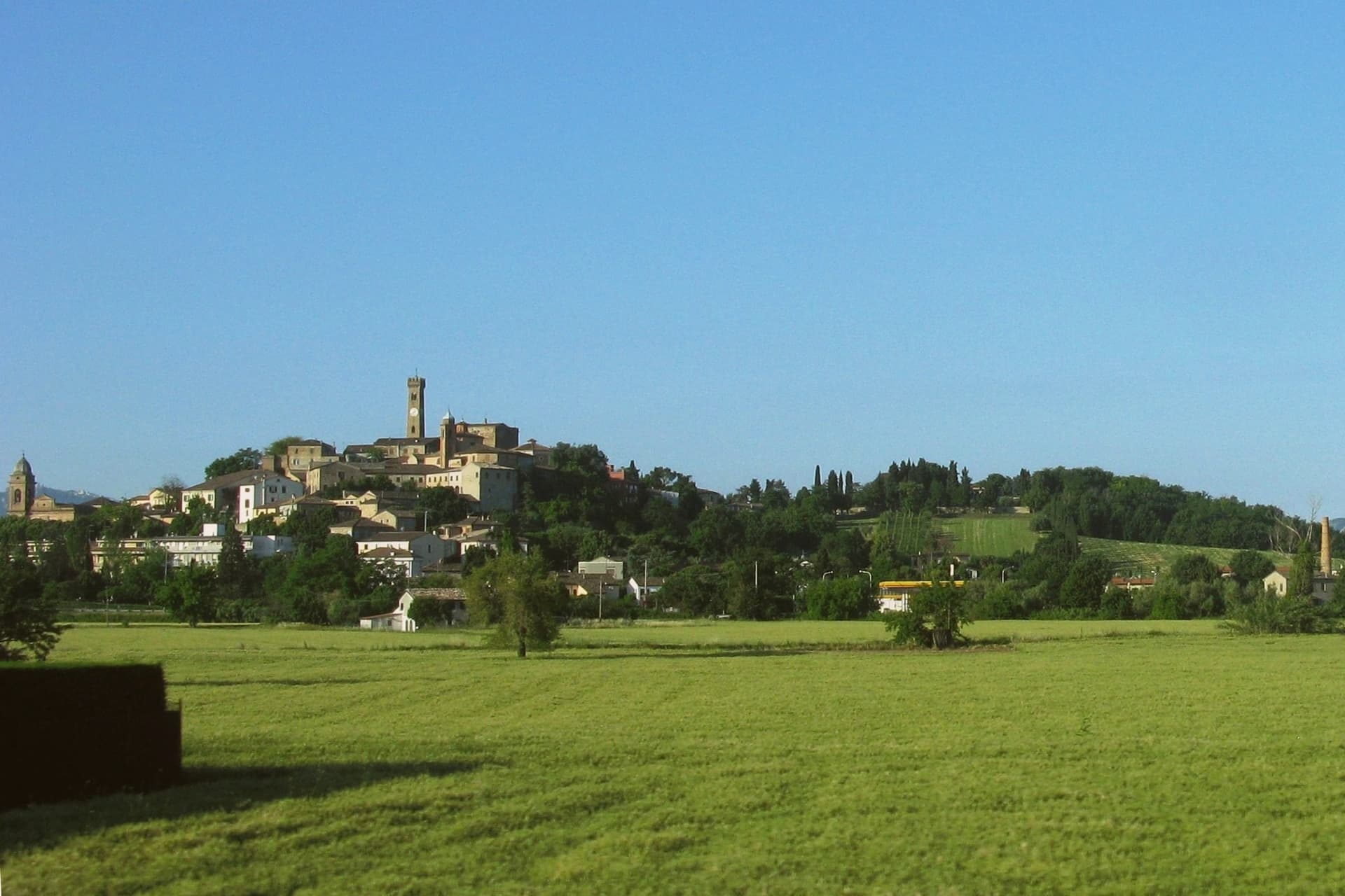
Santarcangelo di Romagna sits at 42 meters on a low hill between the Marecchia and the Uso rivers, eleven kilometers northwest of Rimini on the Via Emilia. Roman in origin, named Pagus Acervolanus, the town grew under the Malatesta of Rimini, who fortified the hill in 1386 with the Rocca Malatestiana that Carlo Malatesta built and contemporaries called an eighth wonder of the world.
Under the centro storico, over 150 man-made caves on eight levels cut into the soft tufa rock form an underground city: pagan place of worship, burial chambers, wine cellars, and in 1944 air-raid shelters that saved most of the population. The town gave the world two dialect poets, Raffaello Baldini and Tonino Guerra, whose verses earned Santarcangelo the title capital of Romagnolo dialect poetry.
Guerra, also Fellini's screenwriter, designed the Strada delle Meridiane that runs through the centro. The Festival Internazionale del Teatro in Piazza, founded in 1971, fills the streets every July.
Lazaroun, Osteria La Sangiovesa have been named by a guide.
What to see in Santarcangelo di Romagna
- Rocca Malatestiana. Hilltop fortress built by Carlo Malatesta in 1386, with the surviving keep, walls, and the Torre del Campanone over the centro.
- Grotte Tufacee. Over 150 man-made caves on eight levels cut into the tufa under the centro storico, used as pagan sanctuaries, wine cellars, and 1944 air-raid shelters.
- Piazza Ganganelli. Central square named for Pope Clement XIV (Giovanni Ganganelli, born here in 1705), with a triumphal arch from 1779.
How to get to Santarcangelo di Romagna
There is a railway station in the town, so you can arrive without a car and never need one while you are here. Rimini is roughly 17 minutes away by road.
Our tip
April through June and September through October are the working months on the Marecchia plain. Spring brings clear evenings on the hill and water in the underground grottos; autumn dries the surrounding fields and brings the wine and olive presses back to work. July fills the streets with the Festival del Teatro in Piazza, with companies performing in the piazze, the Rocca courtyard, and the lavatoio. Fiera di San Michele falls in September.
Cesenatico
Why visit Cesenatico
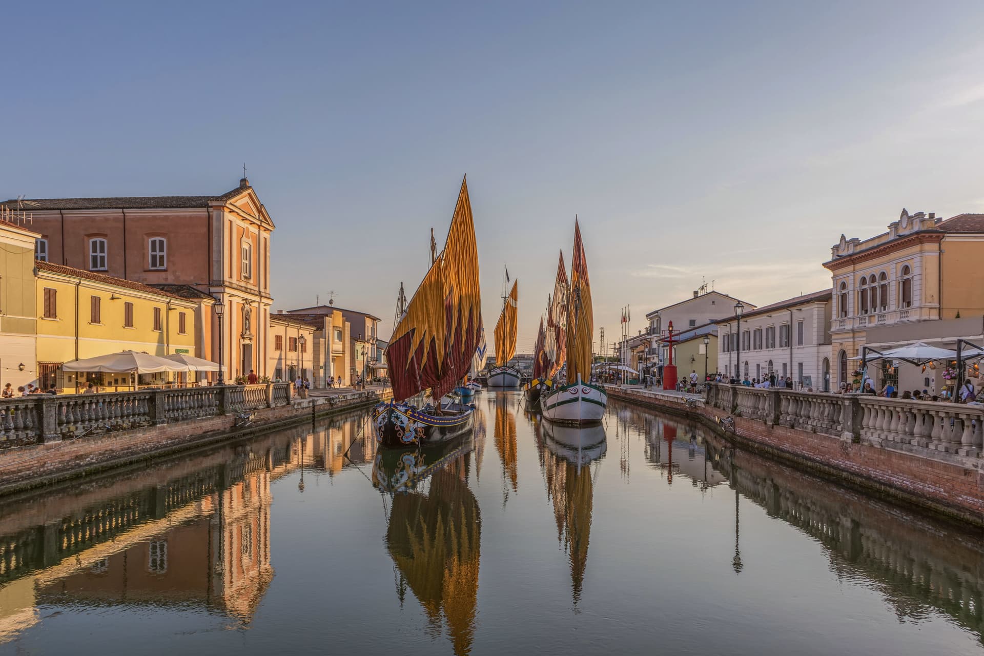
Cesenatico sits at three meters on the Adriatic, fifteen kilometers east of Cesena. The town grew around a canal port begun in 1302 by the Malatesta of Cesena to give the inland city its outlet to the sea, and the canal still runs through the centro storico as the town's working spine.
Leonardo da Vinci arrived in 1502 at the request of a Borgia patron to survey and redraw the port; his sketch, preserved in the Codex L, corresponds to the harbor layout today. Garibaldi embarked from this port in August 1849, fleeing the failed Roman Republic on commandeered fishing boats with about two hundred followers.
The canal separates and joins the two halves of the old town, its banks lined with the pastel facades of fishermen's houses, and it is this same stretch of water that carries the floating section of the Museo della Marineria, sails hoisted through the summer. Cesenatico is also the home town of the cyclist Marco Pantani, marked inland by the Nove Colli ride each May.
The beach carries Bandiera Blu. What holds the town together is the canal itself: a fifteenth-century engineering commission that outlasted the port's original purpose and became the frame for everything Cesenatico later added, from Garibaldi's escape to the moored boats of the maritime museum.
La Buca, Ancòra, Osteria Bartolini and 5 more have been named by a guide.
What to see in Cesenatico
- Porto Canale Leonardesco. Canal port begun in 1302 by the Malatesta, running through the centro storico and lined with the pastel facades of fishermen's houses. Leonardo da Vinci's redrawn layout from 1502 still corresponds to the harbor as it stands.
- Museo della Marineria. Maritime museum with a floating section of historic Adriatic sailboats moored in the canal, their sails hoisted daily in summer.
- Spazio Pantani. Museum near the railway station dedicated to the cyclist, tracing his career including the 1998 Giro and Tour double.
How to get to Cesenatico
There is a railway station in the town, so you can arrive without a car and never need one while you are here. Rimini is roughly 28 minutes away by road.
Our tip
May through September is the working season on the Cesenatico coast. June and the first half of July hold the best balance of warm sea and lighter crowds. Late July and August are the Italian beach peak, when the seven kilometers of sand fill up and the Porto Canale evening passeggiata runs until midnight.
Cervia
Why visit Cervia
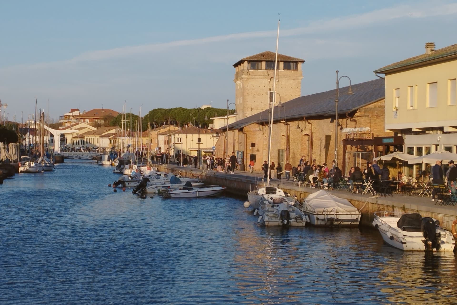
Cervia sits at sea level on the Adriatic, twenty kilometers south of Ravenna, between the pine forest of Milano Marittima and the salt pans that have given the town its identity since Roman times. The original settlement, Ficocle, stood inside the saline itself; the move to the coast in 1697 put the grid of workers' housing where it now stands, closer to the water and to the canal port that the tower on its north side was built to guard.
The two halves of the municipality read as a pairing of extraction and leisure: the saline and the old grid town to the south, worked continuously and still yielding salt by hand at one basin, and the planted pine forest to the north, laid out as a garden-city resort in the following century. The museum inside the old salt warehouse holds two thousand years of the tools and records that connect the two eras.
The beach carries Bandiera Blu recognition along nine kilometers of coast. What holds the town together is that its shape was dictated by salt long before tourism arrived: the grid, the tower, the canal and even the forest to the north all trace back to the working of the saline, with the resort at Milano Marittima grown from land the salt industry had left standing.
Osteria Bartolini, Locanda dei Salinari, Le Ghiaine and 2 more have been named by a guide.
What to see in Cervia
- Saline di Cervia. Working salt pans covering 827 hectares, the northernmost in Italy, with the Camillone basin still harvested by hand using nineteenth-century methods.
- Torre San Michele. Defensive tower built in 1691 to protect the salt warehouses and control the canal port, on the north side of the harbor.
- MUSA - Museo del Sale. Salt museum inside the Magazzino del Sale Torre, with tools, documents and photographs gathered from former salt workers.
How to get to Cervia
There is a railway station in the town, so you can arrive without a car and never need one while you are here. Forlì is roughly 29 minutes away by road.
Our tip
May through September is the Cervia season. Late May and June hold the best balance of warm sea and quiet beach, before the Italian holiday peak. July and August bring full beach and full pine forest, with thirty-degree afternoons broken by the evening sea breeze. Festa di San Lorenzo falls in August.
Foligno
Why visit Foligno
Foligno sits on the left bank of the Topino where the river leaves the Apennines and meets the plain of the Clitunno, the point at which the mountains give way to the Umbrian Valley. The town was called Fulginium in antiquity, and Cicero mentions the prefecture in two surviving fragments.
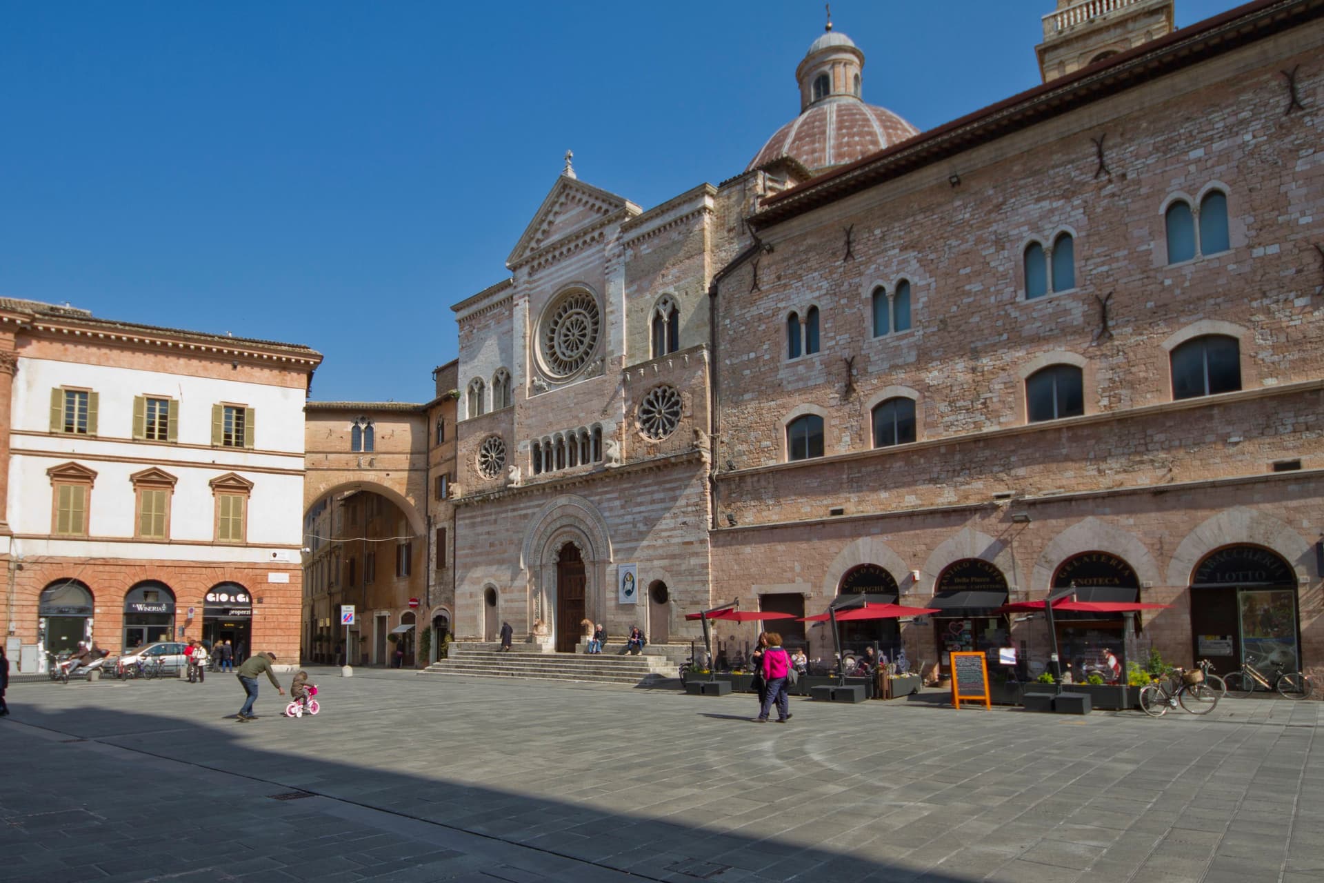
The Trinci ruled the town from 1305 to 1439, and the palace that carries their name still stands at its center, with the cathedral facing the same square where the town's tournament has run twice a year since its revival. The city's oldest church predates the Trinci period by centuries, its site going back to an 8th-century chapel, while the abbey in the hills above town was founded still earlier, in 1084, its cloister finished in 1229.
Between the ancient prefecture, the medieval abbey, the Trinci court, and the print workshop that put Dante into type, Foligno reads as a valley crossing point where successive centuries each left a building rather than displacing what came before.
Une, Osteria Bacerotti, Cucinaa and 2 more have been named by a guide.
What to see in Foligno
- Palazzo Trinci. Seat of the Trinci signoria 1305-1439, frescoed by Gentile da Fabriano and Jacopo Bellini, now holding the Pinacoteca and archaeological museum.
- Cattedrale di San Feliciano. Romanesque cathedral on Piazza della Repubblica, built over the tomb of the bishop-martyr buried here in 251 AD.
- Basilica di Santa Maria Infraportas. Oldest church in the city on the site of an 8th-century chapel, frescoes by Nelli, Ugolino di Gisberto, Alunno and Mezzastris.
How to get to Foligno
There is a railway station in the town, so you can arrive without a car and never need one while you are here. Perugia is roughly 42 minutes away by road.
Our tip
April through June and September into October are the months locals prefer. The Quintana runs twice a year, the June and September editions filling the rioni for a week each. April through October is also the season for the Topino river paths and the climb up to Sassovivo. Festevolezze falls in July.
Faenza
Why visit Faenza
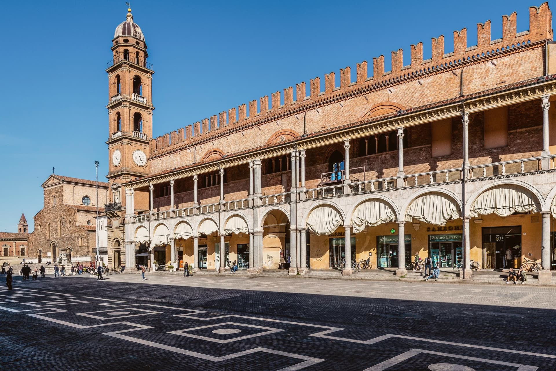
Faenza sits at 34 meters on the Via Emilia between Bologna and Rimini, on the Lamone river fifty kilometers southeast of Bologna. The city gave its name to faïence: tin-glazed earthenware that emerged here in the late fourteenth century and reached its peak in the early sixteenth, when the bianchi di Faenza, white-on-white ceramics exported across Europe, set the standard for Renaissance maiolica.
The Museo Internazionale delle Ceramiche, founded in 1908 by Gaetano Ballardini, holds 15,000 square meters of collections from 4000 BC to the present, with rooms dedicated to Picasso, Matisse, Chagall, Léger, Dalí, Burri, and Fontana. UNESCO named it a Monument Witness to a Culture of Peace in 2000.
The Cattedrale di San Pietro Apostolo, begun by Giuliano da Maiano in 1474, dominates Piazza della Libertà; Piazza del Popolo next door holds the medieval Palazzo del Podestà and the municipal palace. The Palio del Niballo, an equestrian competition between the five city rioni, runs every June.
La Baita, Manueli have been named by a guide.
What to see in Faenza
- Museo Internazionale delle Ceramiche. Founded in 1908 by Gaetano Ballardini, 15,000 square meters spanning 4000 BC to contemporary work by Picasso, Matisse, Chagall, and Fontana.
- Cattedrale di San Pietro Apostolo. Renaissance cathedral begun by Giuliano da Maiano in 1474, completed by 1515, with sculptures by Benedetto da Maiano in the nave.
- Piazza del Popolo. Twin medieval square to Piazza della Libertà, framed by the Palazzo del Podestà and the porticos of the municipal palace.
How to get to Faenza
There is a railway station in the town, so you can arrive without a car and never need one while you are here. Forlì is roughly 26 minutes away by road.
Our tip
April through June and September through October are the working months on the Romagna plain. Spring brings the Palio del Niballo at the end of June and clear water in the Lamone; autumn dries the fields gold and brings the ceramics fairs back to the centro. July and August touch thirty-six degrees with high humidity, and Piazza del Popolo empties between two and five.
More from Anywhere Italy
 The best towns known for what they grow within an hour of Rimini
 The best towns known for what they grow within 90 minutes of Perugia
 The best towns you can reach by train within 45 minutes of Rimini
 The best wine towns within two hours of Ancona
- The best towns known for what they grow within two hours of Florence
 The best towns with a serious restaurant that eat well within 90 minutes of Rimini