
The 8 best towns inside a national park in the province of Potenza
The province of Potenza is mountain country before it is anything else. Villages of grey stone and pale render cling to ridges above valleys of beech and oak, and above them the loricate pines of the Pollino massif stand out on bare rock. Autumn is the season the food follows the landscape: chestnuts roasted in the squares, porcini, lamb, pasta with peppers dried on strings by the doorways. In winter the higher passes hold snow into spring, and in summer the air at these altitudes stays cool while the coast bakes.
Most people who come to Basilicata come for Matera, in the neighbouring province, and they come in numbers. The sassi are extraordinary and everyone has seen them by now, in films, on posters, on the covers of guidebooks. Cave hotels are booked out months ahead, coach parties fill the belvedere at sunset, and the queue for the rock churches is a real queue. It is worth the visit, but it is not the whole region, and it is not the mountains.
The same limestone, the same forest and the same cooking carry on west and south, into the Pollino and the Appennino Lucano parks. These are the towns that live inside those boundaries: on wooded slopes, at the head of river gorges, with rafting on the Lao, trails to the pines, and sanctuaries reached on foot. Fewer people go, and the ones who do tend to be walking.
Of the 16 communes we have mapped in the province of Potenza, 8 qualify as towns inside a national park: each sits inside the boundary of a national park. The smallest, Sasso di Castalda, has 733 residents.
If you are still choosing, we have also written The best high-altitude villages in the province of Potenza and The best mountain towns that eat well in the province of Potenza.
Sasso di Castalda
Why visit Sasso di Castalda
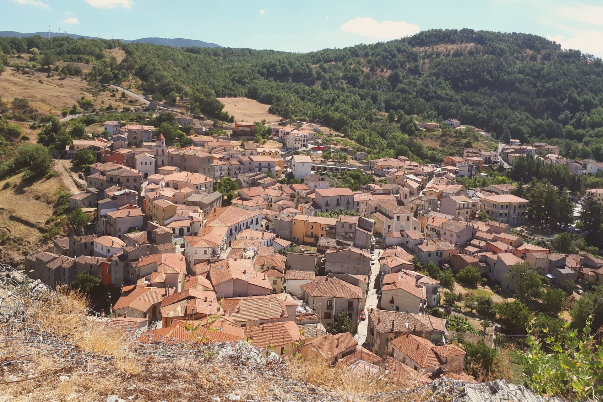
Sasso di Castalda sits at 949 meters in the Appennino Lucano Val d'Agri Lagonegrese National Park, on a rock spur above the Arenazzo torrent. Seven hundred and thirty people live in the medieval core that climbs toward the ruins of the Norman castello.
The village's modern claim is the Ponte alla Luna, a Tibetan-style suspension footbridge installed in 2014: a single span of 300 meters, 102 meters above the gorge, paired with a shorter second crossing in a circuit walked annually by more than 30,000 visitors. The name reaches back further.
Rocco Petrone, born in New York in 1926 to emigrants from Sasso, became NASA's launch director for the Saturn V and ran the Apollo program through the first moon landing in 1969. The bridge points at the connection.
The old town below holds the Chiesa Madre, San Rocco and San Nicola, walked in twenty minutes end to end.
What to see in Sasso di Castalda
- Ponte alla Luna. Tibetan suspension footbridge of 300 meters at 102 meters above the Arenazzo torrent, named for emigrant Rocco Petrone who launched Apollo 11.
- Castello. Norman fortress ruins crowning the rock spur above the village, the historic defensive anchor of the Lucanian Apennine valley.
- Chiesa Madre. Mother church in the centro storico, the principal religious building of the upper village around the castle rock.
How to get to Sasso di Castalda
Salerno is roughly 75 minutes away by road.
Our tip
May through October is the bridge season. The Ponte alla Luna runs ticketed crossings on a daily schedule, and the surrounding national park trails dry out from April onward. July and August are the busiest weekends, with bus tours arriving from Potenza and Salerno; the centro storico empties between three and six in the afternoon as the rock face holds the heat.
Terranova di Pollino
Why visit Terranova di Pollino
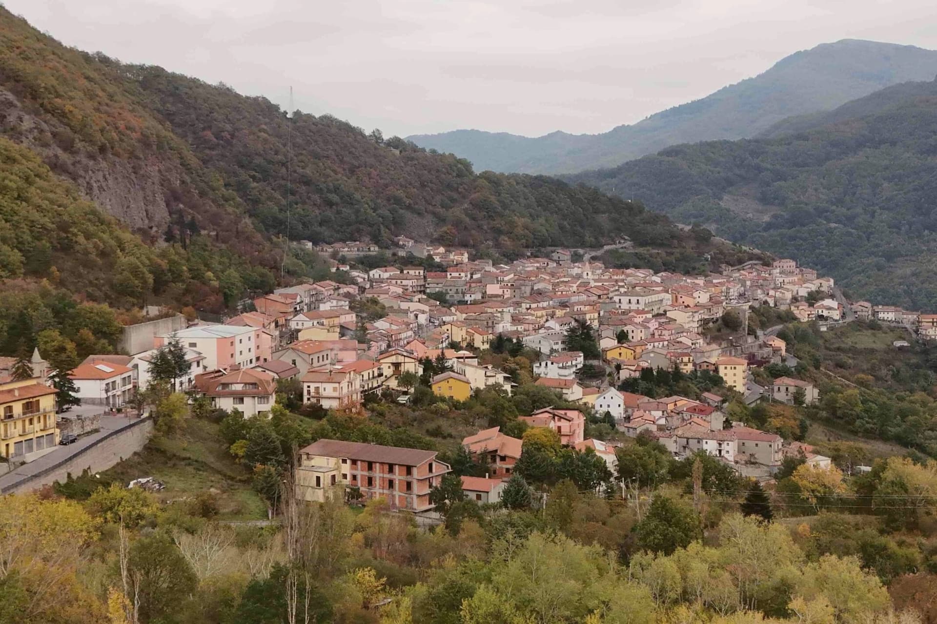
Terranova di Pollino sits at 926 meters on the Lucanian side of the Parco Nazionale del Pollino, Italy's largest national park at 192,000 hectares straddling Basilicata and Calabria. A thousand people live in the stone village above the Sarmento valley, in the territory locals call the gate of the park.
The land around the village rises into the Bosco Magnano and the Bosco di Chiaromonte, beech and Bosnian pine forest that holds the symbolic tree of the park, the loricato pine, on the higher ridges above. Local cuisine is mountain cuisine: hand-rolled pasta, lamb, pecorino, porcini in autumn.
The patata rossa di Terranova, a red-skinned firm-fleshed variety grown at 800 meters, has Slow Food Presidium recognition and is the village's flagship product. Luna Rossa, the Michelin-listed restaurant of Federico Valicenti, has anchored the contemporary Lucanian peasant kitchen here for thirty years.
What to see in Terranova di Pollino
- Parco Nazionale del Pollino. Italy's largest national park at 192,000 hectares, Terranova is one of the principal Basilicata-side entrance villages with trailheads from the centro.
- Serra di Crispo. Ridge above the village at 2,053 meters known as the Garden of the Gods for its stand of loricato pines, the symbol tree of the park.
- Centro storico. Stone-built mountain village at 926 meters with narrow ascending lanes, organised around the Chiesa Madre and the small piazze of the upper streets.
How to get to Terranova di Pollino
Taranto is roughly 138 minutes away by road.
Our tip
May through October is the trekking window. The Pollino trails open as snow clears the high ridges, usually by mid-May, and the loricato circuits to Serra di Crispo and Serra delle Ciavole run through October. July and August bring weekend visitors from the Ionian coast, but at 926 meters the heat rarely settles.
Calvello
Why visit Calvello
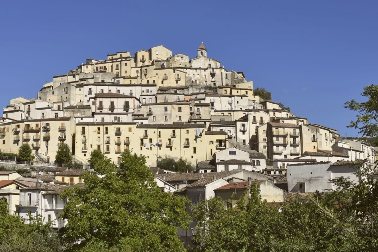
Calvello sits on the northern edge of the Appennino Lucano Val d'Agri Lagonegrese National Park, at the foot of Monte Venturino, whose beech and chestnut cover is walked from the village in summer. The historic centre gathers on a promontory below the mountain, with the castle at its head and the Ponte di Sant'Antuono carrying the town across the Terra stream toward the chapel and hermit's grotto on the opposite slope.
Above it all, at 1,320 meters, the sanctuary occupies a separate peak entirely, linked to the town only by the statue's twice-yearly journey up in May and down again in September. Calvello is part of the official Italian Ceramic Cities association, a standing that follows from the Benedictine introduction of the wheel around 1200 and the sparrow-peacock motif that has marked the town's output since.
Between the clay worked in the workshops, the fortress rebuilt by the family that gave the castle its later form, and the sanctuary kept apart on its own summit, the town reads as three separate histories that happen to share one address: a craft brought from outside, a family that rebuilt what was already there, and a devotion that lives on the mountain rather than in the streets.
What to see in Calvello
- Castello Carafa-Ruffo. On Lombard foundations and expanded in the Swabian-Angevin period, the fortress was remodeled into a Carafa della Marra residence in the sixteenth century. Its rooms now hold the ceramics museum.
- Museo Multimediale della Ceramica. Inside the castle, the museum traces the sparrow-peacock motif through the pieces themselves, garlanded in forest green and wheat-field yellow.
- Santuario di Maria Santissima del Monte Saraceno. The sanctuary stands apart from the town on its own peak, reached by the same route the statue travels each May and September, a walk rather than a visit.
How to get to Calvello
Salerno is roughly 131 minutes away by road.
Our tip
May through October is the working window. The Monte Saraceno procession in mid-May is the year's opening event, and the trails into the Parco Lucano dry out from late April. July and August bring heat in the lower piazze and ceramicists keep shorter morning hours; the chestnut woods above the village stay cooler.
Rivello
Why visit Rivello
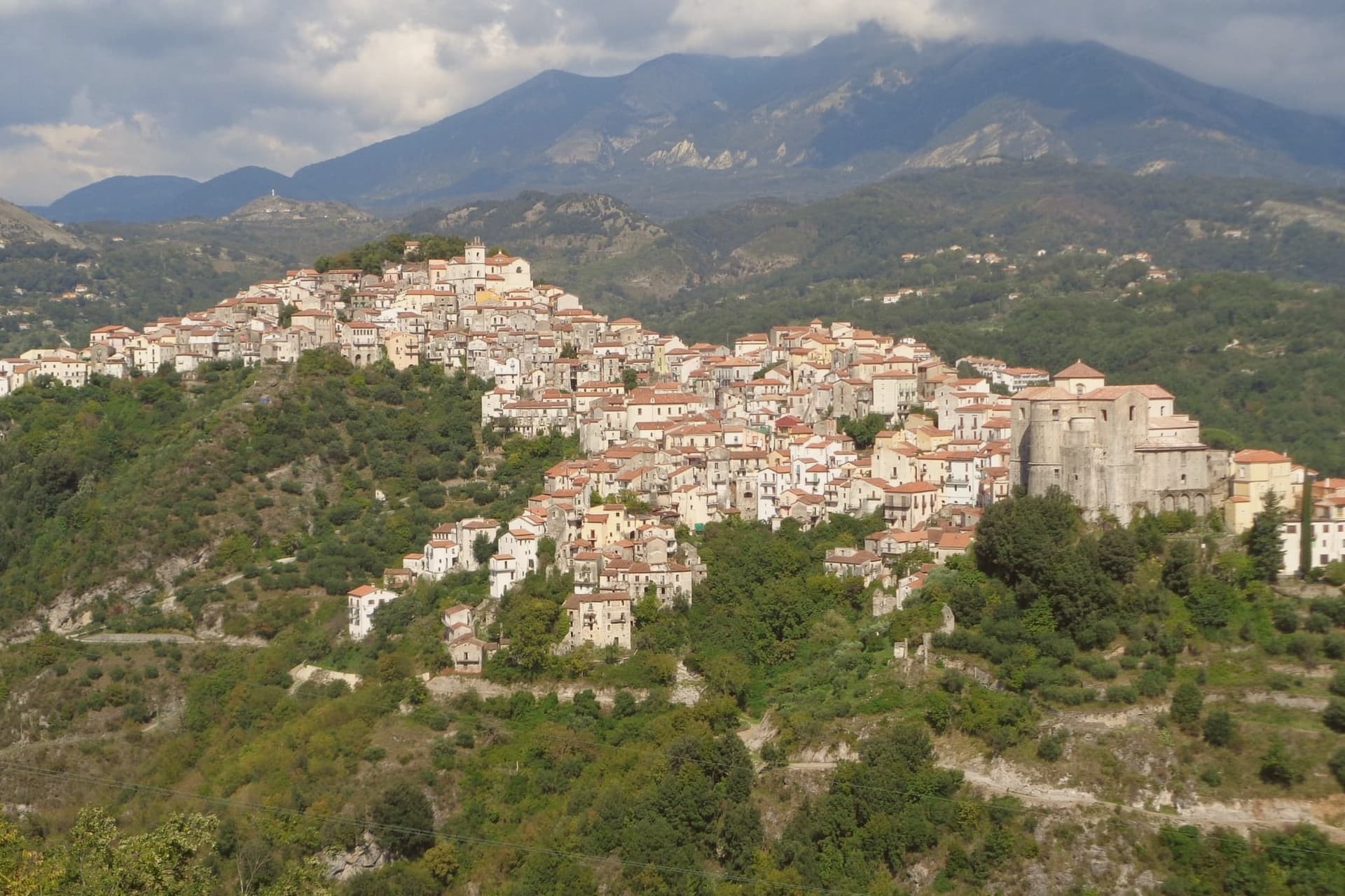
Rivello sits at 479 meters on a ridge above the Noce valley, twenty kilometers inland from Maratea and the Tyrrhenian. The town was disputed between Lombards and Byzantines after the fall of Velia, and its name is read by some as Re-Velia, the place where Velian refugees regrouped.
Both peoples settled here and never fully separated: the ridge organized itself into an upper town and a lower town, and for centuries each pole kept its own church, its own clergy, and its own rite, meeting at the market but not at the altar. The eighteenth century was Rivello's prosperous moment, judging from the parish archives and the stone houses that climb the ridge from that period, including the Baroque work layered onto older Greek-rite foundations in the lower town.
The Pollino park boundary runs nearby, and the belvedere at Passo la Colla looks down on the Gulf of Policastro, a reminder that the ridge, for all its inland feel, sits a short distance from the coast it once helped populate. What the town amounts to is a single street holding two histories that ran side by side for the better part of a millennium before finally merging.
What to see in Rivello
- Convento di Sant'Antonio da Padova. Sixteenth-century Franciscan complex built around a cloister, its frescoes by Giovanni Todisco and Giovanni De Gregorio covering the cloister walls and refectory.
- Chiesa di Santa Maria Maggiore. Upper-town church, plainer in its stonework than its lower-town counterpart, standing at the pole of the ridge that held the Latin congregation.
- Chiesa di San Nicola dei Greci. Lower-town church with Byzantine architectural elements still legible beneath an eighteenth-century reorganisation of the interior.
How to get to Rivello
Salerno is roughly 88 minutes away by road.
Our tip
April through June is the comfortable window, when the Noce valley turns green and the convent frescoes can be viewed without queues. September and October are dry and gold. July and August push toward thirty-five degrees on the ridge, hotter still in the valley, and locals retreat to the Tyrrhenian or the Pollino slopes nearby.
Rotonda
Why visit Rotonda
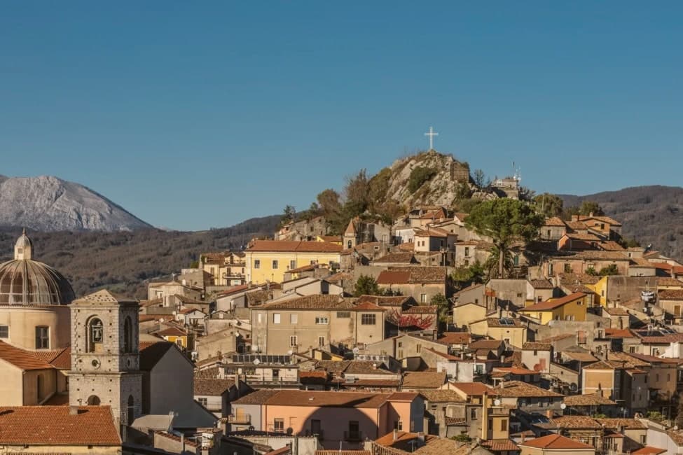
Rotonda sits at 626m in the Mercure river valley, on the Basilicata side of the border that the Parco Nazionale del Pollino, at 1,925 km2 and founded in 1993, draws across two regions. The centro is Lucanian in character: intact stone-paved vicoli, a quiet architectural register, and a hill silhouette closed by the medieval castle ruins above and the 16th-century parish church below, the two marking the old and the sacred ends of the settlement.
Inside the church, later restorations have not displaced the Madonna painted by the Lucanian Mannerist Giovanni de Gregorio, and the castle ruins belonged to the Sangineto family. The park's administrative and visitor apparatus is folded into the town itself rather than kept apart from it: the executive headquarters, the visitor centre, and the main interpretive trail system all sit within walking distance of the church and the castle summit, with the pine-clad slopes rising directly behind the centro.
The pines are Loricato, a high-altitude conifer surviving only here and in the Balkans, some specimens reckoned a thousand years old, and they give the park its symbol. Two Slow Food Presidia are grown on the terraces that step down toward the river, a microclimate specific enough that neither product is found elsewhere: the Fagiolo Bianco Poverello, a white bean with a 14-day cooking-resistance and a buttery texture, and the Melanzana Rossa di Rotonda DOP, a small red eggplant resembling a tomato but closer to a fruit in its cooking properties, used locally in jams and sweet-and-sour preserves.
Both have their own August sagre. Further out, the Loricato pine trails climb toward Monte Pollino at 2,248m and Serra del Prete at 2,181m, the Calabria-side Civita and Bovesìa Grecanic villages lie about 30 km south, and the Tirreno coast at Maratea and Praia a Mare is roughly 50 km west.
The table draws on the same geography: pasta with peperoni cruschi, capocollo and salsiccia lucana, pecorino, the Aglianico del Vulture red from 100 km north, and the Cirò DOC from Calabria 60 km south. Two DOP designations, the Borgo Autentico mark, and the national park's executive seat together make Rotonda one of the most signal-loaded small comuni in Basilicata: a town where the bureaucracy of Italy's largest national park and the agriculture of two Slow Food terraces occupy the same short stretch of streets.
What to see in Rotonda
- Parco Nazionale del Pollino HQ. Executive headquarters, visitor centre, and main interpretive trail system, set at the edge of the centro with the pine-clad slopes rising directly behind it.
- Fagiolo Bianco Poverello (Slow Food Presidium). Delicate white bean grown on Mercure valley terraces. 14-day cooking-resistance and a buttery texture unlike ordinary dried beans. Sagra del Fagiolo in early August.
- Melanzana Rossa di Rotonda DOP. Small red eggplant resembling a tomato, closer to a fruit in its cooking properties. Used in jams and sweet-and-sour preserves, grown only in this microclimate. Sagra della Melanzana Rossa in August.
How to get to Rotonda
Salerno is roughly 118 minutes away by road.
Our tip
Rotonda is best May through September — the Pollino summer is cool (the 626m altitude + the park's higher elevations keep temperatures pleasant). The Sagra del Fagiolo (early August) + Sagra della Melanzana Rossa (mid August) are the year's culinary highlights. October is autumn-foliage season in the Loricato pine forests.
Viggiano
Why visit Viggiano
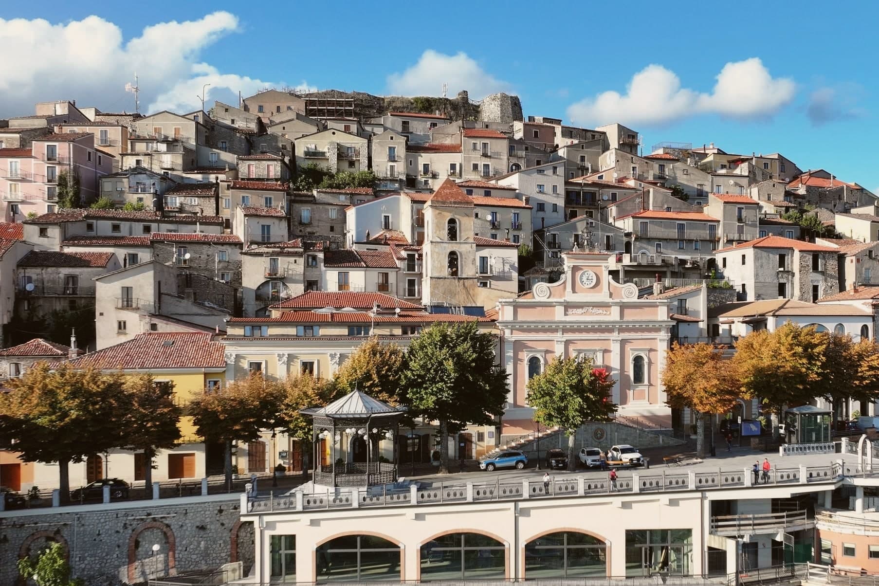
Viggiano sits at 975 meters on a ridge in the Alta Val d'Agri, in the national park. The Santuario della Madonna Nera del Sacro Monte stands at 1,725 meters on the summit above the town: a dark wooden statue of the enthroned Virgin in Byzantine Nikopoia style, the patron saint of Lucania, carried up to the sanctuary on the first Sunday of May and back down to Viggiano on the first Sunday of September.
The procession is the largest religious event in the region. Viggiano is also the historic centre of Italian harp-making and of the arpisti viggianesi, the itinerant harpist musicians who carried Lucanian folk music across Europe and the Americas in the nineteenth century.
The Museo dell'Arpa Vittoria continues the tradition. Beneath the valley floor sits Europe's largest onshore oil field, operated by Eni at the Centro Olio Val d'Agri, producing the majority of Italy's domestic crude.
What to see in Viggiano
- Santuario della Madonna Nera del Sacro Monte. Sanctuary at 1,725 meters on the summit above town, housing the Byzantine-style Black Madonna statue, patron saint of Lucania.
- Museo dell'Arpa Vittoria. Museum dedicated to the Viggiano harp tradition, the Italian folk harp and the itinerant arpisti viggianesi musicians of the nineteenth century.
- Chiesa Madre Santa Maria Assunta. Mother church of the village in the centro storico, the year-round home of the Black Madonna statue between her two annual processions.
How to get to Viggiano
Salerno is roughly 100 minutes away by road.
Our tip
May through October is the festival window. The first Sunday of May opens the year with the Madonna Nera carried from the Chiesa Madre to the Sacro Monte sanctuary; the first Sunday of September brings her back. Both processions fill the ridge with pilgrims from across Lucania. Festa della Madonna Nera falls in September.
Latronico
Why visit Latronico
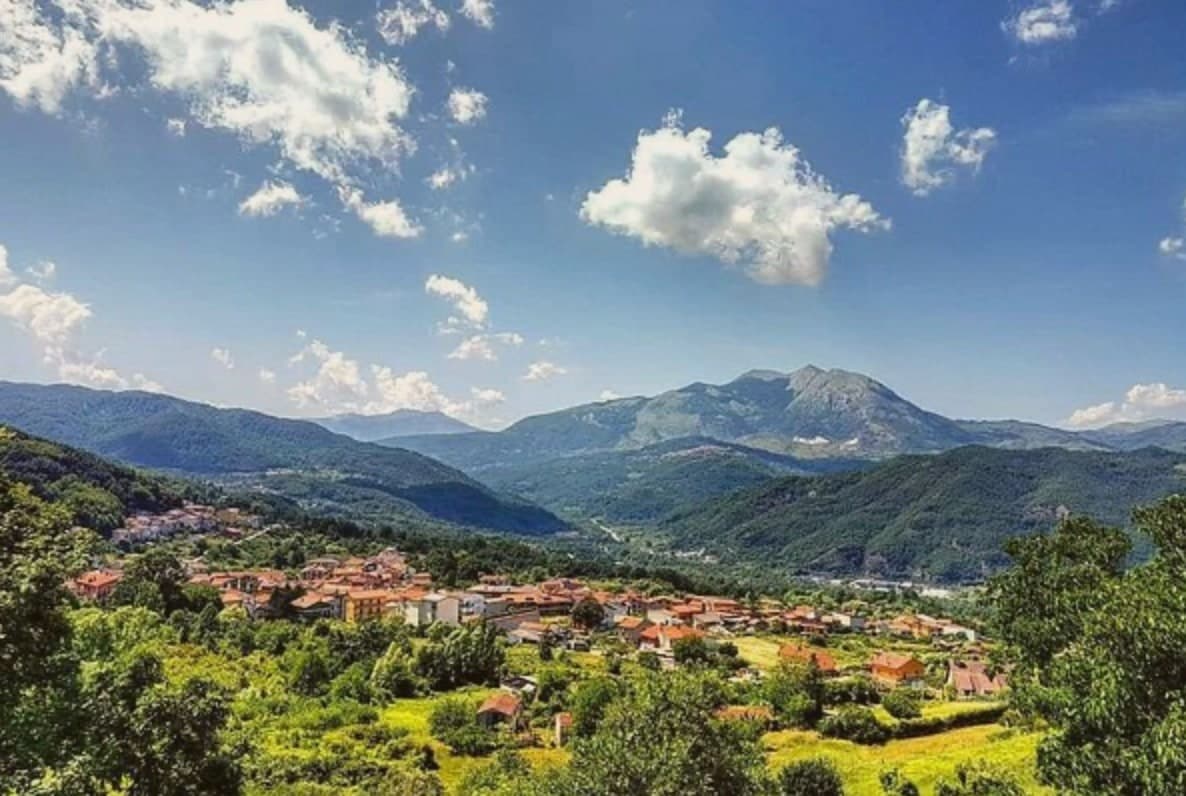
Latronico sits ninety kilometers north of Cosenza, on the northern flank of the park, at an elevation that keeps the town cool in August when the coasts on both seas push past forty. The historic center holds the ridge above the valley, its lanes and stone houses built for that upper ground.
The spa hamlet lies two kilometers below by road, its name meaning hot, a separate settlement tied to the town by that single road and by the water itself. The comune carries three institutional signals at once: national park, thermal town, and a place recognized for how it manages waste, energy and territory inland.
The mountain above, the springs below and the governance in between describe a town that has built its identity on what the ground under it provides, water at a constant temperature and slopes that hold pine forest instead of farmland.
What to see in Latronico
- Terme Lucane. The Grande Sorgente runs bicarbonate-calcic, the Piccola Sorgente bicarbonate-calcic-sulfurous and slightly radioactive. Archaeological finds around the site attest to prehistoric use of the waters.
- Parco Nazionale del Pollino. Rings the southern half of the comune, old-growth Bosnian pine on the upper slopes and the karst mass of Monte Alpi rising over the trails.
- Monte Alpi. Karst peak at 1,892 meters above the town, reached by trails from the village, a single high massif standing apart from the main Pollino chain.
How to get to Latronico
Salerno is roughly 102 minutes away by road.
Our tip
May through October is the season for Latronico. The Pollino trails open in late spring, the spa runs full hours, and the 888-meter elevation keeps the town cool even in the August heat that crushes the coasts. June, July and September are the strongest months for thermal cures and hiking combined.
Lagonegro
Why visit Lagonegro
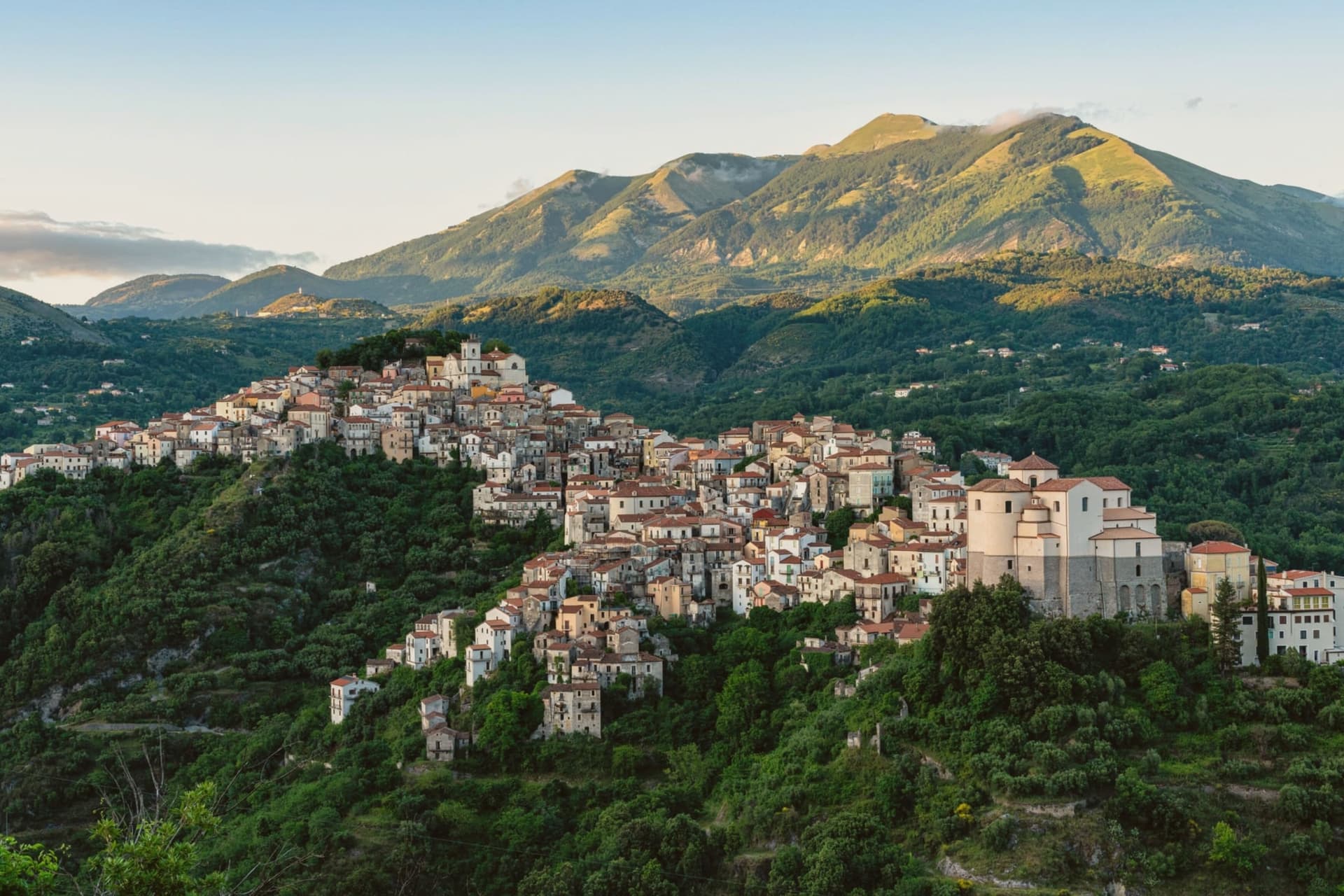
Byzantine monks established the settlement between the ninth and tenth centuries on a defensive promontory between the Noce and Cogliandrino streams, the position that gives the valley its name. The town divides cleanly in two: the old village climbs around the castle ruins and the parish church, while the modern town spreads from the tree-lined Piano square below, the wooded slope between them marking the line where medieval stone gives way to nineteenth-century planning.
The church holds the tomb local tradition assigns to the Florentine model of Leonardo's Mona Lisa, said to have died here in 1506. Lake Sirino at 788 meters and the glacial Lake Laudemio at 1,525 meters both lie within twenty minutes of the town, under the same mountain wall that shelters it.
The town's two halves and the legend it keeps in spite of the evidence against it both point to the same trait: a place defined by what it holds onto, geographically and otherwise.
What to see in Lagonegro
- Chiesa di San Nicola. Tenth-century church in the old village, holds the tomb local tradition assigns to Lisa del Giocondo and two sculptures by Altobello Persio.
- Castello feudale. Ruins of the feudal fortress on the promontory of the old village, the original Byzantine and later Norman defensive anchor of the Valle del Noce.
- Borgo antico. Stone-built medieval core climbing around the castle ruins, separated by the wooded slope from the modern town below.
How to get to Lagonegro
There is a railway station in the town, so you can arrive without a car and never need one while you are here. Salerno is roughly 85 minutes away by road.
Our tip
May through October is the walking and lake season. The Laudemio reserve opens once snow clears from the upper Sirino, usually by late May, and the Cammino di San Nilo passes through Lagonegro for pilgrims working southward. July and August are warm in the lower town but the upper village holds shade; weekends fill with Salerno families on the Sirino trails. Festa lagane e fagioli falls in August.
More from Anywhere Italy
- The best high-altitude villages in the province of Potenza
 The best mountain towns that eat well in the province of Potenza
- The best towns that eat well in the province of Potenza
- The best cheese towns within 90 minutes of Salerno
- The best mountain towns within 90 minutes of Salerno
- The best towns with a serious restaurant in Basilicata