
The best towns known for what they grow within two hours of Trento
The land between the Adige and the Piave grows things with paperwork attached. Chestnuts ripen on the terraces of Monte Baldo, white asparagus comes out of the sandy plain in spring, cherries redden on the Valpolicella slopes, and Glera grapes climb the steep hills above Treviso in rows too tight for tractors. The building material shifts with the crop: pale Prun limestone in the Verona hills, brick and river silt down along the Po, plastered porticoes on the Palladian plain. Village festivals here are named after a vegetable or a fruit rather than a saint, and the menu at the local trattoria narrows to whatever the fields are doing that week.
Most visitors to this part of Italy point themselves at Verona and Lake Garda's western shore, and in July the road around Sirmione barely moves. It makes sense: the arena, the amphitheatre crowds, the ferries, the lemon houses. Those places absorb almost everyone who comes through, and the agricultural country that feeds them goes unvisited even when it starts at the edge of the car park.
The same hills and the same alluvial plain keep going, though, past the resort strip and past the ring road. Chestnut woods continue up the mountain, the asparagus beds continue across the plain, the vineyards continue along the ridge, and the towns in them are smaller, cheaper and quieter than the famous names an hour away. These are the ones inside a protected production zone, where the crop is a legal fact and not a marketing line. Fewer people go, which is mostly a matter of habit.
Of the 78 communes we have mapped in a 120-minute drive of Trento, 12 qualify as towns known for what they grow: each sits inside the production zone of a protected fruit or vegetable. This list is 10 of them. The smallest, San Zeno di Montagna, has 1,464 residents.
Elsewhere in the catalogue: The best towns known for what they grow within an hour of Verona and The best towns known for what they grow within 90 minutes of Brescia.
San Zeno di Montagna
Why visit San Zeno di Montagna
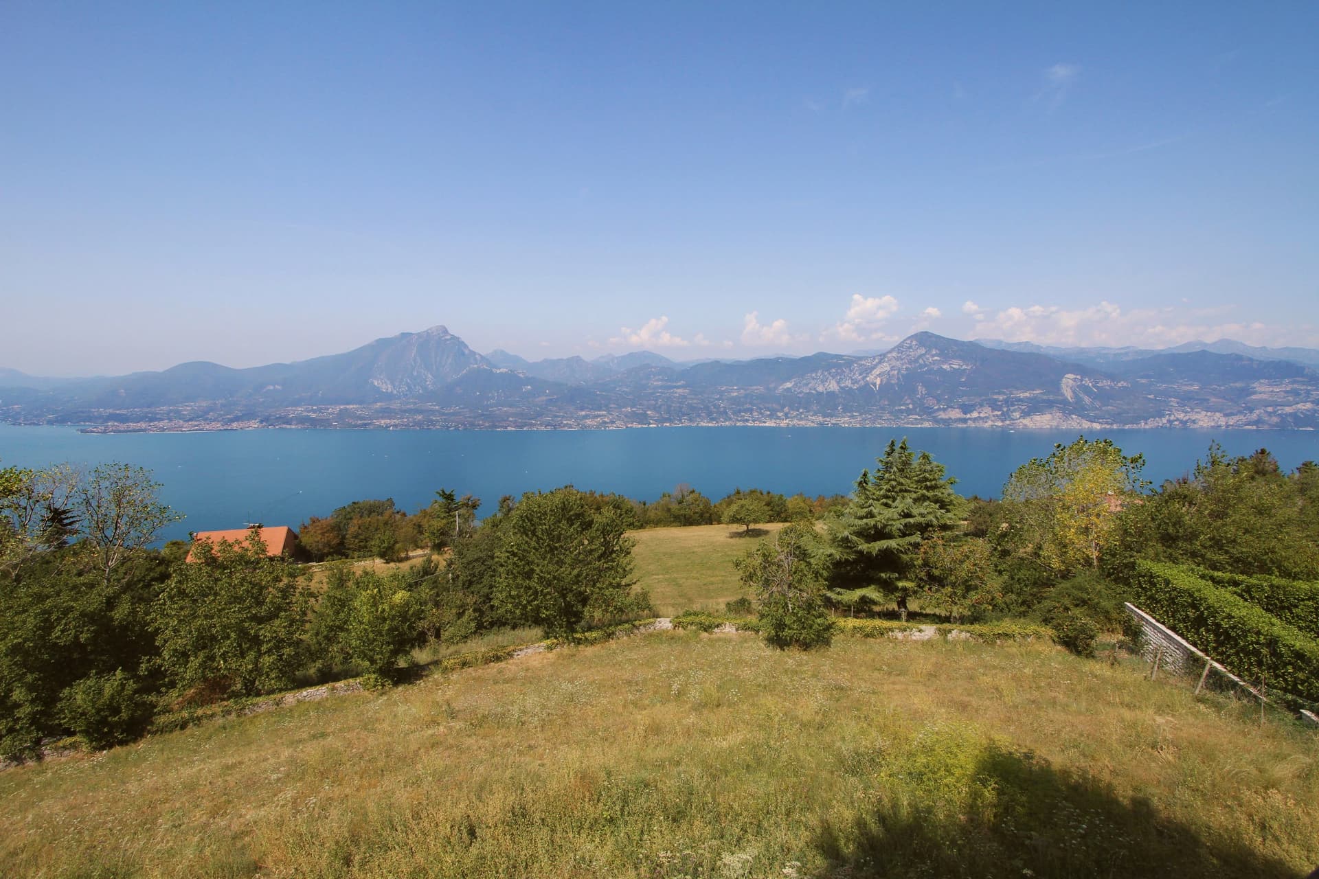
The village sits thirty kilometers northwest of Verona. It took its current name in 1871, after unification, borrowing the name of Verona's patron saint; before that it was called Montagna di Monte Baldo, a plainer name tied directly to the mountain above it.
Pastoralism here goes back to the Copper and Bronze ages, when small communities drove herds up from the plain in summer along routes that still cross the mountain. Sheep and goats gave way to cattle as the dominant economy in the seventeenth century.
The frazione of Prada, reached by cable car from the lakeshore, holds the longest of these pasture terraces, its Church of San Bartolomeo built for the shepherds who worked the ground seasonally rather than for a settled parish. Below, the chestnut groves that ring the village are a separate, older layer of the economy, worked at lower altitude while the herds went up.
What emerges is a village organized on a vertical axis: lake view at one elevation, chestnut groves at another, pasture and summer huts higher still, each belonging to a different rhythm of use rather than to a single center.
Taverna Kus have been named by a guide.
What to see in San Zeno di Montagna
- Balcone del Garda. The viewpoint that names the commune, a place to stand at the edge of the ridge and take in the water and the opposite shore at once.
- Monte Baldo. Regional park rising above the village, its slopes still worked as pasture, with the old herding paths climbing through it toward the grass terraces higher up.
- Prada. Three-kilometer grass terrace on the mountain, reachable by cable car from the lakeshore, with the Church of San Bartolomeo standing among the summer pasture huts.
How to get to San Zeno di Montagna
Verona is roughly 51 minutes away by road.
Our tip
April through June and September through October are the months the commune works best. The chestnut groves green up in spring, the Baldo opens for walking, and the lake below stays cool enough to swim in by June. October brings the Festa delle Castagne over three weekends, with roasted Marrone di San Zeno and the woods turning to ochre and rust.
Pomponesco
Why visit Pomponesco
Pomponesco sits at 21 meters on the left bank of the Po, at the southern edge of Mantova province twenty-five kilometers north of Parma. The Roman Pompea family gave the village its name; the Etruscans and Gauls held the ground before them.
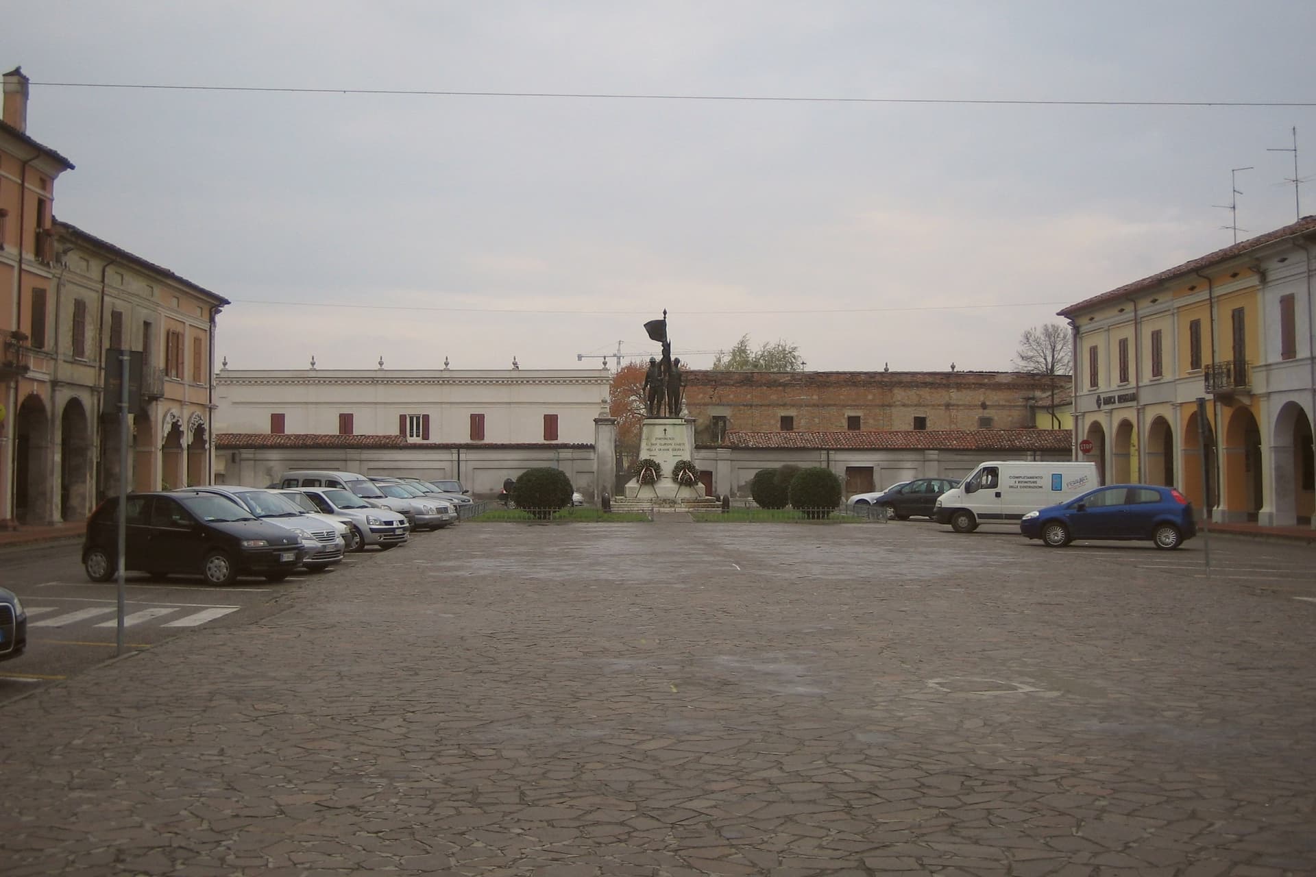
The town grid radiates from where a castle once stood, two axes crossing to divide the settlement into four symmetrical quarters, and that castle was pulled down by French troops in the eighteenth century, leaving the open square that replaced it. Around that square the courtier palaces still stand, most built between 1590 and 1630, and behind their arcades a number keep original wooden ceilings and, in rarer cases, original frescoes.
The bell tower of the Comune and the campanile of the parish church face each other across the piazza, almost in competition, before the view narrows toward the embankment and the river beyond. The result is a village whose whole shape, from the vanished castle at its center to the water at its edge, still reads as the plan one Gonzaga governor imposed on it four centuries ago.
What to see in Pomponesco
- Piazza XXIII Aprile. Arcaded square where the Gonzaga castle stood until the French demolition in the eighteenth century, lined with late-sixteenth-century courtier palaces.
- Chiesa di Santa Felicita e dei Sette Martiri. Parish church on the central square, with a tall bell tower facing the town hall across the piazza.
- Late-Cinquecento Gonzaga plan. Town grid laid out by Giulio Cesare Gonzaga at the end of the sixteenth century, with two axes dividing the village into four symmetrical quarters.
How to get to Pomponesco
Reggio Emilia is roughly 47 minutes away by road.
Our tip
April through June and September into October are the workable months on the lower Po. April and May bring stable weather, the river at full water, and the embankment paths in good condition. September and October stay dry and gold, the cleanest light photographers come for.
Follina
Why visit Follina
Follina sits at 191 meters where a stream cuts out of the Treviso Prealps into the upper Prosecco hills, sixty-five kilometers northwest of Padova. The name comes from follare, to full wool, and the Sanavalle stream powered fulling mills here from antiquity through the nineteenth century.
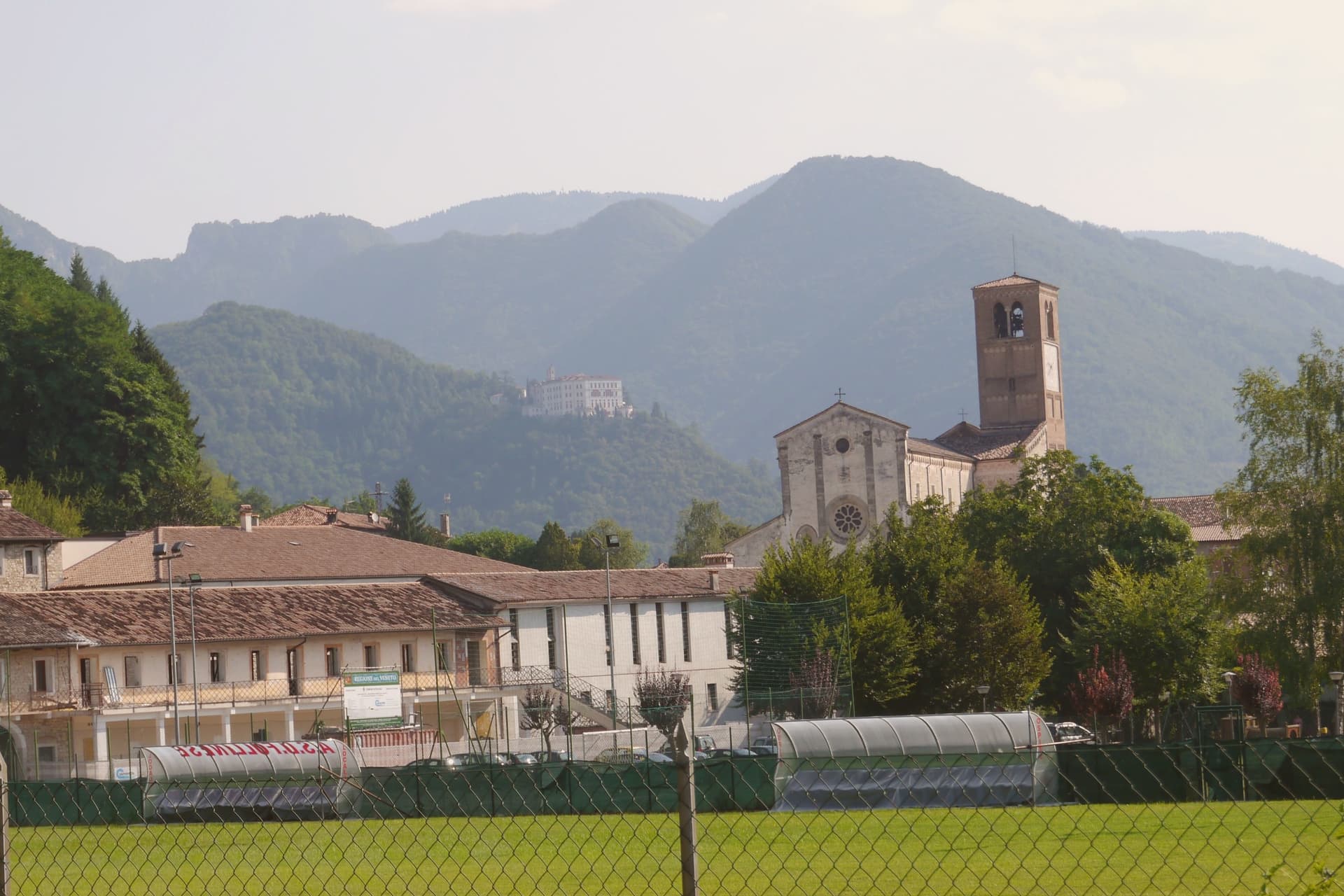
A monastic complex existed before the Cistercians arrived in the mid-twelfth century, likely a Benedictine house dependent on San Fermo di Verona. The Cistercians built the Abbey of Santa Maria from 1170; the cloister was completed in 1268.
The abbey is now a minor basilica and parish seat, a national monument since 1921, with frescoes of the Veneto-Byzantine school in the chapter house and a thirteenth-century stone Madonna inside the church. The Brandolini family, lords of nearby Cison di Valmarino, used Follina as a textile center through the Venetian period.
The borgo carries five institutional signals at once. The frazione of Pedeguarda holds the older parish church; the centro of Follina runs along the abbey wall and the stream that powered the mills.
La Corte, Osteria dai Mazzeri, Al Castelletto have been named by a guide.
What to see in Follina
- Abbazia di Santa Maria. Cistercian abbey built from 1170, with the cloister completed in 1268, raised to minor basilica and a national monument since 1921.
- Chiostro dell'Abbazia. Cistercian cloister of 1268, with twin colonnettes, sculpted capitals and a central well, intact in its medieval form.
- Sala del Capitolo. Abbey chapter house with frescoes of the Veneto-Byzantine school from the late thirteenth and early fourteenth centuries.
How to get to Follina
Venezia is roughly 73 minutes away by road.
Our tip
April through October is the working season. April and May bring the abbey gardens into bloom and the Prosecco hills into green; September and October bring harvest and the gold light the Rive belt is built on. July and August push into the low thirties and the centro empties in the afternoon, though the cloister stays cool.
San Benedetto Po
Why visit San Benedetto Po
San Benedetto Po sits at 19 meters in the flat Po plain, 22 kilometers southeast of Mantova, on what was once an island between the Po and the Lirone rivers. The town has no origin apart from the abbey: in 1007 Tedald of Canossa, grandfather of Matilda, granted half his land between the two rivers to the Benedictines, and the resulting monastery became one of the principal centers of the Gregorian Reform in northern Italy.
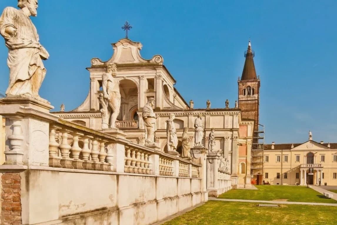
Matilda herself, the countess who hosted the emperor's penance at Canossa in 1077, was buried within it for five centuries before her remains went to Rome. The abbey held its position from its founding until the Napoleonic suppression of 1797 emptied the community out, by which time it had grown its church, its three cloisters, its refectory and infirmary.
What is left standing today is essentially the monastery's own floor plan with the town arranged around it. A place built entirely by and for a religious institution, still legible as such long after the monks themselves are gone.
What to see in San Benedetto Po
- Abbazia di San Benedetto in Polirone. The complex holds frescoes by Correggio and statues by Begarelli, added when Giulio Romano restructured it between 1540 and 1547.
- Basilica di San Benedetto. The church Giulio Romano redesigned stands at cathedral scale, the visual center around which the rest of the monastery is arranged.
- Chiostri di Polirone. Three cloisters, one for each major building phase from medieval through Renaissance, forming the working spine of the monastery behind the church.
How to get to San Benedetto Po
There is a railway station in the town, so you can arrive without a car and never need one while you are here. Modena is roughly 50 minutes away by road.
Our tip
April through June and September into October are the months that suit the Po plain. The basilica is open without summer heat, the cycling routes along the river are dry, and the cloisters hold their cool morning shade. July and August push past thirty-two degrees in the valley and the humidity off the river makes midday heavy.
Lazise
Why visit Lazise
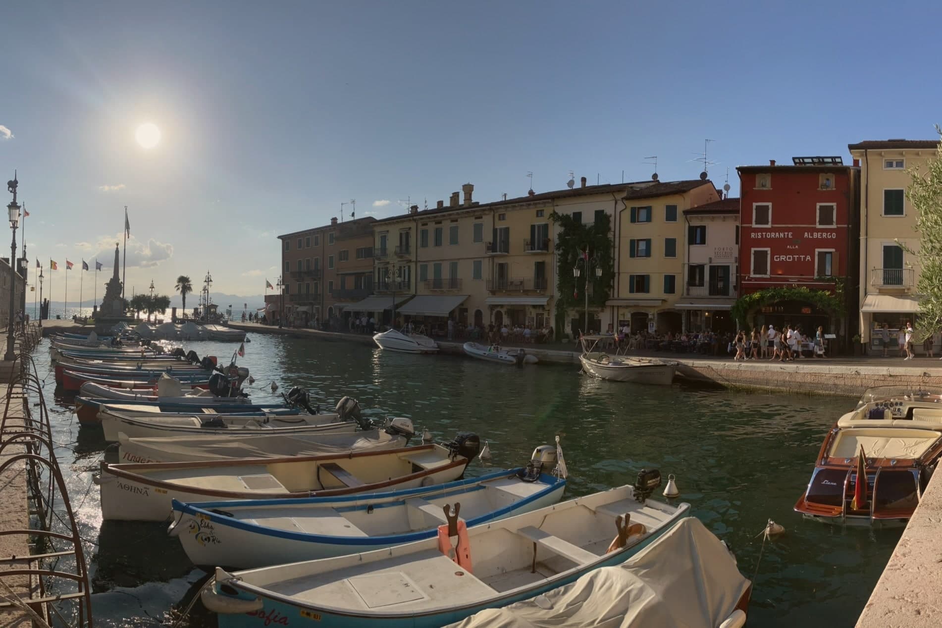
Lazise sits at 76 meters on the southeastern shore of Lake Garda, twenty kilometers northwest of Verona. The first walls went up shortly after the 983 charter; Venice took the town in 1405 and held it until Napoleon arrived in 1796, and Porta Lion, on the south, still carries the winged lion of Saint Mark from that period of rule.
The castle anchors the southern corner of the fortifications while the harbor sits enclosed within their reach, and the church and the customs house both face onto that same stretch of water, one built for worship and later pressed into use as a warehouse, the other built outright for Venice to tax what passed through the port. Behind the town, the morainic hills carry the vines of the Bardolino DOC, and Lazise counts itself among the Veneto's wine and honey communes.
The town reads, in short, as a small fortified port whose walls, harbor and customs works were all built to serve and guard the same trade on the same shore.
What to see in Lazise
- Castello Scaligero. Rectangular fortress at the south corner of the walls, with five square towers and a fortified dock built for the lake galleys, facing Lake Garda.
- Mura medievali. Thirteen surviving towers and three gates, San Zeno, Nuova and Lion, ring the old town along the shore of Lake Garda.
- Chiesa di San Nicolò. Romanesque church on the harbor, with frescoes attributed to the Giotto school and a former function as a customs warehouse.
How to get to Lazise
Verona is roughly 36 minutes away by road.
Our tip
April through June and September through October are the right months for Lazise. The walled centro storico stays cool from the lake breeze, the harbor fills with sailboats, and the Bardolino hills behind the town are green in spring and gold in October. July and August are warm and very crowded: the southern Garda shore concentrates more than half of the lake's tourist beds, and the gates of Lazise queue from morning.
Montagnana
Why visit Montagnana
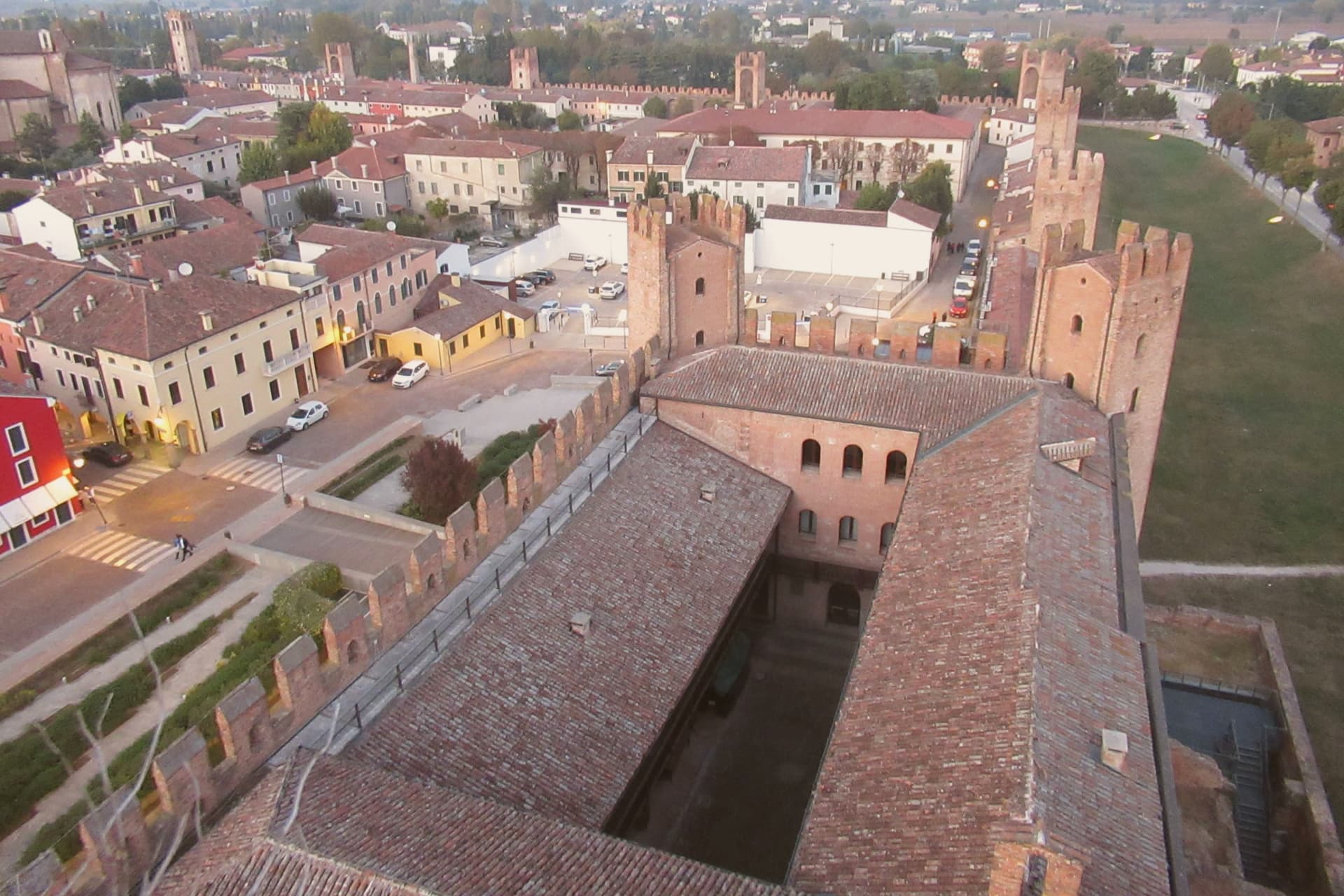
Montagnana sits at 16 meters on the lower Padova plain, thirty-five kilometers southwest of Padova, on the watershed between the Adige and the Bacchiglione. The wall ring is unbroken enough that the town's whole plan still reads as the fortification that produced it: the castle anchors the eastern gate, the rocca anchors the western one, and the road to Verona runs between them through what was once contested ground between Ezzelino's garrison and the Carraresi who came after.
Inside the walls, the center holds the Duomo and the two flanking palazzi around Piazza Maggiore, while the villa built for the cardinal stands deliberately outside the gate, a country house that still shows its face to the town. The May festival now fills the same ground the walls were built to defend, the modern economy of the place staged inside its medieval perimeter.
What to see in Montagnana
- Cinta muraria. Six to eight meters high and ninety-six centimeters thick, the rampart carries a continuous parapet walk, so the towers can be counted from above rather than just from the road.
- Castello di San Zeno. Fortress at the eastern gate, built by Ezzelino III da Romano in 1242, with the Mastio tower 38 meters high and a civic museum inside.
- Rocca degli Alberi. Western gate fortress built by the Carraresi between 1360 and 1362, with a moat and double drawbridge defending the road to Verona.
How to get to Montagnana
There is a railway station in the town, so you can arrive without a car and never need one while you are here. Vicenza is roughly 47 minutes away by road.
Our tip
April through June and September through October are the right months for Montagnana. The lower Padova plain runs cool and clear in those windows, and the parapet walk on the walls gives the best views when the haze lifts. The Festa del Prosciutto Veneto DOP runs across two weekends in mid-May, the largest event of the year, with tastings and tours of the curing houses.
Valdobbiadene
Why visit Valdobbiadene
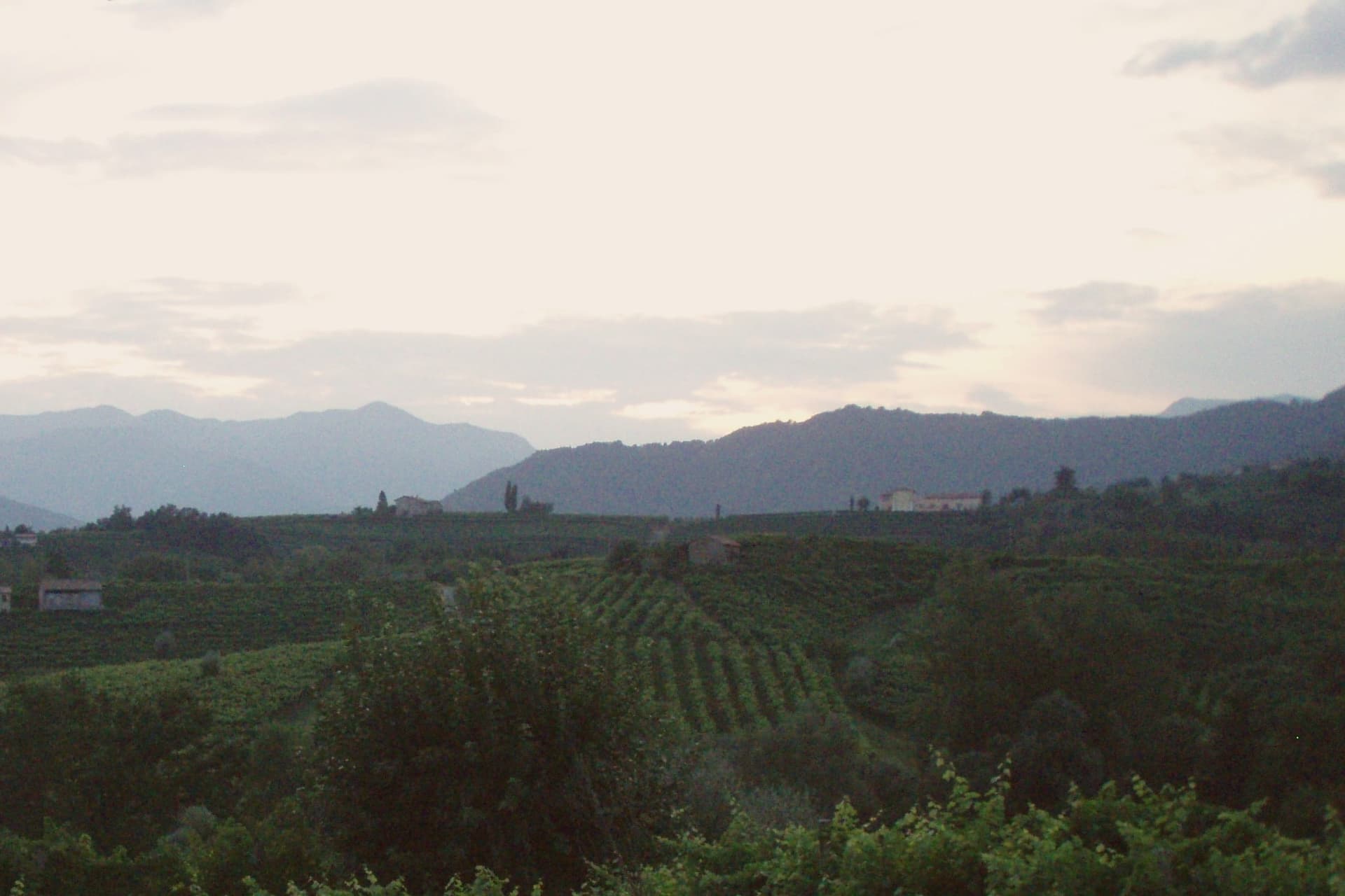
Valdobbiadene sits at 253 meters in the Treviso Prealps, fifty-five kilometers northwest of Venice, on the western edge of the Conegliano-Valdobbiadene UNESCO landscape inscribed in 2019. The town gives its name to the Conegliano Valdobbiadene Prosecco Superiore DOCG, and its own centro storico sits above a cluster of frazioni, among them the hilltop parcel that ranks as the zone's peak cru and the hamlet of Colderove with its sixteenth-century church.
Producers work these slopes on a shared calendar: the Antica Fiera di San Gregorio opens the working year on the second Monday of March, Villa dei Cedri hosts its own DOCG exhibition each spring, and cellar doors along the signed wine route stay open through the warm months as the harvest advances. The rhythm of the town follows the vine from one edge of the appellation to the other, with the hilltop parcel standing as the point the whole zone is measured against.
Tre Noghere, Alla Cima, Locanda Sandi have been named by a guide.
What to see in Valdobbiadene
- Cartizze. Rocky, south-facing hilltop with vineyards from 200 to 350 meters, worked in classified parcels above San Pietro di Barbozza.
- Duomo di Santa Maria Assunta. Neoclassical cathedral on Piazza Marconi, the civic anchor of the centro storico.
- Villa dei Cedri. Nineteenth-century villa and park at the foot of the centro storico, host of the Mostra del Cartizze e Valdobbiadene DOCG each spring.
How to get to Valdobbiadene
Venezia is roughly 85 minutes away by road.
Our tip
April through October is the working season. April and May bring vine flowering on the Cartizze and the Rive parcels and the Mostra del Cartizze opens at Villa dei Cedri in late April. June through August pushes into the low thirties on the lower slopes; the hilltop parcels stay cooler with the breeze off the Prealps. Mostra del Vin col Fondo a Valdobbiadone falls in July.
Sant'Ambrogio di Valpolicella
Why visit Sant'Ambrogio di Valpolicella
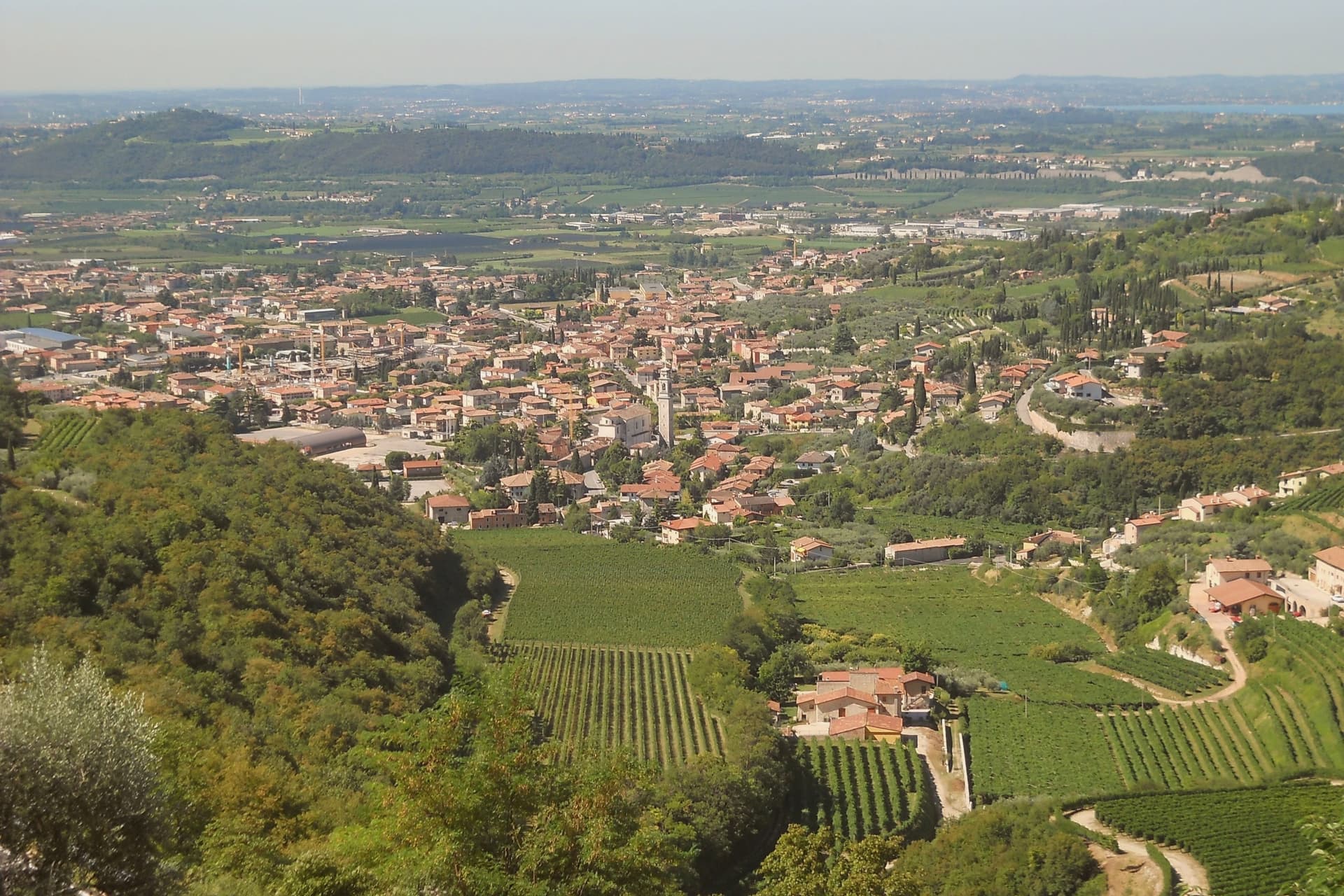
Sant'Ambrogio di Valpolicella sits at 174 meters in the heart of the Valpolicella DOC, fifteen kilometers northwest of Verona, on the rolling hills that close the eastern shore of Lake Garda. The commune groups five frazioni around the main village: Domegliara, Gargagnago, Monte, Ponton and the ridge settlement above them.
Gargagnago sits at the foot of the hills, its cellars closest to the valley floor; the ridge frazione occupies the higher limestone ground, reached by a climb steep enough to have earned the church its nickname. Between them the Serego Alighieri estate has worked the same parcels since Pietro Alighieri, son of Dante the poet who had followed his father into exile in Verona, bought the property in 1353, and the family still grows Corvina, Rondinella and Molinara there, with the Vaio Armaron Amarone counted among the appellation's cru benchmarks.
The pattern of the commune is one of a valley economy and a hill economy sharing a single administrative roof: wine pressed and aged below, an older, stiller settlement kept above it, with the quarries that once supplied Verona still worked on the slopes that join the two.
Dalla Rosa Alda, Masi Agricola have been named by a guide.
What to see in Sant'Ambrogio di Valpolicella
- Pieve di San Giorgio Ingannapoltron. Romanesque parish church whose ciborium columns carry an inscription naming the master builder Orso and his disciples Juventino and Juviano.
- San Giorgio di Valpolicella. Frazione on the limestone ridge above the valley, in the Borghi più belli d'Italia network, nicknamed Ingannapoltron for the steep climb up to it.
- Villa Serego Alighieri. Estate still owned by the Alighieri descendants; produces Vaio Armaron Amarone from Corvina, Rondinella and Molinara grown on the same parcels the family has worked.
How to get to Sant'Ambrogio di Valpolicella
There is a railway station in the town, so you can arrive without a car and never need one while you are here. Verona is roughly 34 minutes away by road.
Our tip
April through June and September through October are the months for Valpolicella. The vineyards green up in spring, harvest runs from mid-September into October, and the appassimento drying begins in the cellars while the leaves turn. July and August push past thirty degrees in the valley and the village empties between two and six in the afternoon; cellar visits move to morning slots.
Marostica
Why visit Marostica
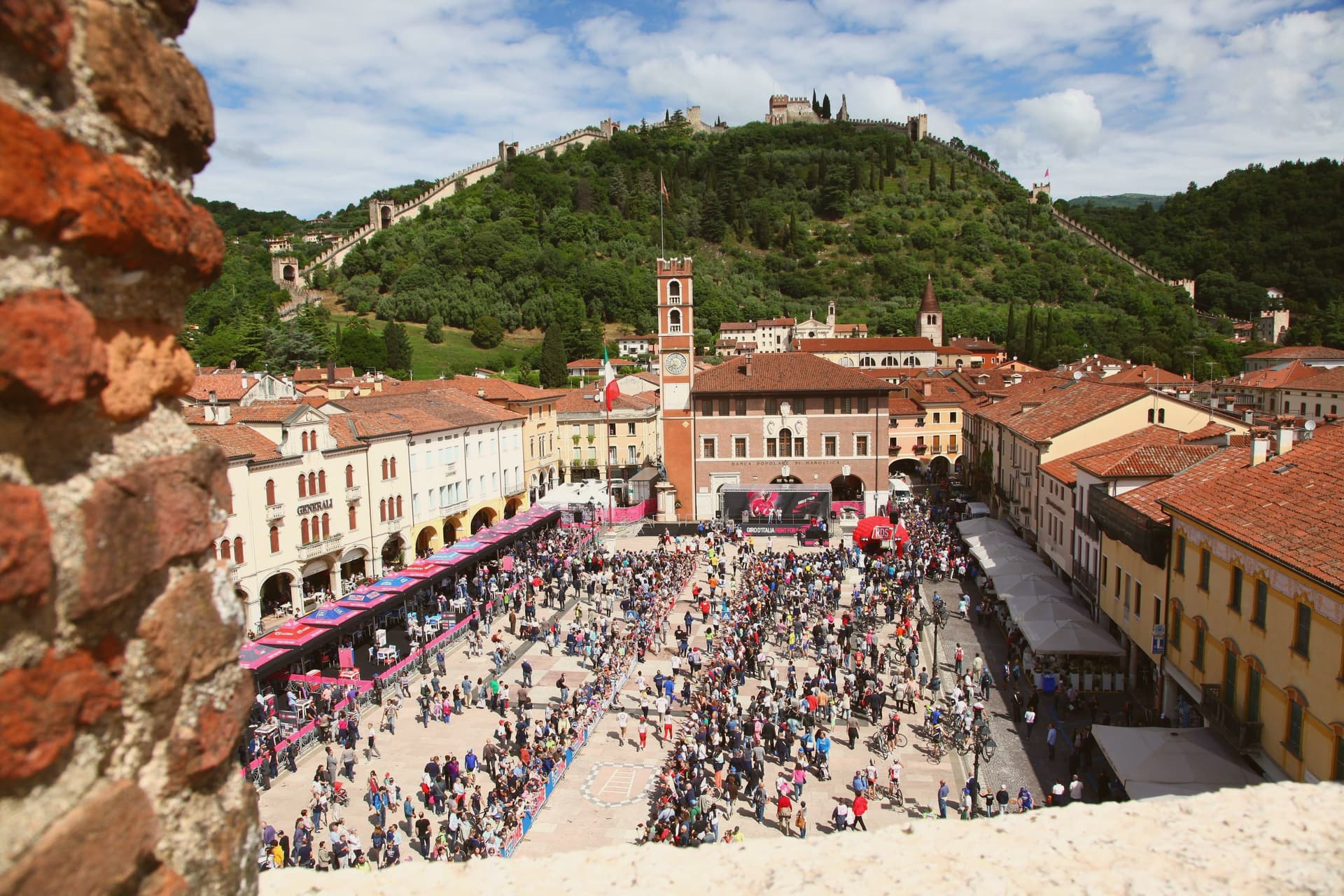
Marostica sits at 103 meters at the foot of the Asolan hills, forty-five kilometers northwest of Padova. Cangrande della Scala took the town in 1311, building his lower fortress on the plain and a second stronghold on the hill above it, then joining the two with a wall long enough to carry two dozen towers and four gates between them.
The arrangement is unusual: most walled towns fortify a single point, but here the defense runs uphill, turning the slope itself into the connecting structure between plain and ridge. The upper stronghold did not survive the artillery of the War of the League of Cambrai in 1510 and has stood as a ruin since, while the lower one remained inhabited and working, which is why the town's public life, its square, its church, its chess board, still gathers at the base of the hill rather than at its summit.
The cherries grown on the slopes to the north, since given IGP status, are the one product of the surrounding land that made it into the local kitchen as the crostata. What the town amounts to is a fortification that never stopped being a town: the walls did not seal Marostica off from its hillside, they organized it, and the square where the chess is played twice a decade sits exactly where the two castles' lines of sight once met.
La Rosina, Madonnetta have been named by a guide.
What to see in Marostica
- Castello Inferiore. Built from 1311 on Piazza Castello, its keep rising 44 meters over the square, with a museum inside on the chess match traditions.
- Castello Superiore. Ruined by Venetian artillery in 1510, standing on Monte Pausolino and reached by a footpath through the walls, with views over the Brenta valley.
- Mura di Marostica. Fourteenth-century walls running two kilometers between the two castles, with twenty-four towers and four gates; the parapet walk is open to the public.
How to get to Marostica
Vicenza is roughly 43 minutes away by road.
Our tip
April through June and September through October are the working months. The cherry harvest runs from late May to mid-June and the orchards on the lower slopes of the Asolan hills mark the season; the Mostra delle Ciliegie in early June is the major spring event. The Partita a Scacchi falls on the second weekend of September in even-numbered years and books the town a year ahead.
Valeggio sul Mincio
Why visit Valeggio sul Mincio
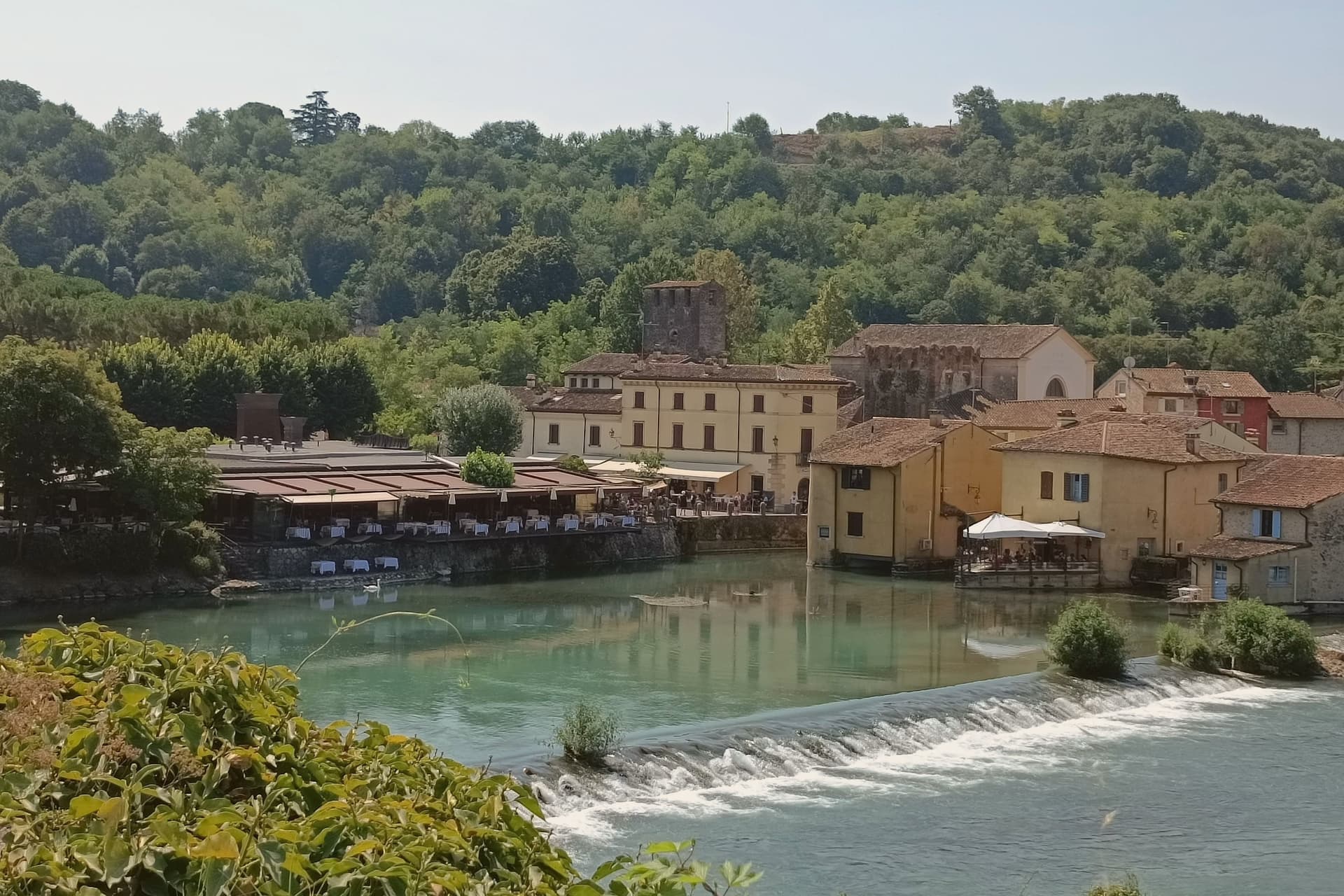
Valeggio sul Mincio sits at 88 meters on the morainic hills shaped by the Garda glaciers, twenty kilometers southwest of Verona and ten kilometers from the southern end of Lake Garda. The Mincio cuts north-south through the commune and was the Veneto-Lombardy military frontier for centuries.
The frazione of Borghetto on the river is one of I Borghi più belli d'Italia, a single line of houses and water mills along the left bank under the Castello Scaligero. The fortified Ponte Visconteo, built in 1393 by Gian Galeazzo Visconti of Milan as part of the sixteen-kilometer Serraglio defensive line, is 650 meters long and 25 meters wide and still spans the valley above the village.
The local pasta is the Nodo d'Amore, an oversize hand-rolled tortellino with meat filling; the third Tuesday of June it is served to four thousand diners at a single table laid across the Visconti bridge. The Parco Giardino Sigurtà, a sixty-hectare landscape garden two kilometers north, draws over half a million visitors a year, peaking with the Tulipanomania bloom in April.
Ristorante Antica Locanda Mincio, Alla Borsa have been named by a guide.
What to see in Valeggio sul Mincio
- Borghetto sul Mincio. Riverside hamlet on the left bank of the Mincio, one of I Borghi più belli d'Italia, with surviving water mills and a single arcaded line of houses.
- Ponte Visconteo. Fortified bridge-dam built in 1393 by Gian Galeazzo Visconti, 650 meters long and 25 wide, anchor of the Serraglio defensive line.
- Castello Scaligero. Della Scala fortress on the hill above Borghetto, built in the thirteenth century as the southern hinge of the Verona defensive line.
How to get to Valeggio sul Mincio
Verona is roughly 34 minutes away by road.
Our tip
April through June and September through October are the working months. April brings Tulipanomania at Parco Sigurtà and Borghetto on the river at its quietest. May and June fill the gardens and the bridge with weekend visitors; the Festa del Nodo d'Amore on the third Tuesday of June draws four thousand diners onto the Visconti bridge.
More from Anywhere Italy
- The best towns known for what they grow within an hour of Verona
- The best towns known for what they grow within 90 minutes of Brescia
 The best towns known for what they grow within 90 minutes of Venice
 The best towns known for what they grow within two hours of Milan
 The best towns known for what they grow within 75 minutes of Padua
- The best towns known for what they grow within 75 minutes of Parma