
The best towns known for what they grow within two hours of Milan
The land around Milan is a working larder before it is a view. South and east the Po plain runs flat and hazy, planted with rice and pumpkin and melon, its farmhouses long and low in brick the colour of dried tomato. West and north the ground tilts into moraine hills and then into the Alps, where apple orchards climb the valley sides and Nebbiolo vines take the sunniest slopes above stone-built villages. Autumn is the season that makes the case: risotto with sausage, tortelli di zucca, new oil from the Garda groves, wine still smelling of the cellar.
Most visitors spend their Lombard weekends on Lake Como, and it is easy to see why: Bellagio, the ferries, the villa gardens, the water in a shade of blue that photographs well in any weather. The result is a shoreline road that stops moving on Sunday afternoon and lakefront restaurants serving the same menu at the same price to people who arrived an hour ago. The lake is lovely. It is also the one part of the region that everyone has already agreed on.
The same landscape carries on past it, and it carries on growing things. Within a couple of hours of the city there are towns whose names appear on the label of a protected fruit, vegetable, grape or grain, where the harvest still sets the calendar and the local festival is about produce rather than tourism. Fewer people go, which mostly means the trattoria takes a booking and the producer has time to talk. These are the places worth the drive.
Of the 104 communes we have mapped in a 120-minute drive of Milan, 6 qualify as towns known for what they grow: each sits inside the production zone of a protected fruit or vegetable. The smallest, Sabbioneta, has 4,096 residents.
If you are still choosing, we have also written The best towns known for what they grow within 90 minutes of Brescia and The best towns known for what they grow within an hour of Verona.
Sabbioneta
Why visit Sabbioneta
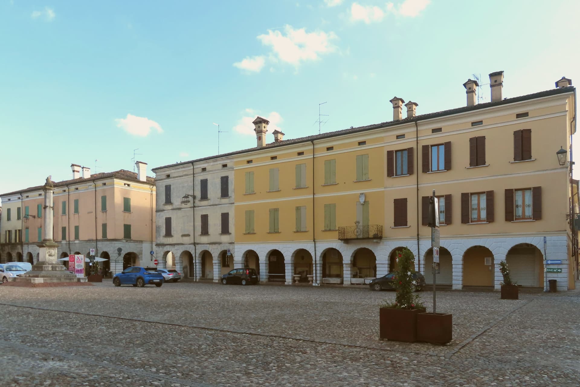
Sabbioneta sits at about 25 meters on a sandy bank of the Po, north of Parma and southwest of Mantova. Vespasiano I Gonzaga, a cadet of the Mantuan line, founded it in the late sixteenth century along the Roman Via Vitelliana as his personal fortress and ducal seat, built almost in one campaign between 1554 and 1591.
The town is organized around two main axes and two squares, with the star walls set at a fixed distance from that grid so the fortification and the street plan read as a single design rather than a wall added to an existing settlement. Vespasiano commissioned the theatre, the gallery, and the two palaces in sequence, each filling a distinct role in the ducal seat: a residence, a pleasure palace, a display case for his marbles, a place for performance.
The church holds his tomb, closing the set with a mausoleum built to the same scale as everything else he raised. What results is a town where every set piece was planned as part of one court rather than accumulated over generations, which is the quality that put it alongside Mantua as the planned counterpart to the organic city.
What to see in Sabbioneta
- Teatro all'Antica. Designed by Vincenzo Scamozzi with a raked wooden cavea and a painted false loggia opening onto a sky that never changes. It still stands as it was built for the Gonzaga court.
- Galleria degli Antichi. 97-meter arcaded gallery built to display Vespasiano's collection of ancient marbles, the longest such gallery of its period. The arcade runs in a single unbroken line, a corridor meant to be walked past statues rather than stood in.
- Palazzo Ducale. Vespasiano's main residence on Piazza Ducale, with frescoed rooms, wooden equestrian statues of the Gonzaga ancestors and gilded ceilings.
How to get to Sabbioneta
Parma is roughly 40 minutes away by road.
Our tip
April through June and September into October are the months Sabbioneta opens up. The Teatro all'Antica and the Galleria degli Antichi keep regular hours, the Po plain is green or gold depending on the half, and the bike path along the Oglio is rideable. July and August are humid and still: shade on the Piazza Ducale stays in short supply, and afternoons empty the centro storico.
Lazise
Why visit Lazise
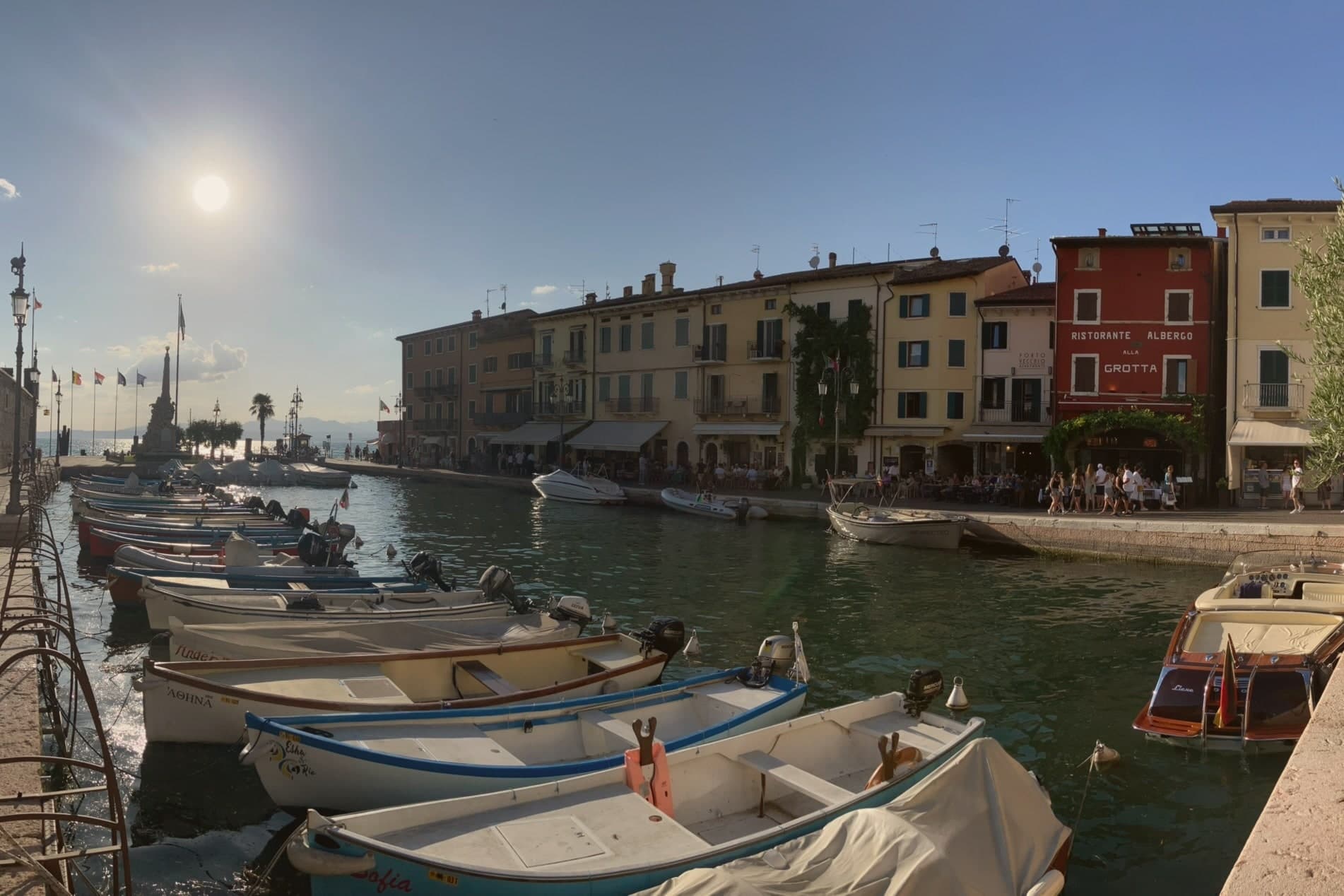
Lazise sits at 76 meters on the southeastern shore of Lake Garda, twenty kilometers northwest of Verona. The first walls went up shortly after the 983 charter; Venice took the town in 1405 and held it until Napoleon arrived in 1796, and Porta Lion, on the south, still carries the winged lion of Saint Mark from that period of rule.
The castle anchors the southern corner of the fortifications while the harbor sits enclosed within their reach, and the church and the customs house both face onto that same stretch of water, one built for worship and later pressed into use as a warehouse, the other built outright for Venice to tax what passed through the port. Behind the town, the morainic hills carry the vines of the Bardolino DOC, and Lazise counts itself among the Veneto's wine and honey communes.
The town reads, in short, as a small fortified port whose walls, harbor and customs works were all built to serve and guard the same trade on the same shore.
What to see in Lazise
- Castello Scaligero. Rectangular fortress at the south corner of the walls, with five square towers and a fortified dock built for the lake galleys, facing Lake Garda.
- Mura medievali. Thirteen surviving towers and three gates, San Zeno, Nuova and Lion, ring the old town along the shore of Lake Garda.
- Chiesa di San Nicolò. Romanesque church on the harbor, with frescoes attributed to the Giotto school and a former function as a customs warehouse.
How to get to Lazise
Verona is roughly 36 minutes away by road.
Our tip
April through June and September through October are the right months for Lazise. The walled centro storico stays cool from the lake breeze, the harbor fills with sailboats, and the Bardolino hills behind the town are green in spring and gold in October. July and August are warm and very crowded: the southern Garda shore concentrates more than half of the lake's tourist beds, and the gates of Lazise queue from morning.
Gattinara
Why visit Gattinara
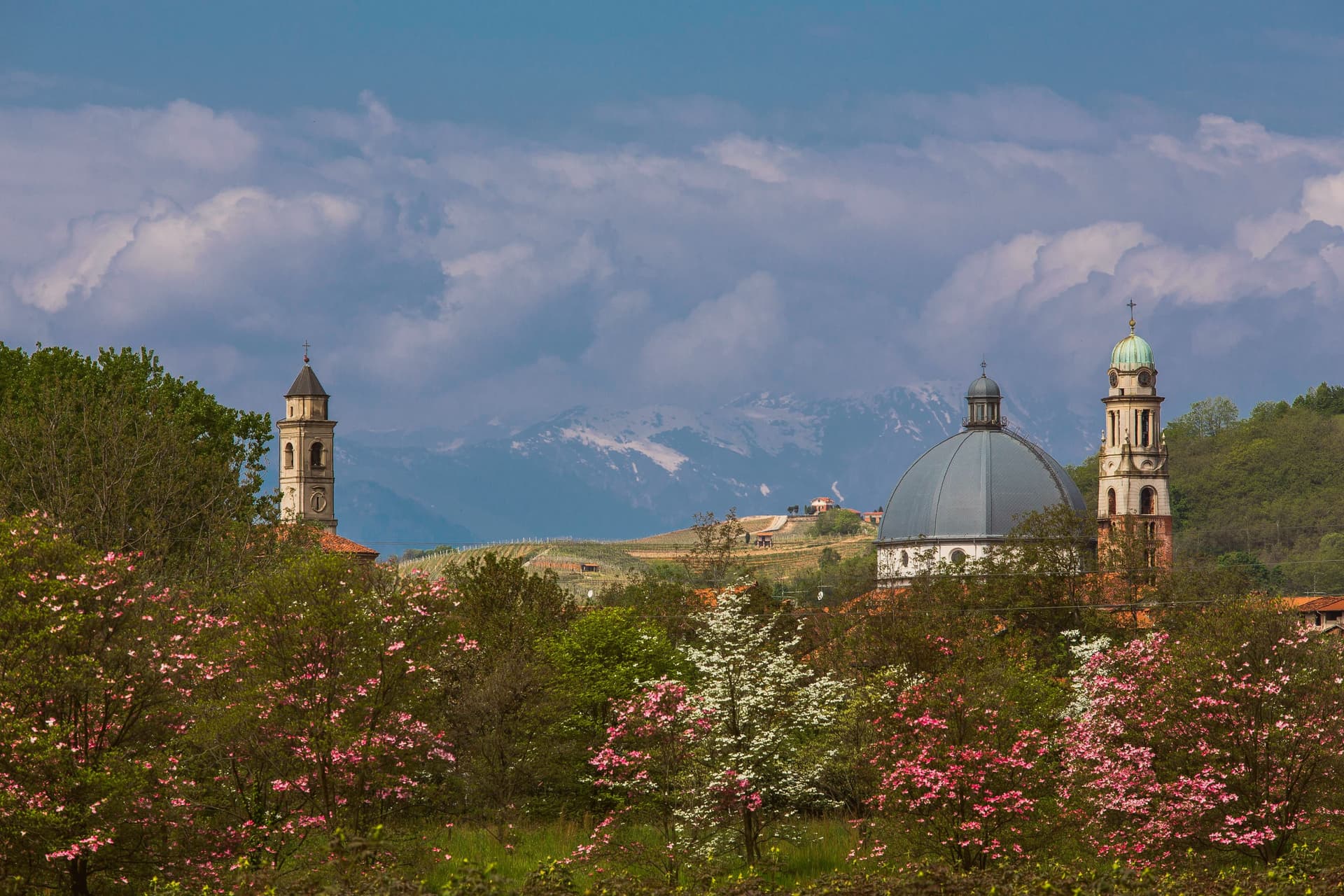
Gattinara sits on the right bank of the Sesia, north of Vercelli, in the Alto Piemonte wine zone where Nebbiolo is called Spanna. The hills behind the town are volcanic, the surface gravel pushed up when Africa met Europe and built Monte Rosa sixty million years ago.
Romans planted vineyards here in the second century BC. In 1242, the commune of Vercelli established a borgofranco that became the modern town.
In the early sixteenth century Cardinal Mercurino Arborio di Gattinara, Grand Chancellor to Emperor Charles V, served the local wine at his diplomatic dinners in Spain and Flanders; it stayed a court favorite for decades. The Torre delle Castelle, tenth-century watchtower above the vineyards, still stands on the ridge.
Gattinara became Italy's twentieth DOCG in 1990. The wine is at least ninety percent Nebbiolo, aged three years in wood for the riserva, and the bottles age longer than most Barolo because the volcanic minerality slows everything down.
Cucine Nervi, Osteria Contemporanea have been named by a guide.
What to see in Gattinara
- Torre delle Castelle. Tenth-century watchtower on the ridge above the vineyards, part of a fortified system that guarded the wine hills.
- Castello di San Lorenzo. Medieval fortress on the hill, paired with the Torre delle Castelle as the upper defensive line.
- Chiesa di San Pietro. Parish church in the historic center, the religious anchor of the borgofranco founded in 1242.
How to get to Gattinara
There is a railway station in the town, so you can arrive without a car and never need one while you are here. Novara is roughly 45 minutes away by road.
Our tip
April through June and September through October are the best months. The vineyards green up by Easter and the wine roads through the hills are walkable without heat. Harvest in late September pulls visitors to the cellars.
Avigliana
Why visit Avigliana
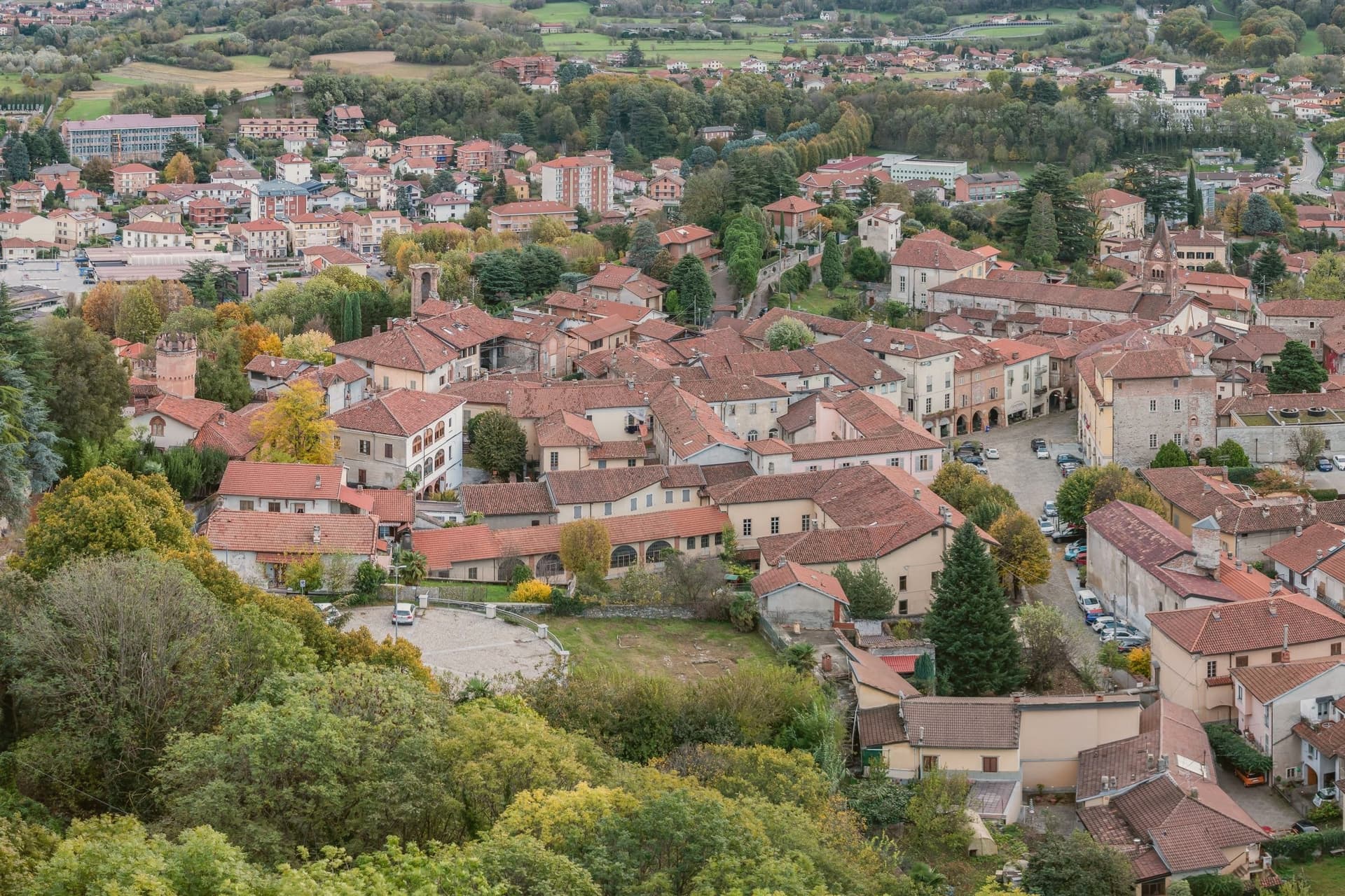
Avigliana sits at 383 meters in the lower Susa Valley, twenty-five kilometers west of Torino at the point where the Alps meet the Po plain. The first castle on Monte Pezzulano was built in 942 by the Arduinici Marquises of Turin and passed to the Counts of Savoy from 1137; Frederick Barbarossa destroyed it and Thomas I of Savoy rebuilt it, before the French marshal Catinat finally demolished it in 1691.
The medieval core that grew below the fortress is still ringed by porticoed houses from the twelfth to fifteenth centuries. The Chiesa di San Pietro and the Chiesa di San Giovanni hold frescoes spanning the eleventh through the sixteenth century, a run of decoration that outlasted the castle itself.
Below the centre, two glacial lakes, Lago Grande and Lago Piccolo, sit at 352 and 356 meters in a natural park established in 1980, while the Via Francigena passes through on its way toward the mountain above. What the town adds up to is a settlement built in layers around a single defensible height, with the ruined fortress marking the summit of Savoy power here and the abbey on the neighboring peak marking its longer, still-standing religious counterpart.
What to see in Avigliana
- Piazza Conte Rosso. The square that gives the old core its shape, named for Amedeo VII of Savoy and ringed by porticoed houses whose ground floors still trace the medieval street line.
- Castello di Avigliana. Ruined Savoy fortress on Monte Pezzulano, built in 942, rebuilt by Thomas I of Savoy and demolished by Marshal Catinat in 1691.
- Chiesa di San Pietro. Romanesque church on the road to the lakes, decorated with frescoes from the 11th to the 16th century.
How to get to Avigliana
There is a railway station in the town, so you can arrive without a car and never need one while you are here. Torino is roughly 36 minutes away by road.
Our tip
April through June are the green months: the moraine lakes open for kayaking and swimming, the porticoed core stays cool under shade, and the climb to the Sacra di San Michele runs free of haze. July and August touch the low thirties in the valley, though the Sacra at 962 meters carries a steady wind. September and October bring chestnuts and the wine harvest in the surrounding Pinerolese hills.
Valeggio sul Mincio
Why visit Valeggio sul Mincio
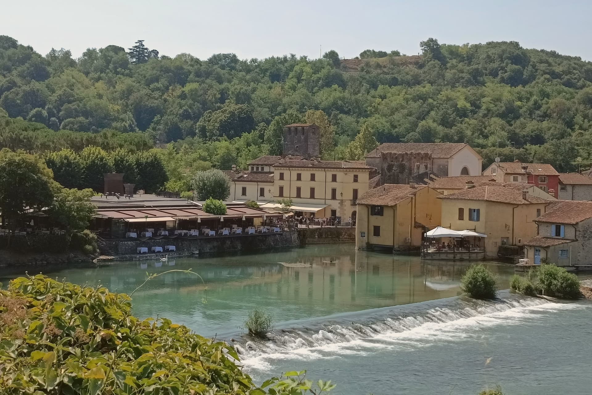
Valeggio sul Mincio sits at 88 meters on the morainic hills shaped by the Garda glaciers, twenty kilometers southwest of Verona and ten kilometers from the southern end of Lake Garda. The Mincio cuts north-south through the commune and was the Veneto-Lombardy military frontier for centuries.
The frazione of Borghetto on the river is one of I Borghi più belli d'Italia, a single line of houses and water mills along the left bank under the Castello Scaligero. The fortified Ponte Visconteo, built in 1393 by Gian Galeazzo Visconti of Milan as part of the sixteen-kilometer Serraglio defensive line, is 650 meters long and 25 meters wide and still spans the valley above the village.
The local pasta is the Nodo d'Amore, an oversize hand-rolled tortellino with meat filling; the third Tuesday of June it is served to four thousand diners at a single table laid across the Visconti bridge. The Parco Giardino Sigurtà, a sixty-hectare landscape garden two kilometers north, draws over half a million visitors a year, peaking with the Tulipanomania bloom in April.
Ristorante Antica Locanda Mincio, Alla Borsa have been named by a guide.
What to see in Valeggio sul Mincio
- Borghetto sul Mincio. Riverside hamlet on the left bank of the Mincio, one of I Borghi più belli d'Italia, with surviving water mills and a single arcaded line of houses.
- Ponte Visconteo. Fortified bridge-dam built in 1393 by Gian Galeazzo Visconti, 650 meters long and 25 wide, anchor of the Serraglio defensive line.
- Castello Scaligero. Della Scala fortress on the hill above Borghetto, built in the thirteenth century as the southern hinge of the Verona defensive line.
How to get to Valeggio sul Mincio
Verona is roughly 34 minutes away by road.
Our tip
April through June and September through October are the working months. April brings Tulipanomania at Parco Sigurtà and Borghetto on the river at its quietest. May and June fill the gardens and the bridge with weekend visitors; the Festa del Nodo d'Amore on the third Tuesday of June draws four thousand diners onto the Visconti bridge.
Biella
Why visit Biella
Biella sits at 417 meters at the foot of the Biellese Alps, in a basin where fast Alpine streams cut down from Mont Mars and the Oropa range. The statutes of 1245 already named the woolworkers' and weavers' guilds, and the city built itself around them: by the nineteenth century, vertical mills along the streams had turned Biella into the Manchester of Italy.
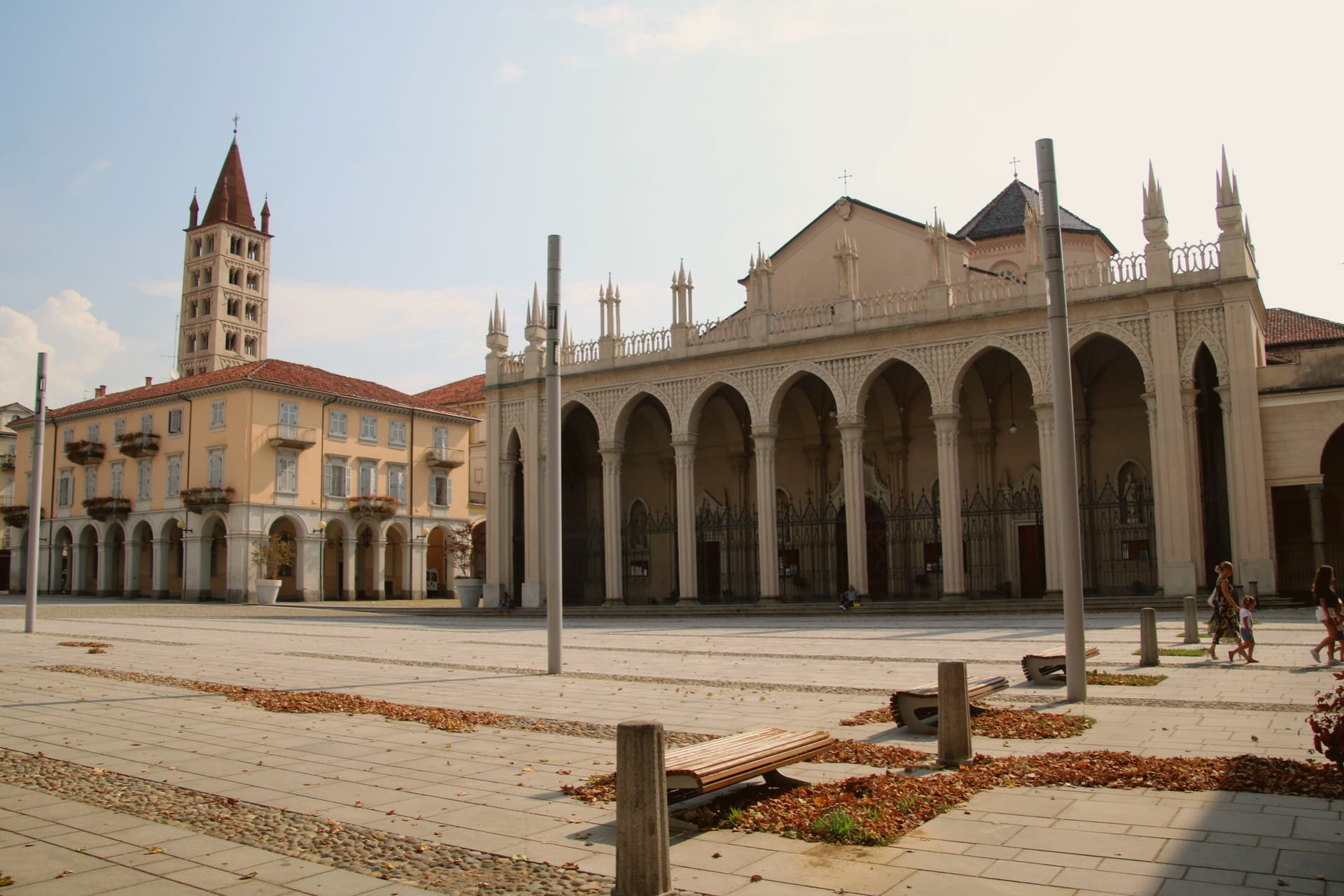
The names still on the labels, Zegna, Cerruti, Loro Piana, Piacenza, Fila, were founded here. The upper town, Biella Piazzo, sits above the modern Piano on a small hill, reached since 1885 by a water-counterbalance funicular that still runs the same 60-meter climb.
The Romanesque Baptistery on Piazza Duomo is the city's oldest stone, ninth or tenth century, set next to the cathedral. Above the city, the Sacro Monte di Oropa belongs to the UNESCO Sacri Monti site, and Biella was named a UNESCO Creative City for Crafts and Folk Art in 2019.
Il Patio, Matteo Ristorante, Regallo and 2 more have been named by a guide.
What to see in Biella
- Biella Piazzo. Medieval upper town on a small hill above the modern Piano, with arcaded palazzi and narrow stone streets, reached by funicular since 1885.
- Funicolare del Piazzo. Historic funicular opened in December 1885, covering a 60-meter altitude gradient in 177 meters between Via Curiel and Via Avogadro.
- Battistero di Biella. Romanesque baptistery on Piazza Duomo, ninth to tenth century, the oldest standing monument in the city.
How to get to Biella
There is a railway station in the town, so you can arrive without a car and never need one while you are here. Novara is roughly 63 minutes away by road.
Our tip
April through June brings green pastures on the Biellese Alps and clean light off the streams that built the mills. September and October are the dry, gold months, when the chestnut woods around Oropa turn and the textile fairs run in town. July and August stay cooler than the Po Valley but can sit humid; the upper Piazzo holds breeze that the Piano does not. Bolle di Malto - Salone Italiano della Birra falls in August.
More from Anywhere Italy
 The best towns known for what they grow within 90 minutes of Brescia
- The best towns known for what they grow within an hour of Verona
- The best towns known for what they grow within two hours of Trento
 The best towns known for what they grow within 75 minutes of Parma
 The best towns known for their meat within two hours of Turin
 The best towns known for what they grow within 75 minutes of Padua