
The best towns known for what they grow within 75 minutes of Padua
The Veneto plain is farmland first, and it shows on the table. Late autumn brings radicchio pulled from cold fields and forced in spring water until the leaves turn bitter and pale at the rib, sold by weight in market squares under brick arcades. Spring brings white asparagus, grown under soil so it never greens, eaten with boiled egg and oil. Early summer brings cherries off the hill orchards, and the houses stay much the same throughout: brick, plaster the colour of dust, a portico deep enough to keep the rain off a stall.
Most visitors to this part of the Veneto arrive by way of Venice, and Venice absorbs almost all of them. It is a good reason to come and a poor place to eat cheaply, and the crowds on the Rialto are heaviest in exactly the months when the fields inland are doing their best work. The lagoon city buys much of its produce from the mainland without many of its guests ever going to look at where it comes from.
The same soil that supplies those kitchens keeps going west and north, up through walled towns on the plain and into the hills where the vines and orchards start. That is where these towns are, each sitting inside the protected production zone of a named fruit or vegetable, with the market days, festivals and trattoria menus arranged around it. Fewer people go, and the growing season is the best guide to when to.
Of the 16 communes we have mapped in a 75-minute drive of Padua, 6 qualify as towns known for what they grow: each sits inside the production zone of a protected fruit or vegetable. The smallest, Asolo, has 8,916 residents.
Elsewhere in the catalogue: The best towns known for what they grow within 90 minutes of Venice and The best towns known for what they grow within two hours of Trento.
Asolo
Why visit Asolo
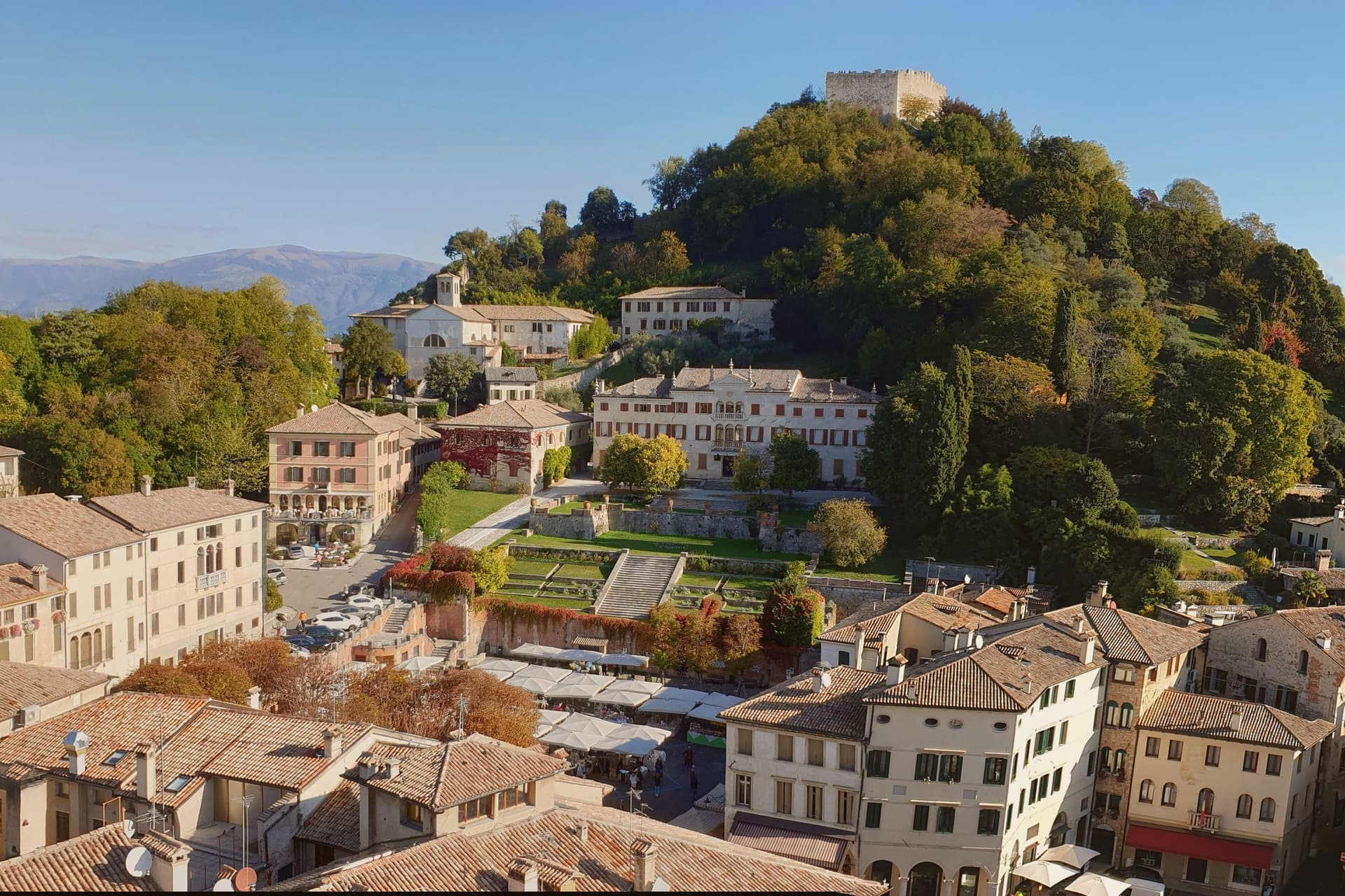
Asolo perches at 205 meters on a ridge between the Asolan hills and the Veneto plain, forty kilometers north of Padova. Pliny knew it as Acelum.
The Ezzelini family held it in the early Middle Ages; the Rocca on the hill above town dates from the late twelfth and early thirteenth centuries and was restored in 2020 after a 2016 storm damaged the walls. The defining episode came in 1489, when the Republic of Venice gave Asolo as a fiefdom to Caterina Cornaro, the deposed Queen of Cyprus, in exchange for her island.
She kept a court here for twenty years until the League of Cambrai sacked the town in 1509. Her circle included Gentile Bellini, the humanist Pietro Bembo and the poet Andrea Navagero.
Robert Browning wintered in a villa here from 1838 onward, and the actress Eleonora Duse retired to Asolo and is buried in the local cemetery. The town carries six institutional signals at once.
Caffè Centrale Asolo, La Terrazza, Locanda Baggio have been named by a guide.
What to see in Asolo
- Rocca di Asolo. Late twelfth and early thirteenth-century fortress on the hill above the town, restored in 2020 with €300,000 in ministry funding.
- Castello di Caterina Cornaro. Medieval castle in the town, court of the Queen of Cyprus from 1489 to 1509, now home to the Eleonora Duse theater.
- Duomo di Asolo. Cathedral rebuilt in 1747 with an Assunta altarpiece by Lorenzo Lotto, standing on the foundations of a Roman bath complex.
How to get to Asolo
Vicenza is roughly 57 minutes away by road.
Our tip
April through June and September through October are the right months. The ridge stays a few degrees cooler than the plain, and the views north to Monte Grappa are clearest in spring and autumn. July and August are warm and busy; weekend traffic from Venice and Padova fills the Piazza Garibaldi car park by ten.
Montagnana
Why visit Montagnana
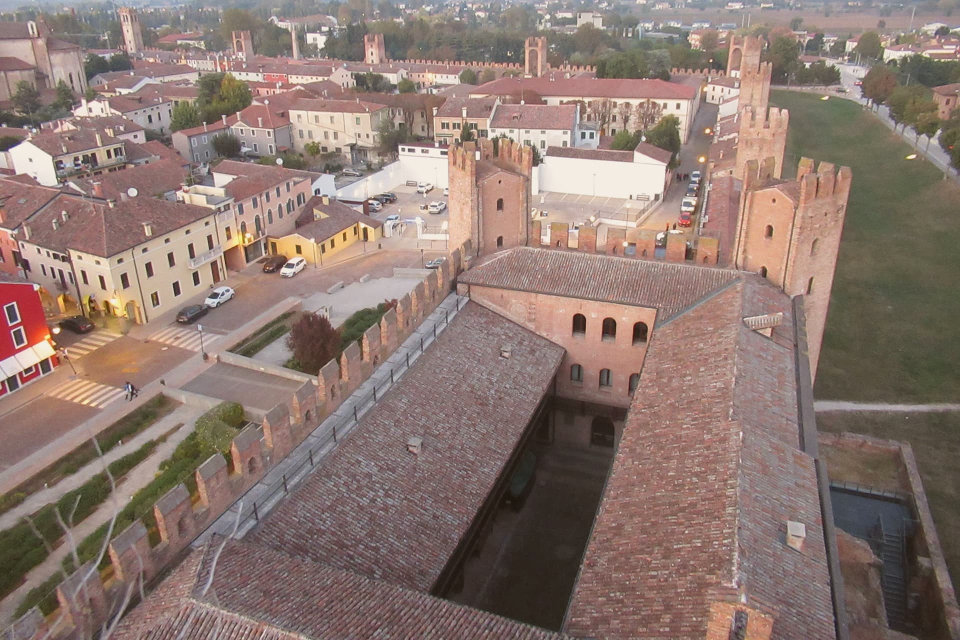
Montagnana sits at 16 meters on the lower Padova plain, thirty-five kilometers southwest of Padova, on the watershed between the Adige and the Bacchiglione. The wall ring is unbroken enough that the town's whole plan still reads as the fortification that produced it: the castle anchors the eastern gate, the rocca anchors the western one, and the road to Verona runs between them through what was once contested ground between Ezzelino's garrison and the Carraresi who came after.
Inside the walls, the center holds the Duomo and the two flanking palazzi around Piazza Maggiore, while the villa built for the cardinal stands deliberately outside the gate, a country house that still shows its face to the town. The May festival now fills the same ground the walls were built to defend, the modern economy of the place staged inside its medieval perimeter.
What to see in Montagnana
- Cinta muraria. Six to eight meters high and ninety-six centimeters thick, the rampart carries a continuous parapet walk, so the towers can be counted from above rather than just from the road.
- Castello di San Zeno. Fortress at the eastern gate, built by Ezzelino III da Romano in 1242, with the Mastio tower 38 meters high and a civic museum inside.
- Rocca degli Alberi. Western gate fortress built by the Carraresi between 1360 and 1362, with a moat and double drawbridge defending the road to Verona.
How to get to Montagnana
There is a railway station in the town, so you can arrive without a car and never need one while you are here. Vicenza is roughly 47 minutes away by road.
Our tip
April through June and September through October are the right months for Montagnana. The lower Padova plain runs cool and clear in those windows, and the parapet walk on the walls gives the best views when the haze lifts. The Festa del Prosciutto Veneto DOP runs across two weekends in mid-May, the largest event of the year, with tastings and tours of the curing houses.
Marostica
Why visit Marostica
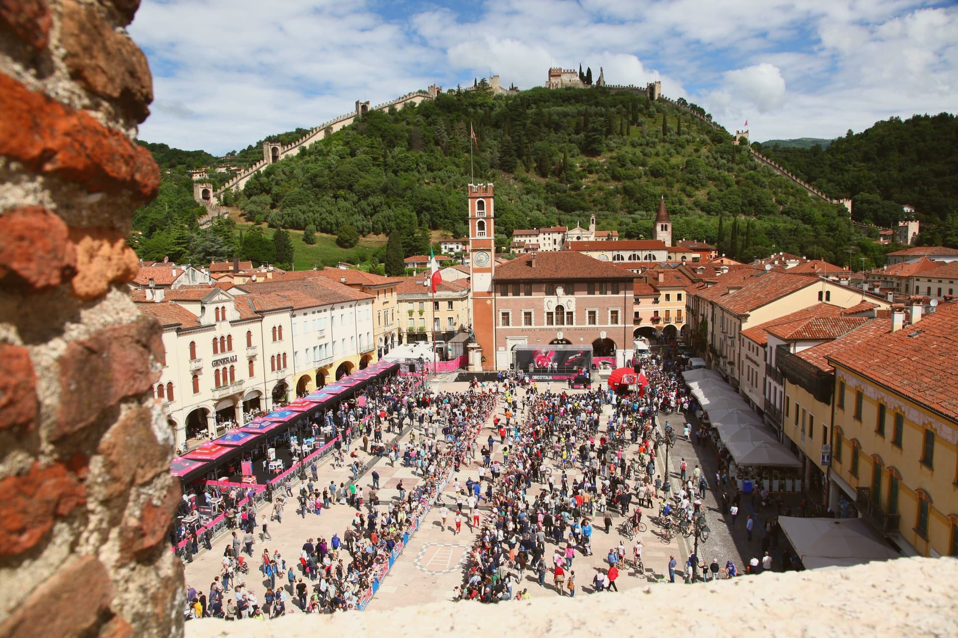
Marostica sits at 103 meters at the foot of the Asolan hills, forty-five kilometers northwest of Padova. Cangrande della Scala took the town in 1311, building his lower fortress on the plain and a second stronghold on the hill above it, then joining the two with a wall long enough to carry two dozen towers and four gates between them.
The arrangement is unusual: most walled towns fortify a single point, but here the defense runs uphill, turning the slope itself into the connecting structure between plain and ridge. The upper stronghold did not survive the artillery of the War of the League of Cambrai in 1510 and has stood as a ruin since, while the lower one remained inhabited and working, which is why the town's public life, its square, its church, its chess board, still gathers at the base of the hill rather than at its summit.
The cherries grown on the slopes to the north, since given IGP status, are the one product of the surrounding land that made it into the local kitchen as the crostata. What the town amounts to is a fortification that never stopped being a town: the walls did not seal Marostica off from its hillside, they organized it, and the square where the chess is played twice a decade sits exactly where the two castles' lines of sight once met.
La Rosina, Madonnetta have been named by a guide.
What to see in Marostica
- Castello Inferiore. Built from 1311 on Piazza Castello, its keep rising 44 meters over the square, with a museum inside on the chess match traditions.
- Castello Superiore. Ruined by Venetian artillery in 1510, standing on Monte Pausolino and reached by a footpath through the walls, with views over the Brenta valley.
- Mura di Marostica. Fourteenth-century walls running two kilometers between the two castles, with twenty-four towers and four gates; the parapet walk is open to the public.
How to get to Marostica
Vicenza is roughly 43 minutes away by road.
Our tip
April through June and September through October are the working months. The cherry harvest runs from late May to mid-June and the orchards on the lower slopes of the Asolan hills mark the season; the Mostra delle Ciliegie in early June is the major spring event. The Partita a Scacchi falls on the second weekend of September in even-numbered years and books the town a year ahead.
Vittorio Veneto
Why visit Vittorio Veneto
Vittorio Veneto sits at 138 meters at the foot of the Cansiglio plateau, seventy-five kilometers north of Padova. The commune was formed in 1866 by merging Ceneda, on the plain, with Serravalle, in the narrow valley above, and named for King Vittorio Emanuele II.
The two centers kept their own identities rather than blending into one. Serravalle is the older, walled district, set higher in the valley, with its cathedral holding the altarpiece of the Virgin with two saints.
Ceneda lies lower down on the plain, holding the Loggia of the Comunità and an eighteenth-century cathedral of its own alongside the castle ruins on the hill above it. In July 1923 the town took the name it carries now, after the battle that had taken its name from it three years earlier: the offensive of 24 October 1918 broke the Austro-Hungarian line, and the Armistice of Villa Giusti, effective 4 November, closed the war on this front.
The renaming fixed a wartime event permanently onto a place that had, until then, been two separate medieval settlements sharing a valley. What stands today is that same double structure, upper town and lower town, walled district and plain, still legible as two places joined by one name.
Le Macine have been named by a guide.
What to see in Vittorio Veneto
- Duomo di Serravalle. Rebuilt cathedral in the upper walled centro storico, holding the altarpiece of the Virgin with Saints Peter and Andrew in continuous liturgical use since it was painted.
- Museo della Battaglia. In the Loggia of the Comunità di Ceneda, built 1534-1538, with relics and documents of the offensive that ended the war on this front.
- Serravalle. Northern walled district above Ceneda, with sixteenth-century arcaded houses along the Meschio and the 1462 Loggia Serravallese.
How to get to Vittorio Veneto
There is a railway station in the town, so you can arrive without a car and never need one while you are here. Venezia is roughly 59 minutes away by road.
Our tip
April through October is the working season. April and May bring the Cansiglio plateau into play with walking weather and the upper Meschio at full flow. June through August stays cooler than the plain, with the narrow Serravalle valley holding shade through midday; the lower part around Ceneda pushes into the low thirties. Festa della Val Lapisina falls in July.
Treviso
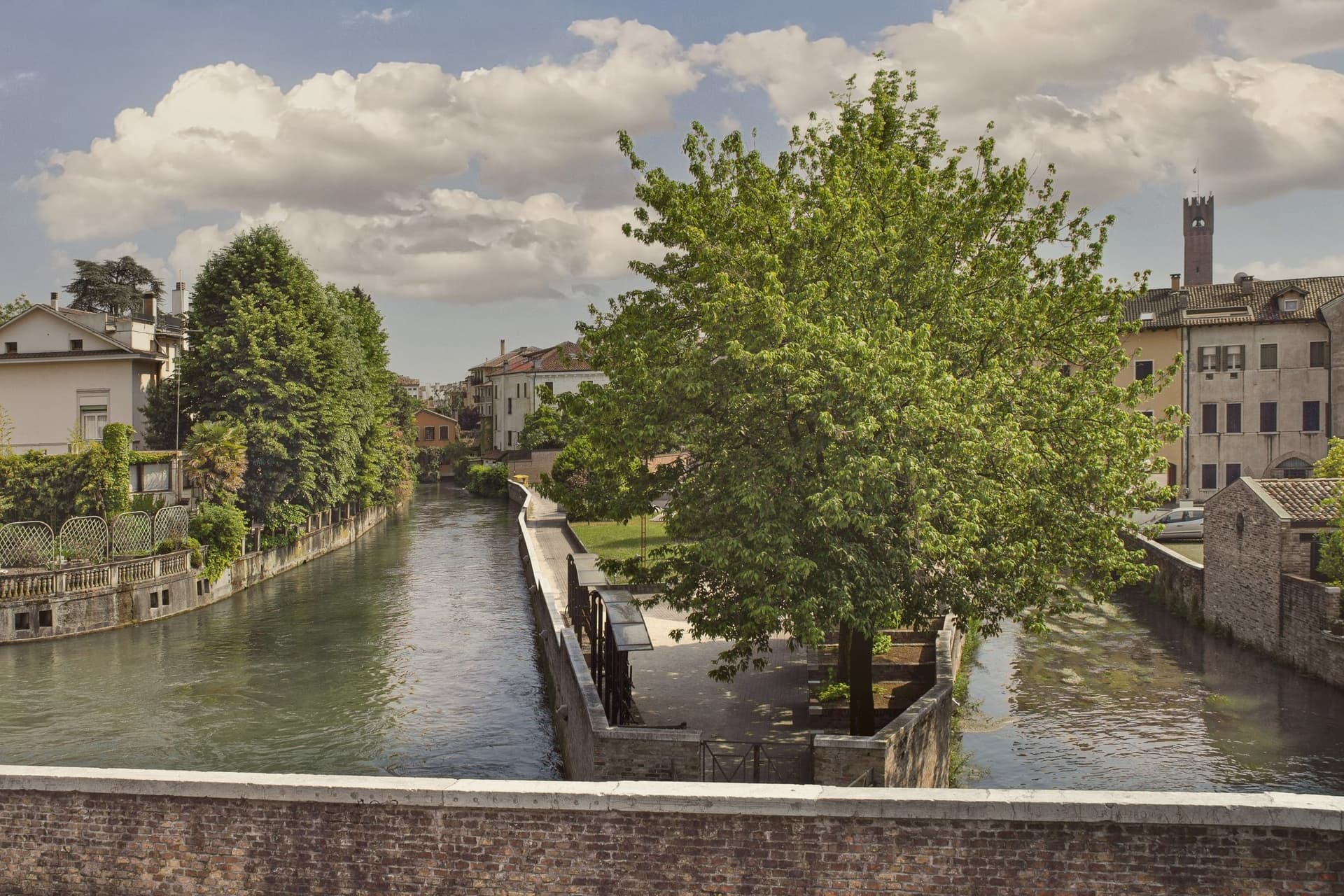
Why visit Treviso
Treviso sits at 15 meters where the Botteniga flows into the Sile, twenty-five kilometers inland from Venice. The Roman Tarvisium took its name from a Celtic root for bull, and the city became a municipium after 89 BC.
After the Caminesi and a brief Scaliger domination, Treviso submitted to the Republic of Venice on 29 June 1339, the first major mainland territory of the Serenissima. The walls and ramparts that still ring the centro storico were built then and renewed in the next century under Fra Giocondo.
The Botteniga splits into a network of canals locals call the cagnan; the Sile runs the southern flank of the walls and feeds the Pescheria, the fish market on its own island. The Palazzo dei Trecento on Piazza dei Signori, the Loggia dei Cavalieri, the Duomo with the Annunciazione of Titian and the frescoed cloister of San Nicolò give the city its medieval and Renaissance spine.
Tiramisu was invented at the Alle Beccherie restaurant near the duomo in the 1970s.
Il Basilisco, Le Beccherie, Feria and 8 more have been named by a guide.
What to see in Treviso
- Piazza dei Signori. Civic heart of Treviso, with the thirteenth-century Palazzo dei Trecento, the Torre Civica and the arcades that frame the medieval public space.
- Duomo di San Pietro. Cathedral founded in the twelfth century and rebuilt in the eighteenth, with the Annunciazione by Titian in the Malchiostro chapel.
- Chiesa di San Nicolò. Gothic Dominican church with frescoes by Tomaso da Modena, including the 1352 chapter house portraits of forty Dominican brothers.
How to get to Treviso
There is a railway station in the town, so you can arrive without a car and never need one while you are here. Venezia is roughly 39 minutes away by road.
Our tip
April through June and September through October are the working months. The Sile and the canals are at their best in spring and autumn, when the willows along the southern walls are in leaf and the trattorie open their courtyards. July and August push past thirty degrees and the centro storico empties in the afternoon; the canals still hold cooler air at dusk.
Ferrara
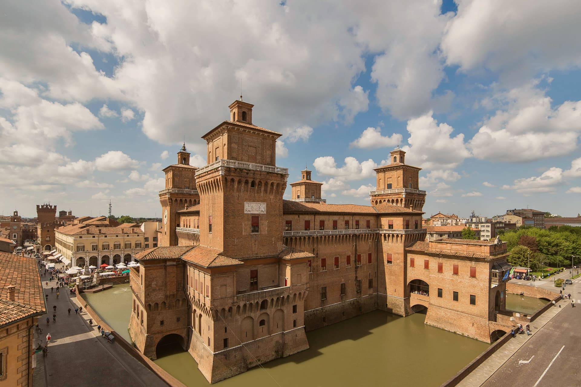
Why visit Ferrara
Ferrara is the city the Este family built and that the Po built around. For two centuries, from 1264 to 1598, the Este dukes ran their court from a moated brick fortress at the centre of town: Ariosto wrote the Orlando Furioso here, and the Ferrara school of painting flowered under Cosmè Tura.
In 1492, Duke Ercole I commissioned Biagio Rossetti to lay out a new quarter on a rational grid, with engineered perspectives and zoned districts, grafted onto the older medieval core rather than replacing it. That layering is still legible on the ground.
The old quarter, narrow and irregular, sits against Rossetti's planned extension, wide and gridded, and the two are stitched together inside a single ring of walls nine kilometres around. The scale is small enough that the whole centro can be crossed by bicycle in twenty minutes, and locals do: Ferrara has close to one bike per resident, and the medieval streets are narrow enough to keep cars mostly out.
The food carries its own local character apart from any of this: cappellacci di zucca, salama da sugo, pampepato at Christmas, and a Trebbiano-based wine grown on coastal sand dunes to the east. The Comacchio lagoons and the eel-fishing villages of the Po Delta are an easy half-day from the city, which served as the gateway to that whole territory.
What the plan and the walls add up to is a city that grew twice, once organically and once by design, and kept both versions intact side by side rather than letting one erase the other.
Osteria Enoteca Al Brindisi, Trattoria Lanzagallo, Ca' d'Frara and 8 more have been named by a guide.
What to see in Ferrara
- Castello Estense. 1385 moated brick fortress at the very centre, the Este dukes' palace. The moat is still water-filled and the four corner towers are still walkable.
- Palazzo dei Diamanti. Rossetti's 1493 anchor of the new quarter, faced with 8,500 white-marble pyramid blocks. Now hosts major art exhibitions.
- 9 km of intact brick walls. The Renaissance ramparts ring the entire centro, and the top is a continuous cycling path with views over the moat and the Po valley.
How to get to Ferrara
There is a railway station in the town, so you can arrive without a car and never need one while you are here. Ferrara is roughly 6 minutes away by road.
Our tip
Ferrara is brilliant in April–June and September–October. The Po valley gets hot and sticky July–August and the brick city radiates heat. October has the Buskers Festival (Europe's largest street-musician festival, late August now). Sagra Di San Lorenzo A Baura falls in July.
More from Anywhere Italy
 The best towns known for what they grow within 90 minutes of Venice
 The best towns known for what they grow within two hours of Trento
 The best hill towns within 90 minutes of Padua
- The best towns known for what they grow within an hour of Verona
 The best hill towns with a serious restaurant in Veneto
- The best towns with a serious restaurant in the province of Treviso