
The best hill towns within an hour of Turin
The plain around Turin ends abruptly, and the land begins to fold. Ridges of Monferrato and the Langhe run south-east in long green waves, planted to Nebbiolo, Barbera and Arneis, with hazelnut groves filling the steeper slopes; to the west the Susa valley climbs towards the Alps under castles and Roman stone. The towns up there are built of brick and river cobble, warm ochre in the low light, with arcaded squares and bell towers that read from a long way off. Autumn is the season everyone wants, when the fog sits in the valleys and the truffle market opens, but spring on the vine terraces is quieter and just as good.
Most people who come for these hills point straight at the village of Barolo. It is a short drive, the cellars are open, the wine is famous the world over, and in October the parking fills before lunch and the tasting rooms run on a schedule. The reputation is earned. It also means a small place absorbs a very large number of day visitors from Turin and beyond, all arriving in the same few weekends.
The same ridges keep going. The vineyards, the arcades, the castles and the Sunday lunch of raw veal and agnolotti continue north into Monferrato, west towards the Alpine passes and out along the Canavese, on hills that see fewer people. These are towns on high ground within an hour of the city, worth a detour for the view alone and better still for what is on the table when you get there.
Of the 11 communes we have mapped in a one-hour drive of Turin, 10 qualify as hill towns: each stands on high ground rather than on the plain. The smallest, Verduno, has 567 residents.
Elsewhere in the catalogue: The best towns you can reach by train within an hour of Turin and The best towns that eat well within an hour of Turin.
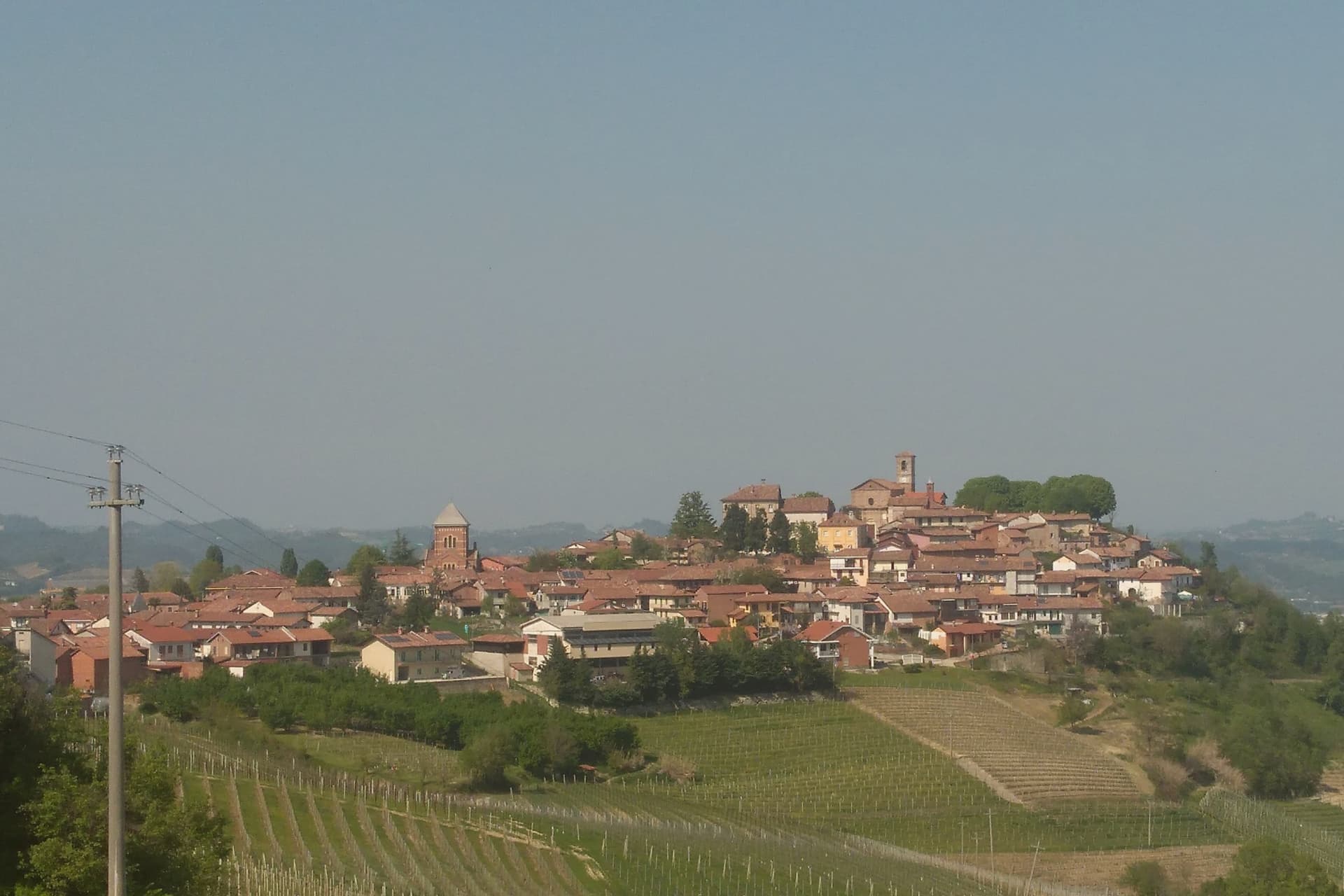
Verduno
Why visit Verduno
Verduno sits fifty kilometers south of Torino on a Langhe ridge above the Tanaro, its vineyards the only ones among the eleven Barolo communes to lean partly toward the river plain rather than folding back into the hills. That position, facing the water and the Alps beyond it, sets the village apart from the rest of the DOCG even before the wine is considered.
The other thing that sets it apart is Pelaverga Piccolo, a native black grape cultivated commercially in only three Langhe communes: Verduno, La Morra and Roddi. It yields a light ruby red with strawberry, rose and a distinct white-pepper finish, and the first single-variety Pelaverga vineyard on these slopes was planted in 1972.
Between the castle on the ridge and the vine on the plain-facing slope, Verduno holds two things most of its neighbors do not: a wine that is Barolo's own, structurally, and a wine that belongs to almost nowhere else.
What to see in Verduno
- Castello di Verduno. The castle stands on the Langhe ridge and passed to the Burlotto family in 1909, who still work it as a winery producing Barolo and Pelaverga.
- Centro storico. Small hilltop village arranged around the castle and the parish church, with views across the Tanaro and the northern Barolo vineyards.
- Vigneti di Pelaverga. Indigenous Pelaverga Piccolo plantings on the Verduno slopes, including the first single-variety Pelaverga vineyard planted in 1972.
How to get to Verduno
There is a railway station in the town, so you can arrive without a car and never need one while you are here. Torino is roughly 60 minutes away by road.
Our tip
April through June is the green window in the Langhe, hillsides striped between Nebbiolo and Pelaverga vines, mild evenings on the Verduno ridge. September and October are the harvest months: Pelaverga first, Nebbiolo last, with the surrounding cantine open for tastings and walking through the rows possible without crowds. July and August touch the low thirties on the hills; the centro storico thins after lunch and the cellar tastings move under stone vaults to stay cool.
Cocconato
Why visit Cocconato
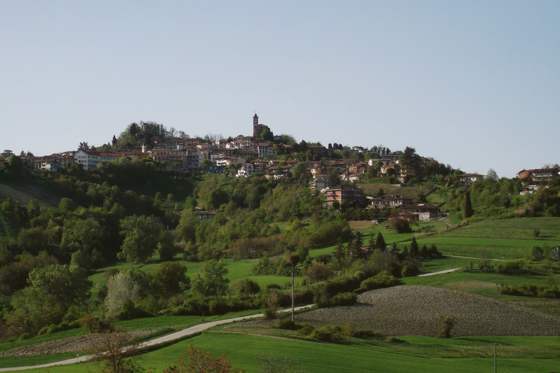
Cocconato sits thirty kilometers east of Torino, on a ridge whose south-facing slope catches enough sun to keep olives, palms and mimosas alive this far north, the reason locals call the area the Riviera del Monferrato. From the tenth century the ridge was held by the Radicati counts, a Manfredian family, as an imperial fief for four hundred years, until 1586: the centro storico that survives is their seat, not a later reconstruction.
The town's two anchors sit close together but answer to different authorities. The civic palace, built in the fifteenth century, faces the seventeenth-century parish church of Santa Maria della Consolazione across the upper piazza, government and religion holding opposite ends of the same small square.
Beyond the built center, the ridge opens onto a belvedere looking south across vineyards toward the Alta Langa and, on clear days, the Monviso massif. Since 1970 the six frazioni of Airali, Brina, Colline Magre, San Carlo, Torre and Tuffo have raced their donkeys in the Palio degli Asini, a modern rivalry laid over an old administrative one.
Cocconato is the only commune in the province of Asti to hold the Bandiera Arancione, a fitting distinction for a ridge that has been organizing the same handful of parts, fief, palace, church, frazioni, for centuries.
What to see in Cocconato
- Palazzo Comunale. Pointed-arch porticoes and terracotta-framed windows on the Late Gothic facade, still the building the ridge town organizes itself around.
- Chiesa di Santa Maria della Consolazione. Seventeenth-century parish church anchoring the upper piazza, the religious counterweight to the medieval civic palace below it.
- Centro storico. Medieval ridge town that was the seat of the Radicati counts from the tenth century until 1586, well preserved on the south-facing slope.
How to get to Cocconato
There is a railway station in the town, so you can arrive without a car and never need one while you are here. Torino is roughly 57 minutes away by road.
Our tip
April through June and September through October are the months that earn Cocconato its Riviera nickname: dry warm days on the ridge, vineyards in green or gold, and the palms in the lower gardens visibly out of season. July and August are warm and busy, with Cocco Wine at the end of summer drawing crowds into the centro storico. November through March is the quiet half of the year.
Agliè
Why visit Agliè
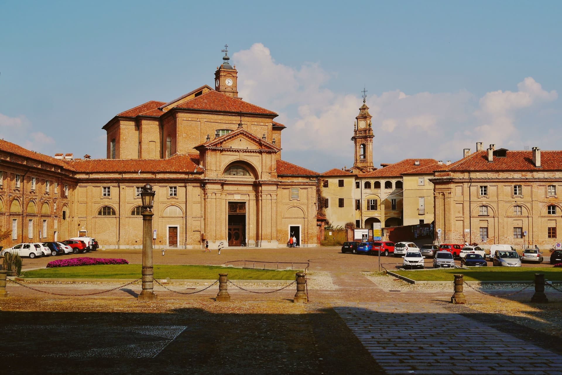
Agliè sits at 330 meters in the Canavese, thirty-five kilometers north of Torino on the foothills above the Po plain. The d'Agliè family held the fortified core from 1259, and the conversion to a Sabauda residence began in the mid-1600s under Count Filippo San Martino d'Agliè, favourite of the Regent Christine of France.
The castle later entered the UNESCO list of Savoy Residences, one of fourteen royal sites recognised together as a single serial property, and its gardens grew alongside it, enlarged in the nineteenth century with terraced Italian and English layouts. The town's other center of gravity lies apart from the castle, at a country house on the edge of the commune where a Crepuscolar poet kept his own quiet ground.
The centro storico adds a third note, a confraternity church faced in glazed terracotta from nearby Castellamonte. The town carries the Bandiera Arancione of the Touring Club, a place where a Savoy court seat, a poet's retreat, and a working parish church occupy the same small radius without competing for it.
What to see in Agliè
- Castello Ducale. The two parallel galleries framing the courtyard and the internal Chapel of San Massimo are the work Amedeo di Castellamonte added for Count Filippo San Martino, the piece that turned a fortified seat into a residence fit for the Savoy court.
- Giardini e Parco del Castello. The eighteenth-century basin stages an allegory in stone: the Dora Baltea meeting the Po, set among the terraced beds where Italian and English styles sit side by side.
- Chiesa di Santa Marta. Confraternity church in the centro storico, decorated with polychrome glazed terracottas from nearby Castellamonte.
How to get to Agliè
Torino is roughly 45 minutes away by road.
Our tip
April through June is the green window for the Canavese hills, when the castle gardens are in full leaf and the morning light works well on the long west façade. July and August are hot in the valley below and the gardens carry the heat; Agliè empties between two and five in the afternoon. September and October are the second peak, with vineyards in the surrounding frazioni turning over for harvest.
La Morra
Why visit La Morra
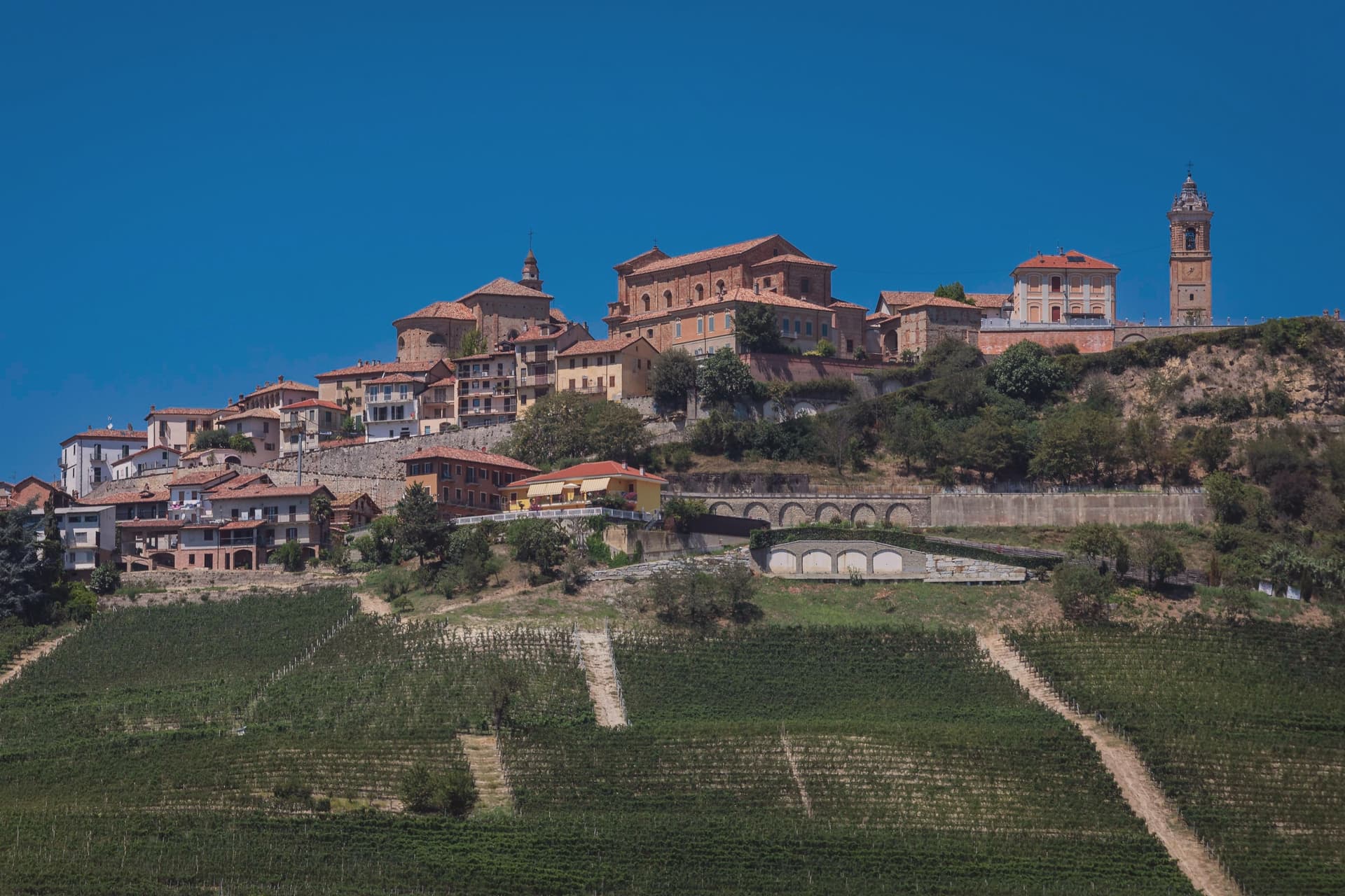
La Morra sits at 513 meters on the western edge of the Barolo zone, fifty kilometers southeast of Torino, the highest of the eleven communes and the one with the widest view over the rest of them. The village itself gathers around the square and the tower; the working part of it, the crus, spreads downhill and outward, Brunate and Cerequio among them, with the Cantina Comunale pouring producers from across that spread under one roof in the old Marchesi di Barolo cellars.
A kilometer outside the centro, below the village, the former abbey sits in the Marcenasco cru with its wine museum, and Renato Ratti bought his first parcel near it in 1965, drawing the first cru map of the zone a decade later. The village is compact and fixed in place; the vineyards around it are what the whole zone is measured against.
What to see in La Morra
- Belvedere di Piazza Castello. The highest point of the village, with the 18th-century bell tower rising above the terrace.
- Cappella del Barolo (Cappella delle Brunate). A small vineyard chapel among the vine rows of the cru, its two faces given over entirely to the artists' repainting, interior and exterior alike.
- Cantina Comunale di La Morra. Municipal wine cellar founded 1973 in the 18th-century palace of the Marchesi di Barolo, pouring 70+ local producers.
How to get to La Morra
Torino is roughly 59 minutes away by road.
Our tip
April through June bring green vines, mild evenings and the long views the Belvedere is built for. September and October are harvest, when the cellars open and the hills turn copper. July and August push past thirty degrees and the centro thins between two and six, though the elevation keeps nights cooler than Alba.
Susa
Why visit Susa
Susa sits fifty kilometers west of Torino, on the road that climbs toward the Moncenisio and Montgenèvre passes into France. Ligurians and Celts settled the site around 500 BC.
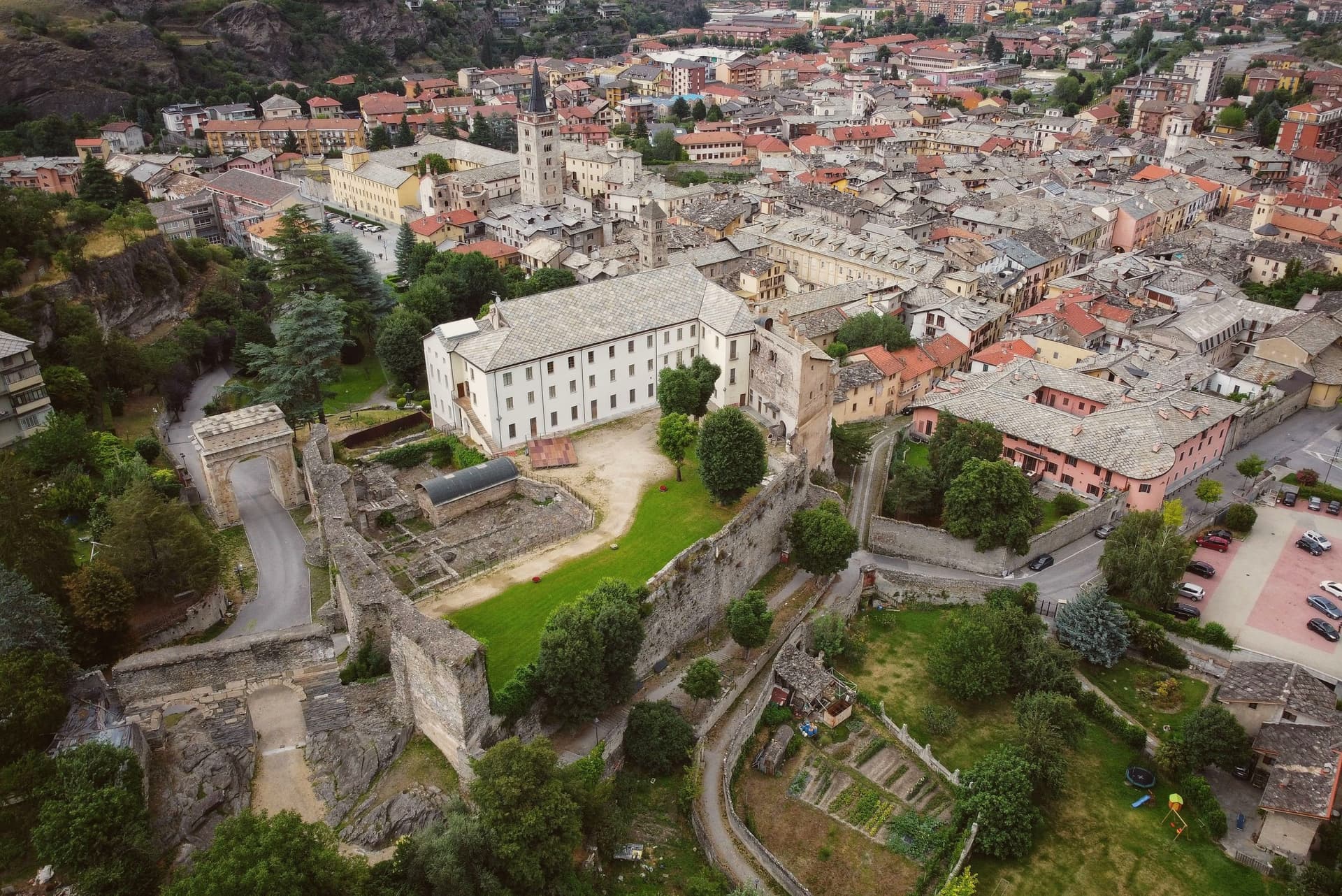
It later emerged as the capital of the kingdom of the Cozii under Marcus Julius Cottius, son of King Donnus, who allied with Rome and was confirmed as prefect of the new province of Alpes Cottiae, with Segusio, modern Susa, as its capital: the arch in the town center and the town's name in the Cottian Alps both descend from that alliance. The old core, arch, cathedral and castle, sits compact around the Roman gate that the castle absorbed into its later walls, with the amphitheatre just outside that line.
The pilgrim route threads through this core on its way down from the pass, meaning the town has functioned as a waypoint on the same north-south line, Roman road, medieval pilgrimage route, alpine crossing, since Ligurians and Celts first settled it. What the Cozii capital, the pilgrim stop and the mountain gateway add up to is a single fact repeated across the centuries the arch and the campanile have stood: Susa exists because of the road, not beside it.
What to see in Susa
- Arco di Augusto. White marble arch over 13 meters tall, standing in the centre of town and counted among the best preserved of its kind in north Italy.
- Cattedrale di San Giusto. Founded by Olderico Manfredi, with the terracotta spires added in the 1480s. The campanile remains the tallest feature of the skyline.
- Castello della Contessa Adelaide. Built into a Roman gate on the line of the old walls, later reworked into a noble residence with medieval towers and Renaissance windows. It stands beside the cathedral.
How to get to Susa
There is a railway station in the town, so you can arrive without a car and never need one while you are here. Torino is roughly 53 minutes away by road.
Our tip
April through June is the green window in the Susa valley: the Cottian Alps with snow still on the upper slopes, mild evenings at 503 meters, and the Roman monuments lit clearly in the long light. July and August are warm but cooler than the Po plain; the Arch and the Cattedrale draw most of the year's visitors and the festival programme runs through summer. September and October are the second peak, with crisp air and the chestnut woods turning above the town.
Avigliana
Why visit Avigliana
Avigliana sits at 383 meters in the lower Susa Valley, twenty-five kilometers west of Torino at the point where the Alps meet the Po plain. The first castle on Monte Pezzulano was built in 942 by the Arduinici Marquises of Turin and passed to the Counts of Savoy from 1137; Frederick Barbarossa destroyed it and Thomas I of Savoy rebuilt it, before the French marshal Catinat finally demolished it in 1691.
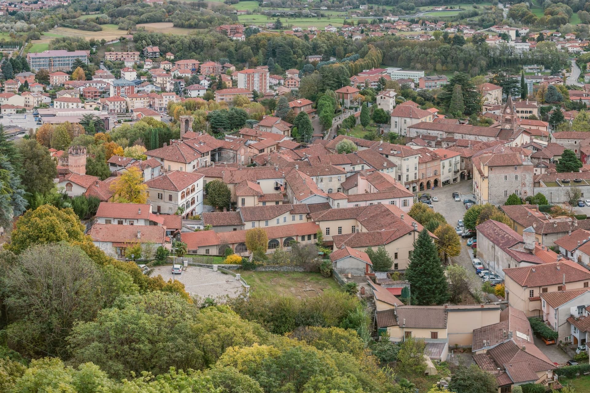
The medieval core that grew below the fortress is still ringed by porticoed houses from the twelfth to fifteenth centuries. The Chiesa di San Pietro and the Chiesa di San Giovanni hold frescoes spanning the eleventh through the sixteenth century, a run of decoration that outlasted the castle itself.
Below the centre, two glacial lakes, Lago Grande and Lago Piccolo, sit at 352 and 356 meters in a natural park established in 1980, while the Via Francigena passes through on its way toward the mountain above. What the town adds up to is a settlement built in layers around a single defensible height, with the ruined fortress marking the summit of Savoy power here and the abbey on the neighboring peak marking its longer, still-standing religious counterpart.
What to see in Avigliana
- Piazza Conte Rosso. The square that gives the old core its shape, named for Amedeo VII of Savoy and ringed by porticoed houses whose ground floors still trace the medieval street line.
- Castello di Avigliana. Ruined Savoy fortress on Monte Pezzulano, built in 942, rebuilt by Thomas I of Savoy and demolished by Marshal Catinat in 1691.
- Chiesa di San Pietro. Romanesque church on the road to the lakes, decorated with frescoes from the 11th to the 16th century.
How to get to Avigliana
There is a railway station in the town, so you can arrive without a car and never need one while you are here. Torino is roughly 36 minutes away by road.
Our tip
April through June are the green months: the moraine lakes open for kayaking and swimming, the porticoed core stays cool under shade, and the climb to the Sacra di San Michele runs free of haze. July and August touch the low thirties in the valley, though the Sacra at 962 meters carries a steady wind. September and October bring chestnuts and the wine harvest in the surrounding Pinerolese hills.
Ivrea
Why visit Ivrea
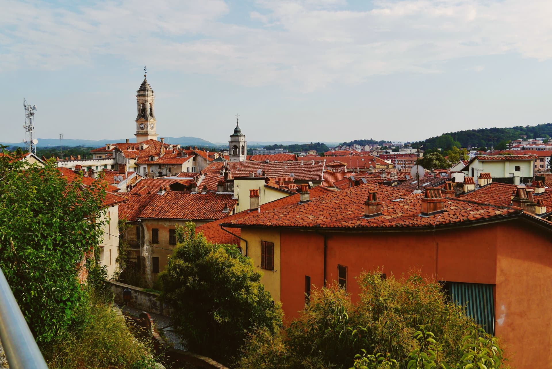
Ivrea sits at 267 meters where the town meets the river that drains the Aosta valley before it reaches the Po, the Dora Baltea, guarding the Alpine routes into Gaul that made the site worth fortifying in the first place. The medieval town grew upward from that Roman garrison into a seat of regional power, and centuries later the same streets became the frame for an industrial experiment: Camillo Olivetti opened a typewriter factory here in 1908, and his son Adriano rebuilt the town around its workers, threading glass-walled plants, housing, schools, libraries, and cultural centers into the landscape rather than beside it.
The Cinque Laghi lie north of the center, five small lakes left by the Balteo glacier, a different register of water from the Dora Baltea that carried the Roman and industrial town below. The layers do not so much replace each other as sit stacked: a Roman garrison town, a medieval capital, and a twentieth-century factory city occupy the same ground on the same river, and the carnival each February, with its reenacted revolt, is the one moment the town stages its own long memory in public.
What to see in Ivrea
- Castello di Ivrea. Fourteenth-century red-brick castle of the Savoy on the hill above the centro storico, with four towers and views over the Dora Baltea.
- Duomo di Santa Maria Assunta. Ninth-century cathedral on the site of a Roman temple, with Romanesque crypt and bell tower, the religious anchor of medieval Ivrea.
- MAAM - Museo a Cielo Aperto dell'Architettura Moderna. Open-air museum of the ICO factories and the Talponia underground housing, walkable ground for tracing how the glass-walled plants and worker facilities sit against the town.
How to get to Ivrea
There is a railway station in the town, so you can arrive without a car and never need one while you are here. Torino is roughly 56 minutes away by road.
Our tip
April through October is the open season. May and June green the morainic hills around the Cinque Laghi and the Olivetti factory tours run on full schedule. September and October are dry and quiet, the time to walk the UNESCO industrial route without summer heat.
Bra
Why visit Bra
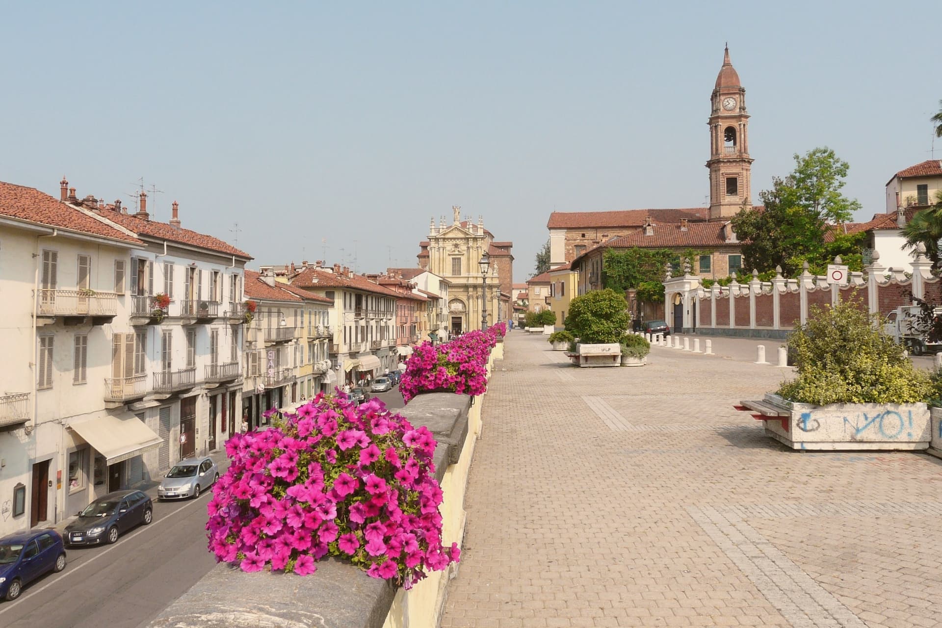
Bra sits at 290 meters in the Roero hills, fifty kilometers southeast of Torino, on the north edge of the Langhe-Roero-Monferrato UNESCO wine landscape. The old center, with its porticoed Corso Garibaldi and Via Cavour, is the working core of town; above it a nineteenth-century pavilion looks out over the surrounding hills, and below, on the Tanaro, a frazione occupies the site of a Roman colony inside a former Savoy royal estate.
Carlo Petrini founded Slow Food here in 1986 in response to a McDonald's planned next to the Spanish Steps in Rome, and the movement's headquarters has stayed in town since. In 1999 Bra was one of the four founding cities of Cittaslow, the small-town quality-of-life network.
The biennial Cheese fair, the largest event in the world for raw-milk cheeses, fills the old center in odd-numbered Septembers, alongside the town's own DOP cheese and its ground veal sausage, eaten raw by local custom. A town this size holding a global food movement, a gastronomic university, and a Roman site within its own borders is not an accident of promotion: it reflects a place that has treated eating and its history as civic matters worth building institutions around.
What to see in Bra
- La Zizzola. Octagonal pavilion on the hill above town, reached as the best panoramic point over the Langhe and Roero.
- Palazzo Mathis. Fourteenth-century palazzo on the central piazza with frescoed main floor and eighteenth-century oil-painted door covers, now used for exhibitions.
- Palazzo Traversa. Fifteenth-century building housing the Museo di Archeologia, Storia e Arte, with finds from the Roman colony of Pollentia.
How to get to Bra
There is a railway station in the town, so you can arrive without a car and never need one while you are here. Torino is roughly 54 minutes away by road.
Our tip
April through June and September into October are the months Bra runs cleanest. The Roero hills colour up around the town, the cellars hold tastings, and the Cheese fair takes the centro storico in September of odd years. July and August get hot in the Tanaro plain below, and the porticoes on Corso Garibaldi become the cool part of town between four and seven in the afternoon. Bra's - Bra falls in September.
Alba
Why visit Alba
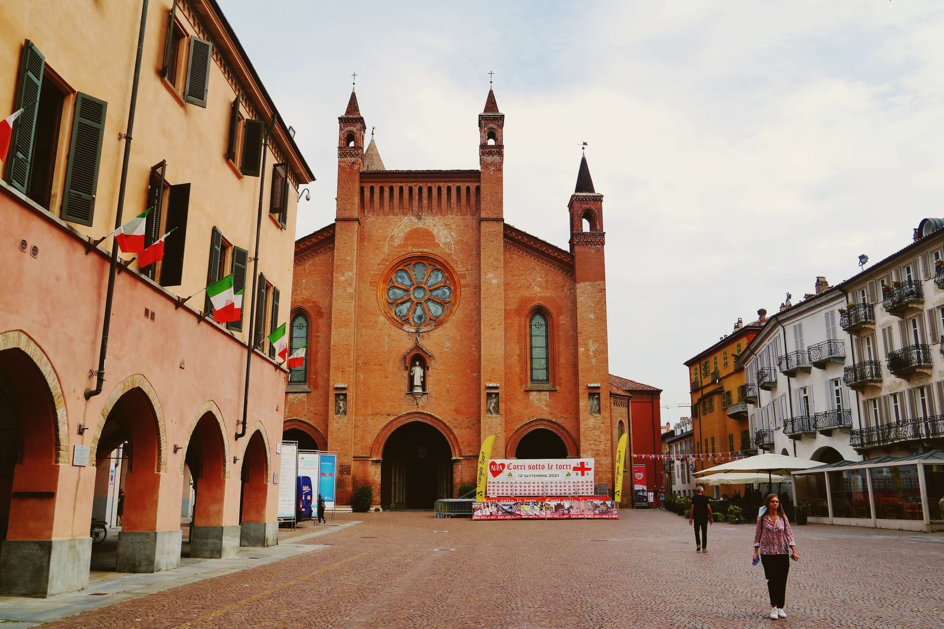
Alba sits at 172 meters on the right bank of the Tanaro, the regional capital of the Langhe and the centre of one of Italy's most concentrated wine and food economies. The Roman city of Alba Pompeia stood on the same site, and the Piazza Risorgimento, locally called Piazza Duomo, is laid out on the line of the old Roman forum.
The Duomo di San Lorenzo dates to the twelfth century and carries a late Gothic red-brick façade and a vaulted nave. In the medieval centuries the town was known as the city of a hundred towers; a few dozen survive, the tallest along Via Cavour.
The Fiera Internazionale del Tartufo Bianco runs across October and November, the oldest white truffle fair in the country. The Palio degli Asini on the first Sunday of October recalls a 1275 dispute with Asti.
The town is the headquarters of Ferrero, the family company that invented Nutella, and the home of Beppe Fenoglio, whose Partisan novels are set in these same hills.
What to see in Alba
- Duomo di San Lorenzo. Twelfth-century cathedral with a late Gothic red-brick façade, vaulted nave and 16th-century inlaid wooden choir, on the line of the Roman forum.
- Piazza Risorgimento. Central square on the site of the Roman forum, framed by the Duomo, the Palazzo Comunale and the surviving medieval brick towers.
- Torri medievali. Roughly forty of the original hundred or more brick towers still rise above the rooftops, most clustered along Via Cavour and Via Vittorio Emanuele.
How to get to Alba
There is a railway station in the town, so you can arrive without a car and never need one while you are here. Torino is roughly 58 minutes away by road.
Our tip
April through June are the green months in the Langhe hills, with mild evenings and vineyards in full leaf. July and August touch the mid-thirties; the centro storico empties between two and five in the afternoon. September and October are the heart of the year: harvest in the surrounding cantine, the Palio degli Asini on the first Sunday of October, and the opening weekends of the white truffle fair. Festa Patronale Madonna della Moretta falls in September.
Venaria Reale
Why visit Venaria Reale
Venaria Reale sits at 269 meters fifteen kilometers northwest of Torino, on the lowland that ran into the Savoy hunting forests of the Mandria. The modern name comes from the Latin ars venatoria, hunting.
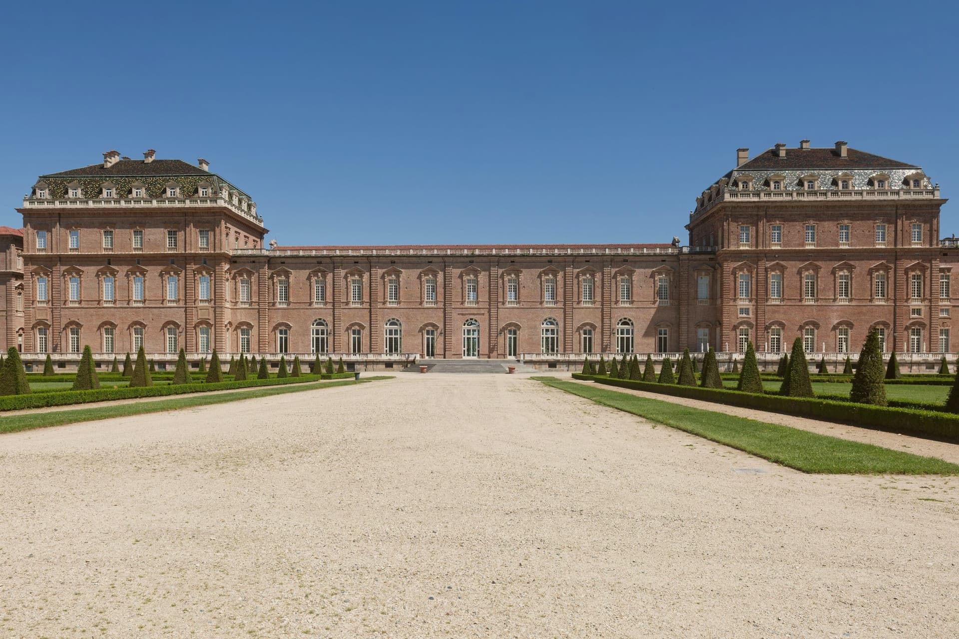
In 1658 Duke Carlo Emanuele II commissioned court architect Amedeo di Castellamonte to build a residence for hunting parties and court leisure, with a coordinated plan for palace, park, hunting wood and adjoining village. In 1716 Filippo Juvarra enlarged the complex with the Galleria Grande, the Cappella di Sant'Uberto, the Citroniera and the Scuderia, lifting the Reggia to one of the major baroque set pieces of Europe.
The Savoy Residences entered the UNESCO list in 1997. After two centuries as a military barracks the palace was restored across eight years from 1999 to 2007, in the largest cultural restoration project in European Union history, with 1,800 operators on site.
The Reggia now opens eighty thousand square meters of floor surface and sixty hectares of gardens, with the three thousand fenced hectares of the Parco della Mandria beyond.
What to see in Venaria Reale
- Reggia di Venaria. UNESCO baroque palace begun in 1658 by Amedeo di Castellamonte for Duke Carlo Emanuele II, with 80,000 m² of floors and 60 hectares of gardens.
- Galleria Grande. Filippo Juvarra's barrel-vaulted gallery of 1716, one of the longest enfilades of baroque court architecture in Europe.
- Cappella di Sant'Uberto. Royal chapel designed by Juvarra inside the palace, completed in the second decade of the eighteenth century for the hunting court.
How to get to Venaria Reale
There is a railway station in the town, so you can arrive without a car and never need one while you are here. Torino is roughly 28 minutes away by road.
Our tip
April through June is the best window for the gardens of the Reggia and the long walks through the Parco della Mandria, with parterres in full bloom and the hunting park green. September and October bring cooler air over the gardens and the start of the autumn exhibition season inside the Galleria Grande. July and August touch the mid-thirties on the Torino plain; the palace interiors stay cool, the Citroniera and the chapel hold the heat at bay, but the gardens flatten in midday glare.
More from Anywhere Italy
- The best towns you can reach by train within an hour of Turin
- The best towns that eat well within an hour of Turin
- The best wine towns within an hour of Turin
 The best hidden hill towns you can reach by train within 90 minutes of Torino
 The 9 best hill towns with a World Heritage site in Piemonte
 The best towns inside a nature park in Piemonte