The best olive oil towns in Veneto
Veneto is not the first region anyone names for olive oil, which says more about Puglia's volume than about what grows here. On the eastern shore of Lake Garda the water holds enough winter warmth for olives to survive far north of where they ought to, and the trees climb in dry-stone terraces above the lemon houses and the pebble beaches. Inland, the Prealpine hills behind Asolo and Vittorio Veneto give a lighter, grassier oil pressed in November, when the frantoi run late and the fog sits in the valleys. The Garda oil is famously delicate, almond-sweet, low in bitterness, good on lake fish and on the white asparagus that comes up in spring. The villages that make it are built from local stone and pale stucco, with porticoes, a castle on the ridge and a mill somewhere down by the stream.
Most visitors to this landscape go to Sirmione, on its narrow peninsula at the southern end of the lake, where the Scaligero castle and the thermal baths pull coaches in from Verona and Milan all summer. It is a remarkable spit of land, and by August the main gate is a queue. The shops sell oil in gift tins to people who will never see an olive tree, and the terraces that actually produce it are somewhere else entirely, further north and further up.
The olive belt continues past the resort towns, up the steep eastern shore towards Malcesine and Brenzone, and then over into the hills where the Prosecco slopes and the olive slopes overlap. Fewer people go to these places, and the ones who do come for the harvest and the mills rather than the beach clubs. Each town on this list belongs to the national association of Italian olive-oil towns, which means the presses are working and the groves are still farmed rather than landscaped. They are also, mostly, small enough to walk across before lunch.
Of the 41 communes we have mapped in Veneto, 8 qualify as olive oil towns: each belongs to the national association of olive-oil towns. The smallest, Arquà Petrarca, has 1,810 residents.
If you are still choosing, we have also written The best hill towns within 90 minutes of Padua and The 9 best hidden hill towns in Veneto.
Arquà Petrarca
Why visit Arquà Petrarca
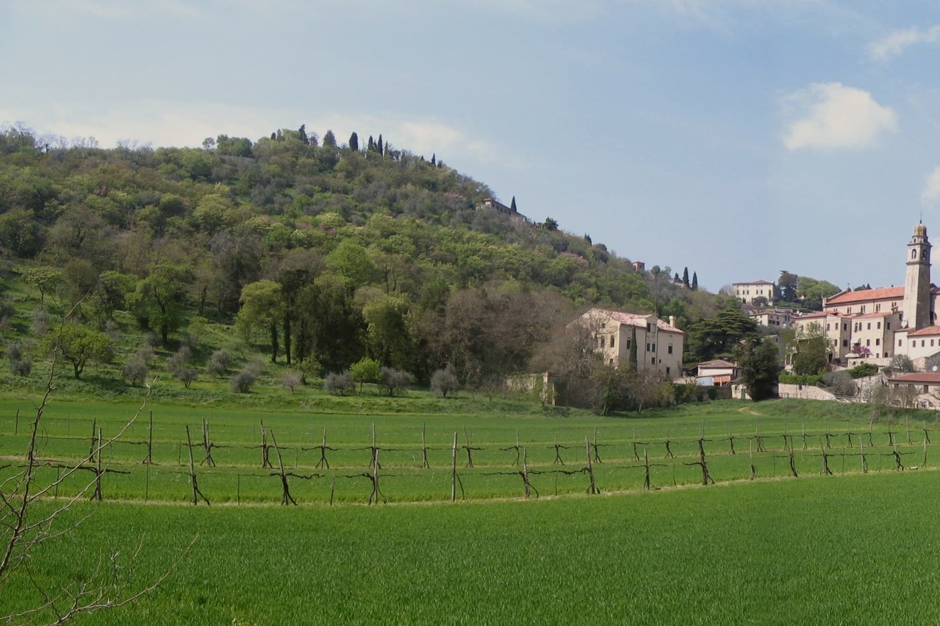
Arquà sits between Monte Ventolone and Monte Castello, in the Euganean Hills south of Padova. The name dates to medieval records; the suffix Petrarca was added in 1868, after the Veneto's annexation to the Kingdom of Italy, as a public homage to the poet who chose to die here.
Francesco Petrarca arrived in 1370 and lived in a thirteenth-century house he renovated himself across two stories, the Casa del Petrarca, now a museum with frescoes from the fifteenth and sixteenth centuries. He died at his desk on the night of 18-19 July 1374.
His tomb, an ark in red Verona marble inspired by Roman sarcophagi, was placed in the churchyard of Santa Maria Assunta in 1380 and reset in 1965. The village kept its medieval layout: two piazzas linked by a stepped path, the Casa above and the church and tomb below.
The hills around it grow Colli Euganei DOC wine, olives, and the giuggiole that go into the local liqueur Brodo di Giuggiole.
What to see in Arquà Petrarca
- Casa di Francesco Petrarca. The poet's thirteenth-century house, renovated by him on two floors and now a museum with frescoes added by later owners in the fifteenth and sixteenth centuries.
- Tomba di Petrarca. Sarcophagus in red Verona marble in the churchyard of Santa Maria Assunta, placed in 1380, six years after the poet's death.
- Chiesa di Santa Maria Assunta. Parish church first documented in 1026, enlarged through the centuries, with frescoes of the Venetian-Byzantine school up to the fifteenth century.
How to get to Arquà Petrarca
There is a railway station in the town, so you can arrive without a car and never need one while you are here. Padova is roughly 28 minutes away by road.
Our tip
April through June and September through October are the months Arquà is built for. The hills are green in spring and gold in autumn; the slope from Piazza Roma down to the church is comfortable walking weather. July and August push past thirty degrees and the village empties between two and six, though Padova day-trippers still arrive in the late afternoon.
Brenzone sul Garda
Why visit Brenzone sul Garda
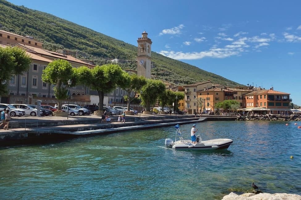
The comune sits on the eastern shore of Lake Garda at 75 meters, thirty-five kilometers northwest of Verona. It is not a town but a string of sixteen hamlets and small frazioni along the foot of the mountain: Assenza, Biaza, Campo, Castelletto, Castello, Magugnano which is the municipal seat, Marniga, Porto, Sommavilla and others, many named after the families who farmed the terraces above them.
Above the lake, fifteen minutes uphill on foot, sits the abandoned village, its stone houses reachable only by that path since the lakeside road below made the mid-slope route obsolete. Five permanent residents remain among the ruins.
The relation between the working shore strung with hamlets and the emptied village on the slope above is the story of the place: the road that connected the lake hamlets to each other was the same road that cut the mountain village off, and each half has stayed exactly where that change left it.
Nin, Al Pescatore have been named by a guide.
What to see in Brenzone sul Garda
- Campo di Brenzone. Reachable only on foot, with five permanent residents and stone houses standing in protected ruin.
- San Pietro in Vincoli, Campo. Church in the abandoned village, with frescoes by Giorgio da Riva dated 1358 still visible inside.
- Monte Baldo. Mountain ridge rising directly behind the lakeside hamlets to 2,218 meters at Cima Valdritta, with cable-car access from neighboring Malcesine.
How to get to Brenzone sul Garda
Verona is roughly 73 minutes away by road.
Our tip
April through October is the only real season. April and May bring the lake back to swimming temperature; the olive groves are flowering and Campo di Brenzone walkable on dry trails. June through August fills the lakefront with German and Austrian visitors; the lungolago path runs at full capacity on weekend afternoons.
Malcesine
Why visit Malcesine
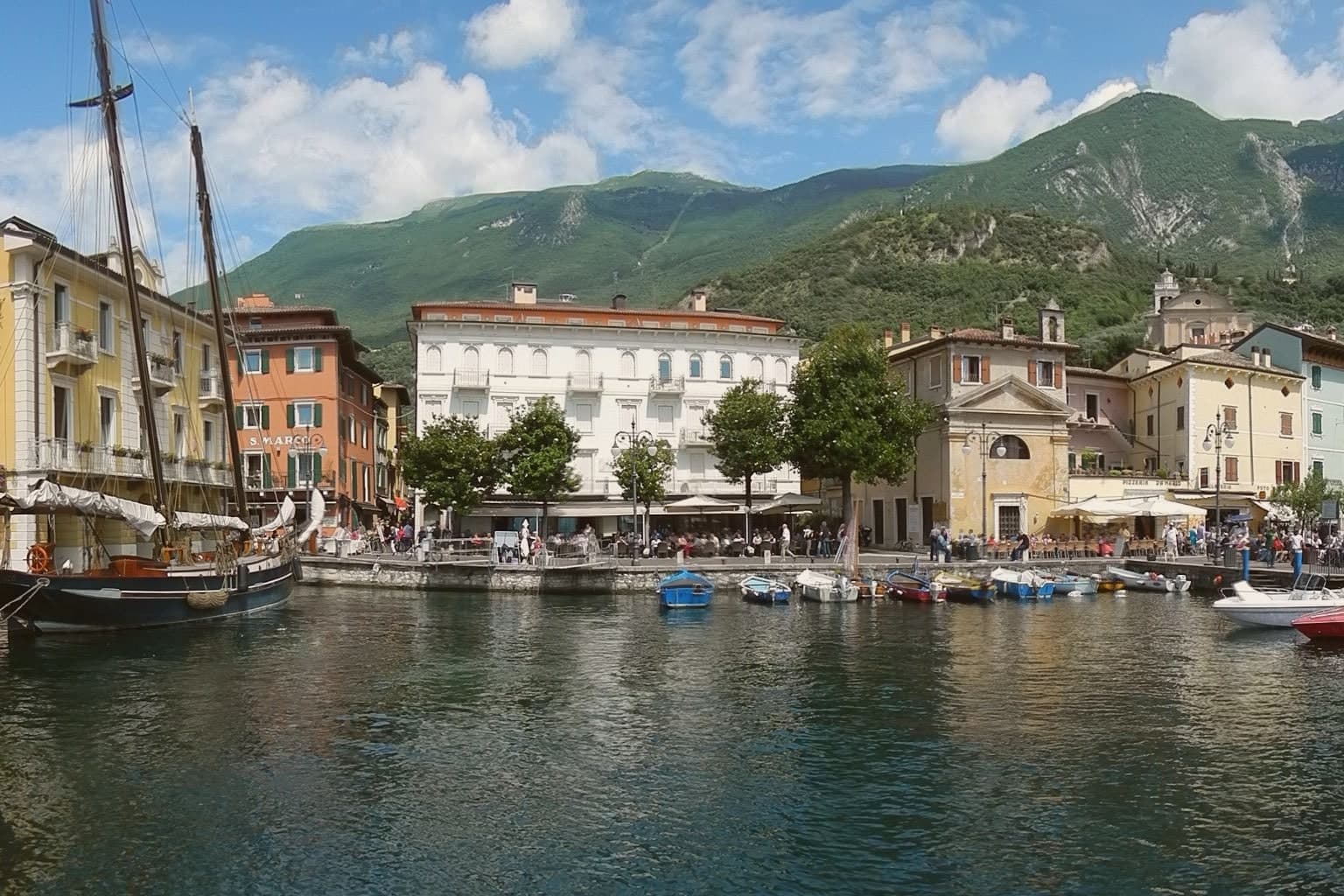
Malcesine sits at 89 meters on the eastern shore of Lake Garda, forty kilometers northwest of Verona and immediately south of Trentino-Alto Adige. The town strings together five lakeside frazioni between Navene and Cassone, pinched between the water and the slopes of Monte Baldo, which rises to 2,218 meters behind the rooftops.
The Castello Scaligero, built by the della Scala family of Verona in the thirteenth century around an older white-stone keep, is the defining building. On 14 September 1786 Johann Wolfgang Goethe was questioned in front of it on suspicion of being an Austrian spy after drawing sketches; he later devoted several pages to the episode in Italienische Reise.
The Monte Baldo cable car, opened in 1962 and rebuilt with rotating cabins in 2002, lifts walkers and paragliders to 1,750 meters in ten minutes. Olive groves along the lower slopes carry the Garda DOP olive oil designation.
Vecchia Malcesine have been named by a guide.
What to see in Malcesine
- Castello Scaligero. Thirteenth-century Scaliger fortress on a rock above the lake, with an older white-stone keep, the rooms where Goethe was held briefly in 1786 and a museum on Monte Baldo flora.
- Palazzo dei Capitani. Fifteenth-century Venetian palazzo on the lakefront, residence of the Captains of the Lake during the Republic of Venice, with a lakeside loggia and gardens.
- Monte Baldo. 2,218-meter ridge behind the town, reached by a two-stage cable car with rotating cabins; the summit is a botanical reserve known since the sixteenth century as Hortus Europae.
How to get to Malcesine
Trento is roughly 65 minutes away by road.
Our tip
April through June and September through October are the months Malcesine is built for. The cable car runs to Monte Baldo through clear spring and autumn air, the windsurfers fill Val di Sogno when the Ora picks up at midday, and the centro storico is busy but walkable. July and August push past thirty degrees on the lake and the village queues for the cable car from eight in the morning; many German and Austrian families have rented apartments here for generations.
Asolo
Why visit Asolo
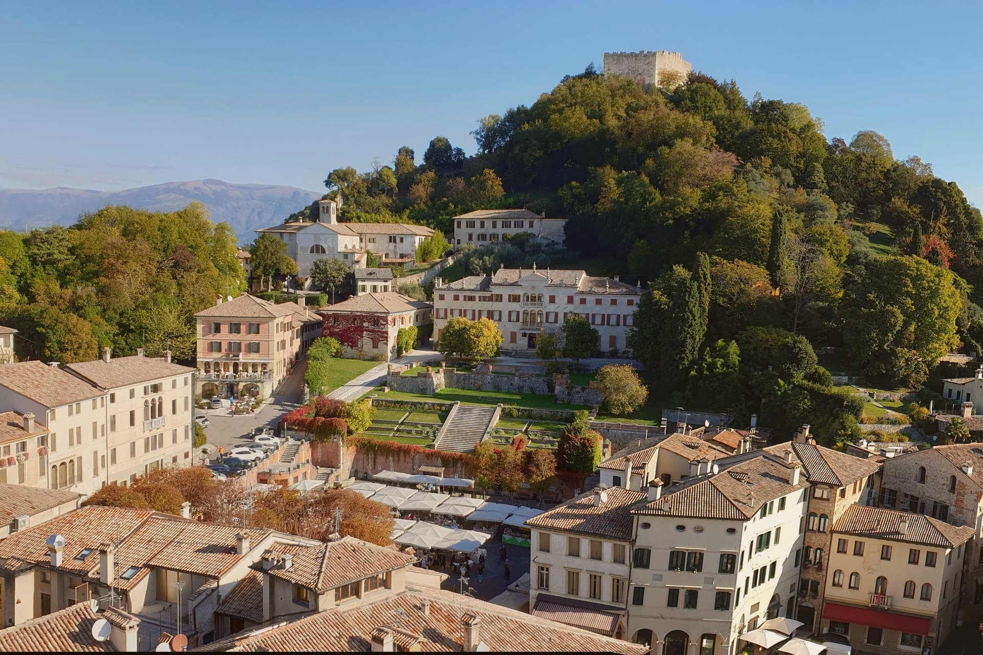
Asolo perches at 205 meters on a ridge between the Asolan hills and the Veneto plain, forty kilometers north of Padova. Pliny knew it as Acelum.
The Ezzelini family held it in the early Middle Ages; the Rocca on the hill above town dates from the late twelfth and early thirteenth centuries and was restored in 2020 after a 2016 storm damaged the walls. The defining episode came in 1489, when the Republic of Venice gave Asolo as a fiefdom to Caterina Cornaro, the deposed Queen of Cyprus, in exchange for her island.
She kept a court here for twenty years until the League of Cambrai sacked the town in 1509. Her circle included Gentile Bellini, the humanist Pietro Bembo and the poet Andrea Navagero.
Robert Browning wintered in a villa here from 1838 onward, and the actress Eleonora Duse retired to Asolo and is buried in the local cemetery. The town carries six institutional signals at once.
Caffè Centrale Asolo, La Terrazza, Locanda Baggio have been named by a guide.
What to see in Asolo
- Rocca di Asolo. Late twelfth and early thirteenth-century fortress on the hill above the town, restored in 2020 with €300,000 in ministry funding.
- Castello di Caterina Cornaro. Medieval castle in the town, court of the Queen of Cyprus from 1489 to 1509, now home to the Eleonora Duse theater.
- Duomo di Asolo. Cathedral rebuilt in 1747 with an Assunta altarpiece by Lorenzo Lotto, standing on the foundations of a Roman bath complex.
How to get to Asolo
Vicenza is roughly 57 minutes away by road.
Our tip
April through June and September through October are the right months. The ridge stays a few degrees cooler than the plain, and the views north to Monte Grappa are clearest in spring and autumn. July and August are warm and busy; weekend traffic from Venice and Padova fills the Piazza Garibaldi car park by ten.
Susegana
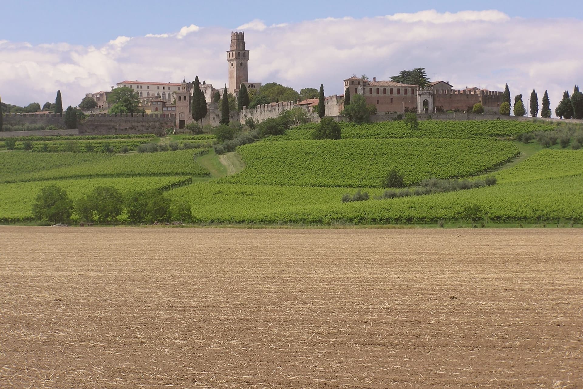
Why visit Susegana
Susegana lies twenty kilometers north of Treviso, at the point where the Piave leaves the Prealps and turns south toward the lagoon. The commune stretches from a hilly northern strip, holding the frazioni of Colfosco and Collalto, down to Ponte della Priula on the plain, where the river is crossed rather than skirted.
The older castle was founded by Ensedisio I in 1110, passed to the Republic of Venice as a Franciscan house, and was suppressed under Napoleon. The younger, Rambaldo III's foundation of 1323, grew into the larger fortress that still stands.
The Collalto counts, lords of the river crossing since the twelfth century, tie both hilltops and the plain below to a single dynasty that farms the southern vineyards to this day. What the two castles and the bridge below them add up to is a town organized by its geography: a family seated on the high ground for defense of the crossing, its wealth still rooted in the slopes it once ruled.
What to see in Susegana
- Castello di San Salvatore. Set on its own hill, the double walls still stand around what remains one of the largest fortified perimeters in the region, and the estate below is worked as a winery by the same family that built the walls.
- Castello di Collalto. The older of the two strongholds, founded on the Colle Alto, passed from fortress to Franciscan monastery and stands now as ruins above the village that took its name.
- Colline del Prosecco. The commune's share of the Valdobbiadene UNESCO slopes, given over to Glera vines producing DOCG Prosecco Superiore.
How to get to Susegana
Venezia is roughly 57 minutes away by road.
Our tip
April through June and September through October are the working months. Vine flowering runs into late May, harvest from mid-August into September, and the gold light over the Conegliano-Valdobbiadene hills draws photographers in October. July and August push past thirty degrees and the centro storico empties in the afternoon. Millenaria Festa in Tombola a Susegana falls in September.
Marostica
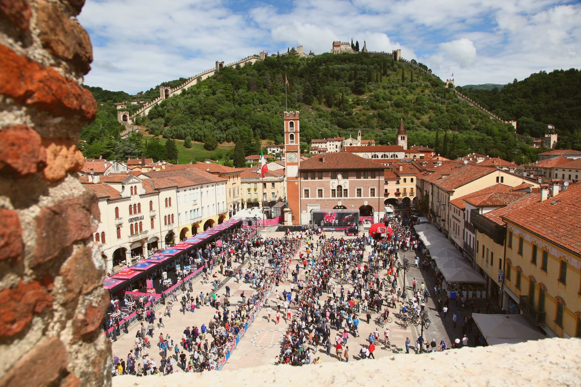
Why visit Marostica
Marostica sits at 103 meters at the foot of the Asolan hills, forty-five kilometers northwest of Padova. Cangrande della Scala took the town in 1311, building his lower fortress on the plain and a second stronghold on the hill above it, then joining the two with a wall long enough to carry two dozen towers and four gates between them.
The arrangement is unusual: most walled towns fortify a single point, but here the defense runs uphill, turning the slope itself into the connecting structure between plain and ridge. The upper stronghold did not survive the artillery of the War of the League of Cambrai in 1510 and has stood as a ruin since, while the lower one remained inhabited and working, which is why the town's public life, its square, its church, its chess board, still gathers at the base of the hill rather than at its summit.
The cherries grown on the slopes to the north, since given IGP status, are the one product of the surrounding land that made it into the local kitchen as the crostata. What the town amounts to is a fortification that never stopped being a town: the walls did not seal Marostica off from its hillside, they organized it, and the square where the chess is played twice a decade sits exactly where the two castles' lines of sight once met.
La Rosina, Madonnetta have been named by a guide.
What to see in Marostica
- Castello Inferiore. Built from 1311 on Piazza Castello, its keep rising 44 meters over the square, with a museum inside on the chess match traditions.
- Castello Superiore. Ruined by Venetian artillery in 1510, standing on Monte Pausolino and reached by a footpath through the walls, with views over the Brenta valley.
- Mura di Marostica. Fourteenth-century walls running two kilometers between the two castles, with twenty-four towers and four gates; the parapet walk is open to the public.
How to get to Marostica
Vicenza is roughly 43 minutes away by road.
Our tip
April through June and September through October are the working months. The cherry harvest runs from late May to mid-June and the orchards on the lower slopes of the Asolan hills mark the season; the Mostra delle Ciliegie in early June is the major spring event. The Partita a Scacchi falls on the second weekend of September in even-numbered years and books the town a year ahead.
Vittorio Veneto
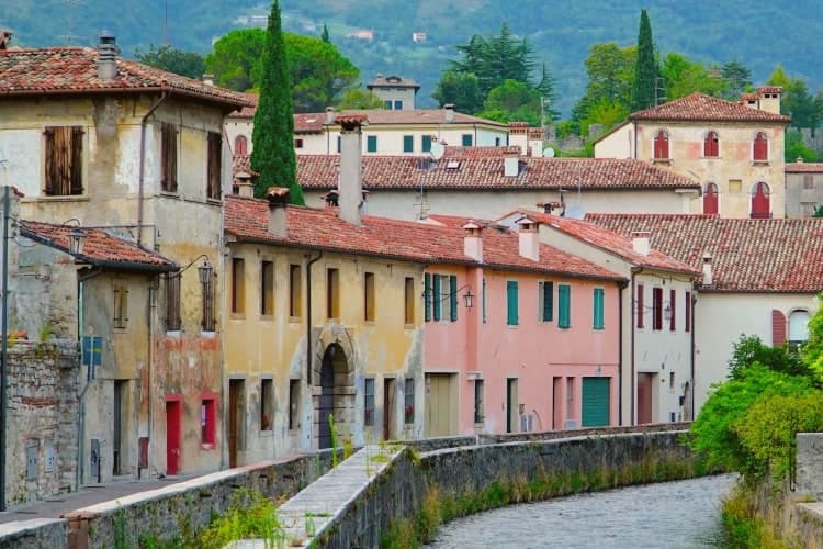
Why visit Vittorio Veneto
Vittorio Veneto sits at 138 meters at the foot of the Cansiglio plateau, seventy-five kilometers north of Padova. The commune was formed in 1866 by merging Ceneda, on the plain, with Serravalle, in the narrow valley above, and named for King Vittorio Emanuele II.
The two centers kept their own identities rather than blending into one. Serravalle is the older, walled district, set higher in the valley, with its cathedral holding the altarpiece of the Virgin with two saints.
Ceneda lies lower down on the plain, holding the Loggia of the Comunità and an eighteenth-century cathedral of its own alongside the castle ruins on the hill above it. In July 1923 the town took the name it carries now, after the battle that had taken its name from it three years earlier: the offensive of 24 October 1918 broke the Austro-Hungarian line, and the Armistice of Villa Giusti, effective 4 November, closed the war on this front.
The renaming fixed a wartime event permanently onto a place that had, until then, been two separate medieval settlements sharing a valley. What stands today is that same double structure, upper town and lower town, walled district and plain, still legible as two places joined by one name.
Le Macine have been named by a guide.
What to see in Vittorio Veneto
- Duomo di Serravalle. Rebuilt cathedral in the upper walled centro storico, holding the altarpiece of the Virgin with Saints Peter and Andrew in continuous liturgical use since it was painted.
- Museo della Battaglia. In the Loggia of the Comunità di Ceneda, built 1534-1538, with relics and documents of the offensive that ended the war on this front.
- Serravalle. Northern walled district above Ceneda, with sixteenth-century arcaded houses along the Meschio and the 1462 Loggia Serravallese.
How to get to Vittorio Veneto
There is a railway station in the town, so you can arrive without a car and never need one while you are here. Venezia is roughly 59 minutes away by road.
Our tip
April through October is the working season. April and May bring the Cansiglio plateau into play with walking weather and the upper Meschio at full flow. June through August stays cooler than the plain, with the narrow Serravalle valley holding shade through midday; the lower part around Ceneda pushes into the low thirties. Festa della Val Lapisina falls in July.
Bassano del Grappa
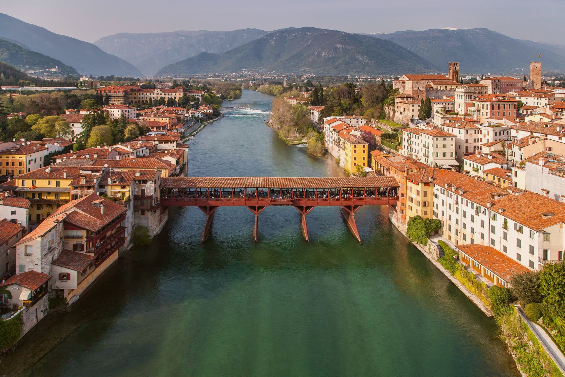
Why visit Bassano del Grappa
Bassano sits at 129 meters on the Brenta, where the river breaks out of the Alpine foothills onto the Veneto plain forty-five kilometers north of Padova. A Roman estate gave the town its name in the second century BC; a pre-Roman bronze sword found here in 2009 dates to the seventh century BC.
The medieval city is first mentioned in 998. Andrea Palladio designed the covered wooden bridge across the Brenta in 1569, replacing an older bridge documented since 1209.
Floods and wars destroyed it repeatedly; the current version, inaugurated 3 October 1948 with Alcide De Gasperi present, was the seventh build. The Alpini, the Italian mountain troops, adopted the bridge as their symbol in the First World War.
Nardini opened its distillery on the bridge in 1779, the oldest grappa house in Italy; Poli is its main local competitor. The city also kept the ceramics trade that flourished here from the sixteenth century, sharing the tradition with neighboring Nove.
Piazza della Libertà, with its fifteenth-century loggia and clock, holds the historic center together.
Ristorante Birraria Ottone, Distilleria Nardini, Ca' 7 have been named by a guide.
What to see in Bassano del Grappa
- Ponte degli Alpini. Covered wooden bridge designed by Andrea Palladio in 1569, rebuilt seven times after floods and wars, current version inaugurated 1948.
- Piazza della Libertà. Main square of the centro storico, overlooked by the Palazzo Municipale with its fifteenth-century loggia and clock tower.
- Grapperia Nardini. Founded 1779, the oldest grappa distillery in Italy; the tasting room on the Ponte degli Alpini still operates daily.
How to get to Bassano del Grappa
There is a railway station in the town, so you can arrive without a car and never need one while you are here. Vicenza is roughly 45 minutes away by road.
Our tip
April through June and September through October are the working months. The Brenta runs cold and clear in spring, the centro storico fills slowly on weekends, and Piazza della Libertà holds the late-afternoon aperitivo crowd without spilling over. July and August push past thirty-two degrees in the valley; Bassano is a transit town for the Asiago plateau then, used for breakfast on the way up.