
Lazio · Roma
Castelnuovo di Porto
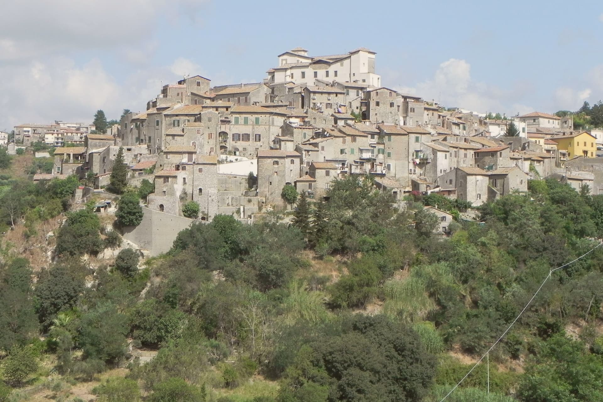
A tufa-ridge borgo twenty-five kilometers north of Rome inside the Parco di Veio, dominated by a Renaissance fortress above the Tiber valley.
- Best time
- Apr–Oct
- By car
- 37 min from Rome
- By train
- Station in the comune
- Population
- 8,567
Known for
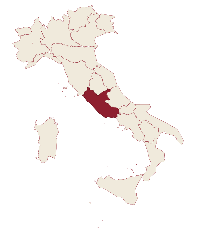
ROCCA COLONNA
Colonna fortress on the tufa spur, used by Marcantonio Colonna after the Battle of Lepanto in 1571.
PARCO DI VEIO
Regional park around the village covering Etruscan and Roman remains in tufa gorges and oak woodland.
TUFA BORGO
Medieval centro storico in concentric loops around the rocca on a tufa spur between two valleys.
When to visit
Best · Apr–Oct
- J11°
- F14°
- M15°
- A18°
- M23°
- J29°
- J33°
- A32°
- S27°
- O21°
- N16°
- D12°
- Best
- Hot or crowded
- Quiet
- Mostly closed
Daytime averages, 2020–2024. Weather data by Open-Meteo.com.
The festa: Antonino di Apamea, prima domenica di settembre
Why come
Castelnuovo di Porto sits on a tufa spur between the Chiarano and Mola valleys. The first fortification went up before the year 1000 under the senator Alberico, and the medieval village grew around it in concentric loops that still shape the centro storico today. The Colonna family took the fief in the late Middle Ages and built the fortress that occupies the highest point of the ridge, the keep from which the whole settlement takes its layout, houses and passages stepping down the slope in rings.
The town's name preserves its administrative link to the river: this was the Castrum Novum of the bishop of Porto, the old diocesan seat at the Tiber mouth, a naming that ties a tufa hilltop village to an ecclesiastical authority seated on the coast. The Borghi più belli d'Italia membership covers the centro storico and the fortress together, while Etruscan and Roman archaeology runs through the Veio park that surrounds both. The result is a village whose name records a bishop's jurisdiction, whose form records a medieval defense, and whose surroundings record two much older civilizations, all still legible on the same ridge.
The Sunday letter
Castelnuovo di Porto is on our list. Its letter is still to come.
We are writing about all 1,000 of these towns, one at a time, in a free letter every Sunday: the photo, the food, the festa. That is our mission. Sign up and you will be there when Castelnuovo di Porto comes up. By Peter & Sophia, from Pietrasanta.
Read on
Castelnuovo di Porto in our articles
 The best hidden towns inside a nature park in the province of Roma6 towns, Castelnuovo di Porto among them.
 The best hill towns inside a nature park within 90 minutes of Roma6 towns, Castelnuovo di Porto among them.
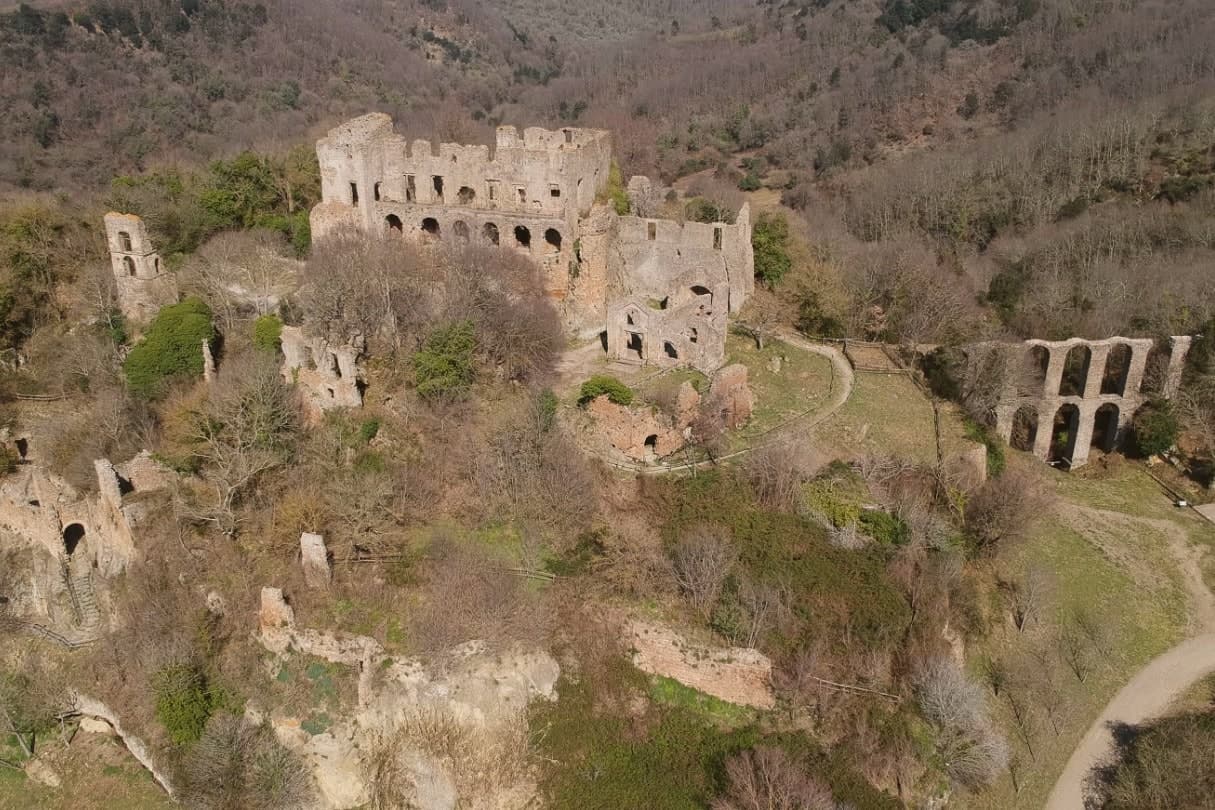 The best hill towns in the province of Roma7 towns, Castelnuovo di Porto among them.
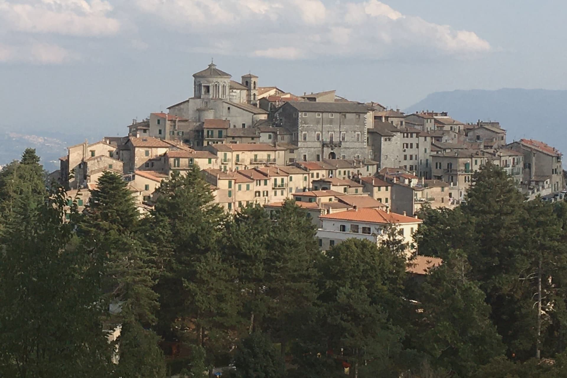 The prettiest villages in the province of Roma7 towns, Castelnuovo di Porto among them.
How to get there
From Rome (FCO), about 1h 12m by car.
Naples / Salerno (NAP) is about 2h 35m away.
By car from the centre of Perugia 2 hours or Siena 2h 29m.
There is a railway station in the comune, so you can arrive without a car.
Coming from Rome?
Coming by train into Roma Termini? Castelnuovo di Porto is about 39 minutes away by road.
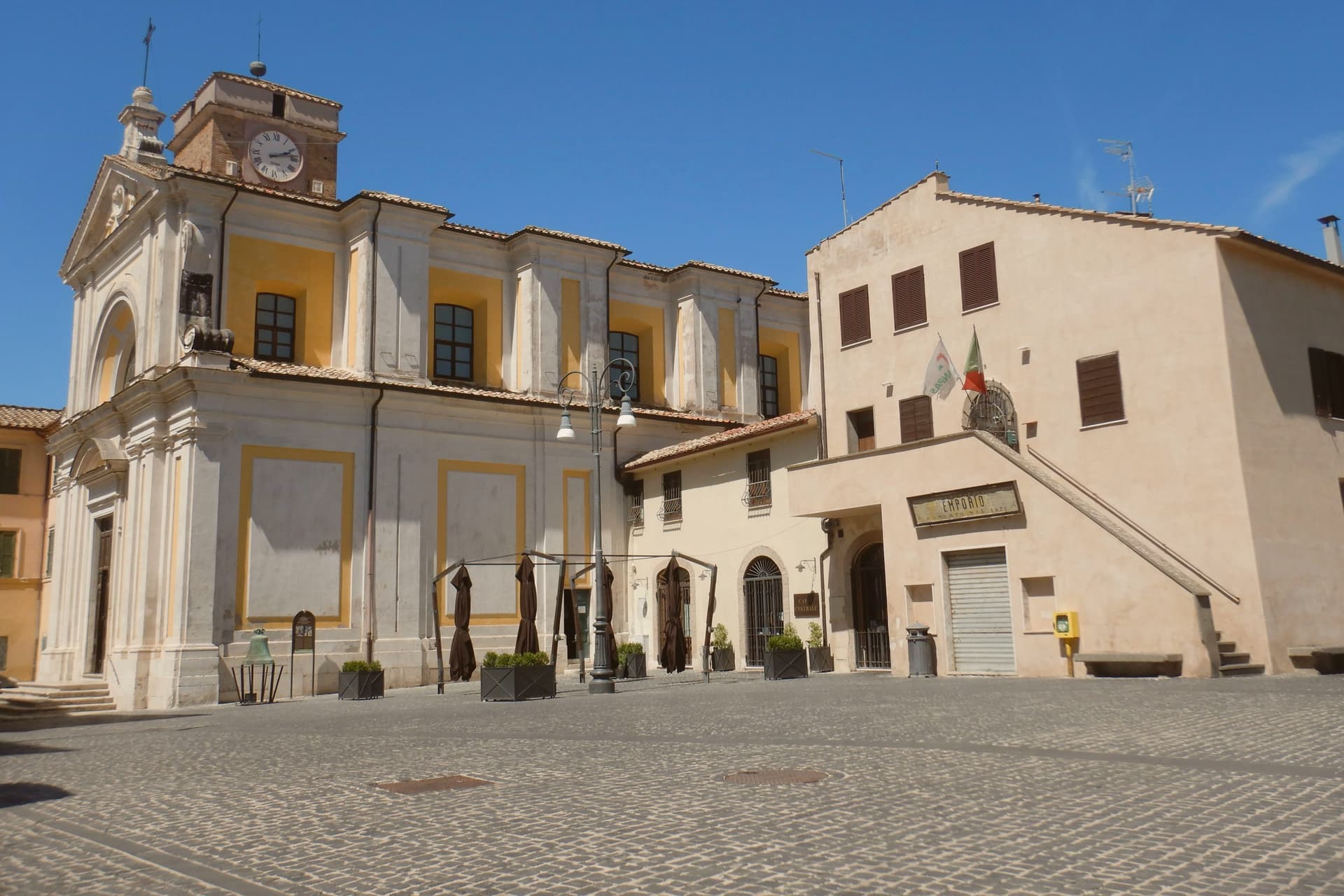
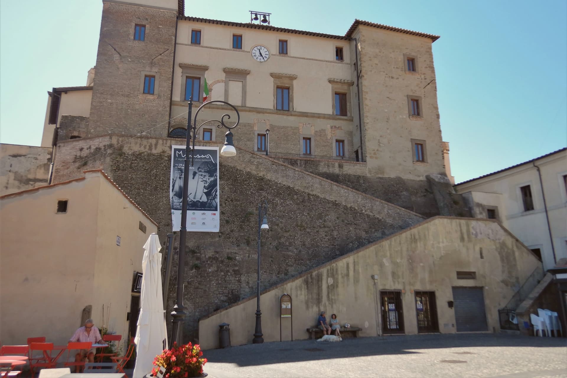
What to see
Rocca Colonna
Ducal palace inside the keep at the highest point of the ridge, used by Marcantonio Colonna after Lepanto and later by Christina of Sweden passing through to Rome.
Centro storico
Tufa houses and vaulted passages along the concentric loops, with the surviving village gates still marking the old perimeter.
Chiesa di Santa Lucia
Parish church inside the walls, with Renaissance frescoes and a baptismal font dating to the period of the fortress above it.
Parco Regionale di Veio
Marked trails through the tufa gorges and oak woods, running past the Etruscan and Roman archaeology scattered across the territory.
Panorama from the rocca
View from the castle terrace over the Tiber valley and Monte Soratte to the north.
The slow-trip planner
Building a trip? Find where Castelnuovo di Porto fits in a slow Italy circuit.
Answer five questions. We will shape a geographically coherent slow trip from the 1,000 Italian towns most travelers skip. Yours to save and share.
Through the year
What happens here
Feasts and festivals that come back year after year. We give the month rather than the date, because the date moves and the month rarely does. Check with the source before you plan a journey around one.
Sagra Degli Gnocchi A Castelnuovo Di Portofood festival
usually held in September. eventiesagre.it
Living here
- Population 8,567
- In-betweeni
- Pharmacy in town
- High school within a 30-minute drive
- Train station in the comune
- Nearest airport Rome, 1 h 12 min drive
- Regional capital Roma, 37 min drive
Common questions
- What is Castelnuovo di Porto known for?
- Castelnuovo di Porto is a tufa-ridge borgo twenty-five kilometers north of Rome inside the Parco di Veio, dominated by a Renaissance fortress above the Tiber valley.
- Where is Castelnuovo di Porto?
- Castelnuovo di Porto is a comune in the province of Roma, in Lazio, at 250 meters above sea level.
- What is the nearest airport to Castelnuovo di Porto?
- Rome (FCO), about 1h 12m by car.
- Can you get to Castelnuovo di Porto without a car?
- Yes. There is a railway station in the comune, so you can arrive by train.
- How long is the drive from Perugia to Castelnuovo di Porto?
- About 2 hours by car.
- When is the best time to visit Castelnuovo di Porto?
- Best in Apr–Oct. July is the warmest month, averaging 33 degrees, and December the wettest, with about 12 rain days.
- Is there a sagra or a festival in Castelnuovo di Porto?
- Yes. Sagra Degli Gnocchi A Castelnuovo Di Porto. September is when the first of them falls.
- Which other towns are like Castelnuovo di Porto?
- Capranica, Magliano Sabina and Arpino.
- How many people live in Castelnuovo di Porto?
- 8,567 at the 2023 count.
Tags & datadesignations · numbers · sources
Recognised as
The numbers
- Elevation: 250 m
- Population: 8,567
- Surface area: 30.57 km²
These figures were compiled from public directories: ISTAT, OpenStreetMap and Wikidata, and from the official listings of the guides named on this page. Town details change; verify with official sources before you travel.
Featured on
Castelnuovo di Porto appears on this themed pick from our Collections:
Similar
Towns like Castelnuovo di Porto
Capranica
Province: Viterbo
both inland, away from the coast · both between 3,000 and 10,000 people
Magliano Sabina
Province: Rieti
both inland, away from the coast · both between 3,000 and 10,000 people
Arpino
Province: Frosinone
both inland, away from the coast · both between 3,000 and 10,000 people
Castro dei Volsci
Province: Frosinone
both inland, away from the coast · both between 3,000 and 10,000 people
Gattinara
Province: Vercelli
both inland, away from the coast · both between 3,000 and 10,000 people
Pontremoli
Province: Massa-Carrara
both inland, away from the coast · both between 3,000 and 10,000 people
🎨 Borghi più belli d'Italia
More Borghi più belli d'Italia towns in Lazio
Acquapendente
Province: Viterbo
The northernmost town in Lazio, at 420 meters above the Paglia, named in 964 for its waterfalls.
Atina
Province: Frosinone
A polygonal-walled town at the foot of the Mainarde, and the DOC that makes Cabernet in central Italy.
Bassano in Teverina
Province: Viterbo
A tufa-spur borgo of 1,260 above the Tiber valley between Lazio and Umbria, with a clock tower that hides an eleventh-century animated bell tower.
Boville Ernica
Province: Frosinone
A Ciociaria hilltop town with eighteen intact medieval towers, ringed by a walled circuit that has stood since the tenth century.
Capranica Prenestina
Province: Roma
A 915-meter ridge village east of Rome, with a sanctuary above the Giovenzano valley at 1,018 meters.