
The best hidden towns worth staying overnight in Campania
The coast between the Sorrentine peninsula and Salerno is built from limestone, whitewash and lemon terracing, stacked so steeply that streets become staircases and roofs become somebody else's terrace. The cooking is coastal and frugal in the best sense: anchovies, provolone del monaco, scialatielli with clams, sfogliatella eaten standing up, wine from vines grown on volcanic soil across the bay. Spring brings wisteria and the first swimmable water; autumn brings the grape and lemon harvest and warm sea long after the crowds have gone. Late evening is when these places are at their most particular, when the ferries have left and the light goes flat gold on the cliffs.
Most visitors treat the whole coastline as a day out from Sorrento or Naples. The pattern is fixed: the morning hydrofoil, the SITA bus along the corniche, Pompeii and Vesuvius squeezed in, and back to the same hotel by dark. It concentrates enormous numbers of people into the same few hours in the same few piazzas, which is why the coast road jams by mid-morning and the beaches thin out dramatically after the last boat. The place people remember is not really the place; it is the middle of the day in the place.
The same cliffs, the same lemon groves and the same kitchens carry on either side of that day-trip window, and they belong to whoever stays. The towns here all have somewhere to sleep that a travel guide has inspected and stood behind, from convent conversions above the water to family-run rooms with a terrace and a jug of wine. Fewer people stay overnight than pass through, which changes the arithmetic of the whole coast: dinner without a queue, a swim before the first ferry, a church open with nobody in it. These are the ones worth booking a room in rather than photographing from a bus.
Of the 66 communes we have mapped in Campania, 11 qualify as towns worth staying overnight: each has a hotel a travel guide has vouched for, so you can stay rather than day-trip. This list is the hidden ones, 8 in all, ordered smallest first. The smallest, Conca dei Marini, has 664 residents.
Elsewhere in the catalogue: The best towns worth staying overnight in the province of Napoli and The best hidden beach towns in Campania.
Conca dei Marini
Why visit Conca dei Marini
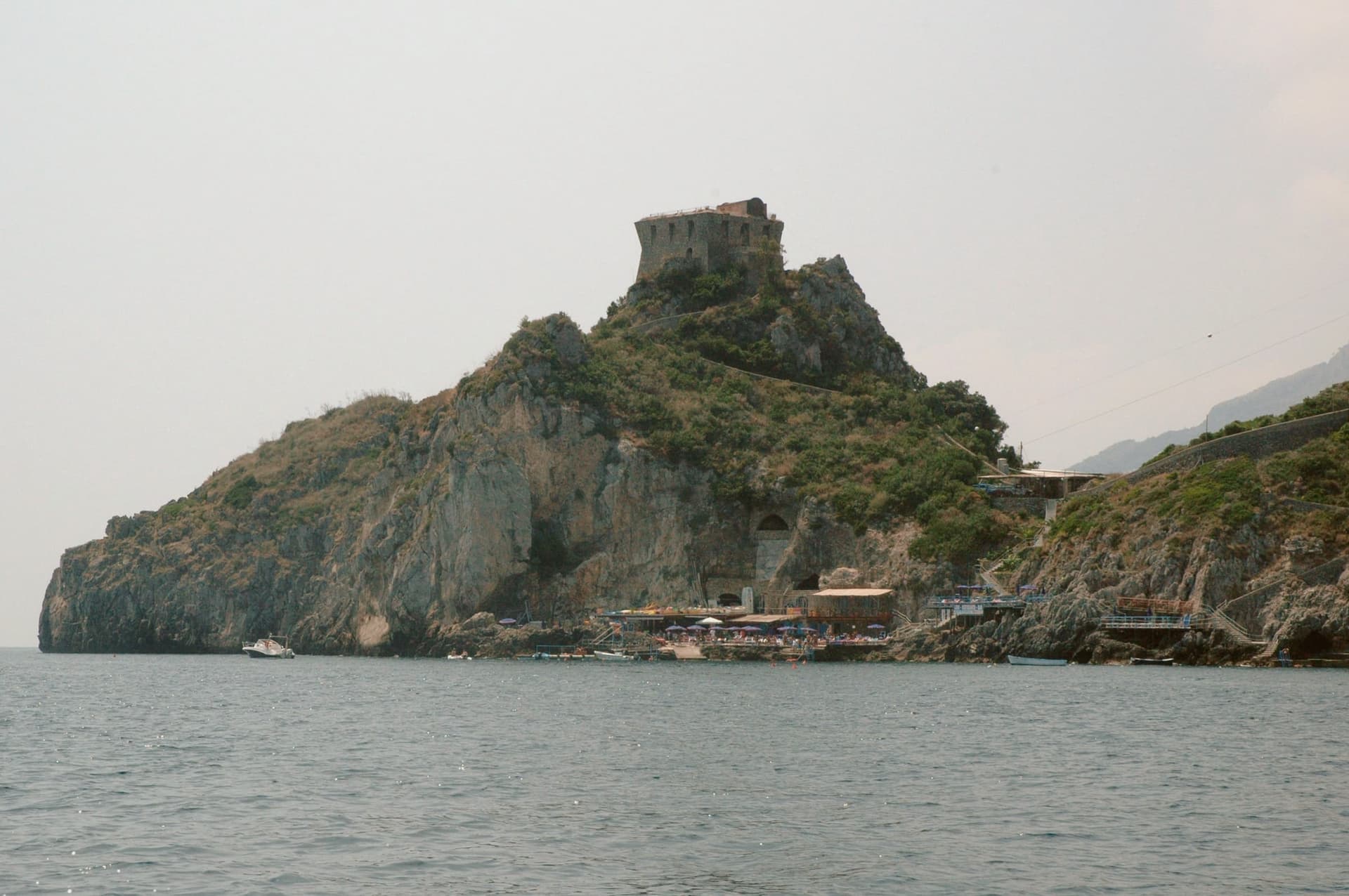
Conca dei Marini sits between Amalfi and Furore on the Tyrrhenian coast, a fold of stone houses around the marina and the promontory above it. According to local tradition the settlement was founded as Cossa by the Etruscans and taken by Rome in 272 BC.
The village divides between the clifftop, where the watchtower and the former monastery stand on their spur, and the water's edge, where the parish chapel sits on a rocky outcrop above the fishing cove. Below the road, accessible by stairs or by boat, the sea cave glows green from an underwater fissure.
The village has 664 residents and stays cooler than Amalfi in August. What holds the place together is the drop from cliff to water: a settlement built in a fold of stone that turned its isolation into a pantry, a lookout, and a hiding place for a green cave, and stayed small enough that all three remain within reach of each other.
What to see in Conca dei Marini
- Grotta dello Smeraldo. 45 by 32 meters of water surface, reached by stairs from the road or by boat from the marina below the village.
- Torre di Capo di Conca. On the promontory above the marina, part of the coastal defense network commissioned by the viceroy of Naples.
- Monastero di Santa Rosa. Former Dominican convent on a clifftop spur, founded 1681; the building is now a luxury hotel.
How to get to Conca dei Marini
Salerno is roughly 34 minutes away by road.
Our tip
May, June, September and October are the months to come. The sea is warm enough for the grotto boats to run reliably, the coastal road is open, and the Santa Rosa is celebrated on 2 August with a new sfogliatella reinterpretation each year by a guest pastry chef. July and August push the SS163 coastal road into single-file traffic from morning to night; locals walk between the marina and the upper village rather than driving.
Praiano
Why visit Praiano
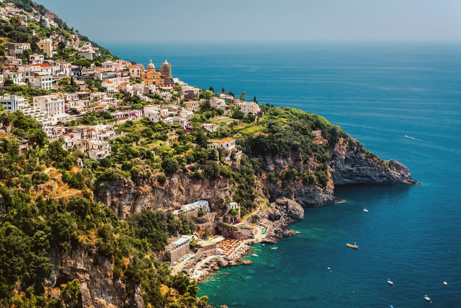
Praiano spreads along a ridge that drops from Monte Sant'Angelo a Tre Pizzi, at 1,444 meters, to the sea, midway between Positano and Amalfi. The Romans called it Plagianum, from the Latin for open sea, a name that fits a town with no single center but a string of settlements strung along the slope.
Vettica Maggiore holds the parish church and the main piazza toward the Positano side. Below the ridge, reached by stairs, Marina di Praia is the only rocky break in the cliffs where boats can land, and the Africana nightclub is cut into the rock above the water.
On the higher ground toward Amalfi, the church and convent mark where the coastal path leaves the town and climbs into the mountain. Gavitella, reached by its own stairway, faces west and keeps the sun after other beaches on this stretch have lost it.
The commune's history as a doges' retreat and Saracen watch post sits above all of this, on the headlands, looking down at a settlement pattern that has changed little: a summer base up high, a working landing below, and a single natural inlet standing in for a harbor. UNESCO listed the Costiera Amalfitana in 1997.
What to see in Praiano
- Chiesa di San Gennaro. Parish church of Vettica Maggiore completed in 1602, Latin-cross plan with three naves, majolica-tiled dome and central barrel vault with lunettes.
- Marina di Praia. Narrow rocky inlet at the foot of Capo Sottile, the historic landing place of Praiano, with the Africana sea-cave nightclub carved into the cliff.
- Santa Maria a Castro e San Domenico. Medieval church and adjoining convent at 364 meters on the slope of Sant'Angelo a Tre Pizzi, with frescoes and a wide view over the coast.
How to get to Praiano
Salerno is roughly 42 minutes away by road.
Our tip
May through September is the season the coast was built for: warm water, open trattorias and the Sentiero degli Dei walkable end to end. July and August push past thirty degrees and the SS163 fills, but Praiano is calmer than Positano five kilometers west. The Gavitella beach catches the late sun and stays busy until dusk.
Ravello
Why visit Ravello
Ravello sits on a spur above the Amalfi Coast, between the valleys of the Dragone and the Reginna Minor, 782 stairs up from Atrani at sea level. The village grew rich in the 12th and 13th centuries as a satellite of the Amalfi maritime republic, when patrician families like the Rufolo, Confalone and d'Afflitto built their houses on the ridge to escape the coastal raids.
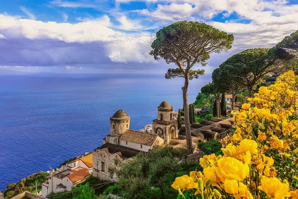
The upper village holds the older churches and the social life of the piazza; the villas that made the town's later reputation sit toward the cliff edge, their gardens and belvederes facing the water. One villa's garden was seen by Richard Wagner in 1880 and identified by him with Klingsor's enchanted garden in his opera Parsifal, and he wrote the opera's second act on the strength of it.
The Ravello Festival began playing orchestral concerts in that same garden in 1953, the year the council decided to use Wagner's visit to rebuild a postwar economy. The town's shape, ridge above, stairs down to the coast, patrician houses turned toward the sea, is the record of why families climbed here in the first place and what they built once they had reason to stay.
What to see in Ravello
- Villa Rufolo. Patrician residence built 1270 with Moorish cloister and terraced gardens; setting for the Ravello Festival concerts and the second act of Wagner's Parsifal.
- Villa Cimbrone. Cliff-edge villa restored after 1904 by Lord Grimthorpe, ending in the Terrazza dell'Infinito, a marble belvedere over the Gulf of Salerno.
- Duomo di Ravello. Cathedral on Piazza Vescovado, founded 1086, with the bronze portal cast by Barisano da Trani in 1179 and the marble pulpit signed by Niccolò di Bartolomeo da Foggia in 1272.
How to get to Ravello
Salerno is roughly 33 minutes away by road.
Our tip
May, June, September and early October are the months Ravello reads best. The temperature on the ridge runs three to five degrees cooler than on the coast below, the festival concerts on the Villa Rufolo belvedere run from late June through August, and the gardens are full without the day-tripper bus queues of high summer. July and August fill the SITA bus from Amalfi and the road up the Dragone valley, and the festival's evening concerts under the stars are the reason most overnight visitors come.
Positano
Why visit Positano
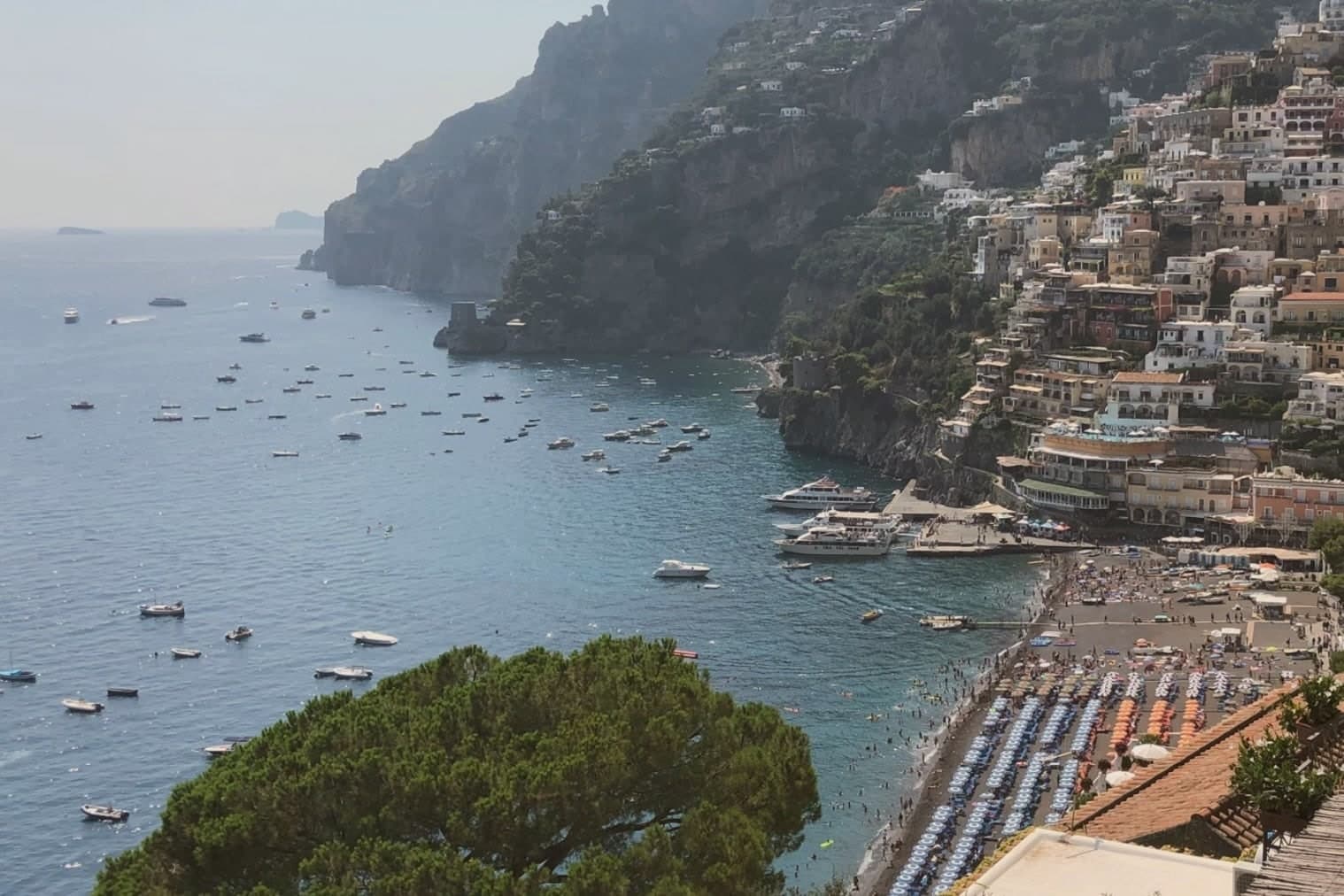
Positano is built on the rugged limestone of the Lattari Mountains, which is why locals call it the città verticale: the ground itself will not allow a level street in the centro storico, and every path either climbs or descends. The settlement grew from the ninth century around the Benedictine monastery that kept the icon, and the frazione of Nocelle above the town shows how far the climb goes, linked to the coast below by the ridge trail rather than by road.
After being sacked by Pisa in the thirteenth century, the town fortified itself with watchtowers and prospered as a small fish-trading port, a working settlement long before it was a resort. The twentieth century made it a writer's refuge: John Steinbeck described it in Harper's Bazaar in 1953 as a dream place that isn't quite real.
Today Positano runs almost entirely on summer tourism, with a UNESCO Amalfi Coast inscription and a Bandiera Blu beach. The vertical geography that once forced fishermen and monks onto narrow terraces is the same feature now sold as a view: the town's difficulty of ground became its main asset.
What to see in Positano
- Chiesa di Santa Maria Assunta. Majolica tiled dome over the church around which the village grew, the icon inside marking the spot where the sailors are said to have set the Madonna down.
- Spiaggia Grande. Main pebble beach below the centro storico, the postcard image of the Amalfi Coast, with the pastel facades of the village rising directly above the sand.
- Sentiero degli Dei. Path of the Gods, the high ridge trail of the Monti Lattari from Agerola to Nocelle, a frazione of Positano, with the Faraglioni of Capri offshore.
How to get to Positano
Salerno is roughly 54 minutes away by road.
Our tip
May, June and September are the open months on the Amalfi Coast, water warm enough for swimming and the road still navigable. July and August fill the village past capacity, with day boats running from Capri and Sorrento and the SS163 backed up for hours; locals avoid the centro storico between eleven and four. April and October stay quiet, with the Path of the Gods at its best and the town easier to walk.
Amalfi
Why visit Amalfi
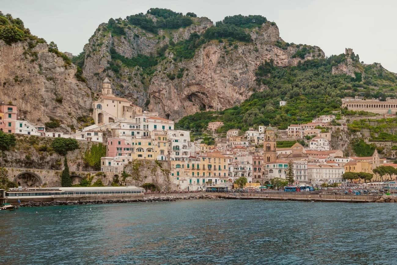
Amalfi sits at the mouth of a deep gorge in the Lattari mountains, six meters above the sea, four thousand seven hundred and twenty-nine people on a stretch of coast that carries its name. The town was capital of a duchy trading with Byzantium, North Africa and the Levant before Pisa and Venice eclipsed it, and the Tavoliere Amalfitano, drawn up here, codified Mediterranean maritime law in the eleventh century for ships far beyond this shore.
The gorge structures the town as much as the sea does: the centro is stacked on the narrow flat ground at the gorge's mouth, the cathedral staircase climbing straight up from the piazza, while the valley behind runs inland and upward, its stream once turning the wheels of the paper mills before the water reaches the harbour below. Upper gorge and lower marina were parts of one working town, the water dropping from the mills to the boatyards to the sea.
The coast was UNESCO-listed in 1997 and the commune is Cittaslow. What made Amalfi a capital was the same terrain that now makes it a resort: a sheltered cut in the mountains with deep water at its foot, close enough to the sea to build ships and drawn up on to the rock to keep the town off the water's threat.
What to see in Amalfi
- Cattedrale di Sant'Andrea. Romanesque facade at the top of the staircase, with the Chiostro del Paradiso attached to one side, striped stone and interlaced arches around a cloister garden.
- Museo della Carta. Paper museum in the Valle dei Mulini, set inside a thirteenth-century working mill where the machinery for hand-forming sheets is still operated.
- Arsenale della Repubblica. Twelfth-century stone-vaulted shipyard near the marina, the only surviving naval arsenal of the four Italian maritime republics.
How to get to Amalfi
Salerno is roughly 35 minutes away by road.
Our tip
May, June, September and early October are the strongest months. The sea climbs past twenty degrees, the ferries to Capri and Positano run on full schedules, and the SS163 cliff road moves before and after the day-trip peak. July and August are full: the town fills with day-trippers arriving by bus, ferry and private boat, and the duomo steps become a queue between ten and four.
Capri
Why visit Capri
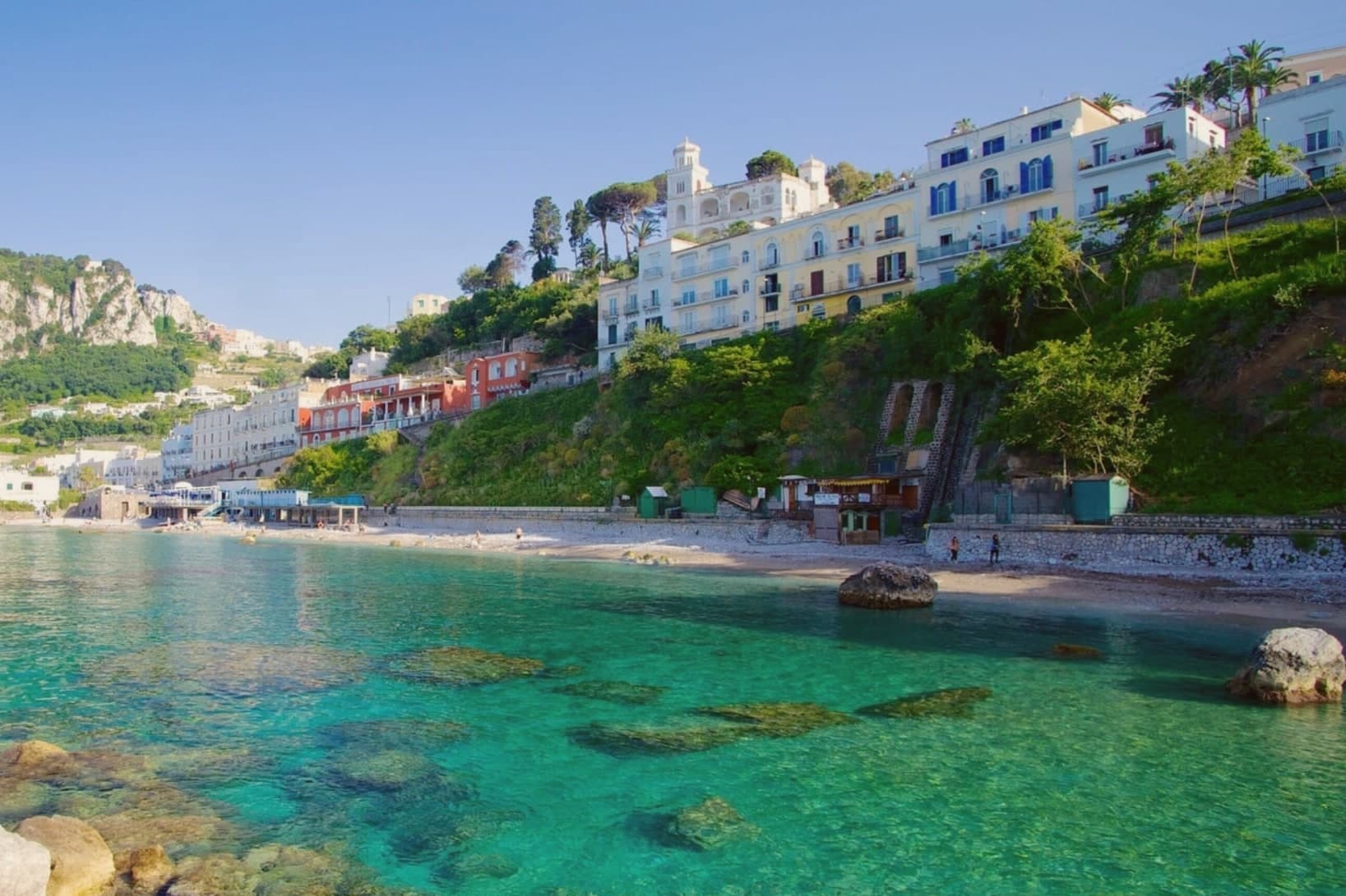
Capri sits at 142 meters above the Marina Grande harbor on the eastern half of the four-square-kilometer island that bears its name, divided between two communes. The town wraps around the Piazzetta, formally Piazza Umberto I, the social center of the island since the funicular replaced the donkey path in 1907.
Tiberius ruled the Roman Empire from here for the last ten years of his life, from twelve villas that Tacitus counted; the ruins of Villa Jovis still stand on the northeastern cape at 334 meters. The Faraglioni, three limestone stacks off the southern coast, rise to 109 meters; the middle one has an arched tunnel through it.
Capri is overwhelmed by day-trippers from June through September. After the last ferry leaves at six in the evening the island returns to its six thousand residents, and the Belvedere of Tragara becomes quiet again.
What to see in Capri
- Villa Jovis. Ruins of Tiberius's imperial villa on Monte Tiberio at 334 meters, the largest of his twelve Capri villas, abandoned after AD 37.
- Piazzetta (Piazza Umberto I). Small square at the heart of Capri town, social hub of the island since 1907 when the funicular replaced the donkey path.
- Belvedere di Tragara. Panoramic terrace at the end of Via Tragara, looking down on the three Faraglioni stacks rising from the southern sea.
How to get to Capri
Our tip
May and early June are the best weeks: the gardens are in bloom, the sea is warm enough to swim, and the day-tripper volume hasn't peaked. July and August are saturated with ferry traffic and tour groups; the Piazzetta is unwalkable between ten and four. September and early October return the island to a calmer pace with water still swimmable.
Anacapri
Why visit Anacapri
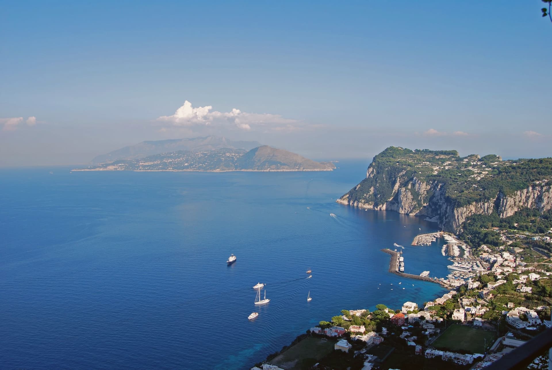
Anacapri occupies the western, higher plateau of Capri, about 150 meters above the harbour town, at 275 meters at the municipal centre and rising to 589 at Monte Solaro. The Ancient Greek prefix ana means up: the name simply says the upper one.
Until 1874 the only link between the two communes was a stairway of some 800 steps, cut by Greek settlers in the seventh or sixth century BC, not by Phoenicians despite what its common name suggests. In 1895 the Swedish physician Axel Munthe began building his villa on the ledge above those steps, on the ruins of one of Tiberius's residences and a tenth-century chapel.
His 1929 memoir turned the place into a literary destination. The two communes of Capri, one at sea level and one on the plateau above, were for centuries connected only by that stair cut into the rock, and a settlement reachable only on foot from its lower twin is a different kind of place than one arrived at by road.
What to see in Anacapri
- Villa San Michele. Neoclassical villa and garden with an antiquities collection and a granite Sphinx set over the harbour, facing east toward Vesuvius.
- Monte Solaro. Reached by a single-seat chairlift from Piazza Vittoria, the summit opens onto views across the whole of Capri.
- Faro di Punta Carena. Second-tallest lighthouse in Italy, built in 1862 and operational since 1867, at the southwestern tip of the island.
How to get to Anacapri
Our tip
May, June, September and the first half of October are the months Anacapri stays usable: blue water at Punta Carena, the Solaro chairlift running, and a degree or two cooler than Capri Marina below. July and August bring the day-trippers off the Naples and Sorrento ferries; the centro of Capri saturates by ten and Anacapri carries the spillover by lunchtime. Villa San Michele books out in advance.
Massa Lubrense
Why visit Massa Lubrense
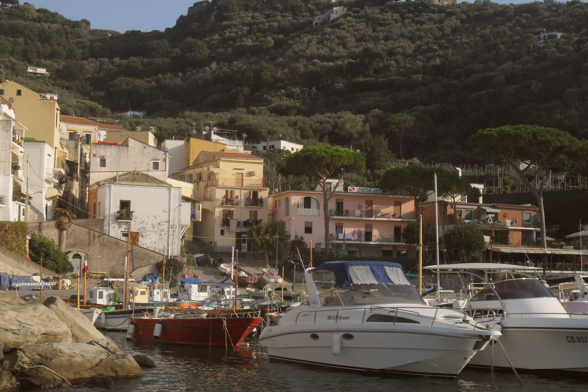
Massa Lubrense holds the western tip of the Sorrentine Peninsula, the largest municipal area on the peninsula and the closest land to Capri, three nautical miles across the Bocche di Capri. The hilltop centro sits at 121 meters; the commune's eighteen frazioni spread between the Tyrrhenian and the Gulf of Salerno, including Termini, Nerano, Sant'Agata sui Due Golfi and the Marina della Lobra.
Punta Campanella, the cape at the end, has the remains of a Roman sanctuary of Athena and a sixteenth-century watchtower against Saracen raids; the surrounding sea is a protected marine area established in 1997. The commune holds a Bandiera Blu, a Spiga Verde, and Città dell'Olio status: the Penisola Sorrentina DOP olive groves climb the hills above the bays.
Spaghetti alla Nerano, courgette and provolone del Monaco, is the dish that came out of these kitchens in the 1950s.
What to see in Massa Lubrense
- Punta Campanella. Cape at the western tip of the peninsula, with the ruins of a Roman sanctuary of Athena, a watchtower, and the marine reserve established in 1997.
- Marina del Cantone. Pebble bay at Nerano, Italy's largest pebble beach by some measures and the kitchen where spaghetti alla Nerano was created.
- Chiesa di Santa Maria della Lobra. Sixteenth-century mother church above the small Marina della Lobra, with a wooden coffered ceiling and a former Franciscan convent attached.
How to get to Massa Lubrense
Napoli is roughly 69 minutes away by road.
Our tip
May, June, September and early October are the months Massa Lubrense was built for. The water around Punta Campanella sits above twenty degrees, the marine reserve runs daily boat tours, and the Sentiero degli Dei from Bomerano descends through olive groves in stable weather. July and August are full: the parking at Marina del Cantone closes by mid-morning and the SS145 from Sorrento backs up.
More from Anywhere Italy
- The best towns worth staying overnight in the province of Napoli
 The best hidden beach towns in Campania
- The 6 best beach towns with a serious restaurant in Campania
- The 9 best towns with a serious restaurant in the province of Napoli
 The best towns known for what they grow within 45 minutes of Salerno
- The best towns with a World Heritage site within 45 minutes of Salerno