
The best towns known for what they grow within 45 minutes of Salerno
The land around Salerno is farmed vertically and horizontally at once. Above the coast, dry stone terraces hold lemon trees under chestnut poles and netting, the sfusato amalfitano ripening thick-skinned and sweet enough to eat with a knife. Inland, on soil that came out of Vesuvius, tomatoes grow long and pointed and go into tins under the San Marzano name, while the plain towards Nola carries hazelnut groves and orchards. Spring brings broad beans, artichokes and the first wine work in the high valleys; late summer brings the tomato harvest, the smell of it on every road.
Most people arrive with one image in mind and go straight to Positano, down the staircases to the beach, back up for an aperitivo with the view. It is a beautiful place and the reason the road exists in its modern form, which is also why the road stops moving in July. Coach parties, wedding parties and day trippers off the Sorrento ferries share the same few hundred metres of pavement. Very little of what is eaten there is grown there.
The terraces do not end where the famous stretch does. They keep climbing behind Minori and Maiori, they turn inland at Tramonti where the vines are ungrafted and old, they run east onto the plain where the fields feed the canning sheds. These are the towns whose names appear on the paperwork of a protected fruit or vegetable rather than on the postcard rack, and fewer people stop in them.
Of the 15 communes we have mapped in a 45-minute drive of Salerno, 12 qualify as towns known for what they grow: each sits inside the production zone of a protected fruit or vegetable. This list is 10 of them. The smallest, Conca dei Marini, has 664 residents.
If you are still choosing, we have also written The best towns with a World Heritage site within 45 minutes of Salerno and The best towns known for what they grow within an hour of Naples.
Furore
Why visit Furore
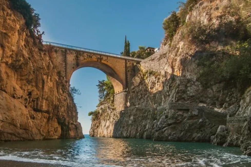
Furore stretches up the cliff between Praiano and Conca dei Marini on the UNESCO-listed Costiera Amalfitana, six hundred and eighty-eight people across houses that don't share a single piazza. The main settlement sits at 300 meters in the upper Vallone del Furore; the commune drops to sea level at the Fiordo di Furore, a narrow ria carved by the Schiato torrent that flows down from Agerola at 550 meters.
The historian Matteo Camera traced the name to the roar storms make through the gorge. Since the late 1980s the painter Silvio Vetrano's project Il Paese Dipinto has invited artists each September to paint murals on the village walls, which is why Furore is sometimes called the painted village or the village that doesn't exist.
The commune is a Borgo più bello d'Italia and a Città del Vino: the Fiorduva white from the Marisa Cuomo winery is grown on terraces above the fjord.
Bluh Furore, Hostaria Baccofurore, Melchiò have been named by a guide.
What to see in Furore
- Fiordo di Furore. Narrow ria cut by the Schiato torrent, southern Italy's only fjord, with a stone bridge crossed by the SS163 and a pebble beach below.
- Il Paese Dipinto. Open-air mural circuit started in 1980 by Silvio Vetrano, with new works added each September by invited Italian and international artists.
- Chiesa di Sant'Elia Profeta. Parish church on the upper part of the village, with a majolica-tiled dome and a small square overlooking the terraces below.
How to get to Furore
Salerno is roughly 36 minutes away by road.
Our tip
May, June, September and early October are the strongest months on this stretch of the Amalfi Coast. The sea climbs past twenty degrees, the SS163 buses run on a working timetable, and the Fiordo di Furore beach is accessible without a queue. July and August are full: the day-trippers come up from Amalfi and the small parking pockets on the SS163 fill before nine.
Cetara
Why visit Cetara
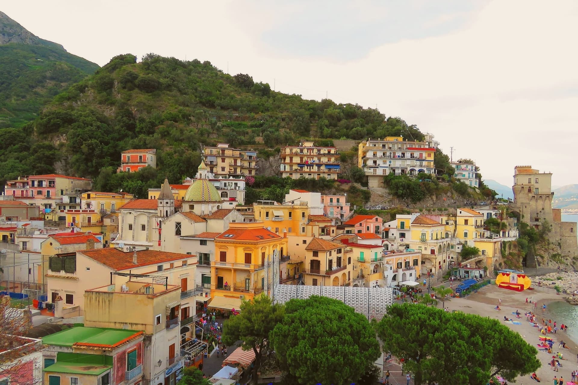
Cetara sits at the eastern end of the Amalfi Coast on a narrow inlet between Vietri sul Mare and Maiori, 17 kilometers from Salerno. Saracen pirates established a base here in 879 AD and made repeated raids west along the coast; in 1534 the corsair Sinan Pasha sacked the village and took roughly 300 inhabitants as slaves to North Africa.
The viceregal watchtower above the beach, Torre di Cetara, was rebuilt in the 16th century as part of the coastal defense system commissioned from Naples; it now holds the civic museum of local painters known as the costaioli. Cetara remains the working fishing village of the coast, with a tuna and anchovy fleet still based in the small port.
Colatura di alici, the amber anchovy sauce descended from Roman garum and revived in the Middle Ages by local monks, is still aged in chestnut barrels in the cellars; it received DOP status in 2020. The Chiesa di San Pietro Apostolo on the marina, with its yellow majolica dome, is the visual signature of the village.
La Dispensa di Armatore, Al Convento have been named by a guide.
What to see in Cetara
- Torre Vicereale. Sixteenth-century viceregal watchtower rebuilt after the 1534 Saracen sack, restored in 2011 and now holding the civic museum of the costaioli painters.
- Chiesa di San Pietro Apostolo. Ninth-century parish church on the marina rebuilt in Baroque style, with a yellow majolica dome that signs the village from the sea.
- Convento di San Francesco. Fourteenth-century Franciscan convent above the port, with a small cloister and a sea-facing terrace, now used for civic events.
How to get to Cetara
Salerno is roughly 17 minutes away by road.
Our tip
May, June, September and October are the months Cetara reads best. The fleet runs daily, the festivals around the colatura and the tuna catch land in the warm shoulders, and the SS163 between Vietri and Maiori is open without high-summer queues. July and August fill the small marina and the pebble beaches to either side of the breakwater.
Praiano
Why visit Praiano
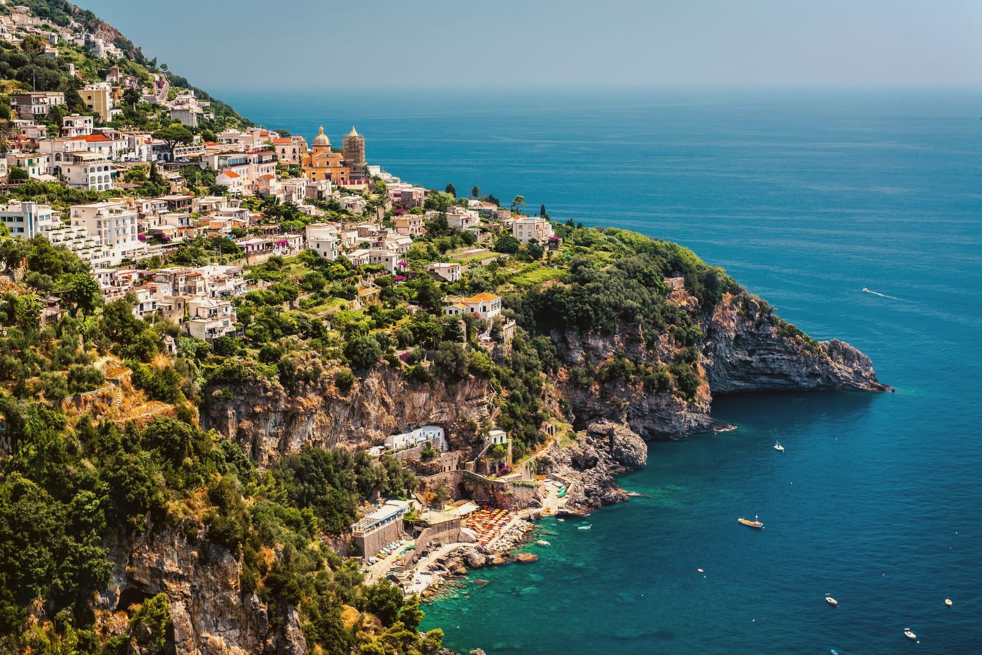
Praiano spreads along a ridge that drops from Monte Sant'Angelo a Tre Pizzi, at 1,444 meters, to the sea, midway between Positano and Amalfi. The Romans called it Plagianum, from the Latin for open sea, a name that fits a town with no single center but a string of settlements strung along the slope.
Vettica Maggiore holds the parish church and the main piazza toward the Positano side. Below the ridge, reached by stairs, Marina di Praia is the only rocky break in the cliffs where boats can land, and the Africana nightclub is cut into the rock above the water.
On the higher ground toward Amalfi, the church and convent mark where the coastal path leaves the town and climbs into the mountain. Gavitella, reached by its own stairway, faces west and keeps the sun after other beaches on this stretch have lost it.
The commune's history as a doges' retreat and Saracen watch post sits above all of this, on the headlands, looking down at a settlement pattern that has changed little: a summer base up high, a working landing below, and a single natural inlet standing in for a harbor. UNESCO listed the Costiera Amalfitana in 1997.
Un Piano nel Cielo, Franchino, Gala Maris dell'Hotel Alfonso a Mare and 1 more have been named by a guide.
What to see in Praiano
- Chiesa di San Gennaro. Parish church of Vettica Maggiore completed in 1602, Latin-cross plan with three naves, majolica-tiled dome and central barrel vault with lunettes.
- Marina di Praia. Narrow rocky inlet at the foot of Capo Sottile, the historic landing place of Praiano, with the Africana sea-cave nightclub carved into the cliff.
- Santa Maria a Castro e San Domenico. Medieval church and adjoining convent at 364 meters on the slope of Sant'Angelo a Tre Pizzi, with frescoes and a wide view over the coast.
How to get to Praiano
Salerno is roughly 42 minutes away by road.
Our tip
May through September is the season the coast was built for: warm water, open trattorias and the Sentiero degli Dei walkable end to end. July and August push past thirty degrees and the SS163 fills, but Praiano is calmer than Positano five kilometers west. The Gavitella beach catches the late sun and stays busy until dusk.
Ravello
Why visit Ravello
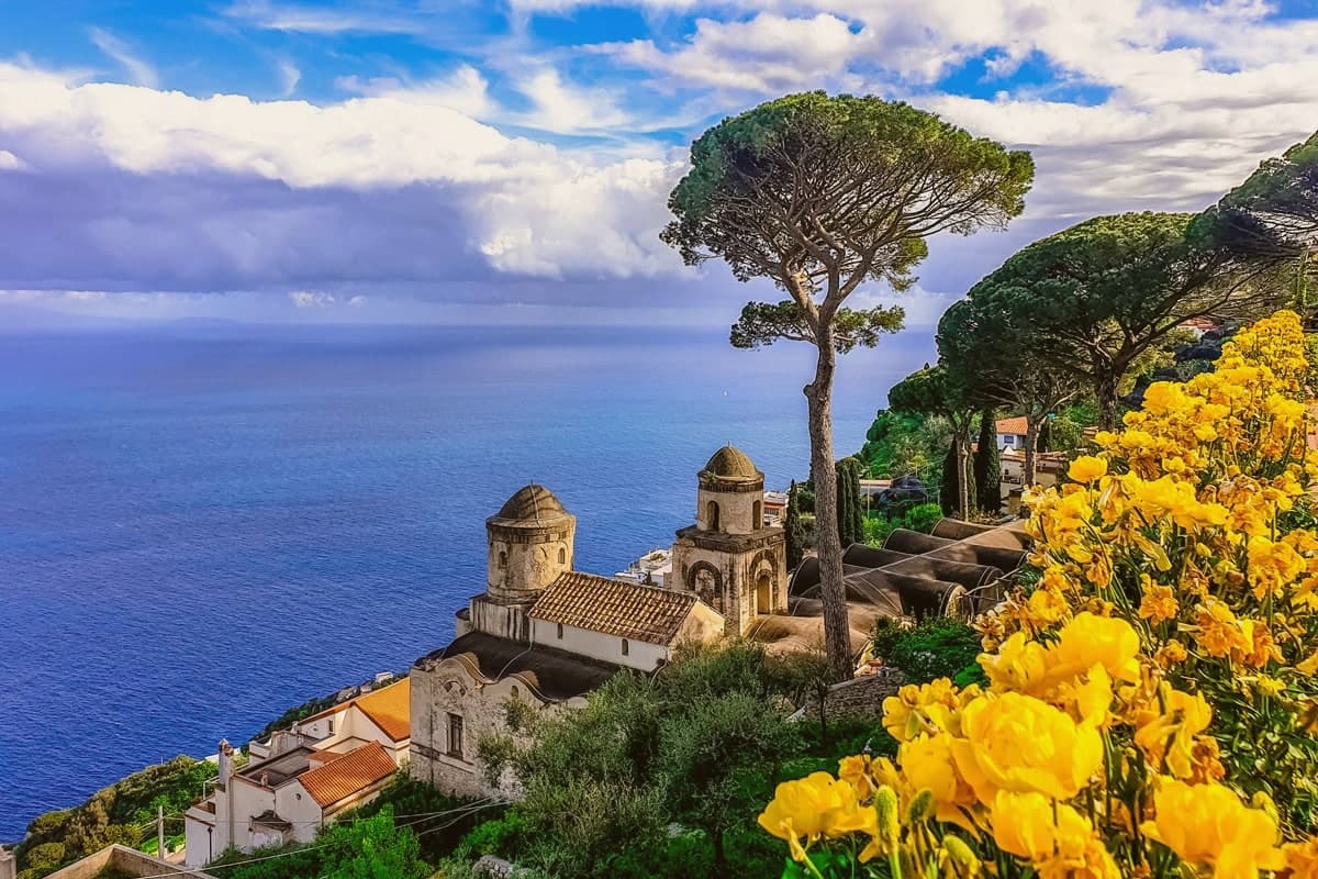
Ravello sits on a spur above the Amalfi Coast, between the valleys of the Dragone and the Reginna Minor, 782 stairs up from Atrani at sea level. The village grew rich in the 12th and 13th centuries as a satellite of the Amalfi maritime republic, when patrician families like the Rufolo, Confalone and d'Afflitto built their houses on the ridge to escape the coastal raids.
The upper village holds the older churches and the social life of the piazza; the villas that made the town's later reputation sit toward the cliff edge, their gardens and belvederes facing the water. One villa's garden was seen by Richard Wagner in 1880 and identified by him with Klingsor's enchanted garden in his opera Parsifal, and he wrote the opera's second act on the strength of it.
The Ravello Festival began playing orchestral concerts in that same garden in 1953, the year the council decided to use Wagner's visit to rebuild a postwar economy. The town's shape, ridge above, stairs down to the coast, patrician houses turned toward the sea, is the record of why families climbed here in the first place and what they built once they had reason to stay.
Rossellinis, Il Flauto di Pan, Belvedere dell'Hotel Caruso and 1 more have been named by a guide.
What to see in Ravello
- Villa Rufolo. Patrician residence built 1270 with Moorish cloister and terraced gardens; setting for the Ravello Festival concerts and the second act of Wagner's Parsifal.
- Villa Cimbrone. Cliff-edge villa restored after 1904 by Lord Grimthorpe, ending in the Terrazza dell'Infinito, a marble belvedere over the Gulf of Salerno.
- Duomo di Ravello. Cathedral on Piazza Vescovado, founded 1086, with the bronze portal cast by Barisano da Trani in 1179 and the marble pulpit signed by Niccolò di Bartolomeo da Foggia in 1272.
How to get to Ravello
Salerno is roughly 33 minutes away by road.
Our tip
May, June, September and early October are the months Ravello reads best. The temperature on the ridge runs three to five degrees cooler than on the coast below, the festival concerts on the Villa Rufolo belvedere run from late June through August, and the gardens are full without the day-tripper bus queues of high summer. July and August fill the SITA bus from Amalfi and the road up the Dragone valley, and the festival's evening concerts under the stars are the reason most overnight visitors come.
Minori
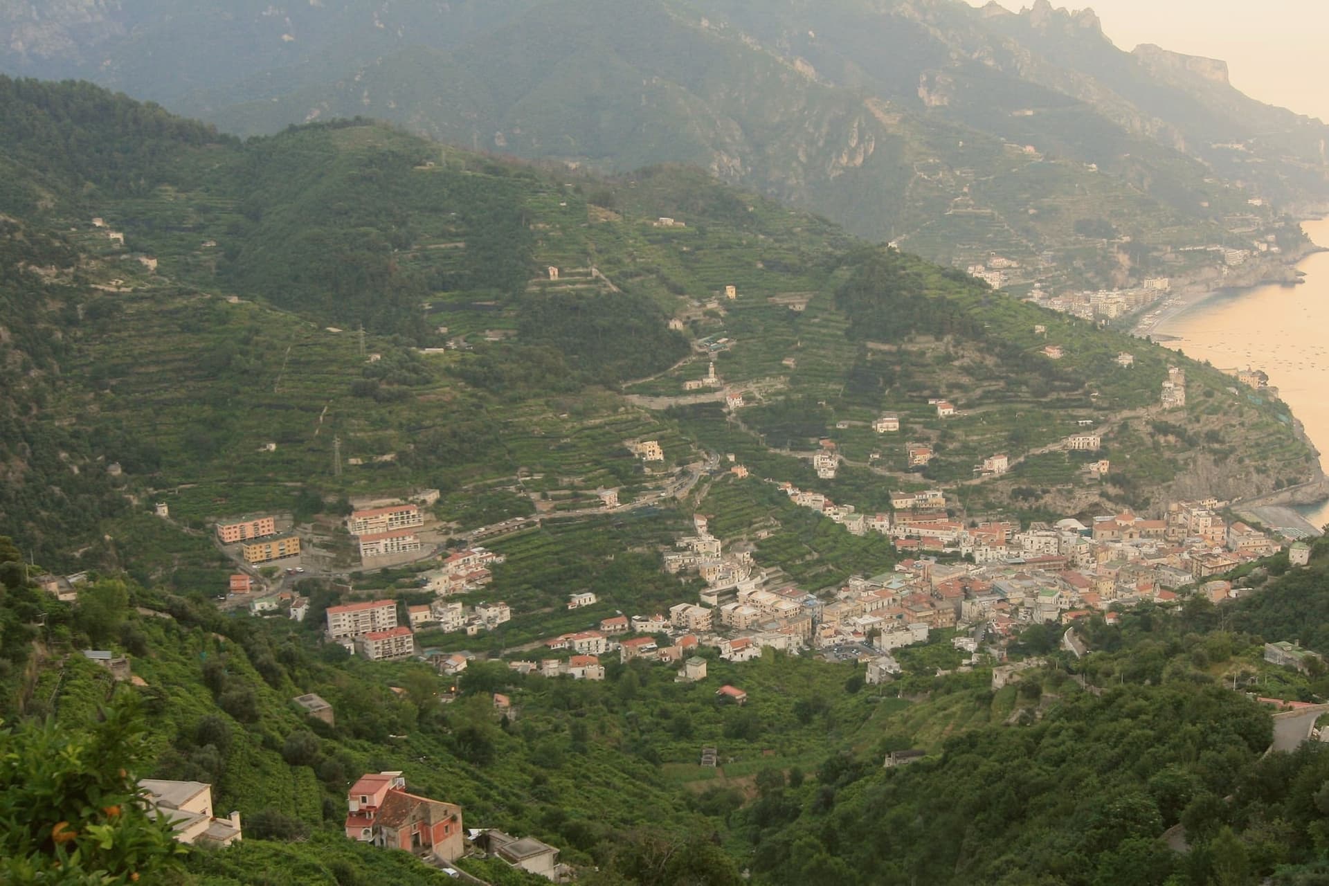
Why visit Minori
Minori sits at sea level on the Amalfi Coast between Maiori and Atrani, named for the Rheginna Minor, the smaller of the two streams that cut down through the cliffs. The Romans built a coastal villa here in the first century; its frescoed cryptoporticus and atrium pool survive almost intact under the modern town, four blocks from the marina.
The Basilica di Santa Trofimena, rebuilt in the eighteenth century after the 987 cathedral was destroyed, holds the saint's relics in a crypt remodeled in the 1700s. The town has the longest unbroken pasta-making tradition on the coast and is the home of Sal De Riso, the pastry chef whose delizia al limone, built in 1978, became the signature dessert of the Costiera.
The Sentiero dei Limoni links Minori uphill to Maiori through working lemon terraces. UNESCO listed the coast in 1997.
What to see in Minori
- Villa Romana Marittima. First-century patrician seaside villa, roughly 2,500 square meters, with frescoed cryptoporticus, atrium and bath complex preserved beneath the modern town.
- Basilica di Santa Trofimena. Eighteenth-century basilica rebuilt after the 987 cathedral was destroyed, with a Latin-cross plan and a crypt holding the relics of the patron saint.
- Marina di Minori. Short pebbled beach at the mouth of the Reginna Minor, lined with pasticcerie and the town's lemon-decorated waterfront.
How to get to Minori
Salerno is roughly 24 minutes away by road.
Our tip
May, June, September and October are the months the coast was built for: open sea, warm water, and lighter crowds than the July and August peak. July and August push past thirty degrees and the Marina di Minori beach fills by ten in the morning; the Villa Romana stays cool because it sits below ground. November through March is winter on the Costiera.
Tramonti
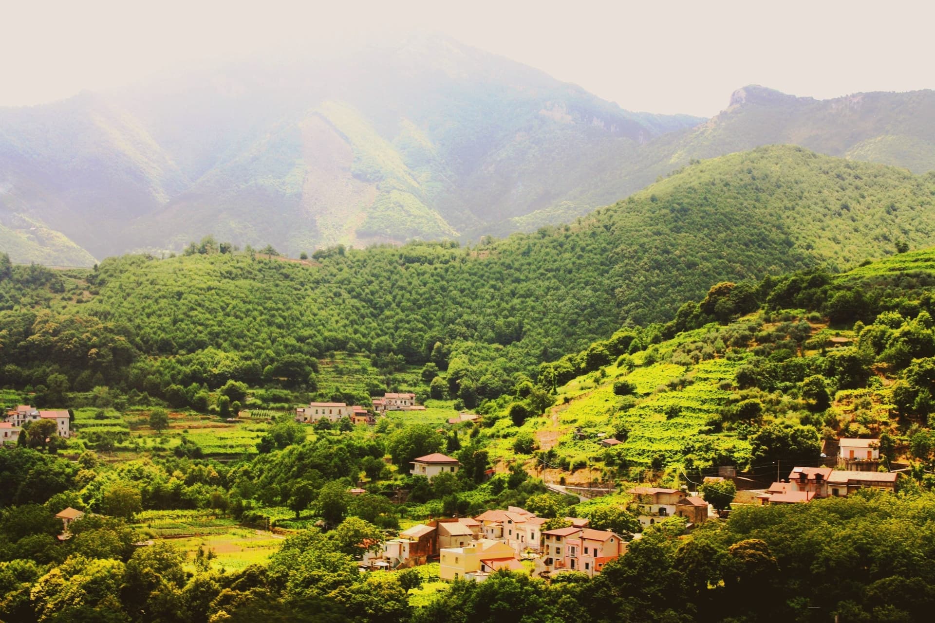
Why visit Tramonti
Tramonti is the Amalfi Coast that does not face the sea. The comune covers thirteen hamlets on the inland Lattari slopes above Maiori, with the seat of Polvica at 321 meters and the higher frazioni climbing past six hundred, each linked by old mule tracks rather than a single main street.
It was an important town of the Maritime Republic of Amalfi between 839 and around 1200, sitting on the inland side of the ridge that divides the coast from the Sorrento peninsula and, by way of the Valico di Chiunzi, from the Sarno valley beyond. Two exports carried the village name further than the village itself: fiordilatte mozzarella from the high pastures, and the long-fermented pizza dough that emigrants took north in the post-war years to found most of the historic pizzerias of Piedmont and Lombardy.
The slopes fall within the UNESCO Amalfi Coast site and the Monti Lattari Park, with chestnut forest and limoncello distilleries on every road. A comune this scattered, with its parishes on separate ridges and its produce known abroad before the place itself, reads less like one town than a federation of hamlets that happened to share a name.
What to see in Tramonti
- Convento di San Francesco. Fourteenth-century Franciscan convent at Polvica with cloister and a rare wooden Christ, founded by Beata Margherita Cigala in 1474.
- Costa d'Amalfi Tramonti DOC vineyards. Terraced parcels climbing the Lattari slopes at a pitch among the steepest viticultures in Italy, worked by hand where machinery cannot stand.
- Thirteen frazioni of Tramonti. Hamlets scattered up the ridges between 250 and 700 meters, each with its own parish and traditions, connected by old mule tracks.
How to get to Tramonti
Salerno is roughly 38 minutes away by road.
Our tip
May through September is the Amalfi calendar, with the inland Lattari side cooler than the coastal road and the vineyard work running into harvest in late September and October. July and August see day-trippers walking up from Maiori for cooler air and lunch; the road to Valico di Chiunzi takes the overflow from Ravello and Amalfi. The chestnut harvest falls in October and November and Pizza a Metro festivals happen in late summer.
Amalfi
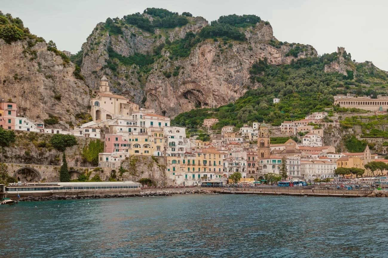
Why visit Amalfi
Amalfi sits at the mouth of a deep gorge in the Lattari mountains, six meters above the sea, four thousand seven hundred and twenty-nine people on a stretch of coast that carries its name. The town was capital of a duchy trading with Byzantium, North Africa and the Levant before Pisa and Venice eclipsed it, and the Tavoliere Amalfitano, drawn up here, codified Mediterranean maritime law in the eleventh century for ships far beyond this shore.
The gorge structures the town as much as the sea does: the centro is stacked on the narrow flat ground at the gorge's mouth, the cathedral staircase climbing straight up from the piazza, while the valley behind runs inland and upward, its stream once turning the wheels of the paper mills before the water reaches the harbour below. Upper gorge and lower marina were parts of one working town, the water dropping from the mills to the boatyards to the sea.
The coast was UNESCO-listed in 1997 and the commune is Cittaslow. What made Amalfi a capital was the same terrain that now makes it a resort: a sheltered cut in the mountains with deep water at its foot, close enough to the sea to build ships and drawn up on to the rock to keep the town off the water's threat.
Pasticceria Pansa Andrea, Glicine, La Caravella dal 1959 and 6 more have been named by a guide.
What to see in Amalfi
- Cattedrale di Sant'Andrea. Romanesque facade at the top of the staircase, with the Chiostro del Paradiso attached to one side, striped stone and interlaced arches around a cloister garden.
- Museo della Carta. Paper museum in the Valle dei Mulini, set inside a thirteenth-century working mill where the machinery for hand-forming sheets is still operated.
- Arsenale della Repubblica. Twelfth-century stone-vaulted shipyard near the marina, the only surviving naval arsenal of the four Italian maritime republics.
How to get to Amalfi
Salerno is roughly 35 minutes away by road.
Our tip
May, June, September and early October are the strongest months. The sea climbs past twenty degrees, the ferries to Capri and Positano run on full schedules, and the SS163 cliff road moves before and after the day-trip peak. July and August are full: the town fills with day-trippers arriving by bus, ferry and private boat, and the duomo steps become a queue between ten and four.
Maiori
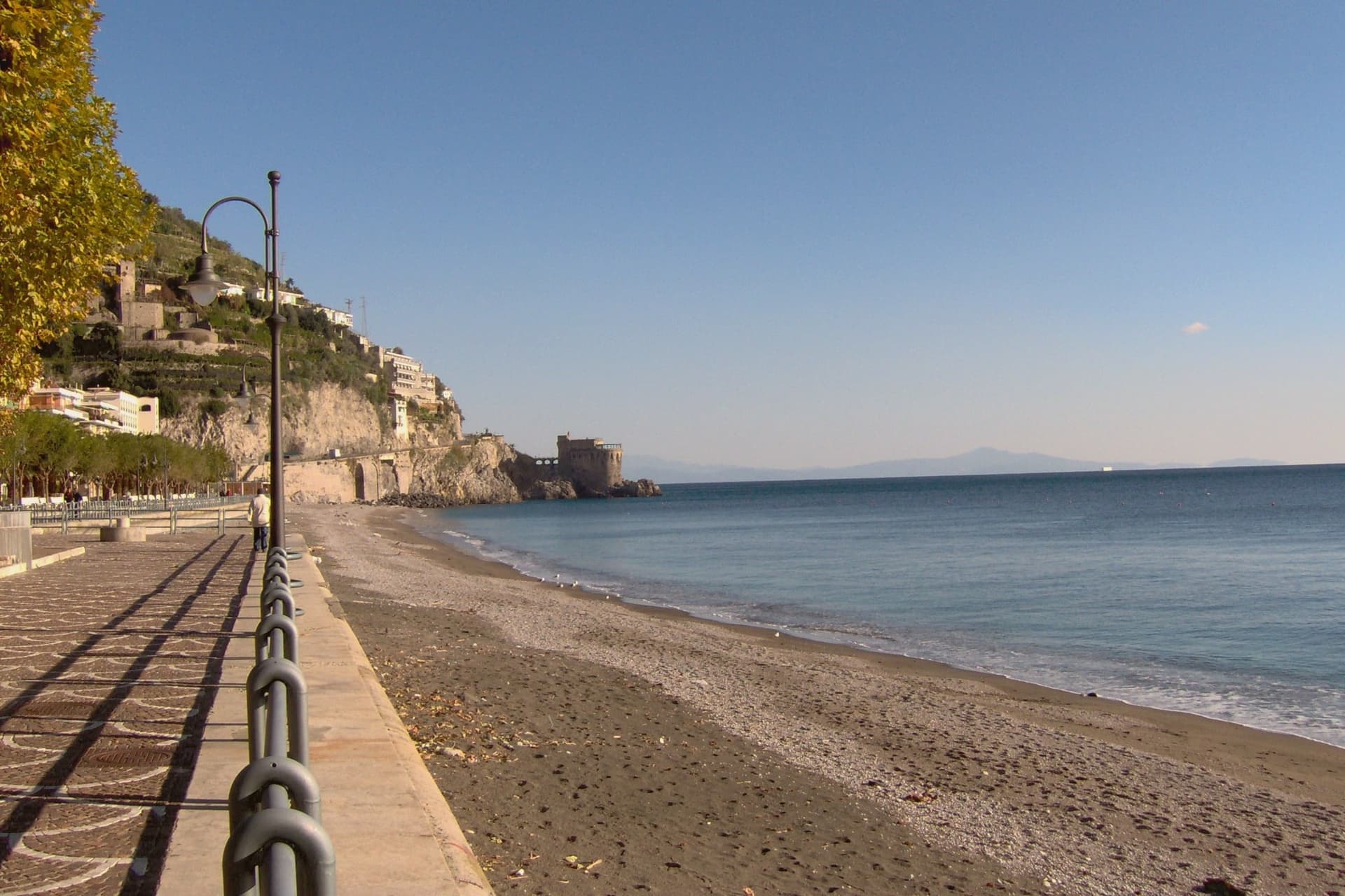
Why visit Maiori
Maiori sits at the mouth of the Reginna torrent between Minori and Cetara, the widest valley on the Amalfi Coast and the only flat ground on the strip. A wall of medieval houses rose up the gorge until the night of 26 October 1954, when a freak storm dropped 500 millimeters of rain on the Lattari ridge in twelve hours.
The torrent swept the centro storico, the lemon terraces and several streets into the sea, killing over 80 people. The town was rebuilt with a rare straight grid behind a kilometer-long beach of volcanic sand, the longest on the coast.
The Castello di San Nicola de Thoro-Plano sits on the ridge above, 11th-century walls part-ruined since the Anjou siege. The Collegiata di Santa Maria a Mare, 13th-century with a green and yellow majolica dome, survived the flood and looks out from the hill.
Roberto Rossellini shot Paisà, Voyage in Italy and Il Miracolo here in the late 1940s.
Oltremare have been named by a guide.
What to see in Maiori
- Collegiata di Santa Maria a Mare. Thirteenth-century parish church on the hill, three-aisle neoclassical interior with gilded coffered ceiling and green-and-yellow majolica dome.
- Castello di San Nicola de Thoro-Plano. Eleventh-century fortress in partial ruin on the ridge above town, with views over the Reginna valley and the coast east to Capo d'Orso.
- Spiaggia di Maiori. Kilometer-long beach of volcanic sand, the longest on the Amalfi Coast, replanted with palms behind the seawall after the 1954 flood.
How to get to Maiori
Salerno is roughly 22 minutes away by road.
Our tip
May, June, September and early October are the months Maiori is set up for. The long beach absorbs more visitors than the cove towns nearby, the SITA bus connects west to Amalfi and east to Salerno, and the Sentiero dei Limoni is open without the heat. July and August fill the kilometer of sand and push every restaurant on the lungomare to two evening shifts.
Vietri sul Mare
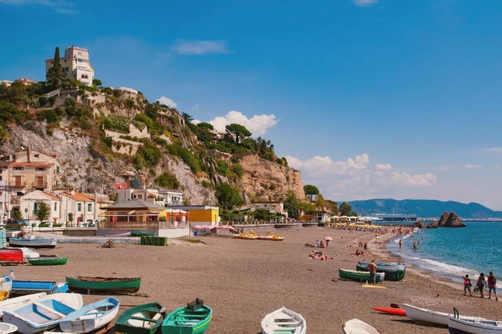
Why visit Vietri sul Mare
Vietri sul Mare sits at 80 meters at the eastern end of the Costiera Amalfitana, the most populous commune of the UNESCO-listed coastline, separated from the port of Salerno by a single harbour wall. The polychrome ceramics tradition is documented from the ninth century, with a generally agreed start around the fifteenth, and the industrial scale-up came in the 1920s and 1930s when a small group of German émigré artists settled in the workshops and brought the bestiary-and-floral pottery the town still produces.
The Chiesa di San Giovanni Battista, sixteenth century, has a green-and-yellow majolica dome that has become the town's signature image. Vietri is the only Amalfi Coast commune that holds Borghi più belli d'Italia and UNESCO together, and is a member of the Città della Ceramica network.
The marina at Marina di Vietri and the cliffside frazione of Raito and Albori sit below and above the centro on the same slope.
Volta del Fuenti by Michele De Blasio, Pascalò have been named by a guide.
What to see in Vietri sul Mare
- Chiesa di San Giovanni Battista. Sixteenth-century parish church with a green-and-yellow majolica dome and a bell tower of polychrome tiles, the most photographed image of the town.
- Museo Provinciale della Ceramica. Ceramic museum in Villa Guariglia at Raito, with Vietri pieces from the seventeenth century through the German-period 1920s and after.
- Albori. Cliffside frazione above the centro, also a Borgo più bello d'Italia, with stone houses, lanes, and views over the Gulf of Salerno.
How to get to Vietri sul Mare
There is a railway station in the town, so you can arrive without a car and never need one while you are here. Salerno is roughly 16 minutes away by road.
Our tip
May, June, September and early October are the strongest months. The water along the Marina di Vietri climbs past twenty degrees, the SS163 west to Cetara and Maiori runs without the gridlock of high summer, and the ceramic workshops keep their full hours. July and August are full: day-trippers arrive from Salerno on the local train and the Marina parking fills before mid-morning.
Pompei
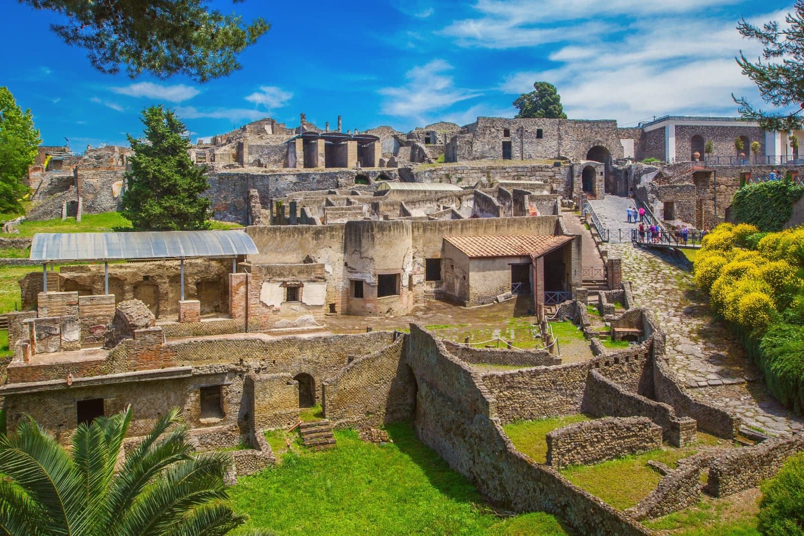
Why visit Pompei
Pompei sits at 30 meters on a volcanic plateau on the south slope of Vesuvius, twenty kilometers from Naples and a hundred meters from where the Sarno meets the sea. The Roman city was buried under five to six meters of ash and lapilli when the volcano erupted on 24 October 79 AD, killing the part of the population that had not already left.
Excavations began in 1748 under the Bourbons and have never stopped; the site has been UNESCO-listed since 1997 alongside Herculaneum and Torre Annunziata, and is the third most visited archaeological site in the world. Modern Pompei was founded in 1881 by the lawyer Bartolo Longo, who built the Santuario della Beata Vergine del Rosario as a center for pilgrimage and social work.
The basilica with its 80-meter campanile and the surrounding grid of streets are entirely a creation of the 1880s, separate from the dig and laid over fields that had been farmland until then.
President, Cosmo Restaurant, Capasanta and 1 more have been named by a guide.
What to see in Pompei
- Parco Archeologico di Pompei. The Roman city buried in 79 AD and excavated since 1748, UNESCO-listed since 1997, with the Forum, the Villa dei Misteri and the Lupanare.
- Santuario della Beata Vergine del Rosario. Pontifical basilica built between 1876 and 1891 by the lawyer Bartolo Longo, the heart of modern Pompei and a pilgrimage site of four million a year.
- Casa del Fauno. Roman patrician house in the dig with a bronze faun at its center and the Alexander Mosaic floor depicting Issus, now in the Naples museum.
How to get to Pompei
There is a railway station in the town, so you can arrive without a car and never need one while you are here. Napoli is roughly 24 minutes away by road.
Our tip
May, June, September and early October are the strongest months for Pompei. The dig opens at nine and the Forum stays walkable before midday heat sets in. July and August are punishing: the site sits on volcanic plateau at thirty meters with no shade in the main streets, and afternoon temperatures cross thirty-five degrees.
More from Anywhere Italy
- The best towns with a World Heritage site within 45 minutes of Salerno
 The best towns known for what they grow within an hour of Naples
- The best towns with a World Heritage site within an hour of Naples
- The 8 best wine towns within 90 minutes of Salerno
- The best coastal towns within an hour of Naples
- The best hidden towns worth staying overnight in Campania