
The best coastal towns worth staying overnight in Toscana
The Tuscan coast is a long, varied stretch of sand, pinewood and rock, and it changes character every hour you drive south. In the north the beaches are wide and flat, ranked with striped umbrellas and backed by the Apuan Alps, whose marble quarries show white against the ridge on clear mornings. Further down, the umbrella pines take over, the sand goes darker, and the water opens onto the Maremma with its buffalo pastures and salt lagoons. Evening is the argument for staying: the beach clubs empty, the seafront restaurants start on the fritto misto and the spaghetti with clams, and a bottle of Vermentino from the coastal vineyards costs less than it does in the hill towns.
Most people arriving in Tuscany go inland instead. Florence, Siena and the Val d'Orcia absorb the great majority of visitors, and in high summer the queue for the Uffizi and the coach parks below San Gimignano make the case for themselves. The coast then gets treated as a day trip, a swim squeezed between museums, with everyone driving back to a hilltop agriturismo before dinner. It is a reasonable plan, and it means the sea is busiest between eleven and four and quiet either side of that.
The same coast keeps going, though, and it has rooms on it. These are towns that sit directly on the water, each with a hotel a travel guide has thought worth naming, which is the practical difference between a beach you visit and a beach you wake up beside. Some are Versilian, formal and pine-shaded, with a promenade and a fish market. Others belong to the Maremma, lower and wilder, where the road runs between the dunes and the lagoon. Worth a detour, and worth the night.
Of the 84 communes we have mapped in Toscana, 7 qualify as coastal towns worth staying overnight: each sits directly on the sea, and each has a hotel a travel guide has vouched for. The smallest, Capalbio, has 3,838 residents.
Elsewhere in the catalogue: The best hidden coastal towns that eat well in Toscana and The best coastal towns within 90 minutes of Florence.
Capalbio
Why visit Capalbio
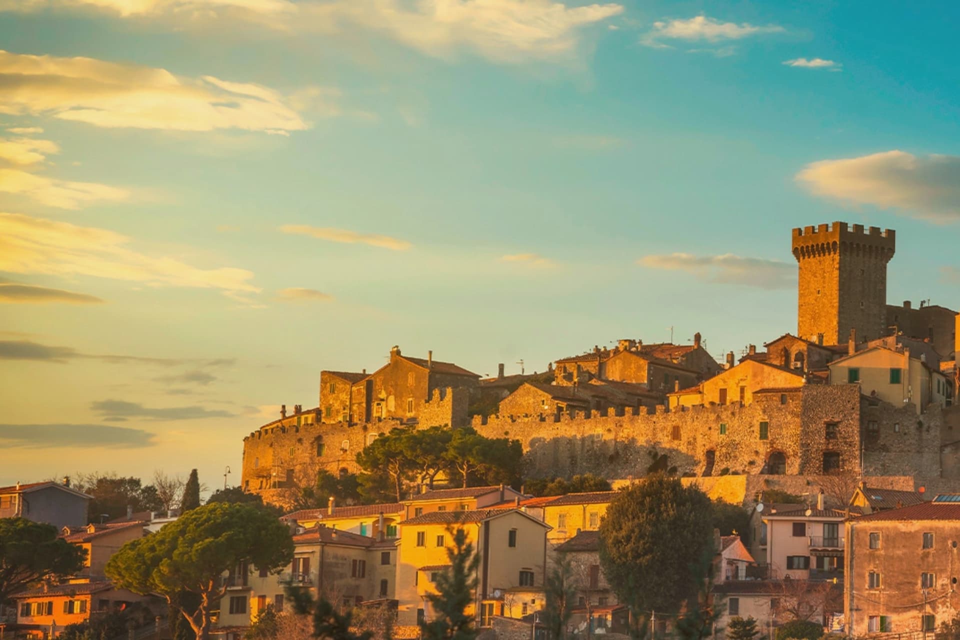
Capalbio stands twelve kilometers from the Tyrrhenian coast, the last hill town before the border with Lazio. Charlemagne gave the land to the Abbey of Tre Fontane in 805; the Aldobrandeschi held it through the medieval period, the Orsini built the castle, and Cosimo I de' Medici took it in 1555.
It became an independent commune in 1960. The medieval walls and the fortress define the centro storico at the top of the hill; the surrounding territory drops from the wooded uplands of Monte Calmata down to the coastal reserve at Lago di Burano.
The sculpture park sits four kilometers south of the walls, apart from the old town rather than within it. A borgo that governed itself late, held by abbey, feudal lords and Medici in turn before its own commune, and a territory that runs in one line from hilltop stone to coastal wetland.
What to see in Capalbio
- Rocca Aldobrandesca. Medieval fortress at the top of the borgo, later expanded by the Orsini, with a square tower and battlements that overlook the Maremma.
- Mura medievali. Two concentric circles of walls enclosing the centro storico, with a walkable parapet that opens onto views toward the Argentario.
- Giardino dei Tarocchi. Sculpture park four kilometers south of the borgo, its ceramic and mirrored figures set among holm oaks.
How to get to Capalbio
There is a railway station in the town, so you can arrive without a car and never need one while you are here. Roma is roughly 108 minutes away by road.
Our tip
May through September is the season the borgo and its territory work together: the centro storico stays cool at 217 meters while the Tyrrhenian coast at Chiarone-Capalbio fills with swimmers. The Giardino dei Tarocchi runs April through October. July and August are hot inland; afternoon hours in the borgo thin out and the coast takes over. Sagra del Cinghiale falls in September.
Forte dei Marmi
Why visit Forte dei Marmi
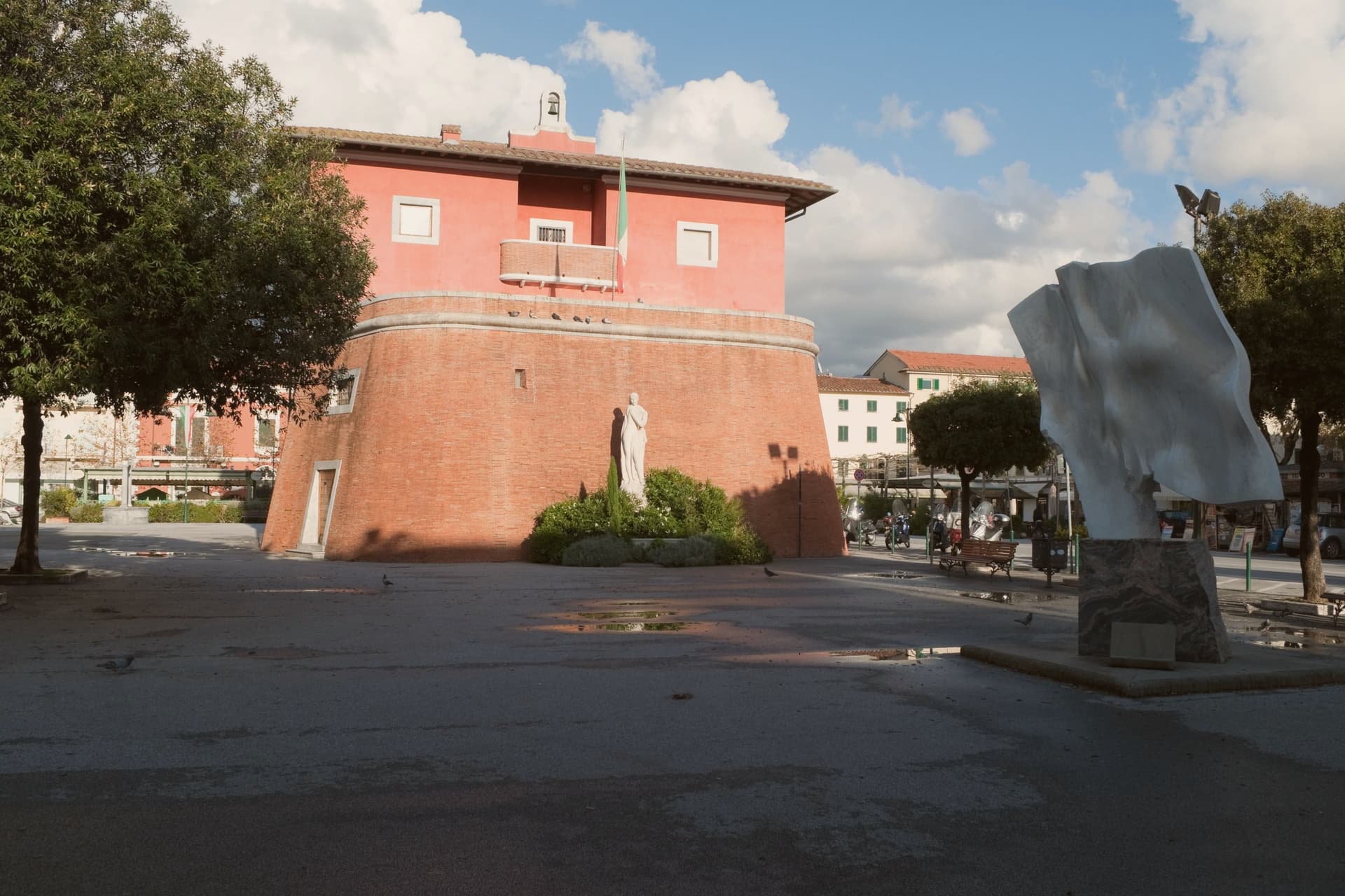
Forte dei Marmi sits at sea level on the Versilia coast, 8.9 square kilometers of flat ground between the Apuan Alps and the Ligurian Sea. The town takes its name from a small fort built in 1788 under Grand Duke Leopold to defend the coast and used through the nineteenth century to stockpile marble shipped down from the Carrara and Seravezza quarries before loading onto ships at the wooden pier.
The Pontile, built between 1867 and 1877, carried tracks and a steam crane for the marble trade and is now the central promenade landmark. The town became a Belle Époque resort in the early twentieth century, then a luxury destination from the 1960s.
Russian buyers arrived in the 1990s, the press named the seafront Piccola Russia, and by 2023 around 99 bagni concessions operate along the beach, the most prestigious cabins renting at over 20,000 euros per season.
The beach here holds the national bathing award, which a comune has to win back every year on water quality, beach management and safety.
What to see in Forte dei Marmi
- Fortino di Leopoldo. The 1788 marble-loading fortress that gave the town its name, on the central piazza, now housing the Museo della Satira e della Caricatura.
- Pontile. Wooden marble-loading pier built between 1867 and 1877, with tracks and a steam crane, now the central seafront promenade.
- Spiaggia di Forte dei Marmi. Wide Versilia Bandiera Blu beach with around 99 bagni concessions running back to the Belle Époque, fine golden sand and the Apuan Alps as backdrop.
How to get to Forte dei Marmi
Pisa is roughly 38 minutes away by road.
Our tip
May through September is the resort season. June and September give the cleanest weather and the calmest beach. July and August fill the bagni to capacity, the seafront restaurants book a month ahead, the Wednesday market gets dense, and the parking on Viale Morin disappears by ten.
Castiglione della Pescaia
Why visit Castiglione della Pescaia
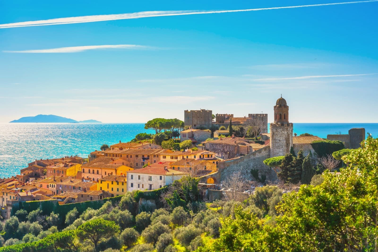
Castiglione della Pescaia sits at sea level on the Maremma coast, north of Grosseto, with a medieval upper town rising on the promontory above the harbor. The site was Roman Salebrone, before that Etruscan and Umbrian, settled because of the lake behind it that the Romans called Portus Traianus.
The lake silted up over time; what remains of it is the wetland reserve southeast of town, a Ramsar site since 1991. The upper town and the harbor below it read as two halves of one settlement: the fortress watching the water from above, the working port beneath, and behind both the flat reclaimed ground where the lake used to be.
Inland and to the east, the hills hold the remains of one of the major Etruscan cities, apart from the coastal life below. North of town, the pine forest gave Calvino his summers and now holds his grave on the hill above the harbor.
The place is built in layers: a silted lake turned nature reserve, a watchtower turned fortress, an Etruscan hill city, and a modern coastline still shaped by all of it.
The beach here holds the national bathing award, which a comune has to win back every year on water quality, beach management and safety. It is also rated for accessibility, which most of this coast is not.
What to see in Castiglione della Pescaia
- Rocca Aragonese. Castle on the promontory above the harbor, 10th-century watchtower core enlarged by Alfonso of Aragon in the 15th century, modified by Cosimo I and the Lorraine.
- Riserva Naturale Diaccia Botrona. Wetland reserve southeast of town with bird-watching hides, pink flamingos and white herons in season.
- Casa Rossa Ximenes. Hydraulic structure built by Jesuit engineer Leonardo Ximenes for the Lorraine drainage works; now multimedia museum of the wetland reserve.
How to get to Castiglione della Pescaia
Livorno is roughly 113 minutes away by road.
Our tip
May and June bring warm sea and quiet beaches, before the high-summer crowds arrive from Rome and Florence. June through September holds the Bandiera Blu and the Diaccia Botrona stays accessible in the cooler hours. July and August push the coast above thirty; Punta Ala and the harbor fill, and the Rocca above the old town becomes a sunset destination. Palio Marinaro di Castiglione della Pescaia falls in August.
Monte Argentario
Why visit Monte Argentario
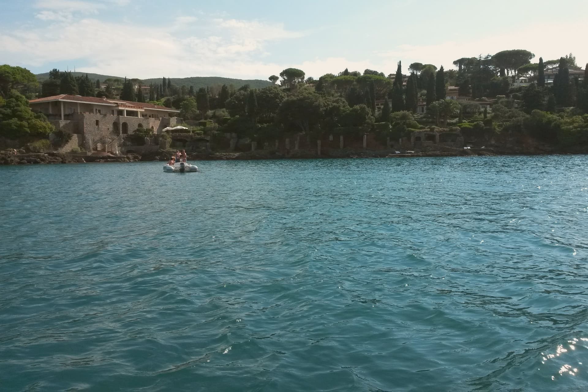
Monte Argentario is a peninsula on the southern Tuscan coast, 35 kilometers south of Grosseto, connected to the mainland by three sand spits that enclose the lagoons of Orbetello. The mountain at its center rises to 635 meters, and the two seats of the comune sit at sea level on opposite sides of it, the northern harbor facing toward Grosseto, the southern one turned toward the open coast below.
The history of the peninsula splits from the rest of Tuscany after 1557, when the territory was carved out of Sienese land and handed to the Spanish crown, which spent the next century and a half fortifying the coastline against corsair raids rather than building the kind of inland towns found elsewhere in the region. The result is a place organized around its edges rather than a center: two ports facing different waters, a mountain of forts between them, and a coastal road that ties the whole shape together for anyone crossing from one harbor to the other.
What the peninsula adds up to is a piece of Tuscany that spent its formative centuries as a Spanish military frontier, and still wears that history in its two-harbor shape and the ring of stone above them.
What to see in Monte Argentario
- Forte Stella. Six-pointed star fort above Porto Ercole, designed for the Spanish by Buontalenti and Camerini and completed in the mid-1600s as part of the Presidi defense system.
- Forte Filippo. Spanish bastioned fortress above Porto Ercole, named for Philip II and built in the late 16th century to protect the Stato dei Presidi from corsair raids.
- Rocca Aldobrandesca, Porto Ercole. Earlier Aldobrandeschi fortress incorporated into the Spanish defense system, dominating the harbor and the old town of Porto Ercole.
How to get to Monte Argentario
There is a railway station in the town, so you can arrive without a car and never need one while you are here. Roma is roughly 137 minutes away by road.
✷ We have written about Monte Argentario
“Everyone driving from Florence down to Rome crosses the Maremma without noticing, because there is nothing on that stretch to make them slow down. The hills give out. The cypresses stop. What opens up instead is flat open country, wheat and grass running off to a few low rises, the least Tuscan-looking part of Tuscany, a landscape you would call dull if you were being honest and which most guidebooks solve by leaving out.”
Read our piece on Monte Argentario →Maremma | The Last Cowboys of Tuscany
Our tip
May through September is the season on the peninsula. Porto Santo Stefano and Porto Ercole fill in July and August; the Palio Marinaro on August 15 doubles the population of Porto Santo Stefano for a single afternoon. June and September are the easiest months, with warm water and fewer day-trippers. Palio Marinaro dell'Argentario falls in August.
Camaiore
Why visit Camaiore
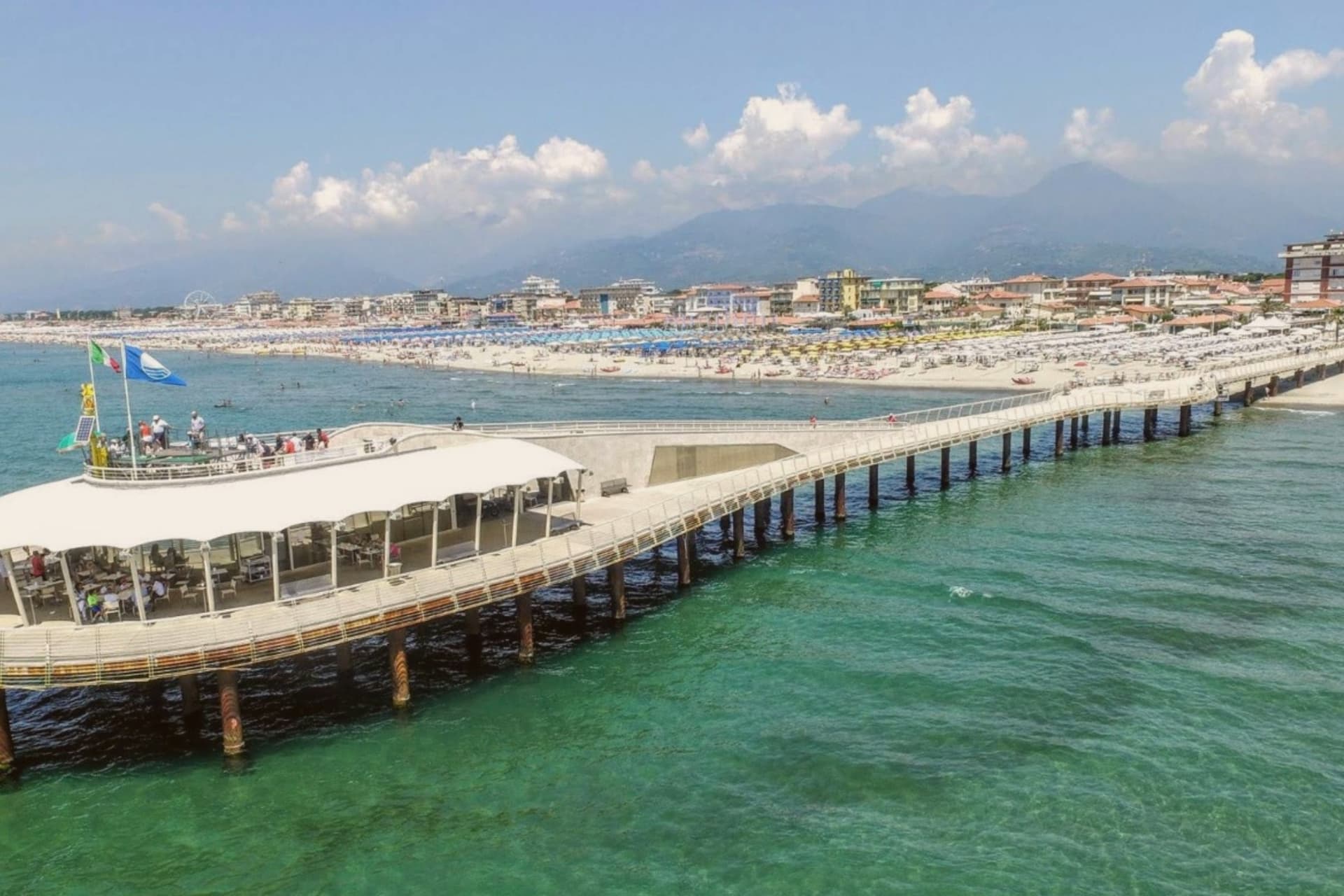
Camaiore stretches from the Apuan Alps to the Versilia coastline, the only Versilia commune with substantial territory in both. The town center sits at 34 meters on the alluvial plain, named Campus Maior by the Romans for a military encampment on the road from Lucca to Luni.
That name and that road explain the town's shape: a fixed inland center built around the Collegiata and the medieval grid, connected by the Via Francigena to a coast six kilometers away that the Romans never had reason to build toward. The inland town and the beach at Lido di Camaiore function as two settlements under one name, joined by the road rather than by contiguous streets, with the Apuan Alps visible from the shore as the backdrop to both.
A commune this shape, mountain territory, a Roman road town, and a beach at the end of it, holds together not because its parts resemble each other but because each has stayed distinct while remaining reachable from the others.
The beach here holds the national bathing award, which a comune has to win back every year on water quality, beach management and safety.
What to see in Camaiore
- Collegiata di Santa Maria Assunta. Thirteenth-century parish church with a fourteenth-century bell tower, the central religious building of the inland town.
- Badia di San Pietro. The church stands alone now, a single Romanesque nave where a monastery once stood, its stone unadorned in the way that marks the Lombard-era Benedictine houses of the region.
- Lido di Camaiore. Fine sand six kilometers from the town center, with the Apuan Alps rising directly behind it, mountain and shoreline visible in the same view.
How to get to Camaiore
There is a railway station in the town, so you can arrive without a car and never need one while you are here. Pisa is roughly 44 minutes away by road.
✷ We have written about Camaiore
“I watched eight old men stand up at once, and something in me quietly rearranged itself. They had been sitting at Caffè Celero on Piazza San Bernardino for most of an hour, maybe longer, doing what men over sixty do on an Italian piazza, which is nothing, but nothing done carefully and particularly.”
Read our piece on Camaiore →I Could Get Old Here
Our tip
May through September runs the Versilia season at the Lido and gives the inland town its share of light evenings. June and September are the quieter brackets: warm enough for the sea, cool enough to walk the Francigena stages without losing the morning. July and August fill the Lido with families from Lucca and Milan, parking gets tight, and the inland piazze stay calmer than the seafront.
Viareggio
Why visit Viareggio
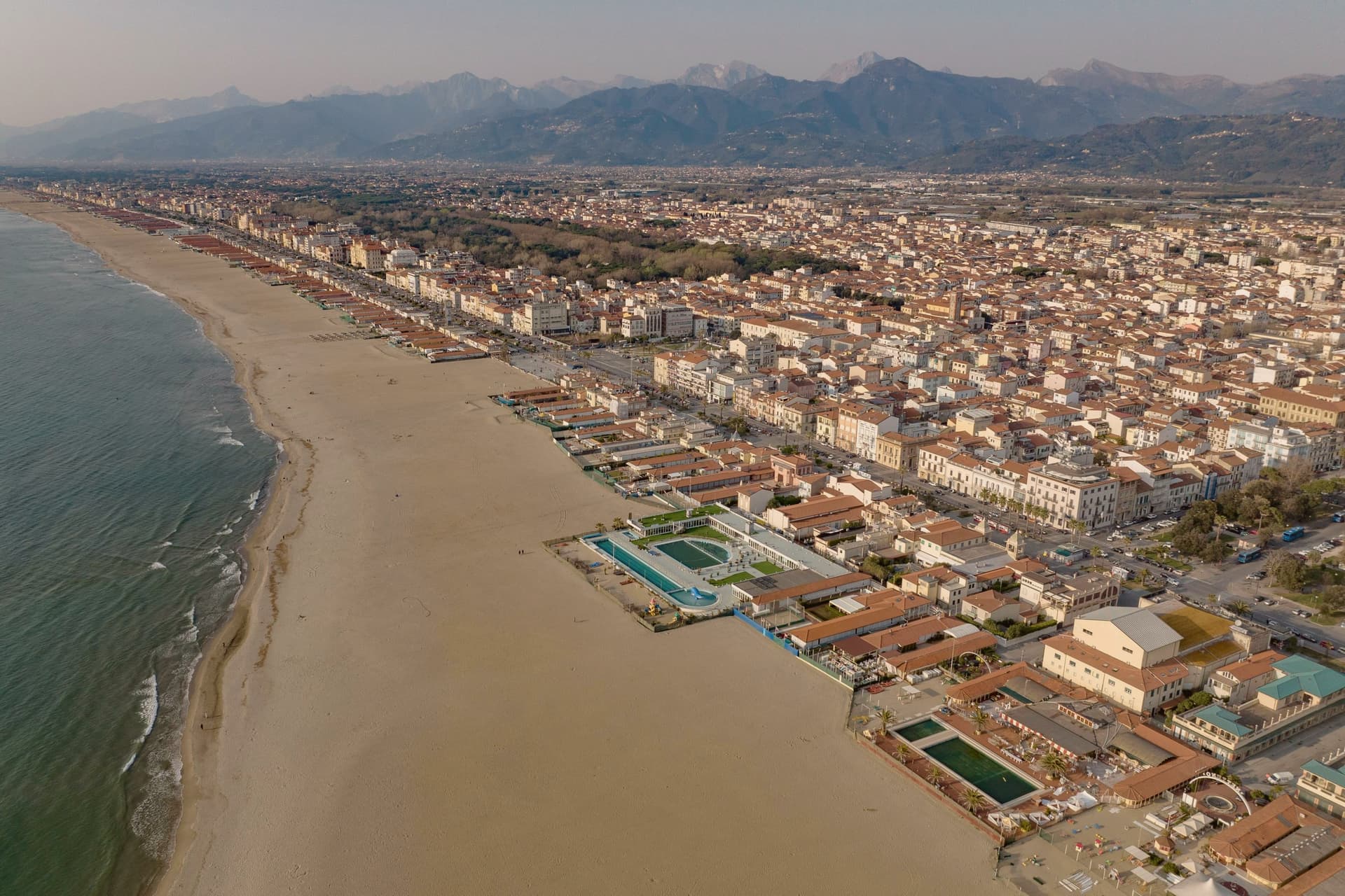
Viareggio sits at sea level on the Versilia coastal plain, the largest commune on the Tuscan riviera. The first parade ran in 1873, organized by middle-class residents as a float procession down the seafront; the masked protest against tax policy that followed gave the event its character.
The mascot's colour scheme, red and white, was taken from the beach umbrellas that line the shore, a detail that ties the Carnival's invented figure back to the town's own beach culture rather than to any outside tradition. The rail link to Lucca and Florence arrived in 1890, and the city turned into a Belle Époque resort in response: the seafront was rebuilt in the ornamented style of that era over the following decades.
The Magazzini Duilio 48 along Viale Margherita, together with the promenade's other survivors, mark out where that resort-era rebuilding is still legible today. The city's two identities sit side by side on the same stretch of shore: one built by a rail-borne resort economy, the other by a homegrown winter festival that turned into the town's defining export.
The beach here holds the national bathing award, which a comune has to win back every year on water quality, beach management and safety.
What to see in Viareggio
- Passeggiata Liberty. Three-kilometer Belle Époque seafront promenade lined with Stile Liberty villas, cafés and bath houses built between 1890 and 1925.
- Cittadella del Carnevale. Sixteen vast hangars where the papier-mâché floats are built year-round, with the Museo del Carnevale and the float-construction workshops open to visitors.
- Spiaggia di Viareggio. Ten-kilometer Bandiera Blu beach lined with the original bagni concessions of the Belle Époque, fine sand and shallow seabed.
How to get to Viareggio
There is a railway station in the town, so you can arrive without a car and never need one while you are here. Pisa is roughly 29 minutes away by road.
✷ We have written about Viareggio
“The bike lane starts at the bottom of Lido di Camaiore and runs south along the coast for about eight kilometers before it hits the pier at Viareggio, and the thing it teaches you, if you ride it often enough, is that Viareggio is a city you should almost always see from the saddle of a bicycle and never, if you can help it, from the pavement. The pavement has the crowd on it. The bike lane has the city.”
Read our piece on Viareggio →Viareggio | The cat at the end of the road
Our tip
May through September runs the season. June and September are calmer than the July-August peak when the beach concessions sell out and the parking on Lungomare fills by ten. February brings Carnival weekends and the largest crowds of the year for the parades along Viale Manin and Viale Margherita; the floats run through a full Sunday route. Sagra sul Sagrato in autunno falls in the season.
Pisa
Why visit Pisa
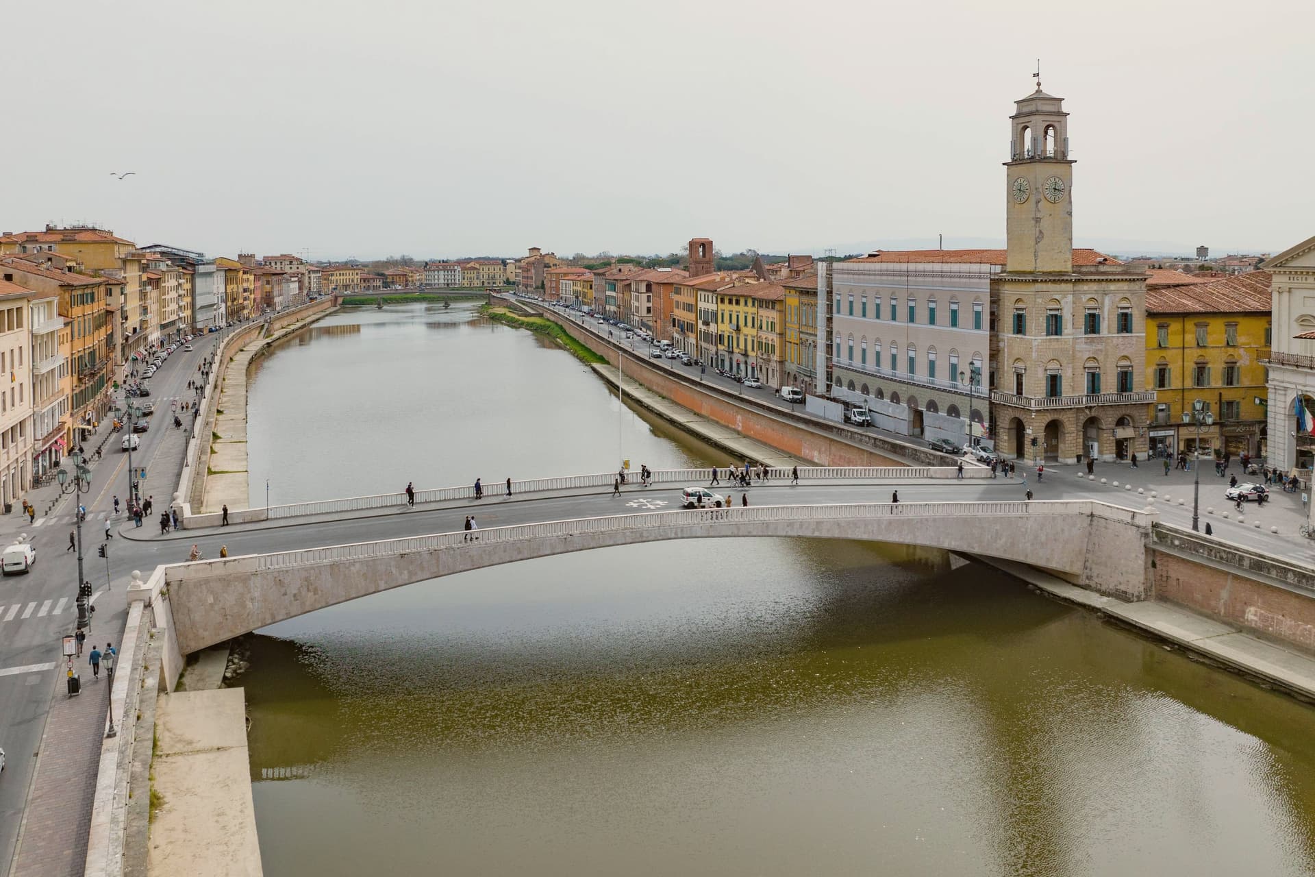
The Arno reaches the Ligurian Sea twelve kilometers past the city, and the river is what built it: an Arsenal on its banks built galleys for the Crusades, and Mediterranean trade paid for the walled compound northwest of the centro. That compound, inscribed by UNESCO as one of the first Italian sites in 1987, gathers four buildings of the same Pisan Romanesque school in one field, the cathedral, the baptistery, the cemetery cloister and the bell tower, close enough to read as a single composition rather than a set of monuments visited separately.
The city has a second center away from that field. Piazza dei Cavalieri became the Medici political seat after the republic fell, and the university founded in 1343 keeps both squares populated with people who live and work there rather than pass through.
The Lungarni tie the two halves together physically, two quays following the river on both banks, lined with palazzi spanning the twelfth to the nineteenth century. What this adds up to is a town built in two unequal pieces: a religious and civic compound frozen at its medieval peak, and a working river city around it that never stopped adding centuries to its banks.
The beach here holds the national bathing award, which a comune has to win back every year on water quality, beach management and safety.
What to see in Pisa
- Torre Pendente. Finished 1372, two centuries after it began, the lean is visible from ground level without needing to climb it, south of vertical against the other three white buildings of the square.
- Duomo di Pisa. Pisan Romanesque cathedral begun 1064 by Buscheto, financed from the Mediterranean trade, with bronze doors by Bonanno Pisano and a pulpit by Giovanni Pisano.
- Battistero di San Giovanni. Largest baptistery in Italy at 54.86 meters tall, begun 1152, Romanesque base and Gothic upper level, with a pulpit by Nicola Pisano.
How to get to Pisa
There is a railway station in the town, so you can arrive without a car and never need one while you are here. Pisa is roughly 16 minutes away by road.
✷ We have written about Pisa
“It was a Tuesday in January, ten degrees, the kind of soft grey Tuscan winter rain that does not quite commit to being rain, and what we wanted, in a way that surprised both of us, was a bowl of Japanese noodle soup. The nearest place to get one was Pisa.”
Read our piece on Pisa →Pisa | Beyond the Tower
Our tip
May, June, September and October are the months when the Lungarni are at their best, the temperature stays in the twenties, and the lines at Piazza dei Miracoli compress by mid-afternoon. The Luminara di San Ranieri, on 16 June, lights the riverbank with eighty thousand candles and is the night the city sees most. July and August are hot and humid, with the day-tripper waves from cruise ships at Livorno filling the compound from morning. Gioco del Ponte falls in June.
More from Anywhere Italy
 The best hidden coastal towns that eat well in Toscana
- The best coastal towns within 90 minutes of Florence
 The best coastal towns in the province of Grosseto
 The best coastal towns that eat well within 90 minutes of Pisa
- The 6 best coastal towns inside a nature park in Toscana
 The best hidden coastal towns you can reach by train in Toscana