
The best coastal towns in the province of Grosseto
The Tuscan coast changes character south of the Ombrone. Umbrella pines give way to macchia scrub, the sand runs long and pale, and the hills behind it are grazing country, with Maremmana cattle and butteri who still work them. Kitchens here lean on the sea and the lagoon together: grey mullet, eels, acquacotta, fish soup thickened with stale bread, bottarga cured from the mullet roe. Late spring and September are the sensible seasons, when the water is warm, the mosquitoes have thinned, and the tufa towns inland are cool enough to walk.
Most people who come to the Tuscan seaside go north instead, to Forte dei Marmi and the Versilia, where the beach clubs are booked by the row and the promenade fills from June to the end of August. It is the coast with the train station, the designer shops and the marble mountains behind it, and it has been the summer address of Milanese and Florentine families for generations. That reputation is earned. It also means traffic on the Aurelia, full car parks and a queue for the same stretch of sand.
The same sea keeps going south. Past Grosseto the shoreline breaks into a lagoon walled by two sandy spits, a mountainous promontory of granite and holm oak, an island of vineyards and coves reachable by ferry, and stretches of pinewood where the beach is reached on foot rather than through a gate. Fewer people go, and the towns below sit directly on that water.
Of the 10 communes we have mapped in the province of Grosseto, 6 qualify as coastal towns: each sits directly on the sea. The smallest, Isola del Giglio, has 1,330 residents.
Elsewhere in the catalogue: A 7-day trip through the Tuscan Maremma, based in Grosseto and The best hidden coastal towns that eat well in Toscana.
Isola del Giglio
Why visit Isola del Giglio
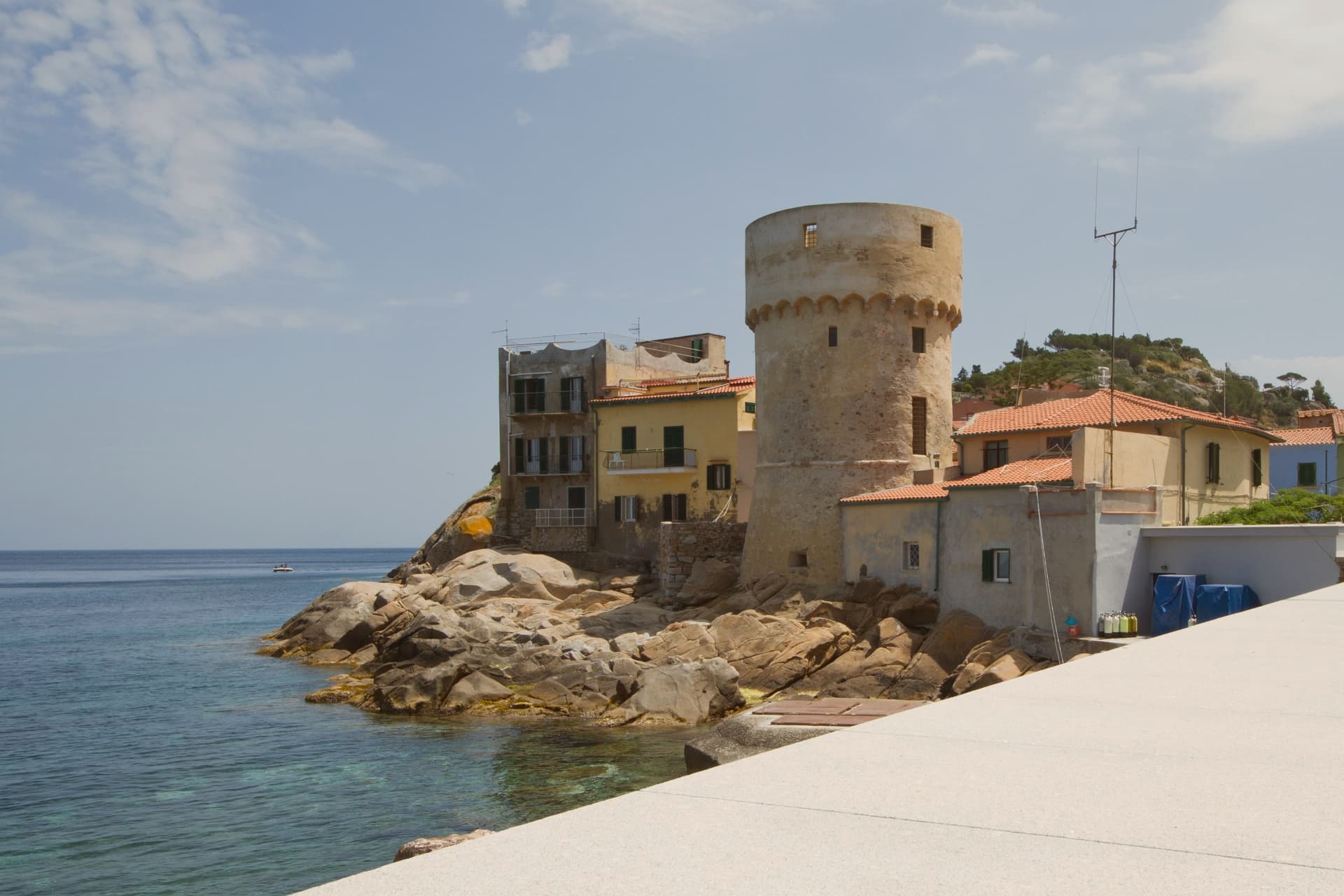
Isola del Giglio is the second-largest island in the Tuscan Archipelago, almost entirely granite, the highest point at Poggio della Pagana 496 meters above the sea. The commune has three inhabited frazioni: Giglio Porto on the eastern coast, where the ferries from Porto Santo Stefano dock; Giglio Castello on the central ridge at around 405 meters, the walled medieval village and administrative center; and Giglio Campese on the western bay, a 1960s seaside resort built on an old pyrite mine closed in 1964.
Charlemagne gave the island to the abbey of Tre Fontane in 805. It was Pisan from 1264, ceded to Antonio Piccolomini in the fifteenth century, then passed to the Medici in 1558.
Saracen raids continued until 1799. The wreck of the Costa Concordia on the night of 13 January 2012 killed thirty-two people and held the world's attention until the ship was righted, refloated and towed to Genoa in July 2014.
What to see in Isola del Giglio
- Giglio Castello. Walled medieval village on the ridge at around 405 meters, with intact mura and the Rocca Aldobrandesca, the administrative center of the island.
- Giglio Porto. Main harbor of the island on the east coast, with the colored houses around the small ferry dock and the lighthouse of Capel Rosso to the south.
- Giglio Campese. Largest bay and sandy beach of the island on the west coast, with the medieval Torre del Campese and the disused pyrite mine on the headland.
How to get to Isola del Giglio
Our tip
May through September is the only practical season for Giglio. The ferries from Porto Santo Stefano run on a full schedule, the beaches at Campese and the smaller coves work, and the temperature in Castello on the ridge stays manageable through August. July and August are crowded with mainland day-trippers; the island roughly doubles in population. Festa dell'Uva e delle Cantine falls in September.
Capalbio
Why visit Capalbio
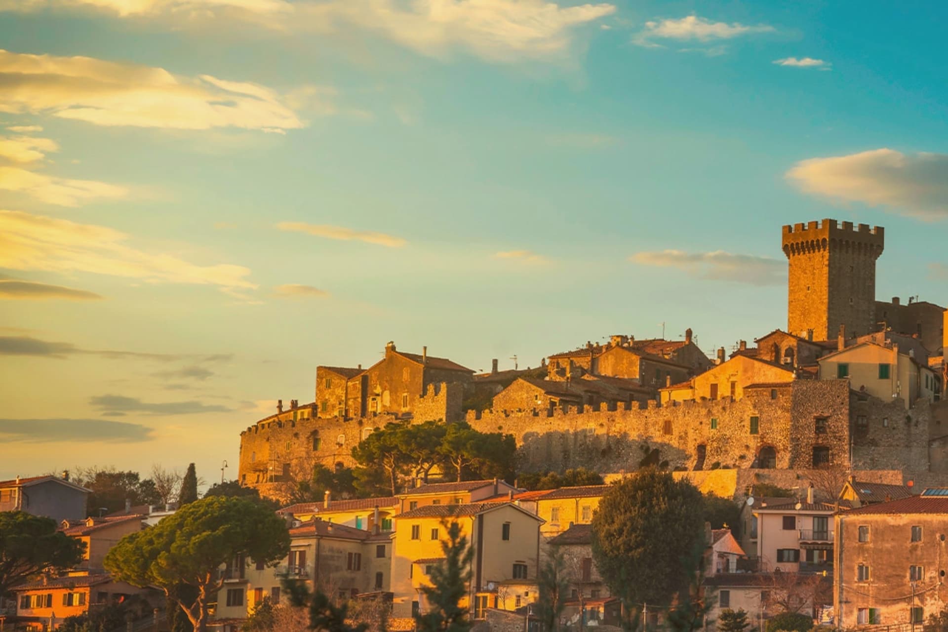
Capalbio stands twelve kilometers from the Tyrrhenian coast, the last hill town before the border with Lazio. Charlemagne gave the land to the Abbey of Tre Fontane in 805; the Aldobrandeschi held it through the medieval period, the Orsini built the castle, and Cosimo I de' Medici took it in 1555.
It became an independent commune in 1960. The medieval walls and the fortress define the centro storico at the top of the hill; the surrounding territory drops from the wooded uplands of Monte Calmata down to the coastal reserve at Lago di Burano.
The sculpture park sits four kilometers south of the walls, apart from the old town rather than within it. A borgo that governed itself late, held by abbey, feudal lords and Medici in turn before its own commune, and a territory that runs in one line from hilltop stone to coastal wetland.
What to see in Capalbio
- Rocca Aldobrandesca. Medieval fortress at the top of the borgo, later expanded by the Orsini, with a square tower and battlements that overlook the Maremma.
- Mura medievali. Two concentric circles of walls enclosing the centro storico, with a walkable parapet that opens onto views toward the Argentario.
- Giardino dei Tarocchi. Sculpture park four kilometers south of the borgo, its ceramic and mirrored figures set among holm oaks.
How to get to Capalbio
There is a railway station in the town, so you can arrive without a car and never need one while you are here. Roma is roughly 108 minutes away by road.
Our tip
May through September is the season the borgo and its territory work together: the centro storico stays cool at 217 meters while the Tyrrhenian coast at Chiarone-Capalbio fills with swimmers. The Giardino dei Tarocchi runs April through October. July and August are hot inland; afternoon hours in the borgo thin out and the coast takes over. Sagra del Cinghiale falls in September.
Castiglione della Pescaia
Why visit Castiglione della Pescaia
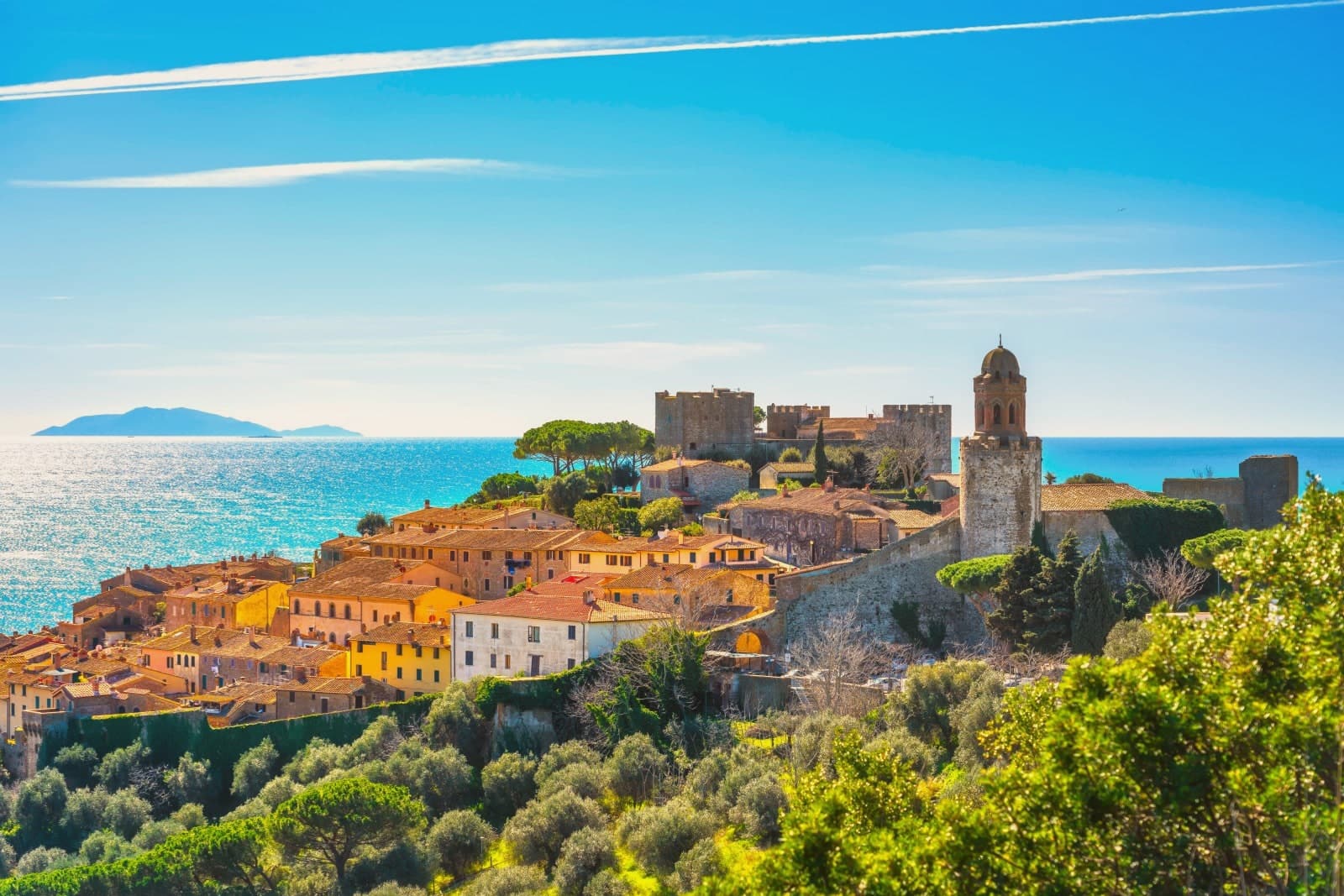
Castiglione della Pescaia sits at sea level on the Maremma coast, north of Grosseto, with a medieval upper town rising on the promontory above the harbor. The site was Roman Salebrone, before that Etruscan and Umbrian, settled because of the lake behind it that the Romans called Portus Traianus.
The lake silted up over time; what remains of it is the wetland reserve southeast of town, a Ramsar site since 1991. The upper town and the harbor below it read as two halves of one settlement: the fortress watching the water from above, the working port beneath, and behind both the flat reclaimed ground where the lake used to be.
Inland and to the east, the hills hold the remains of one of the major Etruscan cities, apart from the coastal life below. North of town, the pine forest gave Calvino his summers and now holds his grave on the hill above the harbor.
The place is built in layers: a silted lake turned nature reserve, a watchtower turned fortress, an Etruscan hill city, and a modern coastline still shaped by all of it.
The beach here holds the national bathing award, which a comune has to win back every year on water quality, beach management and safety. It is also rated for accessibility, which most of this coast is not.
What to see in Castiglione della Pescaia
- Rocca Aragonese. Castle on the promontory above the harbor, 10th-century watchtower core enlarged by Alfonso of Aragon in the 15th century, modified by Cosimo I and the Lorraine.
- Riserva Naturale Diaccia Botrona. Wetland reserve southeast of town with bird-watching hides, pink flamingos and white herons in season.
- Casa Rossa Ximenes. Hydraulic structure built by Jesuit engineer Leonardo Ximenes for the Lorraine drainage works; now multimedia museum of the wetland reserve.
How to get to Castiglione della Pescaia
Livorno is roughly 113 minutes away by road.
Our tip
May and June bring warm sea and quiet beaches, before the high-summer crowds arrive from Rome and Florence. June through September holds the Bandiera Blu and the Diaccia Botrona stays accessible in the cooler hours. July and August push the coast above thirty; Punta Ala and the harbor fill, and the Rocca above the old town becomes a sunset destination. Palio Marinaro di Castiglione della Pescaia falls in August.
Monte Argentario
Why visit Monte Argentario
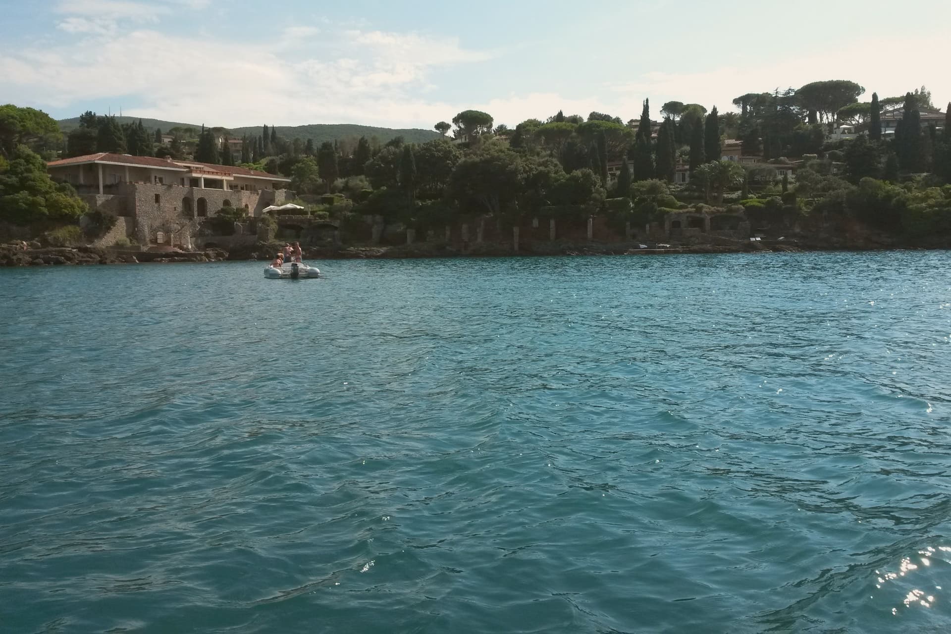
Monte Argentario is a peninsula on the southern Tuscan coast, 35 kilometers south of Grosseto, connected to the mainland by three sand spits that enclose the lagoons of Orbetello. The mountain at its center rises to 635 meters, and the two seats of the comune sit at sea level on opposite sides of it, the northern harbor facing toward Grosseto, the southern one turned toward the open coast below.
The history of the peninsula splits from the rest of Tuscany after 1557, when the territory was carved out of Sienese land and handed to the Spanish crown, which spent the next century and a half fortifying the coastline against corsair raids rather than building the kind of inland towns found elsewhere in the region. The result is a place organized around its edges rather than a center: two ports facing different waters, a mountain of forts between them, and a coastal road that ties the whole shape together for anyone crossing from one harbor to the other.
What the peninsula adds up to is a piece of Tuscany that spent its formative centuries as a Spanish military frontier, and still wears that history in its two-harbor shape and the ring of stone above them.
What to see in Monte Argentario
- Forte Stella. Six-pointed star fort above Porto Ercole, designed for the Spanish by Buontalenti and Camerini and completed in the mid-1600s as part of the Presidi defense system.
- Forte Filippo. Spanish bastioned fortress above Porto Ercole, named for Philip II and built in the late 16th century to protect the Stato dei Presidi from corsair raids.
- Rocca Aldobrandesca, Porto Ercole. Earlier Aldobrandeschi fortress incorporated into the Spanish defense system, dominating the harbor and the old town of Porto Ercole.
How to get to Monte Argentario
There is a railway station in the town, so you can arrive without a car and never need one while you are here. Roma is roughly 137 minutes away by road.
✷ We have written about Monte Argentario
“Everyone driving from Florence down to Rome crosses the Maremma without noticing, because there is nothing on that stretch to make them slow down. The hills give out. The cypresses stop. What opens up instead is flat open country, wheat and grass running off to a few low rises, the least Tuscan-looking part of Tuscany, a landscape you would call dull if you were being honest and which most guidebooks solve by leaving out.”
Read our piece on Monte Argentario →Maremma | The Last Cowboys of Tuscany
Our tip
May through September is the season on the peninsula. Porto Santo Stefano and Porto Ercole fill in July and August; the Palio Marinaro on August 15 doubles the population of Porto Santo Stefano for a single afternoon. June and September are the easiest months, with warm water and fewer day-trippers. Palio Marinaro dell'Argentario falls in August.
Orbetello
Why visit Orbetello
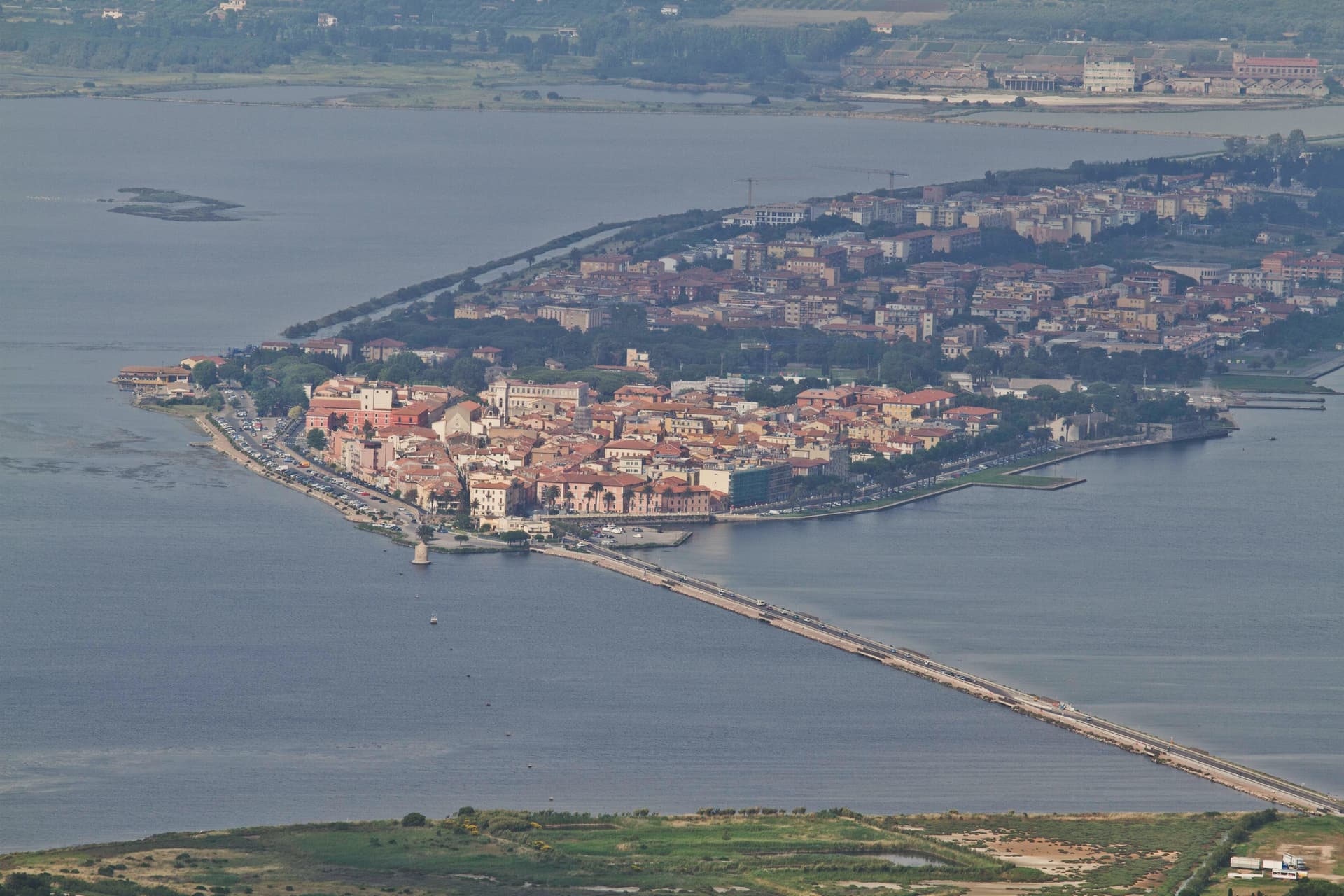
The isthmus runs out into the lagoon and splits it into two basins, Ponente and Levante. Two sand tombolos close the shape from either side: Giannella to the north, Feniglia to the south, both reaching toward the Monte Argentario promontory and meeting it at either end.
The Etruscans settled the site first, the Romans followed with their colony of Cosa nearby, and centuries later the Spanish took the isthmus as the seat of their coastal enclave, leaving the Governor's Palace on the main square where it still stands. Of the nine Sienese windmills once built out in the water, one remains in place, the only Italian water-and-wind mill of its type still fixed where it was built.
The lagoon that once carried Balbo's flying boats out toward Rio and Chicago now carries a WWF reserve and the nets of a bottarga and eel cooperative working the same waters since 1965. A town built on the water it is named for, held between two arms of sand and one mountain it never quite touches.
The beach here holds the national bathing award, which a comune has to win back every year on water quality, beach management and safety.
What to see in Orbetello
- Duomo di Santa Maria Assunta. Fourteenth-century cathedral with a Gothic travertine façade, rebuilt over an earlier Etruscan-Roman temple foundation.
- Fortificazioni Spagnole. The bastions and the Polveriera Guzman magazine, still standing along the edges of the historic center.
- Laguna di Orbetello. The brackish water splits into two basins and is now a WWF reserve and Ramsar wetland.
How to get to Orbetello
There is a railway station in the town, so you can arrive without a car and never need one while you are here. Roma is roughly 124 minutes away by road.
Our tip
May through September is when the lagoon and the Feniglia and Giannella beaches do their work. June brings the migratory bird count back up: flamingos, herons, avocets. July and August push temperatures over thirty degrees and the tombolos fill with Roman day-trippers, so the lagoon path on the Ponente side stays the quieter option. Sagra del Pesce di Albinia falls in the season.
Grosseto
Why visit Grosseto
Grosseto sits on the right bank of the Ombrone, ten meters above sea level and twelve kilometers inland from the Tyrrhenian. The Roman city of Roselle was destroyed in 935 by Saracen pirates; refugees regrouped on the plain below and Grosseto inherited the bishopric.
From 1336 it was Sienese; in 1559 it passed to the Medici after the battle of Montalcino. Cosimo I commissioned Baldassarre Lanci to replace the medieval walls with a hexagonal bastioned circuit, begun in 1565 and finished a decade later.
The walls are intact. Six bastions, two main gates, a continuous earthwork four kilometers around, now planted and used as the city's promenade.
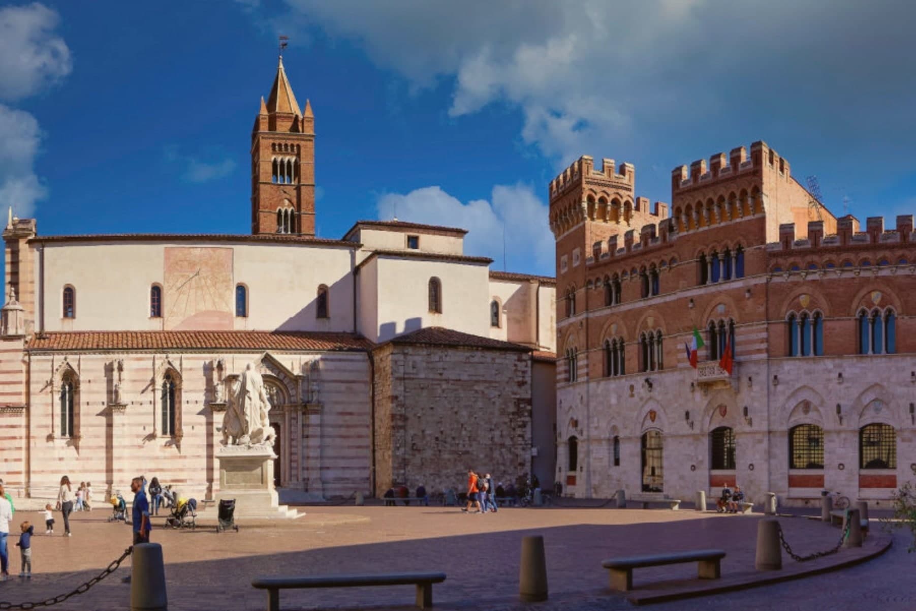
Inside, the Duomo di San Lorenzo holds a Romanesque-Gothic façade in alternating white and pink marble. The Cassero Senese, the Sienese fortress of 1345 swallowed into the later Medici walls, anchors the southeast corner.
Grosseto is the largest city of southern Toscana and the working capital of the Maremma.
The beach here holds the national bathing award, which a comune has to win back every year on water quality, beach management and safety.
What to see in Grosseto
- Mura Medicee. Hexagonal bastioned circuit commissioned by Cosimo I in 1564, designed by Baldassarre Lanci, intact and walkable for the full four kilometers.
- Duomo di San Lorenzo. Thirteenth-century cathedral with a façade in alternating white and pink marble, Latin-cross plan, semicircular apse over the nave.
- Cassero Senese. Travertine-clad Sienese fortress completed in 1345, incorporated into the southeast corner of the Medici walls, now used for exhibitions.
How to get to Grosseto
There is a railway station in the town, so you can arrive without a car and never need one while you are here. Livorno is roughly 110 minutes away by road.
Our tip
May, September and October are the Maremma months. The walls and the Parco Regionale are open without the heat, the umbrella pines hold their shade, and the wild horses are visible at dawn near the Ombrone mouth. July and August push past thirty-five degrees and the city empties between one and six in the afternoon.
More from Anywhere Italy
- A 7-day trip through the Tuscan Maremma, based in Grosseto
 The best hidden coastal towns that eat well in Toscana
 The best towns with a serious restaurant in the province of Grosseto
- The best coastal towns within two hours of Siena
- The best coastal towns worth staying overnight in Toscana
- The prettiest villages in the province of Grosseto