
The best coastal towns within 90 minutes of Taranto
The Gulf of Taranto is a shallow, warm, unusually gentle sea, and the land behind it is farmland rather than cliff. Pinewoods hold the dunes together at Metaponto and Policoro, and behind them come orange groves, artichoke fields and the low white farm buildings of the Ionian plain. The towns themselves are built of tufo and limestone, pale in the flat light, often with a Norman or Angevin castle on the high ground and the newer marina district strung out below on the shore. Come in late spring or September, when the water is still warm, the mussels and the sea urchins are on the table in Taranto and the beaches have space on them.
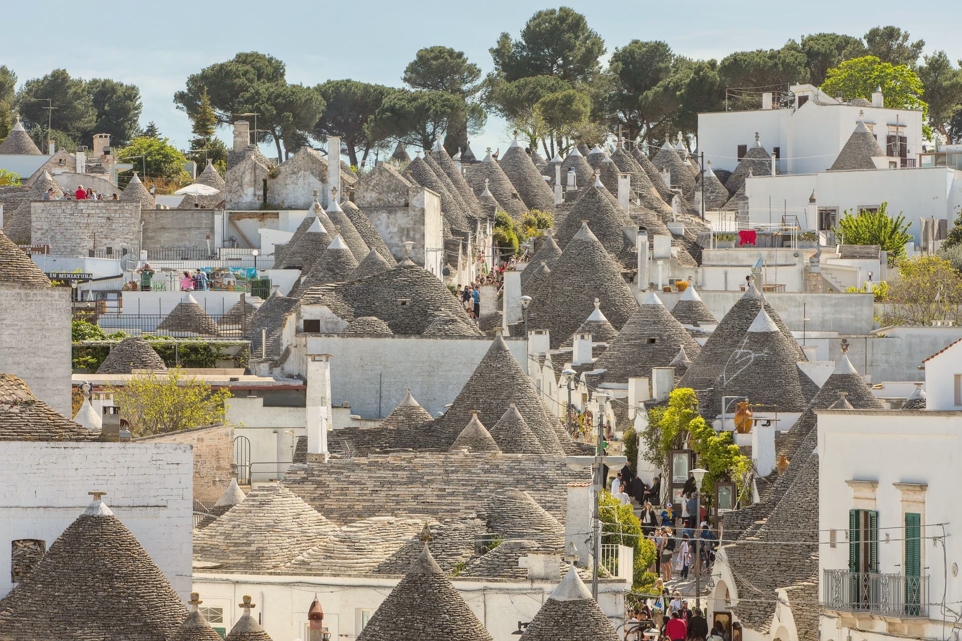
The default plan for anyone with a car in Puglia is to drive across to the Adriatic and work down the Valle d'Itria to Ostuni, then on to Otranto and the tip of Salento. The white town on its hill is worth the drive, and everybody knows it, which is why the August traffic backs up on the road in from the coast and the lidos below charge accordingly. The Ionian side gets far fewer of those cars, partly because Taranto's industrial reputation puts people off before they have looked at a map.
The same coast continues, though, well past the point where the tour buses turn inland. Follow it west into the Basilicata strip and east towards the Salento neck and you find towns that sit directly on the sea, with castles, sand and working fishing harbours, and a fraction of the crowd. These are those towns, all within about an hour and a half of Taranto.
Of the 20 communes we have mapped within 90 minutes of Taranto, 7 qualify as coastal towns: each sits directly on the sea. The smallest, Rocca Imperiale, has 3,204 residents.
Elsewhere in the catalogue: The 6 best towns you can reach by train in the province of Matera and The best coastal towns within an hour of Lecce.
Rocca Imperiale
Why visit Rocca Imperiale
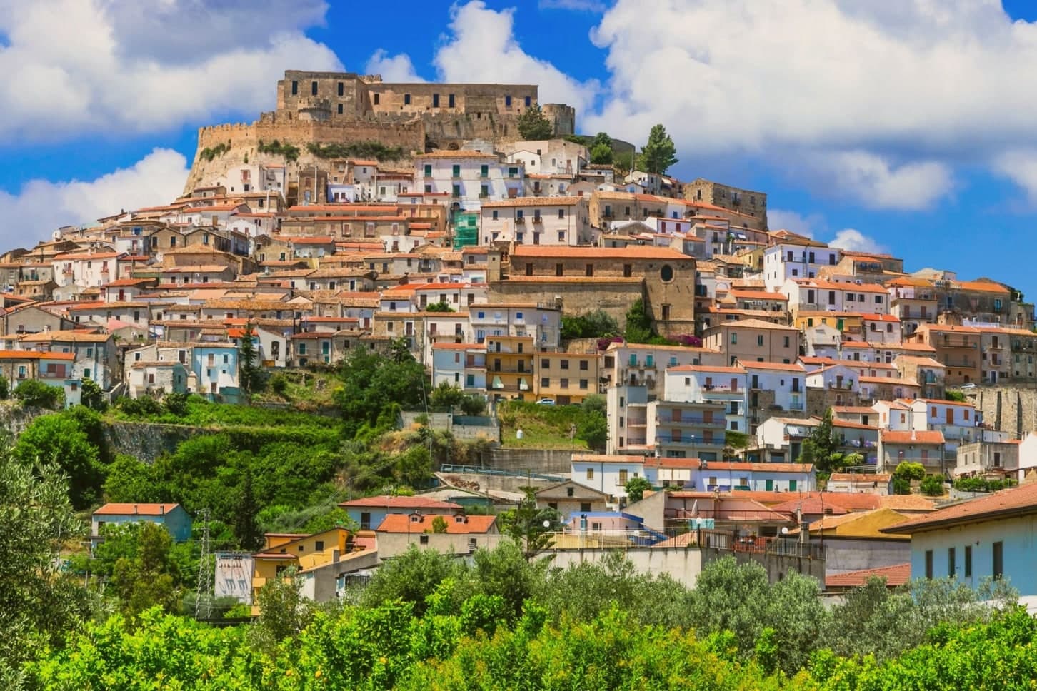
Rocca Imperiale is the northernmost commune of Calabria, pressed against the Basilicata border on the Ionian coast. The hilltop borgo sits a kilometre inland from the long sandy Marina, the two connected by the slope the town has always used to move between fortress and shore.
The castle stands on a defensible hill chosen to command the coastal route between Taranto and Reggio Calabria, and the borgo grew downhill from it in tight medieval grids of whitewashed houses and narrow vicoli, with the Chiesa Madre dell'Assunta, a 15th-century church with a Madonna by Pietro Bernini, father of Gian Lorenzo, anchoring the central piazza. Inland and upland frame the town on the other side: the Pollino park lies 30 km west and the Sila highlands further south, making Rocca a base for both while the coastal frazione below handles the beach trade.
The food is north-Calabrian-meets-Lucanian: peperoni cruschi, pasta with lardo and chilli, pesce azzurro from the Ionian, and the lemon grown only in the surrounding belt, used in liqueurs and the local pasta al limone. The Festa del Limone in early August is the year's main event.
The town works because its geography does the sorting: fortress and church hold the hill, the lemon groves hold the middle slope, and the marina holds the shore, each part visible from the others across the same short drop to the sea.
The beach here holds the national bathing award, which a comune has to win back every year on water quality, beach management and safety. It is also rated for accessibility, which most of this coast is not.
What to see in Rocca Imperiale
- Castello Federiciano (1225). Frederick II Hohenstaufen's square fortress with four corner towers (two cylindrical) commanding the Ionian coastal route. Open as a cultural centre.
- Centro storico (Borghi più belli). Whitewashed houses in tight medieval vicoli cascading downhill from the castle. The Chiesa Madre dell'Assunta has a Pietro Bernini Madonna.
- Rocca Imperiale Marina (Bandiera Blu). Long sandy Ionian beach 1 km below the borgo, holding the Bandiera Blu every recent year for water clarity and beach management.
How to get to Rocca Imperiale
There is a railway station in the town, so you can arrive without a car and never need one while you are here. Taranto is roughly 81 minutes away by road.
Our tip
Rocca Imperiale is best May–June and September–October — the borgo cool in the morning, the Marina swimmable, the lemon orchards in flower or harvest. July–August fills the Marina with Italian families and the Festa del Limone (early August) is the biggest event. The borgo stays atmospheric in winter but most amenities at the Marina close November–March.
Maruggio
Why visit Maruggio
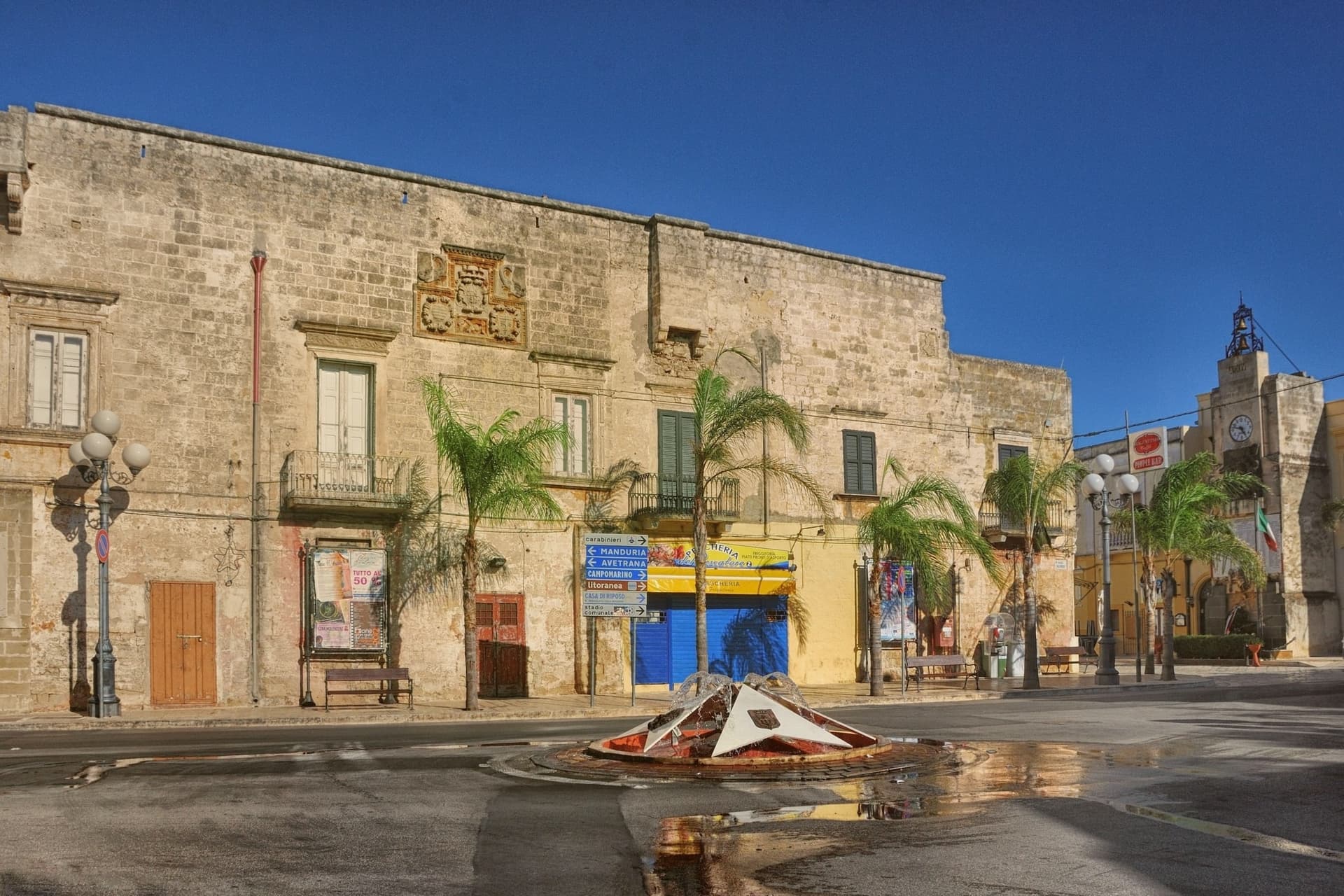
Maruggio sits inland on the Ionian side of Taranto province, a borgo of 5,250 residents built on a low hill with its coastline several kilometres away at Campomarino di Maruggio. The relationship between the two halves defines the place: a walled historic centre turned inward around its towers and commanderies, and a separate coastal strip of sand and dune that belongs administratively to the same town but reads as a different landscape entirely, brackish lagoon and macchia scrub where the borgo is stone and piazza.
The vineyards close that gap. Primitivo and Negroamaro are pressed on farms that run right up to the edge of the built-up centro, so the Città del Vino designation is not a marketing label attached from a distance but a description of what borders the walls.
The food carries the same compression: bombette of pork, panzerotti, sea urchin in spring, and taralli made with fennel seed, all produced within a town small enough that its vineyards, its coast, and its fortifications are never more than a short distance apart. What the place amounts to is a rare case where a single small municipality holds a complete set of Salento's separate identities, military history, wine country, and protected coast, without any of them being a satellite of a larger town nearby.
The beach here holds the national bathing award, which a comune has to win back every year on water quality, beach management and safety. It is also rated for accessibility, which most of this coast is not.
What to see in Maruggio
- Commenda dei Cavalieri di Malta + Maltese Crosses. The commanderie buildings of San Pietro and Santo Stefano stand side by side, twin structures rather than one. The Chiesa Madre holds the Order's archives, and Maltese cross motifs are carved into doorways throughout the centro.
- Centro storico + four surviving towers. The fortified borgo keeps four of its original eight towers and substantial wall sections, raised against Saracen raids from the sea. Inside, a grid of narrow stone-paved vicoli runs between flat-roofed white-and-honey houses with iron balconies, opening onto the 16th-century Palazzo Ducale on the main piazza.
- Campomarino di Maruggio (Bandiera Blu). Sand backed by dunes for the full stretch of coast, held under Bandiera Blu for over a decade. The reserve at its edge protects 1,000 hectares of dune and lagoon.
How to get to Maruggio
Taranto is roughly 46 minutes away by road.
Our tip
Maruggio is at its best in May–June (warm but not yet packed, sea swimmable, the borgo cool in the morning) and September–October (still beach-warm, vendemmia in full swing, Primitivo and Negroamaro in the press). July and August get crowded at Campomarino — the inland borgo stays quieter. Winter is mild Salento — the centro storico is at its most photogenic but most beach amenities close.
Nova Siri
Why visit Nova Siri
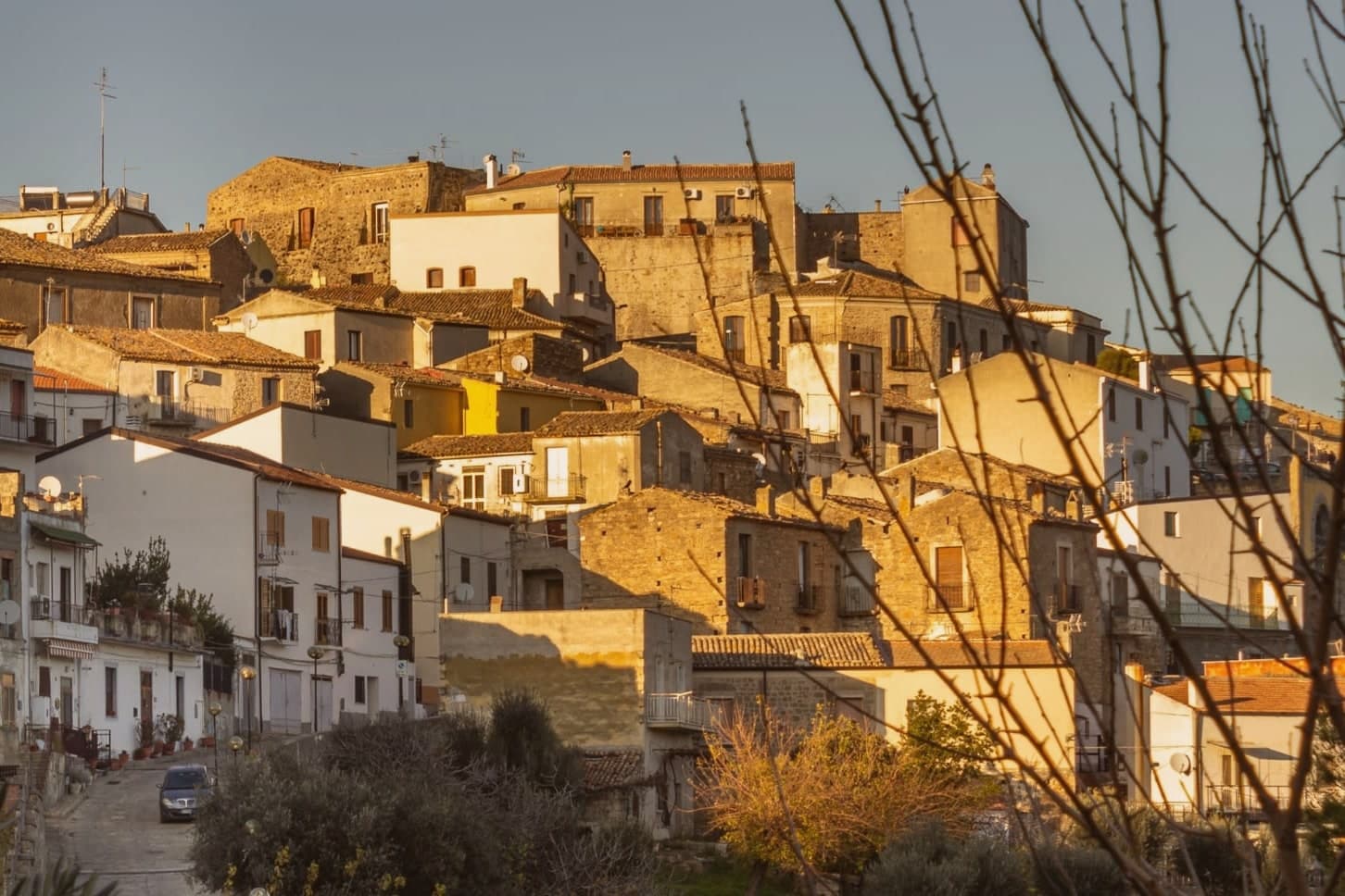
Nova Siri exists in two parts. The old town sits at 350 meters on a hill nine kilometers inland; Marina di Nova Siri lies on the Ionian Sea below, developed from the 1970s onward as a beach town.
The site is on the southern edge of Basilicata where the region meets Calabria, near the ancient Greek colony of Siris, founded by Ionian settlers in the seventh century BC and destroyed in the sixth, whose territory gave the region its name of Siritide and whose river, the modern Sinni, still defines the comune. Byzantine military use followed in the early medieval period.
The Torre Bollita, a semicircular tufo tower inside the medieval walls, is the surviving fortification; in its vicinity, the remains of a Hellenistic necropolis have come to light. The Chiesa Madre dedicated to Santa Maria Assunta dates to the sixteenth century.
The Marina holds the Bandiera Blu since 2018, with wide sandy beaches, dunes and pine forest behind. Spighe Verdi recognises the commune's rural and environmental management.
The beach here holds the national bathing award, which a comune has to win back every year on water quality, beach management and safety.
What to see in Nova Siri
- Marina di Nova Siri. Bandiera Blu beach since 2018, with sandy coast, dunes and a pine-shaded promenade nine kilometers below the old town.
- Torre Bollita. Semicircular tufo defensive tower within the medieval walls, the surviving fortification of the historic centre.
- Chiesa Madre di Santa Maria Assunta. Sixteenth-century mother church in the old town, dedicated to Santa Maria Assunta, the village's patron saint and protectress.
How to get to Nova Siri
There is a railway station in the town, so you can arrive without a car and never need one while you are here. Taranto is roughly 80 minutes away by road.
Our tip
May through September is the Ionian beach season for Nova Siri Marina. Water is swimmable from late May, the Bandiera Blu is in force, and the dune-and-pine strip behind the beach keeps the heat tolerable. July and August reach the mid-thirties; the old town nine kilometers inland is several degrees cooler at 350 meters.
Campi Salentina
Why visit Campi Salentina
Campi Salentina sits on the Salento plain at forty-seven meters, fifteen kilometers north of Lecce. Menhirs around the territory point to Bronze Age occupation, but the town as such dates to 926, when Saracen raids destroyed the nearby villages of Afra, Bagnara, Firmignano, Ainoli and Terenzano and pushed survivors together at the current site.
The Normans came in the eleventh century; Tancred of Altavilla donated Campi to the Bishop of Lecce, and the castle followed in the centuries after. In 1522 the Paladini family bought the fief, and after Maria Paladini married Giovanni Enriquez, the town was elevated to a marquisate in 1627.
The town earned the title of città by presidential decree in 1998. The coat of arms is a sheaf of wheat: locals call Campi the granary of the Terra d'Otranto, and the surrounding plain is olive groves and vines.
The menhirs, the ninth-century founding, and the seventeenth-century marquisate mark three separate layers on the same plain: a scattering of prehistoric stones, a town built from the wreck of five destroyed villages, and a feudal seat raised in status centuries later without ever moving from that original site. What holds the layers together is the plain itself, flat ground given over to wheat and now to vines, which explains why a granary emblem and a castle used only as a summer residence could belong to the same small place.
What to see in Campi Salentina
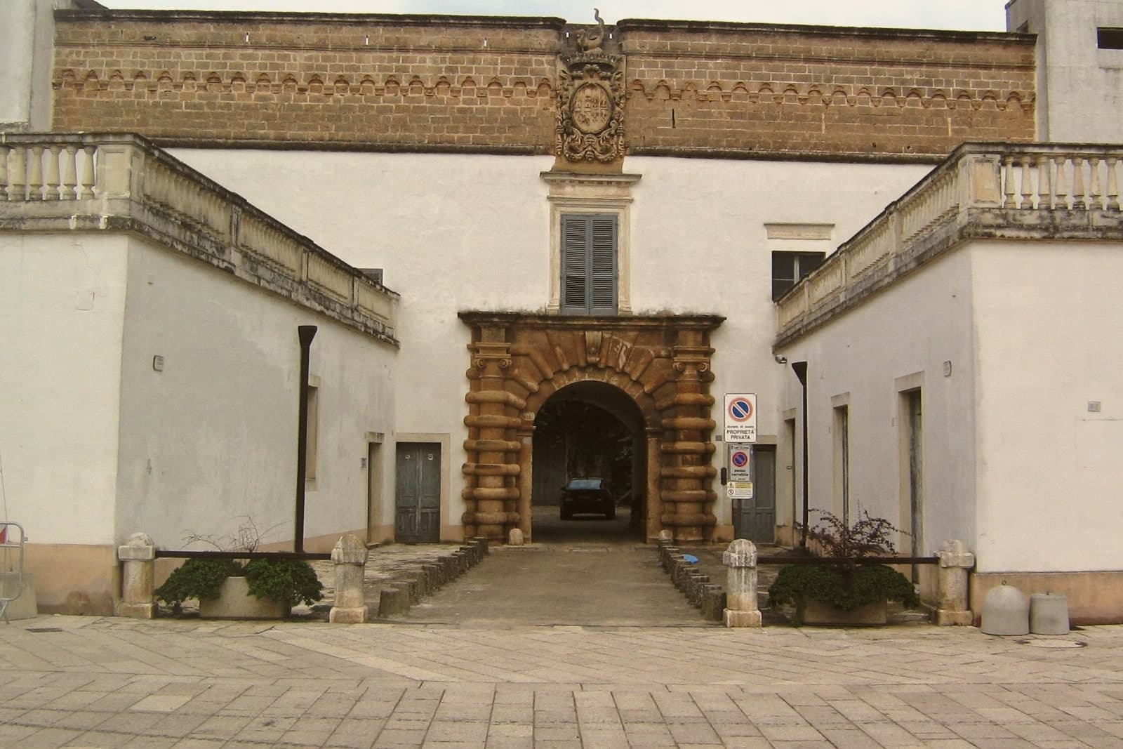
- Castello dei Paladini-Enriquez. The castle stands at the center of the old town, its walls marking the line between the summer residence Frederick II built and the marquisate palace the Paladini and Enriquez families made of it afterward.
- Chiesa Matrice di Santa Maria delle Grazie. Sixteenth-century mother church in the centro storico, rebuilt over the medieval foundations of the original village church.
- Centro storico. Walled Salento old town around the castle and the chiesa matrice, with stone palazzi from the Paladini and Enriquez period.
How to get to Campi Salentina
There is a railway station in the town, so you can arrive without a car and never need one while you are here. Taranto is roughly 81 minutes away by road.
Our tip
May through September are the months the Salento plain is dry, mild and walkable. June through August reach the mid-thirties and the inland villages empty between two and five in the afternoon; Lecce and the Adriatic coast pull the day-trippers. April and October are the steadier months, the wine and olive work either starting or finishing, the light still soft.
Bernalda
Why visit Bernalda
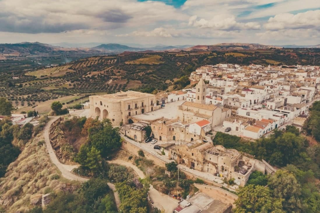
Bernalda sits at 127 meters between the Bradano and Basento rivers, eight kilometers inland from the Ionian coast and the frazione of Metaponto. Almost twelve thousand people live in the town, named for the Aragonese courtier who moved the older Camarda settlement up to the defensible hilltop where the centro still stands.
The corso and the castle anchor the upper town; the coast and its archaeological ground lie a separate world eight kilometers below. Metaponto was founded by Achaean Greeks in the seventh century BC, the plain later home to Pythagoras until his death.
What remains there today spans a wide stretch of time in a small area: temple columns from the sixth century BC, a Greek theater and necropolis, and a beach that draws summer crowds for reasons that have nothing to do with antiquity. Inland, the hill town's own history turns on a single family: an emigration in 1904 and a return a century later that reopened one of its noble houses to visitors.
The town works, then, as two places joined by eight kilometers, one built on Magna Graecia and modern seaside tourism, the other on a hilltop refounding and one family's long departure and return.
The beach here holds the national bathing award, which a comune has to win back every year on water quality, beach management and safety.
What to see in Bernalda
- Castello Aragonese. Hilltop fortress dating to the 1470 refounding by Bernardino de Bernaudo, with medieval origins and Norman, Swabian and Angevin layered additions.
- Palazzo Margherita. Noble palazzo on Corso Umberto, now a nine-room hotel, the family returning most years for the town's patronal feast.
- Tavole Palatine. The columns stand alone on open plain outside Metaponto, no temple walls around them, the ground where Pythagoras founded his school and died.
How to get to Bernalda
There is a railway station in the town, so you can arrive without a car and never need one while you are here. Taranto is roughly 51 minutes away by road.
Our tip
May through September is the coastal season. The Metaponto beach opens reliably by Easter and runs through October, but the heat on the inland hill peaks in July and August. The Festa di San Bernardino in the last week of August brings processions and a fireworks competition that runs three nights.
Carovigno
Why visit Carovigno
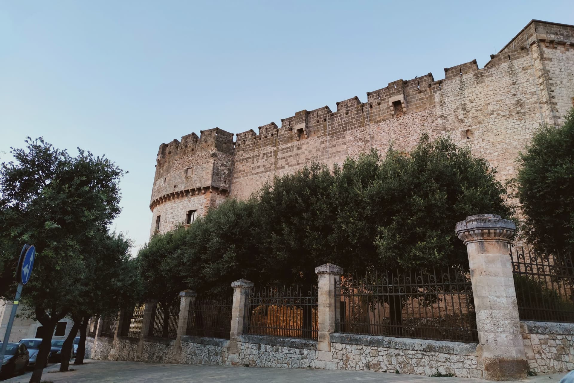
Carovigno sits at 161 meters in upper Salento, seven kilometers from the Adriatic and thirty kilometers from Brindisi. The distance between hill and sea shapes the commune: a walled town on high ground looking inland toward Ostuni, and a strip of protected coast running north along the water, eight kilometers of it, separate enough from the centro storico that they read almost as two different places joined by one municipal boundary.
The old town itself is compact, arranged around its mother church with the castle at the summit and the medieval walls, patched with older stone, closing the circuit. Outside the walls, three kilometers off, stands the sanctuary that draws the town out of itself once a year for the Easter procession.
The coast belongs to no season and no rite in particular. It is simply there, kept clear of building, running along the edge of the commune while the life of the town carries on up on the hill.
What holds Carovigno together is this separation of functions: defense and worship concentrated on the high ground, the shoreline left open and undeveloped, and the two connected only by the road and by the yearly walk to the sanctuary.
The beach here holds the national bathing award, which a comune has to win back every year on water quality, beach management and safety.
What to see in Carovigno
- Castello Dentice di Frasso. Fortress at the highest point of the centro storico, built for defense and later remade into an aristocratic residence, its rooms and outlook telling a different story from its military origins.
- Cinta muraria e torri medievali. Four towers, Torre del Civile, Torre Giranda, Torre delli Brandi and Torre del Prete, still standing on foundations laid before the medieval walls that now bear their names.
- Riserva Naturale di Torre Guaceto. The shoreline itself: shallow clear water, dune systems underfoot and a watchtower standing alone against the coast, reachable north of the town.
How to get to Carovigno
There is a railway station in the town, so you can arrive without a car and never need one while you are here. Taranto is roughly 69 minutes away by road.
Our tip
May through September are the months the Adriatic warms enough to swim at Torre Guaceto and the upper-Salento groves are walkable without sweat. July and August push past thirty-three degrees and the centro storico fills with day-trippers from the Brindisi-Ostuni stretch. June and September are the steadier months, water still warm and the trattorie open without the August crowds.
Policoro
Why visit Policoro
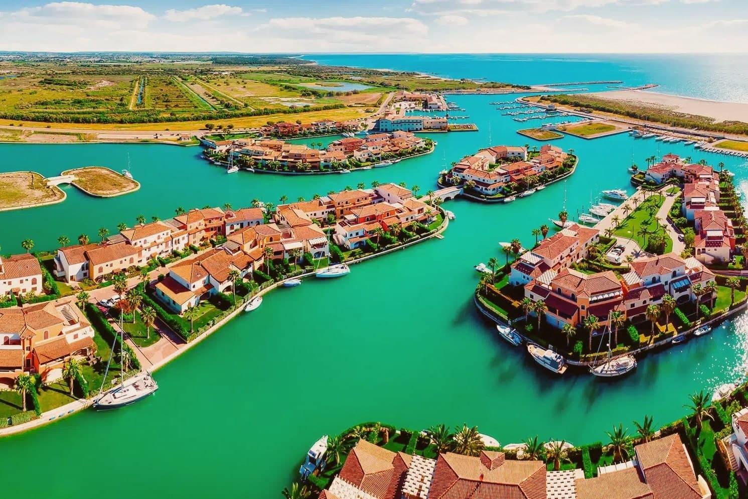
Policoro sits on the Ionian coast of Basilicata where the Agri river reaches the sea. The modern town is built on and around the site of Heraclea (Eraclea Lucana), a Greek polis founded in 433 BC by Taras (Taranto) and Thurii as a joint colony.
The archaeology and the coast now function as two halves of the same place: the excavated city and its museum inland, the beach and the forest reserve running along the shore just beyond it. The Gulf of Taranto shoreline gives the town its second identity, with the Bandiera Blu recognition sitting alongside the Bosco Pantano reserve, which the WWF describes as the most important coastal-forest reserve south of Tuscany.
The Tavole di Eraclea, recovered from the polis and now held in the museum, recorded the city's own regulations on land tenure, a detail that ties the ancient settlement to the same agricultural plain the town still farms. Policoro is the agricultural anchor of the Metapontino plain, growing strawberries, kiwi, and melons, and is one of Basilicata's few year-round-resident coastal communes.
A Greek colony, a Roman battlefield, a working beach, and a farming town turn out to be the same stretch of ground, still worked and still inhabited rather than left as ruins.
The beach here holds the national bathing award, which a comune has to win back every year on water quality, beach management and safety. It is also rated for accessibility, which most of this coast is not.
What to see in Policoro
- Museo Archeologico Nazionale della Siritide. Holds the Tavole di Eraclea, 4th-century BC bronze inscriptions recording the polis's rules on land tenure, alongside Pyrrhic-era armor and finds from the Heraclea and Siris excavations.
- Lido di Policoro — Bandiera Blu. Fine-sand beach along the Gulf of Taranto, with seasonal lidos and a shoreline shared with the sea turtle nesting program run just inland.
- WWF Bosco Pantano. Italy's most important coastal-forest nature reserve south of Tuscany, with a sea turtle rescue centre, birding trails, and the recovered Pantano humid-forest ecosystem.
How to get to Policoro
There is a railway station in the town, so you can arrive without a car and never need one while you are here. Taranto is roughly 65 minutes away by road.
Our tip
April through October is the open season — Ionian sea calm and warm, the Lido di Policoro Bandiera Blu operating, and the museum at full hours. May and September are the best months for combining beach and archaeology: warm but not crowded, the Pantano reserve at peak bird count. July-August are hot (35°C+ inland) and the lido is busy but never wall-to-wall like Puglia's Salento — Policoro stays a regional rather than national destination.
More from Anywhere Italy
 The 6 best towns you can reach by train in the province of Matera
 The best coastal towns within an hour of Lecce
 The best hidden towns you can reach by train in Basilicata
 The best coastal towns with a serious restaurant in Puglia
 The best small coastal towns in Calabria
 The best towns you can reach by train that eat well within 90 minutes of Taranto