
The best beach towns you can reach by train within 90 minutes of Taranto
90 towns visited, 910 to go. Follow along, free: Subscribe on Substack
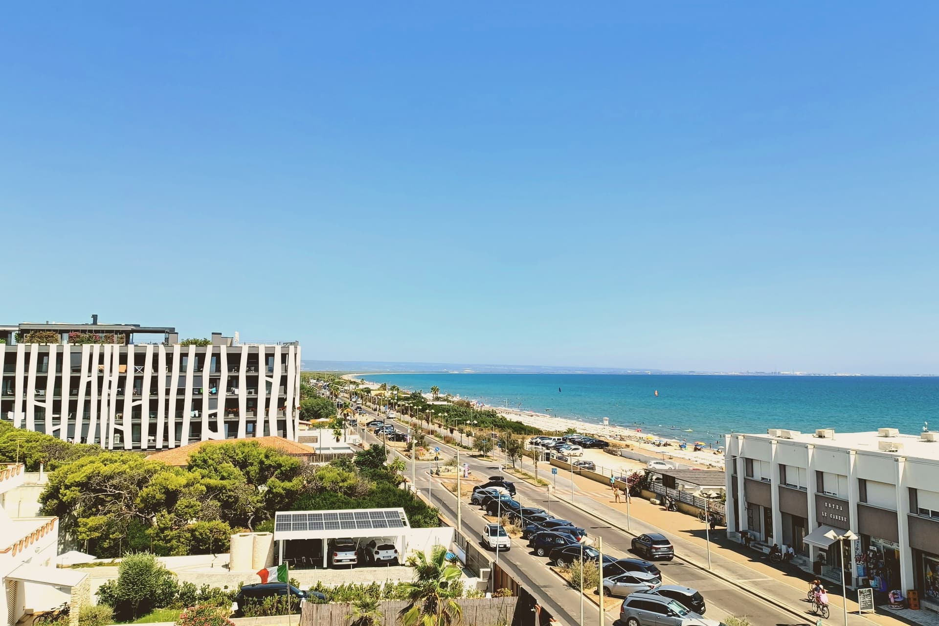
The Gulf of Taranto has a different kind of coast to the one Puglia is famous for: wide sand instead of rock, shallow warm water, umbrella pines and eucalyptus planted as windbreaks behind the dunes. The towns sit back from the beach, usually on a ridge of tufo or a low hill of pale limestone, with the lidos and the marina strung out below. Summer starts early here and holds into late September, when the sea is at its warmest and the crowds have thinned. Inland it is orecchiette, lampascioni, primitivo and negroamaro, and along the shore it is raw prawns, mussels and whatever the boats brought into Taranto that morning.
Most travelers who come to this part of the south point themselves at Alberobello and the trulli, or drive the whitewashed loop around Locorotondo and Martina Franca, then dip down to the coast for an afternoon. Salento's tip, around Gallipoli and Otranto, absorbs almost everyone else, and in August the roads to it are solid. Both are worth seeing. Both are also served by tour coaches, car hire and a queue for parking.
The same sand, the same clean water and the same food carry on north and south of the famous stretch, along the Ionian arc and up into Basilicata, where the Metapontine plain meets the sea. The regional lines out of Taranto reach these places directly, which means a beach day without a hire car or a return drive in the dark. Fewer people go, particularly in June and September. Each town on this list holds the national award for clean bathing water, and we have confirmed each can be reached without a car.
Of the 20 communes we have mapped within 90 minutes of Taranto, 9 qualify as beach towns you can reach by train: each holds the national award for clean bathing water, and we have confirmed each is reachable without a car. The smallest, Rocca Imperiale, has 3,204 residents.
If you are still choosing, we have also written The best coastal towns within 90 minutes of Taranto and The 7 best towns worth staying overnight that you can reach by train within 90 minutes of Taranto.
Going to the sea? How to find the free beaches in Italy.
Why visit Rocca Imperiale
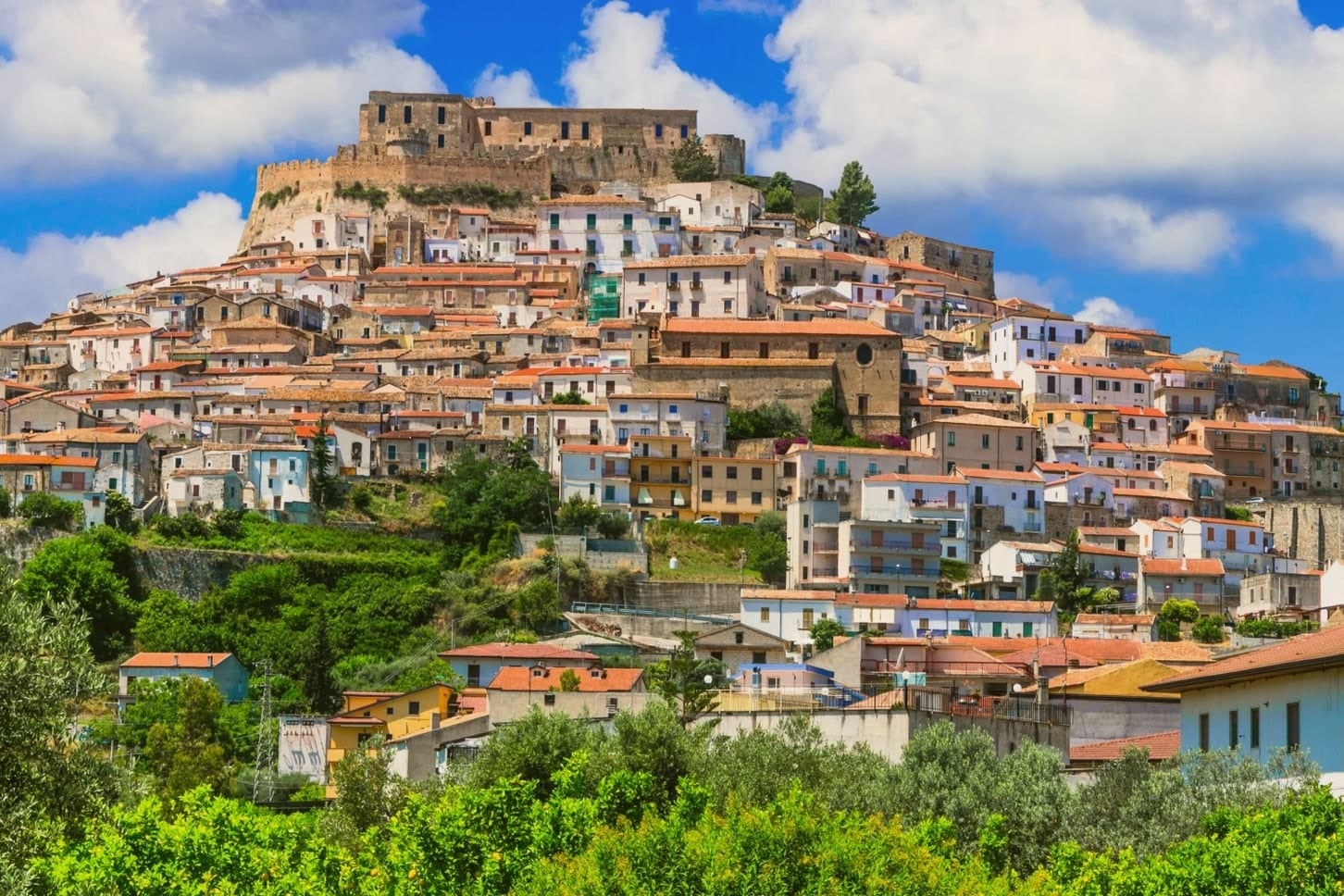
Rocca Imperiale is the northernmost commune of Calabria, pressed against the Basilicata border on the Ionian coast. The hilltop borgo sits a kilometer inland from the long sandy Marina, the two connected by the slope the town has always used to move between fortress and shore.
The castle stands on a defensible hill chosen to command the coastal route between Taranto and Reggio Calabria, and the borgo grew downhill from it in tight medieval grids of whitewashed houses and narrow vicoli, with the Chiesa Madre dell'Assunta, a 15th-century church with a Madonna by Pietro Bernini, father of Gian Lorenzo, anchoring the central piazza. Inland and upland frame the town on the other side: the Pollino park lies 30 km west and the Sila highlands further south, making Rocca a base for both while the coastal frazione below handles the beach trade.
The food is north-Calabrian-meets-Lucanian: peperoni cruschi, pasta with lardo and chilli, pesce azzurro from the Ionian, and the lemon grown only in the surrounding belt, used in liqueurs and the local pasta al limone. The Festa del Limone in early August is the year's main event.
The town works because its geography does the sorting: fortress and church hold the hill, the lemon groves hold the middle slope, and the marina holds the shore, each part visible from the others across the same short drop to the sea.
What to see in Rocca Imperiale
- Castello Federiciano (1225). Frederick II Hohenstaufen's square fortress with four corner towers (two cylindrical) commanding the Ionian coastal route. Open as a cultural center.
- Centro storico (Borghi più belli). Whitewashed houses in tight medieval vicoli cascading downhill from the castle. The Chiesa Madre dell'Assunta has a Pietro Bernini Madonna.
- Rocca Imperiale Marina (Bandiera Blu). Long sandy Ionian beach 1 km below the borgo, holding the Bandiera Blu every recent year for water clarity and beach management.
How to get to Rocca Imperiale
It has its own railway station. Taranto is about 1 h 21 min away by road. The full route from Bari.
Our tip
Rocca Imperiale is best May–June and September–October: the borgo cool in the morning, the Marina swimmable, the lemon orchards in flower or harvest. July–August fills the Marina with Italian families and the Festa del Limone (early August) is the biggest event. The borgo stays atmospheric in winter but most amenities at the Marina close November–March.
Why visit Nova Siri
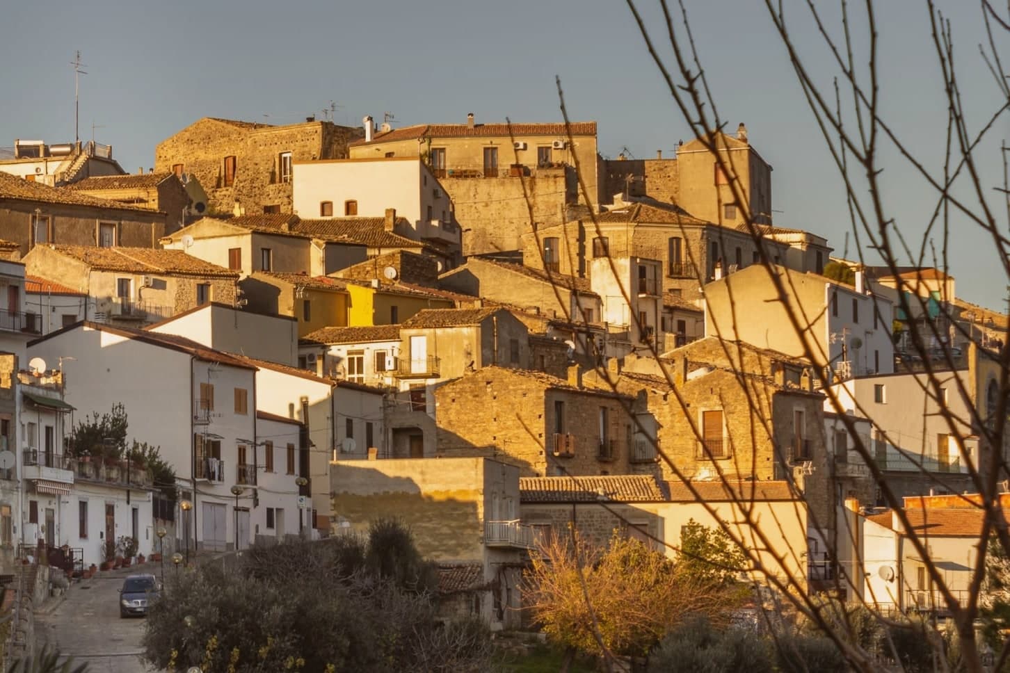
Nova Siri exists in two parts. The old town sits at 350 meters on a hill nine kilometers inland; Marina di Nova Siri lies on the Ionian Sea below, developed from the 1970s onward as a beach town.
The site is on the southern edge of Basilicata where the region meets Calabria, near the ancient Greek colony of Siris, founded by Ionian settlers in the seventh century BC and destroyed in the sixth, whose territory gave the region its name of Siritide and whose river, the modern Sinni, still defines the comune. Byzantine military use followed in the early medieval period.
The Torre Bollita, a semicircular tufo tower inside the medieval walls, is the surviving fortification; in its vicinity, the remains of a Hellenistic necropolis have come to light. The Chiesa Madre dedicated to Santa Maria Assunta dates to the sixteenth century.
The Marina holds the Bandiera Blu since 2018, with wide sandy beaches, dunes and pine forest behind. Spighe Verdi recognizes the commune's rural and environmental management.
What to see in Nova Siri
- Marina di Nova Siri. Bandiera Blu beach since 2018, with sandy coast, dunes and a pine-shaded promenade nine kilometers below the old town.
- Torre Bollita. Semicircular tufo defensive tower within the medieval walls, the surviving fortification of the historic center.
- Chiesa Madre di Santa Maria Assunta. Sixteenth-century mother church in the old town, dedicated to Santa Maria Assunta, the village's patron saint and protectress.
How to get to Nova Siri
It has its own railway station. Taranto is about 1 h 20 min away by road. The full route from Bari.
Our tip
May through September is the Ionian beach season for Nova Siri Marina. Water is swimmable from late May, the Bandiera Blu is in force, and the dune-and-pine strip behind the beach keeps the heat tolerable. July and August reach the mid-thirties; the old town nine kilometers inland is several degrees cooler at 350 meters.
Why visit Bernalda
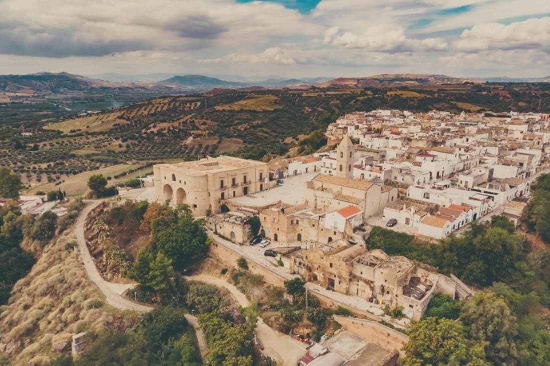
Bernalda sits at 127 meters between the Bradano and Basento rivers, eight kilometers inland from the Ionian coast and the frazione of Metaponto. Almost twelve thousand people live in the town, named for the Aragonese courtier who moved the older Camarda settlement up to the defensible hilltop where the centro still stands.
The corso and the castle anchor the upper town; the coast and its archaeological ground lie a separate world eight kilometers below. Metaponto was founded by Achaean Greeks in the seventh century BC, the plain later home to Pythagoras until his death.
What remains there today spans a wide stretch of time in a small area: temple columns from the sixth century BC, a Greek theater and necropolis, and a beach that draws summer crowds for reasons that have nothing to do with antiquity. Inland, the hill town's own history turns on a single family: an emigration in 1904 and a return a century later that reopened one of its noble houses to visitors.
The town works, then, as two places joined by eight kilometers, one built on Magna Graecia and modern seaside tourism, the other on a hilltop refounding and one family's long departure and return.
What to see in Bernalda
- Castello Aragonese. Hilltop fortress dating to the 1470 refounding by Bernardino de Bernaudo, with medieval origins and Norman, Swabian and Angevin layered additions.
- Palazzo Margherita. Noble palazzo on Corso Umberto, now a nine-room hotel, the family returning most years for the town's patronal feast.
- Tavole Palatine. The columns stand alone on open plain outside Metaponto, no temple walls around them, the ground where Pythagoras founded his school and died.
How to get to Bernalda
It has its own railway station. Taranto is about 51 min away by road. The full route from Bari.
Our tip
May through September is the coastal season. The Metaponto beach opens reliably by Easter and runs through October, but the heat on the inland hill peaks in July and August. The Festa di San Bernardino in the last week of August brings processions and a fireworks competition that runs three nights.
Why visit Castellaneta
Castellaneta sits on the Murge plateau at 235 meters, on the southern rim of the Gravina Grande, a karst canyon 10 kilometers long and 145 meters deep that wraps the town in near-vertical limestone walls. The municipal territory runs from the gravina down to the Ionian coast at Castellaneta Marina, fifteen kilometers south, where the long sand beach has held Bandiera Blu for ten consecutive years.
The cathedral was founded under the Normans in the eleventh century, rebuilt in Romanesque form in the fourteenth, and given its white limestone facade in 1771. The town is best known abroad as the birthplace of Rodolfo Valentino, born here on 6 May 1895 and reborn in Hollywood as Rudolph Valentino.
A blue ceramic statue of the actor by Luigi Gheno was unveiled in the centro storico in 1961, captured in the documentary Mondo Cane, and the Museo Rodolfo Valentino opened on the 1995 centenary.
What to see in Castellaneta
- Gravina Grande. Karst canyon ten kilometers long and 145 meters deep wrapping the town on three sides, part of the Terra delle Gravine regional park.
- Cattedrale di Santa Maria Assunta. Norman cathedral of the eleventh century rebuilt as a Romanesque basilica in the fourteenth and refaced in white limestone in 1771.
- Museo Rodolfo Valentino. Civic museum opened on the actor's 1995 centenary, with the ceramic statue by Luigi Gheno unveiled in 1961 standing in the square outside.
How to get to Castellaneta
It has its own railway station. Taranto is about 49 min away by road. The full route from Bari.
Our tip
April through June and September through October are the months the Murge is dry, mild, and the gravina edges walkable. July and August push past thirty-five degrees on the plateau and the centro storico empties in the afternoon, though Castellaneta Marina fills with Italian families and the beach is at its peak. The Festa di Santa Maria della Stella in May and the Carnevale procession through the centro storico are the civic anchors of the calendar.
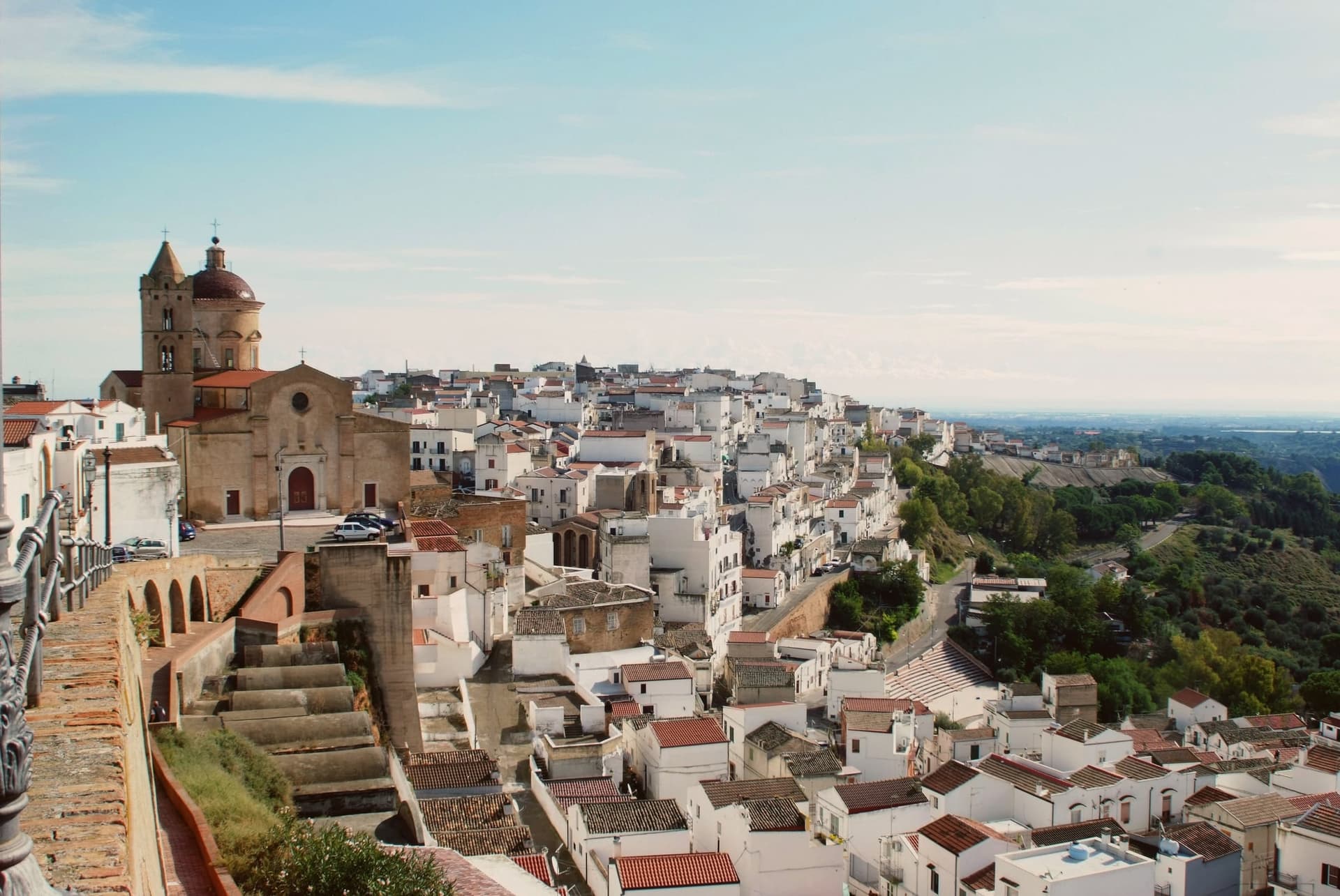
Why visit Pisticci
Pisticci sits on three eroded clay hills in the southern Matera province and is the most populous town in the province after Matera itself. The name of the coastal frazione, and the geology under the whole town, are the same clay that failed on 9 February 1688, when a landslide cut the settlement in half and killed four hundred people.
Rather than move down to the valley, survivors rebuilt directly on the ground the slide had crossed, in two-room houses with pitched red tile roofs, arranged in straight lines instead of the tangled layout typical of hill towns in the region. That district took the name of the cliff itself.
Above it, on the highest point, the older part of the town kept its Norman tower, its medieval gate and its mother church, the built record of what stood before the collapse. Twenty kilometers away on the plain toward the sea, the hamlet of Marconia, named for Guglielmo Marconi, functions as the modern center, while the coastal frazione handles the town's relationship to the Ionian.
The clay hills inland, meanwhile, are worked for truffles rather than housing. What the layout adds up to is a town split by elevation and by function: the old hill preserves what predates the disaster, the rebuilt district records the disaster itself, and the plain and the coast carry everything the eroding hill cannot.
What to see in Pisticci
- Rione Dirupo. Low houses set two rooms wide under pitched red tile roofs, laid out in straight lines rather than the tangled streets typical of the region, the most lived-in district of the town today.
- Terravecchia. Oldest district on the highest hill, with the square tower of the Norman castle, the medieval gate, the mother church and the noble palazzi that survived from before 1688.
- Marina di Pisticci. Coastal frazione on the Ionian, twenty kilometers from the centro storico, a Bandiera Blu beach with pine forest backing the sand.
How to get to Pisticci
It has its own railway station. Taranto is about 1 h 6 min away by road. The full route from Bari.
Our tip
April through June and September into October are the strong months. The Dirupo white houses against a clear sky are best in the slanting light of late afternoon, and the Ionian coast at Marina di Pisticci is warm enough for swimming from late May. July and August push past thirty-five degrees in the centro storico; the beach fills with regional summer crowds and the upper town quiets in the afternoon.
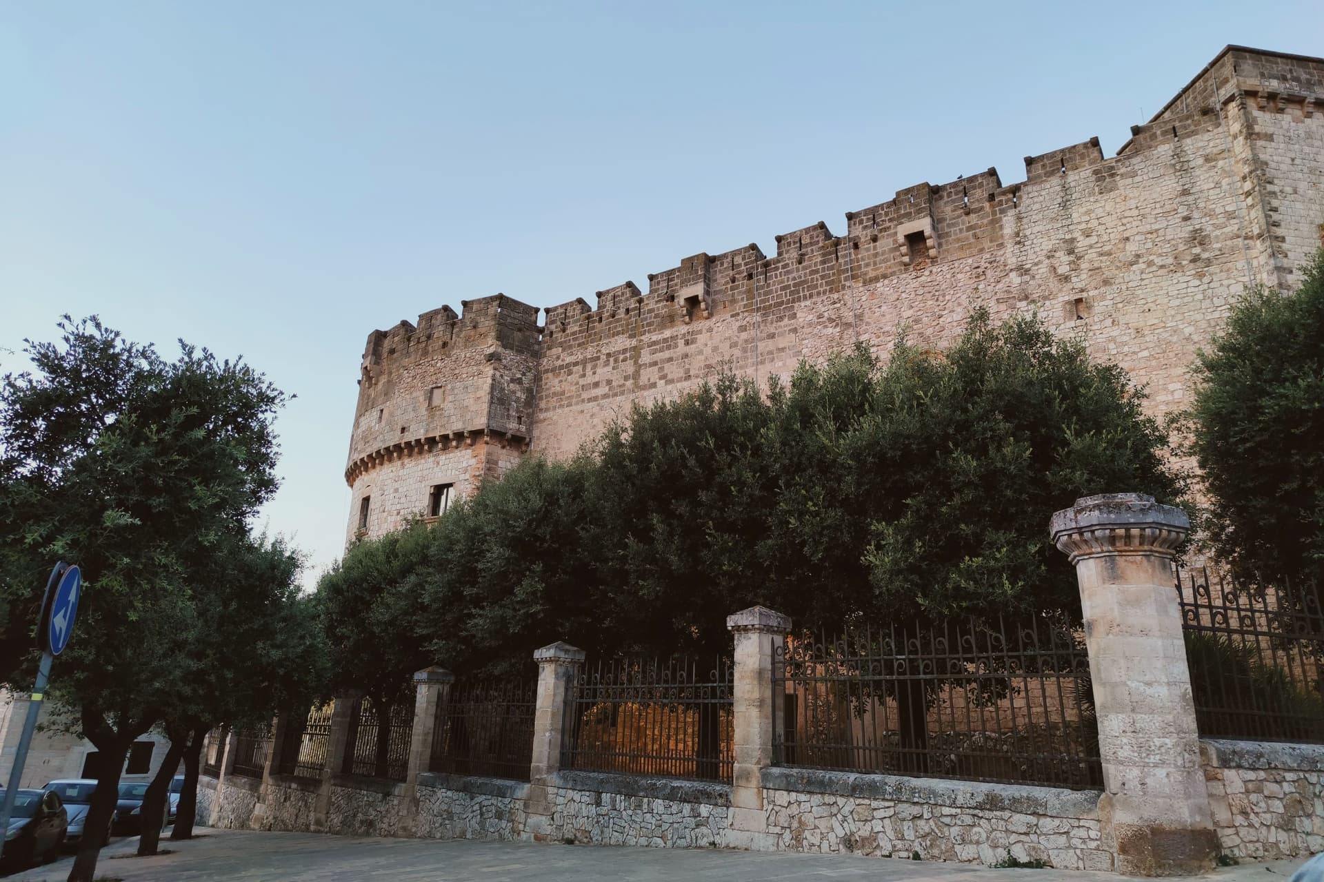
Why visit Carovigno
Carovigno sits at 161 meters in upper Salento, seven kilometers from the Adriatic and thirty kilometers from Brindisi. The distance between hill and sea shapes the commune: a walled town on high ground looking inland toward Ostuni, and a strip of protected coast running north along the water, eight kilometers of it, separate enough from the centro storico that they read almost as two different places joined by one municipal boundary.
The old town itself is compact, arranged around its mother church with the castle at the summit and the medieval walls, patched with older stone, closing the circuit. Outside the walls, three kilometers off, stands the sanctuary that draws the town out of itself once a year for the Easter procession.
The coast belongs to no season and no rite in particular. It is simply there, kept clear of building, running along the edge of the commune while the life of the town carries on up on the hill.
What holds Carovigno together is this separation of functions: defense and worship concentrated on the high ground, the shoreline left open and undeveloped, and the two connected only by the road and by the yearly walk to the sanctuary.
What to see in Carovigno
- Castello Dentice di Frasso. Fortress at the highest point of the centro storico, built for defense and later remade into an aristocratic residence, its rooms and outlook telling a different story from its military origins.
- Cinta muraria e torri medievali. Four towers, Torre del Civile, Torre Giranda, Torre delli Brandi and Torre del Prete, still standing on foundations laid before the medieval walls that now bear their names.
- Riserva Naturale di Torre Guaceto. The shoreline itself: shallow clear water, dune systems underfoot and a watchtower standing alone against the coast, reachable north of the town.
How to get to Carovigno
It has its own railway station. Taranto is about 1 h 9 min away by road. The full route from Bari.
Our tip
May through September are the months the Adriatic warms enough to swim at Torre Guaceto and the upper-Salento groves are walkable without sweat. July and August push past thirty-three degrees and the centro storico fills with day-trippers from the Brindisi-Ostuni stretch. June and September are the steadier months, water still warm and the trattorie open without the August crowds.
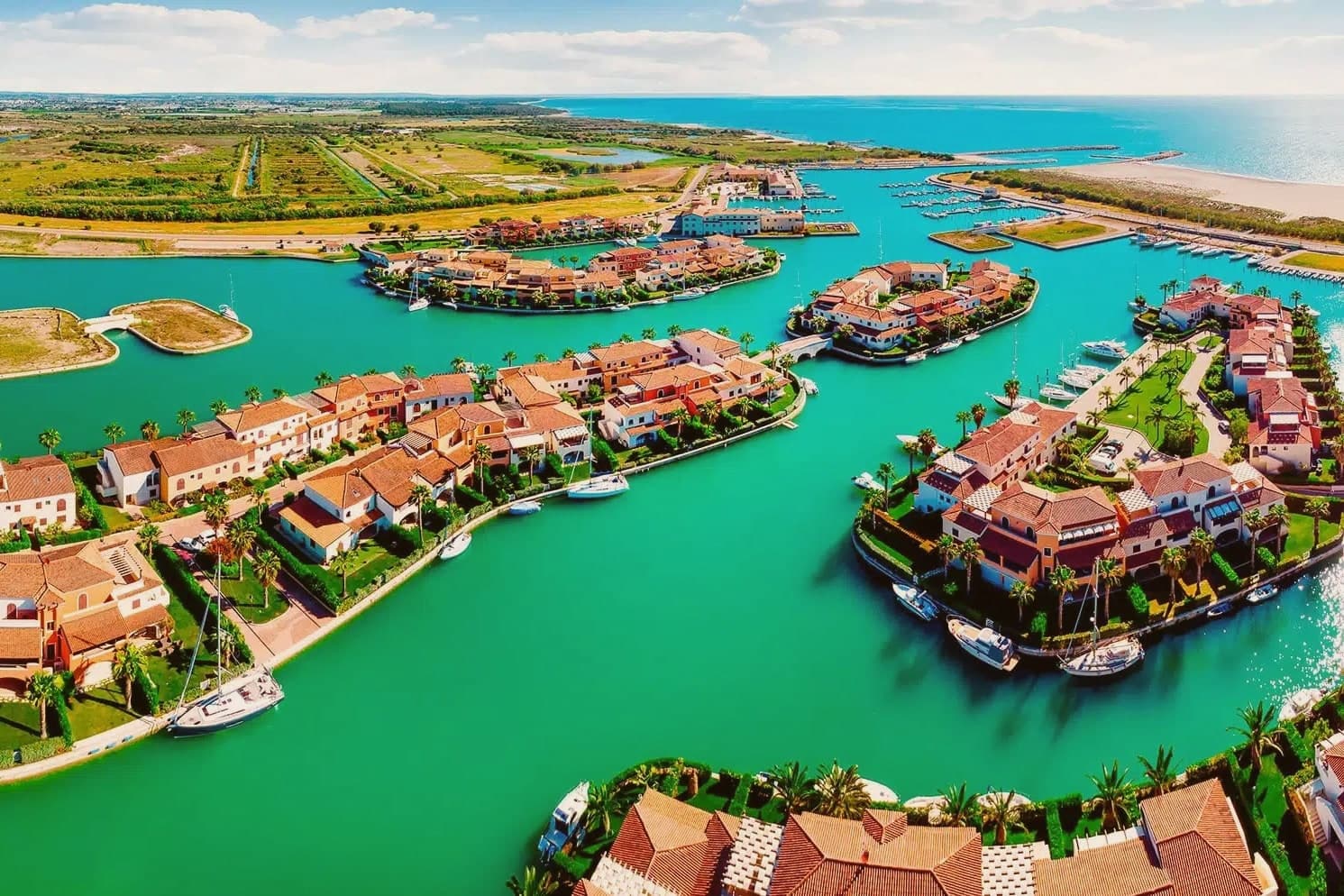
Why visit Policoro
Policoro sits on the Ionian coast of Basilicata where the Agri river reaches the sea. The modern town is built on and around the site of Heraclea (Eraclea Lucana), a Greek polis founded in 433 BC by Taras (Taranto) and Thurii as a joint colony.
The archaeology and the coast now function as two halves of the same place: the excavated city and its museum inland, the beach and the forest reserve running along the shore just beyond it. The Gulf of Taranto shoreline gives the town its second identity, with the Bandiera Blu recognition sitting alongside the Bosco Pantano reserve, which the WWF describes as the most important coastal-forest reserve south of Tuscany.
The Tavole di Eraclea, recovered from the polis and now held in the museum, recorded the city's own regulations on land tenure, a detail that ties the ancient settlement to the same agricultural plain the town still farms. Policoro is the agricultural anchor of the Metapontino plain, growing strawberries, kiwi, and melons, and is one of Basilicata's few year-round-resident coastal communes.
A Greek colony, a Roman battlefield, a working beach, and a farming town turn out to be the same stretch of ground, still worked and still inhabited rather than left as ruins.
What to see in Policoro
- Museo Archeologico Nazionale della Siritide. Holds the Tavole di Eraclea, 4th-century BC bronze inscriptions recording the polis's rules on land tenure, alongside Pyrrhic-era armor and finds from the Heraclea and Siris excavations.
- Lido di Policoro (Bandiera Blu). Fine-sand beach along the Gulf of Taranto, with seasonal lidos and a shoreline shared with the sea turtle nesting program run just inland.
- WWF Bosco Pantano. Italy's most important coastal-forest nature reserve south of Tuscany, with a sea turtle rescue center, birding trails, and the recovered Pantano humid-forest ecosystem.
How to get to Policoro
It has its own railway station. Taranto is about 1 h 5 min away by road. The full route from Bari.
Our tip
April through October is the open season: Ionian sea calm and warm, the Lido di Policoro Bandiera Blu operating, and the museum at full hours. May and September are the best months for combining beach and archaeology: warm but not crowded, the Pantano reserve at peak bird count. July-August are hot (35°C+ inland) and the lido is busy but never wall-to-wall like Puglia's Salento: Policoro stays a regional rather than national destination.
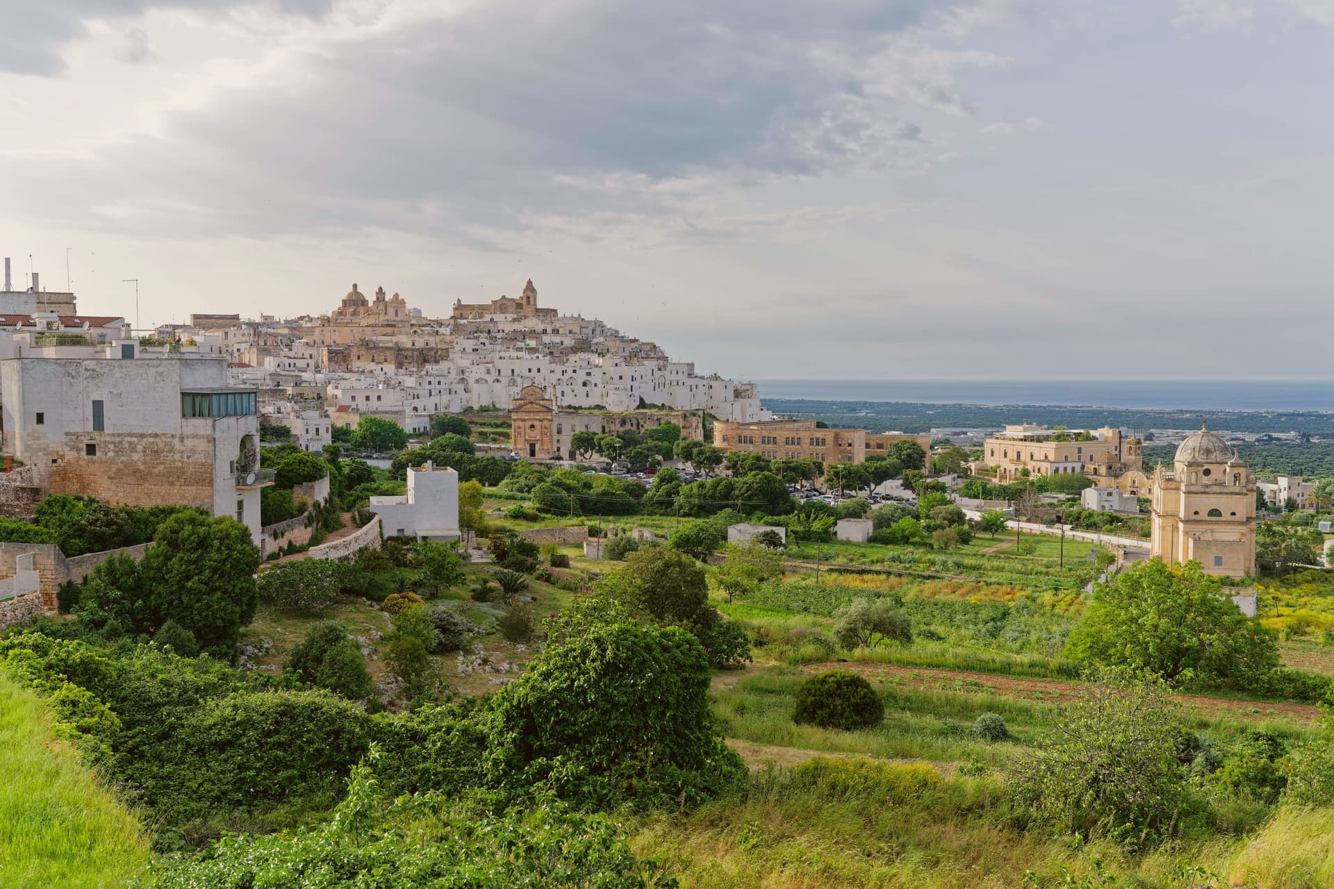
Why visit Ostuni
Ostuni sits at 218 meters on three hills above the Adriatic coastal plain, eight kilometers inland in the southeastern Murge. The whitewashing that gives it the name Città Bianca is medieval in origin, a hygienic measure against plague that survived as the local building convention; the entire centro storico is painted white in lime every spring and reads as a single bright mass from the surrounding olive country.
The territory has been inhabited since the Paleolithic; the Messapii founded the urban nucleus before the Romans absorbed the region. In 1507 it passed to Isabella, Duchess of Bari, then to her daughter Bona Sforza, queen of Poland, who fortified the coast with watchtowers against Ottoman raids in 1539.
The Cattedrale, a late-Gothic facade with a rose window of twenty-four rays, anchors the upper town. The olive landscape around the commune holds some of the oldest cultivated trees in the Mediterranean.
What to see in Ostuni
- Cattedrale di Santa Maria Assunta. Late fifteenth-century Gothic cathedral at the highest point of the centro storico, with a rose window of twenty-four rays unique in Puglia.
- Centro storico. Whitewashed old town on three hills, lime-painted every spring against plague tradition, the single bright mass that names the Città Bianca.
- Piazza della Libertà. Lower civic square outside the medieval walls, with the Guglia di Sant'Oronzo, an early eighteenth-century baroque obelisk to the patron saint.
How to get to Ostuni
It has its own railway station. Taranto is about 1 h 4 min away by road. The full route from Bari.
Our tip
April through June and September through October are the months Ostuni works: olive plain in flower or harvest light, the white walls glowing in mild evenings, the Adriatic eight kilometers away warm enough for swimming by mid-May. July and August touch thirty-five degrees and the centro storico fills with day-trippers from Bari and Brindisi; weekends in August are shoulder to shoulder in the upper alleys. Late afternoon and after dusk are the times to walk, when the white walls cool and the crowds thin.
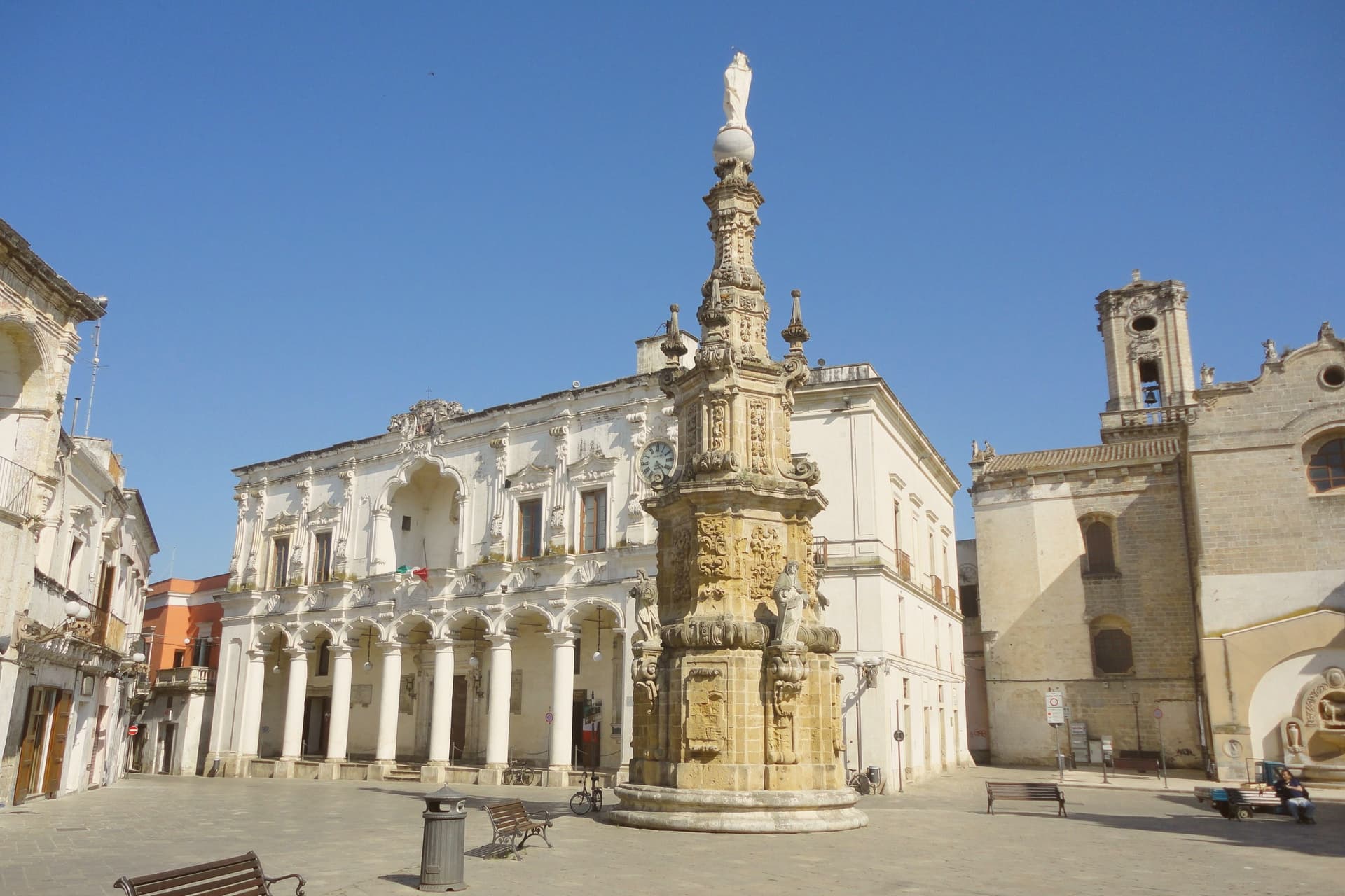
Why visit Nardò
The town sits at 45 meters in the northwestern Salento, about ten kilometers inland from the Ionian coast. With just under 31,000 inhabitants and 190 square kilometers of territory, it is the second-largest commune in the province after the capital.
It was a Byzantine stronghold for centuries; in 1497 the dukes of Acquaviva acquired it and turned it into a cultural seat, with universities, academies and literary circles that drew on the same humanist current as Lecce and Gallipoli. The centro storico, built up under that ducal patronage, forms a dense fabric of palaces and church facades in the local pietra leccese, with the castle standing at its edge, now serving as the municipal seat.
Ten kilometers of inland distance separate that historic core from the municipal coastline, where the Porto Selvaggio nature reserve occupies a stretch of Mediterranean pine forest above limestone cliffs, held by the commune as a regional park. Inland seat of government and culture, coastal reserve of forest and cliff: the two halves of the commune's territory answer to different centuries and different purposes, joined only by the ten kilometers between them.
What to see in Nardò
- Piazza Salandra. Central Baroque square of the centro storico, the Guglia dell'Immacolata at its center, ringed by palazzi and church facades in pietra leccese.
- Castello Acquaviva. Aragonese-Acquaviva castle on the edge of the centro storico, residence of the ducal house from 1497, now the municipal seat.
- Cattedrale di Maria Santissima Assunta. Romanesque-Baroque cathedral founded in the eleventh century and remodelled across the seventeenth, with later Baroque facade and bell tower.
How to get to Nardò
It has its own railway station. Taranto is about 1 h 20 min away by road. The full route from Bari.
Our tip
April through June and September through October are the months Nardò is at its best: Baroque facades in raking light, the Porto Selvaggio pine forest cool, the Ionian water warm enough to swim by mid-May. July and August touch thirty-six degrees and the centro storico empties between two and five in the afternoon; the coastal hamlets of Santa Caterina and Sant'Isidoro fill with Lecce families. The Festa di San Gregorio Armeno in mid-February is the local patronal day, the only large winter event.
More from Anywhere Italy
- The best coastal towns within 90 minutes of TarantoNear Tarantocoastalwithin 90 min7 towns · smallest 3,204 residents · closest 46 min away
- The 7 best towns worth staying overnight that you can reach by train within 90 minutes of TarantoNear Tarantoby trainwithin 90 minworth staying overnight7 towns · smallest 11,968 residents · closest 38 min away
- The 7 best beach towns inside a nature park in PugliaPugliaclean beachinside a park7 towns · smallest 11,988 residents
- The best hill towns inside a nature park in PugliaPugliahill towninside a park6 towns · smallest 8,171 residents
- The best beach towns with a serious restaurant in PugliaPugliaclean beachserious restaurant9 towns · smallest 4,283 residents
- The best beach towns worth staying overnight in PugliaPugliaclean beachworth staying overnight6 towns · smallest 17,531 residents