
The 7 best towns worth staying overnight that you can reach by train within 90 minutes of Taranto
90 towns visited, 910 to go. Follow along, free: Subscribe on Substack
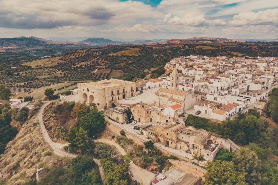
Taranto sits at the junction of Puglia and Basilicata, and the trains out of it climb quickly from the sea into limestone country. Within an hour you are among trulli and dry-stone walls, in towns built from the pale local tufa that goes gold at the end of the afternoon. This is the land of orecchiette with turnip tops, capocollo, burrata eaten the day it was made, and the roasted meat of the Valle d'Itria butcher-grills, ordered by weight at the counter and cooked while you wait. Spring and early autumn are the good months, when the olive groves are worked and the evenings are still warm enough to eat outside.
Most people arriving in this part of the south drive straight to Alberobello and its streets of conical roofs, then on to Matera and the Sassi. Both are extraordinary, and both are busy from morning coach arrival to evening, with the accommodation priced accordingly. Alberobello in particular has become a place people see for an hour or two rather than sleep in, which is a strange fate for a town.
The same stone, the same wine and the same grills carry on for miles past those two names, along lines that are easy to use without a car. The towns here sit on the Valle d'Itria plateau, on the Ionian plain and out toward the Salento, each with somewhere decent to stay so that you get the evening as well as the daytime. Staying overnight is the point: the streets empty of day visitors, the bars fill with people who live there, and dinner stops being a queue.
Of the 20 communes we have mapped within 90 minutes of Taranto, 7 qualify as towns worth staying overnight you can reach by train: each has a hotel a travel guide has vouched for, and we have confirmed each is reachable without a car. The smallest, Bernalda, has 11,968 residents.
Elsewhere in the catalogue: The best hill towns worth staying overnight in Puglia and The best beach towns you can reach by train within 90 minutes of Taranto.
Why visit Bernalda
Bernalda sits at 127 meters between the Bradano and Basento rivers, eight kilometers inland from the Ionian coast and the frazione of Metaponto. Almost twelve thousand people live in the town, named for the Aragonese courtier who moved the older Camarda settlement up to the defensible hilltop where the centro still stands.
The corso and the castle anchor the upper town; the coast and its archaeological ground lie a separate world eight kilometers below. Metaponto was founded by Achaean Greeks in the seventh century BC, the plain later home to Pythagoras until his death.
What remains there today spans a wide stretch of time in a small area: temple columns from the sixth century BC, a Greek theater and necropolis, and a beach that draws summer crowds for reasons that have nothing to do with antiquity. Inland, the hill town's own history turns on a single family: an emigration in 1904 and a return a century later that reopened one of its noble houses to visitors.
The town works, then, as two places joined by eight kilometers, one built on Magna Graecia and modern seaside tourism, the other on a hilltop refounding and one family's long departure and return.
What to see in Bernalda
- Castello Aragonese. Hilltop fortress dating to the 1470 refounding by Bernardino de Bernaudo, with medieval origins and Norman, Swabian and Angevin layered additions.
- Palazzo Margherita. Noble palazzo on Corso Umberto, now a nine-room hotel, the family returning most years for the town's patronal feast.
- Tavole Palatine. The columns stand alone on open plain outside Metaponto, no temple walls around them, the ground where Pythagoras founded his school and died.
How to get to Bernalda
It has its own railway station. Taranto is about 51 min away by road. The full route from Bari.
Our tip
May through September is the coastal season. The Metaponto beach opens reliably by Easter and runs through October, but the heat on the inland hill peaks in July and August. The Festa di San Bernardino in the last week of August brings processions and a fireworks competition that runs three nights.
Why visit Locorotondo
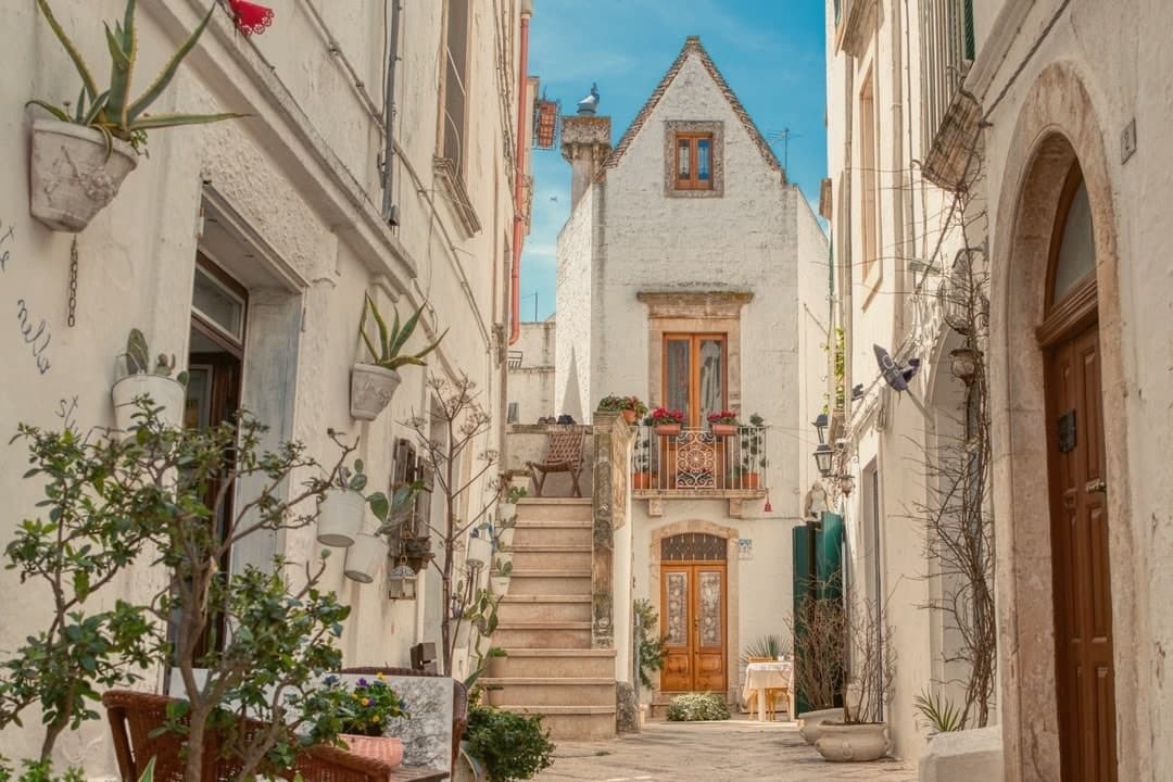
Locorotondo sits on a natural terrace at 410 meters, the high edge of the Valle d'Itria looking south over the trulli countryside between Alberobello, Cisternino and Martina Franca. The name means round place: the centro storico is a perfect circle of whitewashed houses, and the architecture is unique to this town.
The cummerse are stone houses with steep pitched roofs covered in two thin layers of limestone slabs, a profile that exists nowhere else in Puglia. The streets between them run in concentric arcs and are narrow enough to lose the sun by mid-afternoon.
Both the Borghi più belli d'Italia and the Touring Club's Bandiera Arancione recognize the place. The town also makes a white DOC wine from Verdeca and Bianco d'Alessano grapes, grown on 1,650 hectares of vineyards across the surrounding plateau, plus a Città dell'Olio membership for the oil that comes off the same hills.
What to see in Locorotondo
- Centro storico. Circular old town of whitewashed cummerse, an architectural type with double-pitch limestone-slab roofs found only here.
- Villa Garibaldi. Public garden on the ridge with the widest panoramic view over the Itria valley and its trulli countryside.
- Chiesa Madre di San Giorgio. Eighteenth-century parish church on the highest point of the historic center, with a neoclassical façade and a tall central nave.
How to get to Locorotondo
It has its own railway station. Taranto is about 48 min away by road. The full route from Bari.
Our tip
April through June and September through October are the best months on the Itria plateau. Mornings are clear, the surrounding vineyards green up, and the wind off the Murge keeps evenings cool even in summer. July and August push past thirty degrees, the centro storico fills with day-trippers from Alberobello, and the narrow streets get crowded between ten and one.
Why visit Oria
Oria sits at 166 meters on a Salento ridge between Taranto and Brindisi, north of Manduria and southeast of the ancient Taras. The town was Hyria, one of the principal Messapian cities, before the Romans absorbed the region.
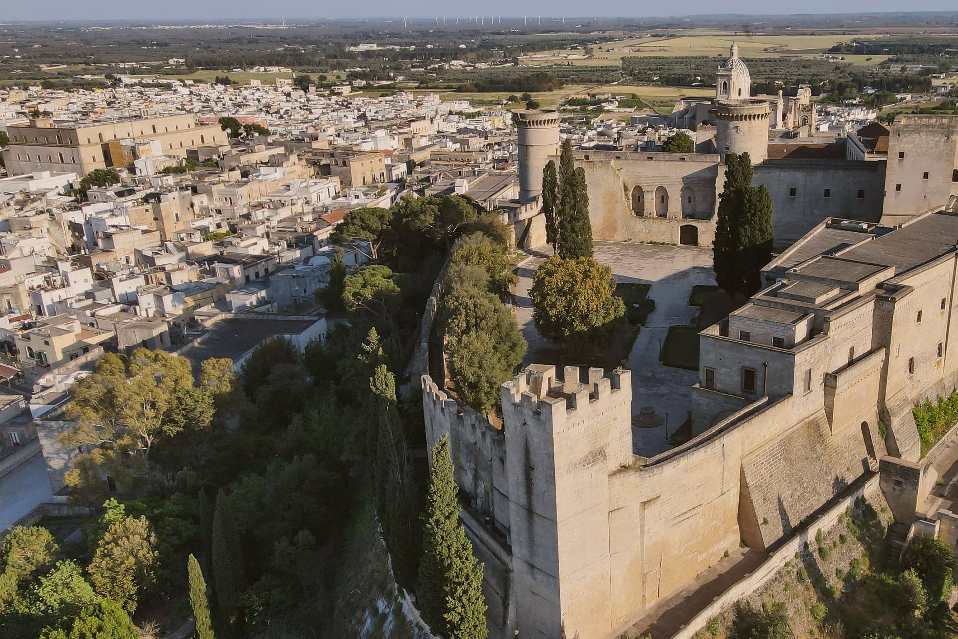
Frederick II rebuilt the castle on the Messapian acropolis between 1227 and 1233; the triangular plan he chose is unique in southern Italian military architecture, with three towers, the Quadrata (Frederician), the Del Cavaliere and the Del Salto (both Angevin additions). Oria also held one of the oldest Jewish communities in Europe, a study center where philosophy, the Talmud, Greek, Latin, medicine and natural science were taught from the ninth century.
Shefatya ben Amitai and Shabbethai Donnolo, two of the first Hebrew writers native to Europe, both lived and worked here. The Jewish quarter, the Giudecca, still organizes the southern edge of the centro storico.
What to see in Oria
- Castello Svevo di Federico II. Frederician castle of 1227-1233 on the Messapian acropolis, triangular plan with three towers, one Frederician and two Angevin, the town's defining monument.
- Cattedrale di Oria. Eighteenth-century Baroque cathedral raised over earlier medieval foundations, the seat of the diocese of Oria since the Lombard era.
- Giudecca. Old Jewish quarter on the southern flank of the centro storico, organized around the Vico degli Ebrei, a continuous medieval settlement from the ninth century.
How to get to Oria
It has its own railway station. Taranto is about 46 min away by road. The full route from Bari.
Our tip
April through June and September through October are the Salento interior months: clear light on the castle ridge, mild evenings, olive country in flower or harvest. July and August touch thirty-six degrees on the hilltop and the centro storico empties between two and five; the Corteo Storico di Federico II runs in mid-August anyway and pulls a regional crowd. October is the olive harvest.
Why visit Pisticci
Pisticci sits on three eroded clay hills in the southern Matera province and is the most populous town in the province after Matera itself. The name of the coastal frazione, and the geology under the whole town, are the same clay that failed on 9 February 1688, when a landslide cut the settlement in half and killed four hundred people.
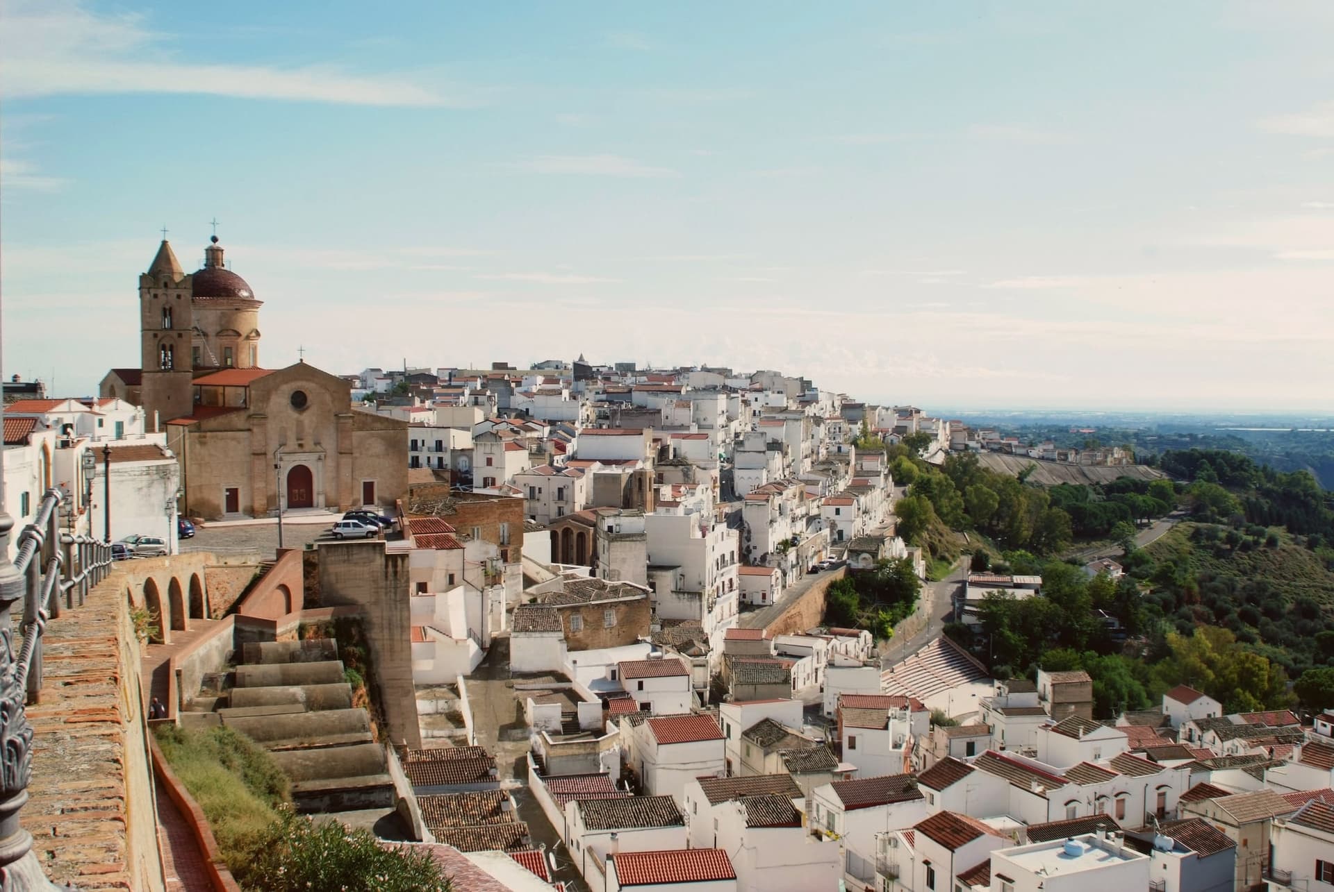
Rather than move down to the valley, survivors rebuilt directly on the ground the slide had crossed, in two-room houses with pitched red tile roofs, arranged in straight lines instead of the tangled layout typical of hill towns in the region. That district took the name of the cliff itself.
Above it, on the highest point, the older part of the town kept its Norman tower, its medieval gate and its mother church, the built record of what stood before the collapse. Twenty kilometers away on the plain toward the sea, the hamlet of Marconia, named for Guglielmo Marconi, functions as the modern center, while the coastal frazione handles the town's relationship to the Ionian.
The clay hills inland, meanwhile, are worked for truffles rather than housing. What the layout adds up to is a town split by elevation and by function: the old hill preserves what predates the disaster, the rebuilt district records the disaster itself, and the plain and the coast carry everything the eroding hill cannot.
What to see in Pisticci
- Rione Dirupo. Low houses set two rooms wide under pitched red tile roofs, laid out in straight lines rather than the tangled streets typical of the region, the most lived-in district of the town today.
- Terravecchia. Oldest district on the highest hill, with the square tower of the Norman castle, the medieval gate, the mother church and the noble palazzi that survived from before 1688.
- Marina di Pisticci. Coastal frazione on the Ionian, twenty kilometers from the centro storico, a Bandiera Blu beach with pine forest backing the sand.
How to get to Pisticci
It has its own railway station. Taranto is about 1 h 6 min away by road. The full route from Bari.
Our tip
April through June and September into October are the strong months. The Dirupo white houses against a clear sky are best in the slanting light of late afternoon, and the Ionian coast at Marina di Pisticci is warm enough for swimming from late May. July and August push past thirty-five degrees in the centro storico; the beach fills with regional summer crowds and the upper town quiets in the afternoon.
Why visit Ostuni
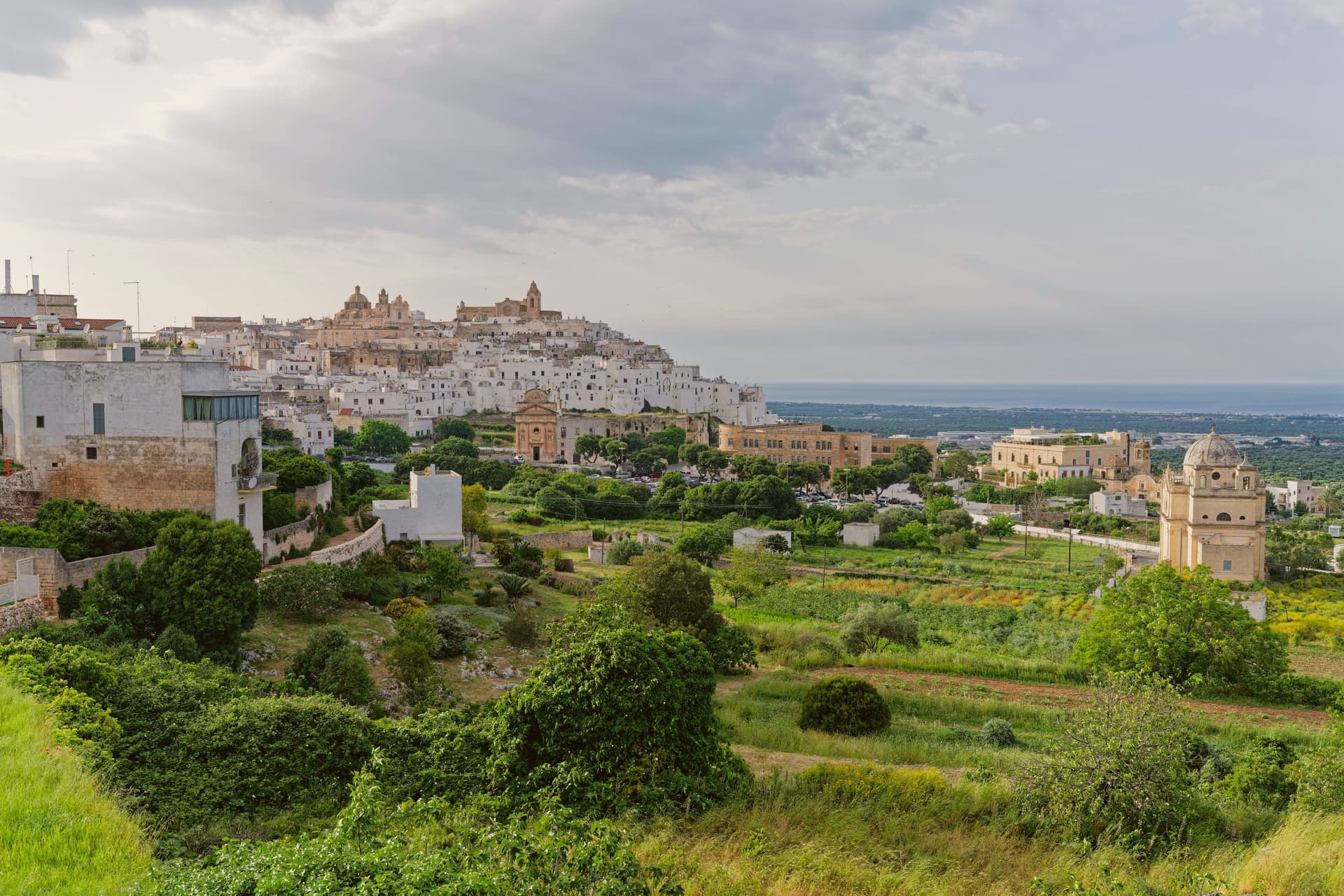
Ostuni sits at 218 meters on three hills above the Adriatic coastal plain, eight kilometers inland in the southeastern Murge. The whitewashing that gives it the name Città Bianca is medieval in origin, a hygienic measure against plague that survived as the local building convention; the entire centro storico is painted white in lime every spring and reads as a single bright mass from the surrounding olive country.
The territory has been inhabited since the Paleolithic; the Messapii founded the urban nucleus before the Romans absorbed the region. In 1507 it passed to Isabella, Duchess of Bari, then to her daughter Bona Sforza, queen of Poland, who fortified the coast with watchtowers against Ottoman raids in 1539.
The Cattedrale, a late-Gothic facade with a rose window of twenty-four rays, anchors the upper town. The olive landscape around the commune holds some of the oldest cultivated trees in the Mediterranean.
What to see in Ostuni
- Cattedrale di Santa Maria Assunta. Late fifteenth-century Gothic cathedral at the highest point of the centro storico, with a rose window of twenty-four rays unique in Puglia.
- Centro storico. Whitewashed old town on three hills, lime-painted every spring against plague tradition, the single bright mass that names the Città Bianca.
- Piazza della Libertà. Lower civic square outside the medieval walls, with the Guglia di Sant'Oronzo, an early eighteenth-century baroque obelisk to the patron saint.
How to get to Ostuni
It has its own railway station. Taranto is about 1 h 4 min away by road. The full route from Bari.
Our tip
April through June and September through October are the months Ostuni works: olive plain in flower or harvest light, the white walls glowing in mild evenings, the Adriatic eight kilometers away warm enough for swimming by mid-May. July and August touch thirty-five degrees and the centro storico fills with day-trippers from Bari and Brindisi; weekends in August are shoulder to shoulder in the upper alleys. Late afternoon and after dusk are the times to walk, when the white walls cool and the crowds thin.
Why visit Nardò
The town sits at 45 meters in the northwestern Salento, about ten kilometers inland from the Ionian coast. With just under 31,000 inhabitants and 190 square kilometers of territory, it is the second-largest commune in the province after the capital.
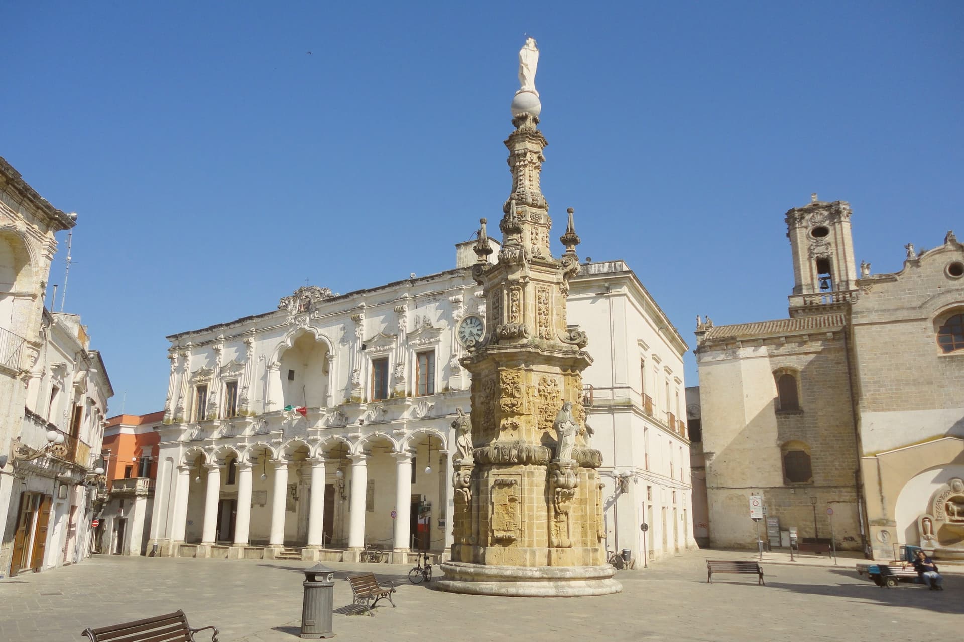
It was a Byzantine stronghold for centuries; in 1497 the dukes of Acquaviva acquired it and turned it into a cultural seat, with universities, academies and literary circles that drew on the same humanist current as Lecce and Gallipoli. The centro storico, built up under that ducal patronage, forms a dense fabric of palaces and church facades in the local pietra leccese, with the castle standing at its edge, now serving as the municipal seat.
Ten kilometers of inland distance separate that historic core from the municipal coastline, where the Porto Selvaggio nature reserve occupies a stretch of Mediterranean pine forest above limestone cliffs, held by the commune as a regional park. Inland seat of government and culture, coastal reserve of forest and cliff: the two halves of the commune's territory answer to different centuries and different purposes, joined only by the ten kilometers between them.
What to see in Nardò
- Piazza Salandra. Central Baroque square of the centro storico, the Guglia dell'Immacolata at its center, ringed by palazzi and church facades in pietra leccese.
- Castello Acquaviva. Aragonese-Acquaviva castle on the edge of the centro storico, residence of the ducal house from 1497, now the municipal seat.
- Cattedrale di Maria Santissima Assunta. Romanesque-Baroque cathedral founded in the eleventh century and remodelled across the seventeenth, with later Baroque facade and bell tower.
How to get to Nardò
It has its own railway station. Taranto is about 1 h 20 min away by road. The full route from Bari.
Our tip
April through June and September through October are the months Nardò is at its best: Baroque facades in raking light, the Porto Selvaggio pine forest cool, the Ionian water warm enough to swim by mid-May. July and August touch thirty-six degrees and the centro storico empties between two and five in the afternoon; the coastal hamlets of Santa Caterina and Sant'Isidoro fill with Lecce families. The Festa di San Gregorio Armeno in mid-February is the local patronal day, the only large winter event.
Why visit Martina Franca
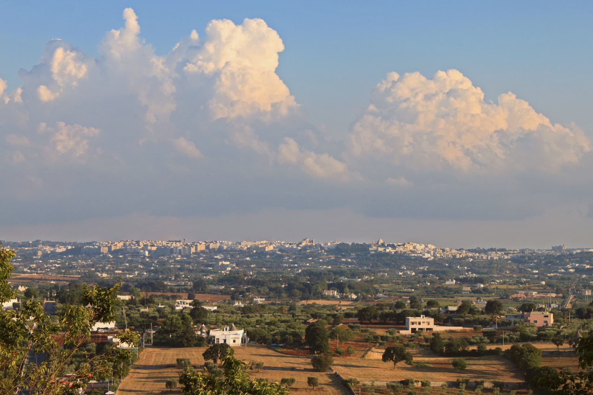
Martina Franca sits at 431 meters on the southern edge of the Valle d'Itria, on the border between the provinces of Taranto, Bari and Brindisi. The town was founded in 1310 by Philip I of Anjou, Prince of Taranto, who granted franchigie, tax exemptions, to settlers willing to repopulate the hill, hence Franca in the name.
The centro storico is the densest concentration of Rococo and late-Baroque architecture in Puglia after Lecce: wrought-iron balconies, carved stone portals, churches built or rebuilt after the 1743 earthquake. The Palazzo Ducale of 1668, raised on the foundations of a 1338 medieval castle, is the seat of the municipal offices and the open-air courtyard where the Festival della Valle d'Itria has been performed every July and August since 1975, founded specifically to recover rare and forgotten operas.
The Basilica di San Martino, begun in 1747, is the most complete example of Martinese Rococo. The surrounding plateau makes a Martina Franca DOC white wine and a strong dry-cured capocollo IGP.
What to see in Martina Franca
- Palazzo Ducale. Built in 1668 on the foundations of a 1338 medieval castle, town hall and home of the Festival della Valle d'Itria summer opera courtyard.
- Basilica di San Martino. Eighteenth-century basilica begun in 1747 after the 1743 earthquake, the most complete Martinese Rococo monument and museum of liturgical art.
- Piazza Roma and Piazza Maria Immacolata. The two main squares of the centro storico, linked by Via Cavour, lined with eighteenth-century palazzi and the town's main passeggiata.
How to get to Martina Franca
It has its own railway station. Taranto is about 38 min away by road. The full route from Bari.
Our tip
April through June and September through October are the best months on the Itria plateau. The 431-meter elevation keeps the air dry, the limestone walls reflect a clear light, and the surrounding vineyards green up in spring then turn gold by the late September harvest. July and August are hot but mitigated by the altitude; they are also the months the Festival della Valle d'Itria runs in the Palazzo Ducale courtyard, the largest cultural draw in southern Puglia.
Read a sample letter
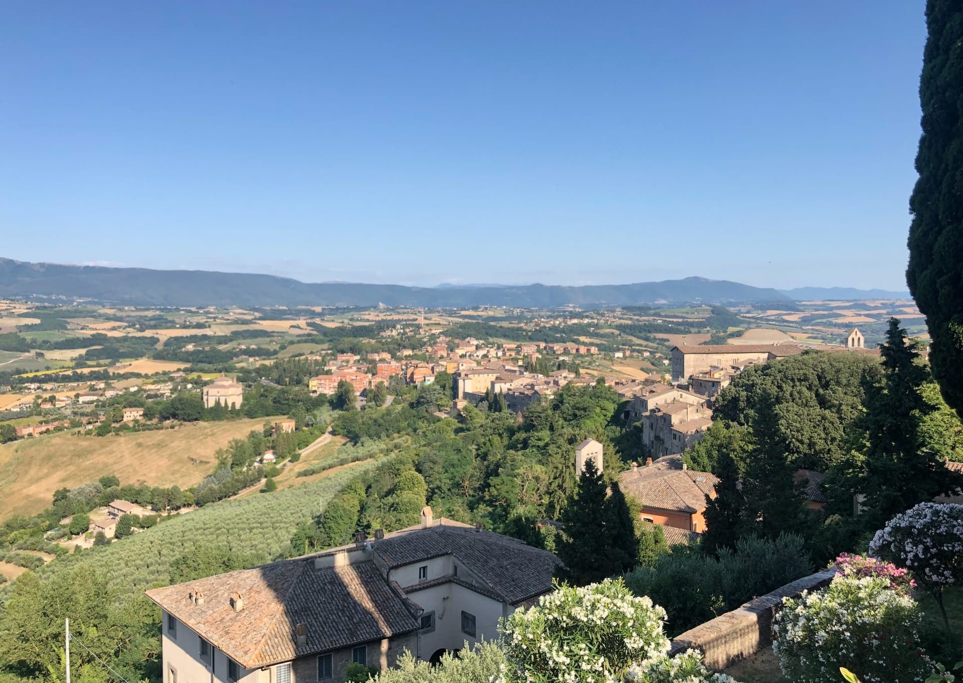
Todi | The Beverly Hills of Umbria
An unusually global town on a clay hill
Letters from the towns we visit. Free.
The button takes you to the letter's own page on Substack, where you leave your email. About the letter
More from Anywhere Italy
- The best hill towns worth staying overnight in PugliaPugliahill townworth staying overnight7 towns · smallest 11,139 residents
- The best beach towns you can reach by train within 90 minutes of TarantoNear Tarantoclean beachby trainwithin 90 min9 towns · smallest 3,204 residents · closest 49 min away
- The best towns worth staying overnight that eat well in PugliaPugliaeats wellworth staying overnight7 towns · smallest 5,631 residents
- The best beach towns worth staying overnight in PugliaPugliaclean beachworth staying overnight6 towns · smallest 17,531 residents
- The best towns inside a nature park that are worth a night in PugliaPugliainside a parkworth staying overnight7 towns · smallest 5,631 residents
- The best hill towns inside a nature park in PugliaPugliahill towninside a park6 towns · smallest 8,171 residents