
The best beach towns you can reach by train in Campania
The Campanian coast is volcanic rock and pale sand in roughly equal measure, and the water clears as you go south, from the deep blue under the tufa cliffs of the Sorrentine peninsula to the shallow green bays of the Cilento. Houses here are lime-washed or left in the raw yellow stone the hills give up, with terraces stacked to catch the sea light. Lemons grow on the northern side, figs and olives on the southern; the fish is anchovy, alici di menaica cured in salt down in the Cilento, and mozzarella di bufala comes up from the plain behind Paestum. The season runs long, with warm sea into October and empty beaches either side of August. Trains run the whole length of it, which is the useful part.
The Amalfi Coast is what most people book, and the road between Positano and Amalfi is the reason the region is known at all. It is also the reason coaches queue at every hairpin from June onward, why parking costs more than lunch, and why the beach at Positano is a mosaic of hired loungers by mid-morning. Capri absorbs the overflow by ferry. None of this is a secret to anyone who has been, and none of it is reachable by train.
The rail lines tell a different story. The Circumvesuviana runs out along the peninsula through towns with their own harbours and bathing rock, and the coastal line south of Salerno stops in the Cilento at stations a short walk from wide sand and clear water. These are working towns with fishing boats, markets and beaches that hold the national award for water quality, and fewer people go. Each of the towns below can be reached without a car.
Of the 66 communes we have mapped in Campania, 6 qualify as beach towns you can reach by train: each holds the national award for clean bathing water, and we have confirmed each is reachable without a car. The smallest, Pisciotta, has 2,428 residents.
Two more lists worth reading alongside this one: The 6 best beach towns with a serious restaurant in Campania and The best hidden beach towns in Campania.
Pisciotta
Why visit Pisciotta
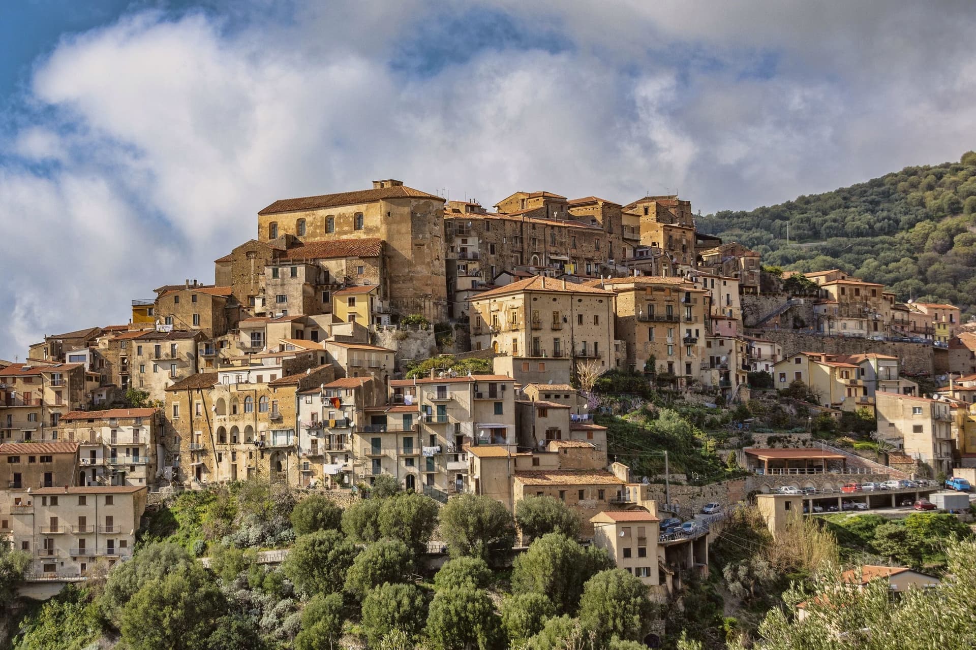
The hill the town occupies rises between Ascea and Palinuro, part of the strictest zone of the Cilento and Vallo di Diano National Park, and the ridge gives the stone houses of the centro storico a clear line of sight to Capo Palinuro twelve kilometers south. The town's parts sit at different elevations doing different work: the historic core holds the ridge at 171 meters, the olive terraces cover the slopes below it, and Marina di Pisciotta occupies the shore at the foot of the hill, where the fishing boats go out.
The menaica net worked by the Marina's fishermen is a technique once widespread around the Mediterranean and now reduced to a few coves, of which this is one. Carlo Pisacane's failed 1857 revolutionary expedition landed at Sapri and was crushed nearby; the Cilento coast keeps the memory in plaques and processions rather than in any structure at Pisciotta itself.
What holds the town together is elevation: everything of note here, the anchovies, the olives, the beach, the ridge, is defined by how far it sits above or below that 171-meter line.
We confirmed you can reach this one by train.
What to see in Pisciotta
- Centro storico di Pisciotta. Hilltop medieval core of stone houses on a ridge 171 meters above the sea, with a clear sightline to Capo Palinuro.
- Marina di Pisciotta. Fishing port at the foot of the hill, departure point for the last menaica anchovy boats on the coast, its beach holding the Blue Flag.
- Uliveti di Pisciottana. Terraces holding trees of considerable age, the source groves of the Cilento DOP extra-virgin oil.
How to get to Pisciotta
There is a railway station in the town, so you can arrive without a car and never need one while you are here. Salerno is roughly 138 minutes away by road.
Our tip
May through September is the open season on the Cilento coast: clear water, warm evenings and the menaica boats out at night. July and August push past thirty-five degrees and the Marina rentals book; the centro storico on the hill above stays a few degrees cooler in the breeze. April and October are dry and mild, the right time for the olive harvest road and Parco Nazionale walks without heat.
Ascea
Why visit Ascea
Ascea sits on the southern Cilento coast, two settlements in one comune: Ascea Paese at 230 meters above olive groves, and Ascea Marina on the flat between the Alento river and the sea. The Greek colonists from Phocaea founded Hyele here around 538 BC after fleeing the Persians; the city became Elea in Greek and Velia in Roman times, and produced the Eleatic school of Parmenides and Zeno that founded Western metaphysics.
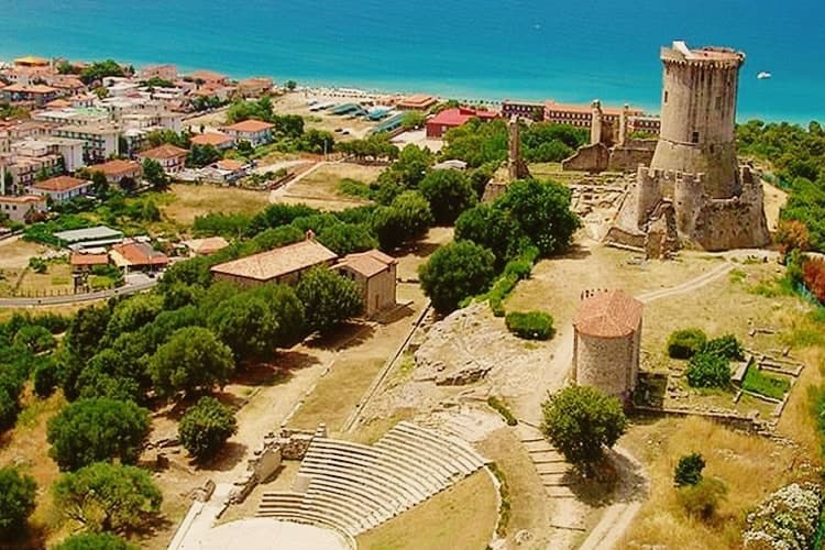
The archaeological park keeps the Porta Rosa, the oldest known round arch in Europe, an Ionian temple acropolis, Roman baths and the medieval Castelluccio Angioino built on the city's highest point. Modern Ascea is a Bandiera Blu beach commune of nine kilometres of sand inside the Cilento, Vallo di Diano and Alburni National Park, with the Spighe Verdi mark for agro-environmental quality.
We confirmed you can reach this one by train.
What to see in Ascea
- Parco Archeologico di Elea-Velia. Ruins of the Greek city founded around 538 BC by Phocaeans, home to Parmenides and the Eleatic school, with Porta Rosa, Ionic temple acropolis and Roman baths.
- Castelluccio Angioino. Medieval Angevin tower built on the highest point of ancient Velia, reusing Greek and Roman masonry, restored as the park's viewpoint.
- Marina di Ascea. Nine kilometres of fine sand between the Alento river mouth and Punta del Telegrafo, Bandiera Blu and Spighe Verdi within the Cilento national park.
How to get to Ascea
There is a railway station in the town, so you can arrive without a car and never need one while you are here. Salerno is roughly 110 minutes away by road.
Our tip
May through September is the open Cilento summer, with the Marina filling up from late June onward and the archaeological park staying open for evening visits in July and August. Mid-summer touches the high thirties and the beach absorbs most of the day; the paese on the hill stays a few degrees cooler. April and early October are dry and quiet, ideal for walking Velia without crowds or sun damage to the stone.
Piano di Sorrento
Why visit Piano di Sorrento
Piano di Sorrento sits at ninety-six meters on the tuff terrace of the Sorrentine peninsula, four kilometers east of Sorrento, thirty kilometers from Napoli. The upper plain has been inhabited since the second millennium BC: pottery and a necropolis from the Gaudo culture were excavated between the frazioni of Trinità and San Massimo.
The town was tied to Sorrento until 1808, when Joseph Bonaparte's reform separated it as an autonomous comune. The local name, Caruotto, comes from the Latin carottum, quarry, after the tuff pits that fed the building of the peninsula.
The Basilica di San Michele Arcangelo, ninth century in origin, was raised to papal basilica status by Benedict XV in 1914 and holds two large inlaid wooden doors. The Villa Fondi de Sangro, a neoclassical 1840 villa above the cliff, now houses the Georges Vallet archaeological museum and faces the Marina di Cassano below.
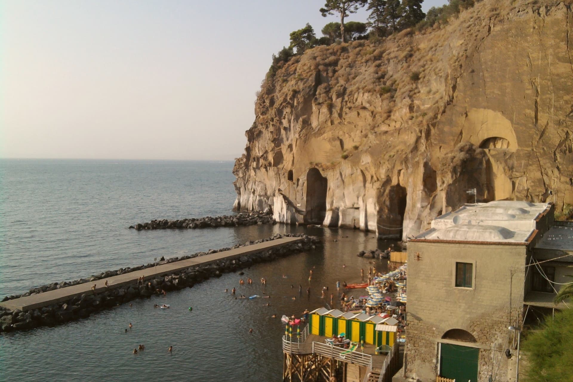
The marina has black volcanic sand, fishing boats and a small port that still works.
We confirmed you can reach this one by train.
What to see in Piano di Sorrento
- Basilica di San Michele Arcangelo. Ninth-century church raised to papal basilica status in 1914 by Benedict XV, with large inlaid wooden doors and a baroque interior in the centro of Piano.
- Villa Fondi de Sangro. Neoclassical villa of 1840 above the cliff, now seat of the Museo Archeologico Georges Vallet, with finds from the Massa Lubrense and Sorrento peninsula excavations.
- Marina di Cassano. Small fishing port with black volcanic sand at the foot of the cliff, reached by a steep path from the upper town, still active for inshore fishing.
How to get to Piano di Sorrento
There is a railway station in the town, so you can arrive without a car and never need one while you are here. Napoli is roughly 49 minutes away by road.
Our tip
May through September is the working season for the Sorrentine peninsula, and Piano follows the same rhythm as Sorrento next door. June and September are the easiest months: warm sea, manageable crowds, full ferry schedules to Capri and Ischia. July and August are crowded with day-trippers; Marina di Cassano fills early and the upper town turns over to the lunch trade.
Sorrento
Why visit Sorrento
Sorrento sits on a block of tuff cliff fifty meters above the Bay of Napoli, thirty kilometers from the city by Circumvesuviana railway or ferry. The town began as a Greek foundation and became the Roman Surrentum, a resort favored by senators.
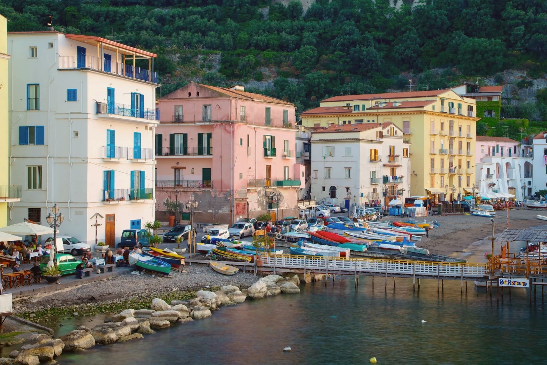
The current population is 15,407. The old town sits above, gathered around the Duomo and the cloister of San Francesco a few minutes apart, while Marina Grande lies below the cliff, reached through the ancient Greek gate, its harbor still working and its trattorie facing the bay.
Terraces of lemon groves ring the slopes above town, the same femminello sorrentino IGP fruit that supplies the limoncello sold through the centro storico. Piazza Tasso, at the head of the old town, is where Corso Italia begins and where the statue of Torquato Tasso stands; the poet was baptized in the cathedral below.
A cliff town facing the bay, its upper streets given to churches and squares, its lower shore to fishing and the harbor, and its surrounding slopes turned over entirely to the lemon that still funds much of what happens in between.
We confirmed you can reach this one by train.
What to see in Sorrento
- Duomo di Sorrento. Eleventh-century cathedral rebuilt in Romanesque style in the fifteenth century, with a baroque interior and the baptistery where Torquato Tasso was christened.
- Chiostro di San Francesco. Fourteenth-century cloister of tuff arches and crossed columns, the marble façade redone in 1926, still used for civic weddings and chamber concerts.
- Museo Correale di Terranova. Decorative arts museum in a seventeenth-century villa opened in 1924, with Neapolitan porcelain, period furniture and seventeenth-century painting.
How to get to Sorrento
There is a railway station in the town, so you can arrive without a car and never need one while you are here. Napoli is roughly 57 minutes away by road.
Our tip
May, June, September and October are the months that work for Sorrento. The sea is warm enough to swim, the temperatures sit in the mid-twenties, and the centro storico is busy without being unworkable. July and August are crowded almost beyond use.
Vico Equense
Why visit Vico Equense
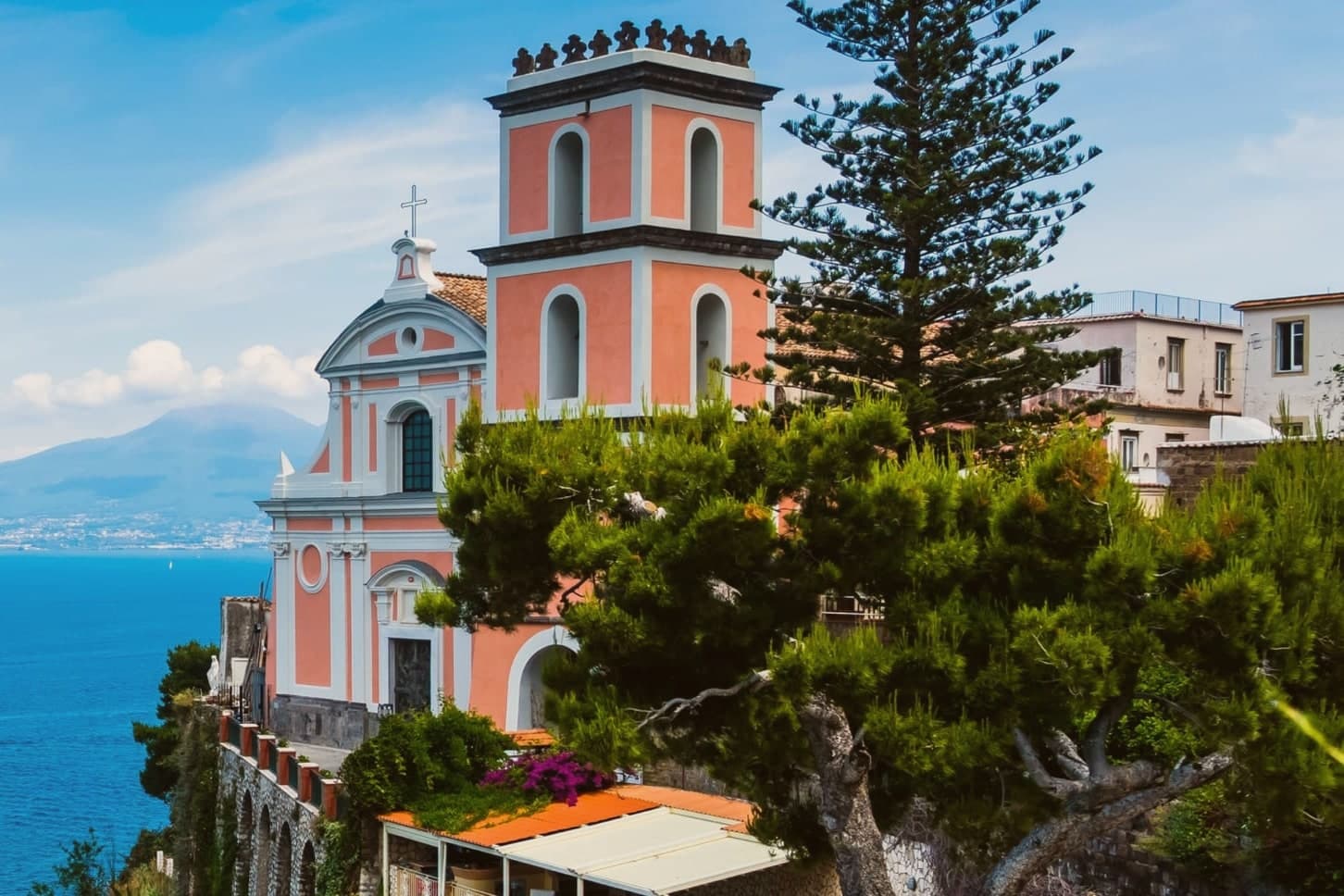
Vico Equense sits on a block of tuff and limestone above the Bay of Napoli, twenty-five kilometers from the city and the first town on the Sorrento peninsula coming from the north. A seventh-century BC pre-Roman necropolis predates the Latin Aequana that Roman patricians built here for their villas, and the finds from that older settlement, funerary objects excavated in the 1960s and 1970s, sit now in a museum founded in 1966.
The medieval town that survives was walled by the Angevins after 1284, when Charles II ordered a fortress built on the cliff as both stronghold and residence, and the diocese's cathedral rose on a neighboring clifftop in the same century, before losing its status as a see in 1818. Behind the town, the limestone mass of the Lattari range closes off the land side, reached since 1952 by cable car from the coast at Castellammare.
Pizza by the meter, the town's best-known export, was invented here by Luigi Dell'Amura, called Gigino, in the 1930s, and his restaurant in the centro still serves it. What holds the town together is the sequence itself: a pre-Roman settlement, a Roman villa town, an Angevin fortress and a bishopric, and finally a twentieth-century dish, each layer built on a narrow shelf of rock between the mountain and the bay.
We confirmed you can reach this one by train.
What to see in Vico Equense
- Chiesa dell'Annunziata. The church stands at the edge of the cliff, its Gothic interior at odds with the Baroque face it was given later. The old cathedral of a diocese that no longer has a seat here.
- Castello Giusso. Angevin castle built between 1284 and 1289 at the order of Charles II of Anjou, with a Renaissance residential wing and gardens above the bay.
- Antiquarium Silio Italico. Archaeological museum founded in 1966, with funerary objects from a seventh-century BC pre-Roman necropolis excavated in the 1960s and 1970s.
How to get to Vico Equense
There is a railway station in the town, so you can arrive without a car and never need one while you are here. Napoli is roughly 55 minutes away by road.
Our tip
May through September is the working season for Vico Equense. June and September are the best months: warm sea, fewer day-trippers than July and August, and the Monte Faito cable car operating on a full schedule. July and August are crowded and hot at sea level, though the Faito plateau stays cooler at around twenty-two degrees. Sagra del Riavulillo falls in the season.
Agropoli
Why visit Agropoli
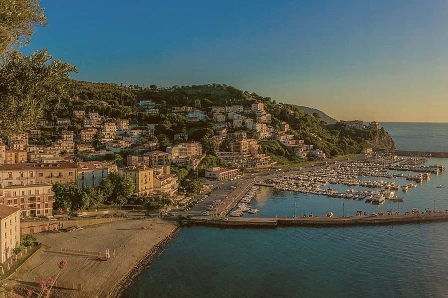
Agropoli is the northern gate of the Cilento coast, a promontory between two bays forty kilometres south of Salerno. The name itself, akropolis, was given by the Byzantines who fortified the high point during the Greco-Gothic war between 535 and 553.
In 882 the Saracens took the town and turned it into a rabat, a trenched stronghold from which they raided as far as the walls of Salerno until they were dislodged from the Garigliano camp in 915. The Angevin-Aragonese castle still stands on the highest point, a triangular plan with three circular towers and a moat, built on the original Byzantine foundations.
Below the castle, the centro storico runs in stone stairways down to the small fishing port. Modern Agropoli has 21,000 residents, a Bandiera Blu beach, the Spighe Verdi mark for agro-environmental quality, and Cilento National Park status that links it inland to the Mediterranean Diet biosphere.
We confirmed you can reach this one by train.
What to see in Agropoli
- Castello Angioino-Aragonese. Triangular castle with three circular towers and a moat, built on sixth-century Byzantine foundations and remodelled by the Angevins and Aragonese.
- Centro storico sul promontorio. Old town on the headland, stone stairways from the castle down to the fishing port, with the seventeenth-century Porta arch and tight whitewashed alleys.
- Chiesa dei Santi Pietro e Paolo. Sixteenth-century mother church inside the centro storico, rebuilt after war damage, dedicated to the patrons celebrated each 29 June.
How to get to Agropoli
There is a railway station in the town, so you can arrive without a car and never need one while you are here. Salerno is roughly 66 minutes away by road.
Our tip
May through September is the open Cilento beach season, with the marina filling up from late June onward and the Trentova bay reachable by foot or boat. July and August push the Cilento past thirty-five degrees and the port and headland fill with day boats from Capri and Salerno. April and October are dry and quieter, ideal for walking the castle path without the queue.
More from Anywhere Italy
- The 6 best beach towns with a serious restaurant in Campania
- The best hidden beach towns in Campania
- The best towns with a serious restaurant that you can reach by train in Campania
- The best beach towns in the province of Salerno
- The 9 best towns you can reach by train in the province of Napoli
- The best coastal towns inside a national park in Campania