
The 6 best towns you can reach by train in the province of Matera
Basilicata's eastern province is built out of what the ground gives: pale tufa cut into cave dwellings and church facades, brick and stone farmhouses on ridges above the calanchi, the grey clay gullies that crack open under the summer sun. Below the hills the land flattens into the Metapontino, where citrus groves and strawberry fields run to pine woods and long sandy beaches on the Gulf of Taranto. Food follows the same split, lamb, chickpeas and crusty durum bread up high, fish and bitter greens near the water, with Matera bread and peppers from the Sinni valley on most tables. Spring and early autumn are the sane seasons, when the gullies are green and the coast is warm without being punishing.
Most people crossing this part of the south are aiming at Puglia, at the trulli of Alberobello and the whitewashed lanes of Ostuni, and in July and August those streets move at a shuffle. The coaches park on the edge of town, the lunch tables are booked out, and the same photograph is taken from the same corner several thousand times a day. It is a good landscape, which is exactly why it fills up.
The trains, though, keep going. The Ionian line runs down the coast through fishing and farming towns with beaches and Greek ruins beside the platform, and the narrow-gauge Appulo Lucane climbs inland to hill towns of tufa and brick where fewer people go. The towns below sit on those lines, and we have confirmed each is reachable without a car.
Of the 15 communes we have mapped in the province of Matera, 6 qualify as towns you can reach by train: we have confirmed each is reachable without a car. The smallest, Irsina, has 4,449 residents.
Elsewhere in the catalogue: The 9 best hill towns in the province of Matera and The best hidden towns you can reach by train in Basilicata.
Irsina
Why visit Irsina
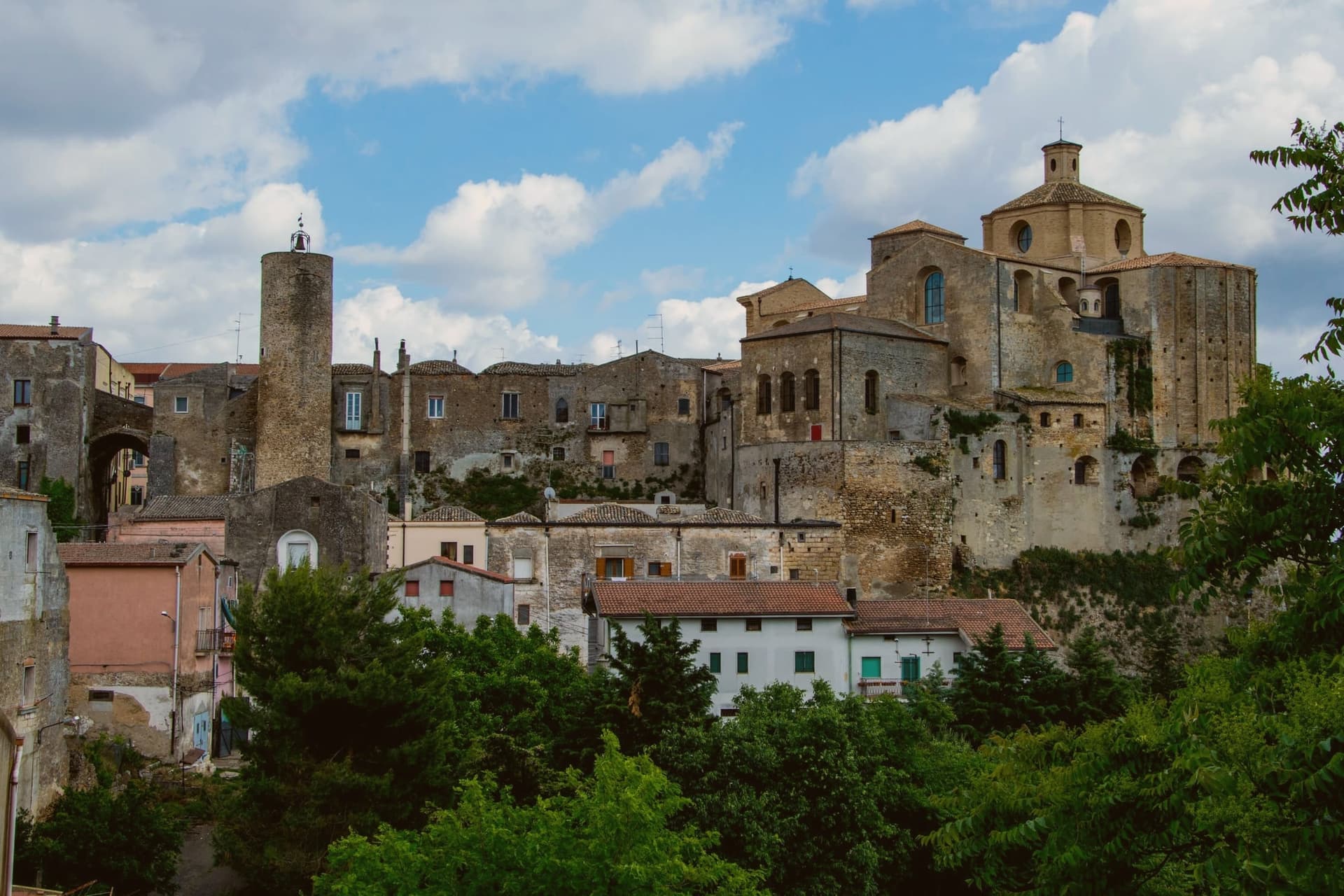
Irsina sits on the border between Basilicata and Puglia, twenty-nine kilometers from Matera, where the Bradano flows below and separates the town from the Murge plateau. The historic centre occupies a tufaceous spur riddled beneath with rupestrian caves and cisterns, a settlement built as much downward as up.
The town's civic and religious history turned on a single commission. Raised to an archbishop's seat in 1452, Montepeloso saw its priest, Roberto de Mabilia, then working as an ecclesiastical notary in Padua, commission a young sculptor from that city to carve a Sant'Eufemia for his home town the following year.
The statue he sent back carries the old town's own coat of arms, the triple mountain and castle, in the saint's hand, binding the imported Renaissance object to the local heraldry it was made to honor. A hill town on a river border ended up holding, by way of a notary's commission to a distant workshop, a devotional statue that ties its Puglia-facing geography to a Veneto hand and its pre-1895 name to the stone the saint holds.
We confirmed you can reach this one by train.
What to see in Irsina
- Cattedrale di Santa Maria Assunta. Thirteenth-century cathedral on the highest point of the borgo. Raised to an archbishop's seat in 1452, it holds the statue as its principal treasure.
- Sant'Eufemia di Mantegna. Carved from Nanto stone of the Veneto, the saint stands with a lion at her side. Identified as Andrea Mantegna's own work in 1996, confirmed by later scholars.
- Ipogei e cantine rupestri. Underground cellars, cisterns and rupestrian rooms cut into the tufaceous spur, reaching beneath the historic centre's alleys and houses.
How to get to Irsina
There is a railway station in the town, so you can arrive without a car and never need one while you are here. Bari is roughly 86 minutes away by road.
Our tip
April through June and September through October are the comfortable months in the Bradano hills, with green wheat fields and dry evenings at 548 meters. July and August touch the mid-thirties on the open spur but stay cool in the rupestrian cellars beneath the centro. November through March is quiet, the cathedral keeps shorter hours and the Mantegna can usually be seen without a queue.
Nova Siri
Why visit Nova Siri
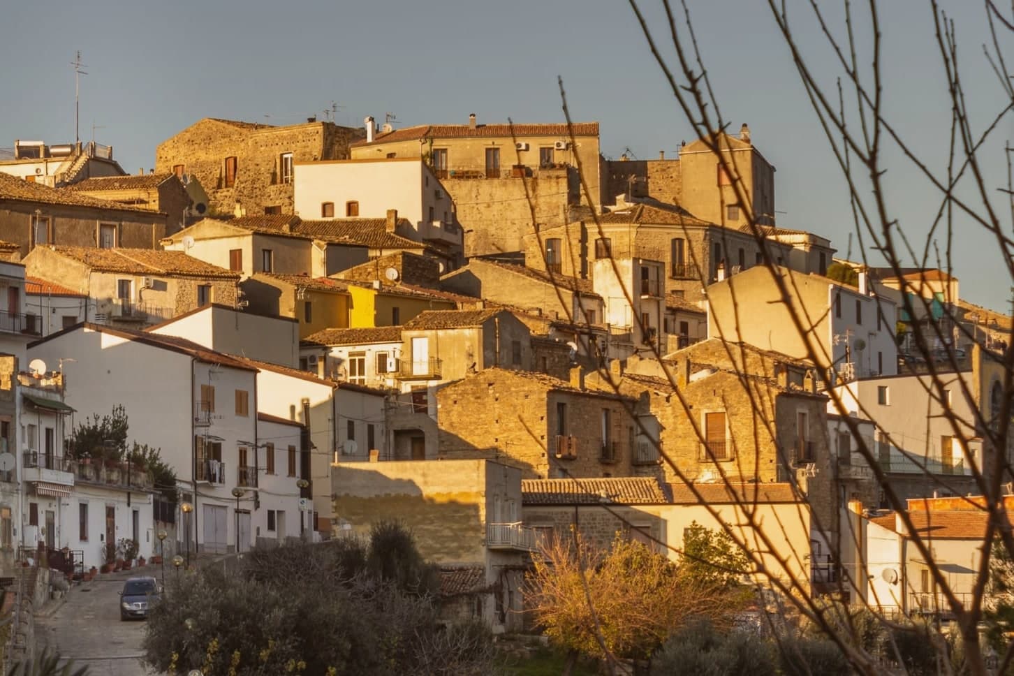
Nova Siri exists in two parts. The old town sits at 350 meters on a hill nine kilometers inland; Marina di Nova Siri lies on the Ionian Sea below, developed from the 1970s onward as a beach town.
The site is on the southern edge of Basilicata where the region meets Calabria, near the ancient Greek colony of Siris, founded by Ionian settlers in the seventh century BC and destroyed in the sixth, whose territory gave the region its name of Siritide and whose river, the modern Sinni, still defines the comune. Byzantine military use followed in the early medieval period.
The Torre Bollita, a semicircular tufo tower inside the medieval walls, is the surviving fortification; in its vicinity, the remains of a Hellenistic necropolis have come to light. The Chiesa Madre dedicated to Santa Maria Assunta dates to the sixteenth century.
The Marina holds the Bandiera Blu since 2018, with wide sandy beaches, dunes and pine forest behind. Spighe Verdi recognises the commune's rural and environmental management.
We confirmed you can reach this one by train.
What to see in Nova Siri
- Marina di Nova Siri. Bandiera Blu beach since 2018, with sandy coast, dunes and a pine-shaded promenade nine kilometers below the old town.
- Torre Bollita. Semicircular tufo defensive tower within the medieval walls, the surviving fortification of the historic centre.
- Chiesa Madre di Santa Maria Assunta. Sixteenth-century mother church in the old town, dedicated to Santa Maria Assunta, the village's patron saint and protectress.
How to get to Nova Siri
There is a railway station in the town, so you can arrive without a car and never need one while you are here. Taranto is roughly 80 minutes away by road.
Our tip
May through September is the Ionian beach season for Nova Siri Marina. Water is swimmable from late May, the Bandiera Blu is in force, and the dune-and-pine strip behind the beach keeps the heat tolerable. July and August reach the mid-thirties; the old town nine kilometers inland is several degrees cooler at 350 meters.
Bernalda
Why visit Bernalda
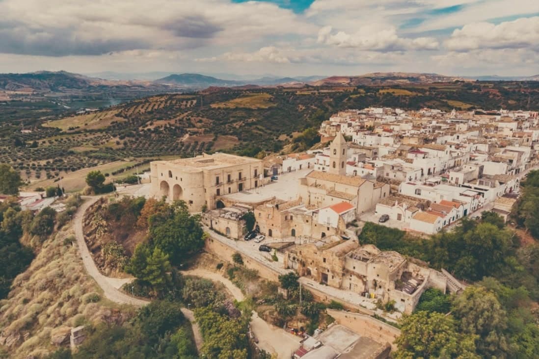
Bernalda sits at 127 meters between the Bradano and Basento rivers, eight kilometers inland from the Ionian coast and the frazione of Metaponto. Almost twelve thousand people live in the town, named for the Aragonese courtier who moved the older Camarda settlement up to the defensible hilltop where the centro still stands.
The corso and the castle anchor the upper town; the coast and its archaeological ground lie a separate world eight kilometers below. Metaponto was founded by Achaean Greeks in the seventh century BC, the plain later home to Pythagoras until his death.
What remains there today spans a wide stretch of time in a small area: temple columns from the sixth century BC, a Greek theater and necropolis, and a beach that draws summer crowds for reasons that have nothing to do with antiquity. Inland, the hill town's own history turns on a single family: an emigration in 1904 and a return a century later that reopened one of its noble houses to visitors.
The town works, then, as two places joined by eight kilometers, one built on Magna Graecia and modern seaside tourism, the other on a hilltop refounding and one family's long departure and return.
We confirmed you can reach this one by train.
What to see in Bernalda
- Castello Aragonese. Hilltop fortress dating to the 1470 refounding by Bernardino de Bernaudo, with medieval origins and Norman, Swabian and Angevin layered additions.
- Palazzo Margherita. Noble palazzo on Corso Umberto, now a nine-room hotel, the family returning most years for the town's patronal feast.
- Tavole Palatine. The columns stand alone on open plain outside Metaponto, no temple walls around them, the ground where Pythagoras founded his school and died.
How to get to Bernalda
There is a railway station in the town, so you can arrive without a car and never need one while you are here. Taranto is roughly 51 minutes away by road.
Our tip
May through September is the coastal season. The Metaponto beach opens reliably by Easter and runs through October, but the heat on the inland hill peaks in July and August. The Festa di San Bernardino in the last week of August brings processions and a fireworks competition that runs three nights.
Pisticci
Why visit Pisticci
Pisticci sits on three eroded clay hills in the southern Matera province and is the most populous town in the province after Matera itself. The name of the coastal frazione, and the geology under the whole town, are the same clay that failed on 9 February 1688, when a landslide cut the settlement in half and killed four hundred people.
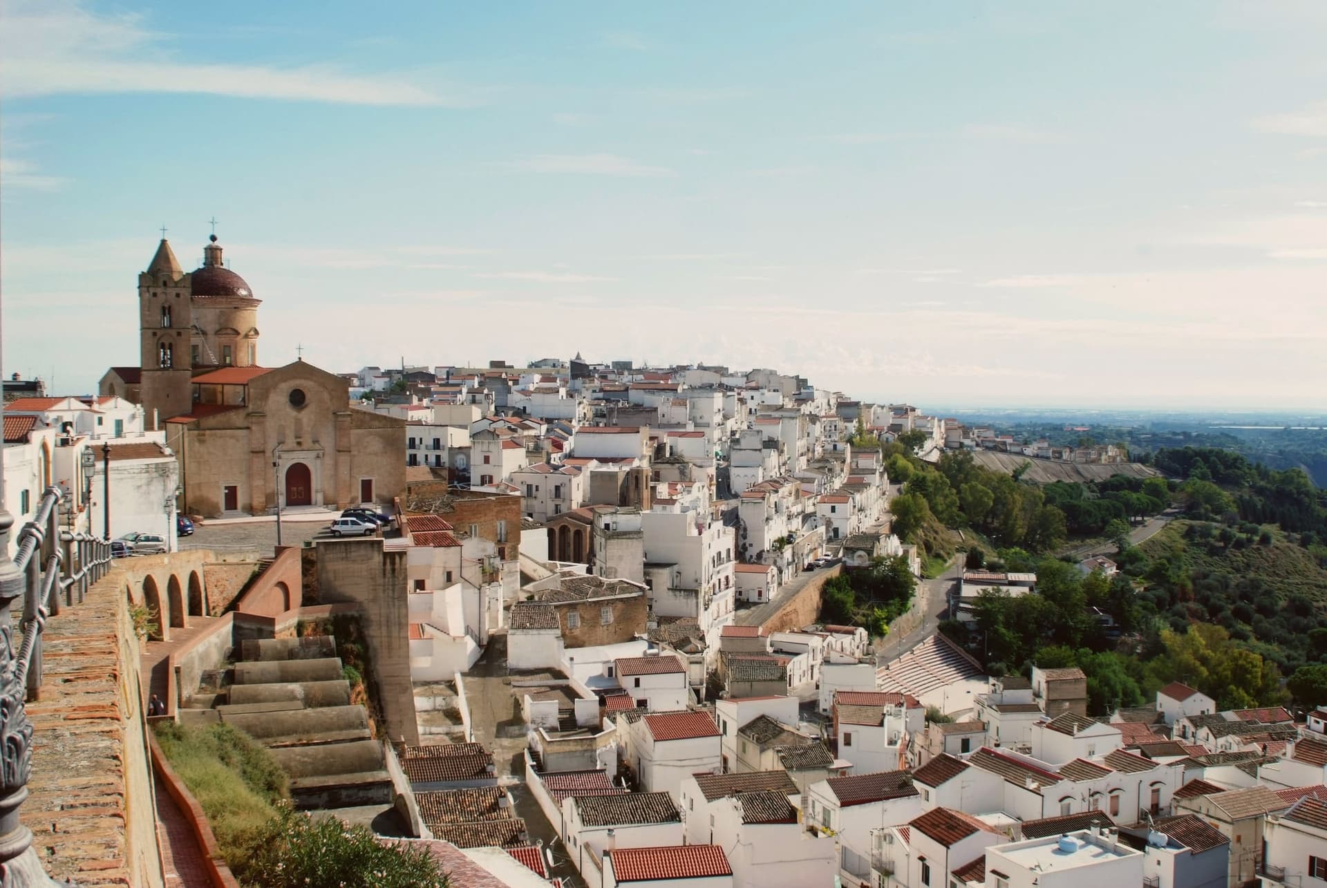
Rather than move down to the valley, survivors rebuilt directly on the ground the slide had crossed, in two-room houses with pitched red tile roofs, arranged in straight lines instead of the tangled layout typical of hill towns in the region. That district took the name of the cliff itself.
Above it, on the highest point, the older part of the town kept its Norman tower, its medieval gate and its mother church, the built record of what stood before the collapse. Twenty kilometers away on the plain toward the sea, the hamlet of Marconia, named for Guglielmo Marconi, functions as the modern centre, while the coastal frazione handles the town's relationship to the Ionian.
The clay hills inland, meanwhile, are worked for truffles rather than housing. What the layout adds up to is a town split by elevation and by function: the old hill preserves what predates the disaster, the rebuilt district records the disaster itself, and the plain and the coast carry everything the eroding hill cannot.
We confirmed you can reach this one by train.
What to see in Pisticci
- Rione Dirupo. Low houses set two rooms wide under pitched red tile roofs, laid out in straight lines rather than the tangled streets typical of the region, the most lived-in district of the town today.
- Terravecchia. Oldest district on the highest hill, with the square tower of the Norman castle, the medieval gate, the mother church and the noble palazzi that survived from before 1688.
- Marina di Pisticci. Coastal frazione on the Ionian, twenty kilometers from the centro storico, a Bandiera Blu beach with pine forest backing the sand.
How to get to Pisticci
There is a railway station in the town, so you can arrive without a car and never need one while you are here. Taranto is roughly 66 minutes away by road.
Our tip
April through June and September into October are the strong months. The Dirupo white houses against a clear sky are best in the slanting light of late afternoon, and the Ionian coast at Marina di Pisticci is warm enough for swimming from late May. July and August push past thirty-five degrees in the centro storico; the beach fills with regional summer crowds and the upper town quiets in the afternoon.
Policoro
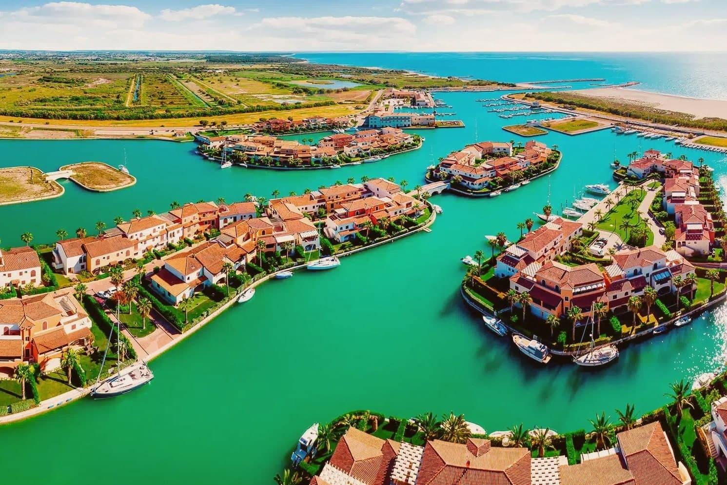
Why visit Policoro
Policoro sits on the Ionian coast of Basilicata where the Agri river reaches the sea. The modern town is built on and around the site of Heraclea (Eraclea Lucana), a Greek polis founded in 433 BC by Taras (Taranto) and Thurii as a joint colony.
The archaeology and the coast now function as two halves of the same place: the excavated city and its museum inland, the beach and the forest reserve running along the shore just beyond it. The Gulf of Taranto shoreline gives the town its second identity, with the Bandiera Blu recognition sitting alongside the Bosco Pantano reserve, which the WWF describes as the most important coastal-forest reserve south of Tuscany.
The Tavole di Eraclea, recovered from the polis and now held in the museum, recorded the city's own regulations on land tenure, a detail that ties the ancient settlement to the same agricultural plain the town still farms. Policoro is the agricultural anchor of the Metapontino plain, growing strawberries, kiwi, and melons, and is one of Basilicata's few year-round-resident coastal communes.
A Greek colony, a Roman battlefield, a working beach, and a farming town turn out to be the same stretch of ground, still worked and still inhabited rather than left as ruins.
We confirmed you can reach this one by train.
What to see in Policoro
- Museo Archeologico Nazionale della Siritide. Holds the Tavole di Eraclea, 4th-century BC bronze inscriptions recording the polis's rules on land tenure, alongside Pyrrhic-era armor and finds from the Heraclea and Siris excavations.
- Lido di Policoro — Bandiera Blu. Fine-sand beach along the Gulf of Taranto, with seasonal lidos and a shoreline shared with the sea turtle nesting program run just inland.
- WWF Bosco Pantano. Italy's most important coastal-forest nature reserve south of Tuscany, with a sea turtle rescue centre, birding trails, and the recovered Pantano humid-forest ecosystem.
How to get to Policoro
There is a railway station in the town, so you can arrive without a car and never need one while you are here. Taranto is roughly 65 minutes away by road.
Our tip
April through October is the open season — Ionian sea calm and warm, the Lido di Policoro Bandiera Blu operating, and the museum at full hours. May and September are the best months for combining beach and archaeology: warm but not crowded, the Pantano reserve at peak bird count. July-August are hot (35°C+ inland) and the lido is busy but never wall-to-wall like Puglia's Salento — Policoro stays a regional rather than national destination.
Matera
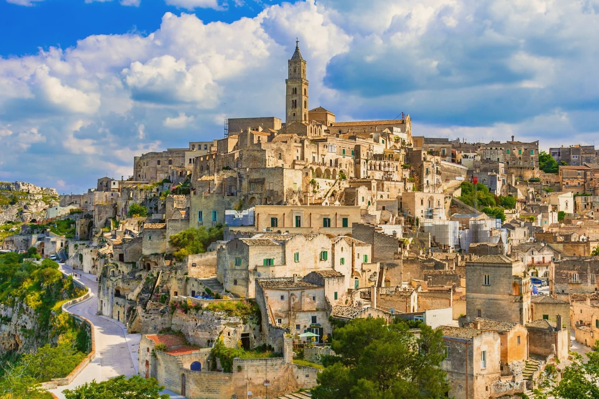
Why visit Matera
Matera sits at 401 meters on the edge of the Gravina ravine in eastern Basilicata, fifty-five kilometers inland from Bari. The Sassi, two districts of houses, churches and cisterns hollowed from tufa limestone, are among the oldest continuously inhabited settlements on earth, with traces of human presence from the Paleolithic.
Sasso Caveoso and Sasso Barisano dropped down the canyon walls; people lived there with their animals into the 1950s. Carlo Levi's 1945 book and the 1948 photographs that followed turned the Sassi into a national scandal, and a 1952 law moved twenty thousand residents to new housing on the plateau above.
The caves stayed empty for thirty years. UNESCO listed them in 1993.
Mel Gibson shot The Passion of the Christ here in 2004 and the city was European Capital of Culture in 2019; No Time to Die filmed in the Sassi in 2019, bringing twelve million euros into the local economy. Bread, ceramics, and rock churches across the Gravina anchor what is now Basilicata's only mass-tourism destination.
We confirmed you can reach this one by train.
What to see in Matera
- Sassi di Matera. Two districts of cave dwellings, Sasso Caveoso and Sasso Barisano, carved from tufa limestone and inhabited continuously from the Paleolithic until the 1950s evictions.
- Cattedrale della Madonna della Bruna e di Sant'Eustachio. Thirteenth-century Apulian Romanesque cathedral on the highest point of the Civita, between the two Sassi, with rose window and bell tower.
- Chiese rupestri del Parco della Murgia. More than 150 rock-cut churches scattered across the Gravina canyon, frescoed between the eighth and thirteenth centuries by Italo-Greek monks.
How to get to Matera
There is a railway station in the town, so you can arrive without a car and never need one while you are here. Bari is roughly 60 minutes away by road.
Our tip
April through June and September into October are the months Matera was built for. The light slants across the tufa façades in the late afternoon and turns the Sassi gold. July and August are punishing: temperatures cross thirty-five degrees and the canyon walls hold the heat past midnight, though hotels stay full because the Bond and Gibson tourism waves have not subsided. Festa della Bruna falls in July.
More from Anywhere Italy
 The 9 best hill towns in the province of Matera
 The best hidden towns you can reach by train in Basilicata
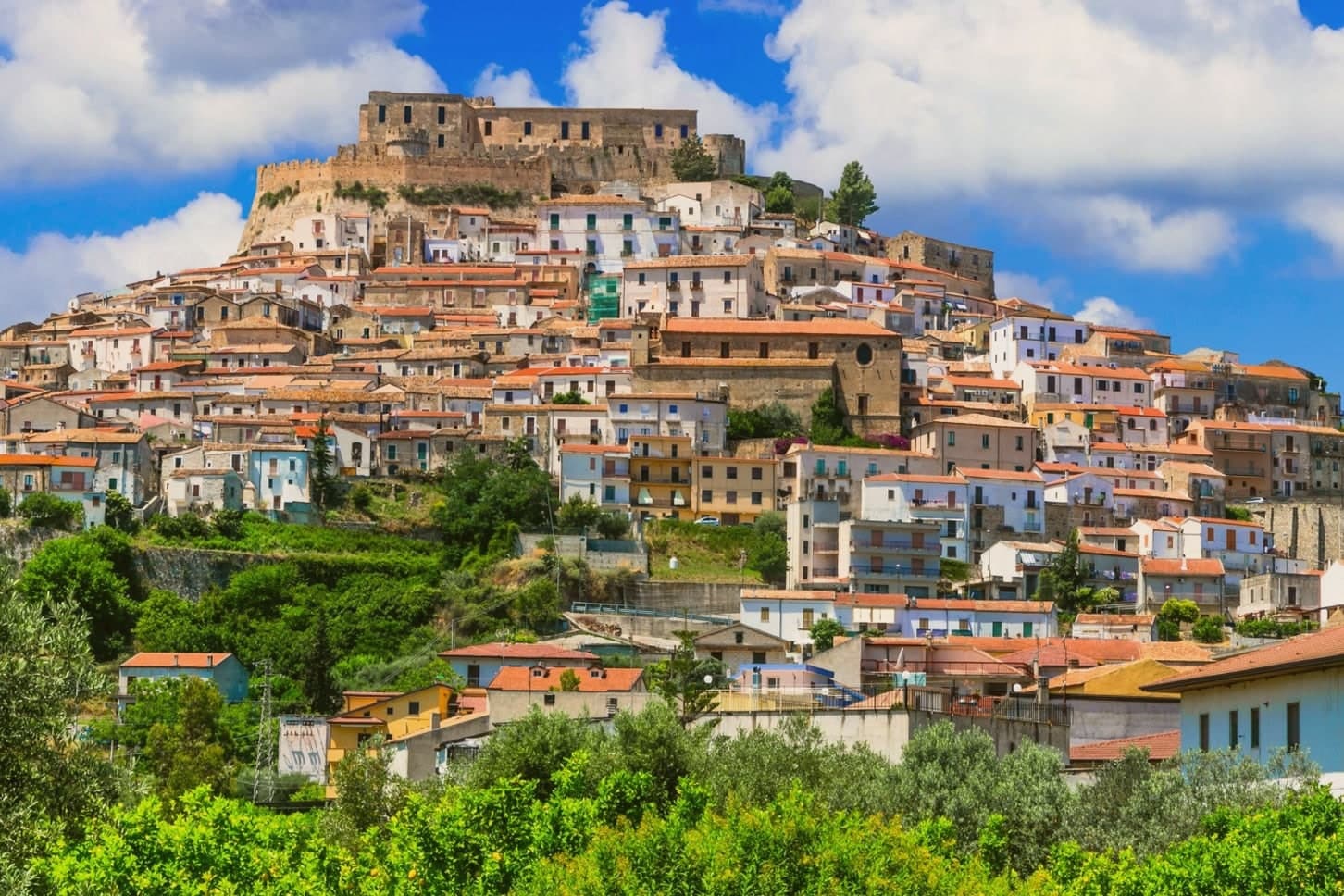 The best coastal towns within 90 minutes of Taranto
- The best hill towns you can reach by train within 90 minutes of Bari
- The best towns you can reach by train that eat well in Basilicata
- The 10 best hidden hill towns in Basilicata