
The 9 best hill towns in the province of Matera
Inland Basilicata is built out of what it stands on: honey-coloured tufa, sandstone, pale clay cut into ravines by winter rain. The hill towns here sit on ridges and spurs because the ground gave them no other option, so streets climb in flights of steps and end in a belvedere over the calanchi, the eroded clay badlands that turn silver at dusk. The food follows the same logic, lamb and pork cooked slowly, peperoni cruschi fried until they shatter, hard durum bread, pecorino, broad beans with wild chicory, and the strong reds of the Bradano and Basento valleys. Late spring brings the wheat green and the broom yellow; autumn brings olives, chestnuts around Accettura, and cellars smelling of must.
Most visitors to this part of the south cross the border into Puglia instead, to the trulli of Alberobello and the sea cliffs at Polignano a Mare, and they are right that those places are remarkable. They are also organised around the coach park. High summer means queues for the same photograph, restaurants working in shifts, and a town centre that empties completely once the last bus pulls out. The Ionian beach resorts along the Metaponto strip absorb another share of the crowd, which leaves the interior largely to people who live there.
The hills do not stop at the provincial boundary. The same ravines, tufa quarries, ridge-top piazzas and church crypts continue west and north, up towards the Lucanian Apennines and along the Bradano, and that is where these towns are. Some are famous for one book or one abandonment, others for a festival, a Mantegna painting, an underground aqueduct, a stand of oaks. Fewer people go, and the ones who do tend to arrive by car, in shoes that handle steps.
Of the 15 communes we have mapped in the province of Matera, 9 qualify as hill towns: each is an inland hill settlement built on ground too steep to spread. The smallest, Craco, has 620 residents.
Two more lists worth reading alongside this one: The 10 best hidden hill towns in Basilicata and The best olive oil towns in Basilicata.
Craco
Why visit Craco
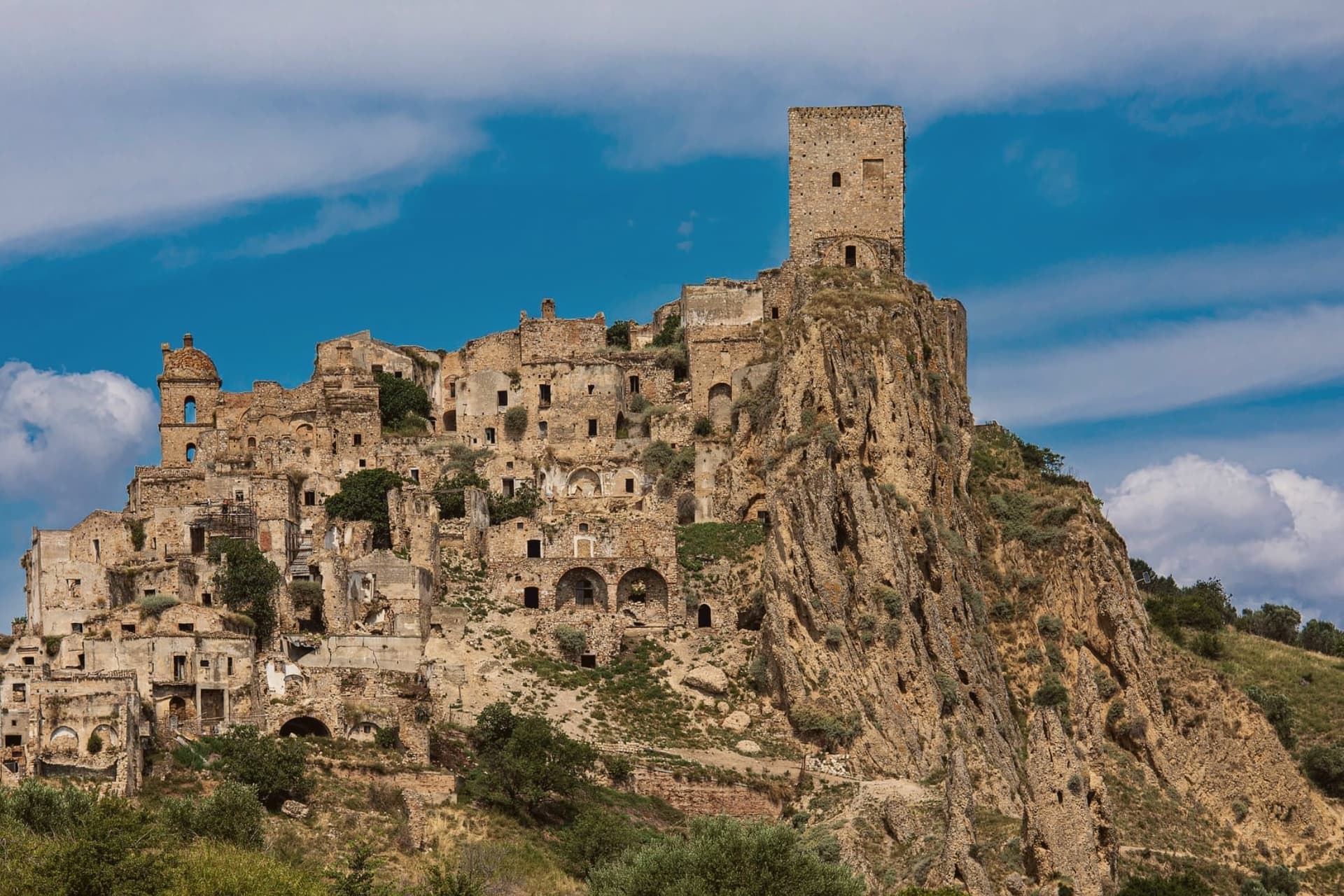
The cliff rises above the Cavone valley, west of the Ionian plain, and the old village on top was abandoned in stages rather than all at once. Heavy autumn rains in 1963 set off a landslide that tore through the slope below and condemned several hundred buildings; the 1,800 residents were evacuated the following year to a planned settlement three kilometers down on the plain.
A 1972 flood worsened the failure in the years that followed, and the earthquake of 1980 finished what the landslide had started. Nothing has been rebuilt on the hilltop since.
The two halves of Craco now sit in a fixed relationship: the ruined village above, empty and fenced into a walking route, and the resettled town below, where the population that once lived on the cliff has continued its life on the plain for six hundred people and counting. The abandonment was not a single event but three separate failures of the same ground, and the empty hilltop is what that slow, repeated collapse left standing.
What to see in Craco
- Craco Vecchia. The abandoned hilltop is accessible only by guided tour with hard hat, walked through marked routes past the ruined buildings.
- Torre Normanna. The tower stands at the summit of the marked tour route, the tallest point of the ruins and the first thing visible from the valley below.
- Chiesa Madre di San Nicola. Gutted but still upright on the marked tour route, its bare walls and open roof are among the most photographed ruins on the walk.
How to get to Craco
Taranto is roughly 77 minutes away by road.
Our tip
April through October is the tour season. The guided routes through Craco Vecchia run on a fixed schedule from the Peschiera ticket office; July and August can hit forty degrees on the exposed clay cliff, and the tour shifts to early morning and late afternoon to make the heat manageable. May, June, September and October are the best months for the route and the light, with the surrounding calanchi turning gold in October.
Aliano
Why visit Aliano
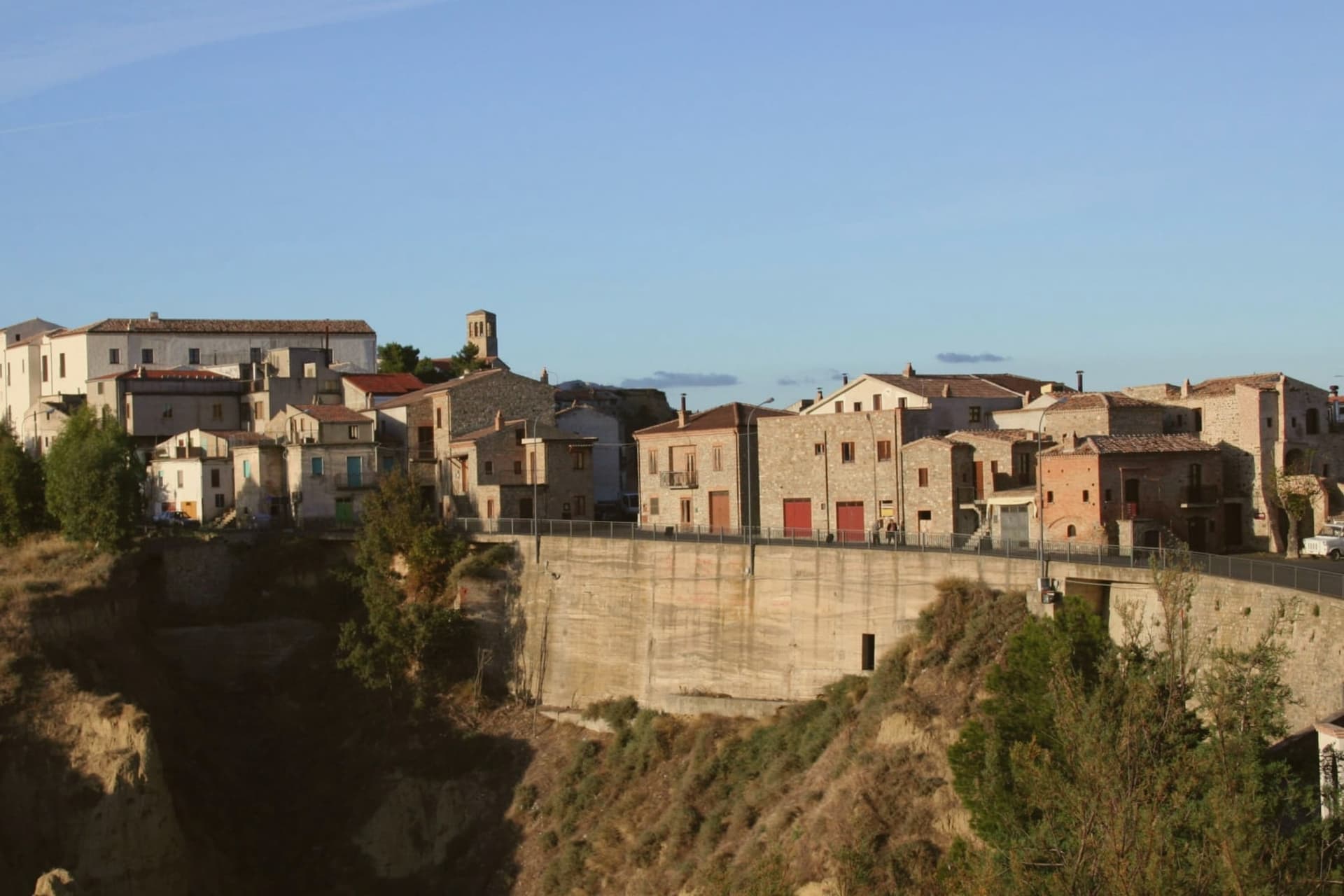
Aliano sits on a clay hill at 555 meters in the southern Matera province, above the Agri river valley and the Sauro stream. The town is surrounded by calanchi, the eroded badlands of bare clay carved by rainwater into ridges and pinnacles, the landscape that became the visual signature of Carlo Levi's exile.
Levi, a Turin doctor, painter and anti-fascist, was confined here from 1935 to 1936 under Mussolini's regime. The book he wrote afterward, Cristo si è fermato a Eboli, published in 1945, gave the village the invented name Gagliano and turned the south's poverty into national literature.
The title comes from a local saying: that Christ stopped short at Eboli, in Campania, and never reached this far. Levi was buried in the village cemetery at his request in 1975.
The house where he was held is now a museum, and the surrounding territory is run as a Parco Letterario. The annual Festival La Luna e i Calanchi, founded by poet Franco Arminio, fills the village every August with readings and music on the bare clay ridges.
What to see in Aliano
- Casa di Carlo Levi. The house where Levi was held in confino from 1935 to 1936, preserved with his paintings, books and personal effects, now the heart of the Parco Letterario.
- Tomba di Carlo Levi. Levi's grave in the village cemetery, where he asked to be buried in 1975 alongside the contadini he wrote about.
- Calanchi di Aliano. Eroded clay badlands surrounding the village, carved by rainwater into bare ridges and pinnacles, a protected geomorphological landscape.
How to get to Aliano
Taranto is roughly 112 minutes away by road.
Our tip
April through June and September into October are the months when the calanchi hold their best light: the bare clay turns silver at dawn and gold at sunset, and the air is clear enough to see down the Agri valley to the Ionian. July and August push past thirty-five degrees and the village empties between two and six in the afternoon, though the Luna e i Calanchi festival in the second half of August packs the streets every night. November through March is quiet and often raw, the calanchi softened by mist.
San Mauro Forte
Why visit San Mauro Forte
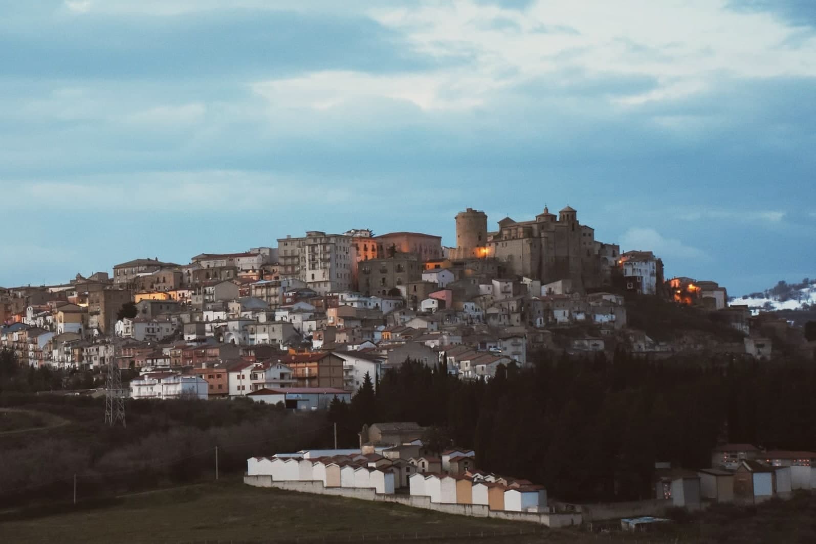
San Mauro Forte sits at 540 meters in the western Matera hills, fifty-five kilometers from the Sassi and forty from Pietrapertosa. The Timponi site, with eighth-century BC remains and fourth-century BC tombs, places the area inside the Lucanian prehistoric network.
The current settlement was founded around 1060 in the Norman period and takes its name from a Benedictine monastery dedicated to Saint Maurus. The Torre Normanna, the cylindrical defensive tower in the main piazza, is the surviving element of the Norman-Swabian castle, later rebuilt by the Angevins.
The Chiesa di Santa Maria Assunta of 1553 preserves a sixteenth-century processional cross. The town's calendar is dominated by the Sagra dei Campanacci on the eve of Sant'Antonio Abate, on 16 January, when men strap belts of cowbells around their waists and walk the streets at dusk in a transhumance rite that predates the church and was kept alive by the shepherding economy.
The town carries Città dell'Olio status: olive groves cover much of the commune.
What to see in San Mauro Forte
- Torre Normanna. Cylindrical Norman tower in the main piazza, the surviving element of the Norman-Swabian castle, rebuilt by the Angevins.
- Chiesa di Santa Maria Assunta. Mother church built in 1553 inside the medieval centre, preserving a sixteenth-century astile cross and an eighteenth-century canvas.
- Chiesa e Convento dell'Annunziata. Franciscan complex begun in the late fifteenth century, with the convent attached to the church of the Annunciation.
How to get to San Mauro Forte
Taranto is roughly 118 minutes away by road.
Our tip
April through June and September through October are the comfortable months in the Matera interior, with green hills and dry evenings. July and August touch thirty-five degrees and the centro storico empties between four and seven. The standout date is 16 January, the eve of Sant'Antonio Abate, when the Sagra dei Campanacci fills the alleys with bell-walkers at dusk and visitors come specifically for the sound.
Accettura
Why visit Accettura
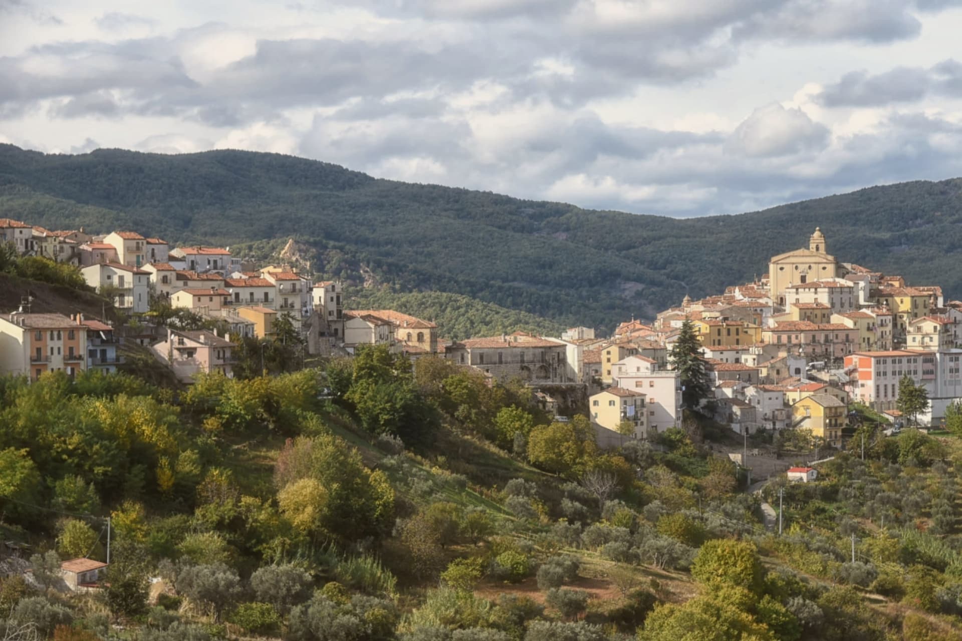
Accettura lies between the Matera hills and the park's western edge, inside the Parco Regionale Gallipoli Cognato e Piccole Dolomiti Lucane, a protected area it shares with Pietrapertosa and Castelmezzano next door. The village's own calendar runs on a separate rhythm: from the octave of Easter to Pentecost, the year builds toward the marriage of two trees.
The oak, u' Masc', comes down from the forest above the village on Ascension Day; the holly, u' Cima, is cut in the park forest the Sunday after. Yoked oxen drag both trunks into the village, where they are joined and raised as one pole in the main piazza, thirty-five meters high.
Ethnographers read the rite as a Lombard arboreal cult laid over the newer cult of the patron saint, the two now inseparable in practice though centuries apart in origin. For the rest of the year the village returns to its ordinary size and quiet, a small stone settlement whose one loud week of the year is also its oldest.
What to see in Accettura
- Bosco di Montepiano. Forest above the village where the oak destined for the rite is chosen on the first Sunday after Easter and felled there on Ascension Day.
- Parco Regionale Gallipoli Cognato. Park land stretching to Pietrapertosa and Castelmezzano and the Lucanian Dolomites, with the Cima holly forest at its core.
- Chiesa di San Nicola di Bari. Mother church in the centro storico, the religious anchor of the village outside the Maggio period.
How to get to Accettura
Salerno is roughly 122 minutes away by road.
Our tip
The Maggio rite covers six weeks from the octave of Easter to Pentecost, with the oak felled on Ascension Day and the trees joined and raised in the piazza at Pentecost weekend. May and June are the visiting peak. April, July and September are quiet, green and walkable, with Gallipoli Cognato trails open and evenings cool at 770 meters.
Grottole
Why visit Grottole
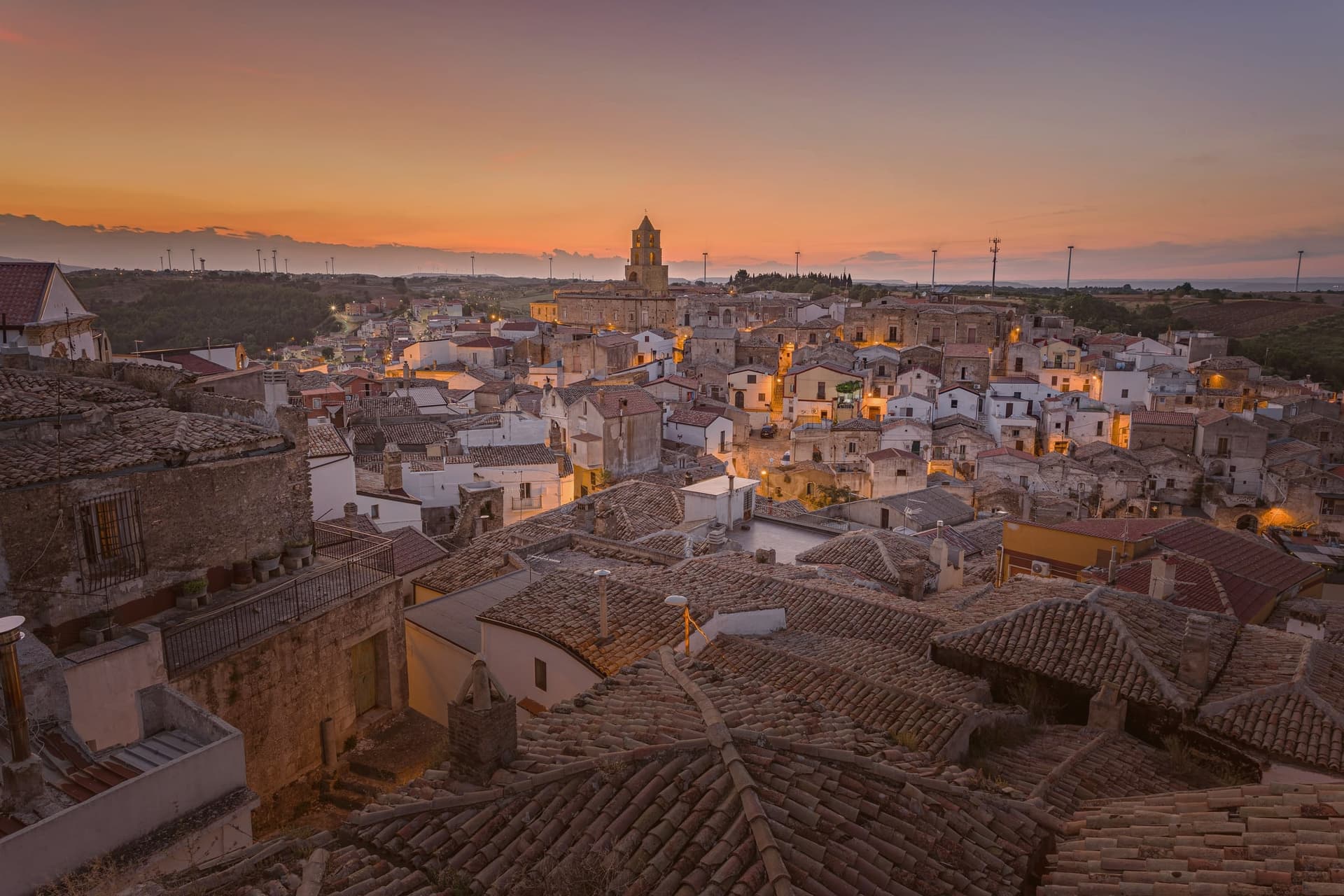
Grottole sits at 481 meters on a hill between the Bradano and Basento rivers, seventeen kilometers from Matera. The current population is around two thousand on paper, but the centro storico has roughly three hundred residents and six hundred empty houses.
At its centre stands the Chiesa Diruta, the medieval church of Saints Luke and Julian, roofless since the seventeenth century and photographed more often than it is prayed in. The Norman-era Castello di Grottole, with a central watchtower, sits on the high point.
The town drew international attention in 2019 when Airbnb and the NGO Wonder Grottole launched the Italian Sabbatical, a three-month volunteer programme offering five people the chance to live in the village free, in partnership with Fondazione Matera 2019. Around 280,000 people applied for the five slots.
The point of the experiment was not tourism but repopulation. Honey, anchored by the Città del Miele designation, comes from the surrounding scrub and pastures and is the village's signature product.
What to see in Grottole
- Chiesa Diruta. Medieval church of Saints Luke and Julian, roofless since the seventeenth century, the most photographed ruin in the centro storico.
- Castello di Grottole. Norman-era fortress on the hilltop with a central watchtower, the high point of the village and the orientation marker visible from the surrounding valleys.
- Centro storico. Stone village with around six hundred empty houses and three hundred residents, the Wonder Grottole programme working to restore and repopulate it house by house.
How to get to Grottole
Bari is roughly 93 minutes away by road.
Our tip
April through June and September into October are the months when Grottole's hill feels right. The light slants across the Chiesa Diruta and the empty stone houses; the air is mild and the surrounding fields are green. July and August push past thirty-five degrees and the centro storico empties between two and seven in the afternoon.
Miglionico
Why visit Miglionico
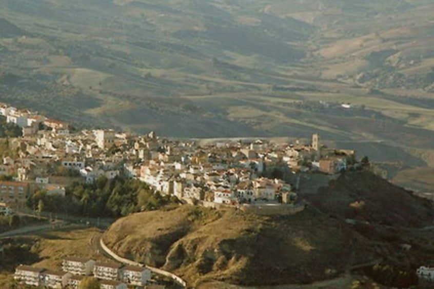
Miglionico sits at 461 meters on a hill between the Bradano and Basento rivers, twelve kilometers from Matera in the central-eastern Matera province. The town is dominated by the Castello del Malconsiglio, the Castle of the Bad Council, built in the eighth or ninth century, enlarged in 1110 and again in the fifteenth century, with seven towers in a parallelogram plan: some square and oldest, two double towers, and circular towers at the corners.
The castle gave its name and its hall to the Conspiracy of the Barons in 1485, when the Sanseverino and Del Balzo families convened here to plot the overthrow of King Ferdinand I of Aragon. The room where they met is still called the Sala del Malconsiglio, the Hall of Bad Counsel; the conspiracy failed and the families were destroyed.
Miglionico is one of the Borghi più belli d'Italia and carries the Città dell'Olio designation for the olive groves on the surrounding slopes.
What to see in Miglionico
- Castello del Malconsiglio. Castle with seven towers in a parallelogram plan, built in the eighth or ninth century, expanded in 1110 and the fifteenth century, site of the 1485 Conspiracy of the Barons.
- Sala del Malconsiglio. The hall inside the castle where the Sanseverino and Del Balzo families plotted against Ferdinand I of Aragon in 1485; the room from which the castle takes its name.
- Chiesa Madre di Santa Maria Maggiore. Mother church on the high point of the village, with a polyptych by Cima da Conegliano dated 1499, one of Basilicata's finest Renaissance works.
How to get to Miglionico
Bari is roughly 92 minutes away by road.
Our tip
April through June and September into October are the months when Miglionico's ridge feels right. The Castello del Malconsiglio against the Bradano and Basento valleys is at its best in slanting light. July and August push past thirty-five degrees; the centro storico empties between two and seven in the afternoon, though the castle stays open with summer hours. XIX Sagra dei Fichi Secchi e dei Sapori d'Autunno di Miglionico falls in September.
Irsina
Why visit Irsina
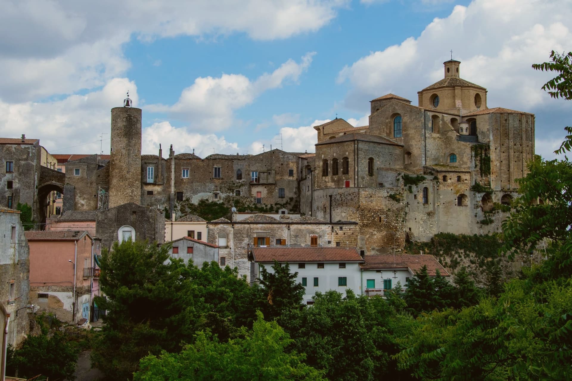
Irsina sits on the border between Basilicata and Puglia, twenty-nine kilometers from Matera, where the Bradano flows below and separates the town from the Murge plateau. The historic centre occupies a tufaceous spur riddled beneath with rupestrian caves and cisterns, a settlement built as much downward as up.
The town's civic and religious history turned on a single commission. Raised to an archbishop's seat in 1452, Montepeloso saw its priest, Roberto de Mabilia, then working as an ecclesiastical notary in Padua, commission a young sculptor from that city to carve a Sant'Eufemia for his home town the following year.
The statue he sent back carries the old town's own coat of arms, the triple mountain and castle, in the saint's hand, binding the imported Renaissance object to the local heraldry it was made to honor. A hill town on a river border ended up holding, by way of a notary's commission to a distant workshop, a devotional statue that ties its Puglia-facing geography to a Veneto hand and its pre-1895 name to the stone the saint holds.
What to see in Irsina
- Cattedrale di Santa Maria Assunta. Thirteenth-century cathedral on the highest point of the borgo. Raised to an archbishop's seat in 1452, it holds the statue as its principal treasure.
- Sant'Eufemia di Mantegna. Carved from Nanto stone of the Veneto, the saint stands with a lion at her side. Identified as Andrea Mantegna's own work in 1996, confirmed by later scholars.
- Ipogei e cantine rupestri. Underground cellars, cisterns and rupestrian rooms cut into the tufaceous spur, reaching beneath the historic centre's alleys and houses.
How to get to Irsina
There is a railway station in the town, so you can arrive without a car and never need one while you are here. Bari is roughly 86 minutes away by road.
Our tip
April through June and September through October are the comfortable months in the Bradano hills, with green wheat fields and dry evenings at 548 meters. July and August touch the mid-thirties on the open spur but stay cool in the rupestrian cellars beneath the centro. November through March is quiet, the cathedral keeps shorter hours and the Mantegna can usually be seen without a queue.
Pisticci
Why visit Pisticci
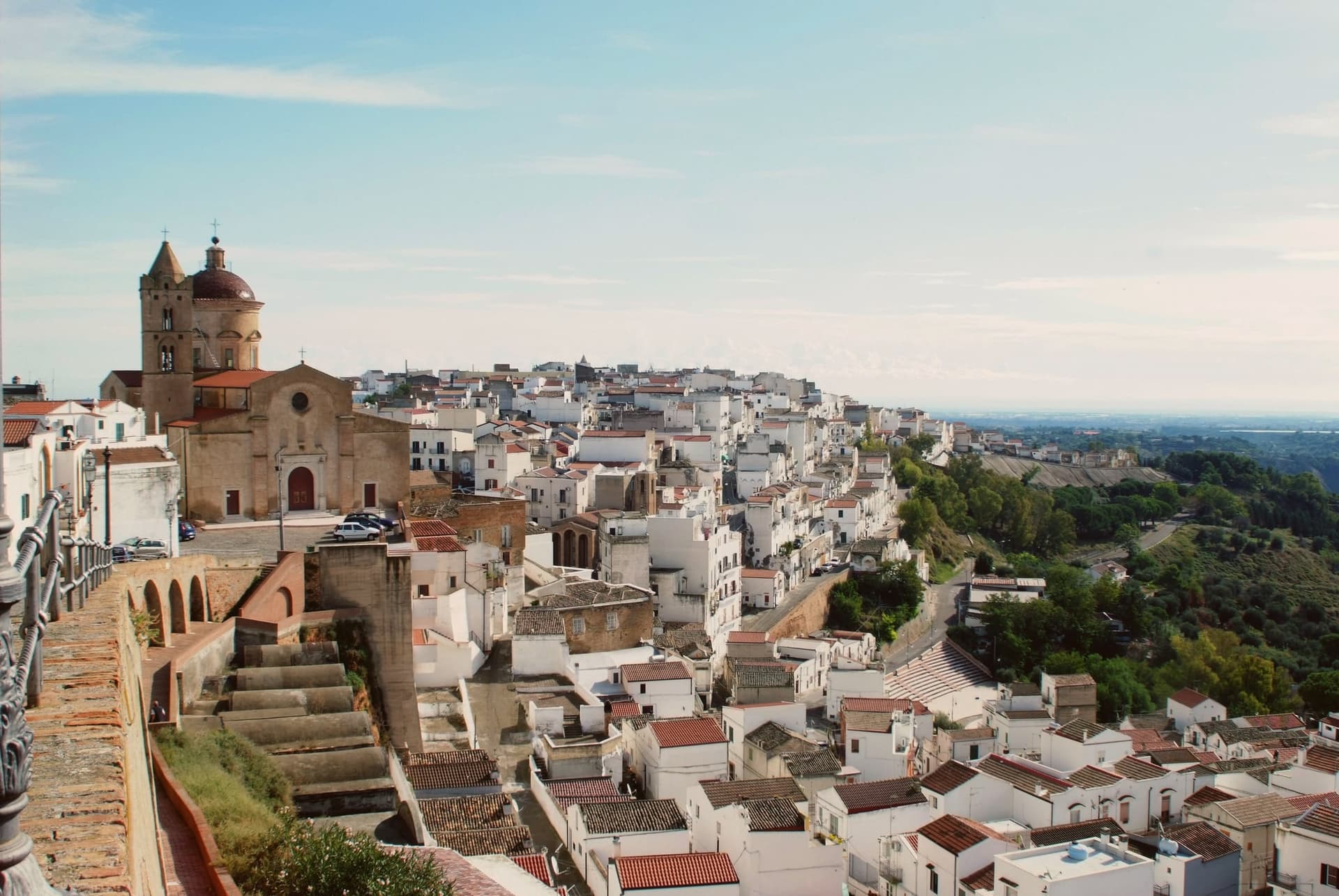
Pisticci sits on three eroded clay hills in the southern Matera province and is the most populous town in the province after Matera itself. The name of the coastal frazione, and the geology under the whole town, are the same clay that failed on 9 February 1688, when a landslide cut the settlement in half and killed four hundred people.
Rather than move down to the valley, survivors rebuilt directly on the ground the slide had crossed, in two-room houses with pitched red tile roofs, arranged in straight lines instead of the tangled layout typical of hill towns in the region. That district took the name of the cliff itself.
Above it, on the highest point, the older part of the town kept its Norman tower, its medieval gate and its mother church, the built record of what stood before the collapse. Twenty kilometers away on the plain toward the sea, the hamlet of Marconia, named for Guglielmo Marconi, functions as the modern centre, while the coastal frazione handles the town's relationship to the Ionian.
The clay hills inland, meanwhile, are worked for truffles rather than housing. What the layout adds up to is a town split by elevation and by function: the old hill preserves what predates the disaster, the rebuilt district records the disaster itself, and the plain and the coast carry everything the eroding hill cannot.
What to see in Pisticci
- Rione Dirupo. Low houses set two rooms wide under pitched red tile roofs, laid out in straight lines rather than the tangled streets typical of the region, the most lived-in district of the town today.
- Terravecchia. Oldest district on the highest hill, with the square tower of the Norman castle, the medieval gate, the mother church and the noble palazzi that survived from before 1688.
- Marina di Pisticci. Coastal frazione on the Ionian, twenty kilometers from the centro storico, a Bandiera Blu beach with pine forest backing the sand.
How to get to Pisticci
There is a railway station in the town, so you can arrive without a car and never need one while you are here. Taranto is roughly 66 minutes away by road.
Our tip
April through June and September into October are the strong months. The Dirupo white houses against a clear sky are best in the slanting light of late afternoon, and the Ionian coast at Marina di Pisticci is warm enough for swimming from late May. July and August push past thirty-five degrees in the centro storico; the beach fills with regional summer crowds and the upper town quiets in the afternoon.
Matera
Why visit Matera
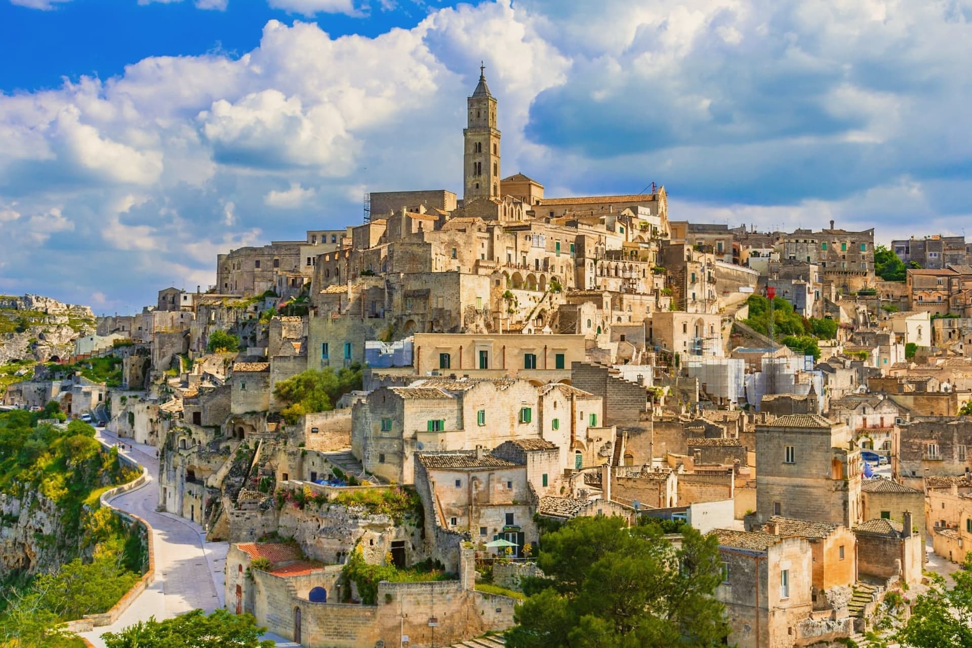
Matera sits at 401 meters on the edge of the Gravina ravine in eastern Basilicata, fifty-five kilometers inland from Bari. The Sassi, two districts of houses, churches and cisterns hollowed from tufa limestone, are among the oldest continuously inhabited settlements on earth, with traces of human presence from the Paleolithic.
Sasso Caveoso and Sasso Barisano dropped down the canyon walls; people lived there with their animals into the 1950s. Carlo Levi's 1945 book and the 1948 photographs that followed turned the Sassi into a national scandal, and a 1952 law moved twenty thousand residents to new housing on the plateau above.
The caves stayed empty for thirty years. UNESCO listed them in 1993.
Mel Gibson shot The Passion of the Christ here in 2004 and the city was European Capital of Culture in 2019; No Time to Die filmed in the Sassi in 2019, bringing twelve million euros into the local economy. Bread, ceramics, and rock churches across the Gravina anchor what is now Basilicata's only mass-tourism destination.
What to see in Matera
- Sassi di Matera. Two districts of cave dwellings, Sasso Caveoso and Sasso Barisano, carved from tufa limestone and inhabited continuously from the Paleolithic until the 1950s evictions.
- Cattedrale della Madonna della Bruna e di Sant'Eustachio. Thirteenth-century Apulian Romanesque cathedral on the highest point of the Civita, between the two Sassi, with rose window and bell tower.
- Chiese rupestri del Parco della Murgia. More than 150 rock-cut churches scattered across the Gravina canyon, frescoed between the eighth and thirteenth centuries by Italo-Greek monks.
How to get to Matera
There is a railway station in the town, so you can arrive without a car and never need one while you are here. Bari is roughly 60 minutes away by road.
Our tip
April through June and September into October are the months Matera was built for. The light slants across the tufa façades in the late afternoon and turns the Sassi gold. July and August are punishing: temperatures cross thirty-five degrees and the canyon walls hold the heat past midnight, though hotels stay full because the Bond and Gibson tourism waves have not subsided. Festa della Bruna falls in July.
More from Anywhere Italy
- The 10 best hidden hill towns in Basilicata
- The best olive oil towns in Basilicata
- The 6 best towns you can reach by train in the province of Matera
- The best hill towns you can reach by train within 90 minutes of Bari
 The 8 prettiest small villages in Basilicata
 The best towns inside a nature park in Basilicata