
The best cheese towns within 90 minutes of Salerno
Cheese in this corner of southern Italy is a matter of altitude and grass. On the limestone ridges of the Sorrentine peninsula, milk from the Agerolese cows goes into provolone del Monaco, aged in cool cellars until the rind turns the colour of straw and the paste tastes of butter and pepper. Inland and higher, in the beech and chestnut country where Campania folds into Basilicata, the caciocavallo is stretched by hand and hung in pairs from a beam. Spring and early autumn are the best months for both, when the pasture is at its richest, and the houses in these towns are built of the same grey stone as the walls holding the terraces up.
The overwhelming majority of visitors on this stretch of coast are heading for Amalfi and Positano, and for good reason: the churches, the lemon terraces, the water. But the coast road is narrow, the parking is scarce, and between June and September the cheese you eat there has usually travelled to reach your plate rather than the other way round. Prices follow the view. The dairies themselves are somewhere else entirely.
The same peninsula continues past the famous bit, over the ridge to the side that faces the Bay of Naples, and the same mountains run on south towards the Vallo di Diano and the Lucanian passes. That is where the protected production zones actually are: hill towns with a caseificio on the main street, a Sunday market, and cheese sold by the people who made it. Fewer travellers stop, and all of them are within about an hour and a half of Salerno.
Of the 48 communes we have mapped in a 90-minute drive of Salerno, 7 qualify as cheese towns: each sits inside the production zone of a protected cheese. The smallest, Sasso di Castalda, has 733 residents.
Elsewhere in the catalogue: The best towns inside a nature park that eat well in the province of Napoli and The 6 best beach towns with a serious restaurant in Campania.
Sasso di Castalda
Why visit Sasso di Castalda
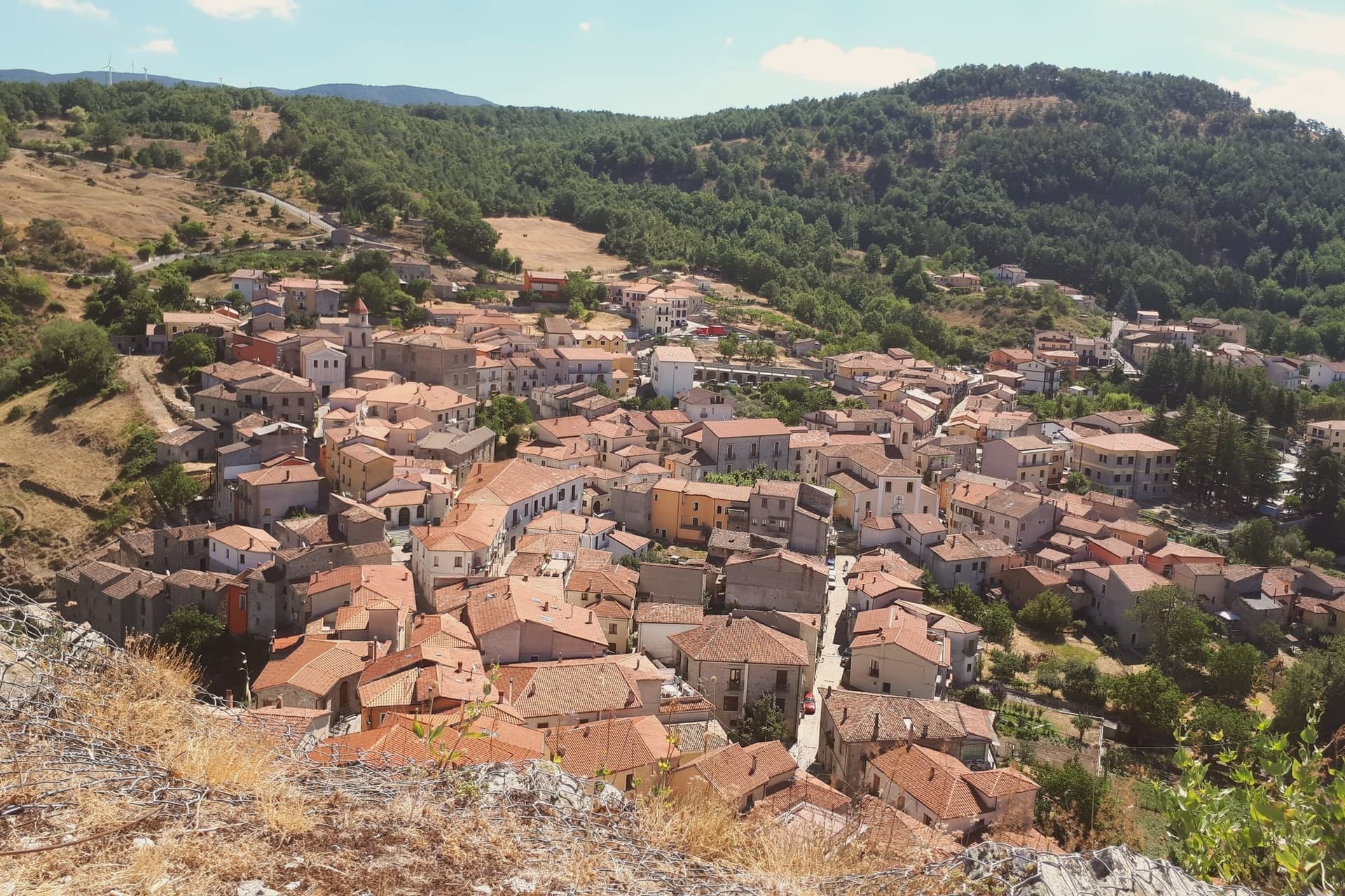
Sasso di Castalda sits at 949 meters in the Appennino Lucano Val d'Agri Lagonegrese National Park, on a rock spur above the Arenazzo torrent. Seven hundred and thirty people live in the medieval core that climbs toward the ruins of the Norman castello.
The village's modern claim is the Ponte alla Luna, a Tibetan-style suspension footbridge installed in 2014: a single span of 300 meters, 102 meters above the gorge, paired with a shorter second crossing in a circuit walked annually by more than 30,000 visitors. The name reaches back further.
Rocco Petrone, born in New York in 1926 to emigrants from Sasso, became NASA's launch director for the Saturn V and ran the Apollo program through the first moon landing in 1969. The bridge points at the connection.
The old town below holds the Chiesa Madre, San Rocco and San Nicola, walked in twenty minutes end to end.
What to see in Sasso di Castalda
- Ponte alla Luna. Tibetan suspension footbridge of 300 meters at 102 meters above the Arenazzo torrent, named for emigrant Rocco Petrone who launched Apollo 11.
- Castello. Norman fortress ruins crowning the rock spur above the village, the historic defensive anchor of the Lucanian Apennine valley.
- Chiesa Madre. Mother church in the centro storico, the principal religious building of the upper village around the castle rock.
How to get to Sasso di Castalda
Salerno is roughly 75 minutes away by road.
Our tip
May through October is the bridge season. The Ponte alla Luna runs ticketed crossings on a daily schedule, and the surrounding national park trails dry out from April onward. July and August are the busiest weekends, with bus tours arriving from Potenza and Salerno; the centro storico empties between three and six in the afternoon as the rock face holds the heat.
Rivello
Why visit Rivello
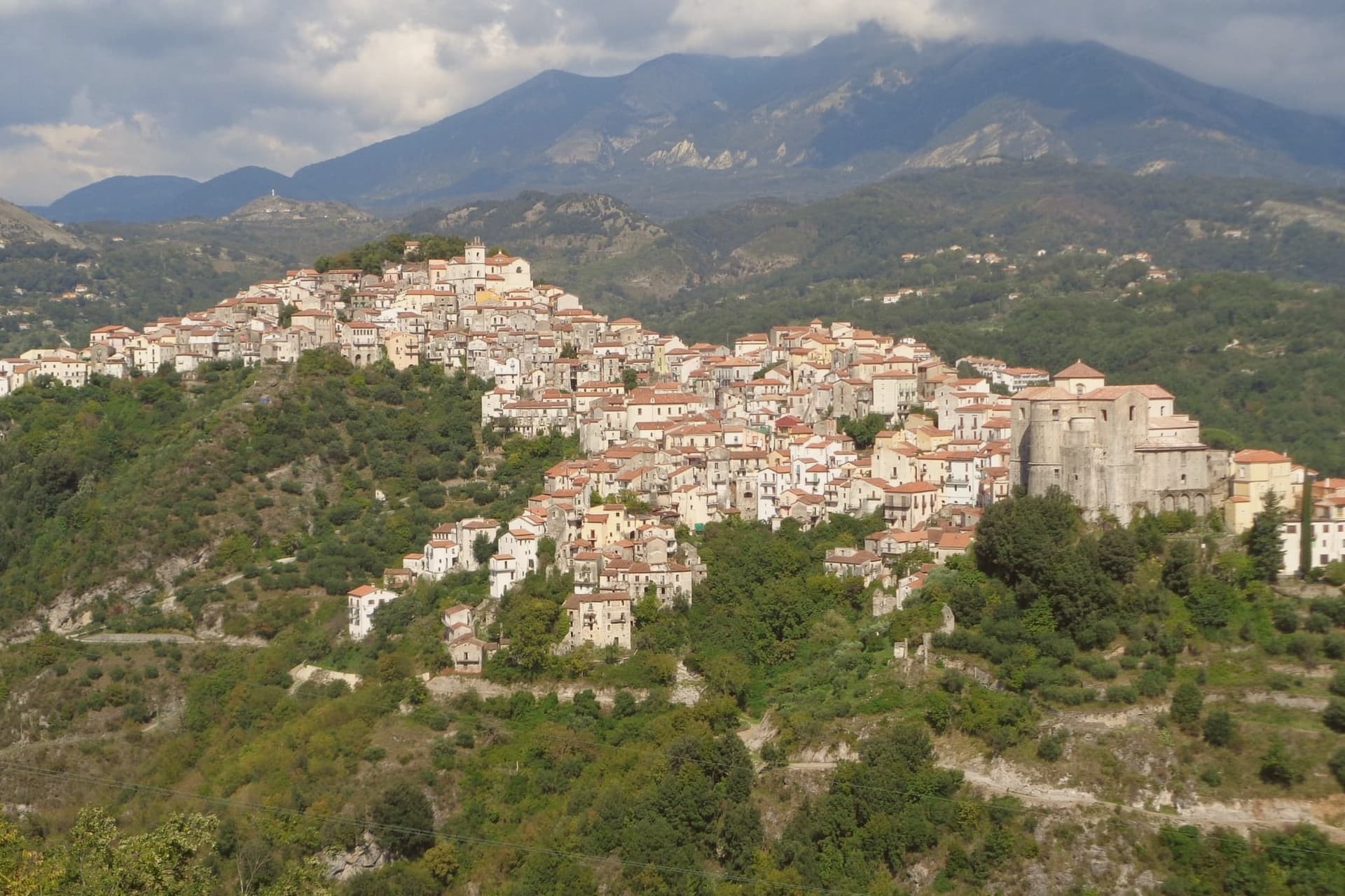
Rivello sits at 479 meters on a ridge above the Noce valley, twenty kilometers inland from Maratea and the Tyrrhenian. The town was disputed between Lombards and Byzantines after the fall of Velia, and its name is read by some as Re-Velia, the place where Velian refugees regrouped.
Both peoples settled here and never fully separated: the ridge organized itself into an upper town and a lower town, and for centuries each pole kept its own church, its own clergy, and its own rite, meeting at the market but not at the altar. The eighteenth century was Rivello's prosperous moment, judging from the parish archives and the stone houses that climb the ridge from that period, including the Baroque work layered onto older Greek-rite foundations in the lower town.
The Pollino park boundary runs nearby, and the belvedere at Passo la Colla looks down on the Gulf of Policastro, a reminder that the ridge, for all its inland feel, sits a short distance from the coast it once helped populate. What the town amounts to is a single street holding two histories that ran side by side for the better part of a millennium before finally merging.
What to see in Rivello
- Convento di Sant'Antonio da Padova. Sixteenth-century Franciscan complex built around a cloister, its frescoes by Giovanni Todisco and Giovanni De Gregorio covering the cloister walls and refectory.
- Chiesa di Santa Maria Maggiore. Upper-town church, plainer in its stonework than its lower-town counterpart, standing at the pole of the ridge that held the Latin congregation.
- Chiesa di San Nicola dei Greci. Lower-town church with Byzantine architectural elements still legible beneath an eighteenth-century reorganisation of the interior.
How to get to Rivello
Salerno is roughly 88 minutes away by road.
Our tip
April through June is the comfortable window, when the Noce valley turns green and the convent frescoes can be viewed without queues. September and October are dry and gold. July and August push toward thirty-five degrees on the ridge, hotter still in the valley, and locals retreat to the Tyrrhenian or the Pollino slopes nearby.
Lagonegro
Why visit Lagonegro
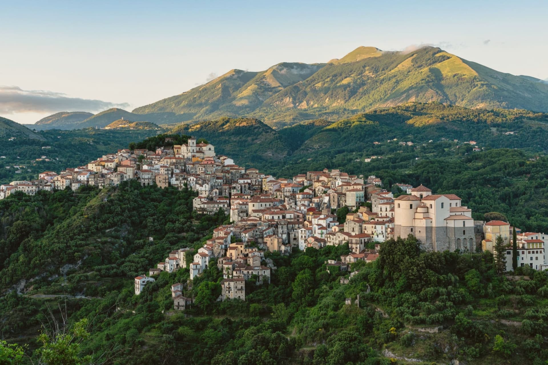
Byzantine monks established the settlement between the ninth and tenth centuries on a defensive promontory between the Noce and Cogliandrino streams, the position that gives the valley its name. The town divides cleanly in two: the old village climbs around the castle ruins and the parish church, while the modern town spreads from the tree-lined Piano square below, the wooded slope between them marking the line where medieval stone gives way to nineteenth-century planning.
The church holds the tomb local tradition assigns to the Florentine model of Leonardo's Mona Lisa, said to have died here in 1506. Lake Sirino at 788 meters and the glacial Lake Laudemio at 1,525 meters both lie within twenty minutes of the town, under the same mountain wall that shelters it.
The town's two halves and the legend it keeps in spite of the evidence against it both point to the same trait: a place defined by what it holds onto, geographically and otherwise.
What to see in Lagonegro
- Chiesa di San Nicola. Tenth-century church in the old village, holds the tomb local tradition assigns to Lisa del Giocondo and two sculptures by Altobello Persio.
- Castello feudale. Ruins of the feudal fortress on the promontory of the old village, the original Byzantine and later Norman defensive anchor of the Valle del Noce.
- Borgo antico. Stone-built medieval core climbing around the castle ruins, separated by the wooded slope from the modern town below.
How to get to Lagonegro
There is a railway station in the town, so you can arrive without a car and never need one while you are here. Salerno is roughly 85 minutes away by road.
Our tip
May through October is the walking and lake season. The Laudemio reserve opens once snow clears from the upper Sirino, usually by late May, and the Cammino di San Nilo passes through Lagonegro for pilgrims working southward. July and August are warm in the lower town but the upper village holds shade; weekends fill with Salerno families on the Sirino trails. Festa lagane e fagioli falls in August.
Piano di Sorrento
Why visit Piano di Sorrento
Piano di Sorrento sits at ninety-six meters on the tuff terrace of the Sorrentine peninsula, four kilometers east of Sorrento, thirty kilometers from Napoli. The upper plain has been inhabited since the second millennium BC: pottery and a necropolis from the Gaudo culture were excavated between the frazioni of Trinità and San Massimo.
The town was tied to Sorrento until 1808, when Joseph Bonaparte's reform separated it as an autonomous comune. The local name, Caruotto, comes from the Latin carottum, quarry, after the tuff pits that fed the building of the peninsula.
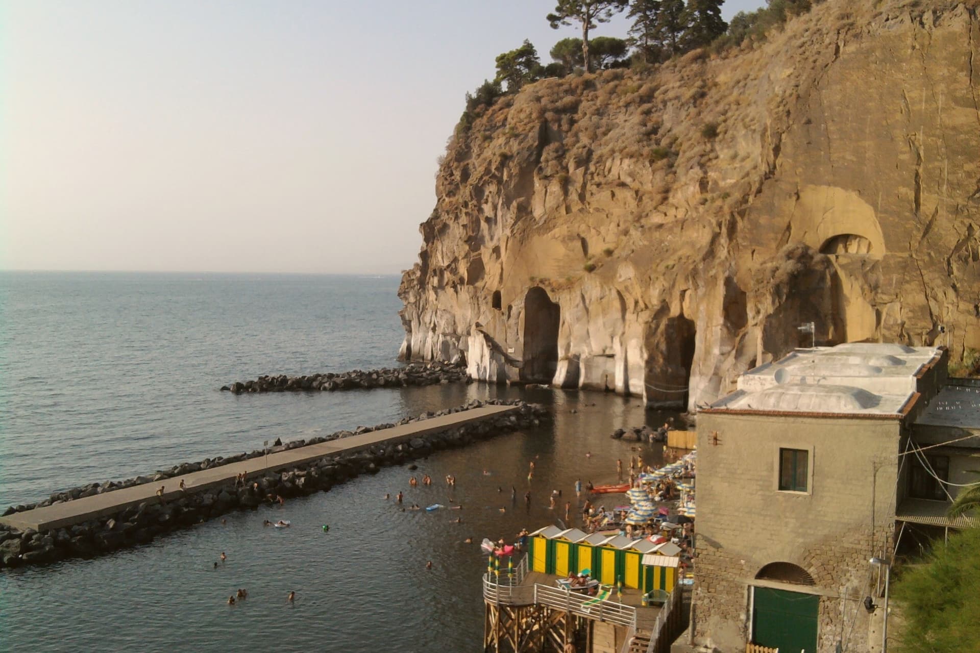
The Basilica di San Michele Arcangelo, ninth century in origin, was raised to papal basilica status by Benedict XV in 1914 and holds two large inlaid wooden doors. The Villa Fondi de Sangro, a neoclassical 1840 villa above the cliff, now houses the Georges Vallet archaeological museum and faces the Marina di Cassano below.
The marina has black volcanic sand, fishing boats and a small port that still works.
Le Tre Arcate have been named by a guide.
What to see in Piano di Sorrento
- Basilica di San Michele Arcangelo. Ninth-century church raised to papal basilica status in 1914 by Benedict XV, with large inlaid wooden doors and a baroque interior in the centro of Piano.
- Villa Fondi de Sangro. Neoclassical villa of 1840 above the cliff, now seat of the Museo Archeologico Georges Vallet, with finds from the Massa Lubrense and Sorrento peninsula excavations.
- Marina di Cassano. Small fishing port with black volcanic sand at the foot of the cliff, reached by a steep path from the upper town, still active for inshore fishing.
How to get to Piano di Sorrento
There is a railway station in the town, so you can arrive without a car and never need one while you are here. Napoli is roughly 49 minutes away by road.
Our tip
May through September is the working season for the Sorrentine peninsula, and Piano follows the same rhythm as Sorrento next door. June and September are the easiest months: warm sea, manageable crowds, full ferry schedules to Capri and Ischia. July and August are crowded with day-trippers; Marina di Cassano fills early and the upper town turns over to the lunch trade.
Massa Lubrense
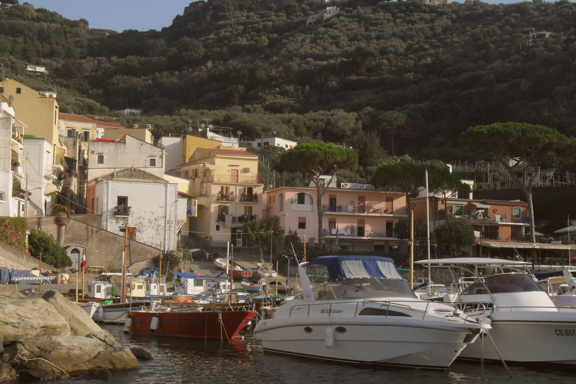
Why visit Massa Lubrense
Massa Lubrense holds the western tip of the Sorrentine Peninsula, the largest municipal area on the peninsula and the closest land to Capri, three nautical miles across the Bocche di Capri. The hilltop centro sits at 121 meters; the commune's eighteen frazioni spread between the Tyrrhenian and the Gulf of Salerno, including Termini, Nerano, Sant'Agata sui Due Golfi and the Marina della Lobra.
Punta Campanella, the cape at the end, has the remains of a Roman sanctuary of Athena and a sixteenth-century watchtower against Saracen raids; the surrounding sea is a protected marine area established in 1997. The commune holds a Bandiera Blu, a Spiga Verde, and Città dell'Olio status: the Penisola Sorrentina DOP olive groves climb the hills above the bays.
Spaghetti alla Nerano, courgette and provolone del Monaco, is the dish that came out of these kitchens in the 1950s.
Ristorante Antico Francischiello da Peppino, Quattro Passi, Relais Blu and 6 more have been named by a guide.
What to see in Massa Lubrense
- Punta Campanella. Cape at the western tip of the peninsula, with the ruins of a Roman sanctuary of Athena, a watchtower, and the marine reserve established in 1997.
- Marina del Cantone. Pebble bay at Nerano, Italy's largest pebble beach by some measures and the kitchen where spaghetti alla Nerano was created.
- Chiesa di Santa Maria della Lobra. Sixteenth-century mother church above the small Marina della Lobra, with a wooden coffered ceiling and a former Franciscan convent attached.
How to get to Massa Lubrense
Napoli is roughly 69 minutes away by road.
Our tip
May, June, September and early October are the months Massa Lubrense was built for. The water around Punta Campanella sits above twenty degrees, the marine reserve runs daily boat tours, and the Sentiero degli Dei from Bomerano descends through olive groves in stable weather. July and August are full: the parking at Marina del Cantone closes by mid-morning and the SS145 from Sorrento backs up.
Sorrento
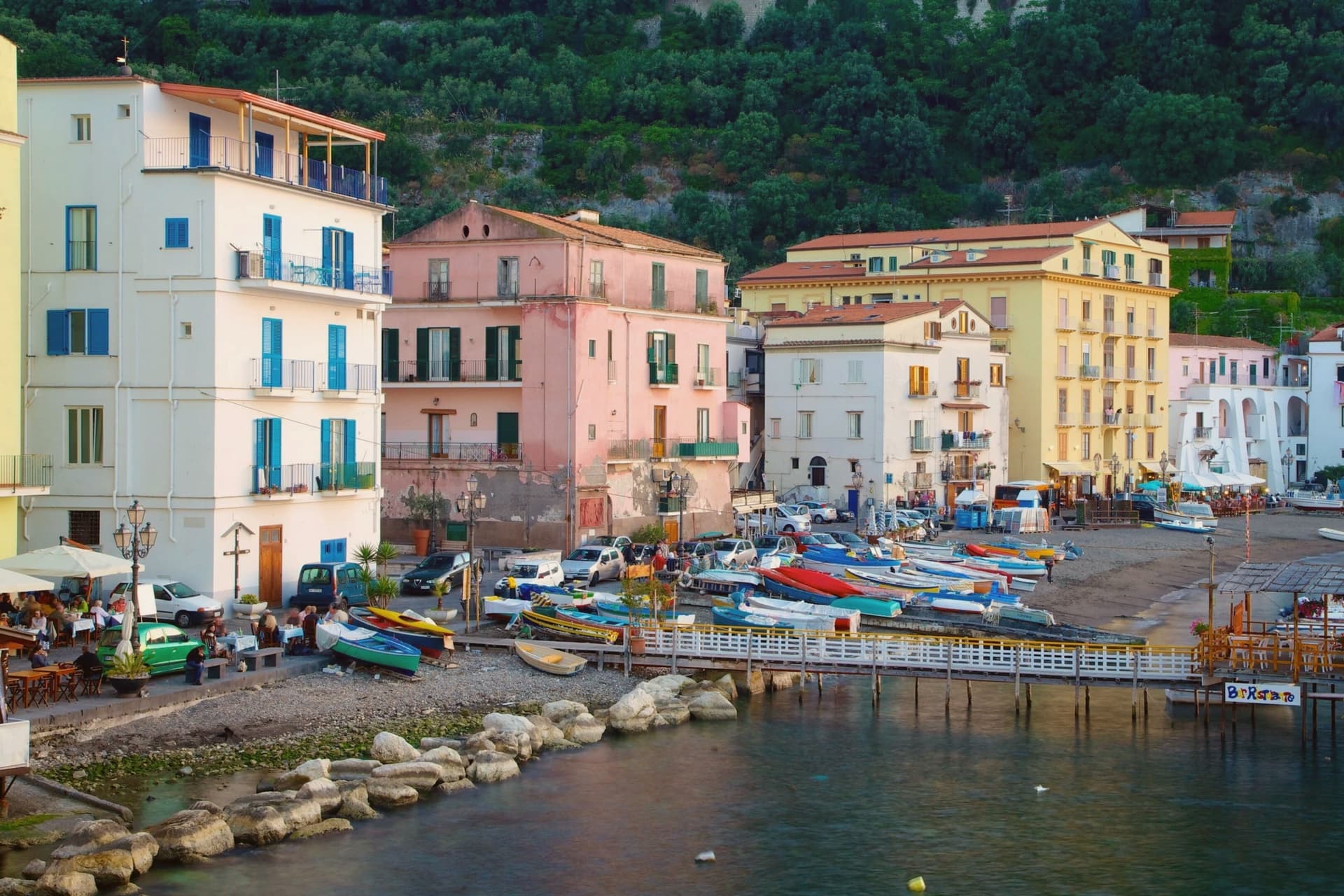
Why visit Sorrento
Sorrento sits on a block of tuff cliff fifty meters above the Bay of Napoli, thirty kilometers from the city by Circumvesuviana railway or ferry. The town began as a Greek foundation and became the Roman Surrentum, a resort favored by senators.
The current population is 15,407. The old town sits above, gathered around the Duomo and the cloister of San Francesco a few minutes apart, while Marina Grande lies below the cliff, reached through the ancient Greek gate, its harbor still working and its trattorie facing the bay.
Terraces of lemon groves ring the slopes above town, the same femminello sorrentino IGP fruit that supplies the limoncello sold through the centro storico. Piazza Tasso, at the head of the old town, is where Corso Italia begins and where the statue of Torquato Tasso stands; the poet was baptized in the cathedral below.
A cliff town facing the bay, its upper streets given to churches and squares, its lower shore to fishing and the harbor, and its surrounding slopes turned over entirely to the lemon that still funds much of what happens in between.
Ristorante O' Canonico 1898, Ristorante O' Parrucchiano, Terrazza Bosquet and 8 more have been named by a guide.
What to see in Sorrento
- Duomo di Sorrento. Eleventh-century cathedral rebuilt in Romanesque style in the fifteenth century, with a baroque interior and the baptistery where Torquato Tasso was christened.
- Chiostro di San Francesco. Fourteenth-century cloister of tuff arches and crossed columns, the marble façade redone in 1926, still used for civic weddings and chamber concerts.
- Museo Correale di Terranova. Decorative arts museum in a seventeenth-century villa opened in 1924, with Neapolitan porcelain, period furniture and seventeenth-century painting.
How to get to Sorrento
There is a railway station in the town, so you can arrive without a car and never need one while you are here. Napoli is roughly 57 minutes away by road.
Our tip
May, June, September and October are the months that work for Sorrento. The sea is warm enough to swim, the temperatures sit in the mid-twenties, and the centro storico is busy without being unworkable. July and August are crowded almost beyond use.
Vico Equense
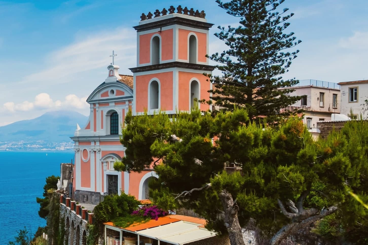
Why visit Vico Equense
Vico Equense sits on a block of tuff and limestone above the Bay of Napoli, twenty-five kilometers from the city and the first town on the Sorrento peninsula coming from the north. A seventh-century BC pre-Roman necropolis predates the Latin Aequana that Roman patricians built here for their villas, and the finds from that older settlement, funerary objects excavated in the 1960s and 1970s, sit now in a museum founded in 1966.
The medieval town that survives was walled by the Angevins after 1284, when Charles II ordered a fortress built on the cliff as both stronghold and residence, and the diocese's cathedral rose on a neighboring clifftop in the same century, before losing its status as a see in 1818. Behind the town, the limestone mass of the Lattari range closes off the land side, reached since 1952 by cable car from the coast at Castellammare.
Pizza by the meter, the town's best-known export, was invented here by Luigi Dell'Amura, called Gigino, in the 1930s, and his restaurant in the centro still serves it. What holds the town together is the sequence itself: a pre-Roman settlement, a Roman villa town, an Angevin fortress and a bishopric, and finally a twentieth-century dish, each layer built on a narrow shelf of rock between the mountain and the bay.
Torre del Saracino, Antica Osteria Nonna Rosa, Cannavacciuolo Countryside and 8 more have been named by a guide.
What to see in Vico Equense
- Chiesa dell'Annunziata. The church stands at the edge of the cliff, its Gothic interior at odds with the Baroque face it was given later. The old cathedral of a diocese that no longer has a seat here.
- Castello Giusso. Angevin castle built between 1284 and 1289 at the order of Charles II of Anjou, with a Renaissance residential wing and gardens above the bay.
- Antiquarium Silio Italico. Archaeological museum founded in 1966, with funerary objects from a seventh-century BC pre-Roman necropolis excavated in the 1960s and 1970s.
How to get to Vico Equense
There is a railway station in the town, so you can arrive without a car and never need one while you are here. Napoli is roughly 55 minutes away by road.
Our tip
May through September is the working season for Vico Equense. June and September are the best months: warm sea, fewer day-trippers than July and August, and the Monte Faito cable car operating on a full schedule. July and August are crowded and hot at sea level, though the Faito plateau stays cooler at around twenty-two degrees. Sagra del Riavulillo falls in the season.
More from Anywhere Italy
- The best towns inside a nature park that eat well in the province of Napoli
 The 6 best beach towns with a serious restaurant in Campania
- The best beach towns you can reach by train in Campania
- The 8 best towns inside a national park in the province of Potenza
 The 9 best towns with a serious restaurant in the province of Napoli
- The 9 best towns you can reach by train in the province of Napoli