
The 10 best small towns you can reach by train in Lombardia
Lombardia is a railway region before it is anything else. Lines run north from Milano into the lake basins, where stone quays meet water the colour of slate, and east into the Valtellina, where terraced vineyards climb above the Adda in dry-stone walls. The food changes with the altitude: risotto and river fish on the plain, pizzoccheri and bitto cheese in the mountains, buckwheat and cured beef where the frost sets in early. Autumn is the season the lakes settle, when the ferries thin out and the chestnut woods above the shore turn.
The problem is Como and Milano. Most visitors take the train to Como San Giovanni, walk the lakefront, queue for the funicular to Brunate and return the same evening, or make the same day trip to Sirmione on Lago di Garda. Both places absorb enormous numbers in high summer, and the piers, gelaterie and lake steamers show it. The famous shoreline is good; it is also the only shoreline a great many people ever see.
The same water and the same rails continue past it. Stations sit at intervals all the way up the eastern arm of Lago di Como, ferries cross to islands with no cars on them at all, and branch lines climb into the Brembana and Valtellina valleys towards spa towns and terraced hillsides. The towns here are smaller, fewer people go, and we have checked that each can be reached without a car, by train, by connecting bus or by boat.
Of the 65 communes we have mapped in Lombardia, 25 qualify as towns you can reach by train: we have confirmed each is reachable without a car. This list is the small ones, 10 in all, ordered smallest first. The smallest, Monteviasco, has 12 residents.
If you are still choosing, we have also written The best small lake towns you can reach by train in Lombardia and The best hidden lake towns you can reach by train in Lombardia.
Monteviasco
Why visit Monteviasco
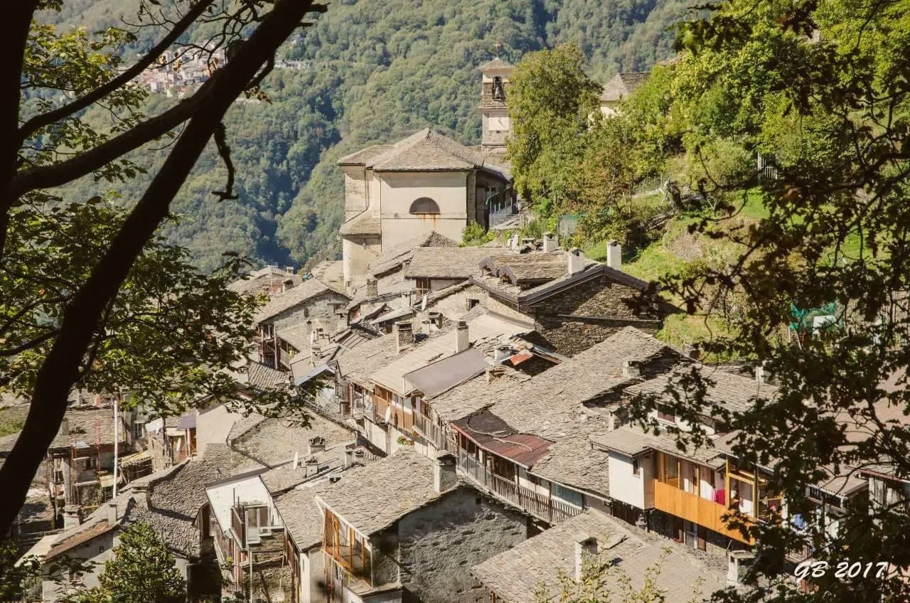
Monteviasco is the highest frazione of Curiglia con Monteviasco, sitting at 928 metres on a terrace above the Val Veddasca near the Swiss border. There is no road.
For half a century the village was reached by a small aerial cable-car (funivia di Monteviasco) installed in 1989; the cable-car has been suspended since a fatal accident in 2018 and the village is now reached only by the historic stone mule path of approximately 1,400 steps from the valley floor, a one-hour climb through chestnut woods. The permanent population is in the single digits — most of the houses are summer residences for descendants of former villagers — but the church of Sant'Antonio Abate, the wash-house at the village fountain, and the small alpine rifugio at the centre remain in use.
The view from the village balcony covers the entire Val Veddasca and, on clear days, Monte Rosa to the west. The 1,400-step climb is the attraction as much as the village itself: a documented historic mule path with stations of the cross along the ascent.
Pair with the Lago di Lugano cable-car at the Cima di Sasso above the valley and a meal at one of Curiglia's small osterie.
We confirmed you can reach this one by train.
What to see in Monteviasco
- Sentiero dei 1.400 gradini. Historic stone mule path of approximately 1,400 steps from the Val Veddasca floor to the village — the only current access. Climbs through chestnut woods past stations of the cross.
- Chiesa di Sant'Antonio Abate. Parish church at the village centre, dating to the 17th century, with a single nave and a stone-roofed bell tower.
- Panorama sulla Val Veddasca. Village balcony at 928 m looking down the entire Val Veddasca toward Lake Maggiore, with Monte Rosa visible on the western horizon in clear weather.
How to get to Monteviasco
There is a railway station in the town, so you can arrive without a car and never need one while you are here. Milano is roughly 131 minutes away by road.
Our tip
May through October is the practical season — the mule path is dry, the alpine rifugio is open weekends, and the chestnut woods stay green into late autumn. June and September are ideal: cool climbing temperatures, long light. July-August stay mild at this elevation but the 1,400 steps need an early start.
Varenna
Why visit Varenna
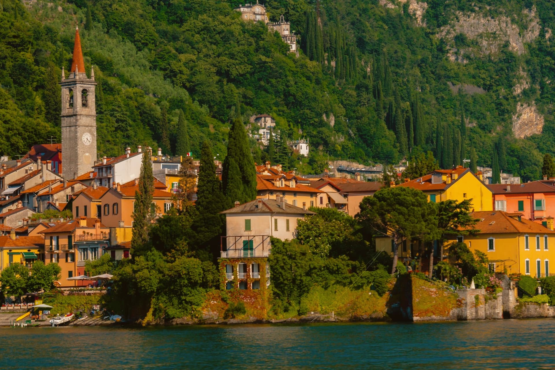
Varenna sits on the eastern shore of Lake Como at the point where the lake forks into the Como and Lecco branches, opposite Bellagio and Menaggio. Local fishermen founded the village in 769.
In 1126 it was destroyed by Como during the wars between the lake's communes, and in 1169 it absorbed the refugees from the destroyed Isola Comacina. The streets fall in a steep grid toward the water, with the lakefront passerella running between the houses and the lake.
The Castello di Vezio, above the village on a spur reached by a 30-minute climb, was a Lombard watchpost reused through the Middle Ages. Villa Monastero, on the lakefront, started in the 12th century as a Cistercian convent and now runs a two-kilometer botanical garden along the shore.
The frazione of Fiumelatte hosts one of the shortest rivers in Italy, 250 meters from spring to lake.
We confirmed you can reach this one by train.
What to see in Varenna
- Castello di Vezio. Lombard-era watchpost on a spur above the village, reached by a 30-minute climb with 160 meters of elevation gain.
- Villa Monastero. Former 12th-century Cistercian convent on the lakefront, now a museum and convention center with a 2-kilometer botanical garden along the shore.
- Villa Cipressi. Sixteenth-to-nineteenth-century lakefront villa next to Villa Monastero, with terraced gardens descending to the water.
How to get to Varenna
There is a railway station in the town, so you can arrive without a car and never need one while you are here. Monza is roughly 62 minutes away by road.
Our tip
April through October is the working season. The ferries from Bellagio and Menaggio run frequently, the villa gardens open in late March, and the lake stays mild enough to swim from June onward. July and August are crowded: 693 residents host thousands of day visitors, and the lakefront fills with photo tripods at sunset.
Monte Isola
Why visit Monte Isola
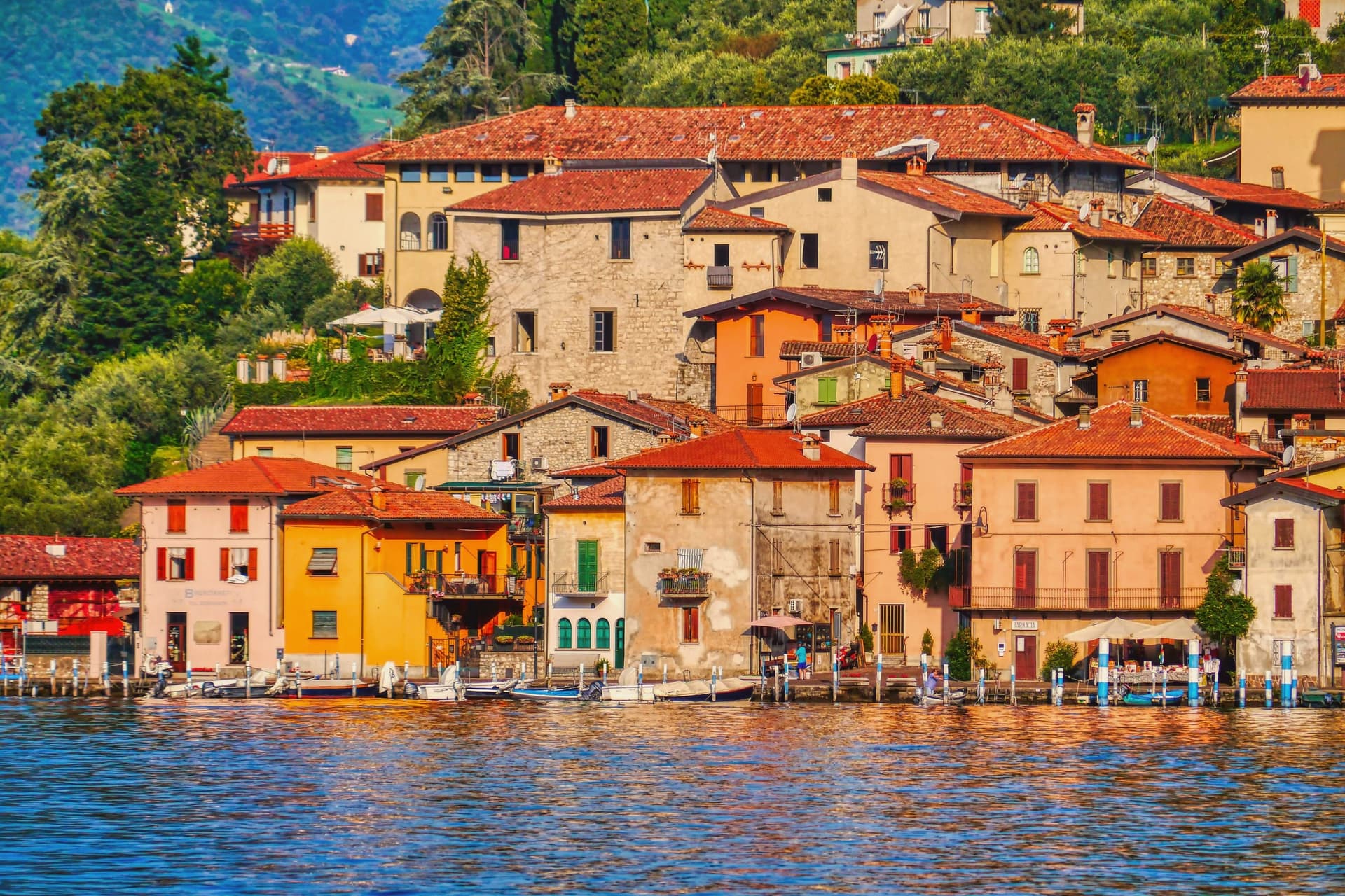
Monte Isola covers 4.5 square kilometers in the middle of Lake Iseo, the largest lake island in southern and central Europe. Eleven villages and hamlets line the shore and climb the slopes: Peschiera Maraglio and Sensole on the south, Siviano on the north, with smaller settlements between.
The Madonna della Ceriola sanctuary stands at 600 meters at the summit, documented in 1410 but built older, holding a twelfth-century wooden sculpture of the Virgin and Child. No private cars are allowed on the island; mopeds, bicycles and feet are the way around.
The Comune still keeps the small island of San Paolo and the privately owned Loreto as part of its territory. Fishing nets are still woven here by hand for use across the lakes of northern Italy, and wooden boats are still built by a handful of craftsmen in Peschiera Maraglio.
In summer 2016, Christo and Jeanne-Claude floated their orange piers from Sulzano to the island, drawing 1.2 million visitors in sixteen days.
We confirmed you can reach this one by train.
What to see in Monte Isola
- Santuario della Madonna della Ceriola. Pilgrimage church at the summit, 600 meters above the lake, holding a twelfth-century wooden Virgin and Child and reached only on foot from Cure.
- Peschiera Maraglio. Main lake-side village on the south of the island, with the ferry landing, the boatyards and the long stone lakefront facing San Paolo.
- Siviano. Capital of the comune on the north of the island, a fortified medieval hamlet with tower houses, narrow streets and the parish church.
How to get to Monte Isola
There is a railway station in the town, so you can arrive without a car and never need one while you are here. Brescia is roughly 48 minutes away by road.
Our tip
April through October is the season Monte Isola is built for. May, June, September and early October are the best months: ferries run on schedule, the perimeter road is open to bikes, the Ceriola climb is dry. July and August bring weekend day-trippers from Brescia, Bergamo and Milano, especially Sundays; the ferries fill and Peschiera Maraglio is at capacity by mid-morning.
Cassinetta di Lugagnano
Why visit Cassinetta di Lugagnano
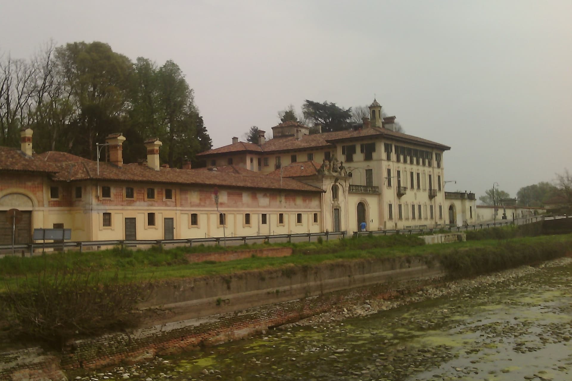
The commune was formed from two older settlements on opposite banks of the canal: Lugagnano, Roman in origin and once called Lucanianus, and Cassinetta, dating to the fourteenth century. The humpbacked bridge that joins them carries the 1584 statue of San Carlo Borromeo.
The town sits at 120 meters, twenty kilometers west of Milan and just outside Abbiategrasso, on the route the Naviglio Grande traces between Milan and the Lago Maggiore, the reason Milanese nobility chose this stretch of water for their country houses from the sixteenth century on. That same 2007 decision to refuse new building and force reuse of existing stock brought the town into the Borghi più belli and Comuni Virtuosi networks.
A town built by families adding country houses along a single waterway, then choosing, four centuries later, to stop building and preserve what stands.
We confirmed you can reach this one by train.
What to see in Cassinetta di Lugagnano
- Villa Visconti Castiglioni Maineri. Formal Italian garden fronting the canal, partly attributed to Ruggero Bascapè.
- Villa Negri-Morosini. Country villa of the Negri-Morosini family on the canal bank, with frescoed interior rooms and outbuildings around a courtyard.
- Villa Trivulzio. Trivulzio family country residence, one link in the chain of aristocratic retreats strung along the water.
How to get to Cassinetta di Lugagnano
There is a railway station in the town, so you can arrive without a car and never need one while you are here. Novara is roughly 37 minutes away by road.
Our tip
April through June and September into October are the months Cassinetta works best. The Naviglio runs full, the towpaths to Abbiategrasso and Robecco sul Naviglio are open to walkers and cyclists, and the villas keep regular visiting hours during the open garden seasons. July and August are humid on the plain; mosquitoes off the canal pick up in late afternoon and the towpath sun gets heavy without shade.
Dervio
Why visit Dervio
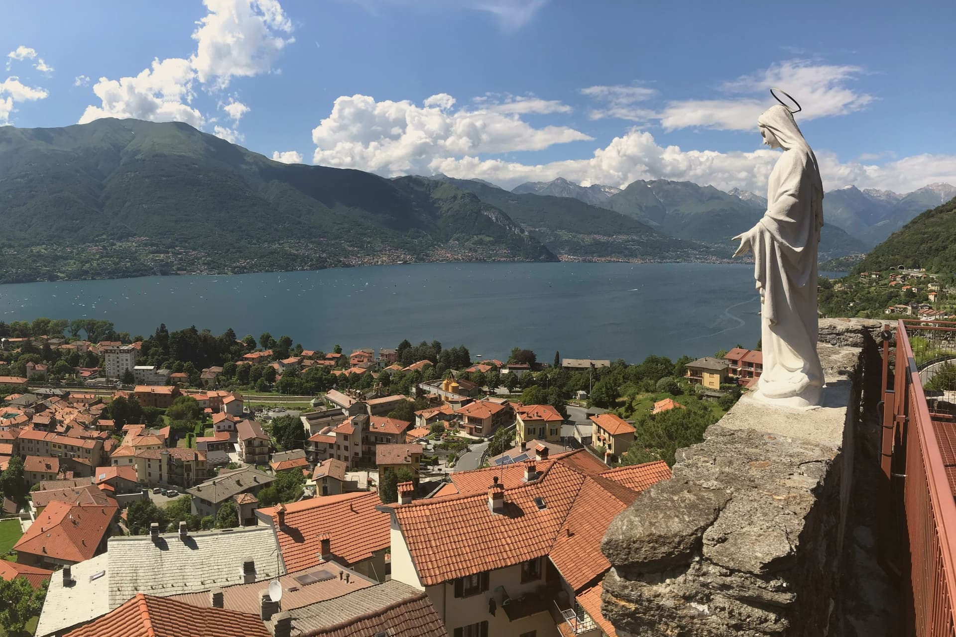
Dervio sits on a small peninsula on the eastern shore of upper Lake Como, where the Varrone torrent emerges from its valley and pushes a delta into the lake. The Romanesque bell tower of the Chiesa di San Quirico e Giulitta, attached to a church first mentioned in 814 and rebuilt around 1080, is the oldest structure in the commune.
Above the village, on a cliff that once blocked the road into the Valvarrone, stand the ruins of the Castello di Orezia, raised in the late Middle Ages and recorded in 1039 during a long siege by three Larian parishes. Dervio's reputation today rests less on its monuments than on its wind.
The position at the peninsula tip funnels the Breva and Tivano onto the lake in a way racing sailors learn to read. The commune draws sailing schools from April through October, and its lakefront promenade extends north toward Dorio along a stone path called the Sentiero del Viandante.
We confirmed you can reach this one by train.
What to see in Dervio
- Campanile di San Quirico e Giulitta. Romanesque stone bell tower from around 1080, attached to one of the oldest churches on Lake Como, first cited in 814.
- Torre del Castello di Orezia. Late medieval tower on a cliff above Dervio, part of a fortress blocking the Valvarrone road, with documented siege in 1039.
- Chiesa dei Santi Pietro e Paolo. Eleventh-century parish church on the lakeshore, with a Romanesque bell tower and later interventions.
How to get to Dervio
There is a railway station in the town, so you can arrive without a car and never need one while you are here. Monza is roughly 62 minutes away by road.
Our tip
April through October works on this part of Lake Como. May and June bring stable winds, mild temperatures, and the alpine slopes still green. July and August are the busiest months; the peninsula fills with sailing crews and Italian families with second homes, and the lake-facing villages hold their summer festas.
Porto Ceresio
Why visit Porto Ceresio
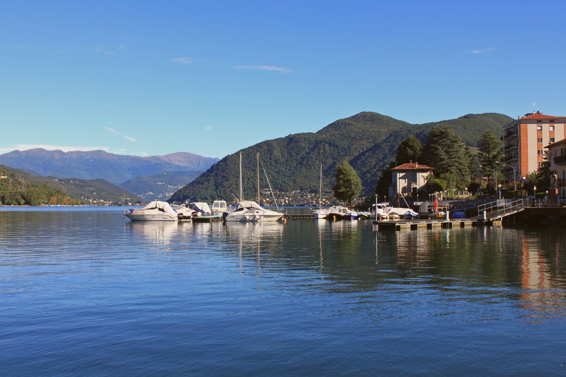
Porto Ceresio sits on the south shore, 11 kilometers northeast of Varese and directly on the Swiss frontier. The lake is also called Ceresio, named for the cherry trees that once lined its banks.
Boats run from the pier across to Lugano and Morcote in Canton Ticino, and an electric railway from Varese, the first in Italy, reached the lake in the early twentieth century. The mountain behind the town covers a tropical sea floor from 240 million years ago, and the 2010 UNESCO extension tied Porto Ceresio to Besano and Viggiù and to the original Swiss site across the water.
The lakefront promenade, with its colored houses, sits between that green mountain slope and the lake itself, looking straight across to the Swiss shore. The town reads as a hinge point: a rail line built to reach the water, a pier built to cross it, and a mountain behind that turns the crossing into a border between two countries and two geological eras.
We confirmed you can reach this one by train.
What to see in Porto Ceresio
- Lungolago di Porto Ceresio. Lakefront promenade with the ferry pier and the colored houses that face Lake Lugano and the Swiss shore opposite.
- Chiesa di Sant'Ambrogio. Parish church in the centro storico, the religious center of the village since the medieval era.
- Monte San Giorgio. Rises to 1,097 meters behind the town, the world's richest Middle Triassic marine fossil site, its green slopes forming the backdrop to the lake.
How to get to Porto Ceresio
There is a railway station in the town, so you can arrive without a car and never need one while you are here. Milano is roughly 66 minutes away by road.
Our tip
April through October is the lake season. The ferries to the Swiss shore run frequent crossings, and the lungolago fills with day-trippers from Varese and Milano on summer weekends. July and August push temperatures into the high twenties; the mountain shade behind the town keeps evenings tolerable, and the lake water stays cool.
Bellano
Why visit Bellano
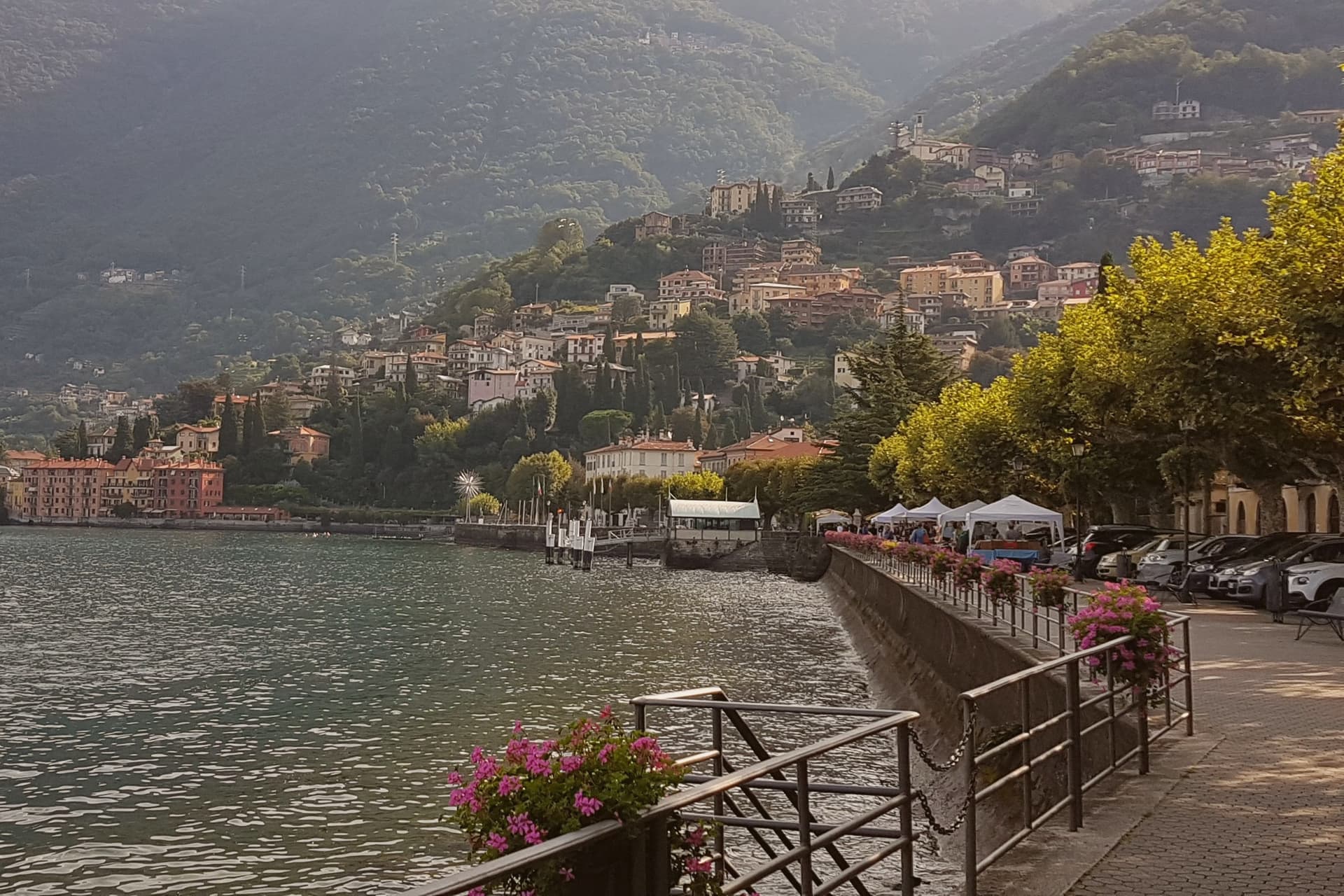
Bellano sits at the outlet of the Valsassina, on the eastern shore of Lake Como, the point where a inland valley meets the water. By 905 the town was under the Archdiocese of Milan; the Torriani and then the Visconti held it through the Middle Ages, long before the gorge became a destination or the mill brought industry.
The commune joined the Borghi più belli network in 2021, and in 2020 absorbed Vendrogno, a former commune higher up Monte Croce di Muggio, so the modern boundary reaches from the lakefront up into the mountain behind it. The town's identity comes from this stacking of inland and shore: a valley torrent cutting down through the rock, a medieval settlement governed from Milan, a nineteenth-century industrial mill at the gorge mouth, and a lake promenade with ferries to the far shore.
Each layer sits on the last without replacing it, which is why a walk from the pier to the gorge and up toward Vendrogno crosses centuries of the town's uses in a short distance.
We confirmed you can reach this one by train.
What to see in Bellano
- Orrido di Bellano. A slot canyon a few hundred meters long, the catwalks bolted directly into the cliff face so the water runs beneath the visitor's feet on both sides at once.
- Chiesa dei Santi Nazaro e Celso. Fourteenth-century parish church on Piazza San Giorgio, with a rose window and façade in alternating black and white stone.
- Cotonificio Cantoni. The brick chimney still stands at the gorge mouth, the one surviving marker of the mill that once made this a working lakeside town rather than a resort.
How to get to Bellano
There is a railway station in the town, so you can arrive without a car and never need one while you are here. Monza is roughly 82 minutes away by road.
Our tip
April through June and September into October are the months Bellano works best. The lake light is sharp, the Orrido catwalks are open, and the ferry to Varenna and Menaggio runs every half hour. July and August fill the eastern shore with day-trippers from Milan and Bergamo, and the lakefront cafés take an hour to seat.
Teglio
Why visit Teglio
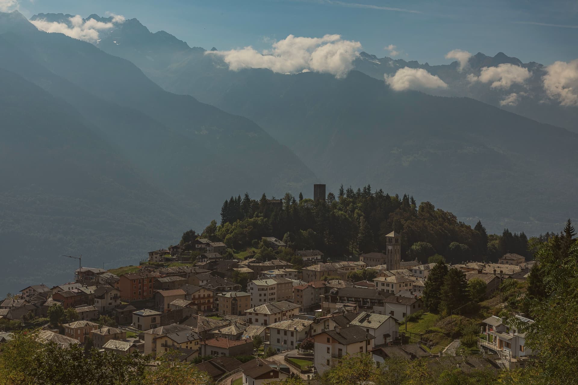
Teglio sits on the south-facing slope of the Valtellina, terraced vineyards dropping toward the Adda below the village and pine forest climbing behind it to the Orobie ridge. The Latin Tellina Vallis, valley of Teglio, gave the whole Valtellina its name, and the comune's own records reach back to the 9th century, when the village held the strategic centre of the valley.
The upper village keeps that older, defensive character; the vineyards and the valley floor below are where the food and wine culture of the place plays out, the two halves of the town facing different directions in what they do. Pizzoccheri, buckwheat tagliatelle with savoy cabbage, potato, garlic-and-butter sauce and casera cheese, has its official home here, and Teglio holds Cittaslow status on the strength of that food culture together with the terraced viticulture below the village.
A hill town that named a valley, still turned toward the river and the vines that keep its economy going, while its height and its records point back to why it was worth holding in the first place.
We confirmed you can reach this one by train.
What to see in Teglio
- Palazzo Besta. The courtyard cycle depicts Virgil's Aeneid; the upper salons hold further biblical and mythological scenes. The Antiquarium Tellinum inside holds Iron Age and Roman material from the valley.
- Accademia del Pizzocchero. The body that certifies trattorie and holds the recipe to its original form: buckwheat tagliatelle with savoy cabbage, potato, and a butter-garlic sauce alongside the cheese.
- Vigneti terrazzati della Valtellina. South-facing terraces stepping down toward the Adda, part of a viticultural landscape under UNESCO candidacy, producing Sforzato and Inferno Nebbiolo.
How to get to Teglio
There is a railway station in the town, so you can arrive without a car and never need one while you are here. Brescia is roughly 142 minutes away by road.
Our tip
May through October is the open season at 856 metres — Palazzo Besta open daily, terraced vineyards green, and the Valtellina wine route in full operation. June and September are the best months for both architecture and wine: long warm light, fewer tourists than peak summer, and the Sforzato and Inferno harvests just preparing in September. July-August stay temperate at this elevation and the trattorie are at full pizzocchero output.
San Pellegrino Terme
Why visit San Pellegrino Terme
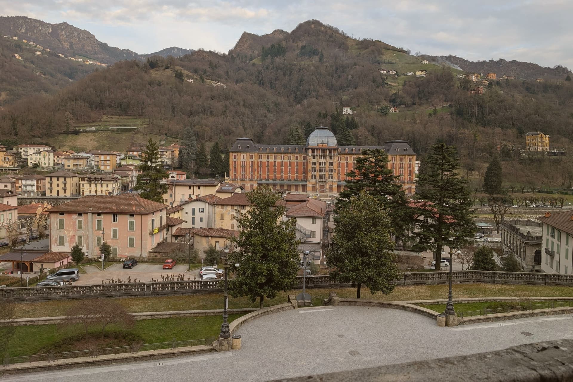
The town sits along a single bend of the Brembo river, where mineral and sulfur springs had been documented since the 13th century but were only commercialised after the railway from Bergamo reached the valley. That timing explains why the whole ensemble reads as one build: the hotel, the casino and the bath house went up within a few years of each other, facing each other across the water rather than scattered through the town.
The bottling plant sits a kilometre downstream from the springs, turning the source into the mineral water sold worldwide. Above the built-up centre, the funicular climbs to the Vetta panoramic point on the ridge, putting the whole valley below in view.
The Val Brembana around it is one of Lombardia's Cittaslow-style slow-tourism valleys, with the Borghi-più-belli of Cornello dei Tasso fifteen kilometres north and a chain of cycling routes along the river. What holds the town together, in the end, is the water itself: it drew the springs' early notice, funded the Liberty building spree once the railway arrived, and still leaves the valley in bottles long after the casino stopped taking bets.
We confirmed you can reach this one by train.
What to see in San Pellegrino Terme
- Grand Hotel San Pellegrino. Completed in 1904, the most elaborate facade of the ensemble: cast-iron balconies, stained glass, and a marble entrance hall by Romolo Squadrelli.
- Casinò Municipale (Casinò Liberty). Matching Liberty style across the Brembo from the hotel, closed to gaming since 1917 but open for events and as a visitable architectural set piece.
- Terme di San Pellegrino (QC Terme). Original 1900 building running on the historic sulfur springs, operated today by QC Terme as a full-day spa with indoor and outdoor pools at 36°C.
How to get to San Pellegrino Terme
There is a railway station in the town, so you can arrive without a car and never need one while you are here. Bergamo is roughly 30 minutes away by road.
Our tip
April through October is the prime spa-town season — outdoor pools open at the Terme, funicular running, and the riverfront promenade in full use. May and September are the architectural-photography months: warm Liberty facades, fewer guests at the Grand Hotel, long light. July-August is busiest — the QC Terme can be fully booked weekends.
Lovere
Why visit Lovere
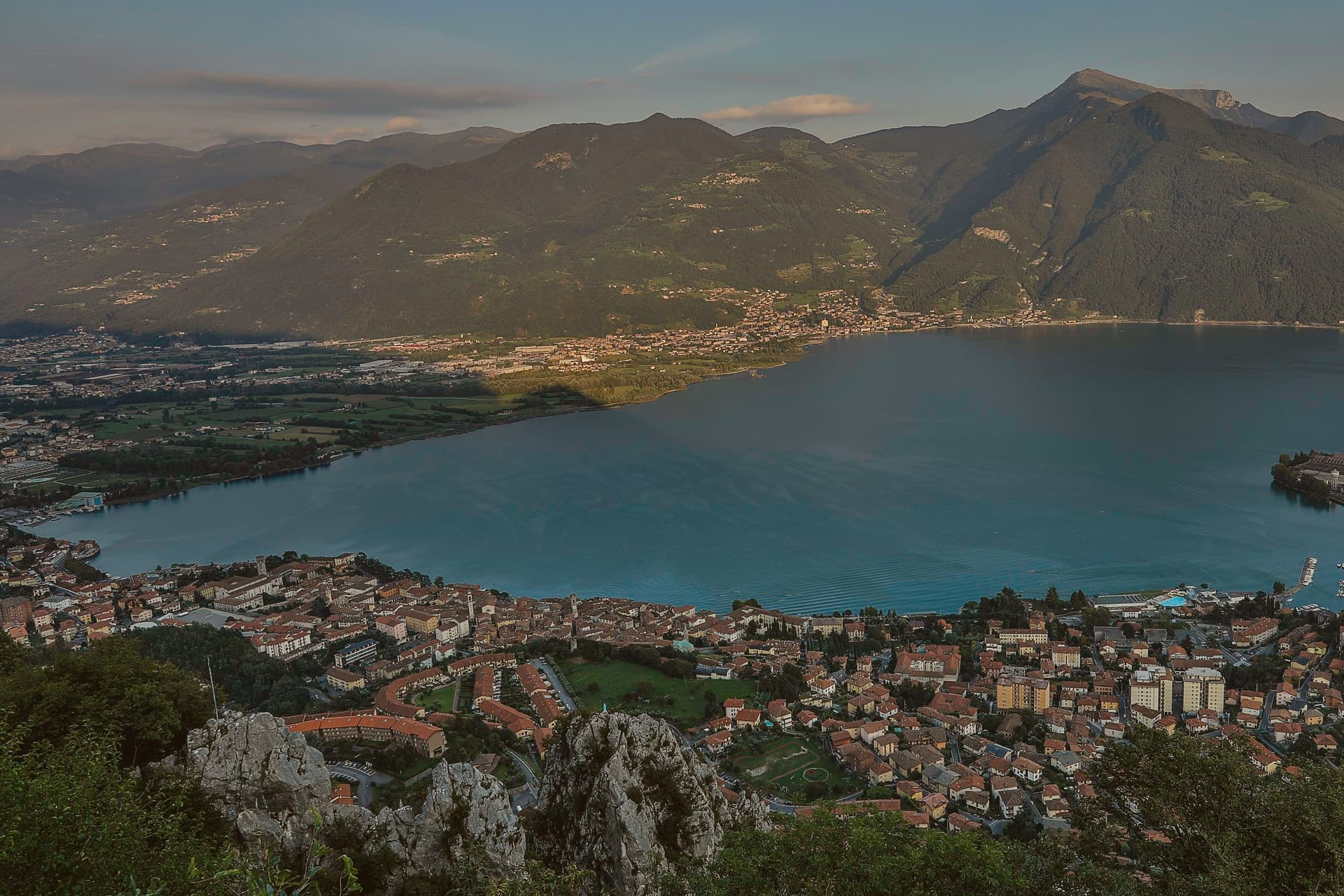
The lake here is known locally as Il Sebino, and the town sits at 200 meters at its northwest corner, where the shore curves between the water and the Bergamasque foothills before rising into the lower and upper parts of the borgo. The lower town holds the fortified medieval core, its towers still visible above the rooftops, while the centro storico below fills out with the palaces of a later, richer period.
That wealth came under the Republic of Venice, built on wool cloth production and trade, and it paid for the basilica and the family chapel that would later hold the Tadini collection. The first settlement on this shore goes back to the fifth and fourth centuries BC, with a Celtic core, long before any of what stands here now.
Lady Mary Wortley Montagu, writing from here in the eighteenth century, called it the most romantic place she had ever seen, and the town has been in I Borghi più belli d'Italia since 2003, the only Lombardia commune to finish in the top twenty of the 2018 Borgo dei Borghi ranking. What these facts add up to is a town shaped in layers, Celtic shore, medieval fortress, Venetian wealth, each still legible in the ground it left behind.
We confirmed you can reach this one by train.
What to see in Lovere
- Accademia Tadini. The Amorino Alato stands among the plaster models, alongside a Lombard-Venetian painting collection housed in the same neoclassical rooms.
- Basilica di Santa Maria in Valvendra. The basilica sits over a diverted stream, its Venetian-influenced classical façade facing the street it was built to reroute water for.
- Piazza XIII Martiri. Main lakefront square, anchored by colored façades and arcades, the central social space of the centro storico.
How to get to Lovere
There is a railway station in the town, so you can arrive without a car and never need one while you are here. Bergamo is roughly 53 minutes away by road.
Our tip
April through October is the active season on the upper end of Lake Iseo. May and June bring stable weather, full ferry schedules to Monte Isola, and the spring Tadini exhibitions. July and August are the busiest, with Italian families filling the lakefront and the Festa di San Giorgio holding the calendar.
More from Anywhere Italy
- The best small lake towns you can reach by train in Lombardia
- The best hidden lake towns you can reach by train in Lombardia
- The 7 prettiest villages you can reach by train in Lombardia
- The best hidden towns with a serious restaurant that you can reach by train in Lombardia
 The best small towns with a serious restaurant in Lombardia
- The best towns with a serious restaurant that you can reach by train in Lombardia