
The best hidden lake towns you can reach by train in Lombardia
The lakes of Lombardia are cold, deep, glacial water held between mountains that fall straight into them, and the towns along their shores are built from grey local stone with plaster the colour of dried apricot. Ferries cross all day, gliding between piers where fishermen still hang shad to dry in the sun. On the table there is lake perch fried and laid over butter rice, missoltino with polenta, olive oil pressed from groves that should not survive this far north but do. Spring brings wisteria over the waterfront railings, autumn brings chestnuts and empty promenades, and both seasons beat August for light on the water.
Most people arrive by way of Como or Bellagio, and both have earned the attention: the silk city has its Duomo and its funicular, and the promontory has the villa gardens and the postcard view down two branches of the lake at once. The consequence is predictable. Ferry queues in July, coaches nose to tail on the Via Regina, and hotel rates on the central lake that make a night on the shore a considered decision rather than an easy one.
The same water keeps going, though, north past the crowds on Como towards the Valtellina, west to Maggiore and Ceresio, east to the quieter basin of Iseo. Regional trains run these shores from Milano Centrale, Porta Garibaldi and Brescia, often in an hour or less, and they stop at towns where the waterfront is still where people buy their bread. These are the smaller stops: stone harbours, a ferry pier, a gorge or an island, and fewer people getting off the train.
Of the 64 communes we have mapped in Lombardia, 10 qualify as lake towns you can reach by train: each sits on a lake shore, and we have confirmed each is reachable without a car. This list is the hidden ones, 9 in all, ordered smallest first. The smallest, Varenna, has 693 residents.
If you are still choosing, we have also written The best small lake towns you can reach by train in Lombardia and The 10 best small towns you can reach by train in Lombardia.
Varenna
Why visit Varenna
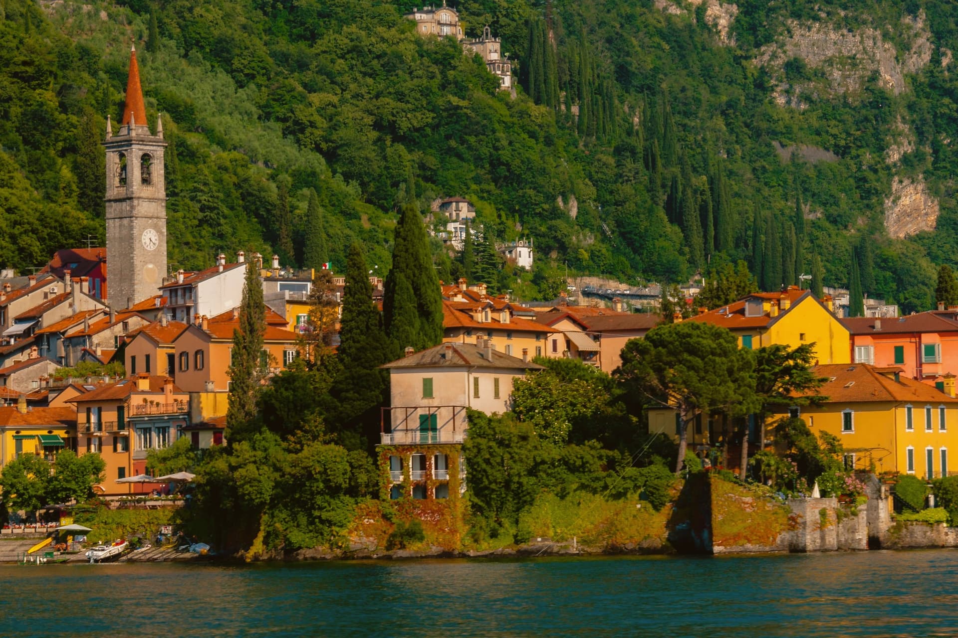
Varenna sits on the eastern shore of Lake Como at the point where the lake forks into the Como and Lecco branches, opposite Bellagio and Menaggio. Local fishermen founded the village in 769.
In 1126 it was destroyed by Como during the wars between the lake's communes, and in 1169 it absorbed the refugees from the destroyed Isola Comacina. The streets fall in a steep grid toward the water, with the lakefront passerella running between the houses and the lake.
The Castello di Vezio, above the village on a spur reached by a 30-minute climb, was a Lombard watchpost reused through the Middle Ages. Villa Monastero, on the lakefront, started in the 12th century as a Cistercian convent and now runs a two-kilometer botanical garden along the shore.
The frazione of Fiumelatte hosts one of the shortest rivers in Italy, 250 meters from spring to lake.
We confirmed you can reach this one by train.
What to see in Varenna
- Castello di Vezio. Lombard-era watchpost on a spur above the village, reached by a 30-minute climb with 160 meters of elevation gain.
- Villa Monastero. Former 12th-century Cistercian convent on the lakefront, now a museum and convention center with a 2-kilometer botanical garden along the shore.
- Villa Cipressi. Sixteenth-to-nineteenth-century lakefront villa next to Villa Monastero, with terraced gardens descending to the water.
How to get to Varenna
There is a railway station in the town, so you can arrive without a car and never need one while you are here. Monza is roughly 62 minutes away by road.
Our tip
April through October is the working season. The ferries from Bellagio and Menaggio run frequently, the villa gardens open in late March, and the lake stays mild enough to swim from June onward. July and August are crowded: 693 residents host thousands of day visitors, and the lakefront fills with photo tripods at sunset.
Monte Isola
Why visit Monte Isola
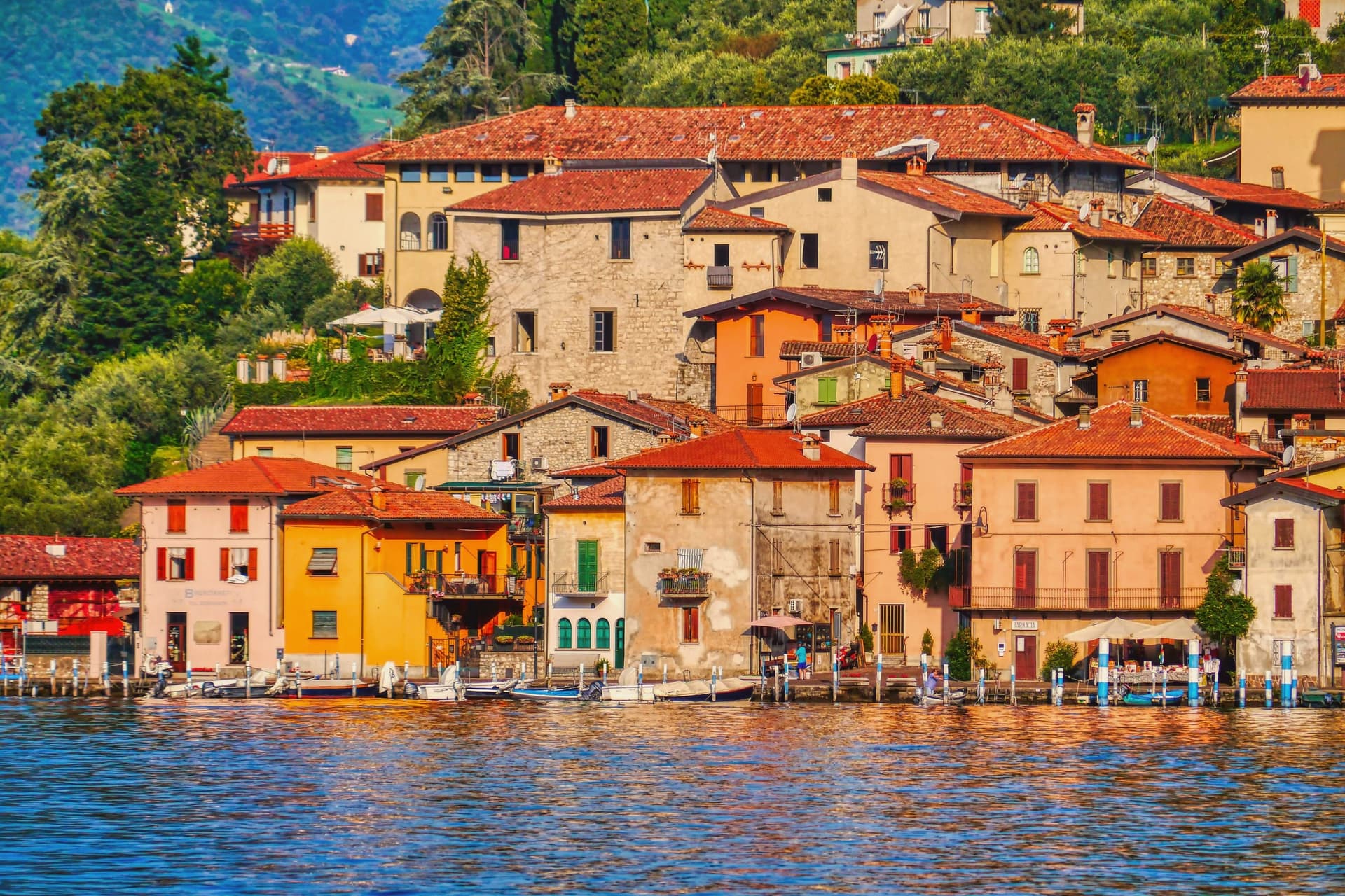
Monte Isola covers 4.5 square kilometers in the middle of Lake Iseo, the largest lake island in southern and central Europe. Eleven villages and hamlets line the shore and climb the slopes: Peschiera Maraglio and Sensole on the south, Siviano on the north, with smaller settlements between.
The Madonna della Ceriola sanctuary stands at 600 meters at the summit, documented in 1410 but built older, holding a twelfth-century wooden sculpture of the Virgin and Child. No private cars are allowed on the island; mopeds, bicycles and feet are the way around.
The Comune still keeps the small island of San Paolo and the privately owned Loreto as part of its territory. Fishing nets are still woven here by hand for use across the lakes of northern Italy, and wooden boats are still built by a handful of craftsmen in Peschiera Maraglio.
In summer 2016, Christo and Jeanne-Claude floated their orange piers from Sulzano to the island, drawing 1.2 million visitors in sixteen days.
We confirmed you can reach this one by train.
What to see in Monte Isola
- Santuario della Madonna della Ceriola. Pilgrimage church at the summit, 600 meters above the lake, holding a twelfth-century wooden Virgin and Child and reached only on foot from Cure.
- Peschiera Maraglio. Main lake-side village on the south of the island, with the ferry landing, the boatyards and the long stone lakefront facing San Paolo.
- Siviano. Capital of the comune on the north of the island, a fortified medieval hamlet with tower houses, narrow streets and the parish church.
How to get to Monte Isola
There is a railway station in the town, so you can arrive without a car and never need one while you are here. Brescia is roughly 48 minutes away by road.
Our tip
April through October is the season Monte Isola is built for. May, June, September and early October are the best months: ferries run on schedule, the perimeter road is open to bikes, the Ceriola climb is dry. July and August bring weekend day-trippers from Brescia, Bergamo and Milano, especially Sundays; the ferries fill and Peschiera Maraglio is at capacity by mid-morning.
Dervio
Why visit Dervio
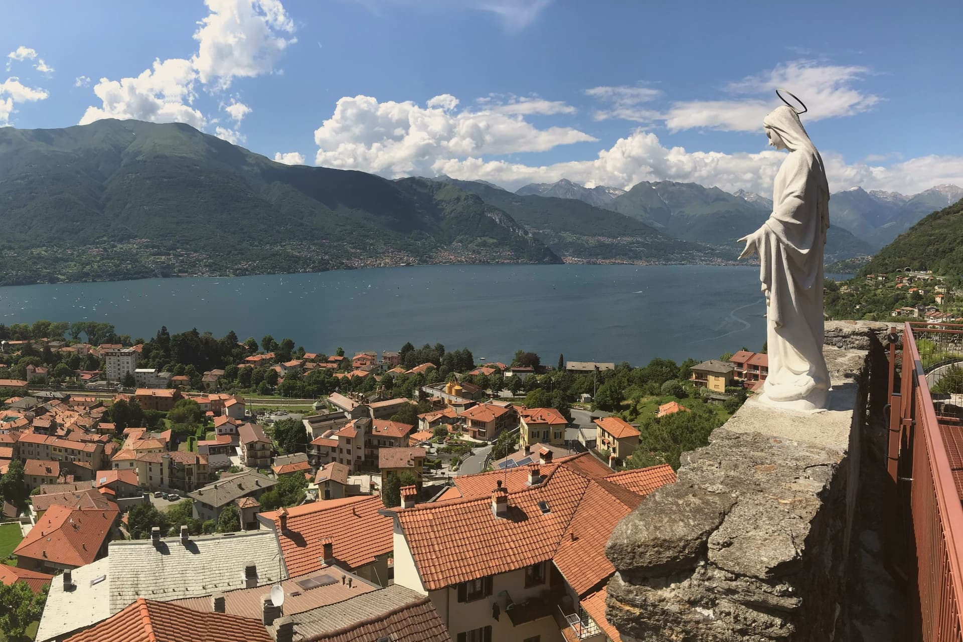
Dervio sits on a small peninsula on the eastern shore of upper Lake Como, where the Varrone torrent emerges from its valley and pushes a delta into the lake. The Romanesque bell tower of the Chiesa di San Quirico e Giulitta, attached to a church first mentioned in 814 and rebuilt around 1080, is the oldest structure in the commune.
Above the village, on a cliff that once blocked the road into the Valvarrone, stand the ruins of the Castello di Orezia, raised in the late Middle Ages and recorded in 1039 during a long siege by three Larian parishes. Dervio's reputation today rests less on its monuments than on its wind.
The position at the peninsula tip funnels the Breva and Tivano onto the lake in a way racing sailors learn to read. The commune draws sailing schools from April through October, and its lakefront promenade extends north toward Dorio along a stone path called the Sentiero del Viandante.
We confirmed you can reach this one by train.
What to see in Dervio
- Campanile di San Quirico e Giulitta. Romanesque stone bell tower from around 1080, attached to one of the oldest churches on Lake Como, first cited in 814.
- Torre del Castello di Orezia. Late medieval tower on a cliff above Dervio, part of a fortress blocking the Valvarrone road, with documented siege in 1039.
- Chiesa dei Santi Pietro e Paolo. Eleventh-century parish church on the lakeshore, with a Romanesque bell tower and later interventions.
How to get to Dervio
There is a railway station in the town, so you can arrive without a car and never need one while you are here. Monza is roughly 62 minutes away by road.
Our tip
April through October works on this part of Lake Como. May and June bring stable winds, mild temperatures, and the alpine slopes still green. July and August are the busiest months; the peninsula fills with sailing crews and Italian families with second homes, and the lake-facing villages hold their summer festas.
Porto Ceresio
Why visit Porto Ceresio
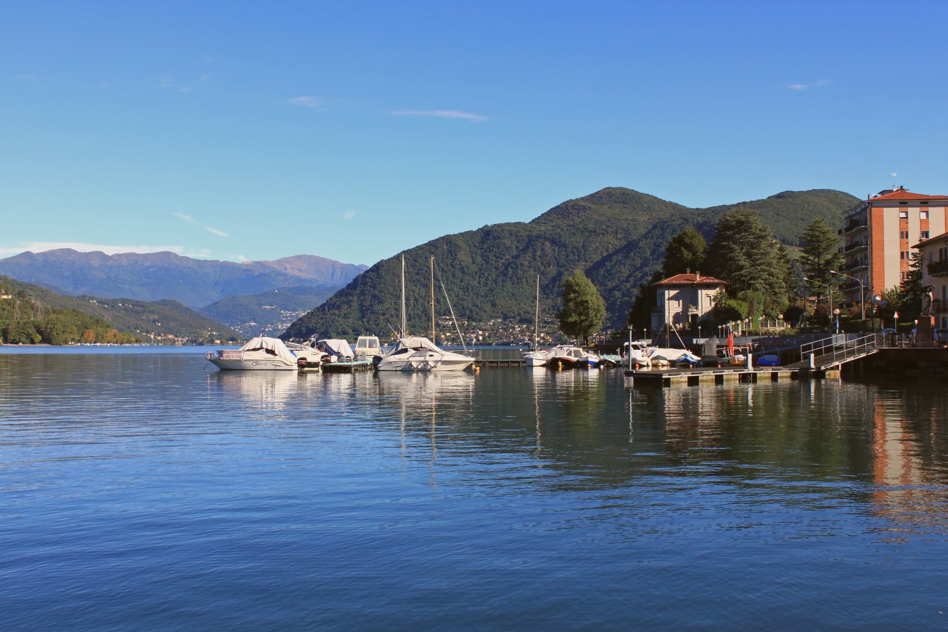
Porto Ceresio sits on the south shore, 11 kilometers northeast of Varese and directly on the Swiss frontier. The lake is also called Ceresio, named for the cherry trees that once lined its banks.
Boats run from the pier across to Lugano and Morcote in Canton Ticino, and an electric railway from Varese, the first in Italy, reached the lake in the early twentieth century. The mountain behind the town covers a tropical sea floor from 240 million years ago, and the 2010 UNESCO extension tied Porto Ceresio to Besano and Viggiù and to the original Swiss site across the water.
The lakefront promenade, with its colored houses, sits between that green mountain slope and the lake itself, looking straight across to the Swiss shore. The town reads as a hinge point: a rail line built to reach the water, a pier built to cross it, and a mountain behind that turns the crossing into a border between two countries and two geological eras.
We confirmed you can reach this one by train.
What to see in Porto Ceresio
- Lungolago di Porto Ceresio. Lakefront promenade with the ferry pier and the colored houses that face Lake Lugano and the Swiss shore opposite.
- Chiesa di Sant'Ambrogio. Parish church in the centro storico, the religious center of the village since the medieval era.
- Monte San Giorgio. Rises to 1,097 meters behind the town, the world's richest Middle Triassic marine fossil site, its green slopes forming the backdrop to the lake.
How to get to Porto Ceresio
There is a railway station in the town, so you can arrive without a car and never need one while you are here. Milano is roughly 66 minutes away by road.
Our tip
April through October is the lake season. The ferries to the Swiss shore run frequent crossings, and the lungolago fills with day-trippers from Varese and Milano on summer weekends. July and August push temperatures into the high twenties; the mountain shade behind the town keeps evenings tolerable, and the lake water stays cool.
Bellano
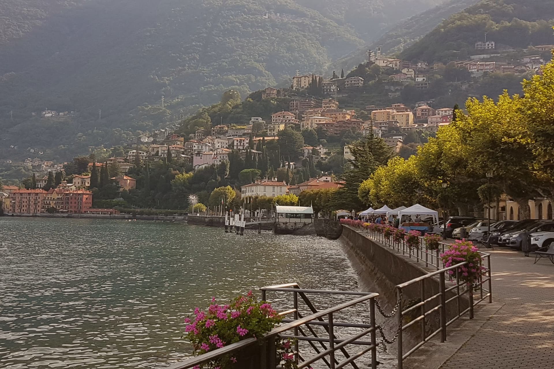
Why visit Bellano
Bellano sits at the outlet of the Valsassina, on the eastern shore of Lake Como, the point where a inland valley meets the water. By 905 the town was under the Archdiocese of Milan; the Torriani and then the Visconti held it through the Middle Ages, long before the gorge became a destination or the mill brought industry.
The commune joined the Borghi più belli network in 2021, and in 2020 absorbed Vendrogno, a former commune higher up Monte Croce di Muggio, so the modern boundary reaches from the lakefront up into the mountain behind it. The town's identity comes from this stacking of inland and shore: a valley torrent cutting down through the rock, a medieval settlement governed from Milan, a nineteenth-century industrial mill at the gorge mouth, and a lake promenade with ferries to the far shore.
Each layer sits on the last without replacing it, which is why a walk from the pier to the gorge and up toward Vendrogno crosses centuries of the town's uses in a short distance.
We confirmed you can reach this one by train.
What to see in Bellano
- Orrido di Bellano. A slot canyon a few hundred meters long, the catwalks bolted directly into the cliff face so the water runs beneath the visitor's feet on both sides at once.
- Chiesa dei Santi Nazaro e Celso. Fourteenth-century parish church on Piazza San Giorgio, with a rose window and façade in alternating black and white stone.
- Cotonificio Cantoni. The brick chimney still stands at the gorge mouth, the one surviving marker of the mill that once made this a working lakeside town rather than a resort.
How to get to Bellano
There is a railway station in the town, so you can arrive without a car and never need one while you are here. Monza is roughly 82 minutes away by road.
Our tip
April through June and September into October are the months Bellano works best. The lake light is sharp, the Orrido catwalks are open, and the ferry to Varenna and Menaggio runs every half hour. July and August fill the eastern shore with day-trippers from Milan and Bergamo, and the lakefront cafés take an hour to seat.
Lovere
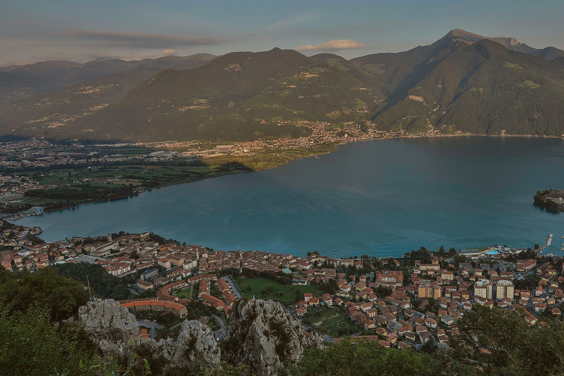
Why visit Lovere
The lake here is known locally as Il Sebino, and the town sits at 200 meters at its northwest corner, where the shore curves between the water and the Bergamasque foothills before rising into the lower and upper parts of the borgo. The lower town holds the fortified medieval core, its towers still visible above the rooftops, while the centro storico below fills out with the palaces of a later, richer period.
That wealth came under the Republic of Venice, built on wool cloth production and trade, and it paid for the basilica and the family chapel that would later hold the Tadini collection. The first settlement on this shore goes back to the fifth and fourth centuries BC, with a Celtic core, long before any of what stands here now.
Lady Mary Wortley Montagu, writing from here in the eighteenth century, called it the most romantic place she had ever seen, and the town has been in I Borghi più belli d'Italia since 2003, the only Lombardia commune to finish in the top twenty of the 2018 Borgo dei Borghi ranking. What these facts add up to is a town shaped in layers, Celtic shore, medieval fortress, Venetian wealth, each still legible in the ground it left behind.
We confirmed you can reach this one by train.
What to see in Lovere
- Accademia Tadini. The Amorino Alato stands among the plaster models, alongside a Lombard-Venetian painting collection housed in the same neoclassical rooms.
- Basilica di Santa Maria in Valvendra. The basilica sits over a diverted stream, its Venetian-influenced classical façade facing the street it was built to reroute water for.
- Piazza XIII Martiri. Main lakefront square, anchored by colored façades and arcades, the central social space of the centro storico.
How to get to Lovere
There is a railway station in the town, so you can arrive without a car and never need one while you are here. Bergamo is roughly 53 minutes away by road.
Our tip
April through October is the active season on the upper end of Lake Iseo. May and June bring stable weather, full ferry schedules to Monte Isola, and the spring Tadini exhibitions. July and August are the busiest, with Italian families filling the lakefront and the Festa di San Giorgio holding the calendar.
Sarnico
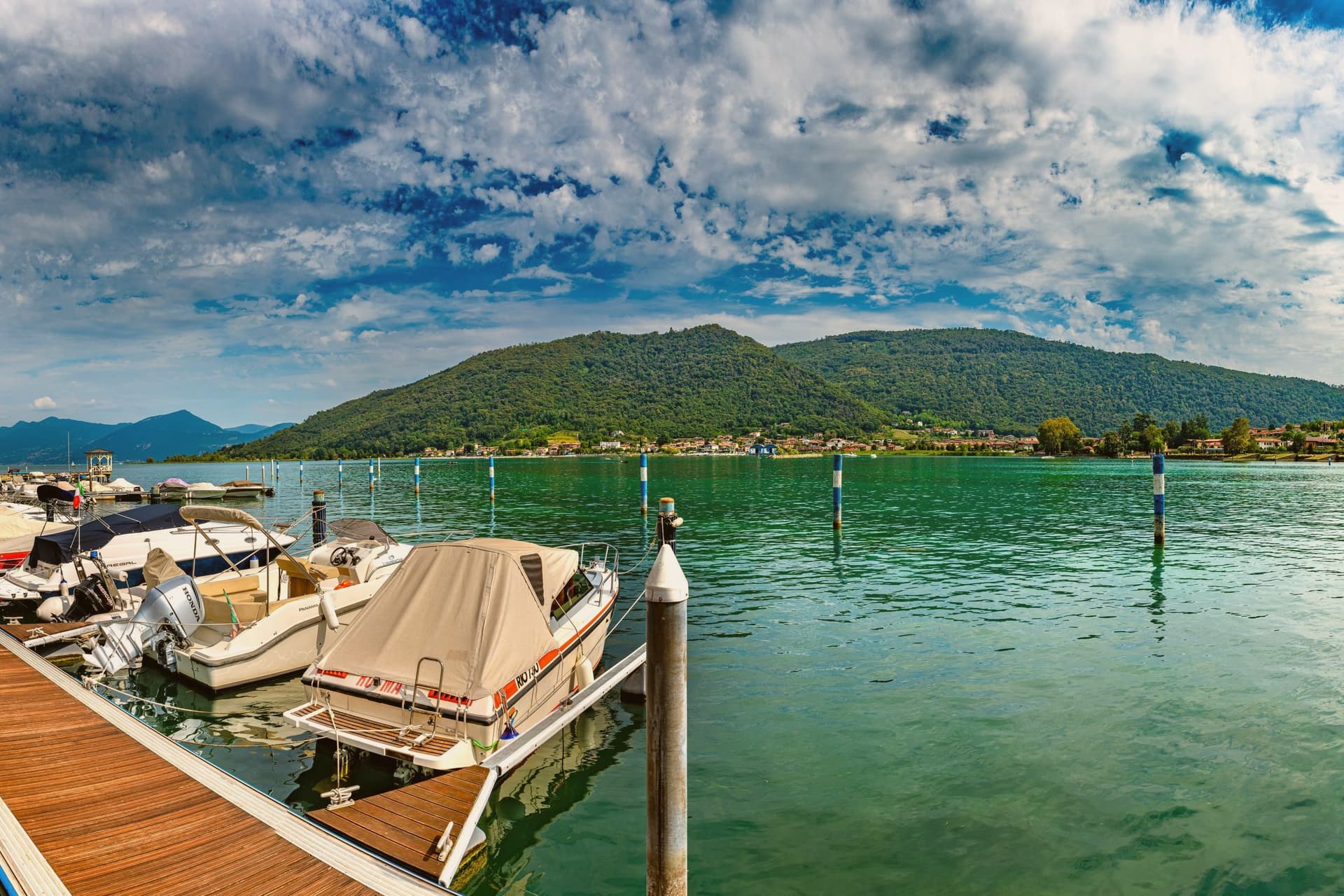
Why visit Sarnico
Sarnico sits at the southern end of Lago d'Iseo, where the Oglio river drains the lake toward the Po valley, twenty-five kilometers east of Bergamo. A document from 861 records the emperor Ludwig II donating the local piscaria to the monastery of Santa Giulia in Brescia, which makes Sarnico's fishing trade older than most things on the lake.
The medieval centro storico still reads as a market town. The second layer arrived in the early twentieth century, when the Faccanoni family commissioned Giuseppe Sommaruga to build a string of Liberty villas along the shore road toward Predore.
Villa Faccanoni, Villa Surre and the family mausoleum are among the most coherent stretches of Italian Art Nouveau outside Milan. The Riva shipyard, founded here in 1842, still builds wooden motor yachts on the lakefront.
Most weekenders come from Bergamo and Brescia for the lake; the buildings are why architecture students come.
We confirmed you can reach this one by train.
What to see in Sarnico
- Villa Faccanoni. Giuseppe Sommaruga's 1907 Liberty villa on the lakefront, one of the finest Art Nouveau buildings in Lombardia.
- Villa Surre. Sommaruga villa built for Luigi Faccanoni on the road toward Predore, a complete early-modernist composition.
- Centro Storico. Medieval lakeside core with porticoed lanes, the old fish market site, and the lungolago promenade.
How to get to Sarnico
There is a railway station in the town, so you can arrive without a car and never need one while you are here. Bergamo is roughly 32 minutes away by road.
Our tip
April through June and September through October are the calmest months on Lago d'Iseo: mild temperatures, low water traffic, and the Faccanoni villas open for guided visits. July and August bring weekenders from Bergamo, Brescia and Milano, and the ferries run full. The Wine Festival in late spring fills the piazza. Gli Ambulanti di Forte dei Marmi falls in August.
Laveno-Mombello
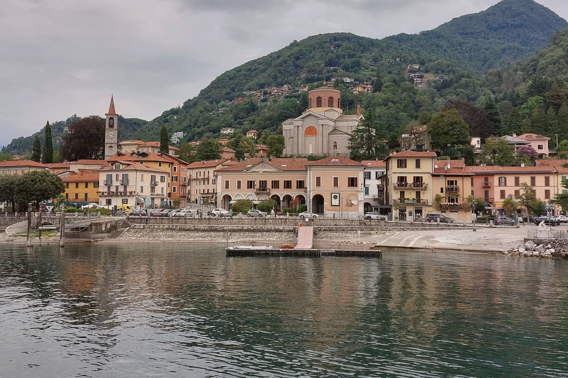
Why visit Laveno-Mombello
Laveno-Mombello sits on Lake Maggiore's eastern shore in the province of Varese, where a limestone wall drops directly to the water at the town's back. The ferry here crosses to Verbania and the Borromean Islands on the opposite shore, making the town as much a hinge point between Lombardia and Piemonte as a destination in itself.
Cerro, the lakefront hamlet folded into the town, kept the workshops after the ceramics factories closed in the 1990s, and its Palazzo Perabò now holds the museum that charts that industry from 1856 forward. South along the shore, a fifteen-minute drive reaches the monastery built into the cliff face, reachable by stairs, lift or boat where the road does not reach directly.
The town's shape follows the lake and the rock in equal measure: industry and transit at the shoreline, the mountain rising straight behind it, and the monastery holding on to the cliff a short way south as if the same geology that made Laveno a port also made it a place for building into stone.
We confirmed you can reach this one by train.
What to see in Laveno-Mombello
- MIDeC – Museo Internazionale Design Ceramico. Ceramics design museum in the sixteenth-century Palazzo Perabò at Cerro, covering Laveno production from 1856 to the 1990s.
- Sasso del Ferro. Limestone summit reached by the bucket funicular, with a terrace looking across Lake Maggiore to Lago d'Orta and the southern Alps.
- Santa Caterina del Sasso. Fourteenth-century monastery clinging to a cliff above Lake Maggiore, fifteen minutes south, reached by stairs, lift or boat.
How to get to Laveno-Mombello
There is a railway station in the town, so you can arrive without a car and never need one while you are here. Novara is roughly 74 minutes away by road.
Our tip
April through October covers the working calendar. The Sasso del Ferro funicular runs most days from spring through autumn, weather permitting, and is unreliable in winter. May, June, September and October are the calmest weeks on the eastern shore.
Iseo
Why visit Iseo
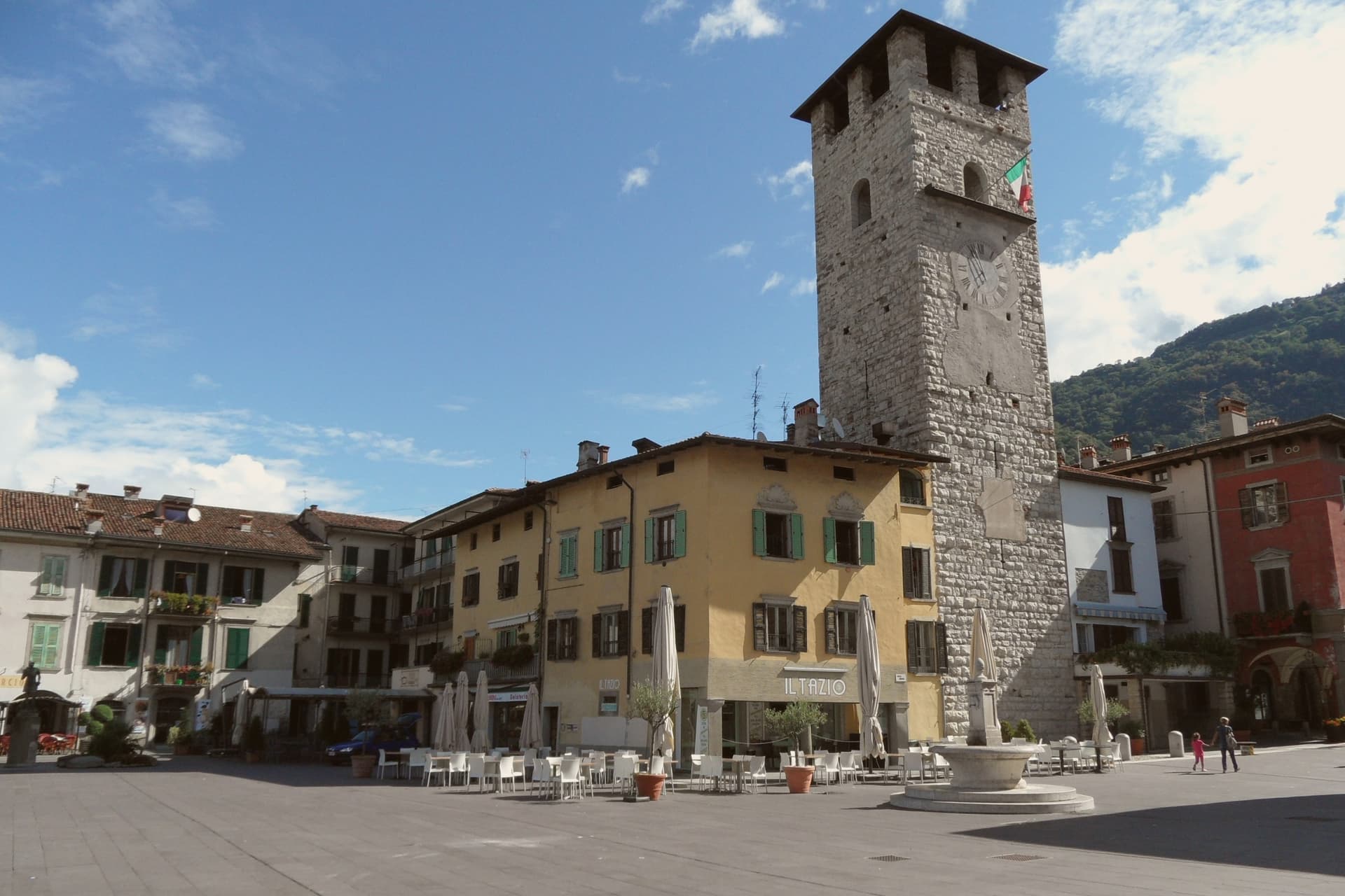
Iseo sits at 198 meters on the southeast shore of Lake Iseo, the fourth-largest lake in Lombardia, fed by the Oglio. The town was founded around a monastery in the 900s and grew under the Sozzi, the Isei, and finally the Oldofredi.
From 1428 to 1797 Iseo was part of the Republic of Venice. The lakefront and the vineyards to the south form the town's two working halves: one facing the water and the ferries that cross it, the other rising into the Franciacorta hills where the metodo classico grapes are grown.
Ferries from the lakefront connect to Monte Isola, the largest lake island in southern Europe, and to Sarnico across the water in Bergamo province. A lake town that turned its inland edge to wine and its waterfront to the island: the two directions, water and vineyard, still define how the town is used.
We confirmed you can reach this one by train.
What to see in Iseo
- Castello Oldofredi. The stone fortress stands above the lakefront, its walls facing the water rather than the town center, a reminder that it was built to watch the lake approach.
- Pieve di Sant'Andrea. Founded by Bishop Vigilio, the church keeps its bell tower set into the middle of the façade rather than beside or behind it, an arrangement rare among Lombard Romanesque buildings.
- Piazza Garibaldi. Main lakeside square with the first Italian statue of Garibaldi, erected in 1883, the year after his death.
How to get to Iseo
There is a railway station in the town, so you can arrive without a car and never need one while you are here. Brescia is roughly 28 minutes away by road.
Our tip
April through October runs Iseo's lake season. April and May open the ferries to Monte Isola, the Franciacorta wineries reopen for tastings, and the lakefront fills on weekends. June through August is the peak window: warm enough to swim, hot enough that the centro empties between 14:00 and 17:00, and the lake breeze keeps evenings comfortable.
More from Anywhere Italy
- The best small lake towns you can reach by train in Lombardia
 The 10 best small towns you can reach by train in Lombardia
- The 7 prettiest villages you can reach by train in Lombardia
- The best hidden towns with a serious restaurant that you can reach by train in Lombardia
- The best towns with a serious restaurant that you can reach by train in Lombardia
- The 8 best lake towns within 90 minutes of Monza