
The 6 best small towns with a food festival in Lazio
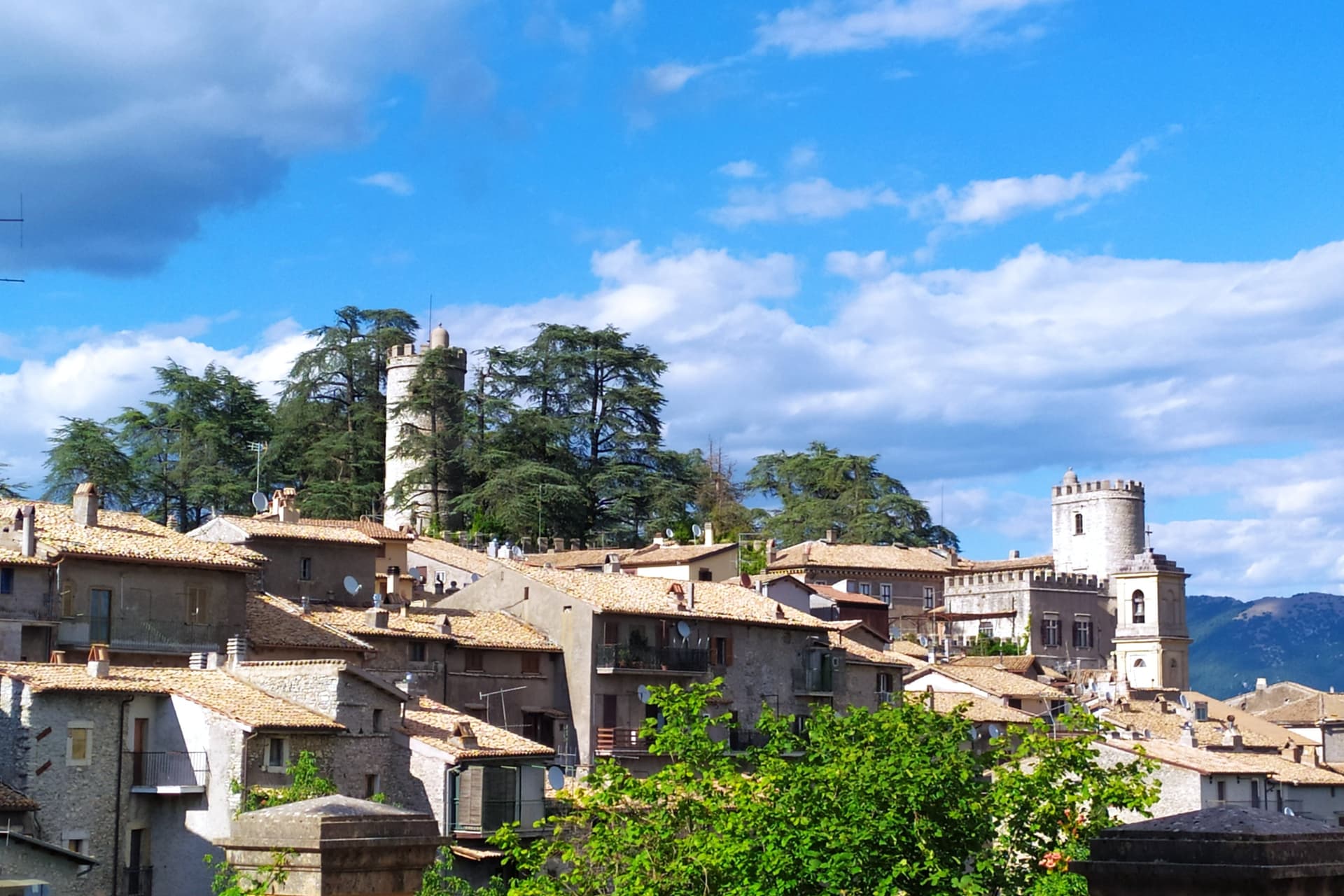
Lazio eats by season, and in the small towns the season gets a date on the calendar. Late spring brings the tiny wild strawberries grown in the damp soil of a volcanic crater, sold in paper cones at trestle tables. Autumn brings chestnuts roasting in perforated drums, porcini from the oak woods of the Monti Sabini, and lake fish grilled on the shore of Bolsena. The towns themselves are built from the region's own rock, dark volcanic tufa cut into blocks, streets running steeply between houses the colour of wet ash, with a piazza at the top where the trestles go up.
Most food travel in Lazio happens in Rome, and understandably. The markets of Testaccio and the trattorie of Trastevere serve the four Roman pastas well, the queues outside them are long, and a visitor can eat very happily without ever leaving the city walls. But Rome in high season means booking ahead, eating early, and sharing the room with a great many other people doing exactly the same thing. The ingredients on those plates come from somewhere else.
They come from the hill towns and lake towns, and those places still throw their own parties for them. The same guanciale, the same lentils, the same lake coregone and the same chestnut flour turn up in villages an hour or two from the capital, cooked in the open by people from the town, served on a paper plate for the price of a coffee in the centre. Fewer travellers make the trip. These are the smaller towns in Lazio where one ingredient gets a festival of its own, and where the festival is still mostly for the neighbours.
Of the 60 communes we have mapped in Lazio, 17 qualify as towns with a food festival: each holds a recurring food festival built around one local ingredient. This list is the small ones, 6 in all, ordered smallest first. The smallest, Orvinio, has 396 residents.
Two more lists worth reading alongside this one: The best hill towns with a food festival in Lazio and The best small towns inside a nature park in Lazio.
Orvinio
Why visit Orvinio
Orvinio sits on a saddle in the Monti Lucretili park, the last village before the slopes drop toward the Turano lake. The ancient settlement called Orvinium was destroyed before the year 1000, and the medieval town that grew up afterward took the name Canemorto, said to commemorate a Saracen defeat by Charlemagne's troops in 817.
The Orsini built the Granarone palace in the fifteenth century, before the Borghese took the fief in 1632. The village they governed still reads in two layers: stone houses running in tight loops below the ridge, and the Castello Malvezzi-Campeggi above them, the physical record of who held the place longest.
The Cammino di San Benedetto crosses this lower town on its way between Subiaco and Norcia, a reminder that the village has always been a point of passage as much as a seat of lordship. What remains is a settlement whose name changed twice and whose skyline did not: the castle above, the loops of houses below, unchanged in relation even as the village below it was renamed.
What to see in Orvinio
- Castello Malvezzi-Campeggi. Rebuilt by the Borghese in the nineteenth century, it dominates the village from the upper ridge, still visibly the seat of the family that held the fief the longest.
- Abbazia di Santa Maria del Piano. Benedictine abbey founded in the early Middle Ages, the original landlords of the territory before the Orsini took it.
- Centro storico. Stone houses in tight medieval loops below the castle, with vaulted passages and the original village gates preserved.
How to get to Orvinio
Roma is roughly 60 minutes away by road.
Our tip
May through September is the working window at 840 meters. The Lucretili woods open, the trails dry out and the village evenings stay cool when Rome forty-five kilometers downhill is hitting thirty-five. October still holds for the woods turning copper and for the Cammino di San Benedetto walkers passing through on the route between Subiaco and Norcia. Sagra della Polenta falls in August.
Casperia
Why visit Casperia
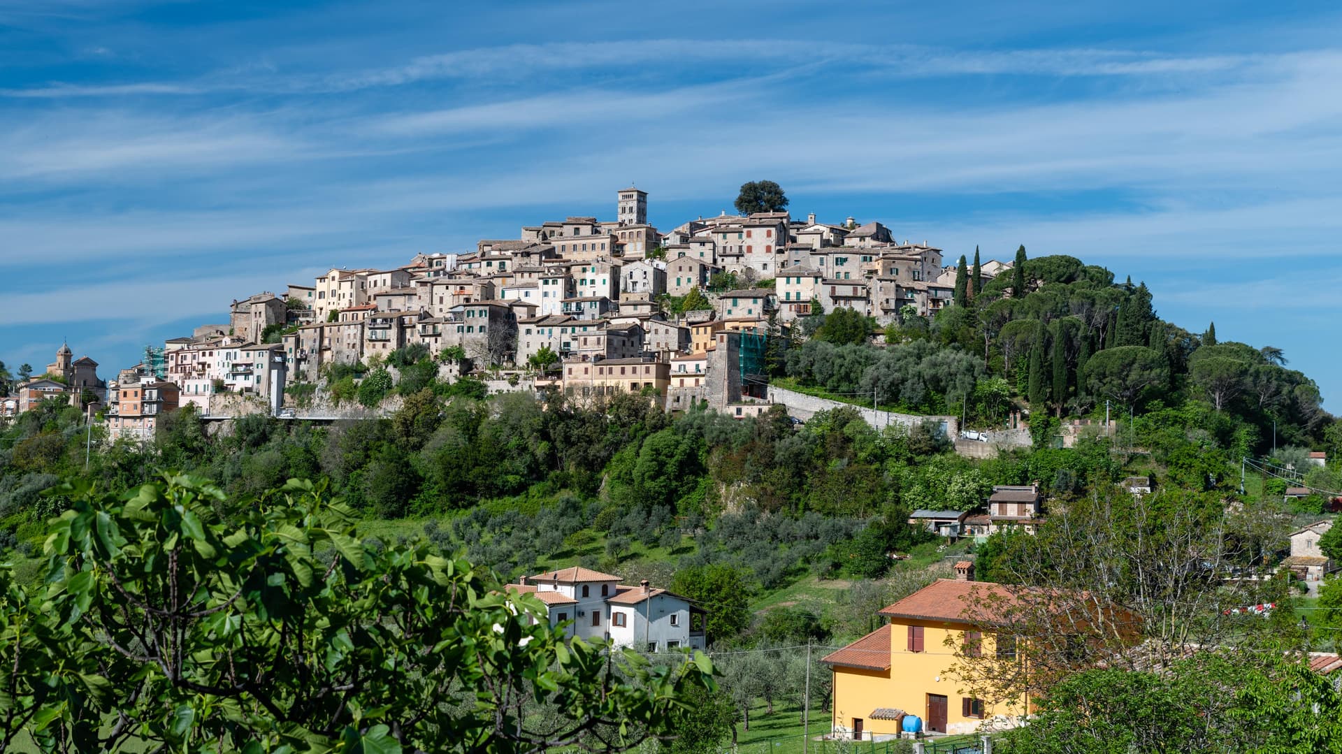
Casperia sits at 397 meters on the western slope of the Monti Sabini, fifty kilometers northeast of Rome. Its two gates face opposite directions on the hillside, one toward the lower road on the west, the other toward the valley on the east, and both feed into the same climbing street pattern that rings the hill in concentric bands up to the church at the summit.
No vehicles pass the gates, so the interior keeps its medieval scale intact, lane by lane, without the intrusions that have altered plenty of comparable towns. Below the walls the slope opens into olive country, part of a protected-origin appellation, in the localities of Paranzano, Santa Maria in Legarano and San Vito.
The relationship between the two levels, hilltop settlement above and working groves below, is the shape of the place: a defended village that never spread past its walls, sitting over land that has been worked continuously and given a name and a boundary of its own.
What to see in Casperia
- Centro storico. Concentric lanes climb from the gates to the parish church at the summit, laid out with no space for vehicles, a compact plan that reads clearly from any of the approaches below.
- Chiesa di San Giovanni Battista. Parish church on the highest point of the village, baroque interior on medieval foundations, with works by Vincenzo Manenti.
- Porta Romana. Western gate of the wall circuit, the main entry point on foot from the lower road.
How to get to Casperia
Terni is roughly 43 minutes away by road.
Our tip
April through June and September through October are the best months in the Sabina hills. The olive harvest runs from mid-October into November; the new oil is pressed in the cooperatives around the village and the town fills on autumn weekends for tastings. July and August are hot in the lower valley; the village at 397 meters is several degrees cooler and the lanes hold shade. Sagra dei Stringozzi Aspresi falls in July.
Nemi
Why visit Nemi
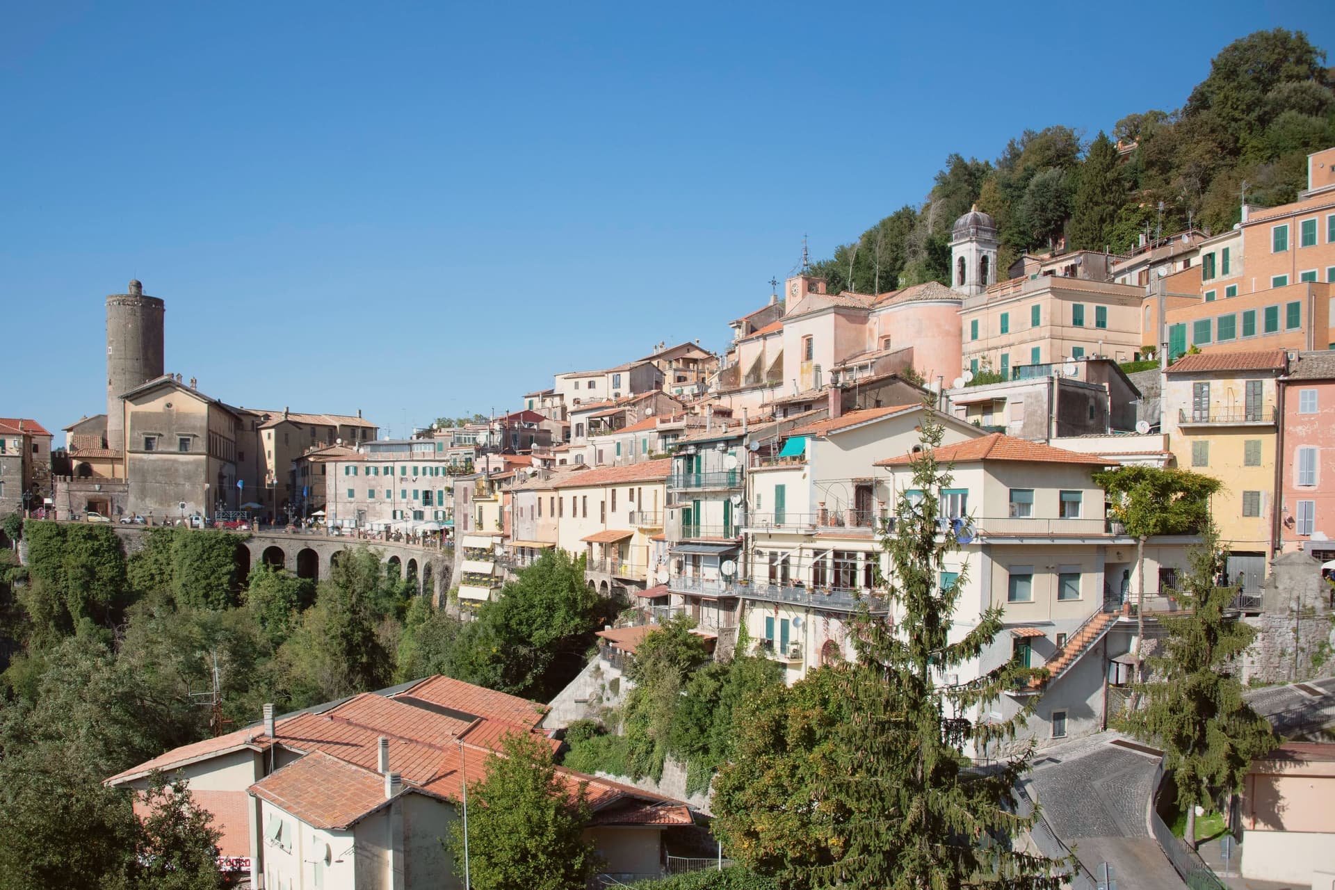
Nemi sits at 521 meters on the rim of a volcanic crater, the smallest of the Castelli Romani and thirty kilometers southeast of Rome. The lake below was the Speculum Dianae, the mirror of Diana, with a sanctuary on its northern shore that covered around 45,000 square meters and drew pilgrims from across Latium.
Emperor Caligula built two ceremonial ships on the lake, ninety meters of timber and bronze that sat on the water until they sank. Mussolini drained part of the lake between 1929 and 1932 to recover them.
They were destroyed by fire in 1944, almost certainly by retreating German troops. The Museo delle Navi Romane, built in 1940 to hold them, now shows scaled reconstructions and salvaged fragments.
Palazzo Ruspoli, a ninth-century castle restored by Valadier, anchors the centro storico. The wild strawberries grown on the inner slopes of the crater are sold from stalls along Via Roma and celebrated each June at the Sagra delle Fragole.
What to see in Nemi
- Palazzo Ruspoli. Ninth-century castle of the Counts of Tuscolo, restored by Valadier, with cylindrical tower and hanging garden over the lake.
- Museo delle Navi Romane. Lakeshore museum built in 1940 for Caligula's two recovered ships, destroyed by fire in 1944, now housing scaled models and fragments.
- Santuario di Diana Nemorense. Remains of the federal sanctuary on the lake's northern shore, once 45,000 square meters of temple, porticoes and theater.
How to get to Nemi
Roma is roughly 52 minutes away by road.
Our tip
April through June and September into October are the dry months on the crater rim, when the wild strawberries ripen and the lake holds its color. The Sagra delle Fragole runs the first Sunday of June and draws thousands. July and August push the basin into the low thirties; the centro storico stays cooler at 521 meters than the coast or the city, but weekends fill with day-trippers from Rome. Borgo diVino in tour falls in September.
Oriolo Romano
Why visit Oriolo Romano
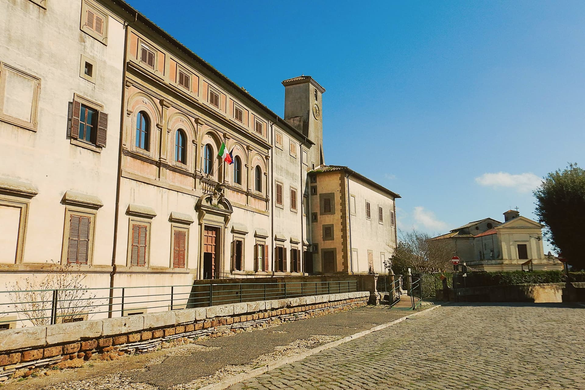
Oriolo Romano sits at 420 meters in the Sabatini hills, between Lake Bracciano and the volcanic Cimini, not far from the old Via Clodia. The village is unusually new for the Tuscia: in 1560 the Orsini family ceded a wooded fief to the nobleman Giorgio Santacroce, who began clearing the forest and founded a planned agricultural settlement.
The first inhabitants were farmers, shepherds and woodcutters drawn from Tuscany and Umbria, so the local accent kept Umbrian inflections for generations. The palace at the center of the village gave the settlement its shape, with the parish church and the main square arranged around it as the plan intended.
The forest that once covered the whole fief survives now at the margins, an exceptionally low-altitude stand for an Apennine beech wood, while hazelnut groves have taken over the lower slopes that were cleared for farming. The village, in effect, is the cleared half of a wooded fief, its cultivated ring still framed by the wood the Santacroce family left standing.
What to see in Oriolo Romano
- Palazzo Altieri. Sixteenth-century palace enlarged in 1674 under Pope Clement X, with Old Testament frescoes and painted views of the Altieri fiefs.
- Faggeta di Monte Raschio. Primeval beech forest of about eighty hectares between 400 and 550 meters, UNESCO World Heritage since 2017.
- Piazza Umberto I. Central square of the 1560 plan, anchored by the palace and the parish Chiesa di Sant'Anna at the head of the village.
How to get to Oriolo Romano
There is a railway station in the town, so you can arrive without a car and never need one while you are here. Roma is roughly 75 minutes away by road.
Our tip
April through June and September into October are the months for the beech forest, when the canopy is full and the trails on Monte Raschio are at their cleanest. The exceptionally low altitude of the faggeta means autumn color arrives earlier and lasts longer than in higher Apennine beech woods. July and August push the lower hills into the low thirties; the forest holds shade and stays five or six degrees cooler than the surrounding farmland. Oriolo Romano Porcini Mushroom Festival falls in September.
Bolsena

Why visit Bolsena
Bolsena stands at 350 meters on the eastern shore of Lake Bolsena, the largest volcanic lake in Europe at 114 square kilometers. The site sits on the old Etruscan town of Volsinii, razed by the Romans in 265 BC; the survivors were resettled here as Volsinii Novi.
In 1263 a Bohemian priest, doubting the doctrine of transubstantiation, was celebrating mass in the church when the host bled onto the corporal. The cloth was carried to Urbino, then to Orvieto, and Pope Urban IV extended the feast of Corpus Domini to the universal Church the following year.
The Basilica di Santa Cristina, where the miracle is said to have occurred, holds the original altar stone and an early Christian catacomb. The Rocca Monaldeschi della Cervara, a fourteenth-century fortress of the Orvietan family, dominates the upper town and houses the Museo Territoriale del Lago di Bolsena.
On Corpus Domini the streets fill with floral mosaics for the Infioritalia network.
What to see in Bolsena
- Basilica di Santa Cristina. Eleventh-century basilica with the altar stone of the 1263 Eucharistic miracle and an early Christian catacomb beneath the apse.
- Rocca Monaldeschi della Cervara. Fourteenth-century fortress of the Orvietan Monaldeschi, dominating the upper town and housing the Museo Territoriale.
- Lago di Bolsena. Largest volcanic lake in Europe at 114 square kilometers, with two small islands and a continuous swimming and fishing tradition.
How to get to Bolsena
Terni is roughly 81 minutes away by road.
Our tip
April through June and September into October are the months on the lake, when the water is clear, the chestnut woods on the volcanic slopes are full, and the swimming temperatures hold. The Infiorata for Corpus Domini, usually in late May or June, is the most photographed weekend. July and August push the basin into the low thirties; the lake stays cool enough to swim through the heat and the upper town keeps shade between the Rocca and Santa Cristina. Sagra delle Bontà falls in August.
Canale Monterano
Why visit Canale Monterano
Canale Monterano sits at 376 meters on a tuff hill forty-five kilometers northwest of Rome, between the Bracciano basin and the Tolfa hills. The inhabited town is small, four thousand residents, built around a working bakery tradition.
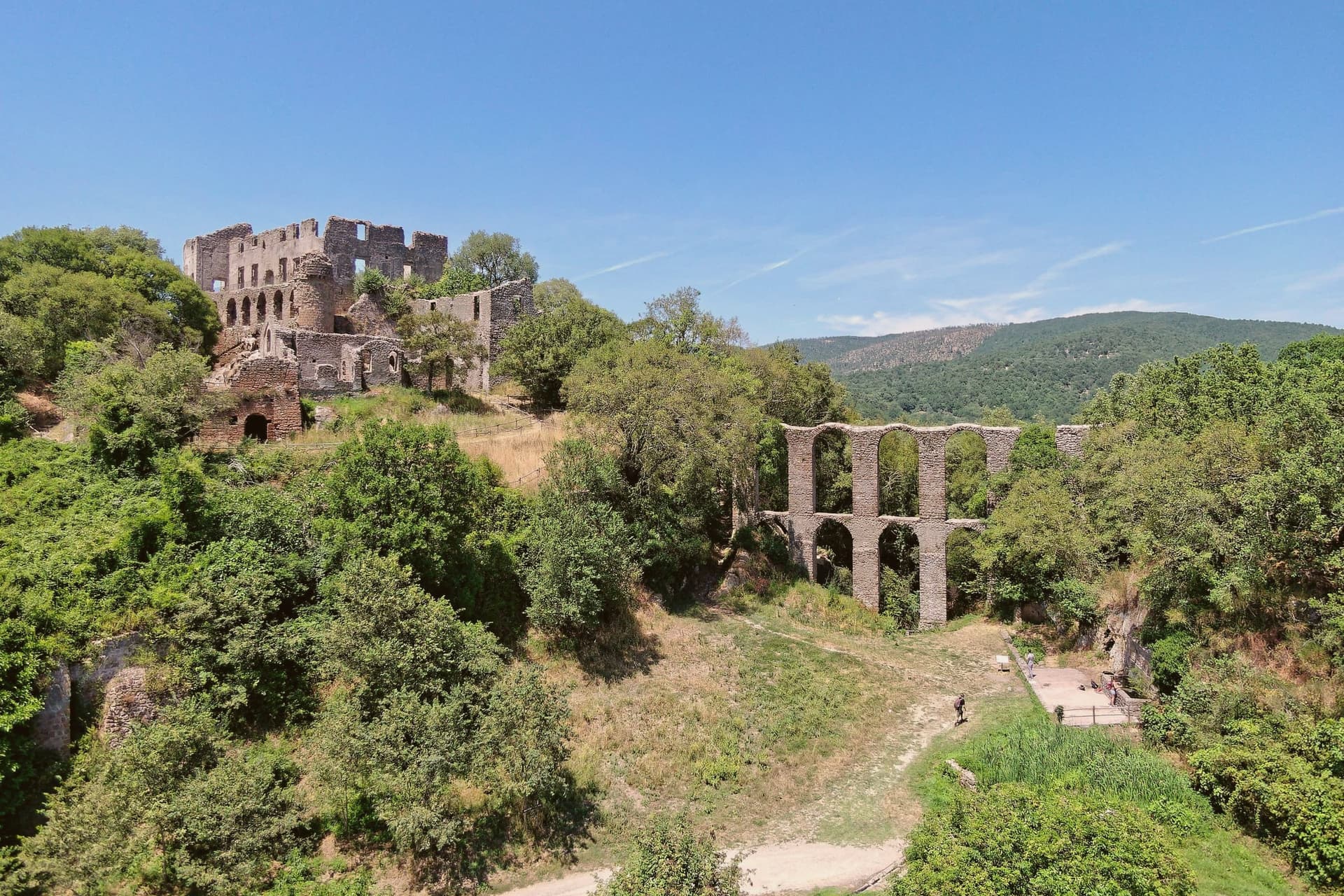
Two kilometers away, on a separate tuff bluff above the confluence of the Mignone and Bicione rivers, is the reason most people make the trip: the ghost town, set on the far side of a valley the living town does not touch. The relationship between the two places is one of distance and separation rather than continuity.
Canale Monterano went on being a town; the settlement on the bluff did not, and the two kilometers between them mark the difference between a place that was rebuilt after the fire and one that never was. What is left on the bluff is masonry with the roofs and interiors gone, watched over from its highest point by the palace facade, with the fountain still running below in an otherwise empty piazza.
The regional reserve now holds the whole valley, ruin and river system together, so that the abandoned village survives inside protected land rather than beside a working one.
What to see in Canale Monterano
- Ruderi di Monterano. Ghost town two kilometers from Canale, burned by French Republican troops in 1799, never rebuilt; now the centerpiece of the regional reserve.
- Chiesa e Convento di San Bonaventura. Roofless, facing an open sky where the roof beams once sat. The façade and convent block still stand at the edge of the ruined village, built for the Altieri family by Gian Lorenzo Bernini.
- Fontana Ottagonale del Leone. Still flowing through the stone lion's mouth in the middle of an otherwise empty piazza, the only thing in the ghost town that still functions as built.
How to get to Canale Monterano
Roma is roughly 70 minutes away by road.
Our tip
April through June and September through October are the best months for the reserve. The trail from the parking lot to the ruins is exposed, and spring and autumn keep the temperatures comfortable. July and August push past thirty degrees on the tuff plateau, and the open ruins offer no shade after eleven in the morning; early-morning visits are the workaround. Sagra del Lombrichello a Canale Monterano falls in July.
More from Anywhere Italy
- The best hill towns with a food festival in Lazio
 The best small towns inside a nature park in Lazio
- The best towns with a food festival that you can reach by train in Lazio
 The 7 best lake towns in Lazio
- The prettiest small villages within 90 minutes of Roma
 The best hot-spring towns within two hours of Rome