
The best hot-spring towns within two hours of Rome
Lazio sits on old volcanoes, and the water that comes back up through the tufa arrives warm, heavy with sulphur and calcium, staining the rock white where it runs. The landscape around it is beech wood, hazelnut groves, gorges cut by small rivers, and towns built of the same grey-brown volcanic stone the springs pass through. Winter is the season for it: cold air, water at bath temperature, the smell of sulphur carrying across a field before you see the pool. Afterwards there is the Lazio table, gnocchi on a Thursday, coda alla vaccinara, sheep's cheese from the Monti Cimini, wine from the volcanic soils around the crater lakes.
The default day trip is Saturnia, up in the Maremma, where the terraced limestone pools below the mill have become one of the most photographed sites in central Italy and the car parks fill by mid-morning at weekends. It deserves its reputation, and it is also a long drive from Rome for something you will share with coach parties and a queue for the changing rooms. The same is true of the spa complexes along the coast road, which are properly run and priced accordingly.
The thermal geology does not stop at the famous pools. It runs north through the Cimini and the Tolfa hills, east into the Aniene valley, south into the mineral-water country of Ciociaria, and the towns along it have been drinking, bathing and building around their springs for a very long time. Fewer people go, the water is the same water, and the towns themselves are worth the detour on their own.
Of the 95 communes we have mapped in a 120-minute drive of Rome, 6 qualify as hot-spring towns: each has thermal water a town has been built around. The smallest, Lugnano in Teverina, has 1,428 residents.
Two more lists worth reading alongside this one: The best towns known for what they grow within 75 minutes of Rome and The best hot-spring towns within 90 minutes of Perugia.
Lugnano in Teverina
Why visit Lugnano in Teverina
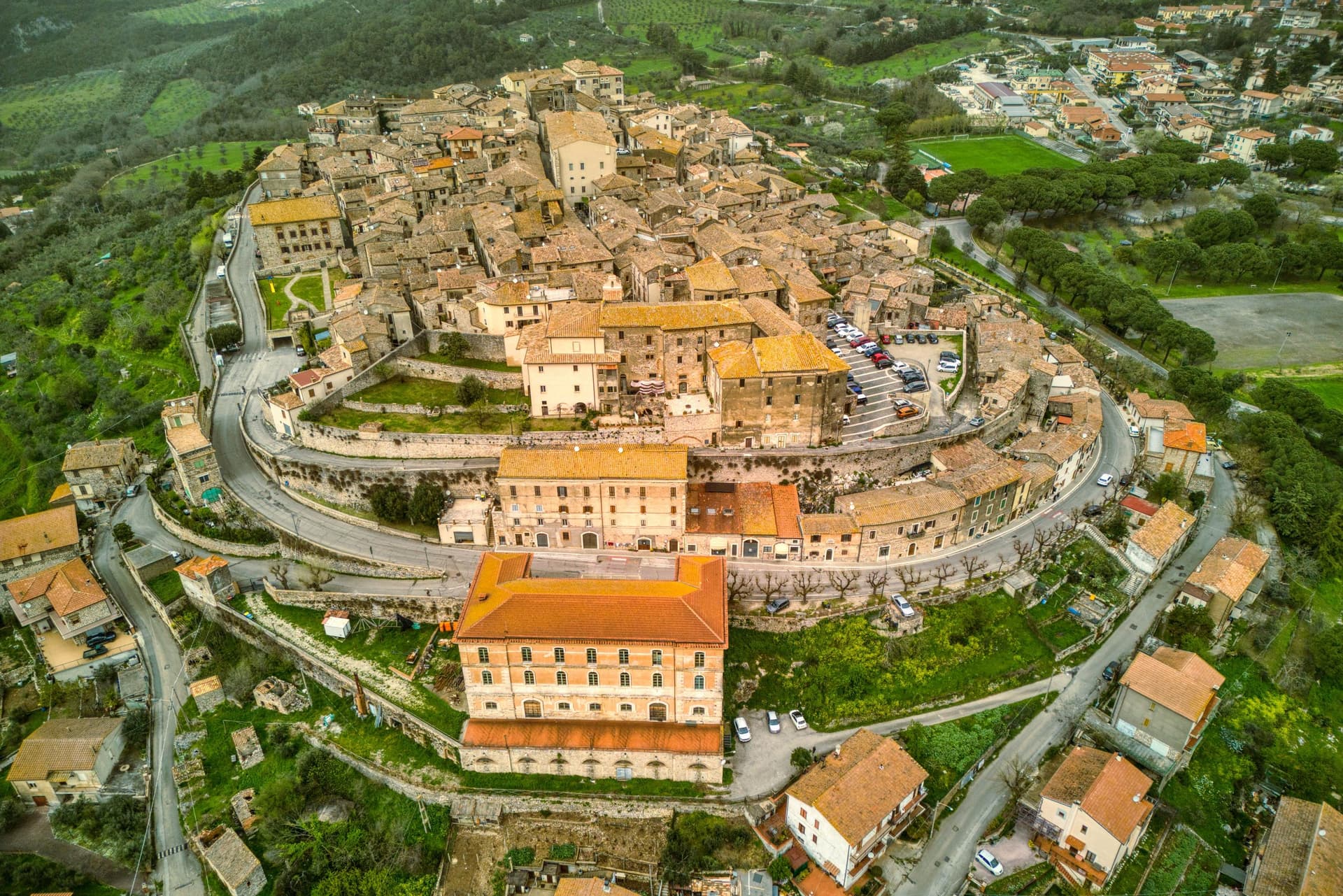
Lugnano in Teverina sits at 441 meters on a ridge above the Tiber, sixty kilometers south of Perugia and twenty-five west of Terni. The town traces its origins to the seventh century, when inhabitants fleeing barbarian invasions sought refuge on the spur after the destruction of nearby Luchiano.
The Collegiata di Santa Maria Assunta, dated 1230 on the inscription of its façade, is built in travertine from quarries by the Tiber, a Romanesque parish church layered over a Lombard-era predecessor, with a cosmatesque pavement and a portico of paired columns. On the hill below, the Villa Romana di Poggio Gramignano, built around the 10s BC, was excavated through the 1980s and again from 2016.
Beneath its collapsed roof archaeologists found a late-fifth-century cemetery of 47 infant and fetal burials, the largest set of child burials in Roman Italy, interpreted as a catastrophic die-off from Plasmodium falciparum malaria. The Olea Mundi olive collection, planted in 2014, holds 1,200 trees from 23 countries.
What to see in Lugnano in Teverina
- Collegiata di Santa Maria Assunta. Romanesque parish church dated 1230 in travertine from Tiber quarries, with cosmatesque pavement and a paired-column portico.
- Villa Romana di Poggio Gramignano. Augustan villa with a late-fifth-century cemetery of 47 infant burials, interpreted as a catastrophic malaria die-off.
- Palazzo Farnese-Ridolfi. Sixteenth-century palace known as the Pennone for its mast-like profile rising above the lower town.
How to get to Lugnano in Teverina
Terni is roughly 40 minutes away by road.
Our tip
April through June and September into October are the months that work. The Tiber valley below stays green into early summer, and the olive harvest carries through November when the Olea Mundi trees come into the frantoi. July and August are hot on the lower Tiber; the centro storico thins between three and six.
Oriolo Romano
Why visit Oriolo Romano
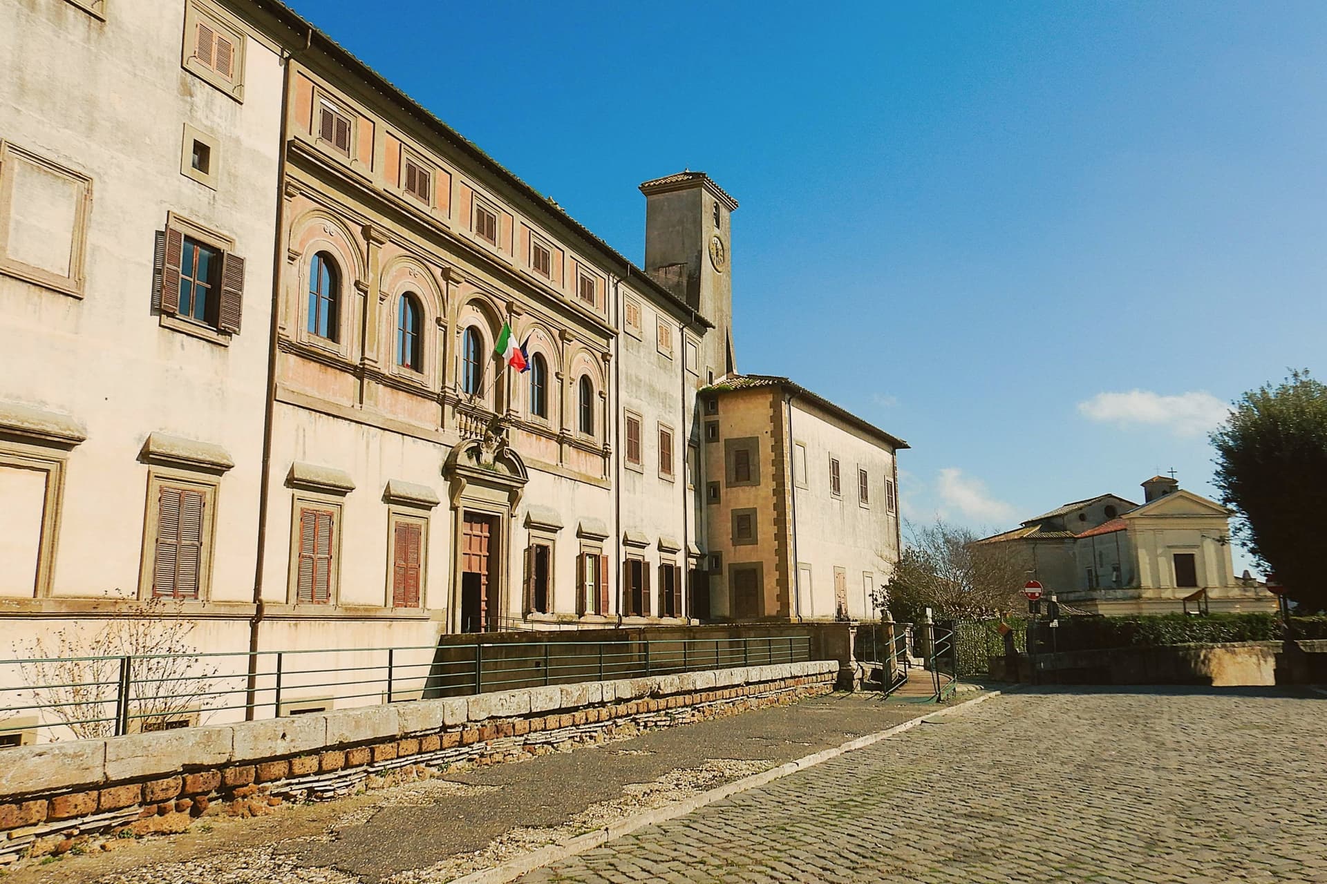
Oriolo Romano sits at 420 meters in the Sabatini hills, between Lake Bracciano and the volcanic Cimini, not far from the old Via Clodia. The village is unusually new for the Tuscia: in 1560 the Orsini family ceded a wooded fief to the nobleman Giorgio Santacroce, who began clearing the forest and founded a planned agricultural settlement.
The first inhabitants were farmers, shepherds and woodcutters drawn from Tuscany and Umbria, so the local accent kept Umbrian inflections for generations. The palace at the center of the village gave the settlement its shape, with the parish church and the main square arranged around it as the plan intended.
The forest that once covered the whole fief survives now at the margins, an exceptionally low-altitude stand for an Apennine beech wood, while hazelnut groves have taken over the lower slopes that were cleared for farming. The village, in effect, is the cleared half of a wooded fief, its cultivated ring still framed by the wood the Santacroce family left standing.
What to see in Oriolo Romano
- Palazzo Altieri. Sixteenth-century palace enlarged in 1674 under Pope Clement X, with Old Testament frescoes and painted views of the Altieri fiefs.
- Faggeta di Monte Raschio. Primeval beech forest of about eighty hectares between 400 and 550 meters, UNESCO World Heritage since 2017.
- Piazza Umberto I. Central square of the 1560 plan, anchored by the palace and the parish Chiesa di Sant'Anna at the head of the village.
How to get to Oriolo Romano
There is a railway station in the town, so you can arrive without a car and never need one while you are here. Roma is roughly 75 minutes away by road.
Our tip
April through June and September into October are the months for the beech forest, when the canopy is full and the trails on Monte Raschio are at their cleanest. The exceptionally low altitude of the faggeta means autumn color arrives earlier and lasts longer than in higher Apennine beech woods. July and August push the lower hills into the low thirties; the forest holds shade and stays five or six degrees cooler than the surrounding farmland. Oriolo Romano Porcini Mushroom Festival falls in September.
Canale Monterano
Why visit Canale Monterano
Canale Monterano sits at 376 meters on a tuff hill forty-five kilometers northwest of Rome, between the Bracciano basin and the Tolfa hills. The inhabited town is small, four thousand residents, built around a working bakery tradition.
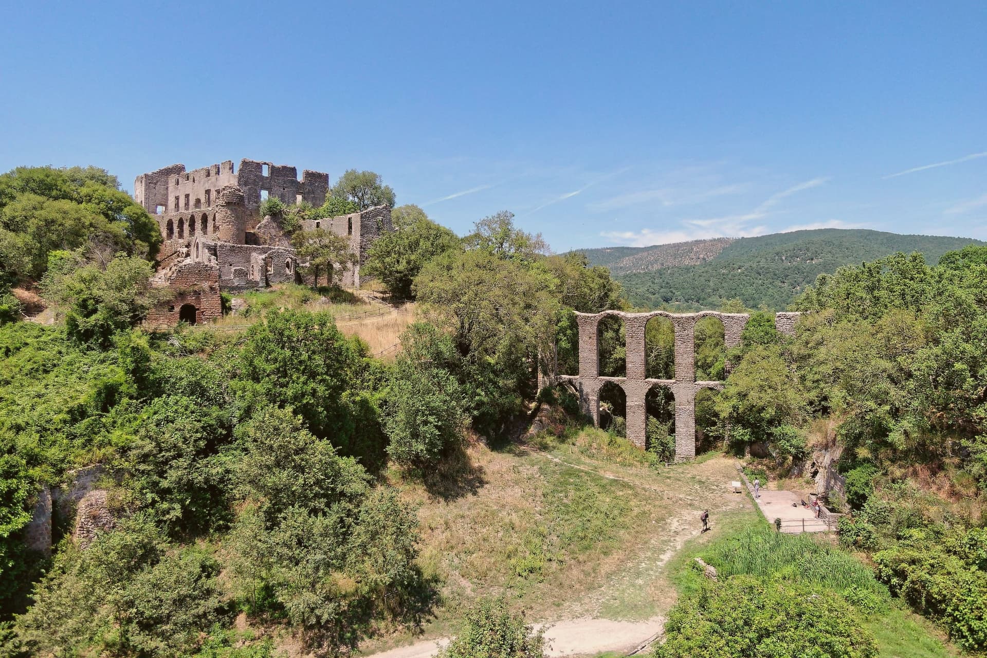
Two kilometers away, on a separate tuff bluff above the confluence of the Mignone and Bicione rivers, is the reason most people make the trip: the ghost town, set on the far side of a valley the living town does not touch. The relationship between the two places is one of distance and separation rather than continuity.
Canale Monterano went on being a town; the settlement on the bluff did not, and the two kilometers between them mark the difference between a place that was rebuilt after the fire and one that never was. What is left on the bluff is masonry with the roofs and interiors gone, watched over from its highest point by the palace facade, with the fountain still running below in an otherwise empty piazza.
The regional reserve now holds the whole valley, ruin and river system together, so that the abandoned village survives inside protected land rather than beside a working one.
What to see in Canale Monterano
- Ruderi di Monterano. Ghost town two kilometers from Canale, burned by French Republican troops in 1799, never rebuilt; now the centerpiece of the regional reserve.
- Chiesa e Convento di San Bonaventura. Roofless, facing an open sky where the roof beams once sat. The façade and convent block still stand at the edge of the ruined village, built for the Altieri family by Gian Lorenzo Bernini.
- Fontana Ottagonale del Leone. Still flowing through the stone lion's mouth in the middle of an otherwise empty piazza, the only thing in the ghost town that still functions as built.
How to get to Canale Monterano
Roma is roughly 70 minutes away by road.
Our tip
April through June and September through October are the best months for the reserve. The trail from the parking lot to the ruins is exposed, and spring and autumn keep the temperatures comfortable. July and August push past thirty degrees on the tuff plateau, and the open ruins offer no shade after eleven in the morning; early-morning visits are the workaround. Sagra del Lombrichello a Canale Monterano falls in July.
Fiuggi
Why visit Fiuggi
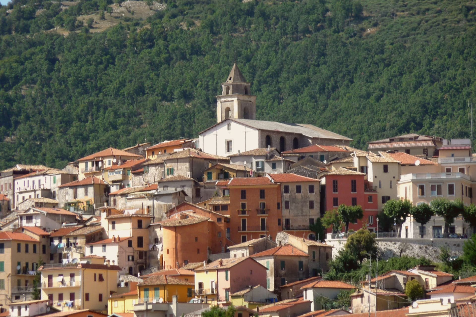
Fiuggi sits in two parts on the slope of the Ernici mountains, ninety kilometers southeast of Rome. The upper town, the medieval Anticoli di Campagna at 747 meters, is the original village; the lower town, Fiuggi Fonte at 643 meters, grew up around the springs in the late nineteenth century and was renamed Fiuggi in 1911.
The Acqua di Fiuggi is the reason for the second town: an oligomineral water that runs through ancient volcanic deposits and has been used since the fourteenth century to dissolve kidney stones. Pope Boniface VIII attested to the cure in his own case; Michelangelo wrote that it had cured him of the only kind of stone he could not love.
The Fonte Bonifacio VIII and Fonte Anticolana stabilimenti, set in landscaped park grounds, are the heart of the lower town. The upper medieval centro storico has stone houses on narrow stepped streets, the Collegiata of San Pietro, and views east across the valley toward Anagni.
What to see in Fiuggi
- Fonte Bonifacio VIII. Main thermal establishment in landscaped grounds, named for the pope cured of kidney stones by the water in the late thirteenth century.
- Fonte Anticolana. Second thermal establishment a short walk from the first, with its own pavilions and tasting fountains in a planted park.
- Centro storico di Anticoli. Upper medieval town at 747 meters, the original village before the springs town grew up below, with stone houses and the Collegiata.
How to get to Fiuggi
Roma is roughly 74 minutes away by road.
Our tip
Fiuggi is a thermal town and works year-round. Most cures are taken in spring and autumn, when the air is mild and the springs are most pleasant to drink in the open. June through August brings the resort season: hotels fill with longer-stay guests, and the 747-meter elevation of the upper town offers a refuge from Roman heat.
Tivoli
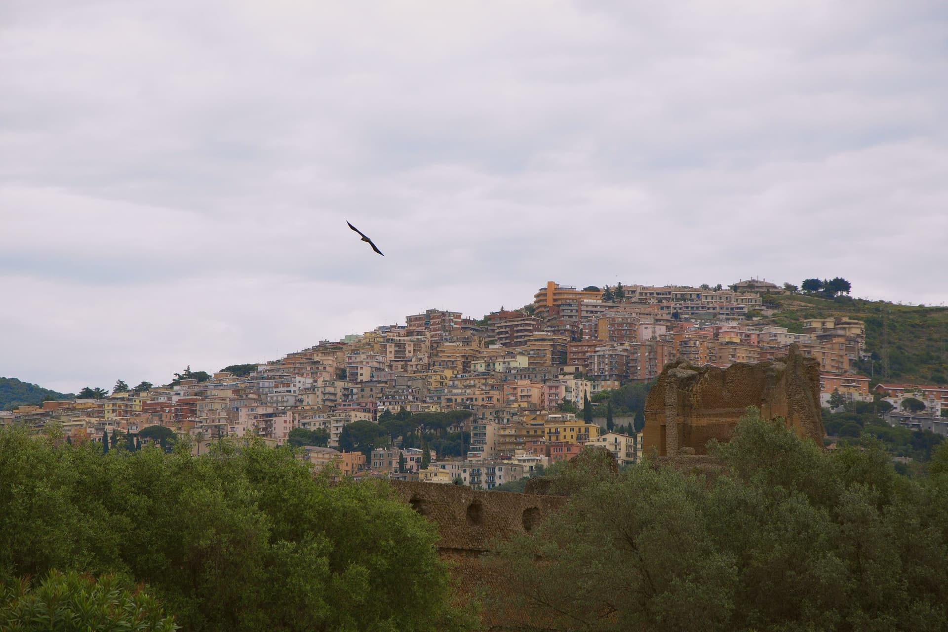
Why visit Tivoli
Tivoli sits at 235 meters on the Aniene where it drops 120 meters off the Tiburtini hills, twenty-five kilometers east of Rome. The Romans called it Tibur and built it up as their summer station; the moneyed classes carried on building here for two thousand years afterward.
Two of those projects became UNESCO sites, listed separately despite standing close together. Hadrian's estate, four kilometers below town, covers 120 hectares with the remains of thirty monumental buildings the emperor built between 117 and 138 AD to recreate the architectural memories of Egypt, Greece and Asia Minor.
The Renaissance garden inside the upper town was laid out from 1550 onward for a cardinal of the Este family; its grounds carry 51 fountains powered entirely by gravity from the Aniene. The cardinal stripped much of the marble from Hadrian's estate to decorate his own grounds, so the imperial villa on the plain and the garden in the upper town are bound together by more than proximity: one was quarried to build the other.
Below them both, the Villa Gregoriana park drops into the gorge where the river was diverted in 1832 to create the 120-meter Cascata Grande. The travertine quarries that built Rome are still working in the plain below.
The upper town, the lower estate, and the gorge between them form a single continuous cut through two thousand years of building, borrowing, and quarrying around the same fall of water.
What to see in Tivoli
- Villa d'Este. The fountains step down the hillside in tiers, fed by nothing but gravity, so the sound of falling water carries through the whole garden. Cardinal Ippolito d'Este stripped much of the marble for it from Hadrian's villa down the hill.
- Villa Adriana. The remains of thirty monumental buildings spread across the Tiburtine plain, among them the Canopo and the Teatro Marittimo, a walled island retreat inside the larger estate.
- Villa Gregoriana. The park drops into the gorge cut by the Aniene, where the river was diverted through Monte Catillo to feed the fall below town.
How to get to Tivoli
There is a railway station in the town, so you can arrive without a car and never need one while you are here. Roma is roughly 31 minutes away by road.
Our tip
April through June and September through October are when the Aniene gardens look the way Cardinal Ippolito wanted them to. The Villa d'Este fountains run hardest in spring after the winter rains; the Villa Adriana hectares are walkable in shoulder weather without burning. July and August touch the upper thirties and the unshaded ruins at Villa Adriana become punishing by mid-morning; the gorge at Villa Gregoriana stays cooler. Festa dell'Inchinata falls in August.
Viterbo
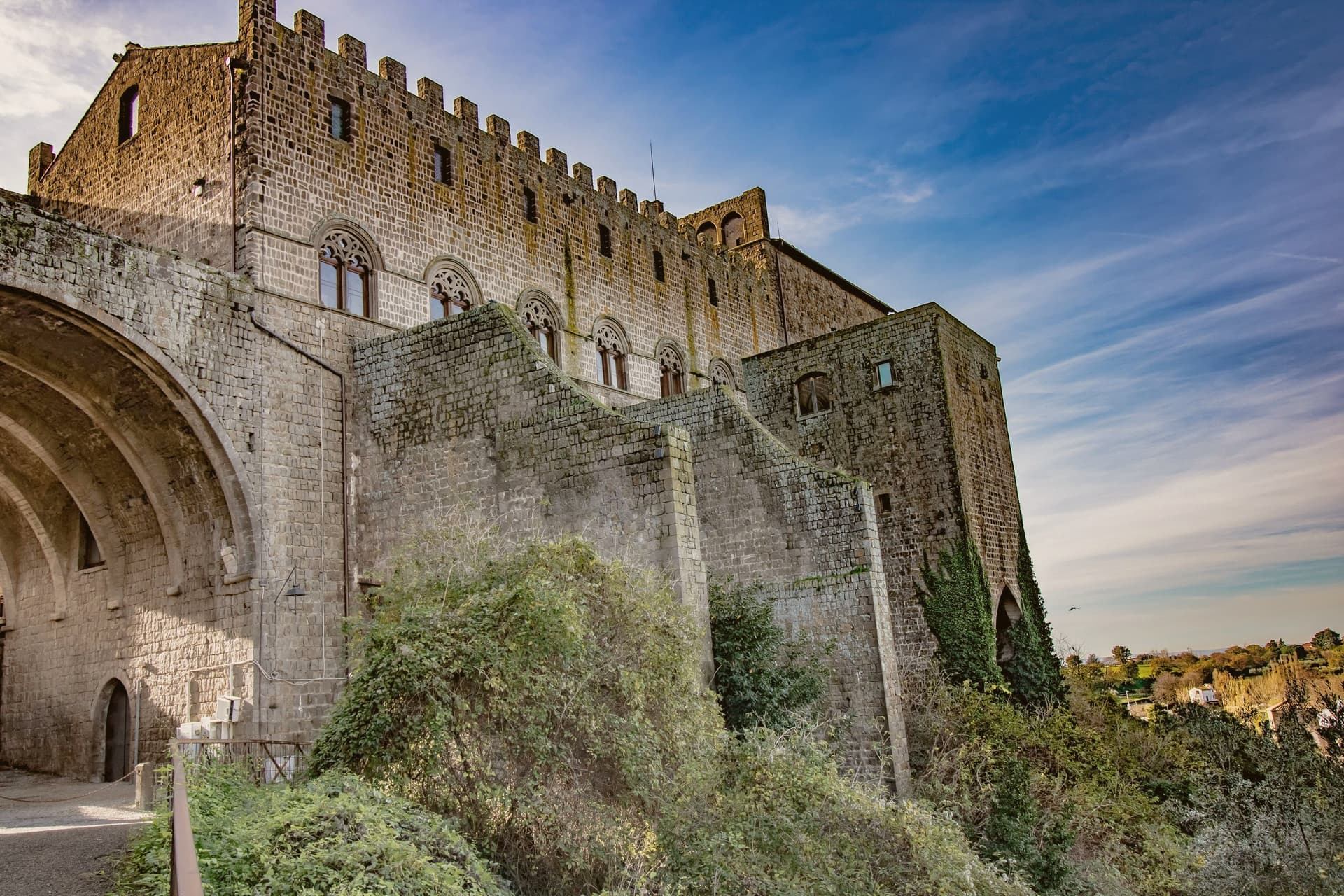
Why visit Viterbo
Viterbo sits at 326 meters in the Tuscia, surrounded by the volcanic Cimini hills and the thermal springs the Etruscans and Romans already used. The city became the favourite papal residence under Eugene III in the twelfth century; between 1257 and 1281, five popes were elected here, and the conclave of 1268-1271 ran nearly three years, the longest in Church history.
To end it, the city's people locked the cardinals inside the Palazzo dei Papi, tore the roof off, and reduced their rations. The decisive conclave is still the reason the word means a place under lock and key.
The San Pellegrino quarter is the largest continuous medieval district in central Italy, with profferli, the external stone staircases that climb to first-floor doorways. The Terme dei Papi outside the walls still draws sulfur-water bathers.
On 3 September the Macchina di Santa Rosa, a thirty-meter illuminated tower weighing five tons, is carried through the streets by a hundred Facchini, a tradition listed by UNESCO since 2013.
What to see in Viterbo
- Palazzo dei Papi. Thirteenth-century papal palace with Gothic loggia and the Sala del Conclave, where the 1268-1271 conclave ran for nearly three years.
- Quartiere San Pellegrino. Largest continuous medieval quarter in central Italy, with stone profferli staircases, towers and the Piazza San Pellegrino.
- Terme dei Papi. Thermal complex outside the walls, fed by sulfur springs used since Etruscan times and named for the medieval popes.
How to get to Viterbo
There is a railway station in the town, so you can arrive without a car and never need one while you are here. Terni is roughly 58 minutes away by road.
Our tip
Viterbo works as a year-round destination because of the thermal springs. April through June and September into October give the easiest combination of clear weather, open monuments and warm pool water. July and August push the medieval quarter into the mid-thirties; the Macchina di Santa Rosa on 3 September is the single largest event in the calendar and the streets stay packed for the night. Festa Medievale Ludika 1243 a Viterbo falls in July.
More from Anywhere Italy
 The best towns known for what they grow within 75 minutes of Rome
- The best hot-spring towns within 90 minutes of Perugia
 The 6 best small towns with a food festival in Lazio
 The 8 best hidden hill towns within 90 minutes of Roma
- The best hill towns in the province of Roma
 The best hill towns with a food festival in Lazio