
Umbria · Perugia
Vallo di Nera
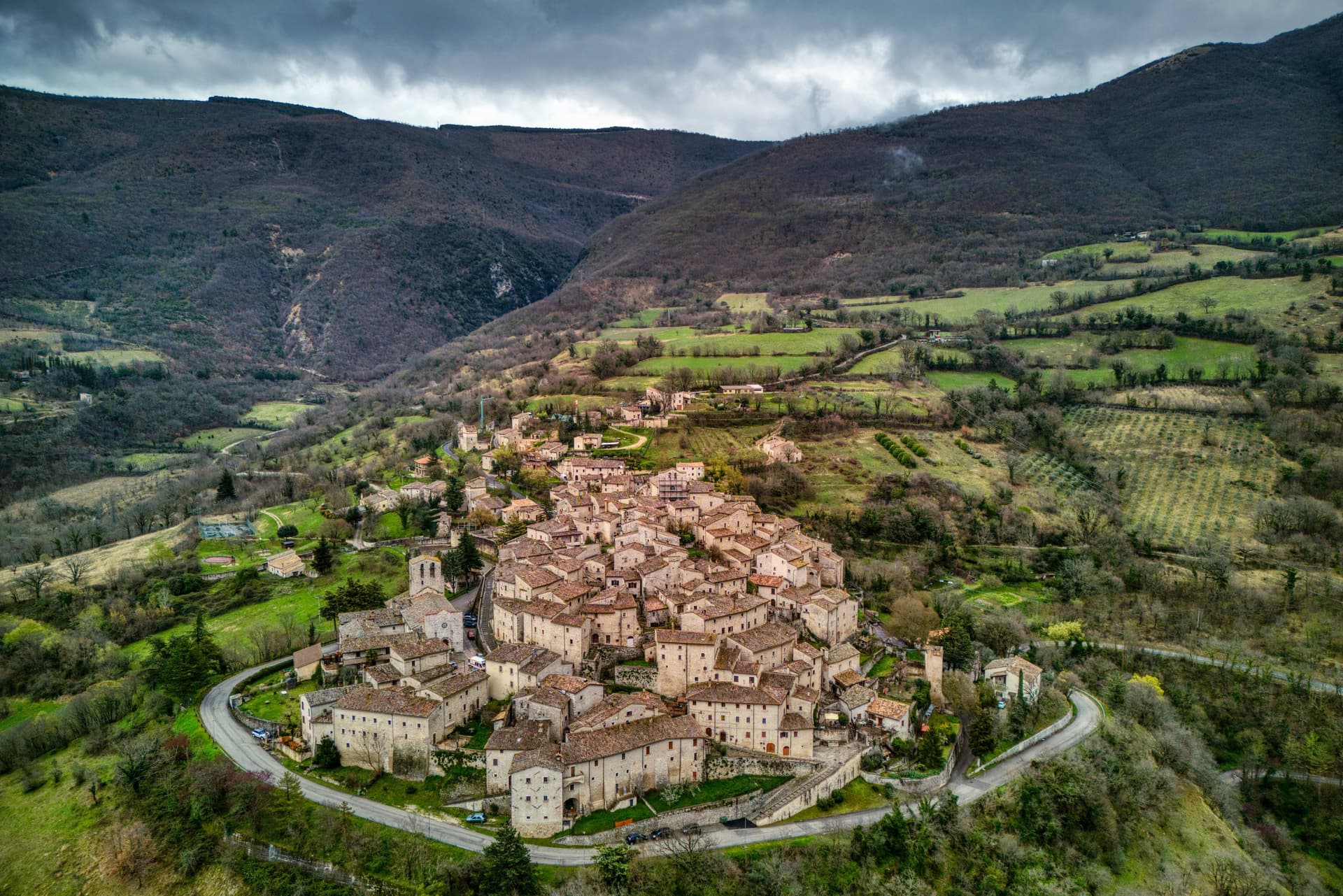
Castle village of 334 people in the upper Valnerina, granted by Spoleto in 1217 and barely changed since.
Picked by Peter Benei
Letter to come
Why Vallo di Nera is on our list
It holds Borghi più belli d'Italia, Bandiera Arancione and Città dell'Olio.
The nearest town with a letter is Campello sul Clitunno, No. 77, 10 km away.
Subscribe and you get Vallo di Nera's letter the day it comes out.
Visiting
- Best time
- Apr–Oct
- By car
- 1 h 5 min from Perugia
- Population
- 334
- J10°
- F12°
- M13°
- A16°
- M22°
- J27°
- J32°
- A31°
- S25°
- O20°
- N15°
- D11°
- Best
- Hot or crowded
- Quiet
- Mostly closed
Daytime air temperature, averages for 2020–2024. Weather data by Open-Meteo.com.
Why come
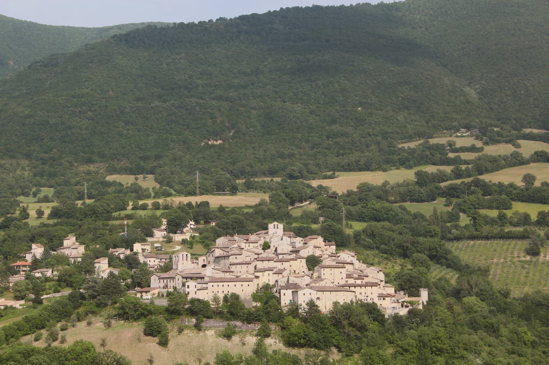
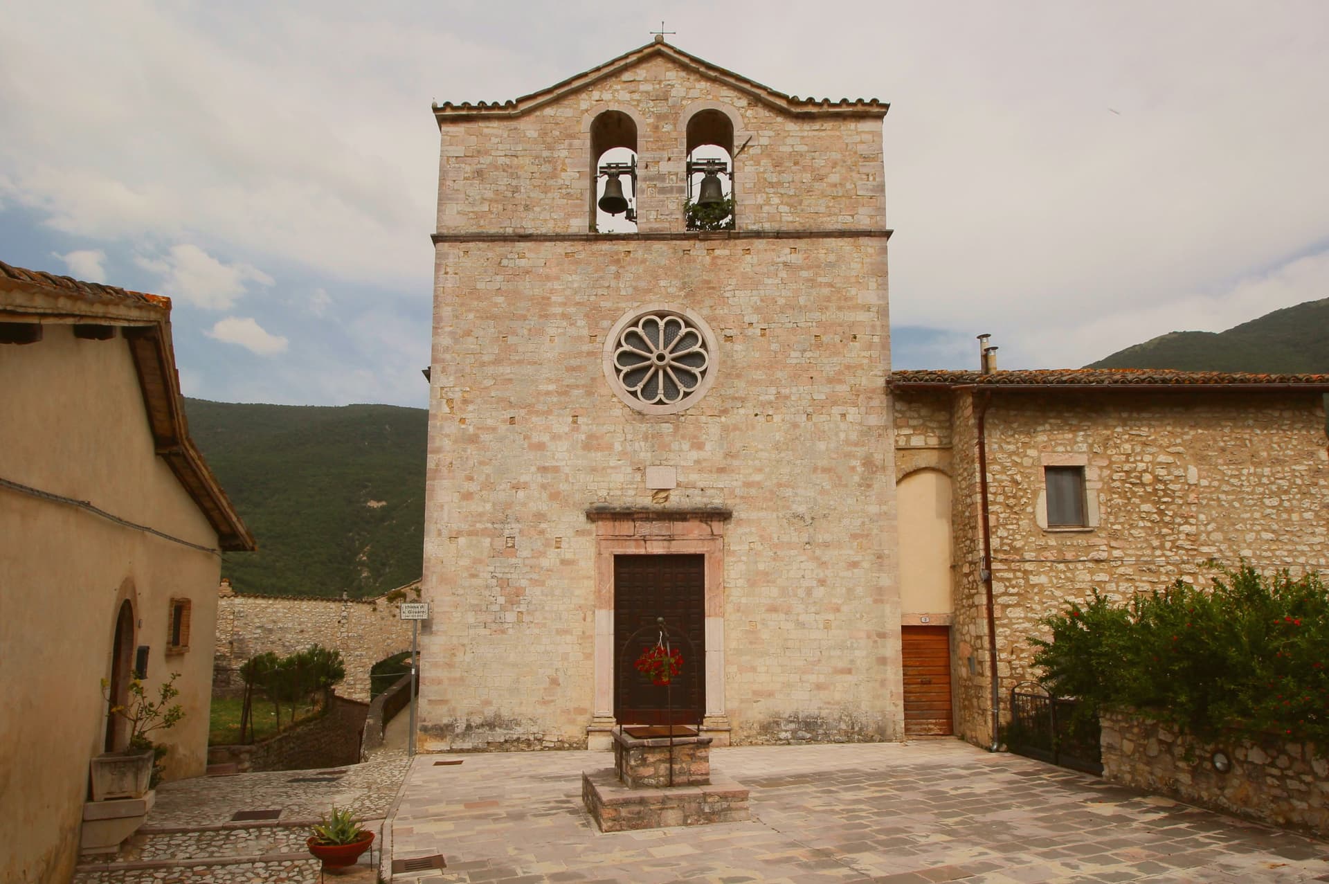
Vallo di Nera sits on a spur of the upper Valnerina, above the Nera river. The town of Spoleto granted the men of Vallo permission to build a castle here in 1217, on the hill where an earlier fortress had stood; the stone houses, the walls and the two symmetrical gates, Portella and Portaranne, have barely changed in eight centuries. Inside, the village climbs in concentric rings to the Chiesa di Santa Maria Assunta at the top, built in 1176 and given to the Franciscans in the 13th century, who turned a defensive tower into a bell tower and frescoed the apse with a cycle of the Giotto school dated 1383.
The Procession of the Whites, traceable to 1401, still leaves the church each year. The population today is 334, smaller than at any point in the medieval records. Black truffle from the woods above and olive oil from the slopes down to the river are the surviving trades.
How to get there
From Ancona (AOI), about 2 h 6 min by car.
Rome Fiumicino (FCO) is about 2 h 21 min away.
By car from the center of Perugia 1 h 5 min or Ancona 2 h 8 min.
Coming from Rome?
Coming by train into Perugia? Vallo di Nera is about 1 h 4 min away by road.
First time driving in Italy? Read our complete manual.
What to see
Chiesa di Santa Maria Assunta
Built 1176, Franciscan from the 13th century, with frescoes of the Giotto school dated 1383 in the apse, by Cola di Pietro da Camerino among others.
Medieval walls
Twelfth-century walls and towers still encircle the village, with two original symmetrical gates, Portella and Portaranne.
Centro storico
Light stone houses leaning against each other on three concentric rings, with embrasures, narrow alleys and stone portals preserved since 1217.
Chiesa di San Giovanni Battista
Romanesque church at the lower end of the centro storico, with a 15th-century fresco of the Madonna and Child.
Living here
Could you live here?
Vallo di Nera is at the end of the road.
- A village of 334. The nearest town of 5,000 people, Spoleto, is 27 min away: past our 15-minute rule, which makes this the end of the road.
- Terni, a city of 106,310, is 51 min by car. Inside our 30 to 60 minutes: close for the services, far enough to keep its own life.
The rules come from our series Where to Move in Italy, written from the places we have lived: Part 1, The End of the Road · Part 2, The Small Town · Part 3, The City · Part 4, The Postcard · Part 5, The Other Half. The towns we would pick are in Part 6, The Best Towns.
- Population 334, down 10.9% since 2015 (Italy's emptying towns)
- Nearest city Terni, 51 min drive
- Nearest national health service hospital Spoleto, 13 km as the crow flies · how healthcare works in Italy
All the numbers Common questions, designations, lists and sources.
More about living here
- Commuter belt
- Pharmacy: none mapped
- High school within a 30-minute drive
- Full fibre reaches 97% of homes
- No primary school in the comune's register
- Earthquake zone 1, Italy's highest hazard
- Perugia airport (PEG), 59 min drive, the nearest with scheduled flights
- Regional capital Perugia, 1 h 5 min drive
If you are moving here
Who lives here
11% of residents are foreign citizens, most often from Romania, Albania and Ukraine, against 9% across Italy. There are 339 people over 65 for every 100 children under 15, against 216 across Italy. 62% of homes have no resident, holiday homes and empty ones counted together, against 27% across Italy. Perugia province ranks 37th of 107 in Il Sole 24 Ore's quality of life ranking for 2025.
Health and schools
The nearest emergency room is in Spoleto, 13 km as the crow flies. The nearest major one is in Terni, 26 km away. The nearest IB school is Viterbo International School, 73 km as the crow flies. The nearest school listed as international is Assisi International School, 40 km away.
Information, not medical advice. Confirm with a professional.
Taxes
A home that is not your main one pays 0.85% a year in property tax, charged on the cadastral value rather than the price. A main home pays none unless it is in a luxury category. 7% pensioner tax: this town qualifies, for someone with a foreign pension who has lived abroad for five years: 7% on foreign income, for ten years.
Information, not tax advice. Confirm with a professional.
What it costs
The average household in Umbria spends about €2,310 a month, €550 of it on food, against about €2,170 across Italy. A family of three pays about €677 a year for water, on the Umbria average. In Perugia, the provincial capital, in September 2026, an espresso cost €1.23, a meal in a pizzeria €12.04 and a man's haircut €20.47.
Climate and risk
It is in climate zone E, on a scale from A, the warmest, to F, the coldest, and heating may run from October 15 to April 15, up to 14 hours a day, unless the mayor changes it. 3% of residents live in a zone the national maps rate high for floods, 12% in a high or medium one. 14% live in a zone rated high or very high for landslides.
These shares cover the whole comune, not any one street. Check an address on IdroGEO.
Moving from abroad? Which visa you need. Sources: ISTAT, the Ministry of Health, ISPRA, the Finance Ministry, the Ministry of Enterprise, Poste Italiane, the comuni, the IB, International Schools Database, Il Sole 24 Ore, Cittadinanzattiva.
Known for
1217
The town of Spoleto granted permission for the castle to be built; the village layout has barely changed since, with original walls and two gates.
GIOTTO SCHOOL
Frescoes of 1383 in the apse of Santa Maria Assunta, painted by Cola di Pietro da Camerino and the Giotto school.
PROCESSION OF THE WHITES
Religious procession traceable to 1401, still leaves Santa Maria Assunta each year, part of the medieval movement of the Bianchi.
Common questions
- What is Vallo di Nera known for?
- Castle village of 334 people at 467 meters in the upper Valnerina, granted by Spoleto in 1217 and barely changed since.
- Where is Vallo di Nera?
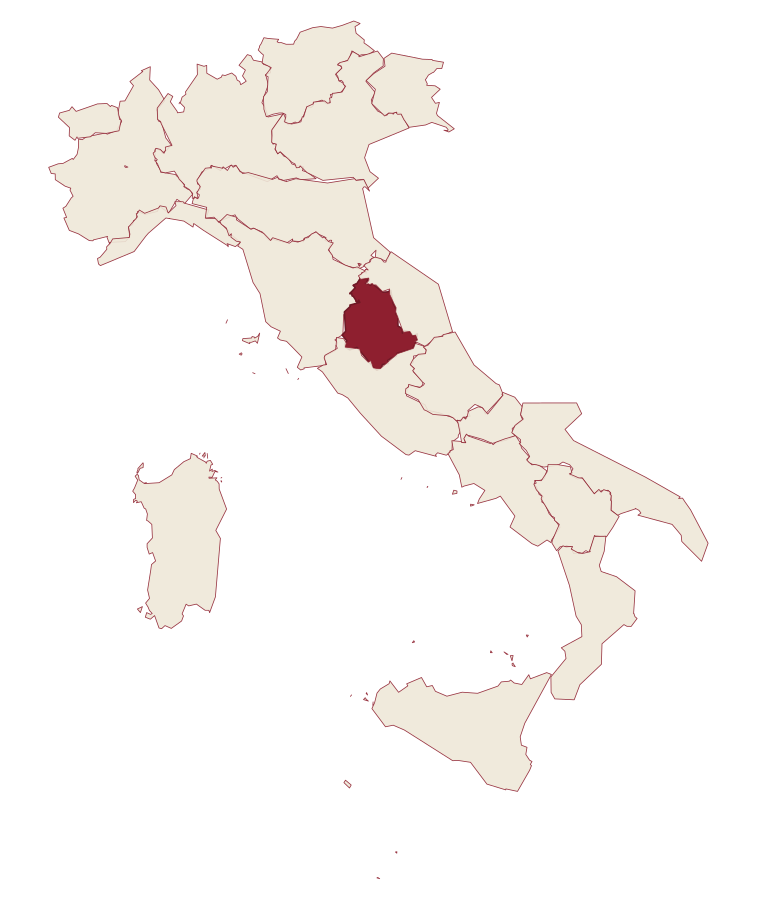
- Vallo di Nera is a comune in the province of Perugia, in Umbria.
- What is the nearest airport to Vallo di Nera?
- The nearest airport with scheduled flights is Perugia (PEG), about 59 min by car.
- How long is the drive from Perugia to Vallo di Nera?
- About 1 h 5 min by car.
- When is the best time to visit Vallo di Nera?
- Best in Apr–Oct. July is the warmest month, averaging 32 degrees, and May the wettest, with about 14 rain days.
- Which other towns are like Vallo di Nera?
- Scheggino, Moresco and Fortunago.
- How many people live in Vallo di Nera?
- 334 residents, by ISTAT's count on 1 January 2025.
- Is Vallo di Nera a good place to live?
- By the rules in our Where to Move in Italy series, Vallo di Nera is at the end of the road: the nearest town of 5,000 people, Spoleto, is 27 min away. The nearest city, Terni, is 51 min away by car. The nearest national health service hospital is in Spoleto, 13 km as the crow flies. Full fibre reaches 97% of homes.
Tags & data designations · numbers · sources
Recognized as
Landscape
The numbers
- Elevation: 467 m
- Population: 334
- Surface area: 36.22 km²
These figures were compiled from public directories: ISTAT, OpenStreetMap and Wikidata, and from the official listings of the guides named on this page. Town details change; verify with official sources before you travel.
The ranked lists
Lists Vallo di Nera appears in
- The 6 best hidden truffle towns in the province of PerugiaPerugia provincetrufflehidden6 towns · smallest 334 residents
- The best small olive oil towns in the province of PerugiaPerugia provinceolive oilsmall6 towns · smallest 334 residents
- The best towns known for what they grow within 90 minutes of PerugiaNear Perugiawithin 90 minproduce zone8 towns · smallest 334 residents · closest 40 min away
- The 9 best olive oil towns within 90 minutes of TerniNear Terniolive oilwithin 90 min9 towns · smallest 334 residents · closest 34 min away
- The 9 best small olive oil towns in UmbriaUmbriaolive oilsmall9 towns · smallest 334 residents
- The best truffle towns in the province of PerugiaPerugia provincetruffle9 towns · smallest 334 residents
Near here, with a letter
- Written about. No. 77.
Campello sul Clitunno
Province: Perugia
Springs of the Clitunno and the Lombard Tempietto on the valley floor at 290 meters, the temple inscribed by UNESCO in 2011.
10 km away
- Written about. No. 86.
Scheggino
Province: Perugia
Triangular castle village on the banks of the Nera at 280 meters, where the first commercial Italian truffle company was founded in 1852.
25 min by car
- Written about. No. 87.
Spoleto
Province: Perugia
Lombard ducal capital at 396 meters under the Rocca Albornoziana, where a 230-meter aqueduct bridge crosses to Monteluco and Menotti founded the Festival in 1958.
27 min by car
Our guide
Our nearest guide, 69 km away
Umbria: the towns, when to go, how to get there
The Umbria guide came out of the letter. Letters from the towns we visit. Free.
Read the guide: Two banks, no sea. 21 towns, the drive and train times, the months, where to eat and sleep.
Paid plans, the moving year and the books are on the membership page.