
The 9 best small olive oil towns in Umbria
Umbrian olive oil comes off hillsides that never quite flatten out, terraces of moraiolo, frantoio and leccino held up by dry stone walls above the Valle Umbra and the Tiber. The harvest runs from the end of October into December, when the mills work late and the smell of crushed fruit sits in the cold air of the valley floor. New oil here is green, bitter at the front and peppery at the back, and it is eaten simply: poured over bruschetta grilled on vine wood, over farro soup, over boiled chard with lemon. The towns themselves are built from the pale local limestone and travertine, walled, steep, with the olive groves starting where the houses stop.
Most people arriving in Umbria for food and landscape head to Assisi and Spoleto, and both earn the traffic, one for the basilica and the frescoes, the other for the aqueduct bridge and the summer festival. The coach parks fill from Easter onward, and by midsummer the main streets of both move at the pace of the group in front. Perugia takes its own share, particularly around the chocolate fair. None of this is a reason to skip them, but it does mean the oil culture of the region gets met in a gift shop rather than in a mill.
The groves do not stop at the edge of the famous places. They continue south along the Martani hills, west across the Tiber towards the Umbrian border with Lazio, and up into the Valnerina where the terraces narrow to almost nothing. That is where the towns in this list sit: smaller places, fewer visitors, each one a member of the national association of olive-oil towns, most with a working frantoio within walking distance of the walls.
Of the 47 communes we have mapped in Umbria, 16 qualify as olive oil towns: each belongs to the national association of olive-oil towns. This list is the small ones, 9 in all, ordered smallest first. The smallest, Vallo di Nera, has 345 residents.
Elsewhere in the catalogue: The best small olive oil towns in the province of Perugia and The 9 best olive oil towns within 90 minutes of Terni.
Vallo di Nera
Why visit Vallo di Nera
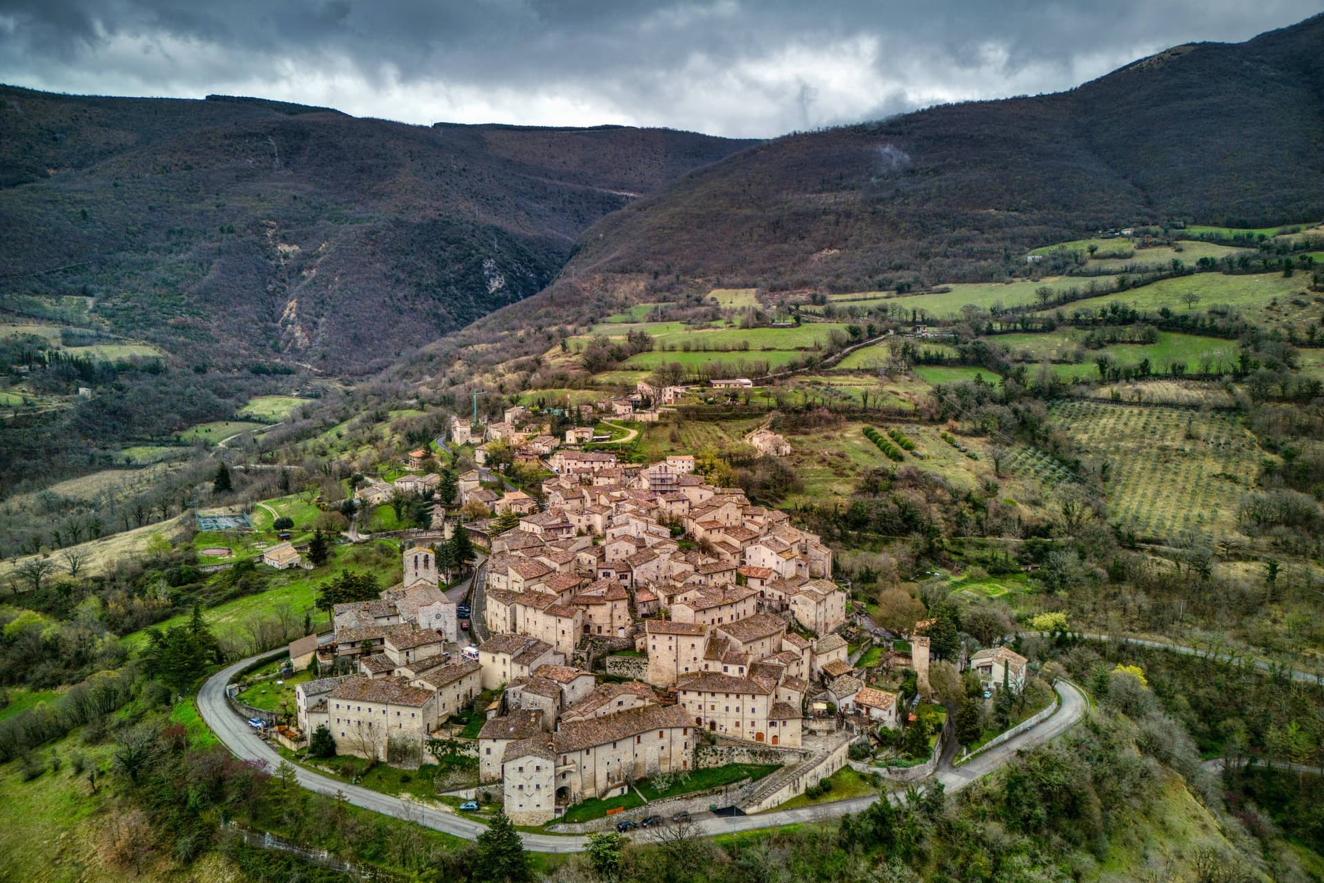
Vallo di Nera sits at 467 meters on a spur of the upper Valnerina, above the Nera river. The town of Spoleto granted the men of Vallo permission to build a castle here in 1217, on the hill where an earlier fortress had stood; the stone houses, the walls and the two symmetrical gates, Portella and Portaranne, have barely changed in eight centuries.
Inside, the village climbs in concentric rings to the Chiesa di Santa Maria Assunta at the top, built in 1176 and given to the Franciscans in the 13th century, who turned a defensive tower into a bell tower and frescoed the apse with a cycle of the Giotto school dated 1383. The Procession of the Whites, traceable to 1401, still leaves the church each year.
The population today is 345, smaller than at any point in the medieval records. Black truffle from the woods above and olive oil from the slopes down to the river are the surviving trades.
What to see in Vallo di Nera
- Chiesa di Santa Maria Assunta. Built 1176, Franciscan from the 13th century, with frescoes of the Giotto school dated 1383 in the apse, by Cola di Pietro da Camerino among others.
- Medieval walls. Twelfth-century walls and towers still encircle the village, with two original symmetrical gates, Portella and Portaranne.
- Centro storico. Light stone houses leaning against each other on three concentric rings, with embrasures, narrow alleys and stone portals preserved since 1217.
How to get to Vallo di Nera
There is a railway station in the town, so you can arrive without a car and never need one while you are here. Terni is roughly 53 minutes away by road.
Our tip
April through June and September into October are the months for Vallo di Nera. The Valnerina is green, the Nera river runs cold, and the trails up to Sellano or down to Scheggino are walkable. July and August push the valley into the mid-thirties; the stone houses hold their cool but most of the 345 residents close shutters between two and six.
Paciano
Why visit Paciano
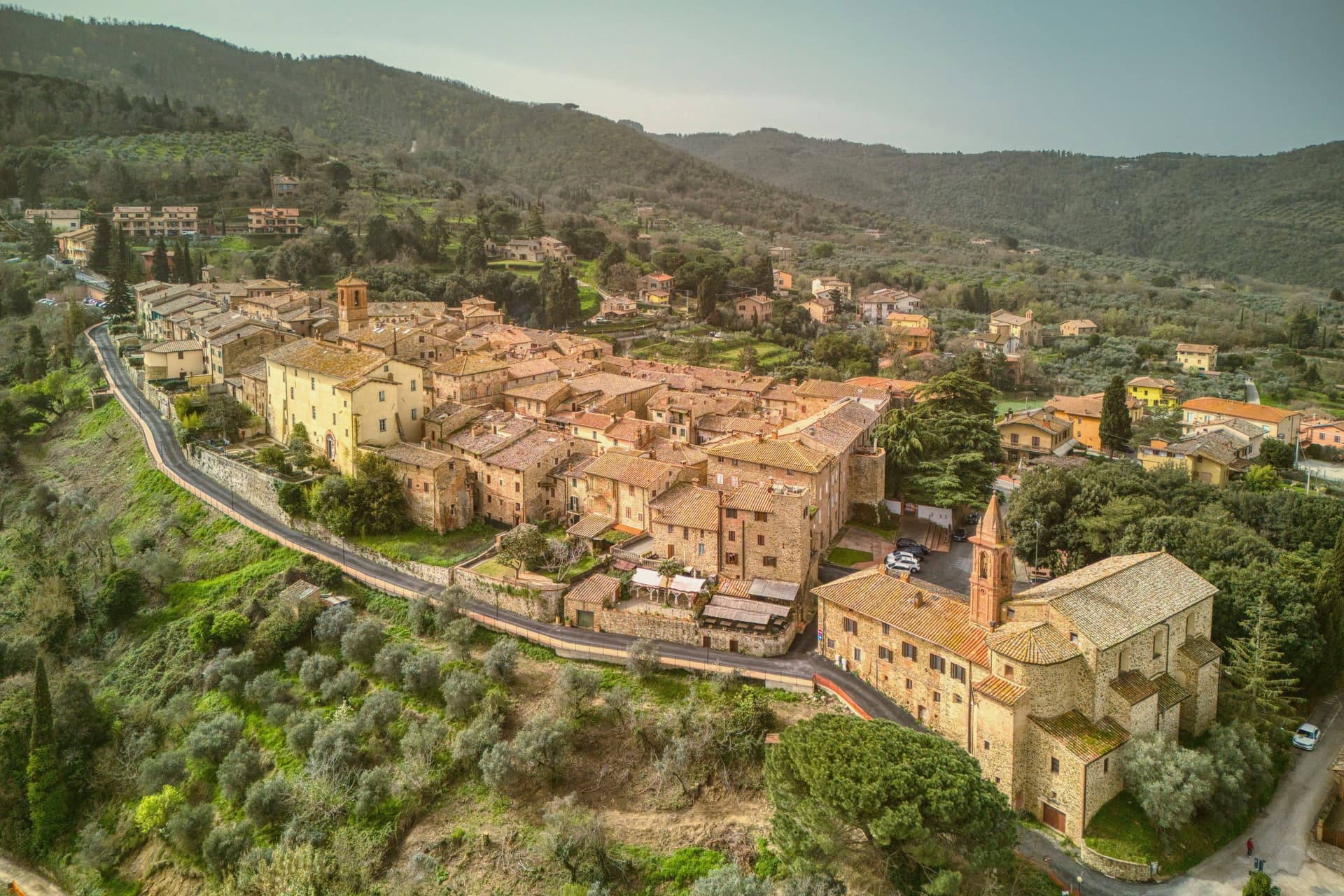
The town is first documented in 917, in an imperial charter of Berengar I, and appears again in 1260 as a castrum, a fortified site. Perugia rebuilt the walls and main tower between 1461 and 1473, using the site as a watch-post over the western approach to the lake below.
Inside the circuit, three parallel streets are linked by orthogonal alleys, a layout that carries the Renaissance palace with the Vignola staircase, the oldest noble residence in the town, and the 17th-century Palazzo Cennini, once the summer residence of a cardinal. The gates and towers sit at the edge of this grid, facing outward toward the water.
Olive oil from the slopes that drop toward the shore is the present-day specialty. What remains is a small fortified grid, built to watch a lake, that turned its military purpose into a domestic one once the watching was no longer needed.
What to see in Paciano
- Medieval walls. About 600 meters of circuit, with the three original gates named Fiorentina, Perugina and Rastrella still standing among the eight towers.
- Palazzo Baldeschi. Assembled from earlier tower houses, with a staircase attributed to Jacopo Barozzi da Vignola. Now used as an exhibition and cultural space.
- Rocca Buitoni. The oldest surviving palace in the town, built as a noble residence inside the walls, with a small private chapel.
How to get to Paciano
Perugia is roughly 44 minutes away by road.
Our tip
April through June and September into October are the months for Paciano. The slopes of Monte Petrarvella hold the wildflowers, Trasimeno is warm enough to swim from late May, and the olive groves run from green to silver-gold across the half-year. The Infiorata fills the three parallel streets each Corpus Domini in late May or June. Sagra dello Strozzaprete falls in August.
Lugnano in Teverina
Why visit Lugnano in Teverina
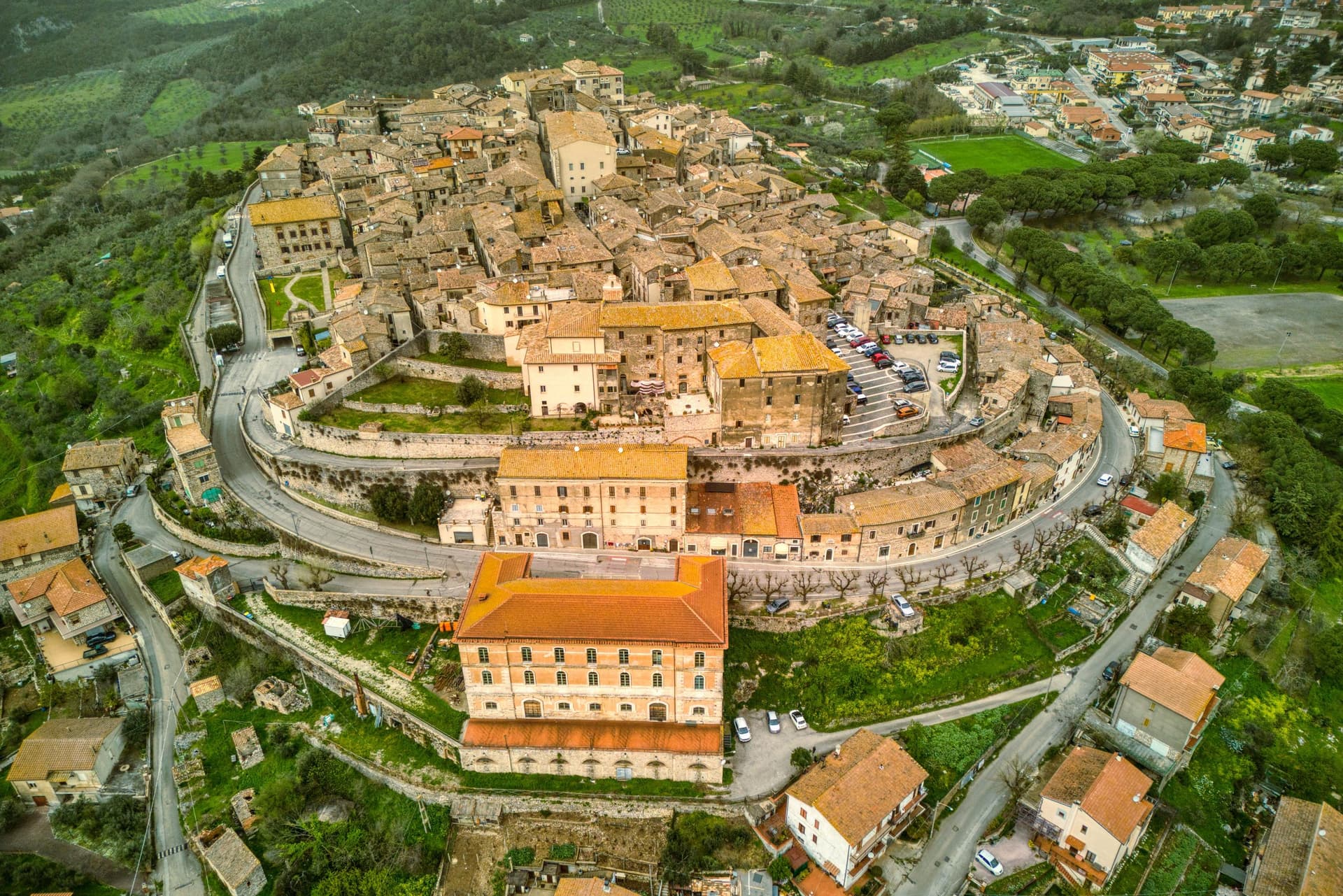
Lugnano in Teverina sits at 441 meters on a ridge above the Tiber, sixty kilometers south of Perugia and twenty-five west of Terni. The town traces its origins to the seventh century, when inhabitants fleeing barbarian invasions sought refuge on the spur after the destruction of nearby Luchiano.
The Collegiata di Santa Maria Assunta, dated 1230 on the inscription of its façade, is built in travertine from quarries by the Tiber, a Romanesque parish church layered over a Lombard-era predecessor, with a cosmatesque pavement and a portico of paired columns. On the hill below, the Villa Romana di Poggio Gramignano, built around the 10s BC, was excavated through the 1980s and again from 2016.
Beneath its collapsed roof archaeologists found a late-fifth-century cemetery of 47 infant and fetal burials, the largest set of child burials in Roman Italy, interpreted as a catastrophic die-off from Plasmodium falciparum malaria. The Olea Mundi olive collection, planted in 2014, holds 1,200 trees from 23 countries.
What to see in Lugnano in Teverina
- Collegiata di Santa Maria Assunta. Romanesque parish church dated 1230 in travertine from Tiber quarries, with cosmatesque pavement and a paired-column portico.
- Villa Romana di Poggio Gramignano. Augustan villa with a late-fifth-century cemetery of 47 infant burials, interpreted as a catastrophic malaria die-off.
- Palazzo Farnese-Ridolfi. Sixteenth-century palace known as the Pennone for its mast-like profile rising above the lower town.
How to get to Lugnano in Teverina
Terni is roughly 40 minutes away by road.
Our tip
April through June and September into October are the months that work. The Tiber valley below stays green into early summer, and the olive harvest carries through November when the Olea Mundi trees come into the frantoi. July and August are hot on the lower Tiber; the centro storico thins between three and six.
Montecchio
Why visit Montecchio
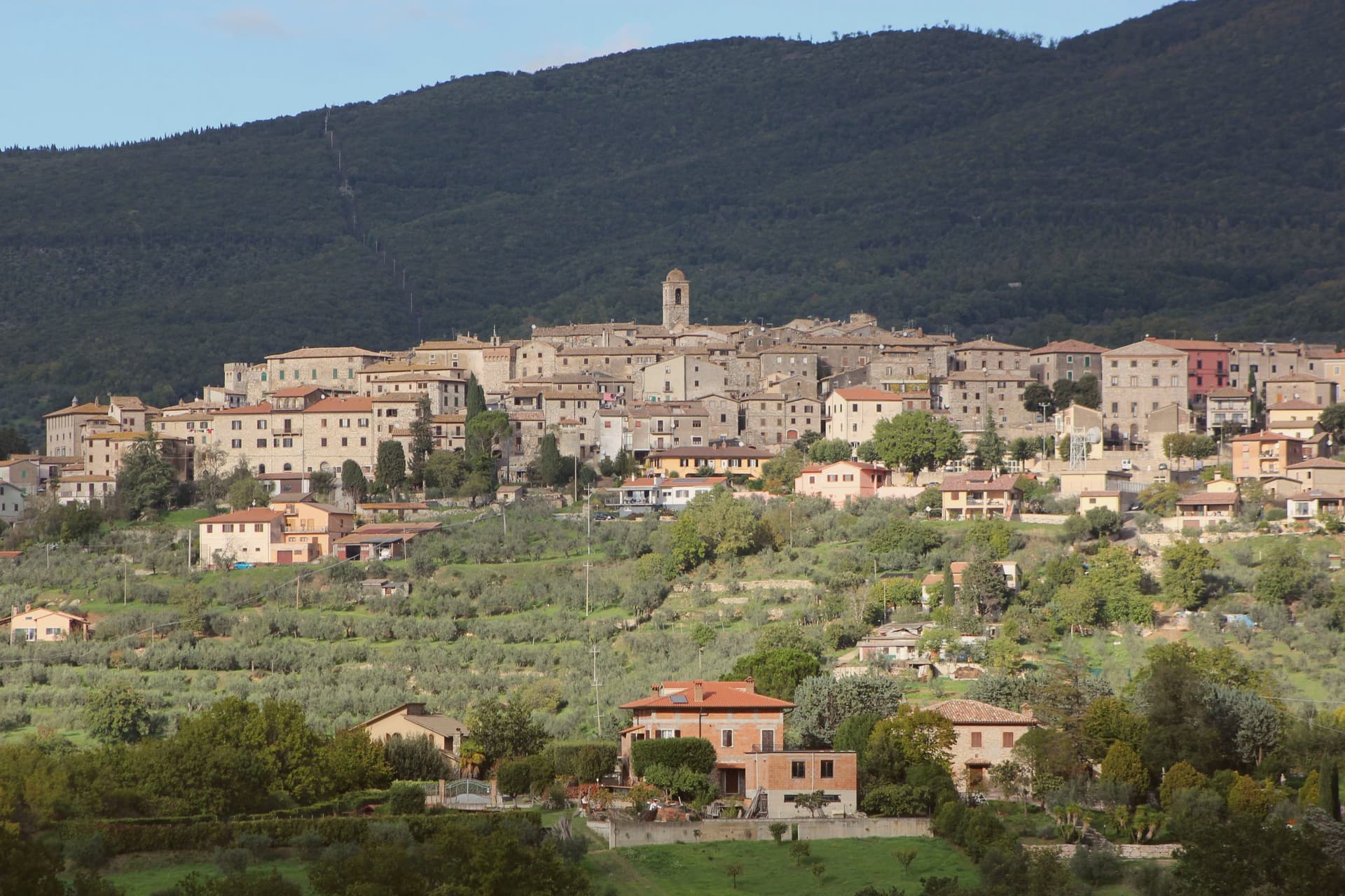
Montecchio sits at 377 meters on a ridge above the Tiber valley, fifty kilometers south of Perugia and thirty northwest of Terni. The territory was inhabited well before Rome: the Vallone di San Lorenzo, about five kilometers below the borgo, holds fifty chamber tombs carved into the soft calcarenite locally called matile, with strong ties to Etruscan Orvieto at its sixth-to-fifth-century BC peak.
The recovered artifacts, now in the Antiquarium of Tenaglie, document a wealthy pre-Roman community. The settlement of Montecchio is first documented in 1154; the castle was raised around 1165 by the Chiaravalle family and passed through the Alviano, Baschi, Colonna and Atti before becoming independent of Baschi in 1948.
Tenaglie, on the opposite ridge, is dominated by Palazzo Ancajani, built in the early 1700s on the foundations of an earlier fortification. The territory holds Borghi più belli, Città dell'Olio and Comuni Virtuosi standing together.
What to see in Montecchio
- Necropoli del Vallone di San Lorenzo. Pre-Roman necropolis 5 km below the borgo, 50 chamber tombs carved in matile rock with klinai-shaped benches, peak 6th-5th century BC.
- AMAT Antiquarium di Tenaglie. Archaeological museum in the Tenaglie frazione displaying the necropolis finds, with strong evidence of Etruscan Orvieto influence.
- Palazzo Ancajani (Tenaglie). Early 18th-century palace on a rocky ridge facing Montecchio, built by Filippo Ancajani over an earlier fortification.
How to get to Montecchio
Terni is roughly 57 minutes away by road.
Our tip
April through June and September into October are the months locals prefer. The necropolis trail through holm oak and juniper is at its best in spring, and the slopes above the Tiber stay golden into late autumn. July and August push temperatures past thirty-five degrees in the valley; the upper borgo holds the breeze and the tomb chambers stay cool year-round. Festa del Bignè falls in August.
Campello sul Clitunno
Why visit Campello sul Clitunno
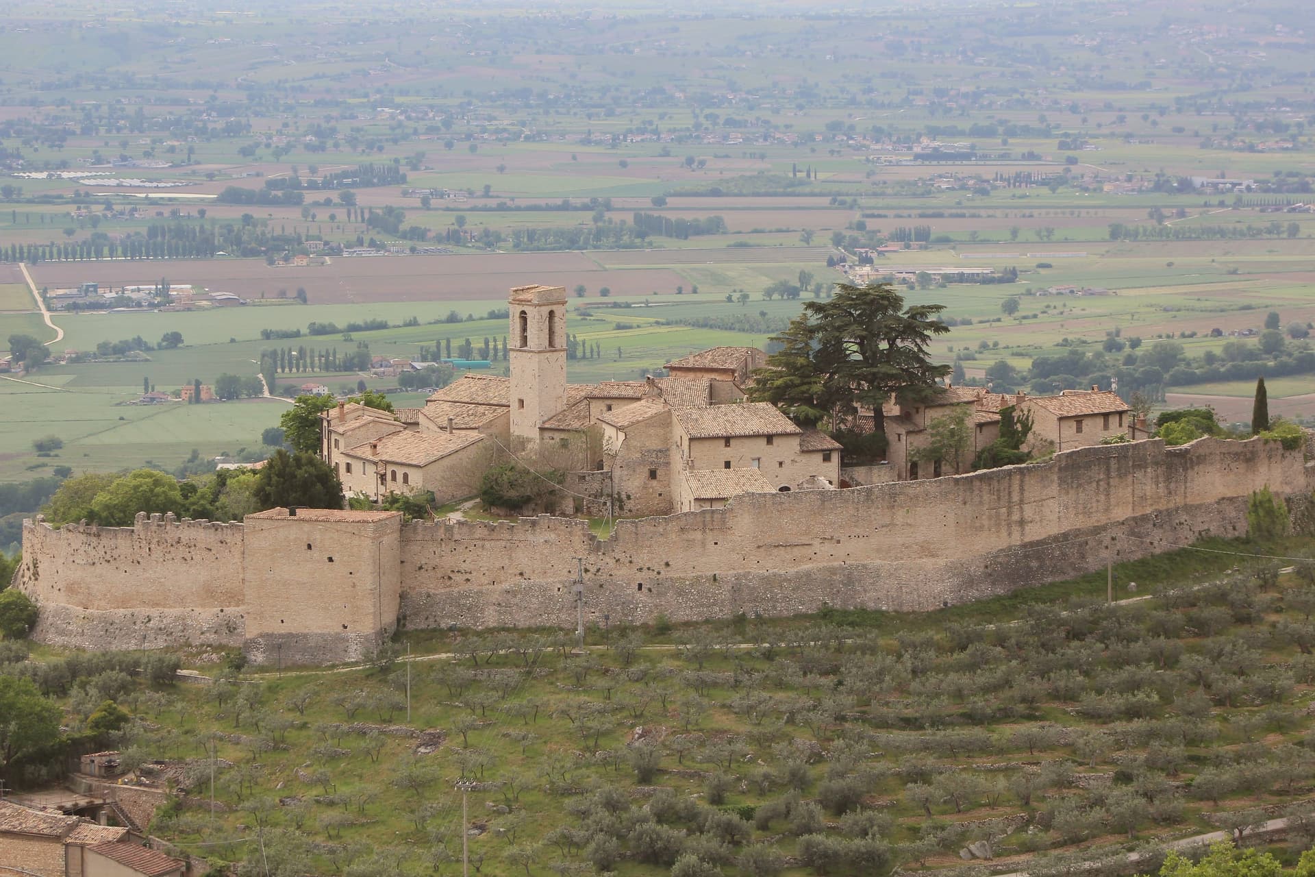
Campello sul Clitunno sits at 290 meters along the Clitunno river, a few kilometers north of Spoleto. The name comes from the Counts Campello, originally Champeaux of Reims, who founded the hilltop nucleus of Campello Alto in the mid-10th century under the Burgundian noble Rovero.
The Fonti del Clitunno, the springs that form the river, produce 1,300 to 1,500 liters of water per second; Pliny the Younger wrote about them, and Lord Byron and Giosuè Carducci returned to the place in poems centuries later, the latter with the ode Le fonti del Clitumno. A kilometer downstream from the springs, in the frazione of Pissignano, the Tempietto del Clitunno is a 4th- or 5th-century pagan sacellum reworked by the Lombards in the 7th and 8th centuries; the interior frescoes have parallels with Santa Maria Antiqua in Rome.
The Tempietto entered the UNESCO World Heritage List in June 2011 as part of the serial site The Lombards in Italy: Places of Power. The Castello di Pissignano above the temple covers the medieval layer.
What to see in Campello sul Clitunno
- Tempietto del Clitunno. Small temple-shaped chapel of the 4th-5th century reworked by the Lombards in the 7th-8th, with frescoes of the Saviour, Peter and Paul; UNESCO World Heritage.
- Fonti del Clitunno. Springs producing 1,300-1,500 liters per second, forming the source of the Clitunno; visited by Pliny, Byron and Carducci.
- Castello di Pissignano. Eleventh-twelfth century hilltop castle just above the Tempietto, founded by Benedictine monks who enclosed the settlement with walls.
How to get to Campello sul Clitunno
There is a railway station in the town, so you can arrive without a car and never need one while you are here. Terni is roughly 86 minutes away by road.
Our tip
April through June and September into October are the months for Campello sul Clitunno. The springs run cold and full, the willows along the lake at the source hold the morning light, and the trails between the Tempietto and Campello Alto are walkable in shade. July and August touch the mid-thirties in the Spoleto valley; the Fonti basin runs a few degrees cooler at the water's edge.
Arrone
Why visit Arrone
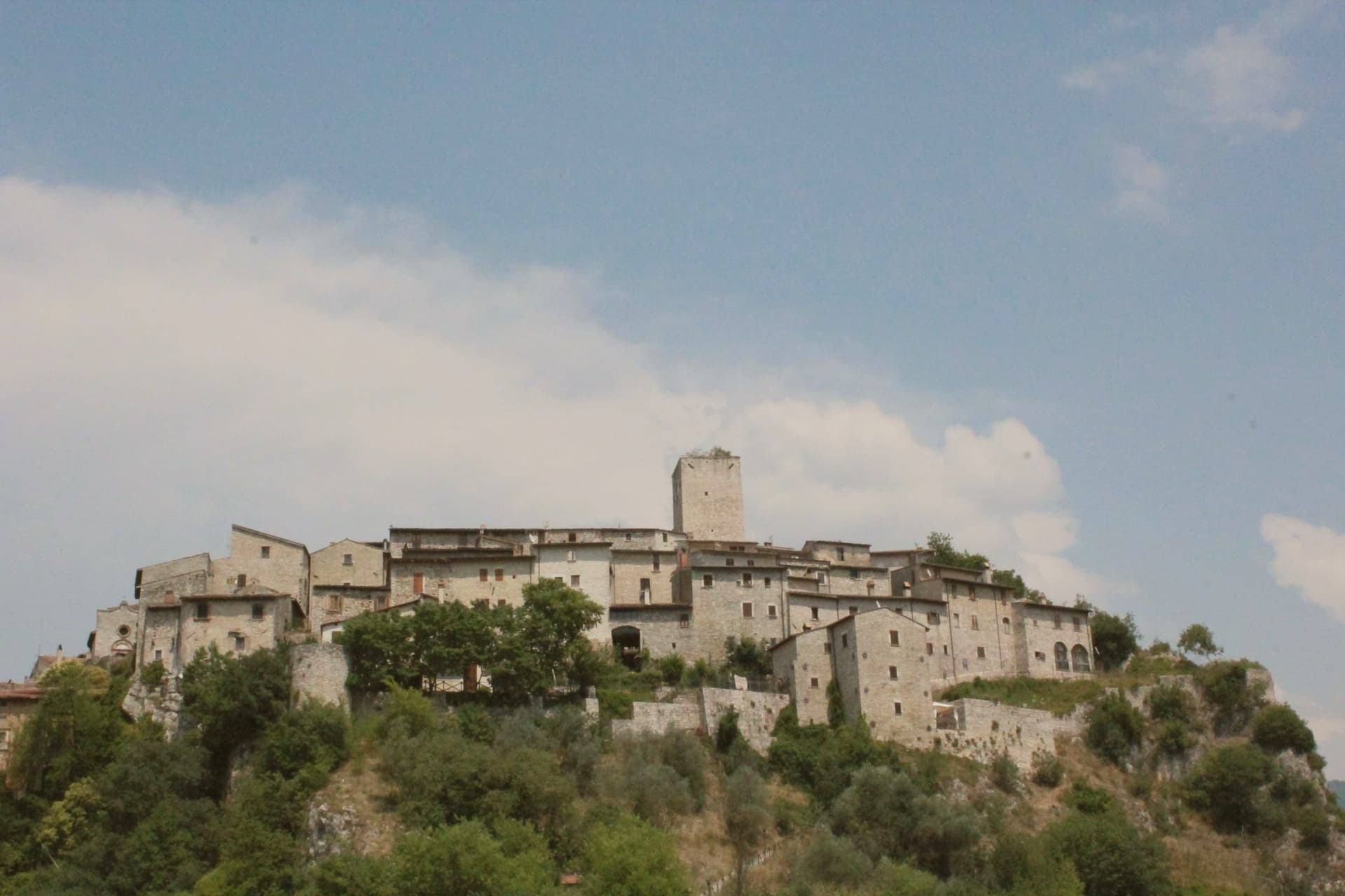
Arrone sits at 243 meters on the left bank of the Nera in the lower Valnerina, the upper part of the village a 9th- or 10th-century noble castle with its walls and alleys still in their medieval layout. The town grew up around the fortified hill and spread along the river as the danger faded.
The Cascata delle Marmore, the largest man-made waterfall in the world at 165 meters across three tiers, is five kilometers downstream; the Romans cut the original channel in 271 BC to drain the marshes around Rieti, and successive interventions through the 16th century gave the falls their present form. The Cammino di San Francesco passes through, and the village is the base for kayaking and rafting on the lower Nera.
The Chiesa di San Giovanni Battista in the upper castle holds 15th-century frescoes of the Umbrian school, and the collegiate Chiesa di Santa Maria in the lower village was rebuilt in the 16th century on Romanesque foundations.
Osteria dello Sportello have been named by a guide.
What to see in Arrone
- Castello di Arrone. Upper part of the village, the 9th-10th century castle, walls and steep medieval alleys preserved to the original layout.
- Chiesa di San Giovanni Battista. Fourteenth-century church inside the upper castle, with 15th-century frescoes of the Umbrian school, including a Madonna and saints.
- Chiesa Collegiata di Santa Maria. Sixteenth-century collegiate church in the lower village, rebuilt on Romanesque foundations, with frescoes by Vincenzo Tamagni.
How to get to Arrone
Terni is roughly 34 minutes away by road.
Our tip
April through June and September into October are the months for Arrone. The Nera runs full from snowmelt and spring rain, the rafting season opens, and the Cascata delle Marmore releases on a fixed schedule that suits the morning light. July and August touch the mid-thirties in the lower Valnerina; the falls cool the air around the basin, and the Cammino di San Francesco walkers pass through early.
Giano dell'Umbria
Why visit Giano dell'Umbria
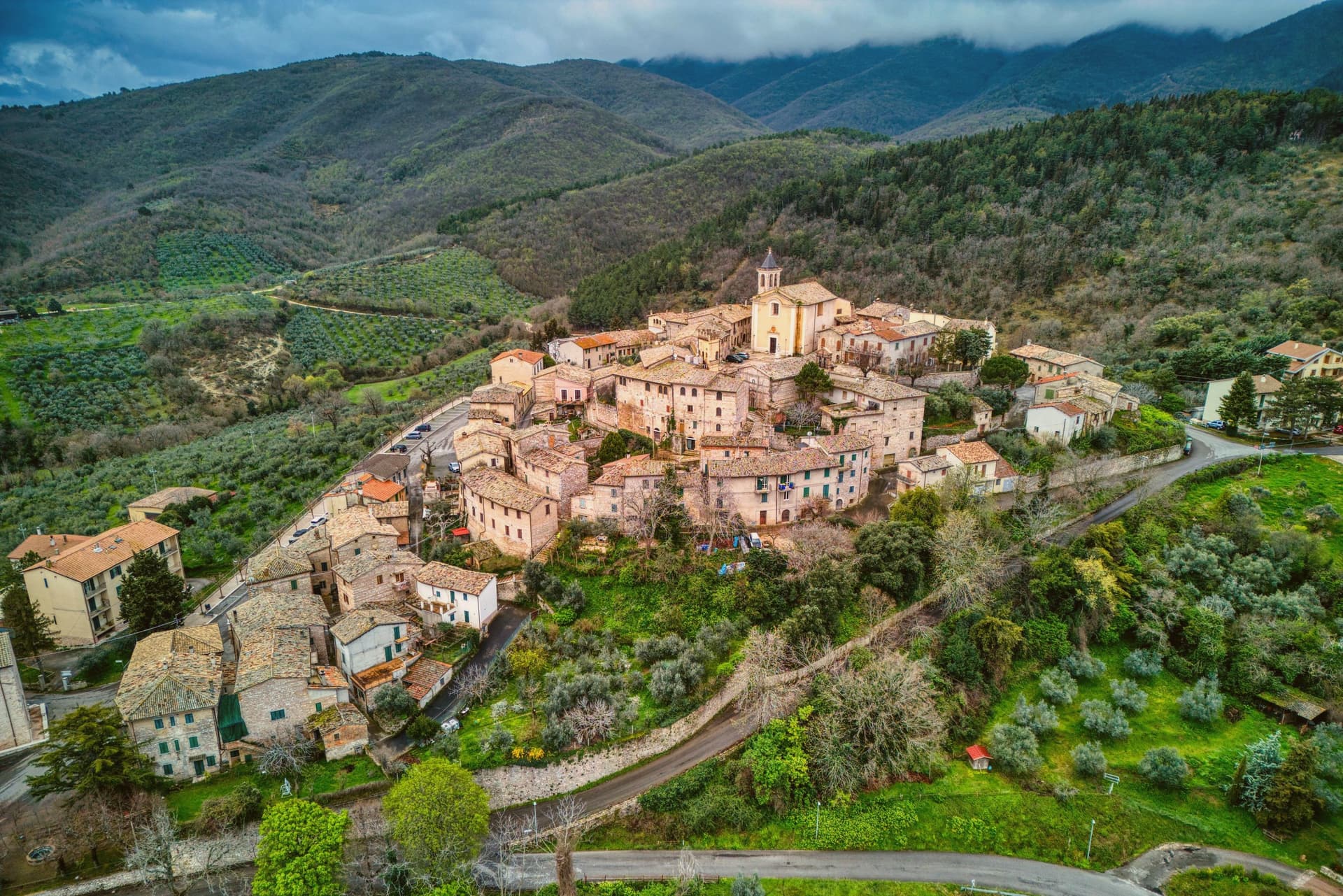
Giano dell'Umbria sits at 547 meters on the eastern slope of a mountain range, inside the triangle between Foligno, Spoleto and Todi. The territory is dotted with small medieval castles, Montecchio and Morcicchia the most intact, and small Romanesque churches scattered between the olive groves.
The abbey stands just outside the walls of the capoluogo, while Montecchio, the castle, the frazione and the Antiquarium together, sits apart on its own ridge above Bastardo, closer to the Via Flaminia than to the main town. The commune is also the seat of the DOC Spoleto wine, with the Trebbiano Spoletino grape reborn here in the last decade, and the olive groves around Bastardo supply the Frantoi Aperti weekends every November.
Abbey, castle and grove read as three settlements on one slope: a religious center below the walls, a fortified outpost on the ridge, and an agricultural economy spread through the land between them.
What to see in Giano dell'Umbria
- Abbazia di San Felice. The crypt below the church is the part worth the stop, a Romanesque space set beneath the rebuilt monastery, holding the ground plan of the oratory that came before it.
- Castello di Montecchio. Fortified on the Monti Martani slope along the Via Flaminia, held by the lords of Giano from the 12th century; the walls and position over the road are still legible.
- Villa Rufione. A rural villa site between Montecchio and Bastardo, on the Via Flaminia Vetus. Nothing remains to visit on the ground; the finds are what survive, held in the Antiquarium of Montecchio.
How to get to Giano dell'Umbria
Terni is roughly 50 minutes away by road.
Our tip
April through June and September into October are the working months on the Martani slopes. The olive groves and the abbey grounds hold light well into the evening. November is the new-oil month: the Frantoi Aperti weekends open the mills, and the town fills for tastings of the just-pressed Martani oil.
Bettona
Why visit Bettona
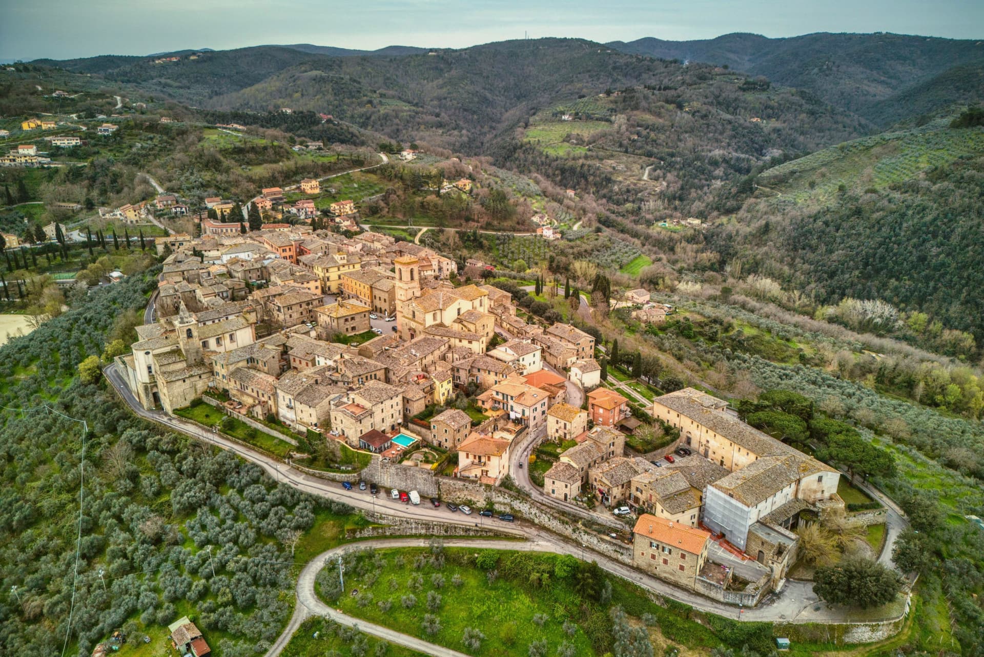
Bettona sits at 353 meters on a hill north of the Colli Martani, looking across the cultivated plain toward Perugia. The Etruscans built here in the seventh century BC, and Bettona remains the only known Etruscan settlement east of the Tiber.
Stretches of polygonal walls from that period are still visible at the base of the medieval circuit, mixed with later Roman blocks. The town became a municipium under Augustus, declined during the barbarian invasions, was sacked by Totila in 548, and rebuilt as a self-governing commune by the late twelfth century.
Papal rule held from 1648 to unification. The Pinacoteca Civica, housed in the Palazzetto del Podestà on Piazza Cavour, keeps two paintings by Pietro Perugino (Sant'Antonio da Padova and Madonna della Misericordia), tabernacle panels attributed to El Greco, and Etruscan funerary stones and architectural terracottas from the territory.
The olive groves below town carry the Città dell'Olio designation.
What to see in Bettona
- Mura etrusche. Stretches of polygonal Etruscan walls visible at the base of the medieval circuit, from the seventh and sixth centuries BC.
- Pinacoteca Civica. Civic art gallery in the Palazzetto del Podestà holding two Perugino paintings, tablets attributed to El Greco and Etruscan finds.
- Chiesa di Santa Maria Maggiore. Main parish church on Piazza Cavour, with a reordered interior holding altarpieces and a Crocifissione fresco.
How to get to Bettona
Perugia is roughly 27 minutes away by road.
Our tip
April through June and September into October are the windows that work. The olive harvest runs from late October through November and gives the town its working rhythm, with the frantoi pressing into the evening. July and August are dry and hot; the centro storico is small enough that midday empties it. Sagra dell'Oca falls in July.
Bevagna
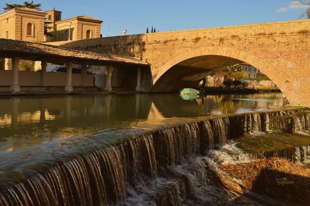
Why visit Bevagna
Bevagna sits on the floor of the Umbrian valley at 225 meters, where the Clitunno meets the Timia. Ancient Mevania, the name means she who stands in the middle, was a Roman mansio on the Via Flaminia, listed in the Antonine Itinerary.
A black-and-white mosaic of the 2nd century AD survives almost intact in the frigidarium of the Roman baths, twelve meters by seven, octopuses and dolphins in the center, tritons and sea-horses on the short sides. Piazza Silvestri at the heart of the centro storico holds two Romanesque churches that face each other at odd angles, San Michele Arcangelo and San Silvestro, built within years of each other in the late 12th century.
The Mercato delle Gaite each June turns the town into the year 1300 for ten days, four quarters competing on medieval trades and tavern menus, no anachronisms allowed. The Sagrantino slopes of Montefalco are nine kilometers up the road.
Serpillo, Ottavi Mare have been named by a guide.
What to see in Bevagna
- Piazza Silvestri. Twelfth-century civic square ringed by the Palazzo dei Consoli, the churches of San Silvestro and San Michele, and the fountain of 1896.
- Chiesa di San Michele Arcangelo. Romanesque collegiate church built by Binello and Rodolfo at the end of the 12th century, on the main square.
- Chiesa di San Silvestro. Romanesque parish church across the piazza, signed and dated 1195 by Binello, the same builder as San Michele.
How to get to Bevagna
Perugia is roughly 39 minutes away by road.
Our tip
April through June and September into October are the months for Bevagna. The valley fills with green, the Sagrantino vines run on the slopes above town, and the rose festival fills the gardens around the walls in May. The Mercato delle Gaite runs the second half of June and is the single most concentrated weekend on the Umbrian medieval calendar. Sagra della Lumaca falls in August.
More from Anywhere Italy
- The best small olive oil towns in the province of Perugia
- The 9 best olive oil towns within 90 minutes of Terni
- The best hidden olive oil towns that eat well in Umbria
- The prettiest small villages within 90 minutes of Perugia
- The 7 best small towns you can reach by train in Umbria
- The best olive oil towns you can reach by train in the province of Perugia