
The 9 best olive oil towns within 90 minutes of Terni
Olive country here is steep, and that is the point. The groves climb in dry-stone terraces above the Valnerina and the Tiber, on limestone soil that keeps the trees small and the yield low, which is why the oil comes out green, grassy and hot at the back of the throat. Harvest runs from late October into the cold weeks, the frantoi work through the night, and the smell of crushed leaf hangs around the mills. The towns above the groves are built from the same pale stone as the terrace walls, with olive-wood smoke coming out of the chimneys.
Most people arrive in Umbria for Assisi, and Assisi earns its coach parks: the basilica, the frescoes, the view over the plain. But the town runs on a fixed circuit, the restaurants near the sanctuary cook for people passing through once, and the oil on the table is rarely from the hill you can see out of the window. The same is true of the day-trip loop through Perugia and Orvieto, where the crowd is thickest between the car park and the cathedral.
The groves do not stop at the famous towns. They continue south down the Nera, west across the Tiber towards Lake Bolsena, and up into the Martani hills, and the towns on those slopes are smaller, quieter and closer to the presses. Each of the places in this list belongs to the national association of olive-oil towns, which means the oil is made where you are standing, not trucked in. Come in the pressing weeks and the mills will let you taste it straight from the tank.
Of the 36 communes we have mapped within 90 minutes of Terni, 9 qualify as olive oil towns: each belongs to the national association of olive-oil towns. The smallest, Vallo di Nera, has 345 residents.
If you are still choosing, we have also written The 9 best small olive oil towns in Umbria and The best olive oil towns you can reach by train in the province of Perugia.
Vallo di Nera
Why visit Vallo di Nera
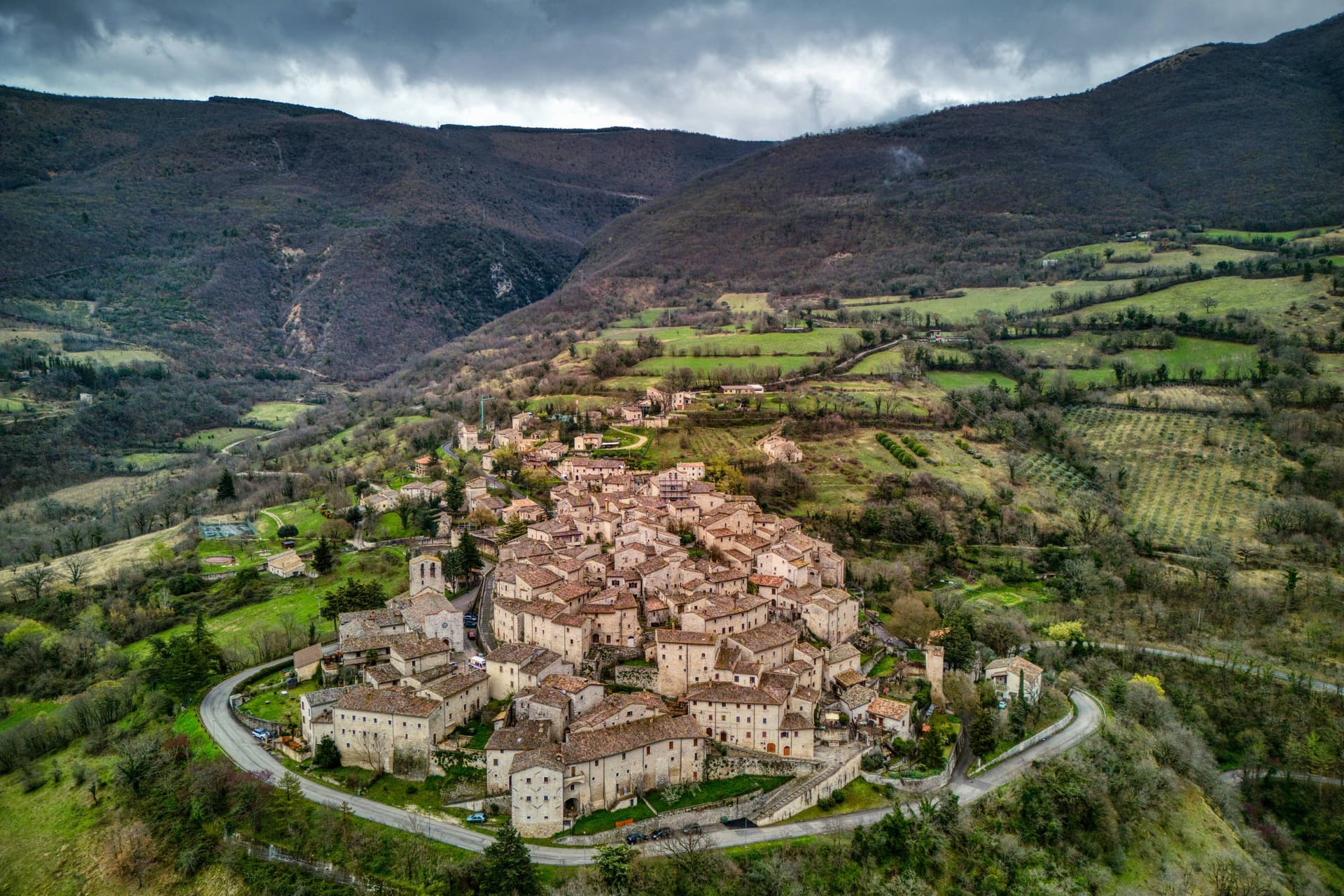
Vallo di Nera sits at 467 meters on a spur of the upper Valnerina, above the Nera river. The town of Spoleto granted the men of Vallo permission to build a castle here in 1217, on the hill where an earlier fortress had stood; the stone houses, the walls and the two symmetrical gates, Portella and Portaranne, have barely changed in eight centuries.
Inside, the village climbs in concentric rings to the Chiesa di Santa Maria Assunta at the top, built in 1176 and given to the Franciscans in the 13th century, who turned a defensive tower into a bell tower and frescoed the apse with a cycle of the Giotto school dated 1383. The Procession of the Whites, traceable to 1401, still leaves the church each year.
The population today is 345, smaller than at any point in the medieval records. Black truffle from the woods above and olive oil from the slopes down to the river are the surviving trades.
What to see in Vallo di Nera
- Chiesa di Santa Maria Assunta. Built 1176, Franciscan from the 13th century, with frescoes of the Giotto school dated 1383 in the apse, by Cola di Pietro da Camerino among others.
- Medieval walls. Twelfth-century walls and towers still encircle the village, with two original symmetrical gates, Portella and Portaranne.
- Centro storico. Light stone houses leaning against each other on three concentric rings, with embrasures, narrow alleys and stone portals preserved since 1217.
How to get to Vallo di Nera
There is a railway station in the town, so you can arrive without a car and never need one while you are here. Terni is roughly 53 minutes away by road.
Our tip
April through June and September into October are the months for Vallo di Nera. The Valnerina is green, the Nera river runs cold, and the trails up to Sellano or down to Scheggino are walkable. July and August push the valley into the mid-thirties; the stone houses hold their cool but most of the 345 residents close shutters between two and six.
Casperia
Why visit Casperia
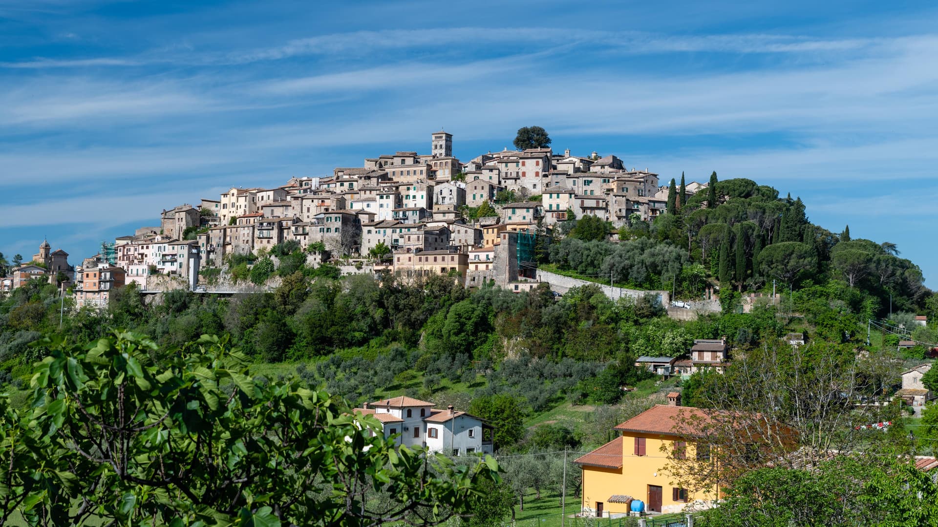
Casperia sits at 397 meters on the western slope of the Monti Sabini, fifty kilometers northeast of Rome. Its two gates face opposite directions on the hillside, one toward the lower road on the west, the other toward the valley on the east, and both feed into the same climbing street pattern that rings the hill in concentric bands up to the church at the summit.
No vehicles pass the gates, so the interior keeps its medieval scale intact, lane by lane, without the intrusions that have altered plenty of comparable towns. Below the walls the slope opens into olive country, part of a protected-origin appellation, in the localities of Paranzano, Santa Maria in Legarano and San Vito.
The relationship between the two levels, hilltop settlement above and working groves below, is the shape of the place: a defended village that never spread past its walls, sitting over land that has been worked continuously and given a name and a boundary of its own.
What to see in Casperia
- Centro storico. Concentric lanes climb from the gates to the parish church at the summit, laid out with no space for vehicles, a compact plan that reads clearly from any of the approaches below.
- Chiesa di San Giovanni Battista. Parish church on the highest point of the village, baroque interior on medieval foundations, with works by Vincenzo Manenti.
- Porta Romana. Western gate of the wall circuit, the main entry point on foot from the lower road.
How to get to Casperia
Terni is roughly 43 minutes away by road.
Our tip
April through June and September through October are the best months in the Sabina hills. The olive harvest runs from mid-October into November; the new oil is pressed in the cooperatives around the village and the town fills on autumn weekends for tastings. July and August are hot in the lower valley; the village at 397 meters is several degrees cooler and the lanes hold shade. Sagra dei Stringozzi Aspresi falls in July.
Lugnano in Teverina
Why visit Lugnano in Teverina
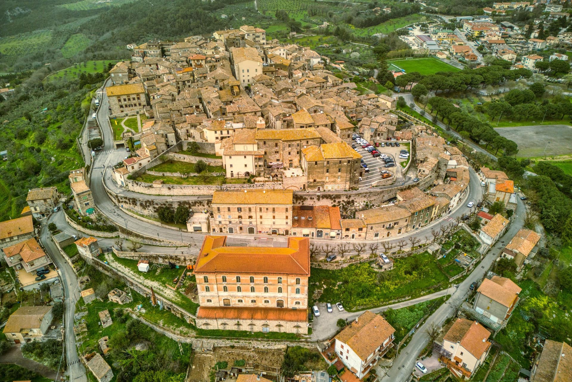
Lugnano in Teverina sits at 441 meters on a ridge above the Tiber, sixty kilometers south of Perugia and twenty-five west of Terni. The town traces its origins to the seventh century, when inhabitants fleeing barbarian invasions sought refuge on the spur after the destruction of nearby Luchiano.
The Collegiata di Santa Maria Assunta, dated 1230 on the inscription of its façade, is built in travertine from quarries by the Tiber, a Romanesque parish church layered over a Lombard-era predecessor, with a cosmatesque pavement and a portico of paired columns. On the hill below, the Villa Romana di Poggio Gramignano, built around the 10s BC, was excavated through the 1980s and again from 2016.
Beneath its collapsed roof archaeologists found a late-fifth-century cemetery of 47 infant and fetal burials, the largest set of child burials in Roman Italy, interpreted as a catastrophic die-off from Plasmodium falciparum malaria. The Olea Mundi olive collection, planted in 2014, holds 1,200 trees from 23 countries.
What to see in Lugnano in Teverina
- Collegiata di Santa Maria Assunta. Romanesque parish church dated 1230 in travertine from Tiber quarries, with cosmatesque pavement and a paired-column portico.
- Villa Romana di Poggio Gramignano. Augustan villa with a late-fifth-century cemetery of 47 infant burials, interpreted as a catastrophic malaria die-off.
- Palazzo Farnese-Ridolfi. Sixteenth-century palace known as the Pennone for its mast-like profile rising above the lower town.
How to get to Lugnano in Teverina
Terni is roughly 40 minutes away by road.
Our tip
April through June and September into October are the months that work. The Tiber valley below stays green into early summer, and the olive harvest carries through November when the Olea Mundi trees come into the frantoi. July and August are hot on the lower Tiber; the centro storico thins between three and six.
Montecchio
Why visit Montecchio
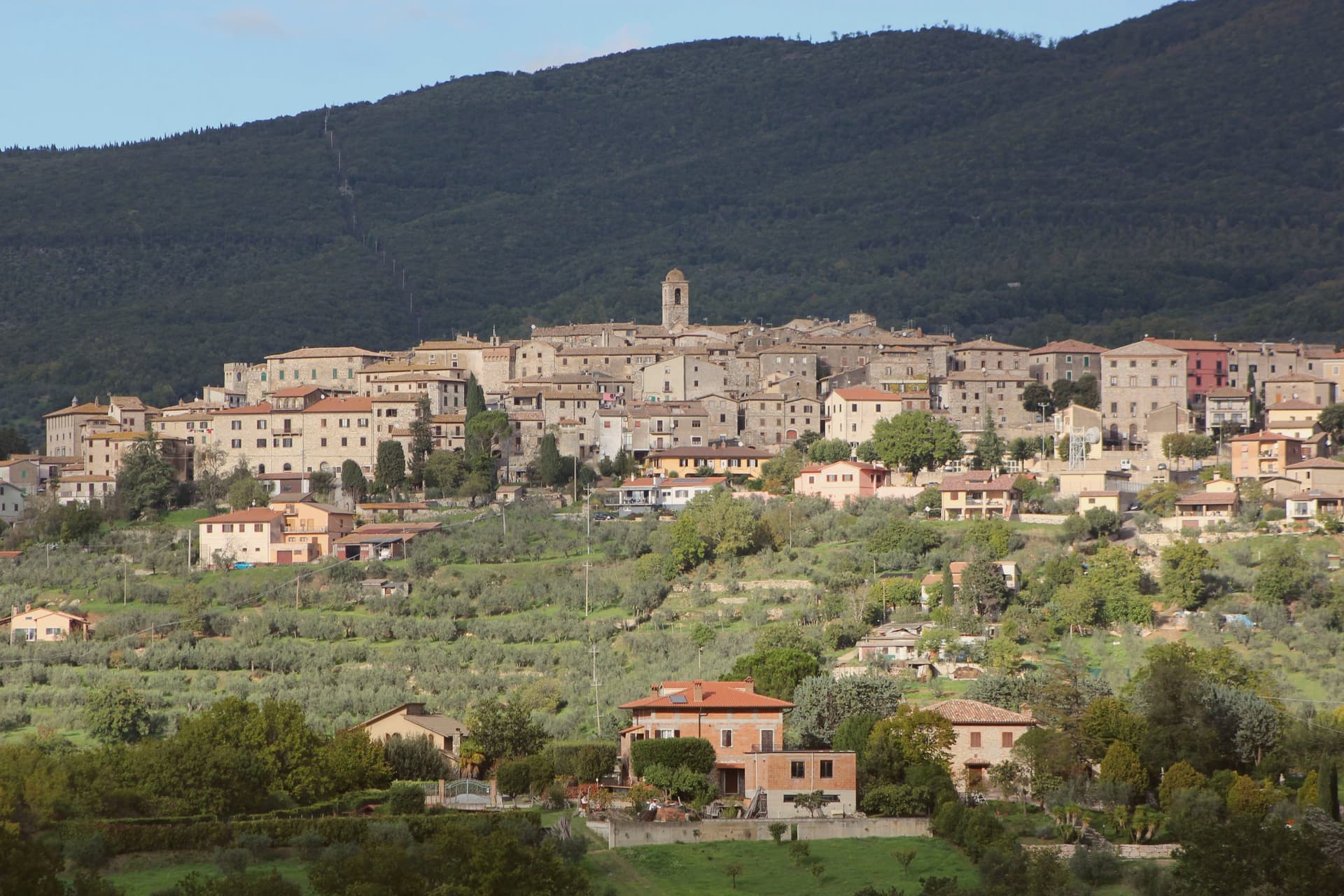
Montecchio sits at 377 meters on a ridge above the Tiber valley, fifty kilometers south of Perugia and thirty northwest of Terni. The territory was inhabited well before Rome: the Vallone di San Lorenzo, about five kilometers below the borgo, holds fifty chamber tombs carved into the soft calcarenite locally called matile, with strong ties to Etruscan Orvieto at its sixth-to-fifth-century BC peak.
The recovered artifacts, now in the Antiquarium of Tenaglie, document a wealthy pre-Roman community. The settlement of Montecchio is first documented in 1154; the castle was raised around 1165 by the Chiaravalle family and passed through the Alviano, Baschi, Colonna and Atti before becoming independent of Baschi in 1948.
Tenaglie, on the opposite ridge, is dominated by Palazzo Ancajani, built in the early 1700s on the foundations of an earlier fortification. The territory holds Borghi più belli, Città dell'Olio and Comuni Virtuosi standing together.
What to see in Montecchio
- Necropoli del Vallone di San Lorenzo. Pre-Roman necropolis 5 km below the borgo, 50 chamber tombs carved in matile rock with klinai-shaped benches, peak 6th-5th century BC.
- AMAT Antiquarium di Tenaglie. Archaeological museum in the Tenaglie frazione displaying the necropolis finds, with strong evidence of Etruscan Orvieto influence.
- Palazzo Ancajani (Tenaglie). Early 18th-century palace on a rocky ridge facing Montecchio, built by Filippo Ancajani over an earlier fortification.
How to get to Montecchio
Terni is roughly 57 minutes away by road.
Our tip
April through June and September into October are the months locals prefer. The necropolis trail through holm oak and juniper is at its best in spring, and the slopes above the Tiber stay golden into late autumn. July and August push temperatures past thirty-five degrees in the valley; the upper borgo holds the breeze and the tomb chambers stay cool year-round. Festa del Bignè falls in August.
Capodimonte
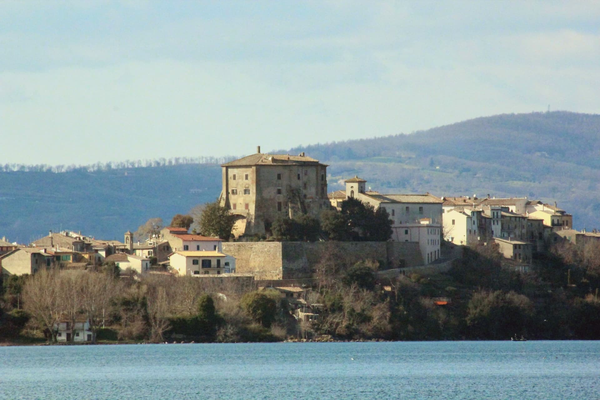
Why visit Capodimonte
Capodimonte is a 1,700-resident lakeside borgo on the southwestern shore of the lake, formed 370,000 years ago when the Vulsini volcanic complex collapsed inward. The town sits on a low peninsula that juts into the water, and the centro is built around that geography: the fortress anchors the point of land, the gardens run beside it, and the shore curves away on both sides into the pebble beaches used for swimming.
From the peninsula's tip the view opens across the water toward the larger of Bolsena's two islands, still privately owned but open for guided visits, while the smaller Isola Martana nearby is uninhabited. Capodimonte is also a Città dell'Olio, and the Tuscia hills behind the town produce a DOP Sabina-style olive oil pressed in small frantoi within 10 km.
The lake itself is deep and clean, warm enough for swimming from May to October, and bream and coregone from its water turn up on every local table. The Via Francigena pilgrimage route passes 8 km east.
The Etruscan necropolis at Vulci is 30 minutes west, and the painted tombs of Tarquinia an hour southwest, both UNESCO sites, while Civita di Bagnoregio, the dying city on its tufa pinnacle, lies 25 km north. The town's identity comes from that position on the water: a fortified point of land looking out at an island that was once its own private world, with the surrounding hills supplying the oil that still runs through the local economy.
Pepe Nero have been named by a guide.
What to see in Capodimonte
- Palazzo Farnese (Rocca Farnese). The fortress built for Pope Paul III's family stands over formal Italian gardens, partially open for visits. Its octagonal plan is unusual among lakeside strongholds of the period.
- Isola Bisentina. Reached from the peninsula's tip, the island holds seven Renaissance chapels, a Franciscan convent and the Farnese tombs, a quiet cluster of buildings for a place that was long the only inhabited island on the lake.
- Lago di Bolsena swimming + beaches. Clean and warm from May to October, with short pebble strands on either side of the Capodimonte peninsula.
How to get to Capodimonte
Terni is roughly 74 minutes away by road.
Our tip
Capodimonte is best May through October — the lake is swimmable and the Isola Bisentina ferries run. June and September are the sweet spot (warm water, no crowds). July–August fills with Roman families on weekends and at ferragosto.
Campello sul Clitunno
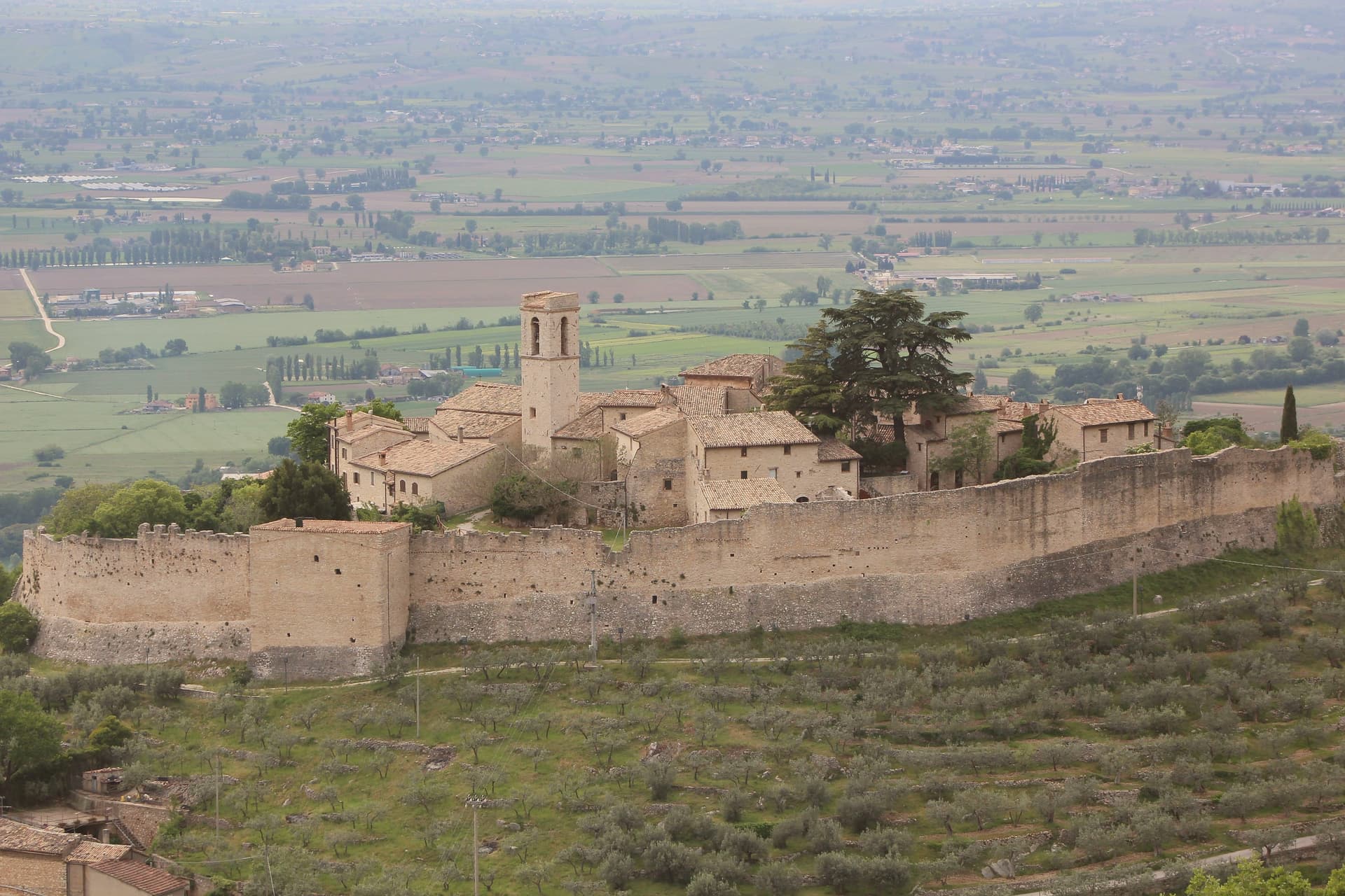
Why visit Campello sul Clitunno
Campello sul Clitunno sits at 290 meters along the Clitunno river, a few kilometers north of Spoleto. The name comes from the Counts Campello, originally Champeaux of Reims, who founded the hilltop nucleus of Campello Alto in the mid-10th century under the Burgundian noble Rovero.
The Fonti del Clitunno, the springs that form the river, produce 1,300 to 1,500 liters of water per second; Pliny the Younger wrote about them, and Lord Byron and Giosuè Carducci returned to the place in poems centuries later, the latter with the ode Le fonti del Clitumno. A kilometer downstream from the springs, in the frazione of Pissignano, the Tempietto del Clitunno is a 4th- or 5th-century pagan sacellum reworked by the Lombards in the 7th and 8th centuries; the interior frescoes have parallels with Santa Maria Antiqua in Rome.
The Tempietto entered the UNESCO World Heritage List in June 2011 as part of the serial site The Lombards in Italy: Places of Power. The Castello di Pissignano above the temple covers the medieval layer.
What to see in Campello sul Clitunno
- Tempietto del Clitunno. Small temple-shaped chapel of the 4th-5th century reworked by the Lombards in the 7th-8th, with frescoes of the Saviour, Peter and Paul; UNESCO World Heritage.
- Fonti del Clitunno. Springs producing 1,300-1,500 liters per second, forming the source of the Clitunno; visited by Pliny, Byron and Carducci.
- Castello di Pissignano. Eleventh-twelfth century hilltop castle just above the Tempietto, founded by Benedictine monks who enclosed the settlement with walls.
How to get to Campello sul Clitunno
There is a railway station in the town, so you can arrive without a car and never need one while you are here. Terni is roughly 86 minutes away by road.
Our tip
April through June and September into October are the months for Campello sul Clitunno. The springs run cold and full, the willows along the lake at the source hold the morning light, and the trails between the Tempietto and Campello Alto are walkable in shade. July and August touch the mid-thirties in the Spoleto valley; the Fonti basin runs a few degrees cooler at the water's edge.
Arrone
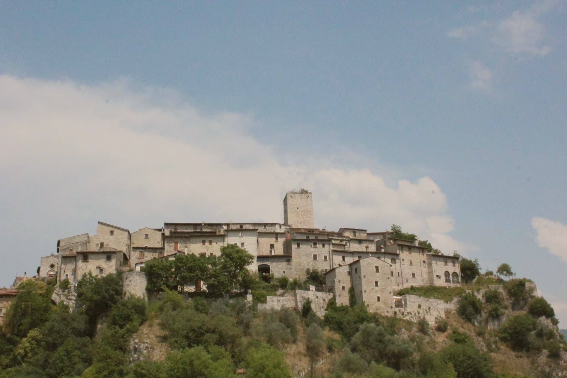
Why visit Arrone
Arrone sits at 243 meters on the left bank of the Nera in the lower Valnerina, the upper part of the village a 9th- or 10th-century noble castle with its walls and alleys still in their medieval layout. The town grew up around the fortified hill and spread along the river as the danger faded.
The Cascata delle Marmore, the largest man-made waterfall in the world at 165 meters across three tiers, is five kilometers downstream; the Romans cut the original channel in 271 BC to drain the marshes around Rieti, and successive interventions through the 16th century gave the falls their present form. The Cammino di San Francesco passes through, and the village is the base for kayaking and rafting on the lower Nera.
The Chiesa di San Giovanni Battista in the upper castle holds 15th-century frescoes of the Umbrian school, and the collegiate Chiesa di Santa Maria in the lower village was rebuilt in the 16th century on Romanesque foundations.
Osteria dello Sportello have been named by a guide.
What to see in Arrone
- Castello di Arrone. Upper part of the village, the 9th-10th century castle, walls and steep medieval alleys preserved to the original layout.
- Chiesa di San Giovanni Battista. Fourteenth-century church inside the upper castle, with 15th-century frescoes of the Umbrian school, including a Madonna and saints.
- Chiesa Collegiata di Santa Maria. Sixteenth-century collegiate church in the lower village, rebuilt on Romanesque foundations, with frescoes by Vincenzo Tamagni.
How to get to Arrone
Terni is roughly 34 minutes away by road.
Our tip
April through June and September into October are the months for Arrone. The Nera runs full from snowmelt and spring rain, the rafting season opens, and the Cascata delle Marmore releases on a fixed schedule that suits the morning light. July and August touch the mid-thirties in the lower Valnerina; the falls cool the air around the basin, and the Cammino di San Francesco walkers pass through early.
Giano dell'Umbria
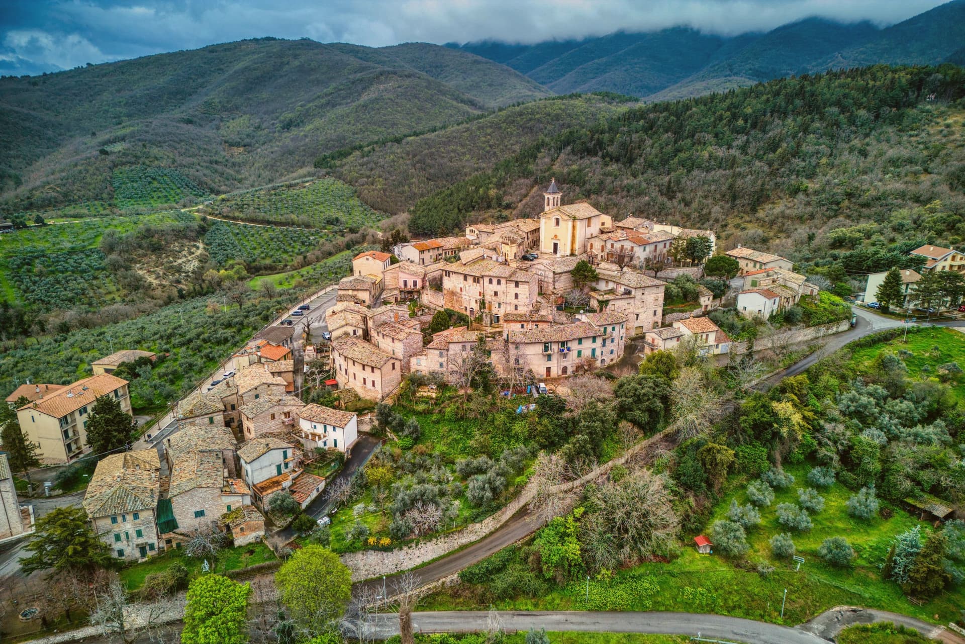
Why visit Giano dell'Umbria
Giano dell'Umbria sits at 547 meters on the eastern slope of a mountain range, inside the triangle between Foligno, Spoleto and Todi. The territory is dotted with small medieval castles, Montecchio and Morcicchia the most intact, and small Romanesque churches scattered between the olive groves.
The abbey stands just outside the walls of the capoluogo, while Montecchio, the castle, the frazione and the Antiquarium together, sits apart on its own ridge above Bastardo, closer to the Via Flaminia than to the main town. The commune is also the seat of the DOC Spoleto wine, with the Trebbiano Spoletino grape reborn here in the last decade, and the olive groves around Bastardo supply the Frantoi Aperti weekends every November.
Abbey, castle and grove read as three settlements on one slope: a religious center below the walls, a fortified outpost on the ridge, and an agricultural economy spread through the land between them.
What to see in Giano dell'Umbria
- Abbazia di San Felice. The crypt below the church is the part worth the stop, a Romanesque space set beneath the rebuilt monastery, holding the ground plan of the oratory that came before it.
- Castello di Montecchio. Fortified on the Monti Martani slope along the Via Flaminia, held by the lords of Giano from the 12th century; the walls and position over the road are still legible.
- Villa Rufione. A rural villa site between Montecchio and Bastardo, on the Via Flaminia Vetus. Nothing remains to visit on the ground; the finds are what survive, held in the Antiquarium of Montecchio.
How to get to Giano dell'Umbria
Terni is roughly 50 minutes away by road.
Our tip
April through June and September into October are the working months on the Martani slopes. The olive groves and the abbey grounds hold light well into the evening. November is the new-oil month: the Frantoi Aperti weekends open the mills, and the town fills for tastings of the just-pressed Martani oil.
Spoleto
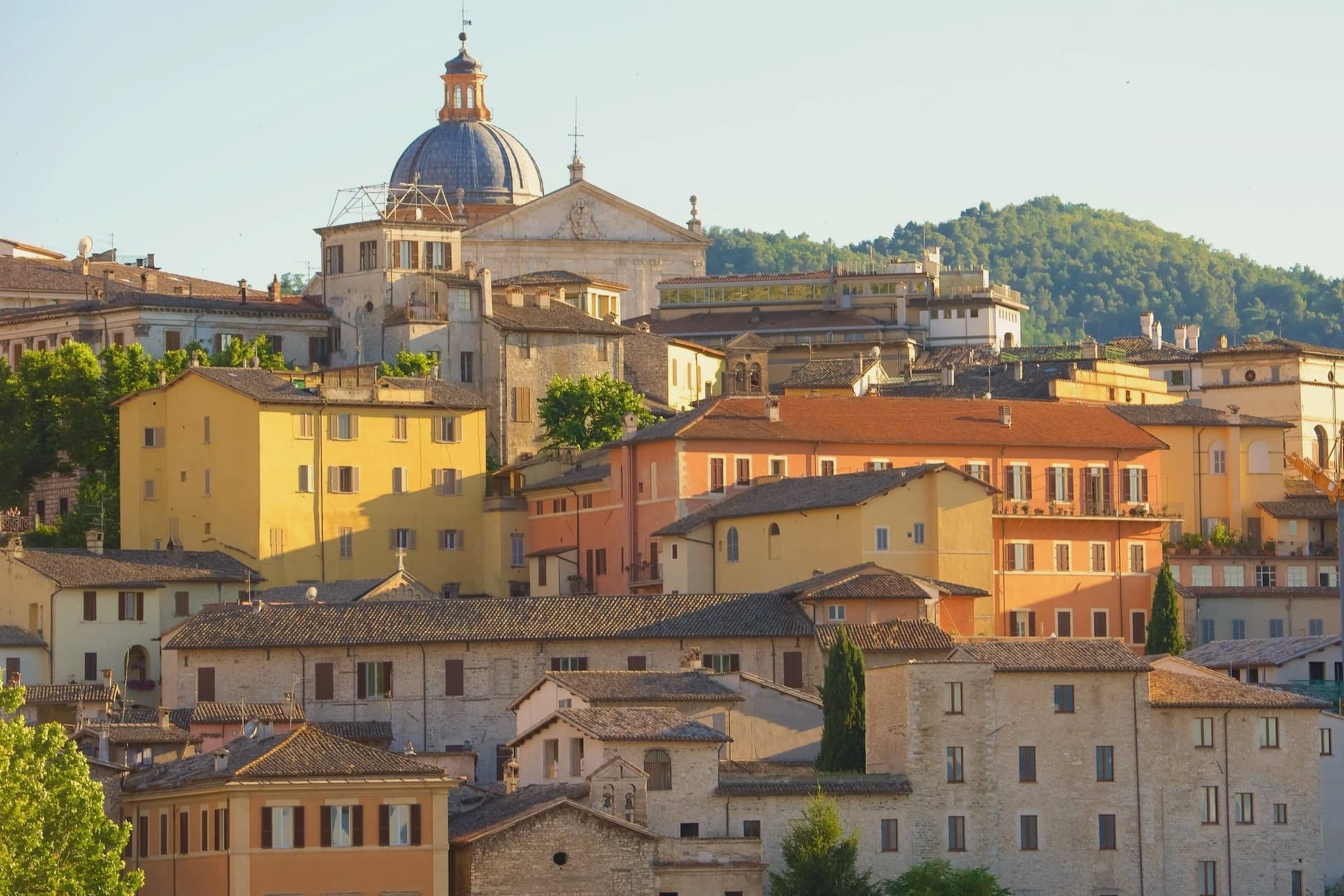
Why visit Spoleto
Spoleto sits at 396 meters at the southern edge of the Valle Umbra, the Apennines rising behind it toward Monteluco. The town was Roman Spoletium from 241 BC, then capital of one of the two great Lombard duchies of Italy from 576, controlling Umbria, Sabina, Picenum and the Pescara valley for more than five centuries.
The Rocca Albornoziana on the Colle Sant'Elia was built between 1363 and 1367 by Matteo Gattapone for Cardinal Albornoz, both a papal fortress and a residence, now the Museo Nazionale del Ducato. From the Rocca the Ponte delle Torri, 230 meters long and 80 meters high, crosses the Tessino gorge to Monteluco, an aqueduct of the 13th century built over Roman foundations.
The Duomo holds a Byzantine mosaic of 1207 across its façade and Filippo Lippi's last fresco cycle in the apse. Gian Carlo Menotti founded the Festival dei Due Mondi in 1958; the Roman theater, the Rocca courtyard and Piazza del Duomo still carry the program each year from late June into mid-July.
Apollinare, San Lorenzo, Il Capanno have been named by a guide.
What to see in Spoleto
- Rocca Albornoziana. Papal fortress built 1363-1367 by Matteo Gattapone for Cardinal Albornoz, now the Museo Nazionale del Ducato di Spoleto.
- Ponte delle Torri. Aqueduct bridge 230 meters long and 80 meters high, crossing the Tessino gorge to Monteluco, 13th-14th century on Roman foundations.
- Duomo di Santa Maria Assunta. Twelfth-century Romanesque cathedral with Byzantine mosaic of 1207 on the façade, Renaissance portico, and Filippo Lippi frescoes in the apse.
How to get to Spoleto
There is a railway station in the town, so you can arrive without a car and never need one while you are here. Terni is roughly 41 minutes away by road.
Our tip
April through June and September into October are the months for Spoleto. The town opens its gardens, the Rocca courtyard fills with sun, and the long walks along the Giro dei Condotti above the Ponte delle Torri become bearable again. The Festival dei Due Mondi runs from late June into mid-July, when Spoleto doubles in population and the Roman theater carries opera into the small hours. Sagra dell'Anguilla e del Gambero di Fiume falls in August.
More from Anywhere Italy
- The 9 best small olive oil towns in Umbria
- The best olive oil towns you can reach by train in the province of Perugia
- The best small olive oil towns in the province of Perugia
- The best olive oil towns in Lazio
- The 10 best hidden hill towns you can reach by train within 90 minutes of Terni
 The 8 best hill towns on a walking route within 90 minutes of Terni