
The best towns known for what they grow within 90 minutes of Perugia
Umbria grows things that carry the name of the place they come from. The valleys south and east of Perugia produce spelt and lentils on thin upland soil, black truffles dug from the damp oak woods along the river Nera, celery, onions and cardoons in the alluvial flats, and olives pressed within days of picking into oil that tastes of cut grass and pepper. The towns themselves are built from the local limestone, pale grey to honey depending on the light, with barrel-vaulted cellars underneath and a mill or a frantoio somewhere near the bottom of the hill. Autumn is when it all lands at once: sagre in draughty village halls, new oil on bruschetta, truffle shaved over strangozzi. Spring brings the wild greens and the first field beans.
Most visitors to this part of Umbria give their days to Assisi, and the reasons are obvious. The basilica, the frescoes, the long view over the Vale of Spoleto: it is one of the great sights in Italy and the coaches park accordingly. By late morning in high season the main street is shoulder to shoulder, and the restaurants along it cook for people who will not be back.
The farmland that feeds all of it continues well past the famous hill. The same valleys, the same terraces, the same protected crops carry on into towns where fewer people go and where the produce is sold by the person who grew it. These are smaller places, mostly walled, mostly quiet outside festival weekends, and all of them sit inside the production zone of a fruit or vegetable that Italy protects by name.
Of the 73 communes we have mapped in a 90-minute drive of Perugia, 7 qualify as towns known for what they grow: each sits inside the production zone of a protected fruit or vegetable. The smallest, Vallo di Nera, has 345 residents.
Two more lists worth reading alongside this one: The best towns known for what they grow within two hours of Ancona and The best towns known for what they grow within 75 minutes of Rome.
Vallo di Nera
Why visit Vallo di Nera
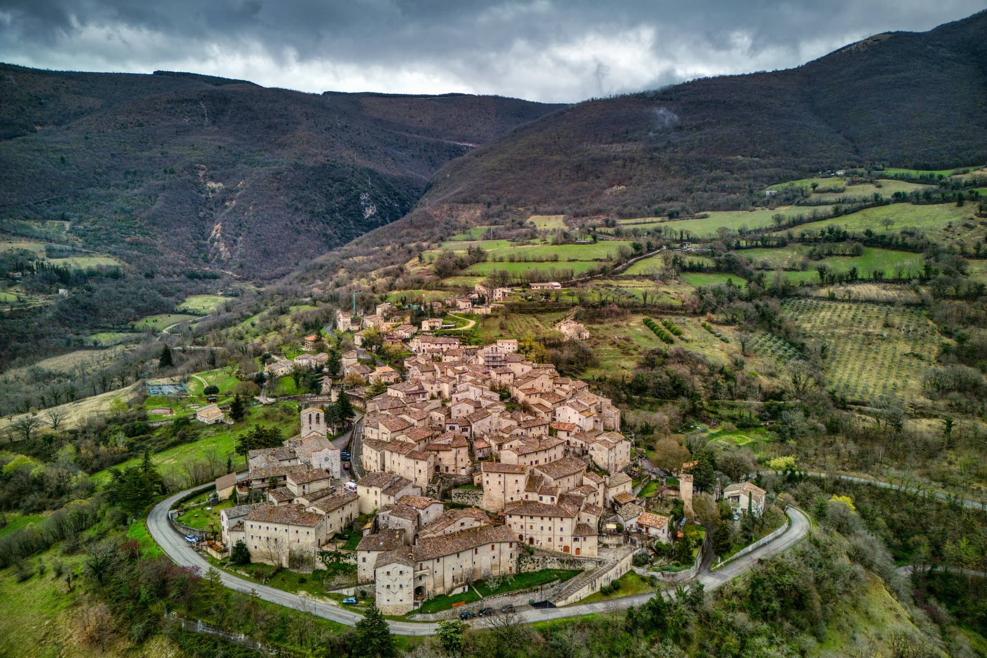
Vallo di Nera sits at 467 meters on a spur of the upper Valnerina, above the Nera river. The town of Spoleto granted the men of Vallo permission to build a castle here in 1217, on the hill where an earlier fortress had stood; the stone houses, the walls and the two symmetrical gates, Portella and Portaranne, have barely changed in eight centuries.
Inside, the village climbs in concentric rings to the Chiesa di Santa Maria Assunta at the top, built in 1176 and given to the Franciscans in the 13th century, who turned a defensive tower into a bell tower and frescoed the apse with a cycle of the Giotto school dated 1383. The Procession of the Whites, traceable to 1401, still leaves the church each year.
The population today is 345, smaller than at any point in the medieval records. Black truffle from the woods above and olive oil from the slopes down to the river are the surviving trades.
What to see in Vallo di Nera
- Chiesa di Santa Maria Assunta. Built 1176, Franciscan from the 13th century, with frescoes of the Giotto school dated 1383 in the apse, by Cola di Pietro da Camerino among others.
- Medieval walls. Twelfth-century walls and towers still encircle the village, with two original symmetrical gates, Portella and Portaranne.
- Centro storico. Light stone houses leaning against each other on three concentric rings, with embrasures, narrow alleys and stone portals preserved since 1217.
How to get to Vallo di Nera
There is a railway station in the town, so you can arrive without a car and never need one while you are here. Terni is roughly 53 minutes away by road.
Our tip
April through June and September into October are the months for Vallo di Nera. The Valnerina is green, the Nera river runs cold, and the trails up to Sellano or down to Scheggino are walkable. July and August push the valley into the mid-thirties; the stone houses hold their cool but most of the 345 residents close shutters between two and six.
Scheggino
Why visit Scheggino
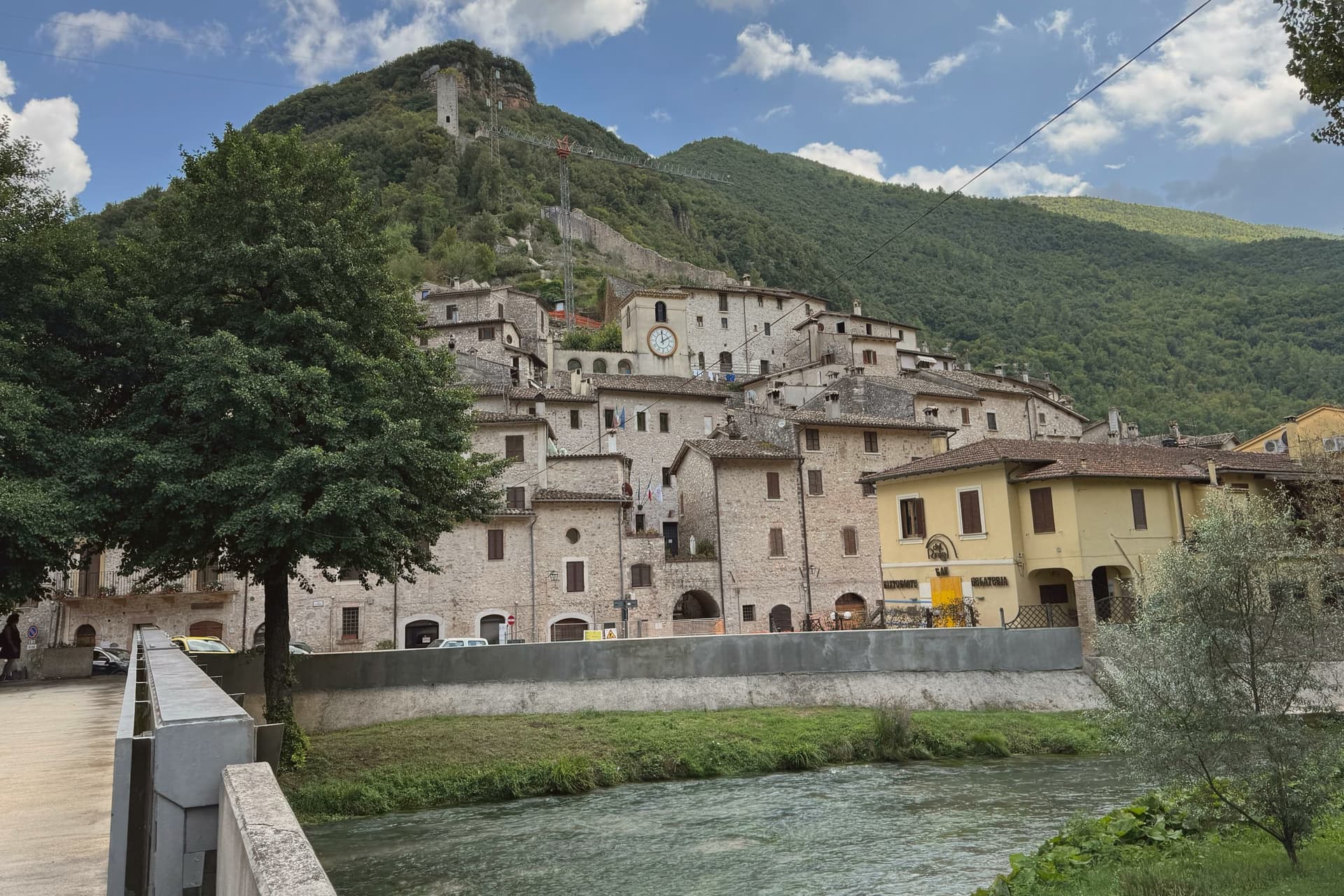
Scheggino sits at 280 meters in the heart of the Valnerina, the village wedged into a triangle of walls between the slope above and the Nera river below. The Duchy of Spoleto built it around the 12th century to defend one of the three bridges over the Nera; the triangular plan and the watchtower of white and pink stone, about 20 meters high, still mark the top of the castle.
The Nera runs alongside the lower edge of the village, divided into channels that once turned mills and now hold trout and the springs that feed the truffle washing rooms. Scheggino is the home of Urbani Tartufi, the first commercial company for the storage and processing of truffle, founded in 1928, which still has its plant on the river.
The Diamante Nero festival each summer prepares a giant frittata with more than 2,000 eggs and 80 kilos of black truffle. The Cammino di San Francesco passes through the village on the way south.
What to see in Scheggino
- Castello di Scheggino. Twelfth-century triangular castle of the Duchy of Spoleto, with a watchtower in white and pink stone about 20 meters high at the summit.
- Chiesa di San Nicola. Romanesque parish church at the heart of the centro storico, frescoes of the Umbrian school of the 15th century in the apse.
- Nera river canals. Channels of the Nera divided through the lower village, once for mills and now for trout farming and the truffle washing rooms of Urbani.
How to get to Scheggino
Terni is roughly 49 minutes away by road.
Our tip
April through June and September into October are the months for Scheggino. The Nera runs cold and full, the trout farms work at capacity, and the trails up to Vallo di Nera or down to Ferentillo are walkable in shade. July and August push the valley into the mid-thirties; the river canals through the village cool the lower streets and the trattorie pour Nera trout with local truffle.
Monteleone di Spoleto
Why visit Monteleone di Spoleto
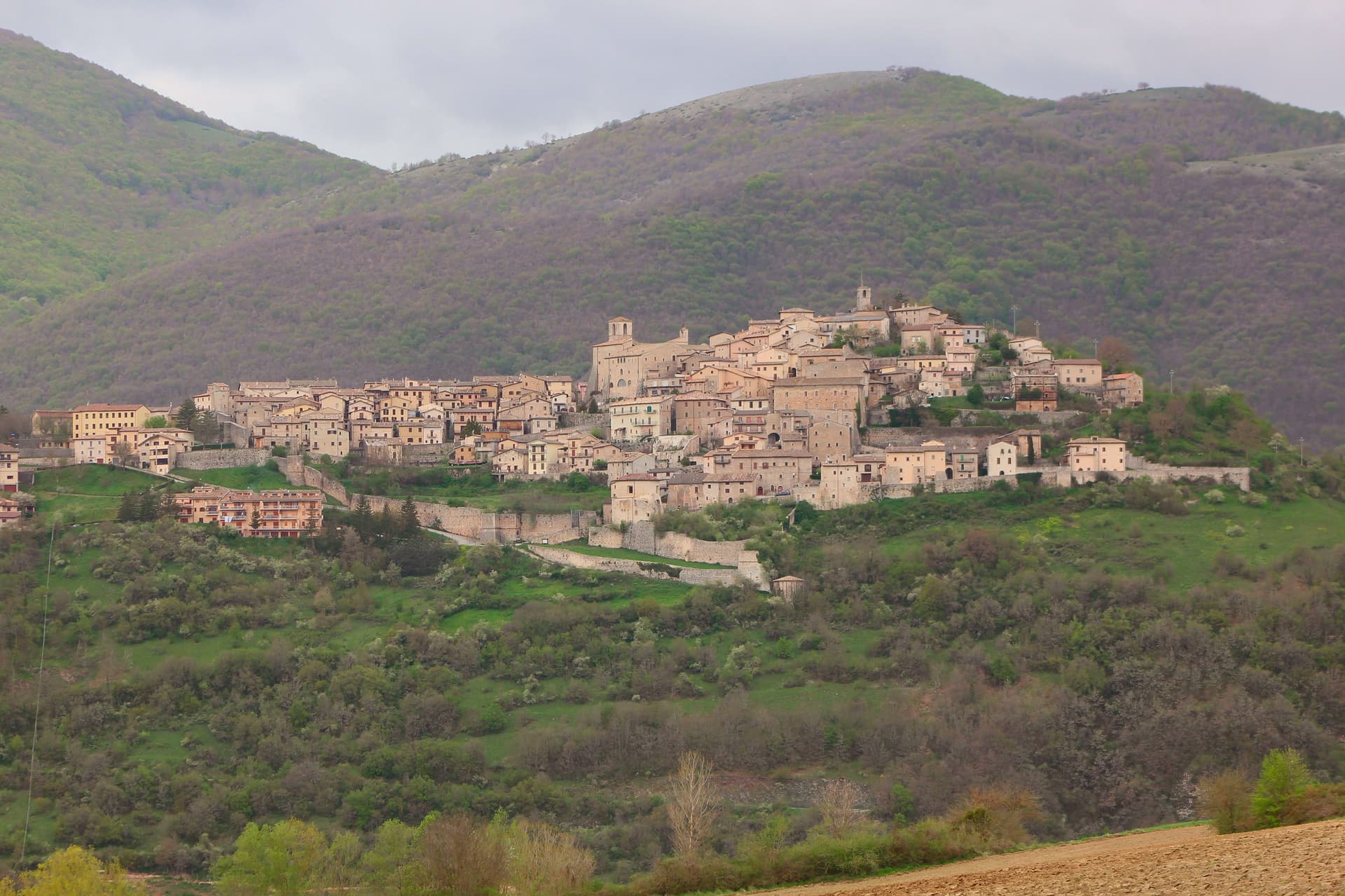
Monteleone sits at 978m on a hilltop in the upper Nera valley, the upper extension of the Valnerina, at the point where Umbria, Lazio and Marche converge. A castle anchors the summit and gives the borgo its defining silhouette, much-rebuilt over the centuries and again after the 2016 earthquake.
Below it sit the Chiesa and Convento di San Francesco, and the whole village is compact enough that the fortress organizes the view from almost anywhere within it. The find that put the town on archaeological maps happened by accident: a local farmer ploughing a field at the Colle del Capitano turned up an Etruscan bronze parade chariot in 1902, a complete biga from the 6th century BC.
His family sold it to French dealers for the equivalent of 950 lire, and it reached the Metropolitan Museum of Art in New York in 1903, where it is now displayed in Gallery 170 as the most complete pre-Roman parade chariot known to survive, its bronze panels depicting Achilles' birth, his combat with Memnon, and his apotheosis. Monteleone has pursued repatriation since 1990 through multiple legal proceedings, none successful, and the Met's title is now considered settled.
The village opened a museum in 2002 holding a full-scale replica alongside the original context of the find, and the town is also a marked stop on a 350-km pilgrim walk running from Norcia, Benedict's birthplace, through Monteleone to Subiaco and Montecassino, with pilgrim accommodation available locally. The 2016 Norcia and Cascia earthquake damaged several buildings in town; the castle and the Franciscan church have been restored, though reconstruction continues elsewhere.
Beyond the village, the Sibillini Mountains National Park lies to the east, the Cascia-Norcia route linking Benedict's and Rita's home towns runs to the north, and Lago di Piediluco is 30 km south. The food follows the Valnerina pattern: strangozzi with truffle, lentils from Castelluccio di Norcia, prosciutto and other Norcineria meats, pecorino, and Sagrantino di Montefalco from 60 km west.
Depopulation has been steep, from 1,800 residents in 1951 to 555 today, which leaves a village built for a much larger population now organized around a fortress, a church and a museum that all outsize the number of people currently living among them.
What to see in Monteleone di Spoleto
- Museo della Civiltà del Carro (replica chariot). Full-scale replica of the Monteleone Chariot, with the context of the 1902 find laid out around it. The panels on the original show Achilles' birth, his combat with Memnon, and his apotheosis. The museum also documents the village's repatriation campaign, active since 1990 and unsuccessful in every legal proceeding brought so far.
- Rocca dei Brancaleoni. The castle anchors the high point of the borgo, its rebuilt walls now standing again after 2016 earthquake repairs. From the top, the view runs across the whole upper Nera valley.
- Chiesa di San Francesco (Renaissance ceiling). 13th-century Franciscan church with later restorations and a carved wooden ceiling added in the 16th century. Also repaired after 2016 earthquake damage.
How to get to Monteleone di Spoleto
Terni is roughly 59 minutes away by road.
Our tip
Monteleone di Spoleto is mountain-seasonal — May through September is the high season. June-July brings the Cammino di San Benedetto pilgrim flow. Castelluccio di Norcia lentil bloom (late June-early July, 20 km east, the famous fiorita) is a major regional draw.
Sellano
Why visit Sellano
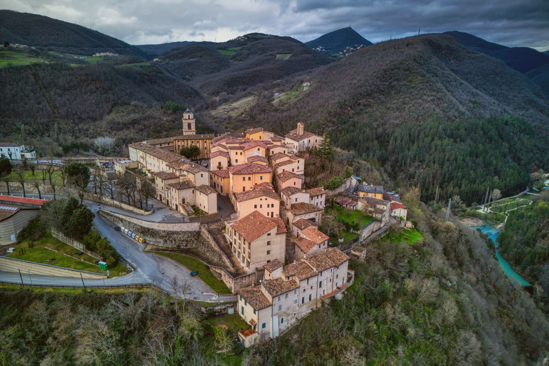
Sellano sits at 641 meters on the eastern edge of Umbria, looking over the Vigi stream toward the Marche border. The Vigi feeds the Nera; the valley is the upper Valnerina, one of the most isolated stretches of the Umbro-Marchigiano Apennines.
The 1979 and 1997 earthquakes hit the commune hard. The 1997 quake destroyed the sixteenth-century Palazzo dei Collicola at Montesanto and emptied most of the surrounding hamlets.
Reconstruction took two decades. In March 2024 a new structure opened: a 517-meter suspension footbridge across the Vigi gorge linking Sellano to the Castello di Montesanto, 175 meters above the valley floor, 1,023 steps, claimed as Europe's highest tibetan bridge alongside Portugal's Arouca 516.
Funded by NextAppennino, 1.6 million euros from PNRR earthquake-area development money. The bridge has become the visible decision of a small commune to bet its future on something other than waiting out emigration.
La Casa Rosa del Castello di Postignano have been named by a guide.
What to see in Sellano
- Ponte tibetano. 517-meter suspension footbridge opened March 2024, 175 meters above the Vigi gorge, 1,023 steps linking Sellano to Castello di Montesanto.
- Castello di Montesanto. Medieval fortress hamlet across the Vigi, depopulated after the 1997 earthquake, reachable on foot via the new bridge.
- Borgo medievale di Sellano. Compact walled centro storico looking east toward the Marche, partially rebuilt after the 1997 quake.
How to get to Sellano
Perugia is roughly 66 minutes away by road.
Our tip
May through October is the working season at 641 meters in the upper Valnerina. The new bridge runs full schedule, the trails along the Vigi gorge are open, and the temperature stays in the low twenties through summer afternoons. June and September are the best months for walking: long light, dry trail, late wildflowers. Sagra della Fojata e dell'Attorta falls in August.
Bassano in Teverina
Why visit Bassano in Teverina
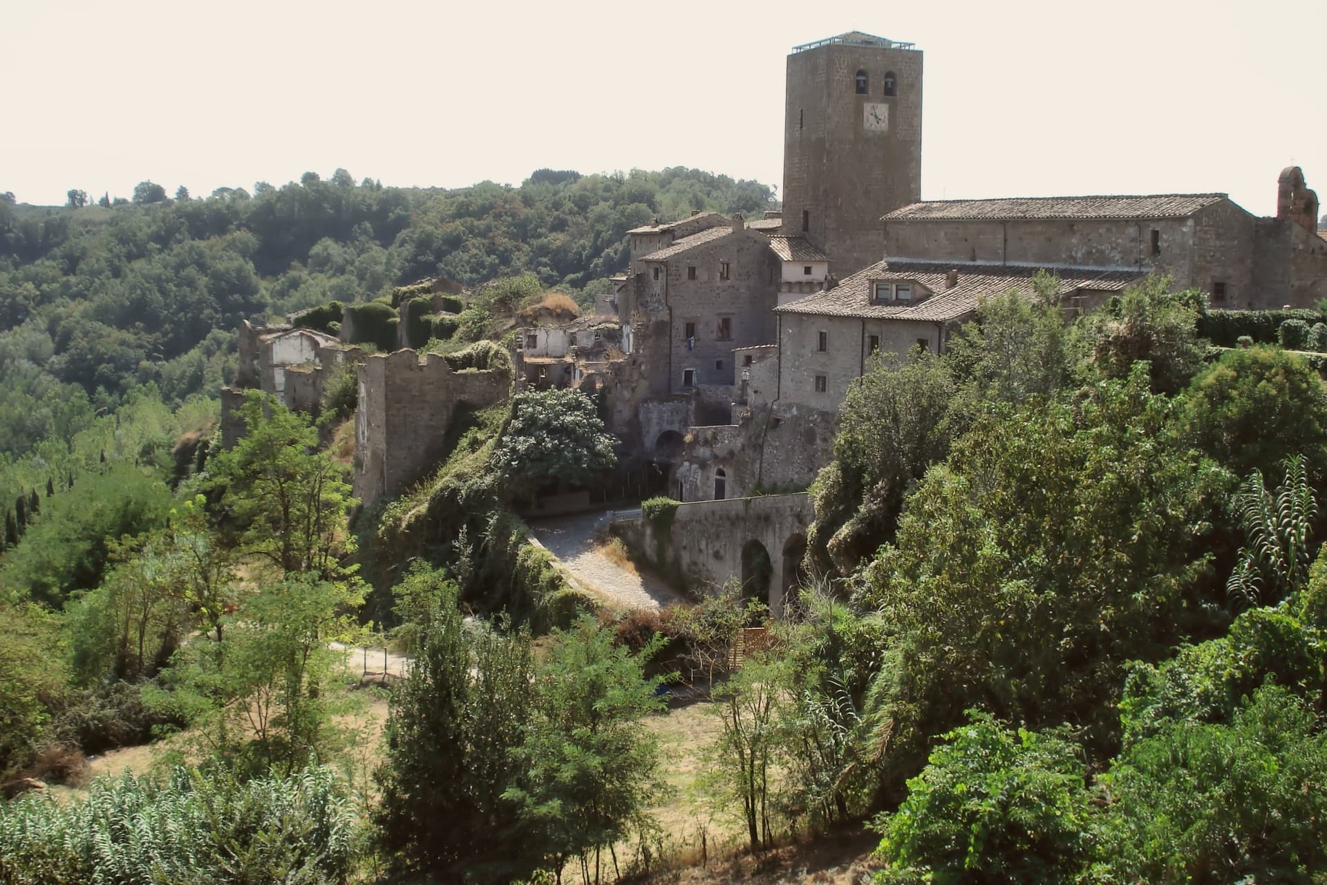
Bassano in Teverina sits at 304 meters on a tufa spur on the eastern offshoots of the Cimini hills, where Lazio meets Umbria above the Tiber valley. It is the smallest commune in the Tuscia Viterbese: 1,260 residents on a hill above the river.
The town is built around the Torre dell'Orologio, a twenty-five-meter peperino tower with a hand-painted majolica clock from around 1700 on its face. Inside it, walled into the structure, stands the Romanesque bell tower of the older church of the Madonna dei Lumi, built around 1100 and embedded within the new tower between 1559 and 1571 by the Madruzzo family.
The inner bell tower is one of the rare Italian campanili animati, with anthropomorphic figures carved into its peperino columns. The Madonna della Quercia chapel, built 1674-1678, stands around the oak where a tile of the Madonna and Child was found.
Bassano is a Borgo più Bello and a Città della Nocciola of the Tonda Gentile Romana DOP.
Olivo Ristorante dell'Olivo Country Club have been named by a guide.
What to see in Bassano in Teverina
- Torre dell'Orologio. Twenty-five-meter peperino tower of around 1500 with majolica clock face from 1700, built around an older Romanesque bell tower by the Madruzzo family.
- Campanile Animato (Madonna dei Lumi). Eleventh-century Romanesque bell tower walled inside the Torre dell'Orologio, with anthropomorphic figures carved into its peperino columns.
- Santuario della Madonna della Quercia. Built 1674-1678 around the oak where a tile of the Madonna and Child was found, on the road below the centro storico.
How to get to Bassano in Teverina
Terni is roughly 36 minutes away by road.
Our tip
April through June and September through October are the months for Bassano. Hazelnut groves leaf out in late April, harvest comes in late August into September, and the Tiber valley clears of haze in autumn. July and August touch the mid-thirties; the small centro storico empties in the afternoon heat.
Nocera Umbra
Why visit Nocera Umbra
Nocera Umbra sits fifteen kilometers north of Foligno. The Romans called it Nuceria; the town has held its own bishopric since the early Middle Ages and was contested between Perugia, Spoleto and the Trinci of Foligno through the medieval period, a tug of war between larger powers that left it walled and defensible on its slope rather than absorbed by any one of them.
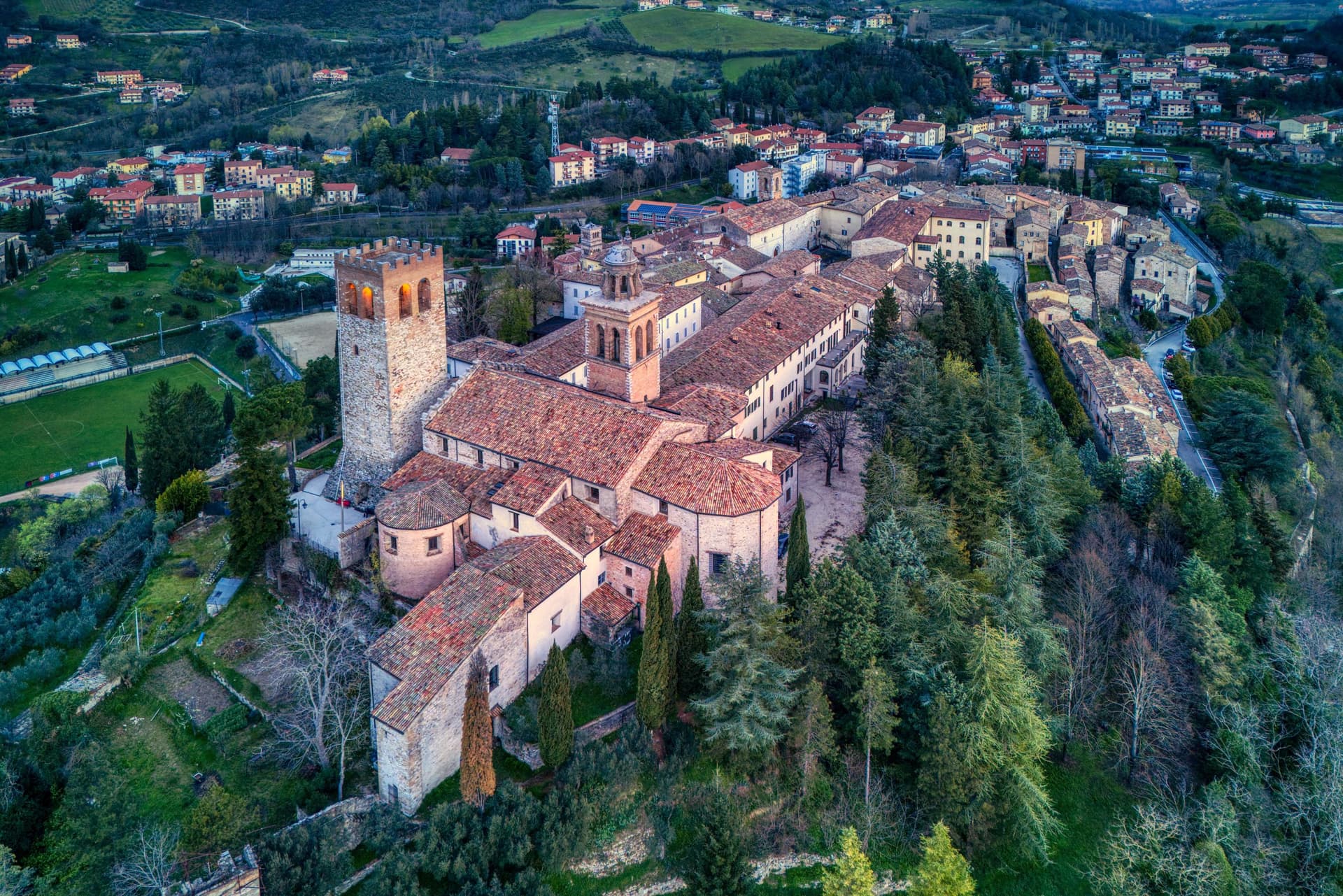
The centro storico climbs to a summit where the tower, the cathedral and the former Rocca stand together, the civic and the religious and the military crowded onto the same high ground. Below, five kilometers down from that core, the springs form a separate pole of the town's life, functional rather than defensive, drawing visitors for water rather than for stone.
The Bandiera Arancione recognition was reconfirmed after reconstruction, a marker that the rebuilding did not just replace what fell but held the town to the standard it met before the quake.
What to see in Nocera Umbra
- Campanaccio (Torre Civica). Eleventh-century square tower at the highest point of the borgo. Only part of one side remained standing after 1997; the rest is reconstruction, stone matched to stone.
- Pinacoteca e Museo Civico. Civic gallery in the deconsecrated Chiesa di San Francesco with works by Niccolò Alunno, Matteo da Gualdo, and the school of Cimabue.
- Cattedrale di Santa Maria Assunta. Cathedral at the summit of the centro storico, partially damaged and restored, set beside the tower and the former Rocca.
How to get to Nocera Umbra
There is a railway station in the town, so you can arrive without a car and never need one while you are here. Perugia is roughly 57 minutes away by road.
Our tip
April through June and September into October are the months locals prefer. The slopes around the centro storico hold light well into the evening and the Bagni di Nocera springs are at their easiest to walk. July and August push temperatures into the low thirties, manageable at this elevation; the Pinacoteca and the cathedral stay cool through the afternoon. Palio dei Quartieri falls in August.
Foligno
Why visit Foligno
Foligno sits on the left bank of the Topino where the river leaves the Apennines and meets the plain of the Clitunno, the point at which the mountains give way to the Umbrian Valley. The town was called Fulginium in antiquity, and Cicero mentions the prefecture in two surviving fragments.
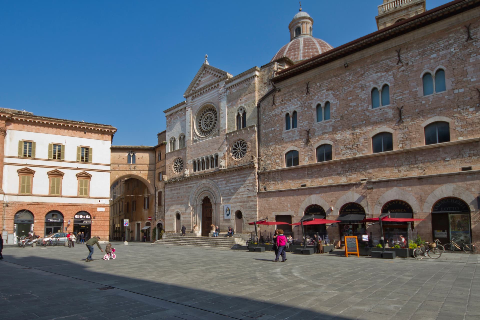
The Trinci ruled the town from 1305 to 1439, and the palace that carries their name still stands at its center, with the cathedral facing the same square where the town's tournament has run twice a year since its revival. The city's oldest church predates the Trinci period by centuries, its site going back to an 8th-century chapel, while the abbey in the hills above town was founded still earlier, in 1084, its cloister finished in 1229.
Between the ancient prefecture, the medieval abbey, the Trinci court, and the print workshop that put Dante into type, Foligno reads as a valley crossing point where successive centuries each left a building rather than displacing what came before.
Une, Osteria Bacerotti, Cucinaa and 2 more have been named by a guide.
What to see in Foligno
- Palazzo Trinci. Seat of the Trinci signoria 1305-1439, frescoed by Gentile da Fabriano and Jacopo Bellini, now holding the Pinacoteca and archaeological museum.
- Cattedrale di San Feliciano. Romanesque cathedral on Piazza della Repubblica, built over the tomb of the bishop-martyr buried here in 251 AD.
- Basilica di Santa Maria Infraportas. Oldest church in the city on the site of an 8th-century chapel, frescoes by Nelli, Ugolino di Gisberto, Alunno and Mezzastris.
How to get to Foligno
There is a railway station in the town, so you can arrive without a car and never need one while you are here. Perugia is roughly 42 minutes away by road.
Our tip
April through June and September into October are the months locals prefer. The Quintana runs twice a year, the June and September editions filling the rioni for a week each. April through October is also the season for the Topino river paths and the climb up to Sassovivo. Festevolezze falls in July.
More from Anywhere Italy
 The best towns known for what they grow within two hours of Ancona
 The best towns known for what they grow within 75 minutes of Rome
 The best mountain towns within 90 minutes of Perugia
- The 6 best hidden truffle towns in the province of Perugia
- The best hidden hill towns you can reach by train in the province of Perugia
- The best hidden towns on a walking route in the province of Perugia