The best towns you can reach by train within two hours of Cagliari
Southern Sardinia away from the water smells of myrtle and wood smoke, and the buildings are the colour of the ground they came from: granite in the Sarcidano, pale limestone in the Barbagia foothills, brick and trachyte around Oristano. Spring is the best of it, when the pastures are green and the almond blossom is over but the heat has not arrived, and again in October for the grape and olive harvest. The kitchen is shepherd food rather than fish: malloreddus with sausage and saffron, culurgiones sealed like a wheat ear, pecorino sardo, pane carasau brittle enough to hear. Trains and the narrow-gauge lines run inland from Cagliari through this country, so a station is often the simplest way in.
Most people arriving at Cagliari airport turn straight for the Costa Smeralda or the beaches around Villasimius and Chia, and in July and August the coast road carries the traffic to prove it. It is understandable. The water is extraordinary, the sand is white, and the resorts have spent decades making themselves easy. What that means in practice is that the whole island's reputation now rests on a strip of shoreline, and the interior is treated as the drive between one beach and another.
The same limestone, the same shepherd cooking and the same saffron fields continue well past the coastal resorts, and they are what the inland towns are made of. These are smaller places where fewer people go, and each one has a station or a stop we have confirmed you can arrive at without a car: waterfalls and karst springs in one, a Bronze Age palace in another, a canyon wall that climbers come for, a mining town of Pisan gates and lamp-black terraces. Two hours of railway out of Cagliari covers most of it.
Of the 13 communes we have mapped in a 120-minute drive of Cagliari, 6 qualify as towns you can reach by train: we confirmed a station you can arrive at. The smallest, Sadali, has 837 residents.
If you are still choosing, we have also written The best hidden towns you can reach by train in Sardegna and The best hill towns within two hours of Cagliari.
Sadali
Why visit Sadali
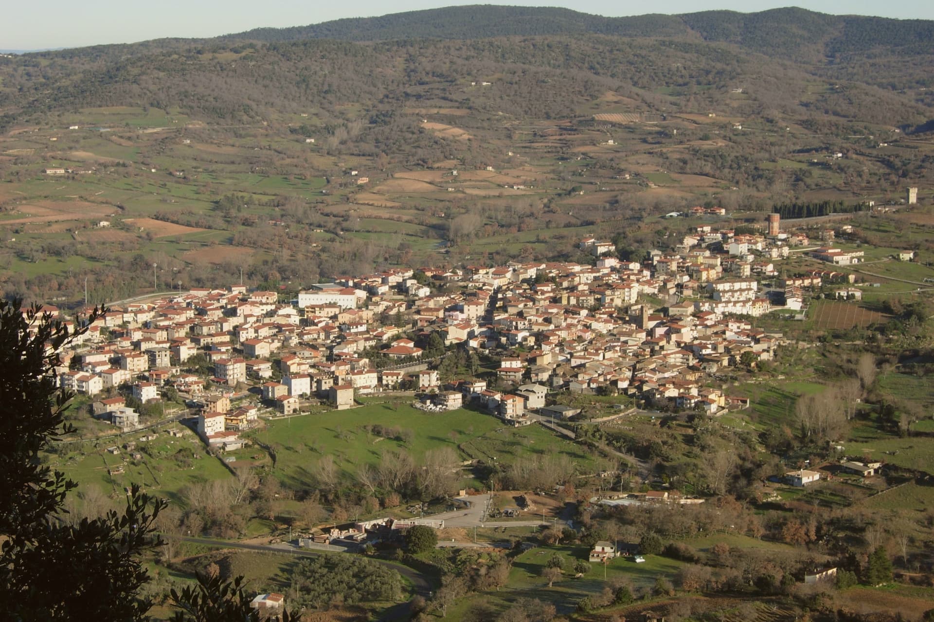
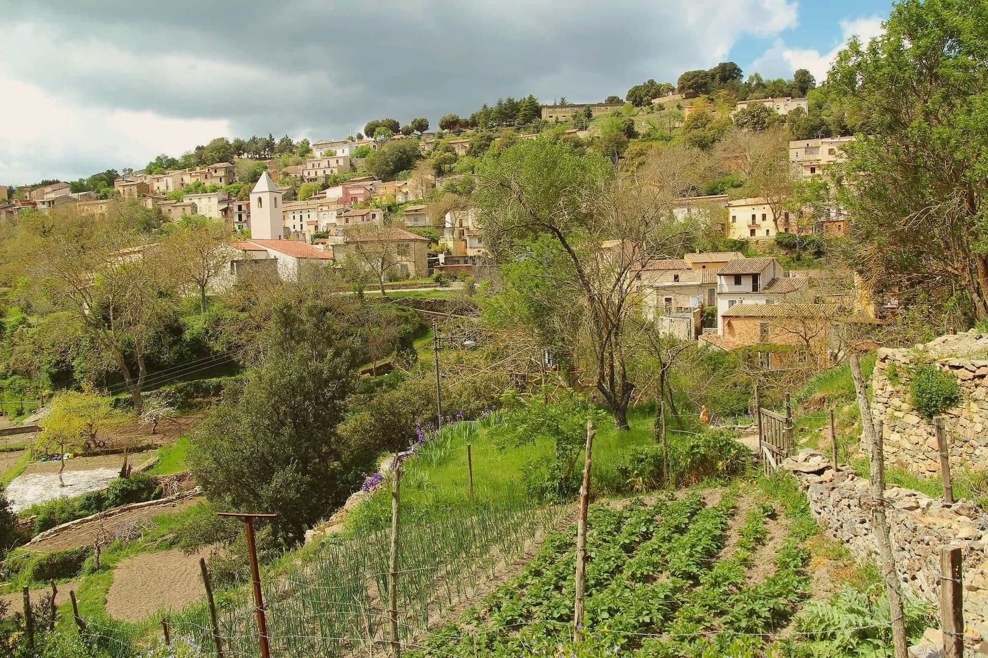
Sadali sits at 750 meters on a karst plateau in the Barbagia di Seulo, an hour and a half by road from Cagliari and far from any coast. The village grew before 1335 around the parish church of San Valentino, and the limestone underneath it does the unusual work that makes the place memorable.
Underground rivers surface as springs inside the village, and one of them, Funtana Manna, drops about seven meters in a cascade beside the church. Sadali is the only Sardinian commune with a waterfall in its centro abitato.
The same karst feeds the Is Janas caves on the edge of town, 300 meters of stalactites and columns open to visitors. Stone houses, narrow lanes, water running audibly through the streets after rain.
The population is under 900 and falling. The Borgo dei Borghi finalist status in 2026 brought the first sustained wave of visitors the village has seen.
We confirmed you can reach this one by train.
What to see in Sadali
- Cascata di San Valentino. Seven-meter waterfall fed by Funtana Manna spring, dropping inside the inhabited centre, the only one of its kind in Sardegna.
- Chiesa di San Valentino. Ancient parish church beside the waterfall, the only Sardinian sanctuary dedicated to Saint Valentine, around which the village formed before 1335.
- Grotte Is Janas. Karst cave system 300 meters long with six rooms of stalactites, stalagmites and ochre flows, joined into columns at the centre.
How to get to Sadali
There is a railway station in the town, so you can arrive without a car and never need one while you are here. Cagliari is roughly 91 minutes away by road.
Our tip
May through October is the workable window in Sadali. The plateau holds at 750 meters, so summer heat stays below the inland average and the springs run cold even in August. June and September are the easiest months: the waterfall is full, the cave temperature stays at 16 degrees, and the village is open. Sagra de is culurgionis falls in August.
Barumini
Why visit Barumini
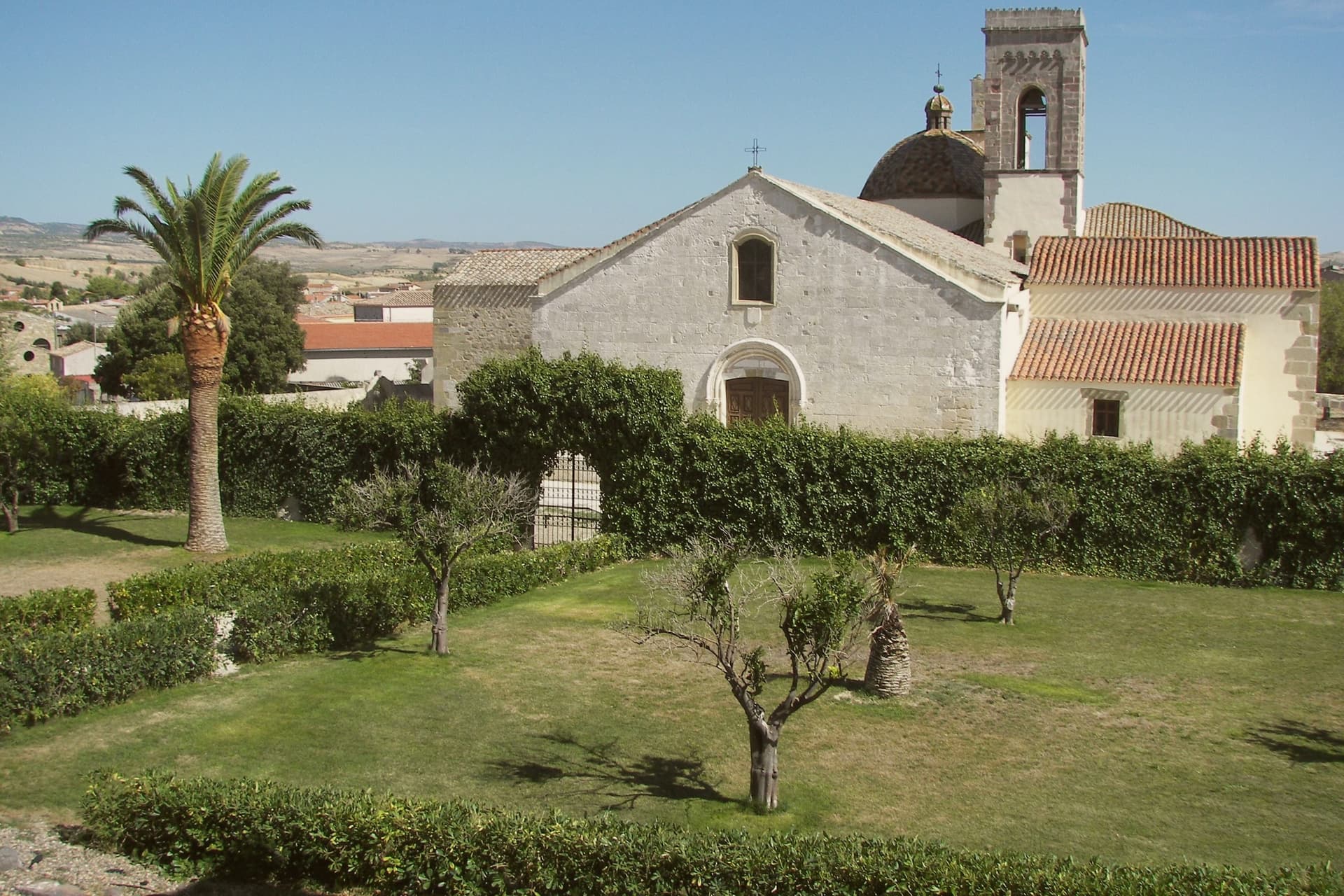
Barumini sits at 202 meters in the Marmilla, 55 kilometers north of Cagliari, on the plain at the foot of the Giara di Gesturi. About 1,150 people live here.
The village would be a small inland farming town except for what sits half a kilometer outside it: a complex of huts grew around a citadel between roughly 1500 and 100 BC, and the surrounding well and towers are the most complete and most studied of their kind on the island, with no parallel elsewhere. UNESCO inscribed the site in 1997, the first Sardinian entry on the World Heritage list.
The plateau rises above the plain on the other side of the village, basalt ground where wild horses live free and seasonal ponds form after rain. The town itself sits between the two, the excavated citadel on one side and the plateau on the other, with the historic centre and its parish church holding the space in between.
What the visitor finds at Barumini, then, is a small farming village whose ordinary footprint is bracketed by two much older and wilder things, one built up over centuries of the Bronze Age and long buried, the other still grazing above it.
We confirmed you can reach this one by train.
What to see in Barumini
- Su Nuraxi di Barumini. 18-meter central tower with four bastions and a surrounding village of huts, set half a kilometer outside the town on the open plain.
- Casa Zapata. Spanish-era noble residence built over a second nuraghe, the underlying tower visible under glass floors of the museum.
- Giara di Gesturi. Basalt plateau above the village at 500-600 meters, home to wild horses and seasonal paulis ponds.
How to get to Barumini
There is a railway station in the town, so you can arrive without a car and never need one while you are here. Cagliari is roughly 69 minutes away by road.
Our tip
April through June and September through November are the easiest months at Su Nuraxi. Spring brings green Marmilla wheat fields and wild flowers on the Giara above. October sees the harvest and the autumn migrations through the basalt ponds.
Ulassai
Why visit Ulassai
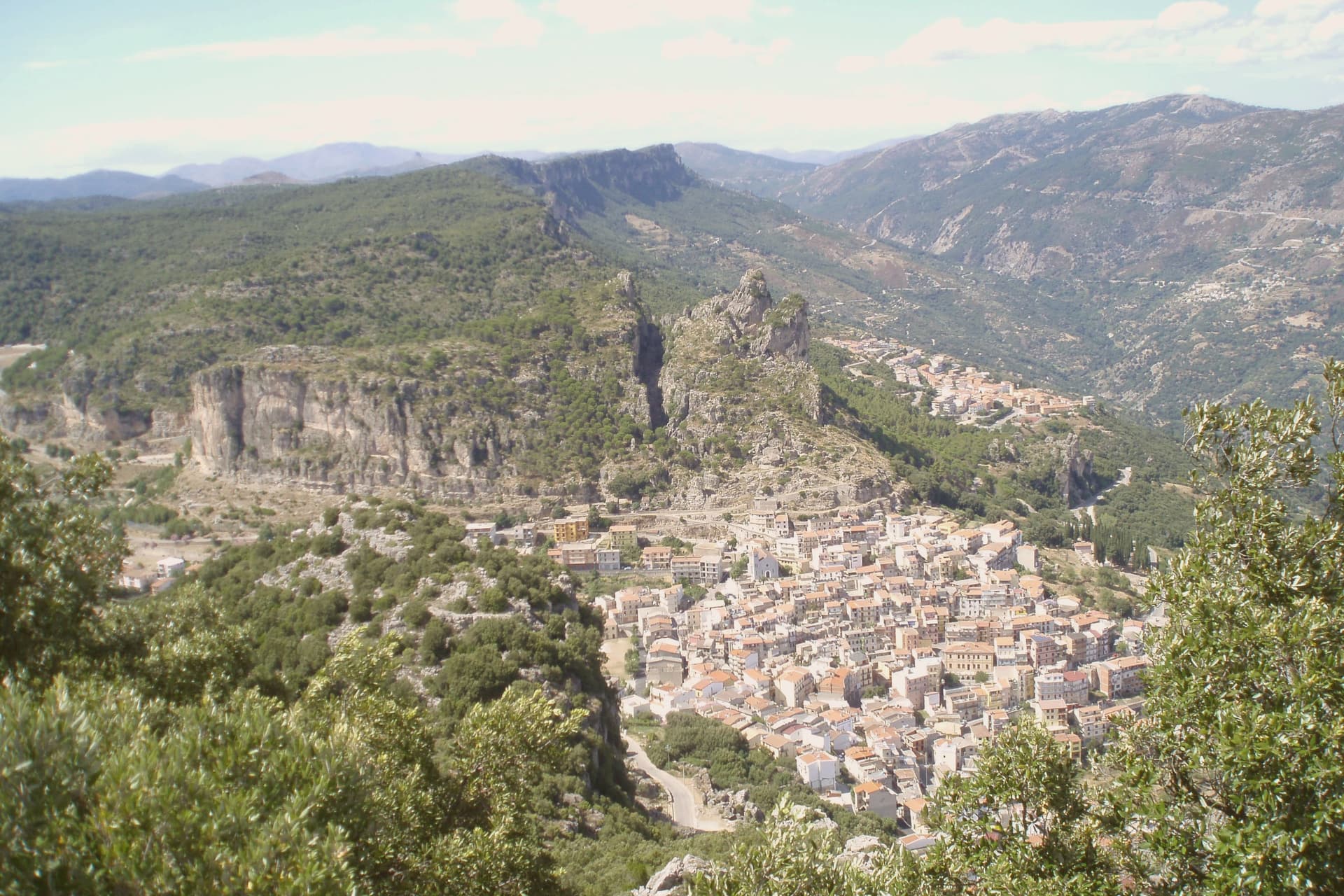
Ulassai sits on a ledge beneath the Tacchi d'Ogliastra, the limestone buttes that rise like broken teeth above the inland Ogliastra. Su Marmuri opens in the rock outside the village, and the Lequarci waterfalls drop off the Tacchi when winter rains fill them, dry again by summer.
The village itself is compact, its upper quarter built around the parish church, its lower streets running toward the old railway line that once connected Ogliastra to the coast and now ends at the station turned museum. Population has been declining here for decades, a pattern common across the inland villages of the subregion.
What keeps Ulassai distinct is the work Maria Lai made of it: a village small enough that one artist's ribbon could reach every house and still climb the mountain above it.
We confirmed you can reach this one by train.
What to see in Ulassai
- Stazione dell'Arte. Former railway station converted in 2006 into a museum holding 140 works by Maria Lai, housed in the platform building where trains once ran.
- Grotta di Su Marmuri. A single chamber deep enough to swallow the light within a few steps of the entrance, reached by guided tour into the limestone.
- Cascate Lequarci. A 100-meter waterfall on the Tacchi cliffs above the village, active after winter rains and usually dry by midsummer.
How to get to Ulassai
There is a railway station in the town, so you can arrive without a car and never need one while you are here. Cagliari is roughly 106 minutes away by road.
Our tip
April through June is the green window: the Lequarci waterfall runs, the Tacchi turn pale gold at sunset, and the trails are walkable without heat. September through November is the second window, drier and quieter, with cooler nights at 775 meters. Summer pushes thirty degrees on the lower slopes; the village stays cooler than the coast but the waterfall dries up by July.
Orroli
Why visit Orroli
Orroli sits at 550 meters on the Pranemuru, a basalt plateau in the central-southern interior of Sardinia, fifty kilometers north of Cagliari. The village exists because of the plateau.
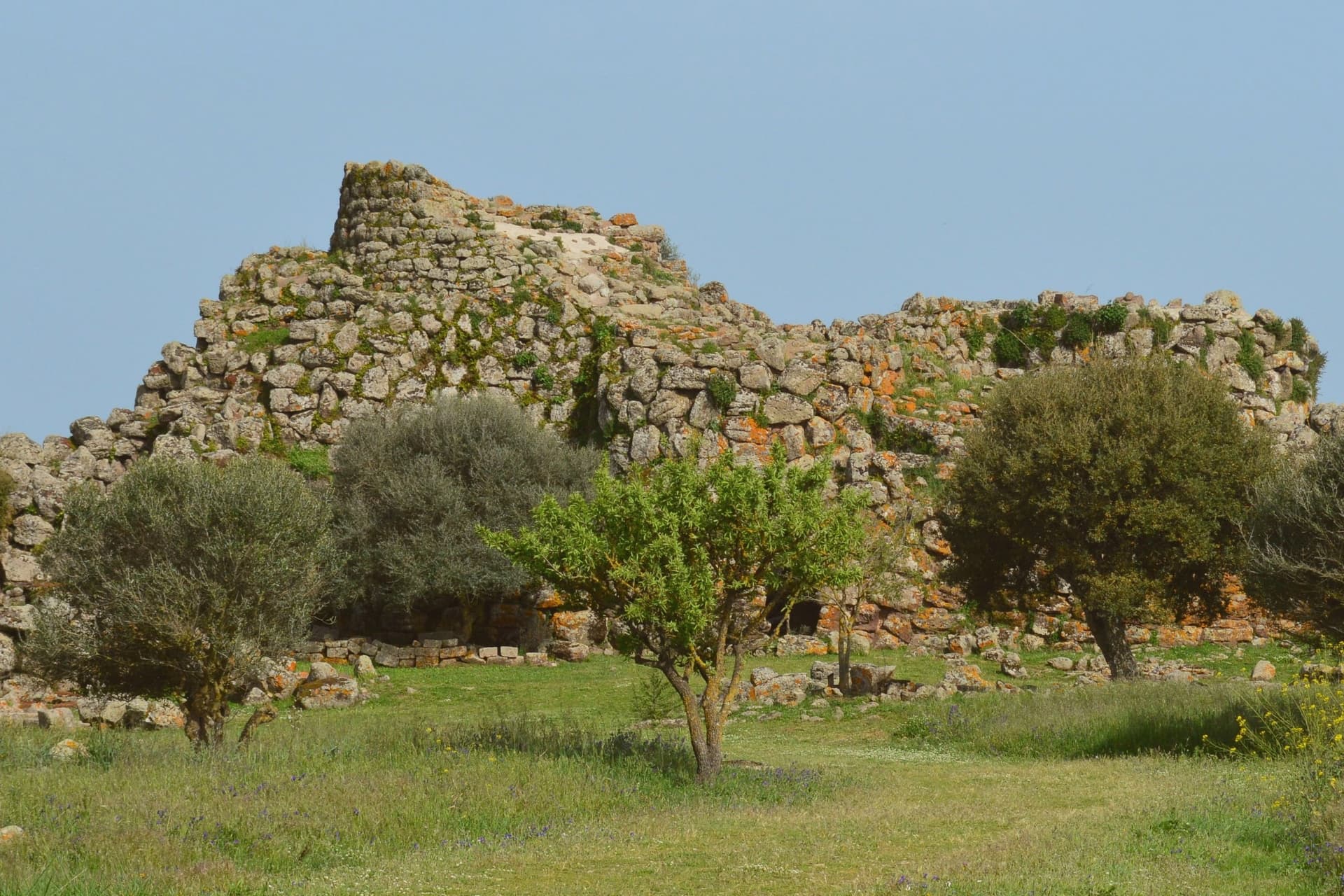
The dark basalt yielded the stone for the Nuraghe Arrubiu, the largest megalithic complex on the island and one of the most ambitious Bronze Age structures in western Europe: a central keep that originally reached thirty meters in height, surrounded by a bastion of five towers, in turn enclosed by a defensive wall with seven more towers connected by curtain walls. Twenty-one towers in total, on a footprint of five thousand square meters.
The complex was built between the fourteenth and twelfth centuries BC, occupied for five hundred years, and produced Mycenaean ceramics that confirm contacts with the eastern Mediterranean. The name Arrubiu, red, is from the lichens that color the basalt walls in summer.
The village itself, with its parish church and small piazze, sits a few kilometers from the site.
We confirmed you can reach this one by train.
What to see in Orroli
- Nuraghe Arrubiu. Bronze Age complex of 21 towers on the Pranemuru plateau, the only five-tower nuraghe and the largest megalithic structure in Sardinia.
- Chiesa parrocchiale di San Nicola. Parish church of the village, named for the patron saint of the Sarcidano, the religious center of the small centro storico.
- Lago Mulargia. Artificial basin south of the village, fed by the Flumendosa river, used for irrigation across the southern interior.
How to get to Orroli
There is a railway station in the town, so you can arrive without a car and never need one while you are here. Cagliari is roughly 103 minutes away by road.
Our tip
April through June is the best window on the Pranemuru. The plateau still holds spring water, the basalt walls of the Arrubiu sit warm in long evening light, and visitor numbers are manageable. September through November brings the second window, with cooler mornings and the basalt taking on the red of the lichens that gave the nuraghe its name.
Iglesias
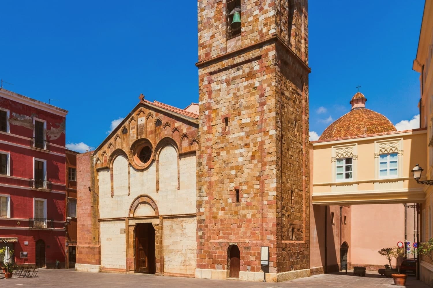
Why visit Iglesias
The Sulcis-Iglesiente district spreads across 1,200 km² of lead, zinc, silver and coal sites, worked continuously from Phoenician and Roman times through the 1990s, and the town is its historic capital. Iglesias sits at the confluence of two valleys at the centre of that district, at 200m altitude, 60 km west of Cagliari, with 25,000 residents.
It began as Villa di Chiesa in the 1240s, founded by Pisans extending their commercial reach into the Sardinian metal trade, then passed to the Aragonese in 1324, who rebuilt it inside the existing Pisan walls as Iglesias, laying out the only fully Aragonese-Gothic urban plan in Sardinia. The centro storico carries that layered history in stone.
The medieval walls still stand with four of their original seven gates, the castle anchors the high end of town, and the cathedral, Pisan-Romanesque at its founding and reworked by the Aragonese behind a Catalan-Gothic facade, serves the historic Sulcis diocese. Piazza La Marmora and the Pisan-era Palazzo Pubblico sit within the same walled core, and the dense grid of vicoli still shows the Catalan-style 'finestre crociate', the double windows that mark the older palazzi from the Aragonese phase.
Outside the walls, the mining landscape unfolds across the wider district: the Monteponi complex to the west, with its 1865 Palazzo della Direzione and the tunnel running out to the seacliff at Nebida, and Masua on the coast, where ore was loaded through a cliff-cut underground port and the Pan di Zucchero sea stack rises offshore, among several other sites. The Parco Geominerario had the whole district inscribed on the UNESCO Global Geoparks Network in 2007.
Holy Week supplies the town's other fixed point on the calendar, a five-day processional cycle staged by a confraternity dating to the 16th-century Aragonese period, counted among the most distinctive in Italy. Food in the town runs to pane carasau, malloreddus alla campidanese and porceddu, roast suckling pig, alongside the local Carignano del Sulcis red and the coastal Vermentino whites.
What the town adds up to is a single Pisan-Aragonese plan wrapped around a district built entirely on extraction: the walls, the castle and the cathedral facade record who ruled the town, while the mines and the coast beyond them record what the town was actually for.
We confirmed you can reach this one by train.
What to see in Iglesias
- Castello di Salvaterra + centro storico. The castle sits at the high end of town, its walls still framed by four standing gates of the original seven. Below it, the vicoli grid still shows Catalan-style 'finestre crociate' on the older palazzi, the double windows that mark the Aragonese rebuilding.
- Cattedrale di Santa Chiara d'Assisi. The cathedral of the historic Sulcis diocese stands on the site founded in 1284, its Pisan-Romanesque core reworked in the 14th century behind a full Catalan-Gothic facade.
- Monteponi + Galleria Henry mining complex. 3 km west of town, the 1865 Palazzo della Direzione presides over the site, and the 1 km Galleria Henry tunnel can be walked out to the cliff at Nebida. Guided tours run through the complex.
How to get to Iglesias
There is a railway station in the town, so you can arrive without a car and never need one while you are here. Cagliari is roughly 62 minutes away by road.
Our tip
Iglesias is best March–June and September–October — the Sulcis is hot and dry in July–August (frequent 35°C+ in the interior, though the coast at Masua/Nebida stays cooler). Settimana Santa (Easter, March–April) is the year's headline event and fills the centro for 5 days. October is harvest in the Carignano del Sulcis vineyards.
Oristano
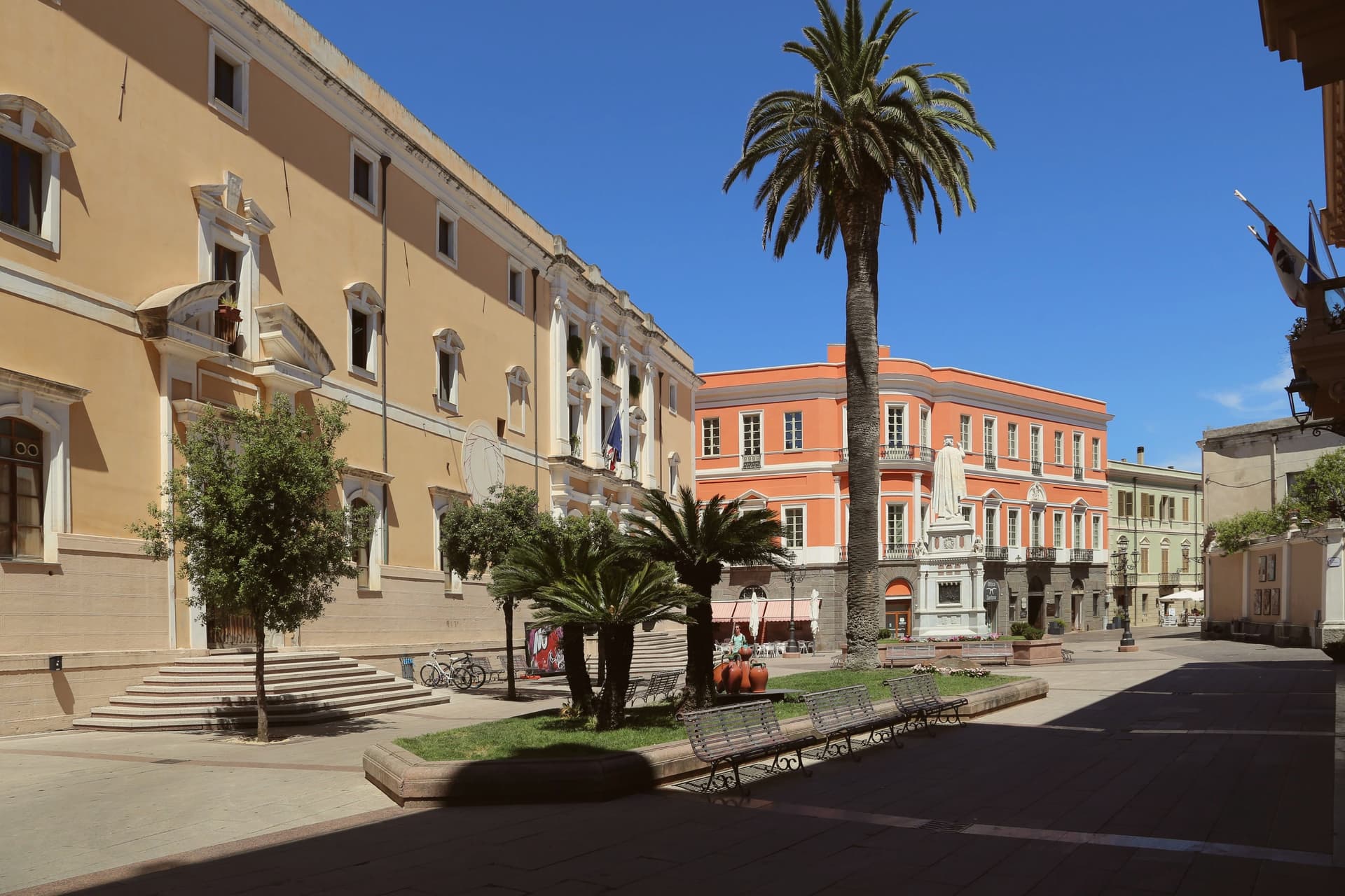
Why visit Oristano
Oristano sits at the mouth of the Tirso river on the Campidano plain, five metres above sea level, looking onto the gulf that carries its name. The city replaced the ancient Phoenician-Roman port of Tharros and became the capital of the Giudicato di Arborea in 1076, the central-western Sardinian state that survived from 900 to 1420.
Eleonora d'Arborea governed as regent from 1383 to 1403 and issued the Carta de Logu, one of the most advanced medieval law codes in Europe, in force on the island for four centuries. Each Carnival the city stages Sa Sartiglia, an equestrian joust at the ring whose lead rider, Su Componidori, is dressed and unmasked according to a fixed sixteenth-century ritual.
The Torre di Mariano II and the Antica Cattedrale di Santa Maria Assunta mark the medieval centre. The coast at Torregrande, six kilometres west, carries the Bandiera Blu rating.
We confirmed you can reach this one by train.
What to see in Oristano
- Torre di Mariano II (Torre di San Cristoforo). Late thirteenth-century medieval tower built by Mariano II d'Arborea on Piazza Roma, one of the surviving fragments of the old city walls.
- Cattedrale di Santa Maria Assunta. Medieval cathedral on Piazza Duomo, rebuilt in the eighteenth century, with the octagonal bell tower retaining its earlier majolica-tiled cap.
- Antiquarium Arborense. Civic museum with the most important collection of Punic-Roman finds from Tharros and medieval material from the Giudicato of Arborea.
How to get to Oristano
There is a railway station in the town, so you can arrive without a car and never need one while you are here. Cagliari is roughly 81 minutes away by road.
Our tip
May through October is the working season on the Campidano coast: warm dry days, Torregrande open, the wetlands of the Sinis full of flamingos. July and August touch thirty-five degrees on the plain and the centre empties between two and five each afternoon. April and the second half of October hold the gold light and the dry warmth that suits Tharros and the cathedral walks. La Sartiglia falls in February.