
Sardinia · Sud Sardegna
Iglesias
Sardinia's medieval mining capital: a 25,000-resident Pisan-Aragonese walled town in the Sulcis-Iglesiente metalliferous district, with an intact Gothic centro storico and UNESCO-recognised mining heritage at Monteponi just outside town.
- Best time
- Mar–Jun, Sep–Oct
- By car
- 1 h from Cagliari
- By train
- Station in the comune
- Population
- 25,093
Known for
SARDINIA'S MINING CAPITAL
Historic centre of the Sulcis-Iglesiente, Phoenician/Roman/medieval/industrial-era mining across 1,200 km². Parco Geominerario UNESCO Global Geopark since 2007.
ARAGONESE-GOTHIC PLAN
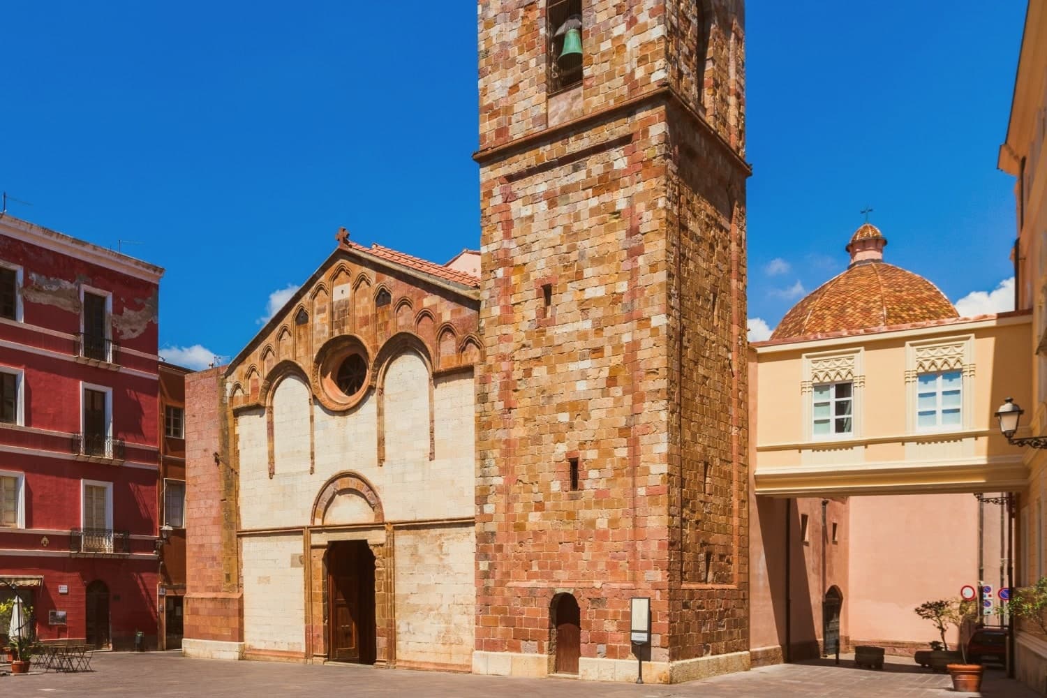
The only fully Aragonese-Gothic urban plan in Sardinia. Pisan walls, a Catalan-Gothic cathedral facade, and 'finestre crociate' on palazzi.
PORTO FLAVIA + PAN DI ZUCCHERO
Underground cliff loading port (1924) plus the iconic offshore sea stack. The whole Masua coastline is industrial-archaeology meeting dramatic Sardinian shoreline.
SPANISH-INFLUENCED HOLY WEEK
5-day processional cycle by the 16th-c Arciconfraternita del Santo Monte, Settimana Santa among the most distinctive in Italy.
When to visit
Best · Mar–Jun, Sep–Oct
- J13°
- F15°
- M16°
- A19°
- M23°
- J29°
- J33°
- A33°
- S28°
- O24°
- N18°
- D15°
- Best
- Hot or crowded
- Quiet
- Mostly closed
Daytime averages, 2020–2024. Weather data by Open-Meteo.com.
Why come
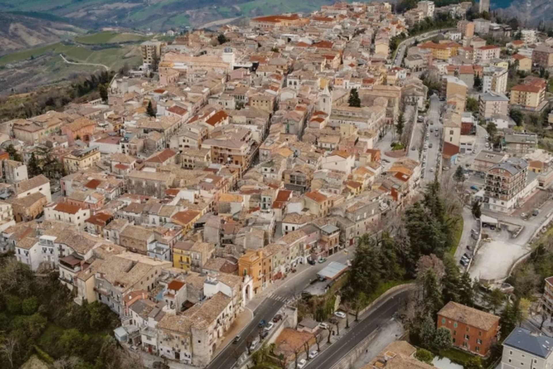
The Sulcis-Iglesiente district spreads across 1,200 km² of lead, zinc, silver and coal sites, worked continuously from Phoenician and Roman times through the 1990s, and the town is its historic capital. Iglesias sits at the confluence of two valleys at the centre of that district altitude, 60 km west of Cagliari, with 25,000 residents. It began as Villa di Chiesa in the 1240s, founded by Pisans extending their commercial reach into the Sardinian metal trade, then passed to the Aragonese in 1324, who rebuilt it inside the existing Pisan walls as Iglesias, laying out the only fully Aragonese-Gothic urban plan in Sardinia.
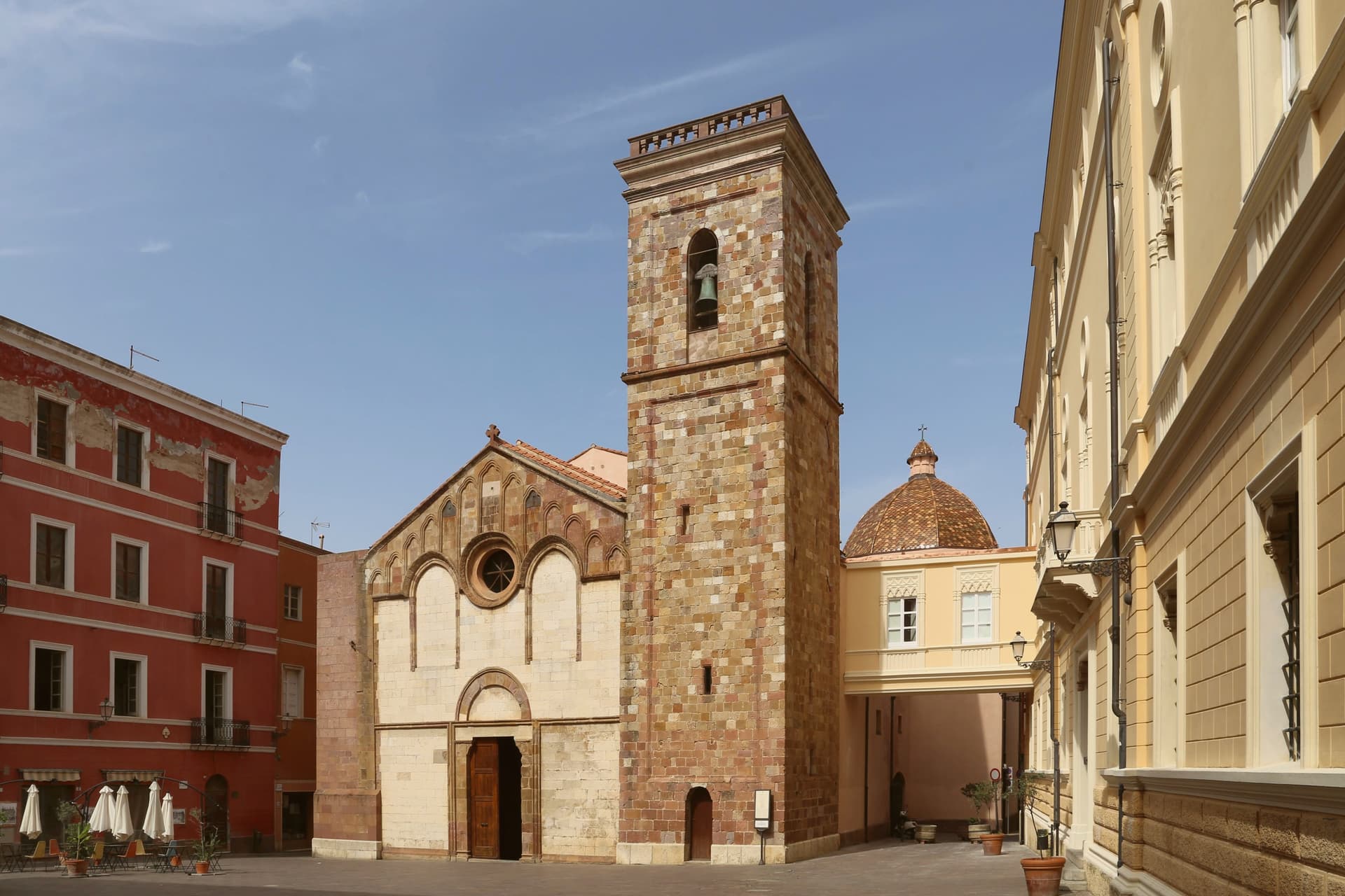
The centro storico carries that layered history in stone. The medieval walls still stand with four of their original seven gates, the castle anchors the high end of town, and the cathedral, Pisan-Romanesque at its founding and reworked by the Aragonese behind a Catalan-Gothic facade, serves the historic Sulcis diocese. Piazza La Marmora and the Pisan-era Palazzo Pubblico sit within the same walled core, and the dense grid of vicoli still shows the Catalan-style 'finestre crociate', the double windows that mark the older palazzi from the Aragonese phase.
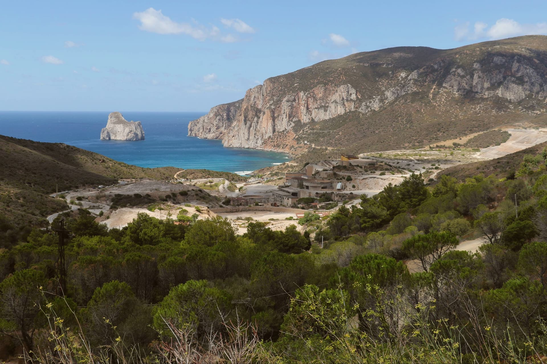
Outside the walls, the mining landscape unfolds across the wider district: the Monteponi complex to the west, with its 1865 Palazzo della Direzione and the tunnel running out to the seacliff at Nebida, and Masua on the coast, where ore was loaded through a cliff-cut underground port and the Pan di Zucchero sea stack rises offshore, among several other sites. The Parco Geominerario had the whole district inscribed on the UNESCO Global Geoparks Network in 2007. Holy Week supplies the town's other fixed point on the calendar, a five-day processional cycle staged by a confraternity dating to the 16th-century Aragonese period, counted among the most distinctive in Italy.
Food in the town runs to pane carasau, malloreddus alla campidanese and porceddu, roast suckling pig, alongside the local Carignano del Sulcis red and the coastal Vermentino whites. What the town adds up to is a single Pisan-Aragonese plan wrapped around a district built entirely on extraction: the walls, the castle and the cathedral facade record who ruled the town, while the mines and the coast beyond them record what the town was actually for.
The Sunday letter
Iglesias is on our list. Its letter is still to come.
We are writing about all 1,000 of these towns, one at a time, in a free letter every Sunday: the photo, the food, the festa. That is our mission. Sign up and you will be there when Iglesias comes up. By Peter & Sophia, from Pietrasanta.
How to get there
From Cagliari (CAG), about 1h 11m by car.
There is a railway station in the comune, so you can arrive without a car.
Coming by train into Cagliari? Iglesias is about 59 minutes away by road.
What to see
Castello di Salvaterra + centro storico
The castle sits at the high end of town, its walls still framed by four standing gates of the original seven. Below it, the vicoli grid still shows Catalan-style 'finestre crociate' on the older palazzi, the double windows that mark the Aragonese rebuilding.
Cattedrale di Santa Chiara d'Assisi
The cathedral of the historic Sulcis diocese stands on the site founded in 1284, its Pisan-Romanesque core reworked in the 14th century behind a full Catalan-Gothic facade.
Monteponi + Galleria Henry mining complex
3 km west of town, the 1865 Palazzo della Direzione presides over the site, and the 1 km Galleria Henry tunnel can be walked out to the cliff at Nebida. Guided tours run through the complex.
Porto Flavia + Pan di Zucchero (Masua)
Ore was loaded directly onto vessels below through this port, carved into the cliff face in 1924, and the tunnels are open on guided tours. Offshore, the Pan di Zucchero sea stack rises as Sardinia's best-known geological landmark.
Settimana Santa processions
The Discesa, the Processione dei Misteri and Lu Scravamentu make up the five-day cycle, staged since the 16th-c Aragonese period and counted among the most distinctive Holy Week traditions in Italy.
The slow-trip planner
Building a trip? Find where Iglesias fits in a slow Italy circuit.
Answer five questions. We will shape a geographically coherent slow trip from the 1,000 Italian towns most travelers skip. Yours to save and share.
Living here
- Population 25,093
- A local hubi
- Pharmacy in town
- High school within a 30-minute drive
- Train station in the comune
- Nearest airport Cagliari, 1 h 11 min drive
- Regional capital Cagliari, 1 h 2 min drive
Common questions
- What is Iglesias known for?
- Sardinia's medieval mining capital: a 25,000-resident Pisan-Aragonese walled town in the Sulcis-Iglesiente metalliferous district, with an intact Gothic centro storico and UNESCO-recognised mining heritage at Monteponi just outside town.
- Where is Iglesias?
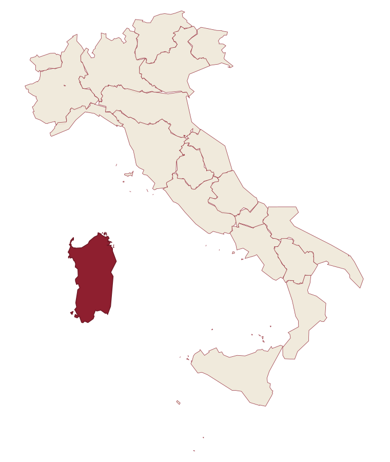
- Iglesias is a comune in the province of Sud Sardegna, in Sardinia, at 200 meters above sea level.
- What is the nearest airport to Iglesias?
- Cagliari (CAG), about 1h 11m by car.
- Can you get to Iglesias without a car?
- Yes. There is a railway station in the comune, so you can arrive by train.
- When is the best time to visit Iglesias?
- Best in Mar–Jun, Sep–Oct. July is the warmest month, averaging 33 degrees, and November the wettest, with about 12 rain days.
- Which other towns are like Iglesias?
- Ivrea, Rovereto and Sondrio.
- How many people live in Iglesias?
- 25,093 at the 2023 count.
Tags & datadesignations · numbers · sources
The numbers
- Elevation: 200 m
- Population: 25,093
- Surface area: 208.23 km²
These figures were compiled from public directories: ISTAT, OpenStreetMap and Wikidata, and from the official listings of the guides named on this page. Town details change; verify with official sources before you travel.
Similar
Towns like Iglesias
Ivrea
Province: Torino
both over 10,000 people · both hill towns
Rovereto
Province: Trento
both over 10,000 people · both hill towns
Sondrio
Province: Sondrio
both over 10,000 people · both hill towns
Domodossola
Province: Verbano-Cusio-Ossola
both over 10,000 people · both hill towns
Feltre
Province: Belluno
both over 10,000 people · both hill towns
Orvieto
Province: Terni
both over 10,000 people · both hill towns