
The best towns with a World Heritage site within two hours of Parma
Parma sits at a useful crossroads. North lies the flat Po country, where towns are built of warm brick and poplar shade, and winter fog softens everything by four in the afternoon. West, past the Apennine passes, the Ligurian coast begins with terraced vines and painted houses stacked above deep water. Between the two you can eat culatello aged in damp cellars, tortelli d'erbetta in butter, sturgeon from the river and, on the coast, anchovies and trofie. Spring and early autumn are the kind seasons, with the plain green and the sea warm enough to swim.
The obvious move from Parma is Bologna, or a train onward to Florence and Venice, and the well-known coastal path of the Cinque Terre for a day at the sea. Those places are famous for good reason and priced accordingly. In high summer the Cinque Terre trails run to timetables, and the queues for Florence's museums are booked out weeks ahead. Most visitors to Emilia never leave that spine of big names.
The listed heritage does not stop where the crowds do. The same brick plain that produced Bologna also produced planned Renaissance towns, mosaic-lined basilicas, walled river ports and a company village built for silk workers; the same coast that produced the Cinque Terre continues around the headland into an older harbour. The towns here hold sites UNESCO has listed, and fewer people go to see them.
Of the 87 communes we have mapped in a 120-minute drive of Parma, 9 qualify as towns with a World Heritage site: each holds a site UNESCO has listed. The smallest, Portovenere, has 3,268 residents.
If you are still choosing, we have also written The best towns with a World Heritage site within 90 minutes of Brescia and The best towns with a World Heritage site within 90 minutes of Verona.
Sabbioneta
Why visit Sabbioneta
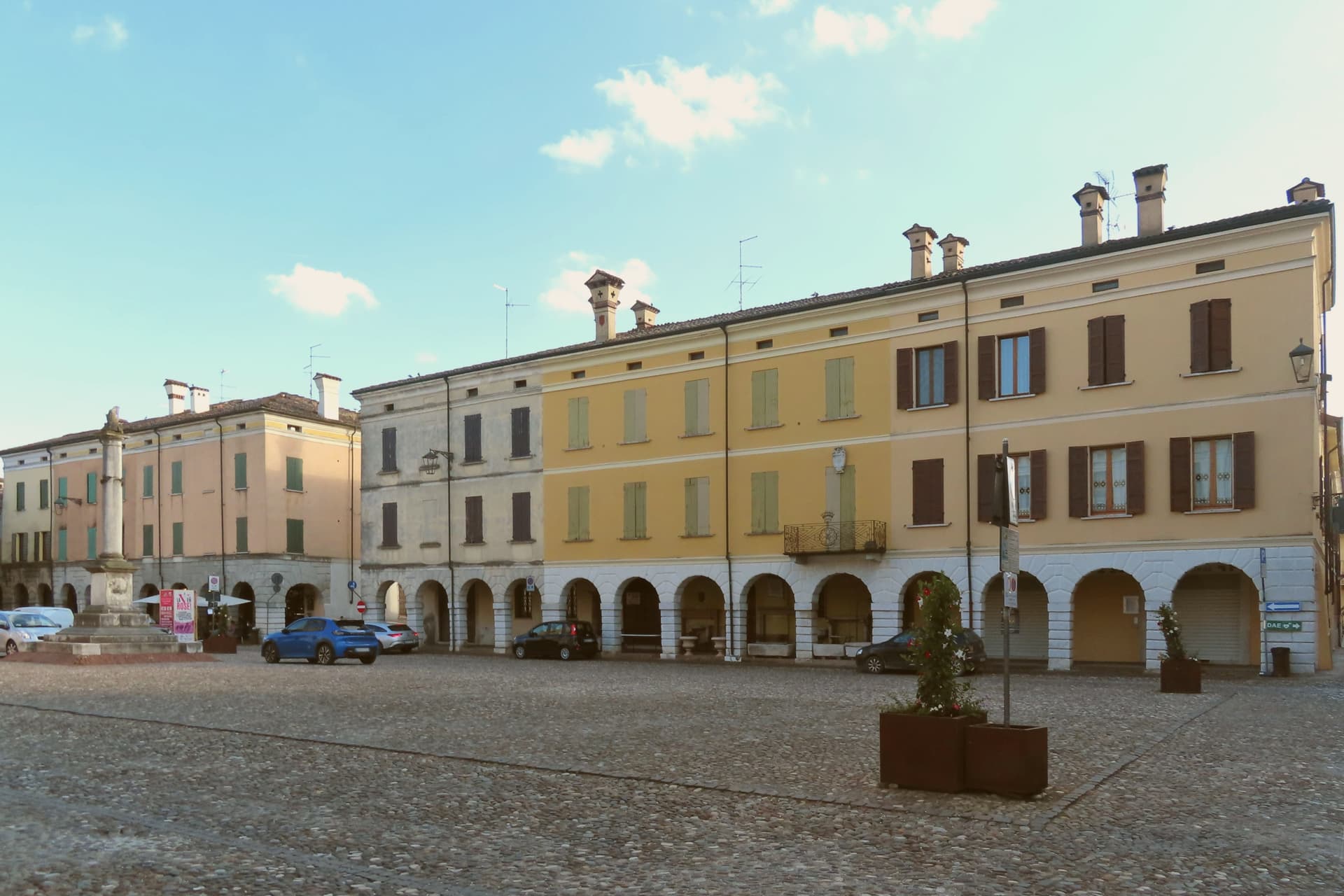
Sabbioneta sits at about 25 meters on a sandy bank of the Po, north of Parma and southwest of Mantova. Vespasiano I Gonzaga, a cadet of the Mantuan line, founded it in the late sixteenth century along the Roman Via Vitelliana as his personal fortress and ducal seat, built almost in one campaign between 1554 and 1591.
The town is organized around two main axes and two squares, with the star walls set at a fixed distance from that grid so the fortification and the street plan read as a single design rather than a wall added to an existing settlement. Vespasiano commissioned the theatre, the gallery, and the two palaces in sequence, each filling a distinct role in the ducal seat: a residence, a pleasure palace, a display case for his marbles, a place for performance.
The church holds his tomb, closing the set with a mausoleum built to the same scale as everything else he raised. What results is a town where every set piece was planned as part of one court rather than accumulated over generations, which is the quality that put it alongside Mantua as the planned counterpart to the organic city.
What to see in Sabbioneta
- Teatro all'Antica. Designed by Vincenzo Scamozzi with a raked wooden cavea and a painted false loggia opening onto a sky that never changes. It still stands as it was built for the Gonzaga court.
- Galleria degli Antichi. 97-meter arcaded gallery built to display Vespasiano's collection of ancient marbles, the longest such gallery of its period. The arcade runs in a single unbroken line, a corridor meant to be walked past statues rather than stood in.
- Palazzo Ducale. Vespasiano's main residence on Piazza Ducale, with frescoed rooms, wooden equestrian statues of the Gonzaga ancestors and gilded ceilings.
How to get to Sabbioneta
Parma is roughly 40 minutes away by road.
Our tip
April through June and September into October are the months Sabbioneta opens up. The Teatro all'Antica and the Galleria degli Antichi keep regular hours, the Po plain is green or gold depending on the half, and the bike path along the Oglio is rideable. July and August are humid and still: shade on the Piazza Ducale stays in short supply, and afternoons empty the centro storico.
Capriate San Gervasio
Why visit Capriate San Gervasio
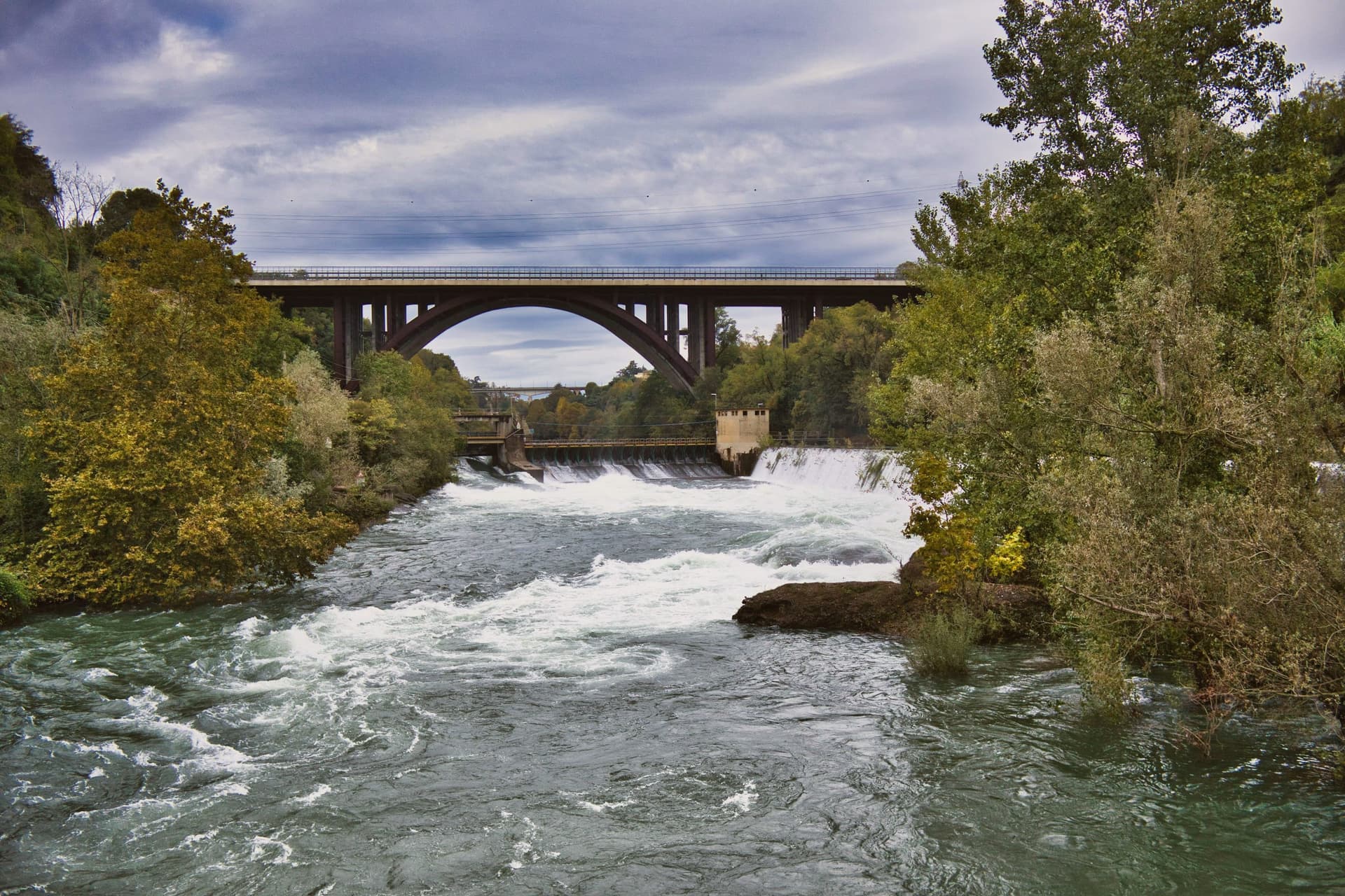
Capriate San Gervasio sits at the southern tip of the Isola Bergamasca, the wedge of plain between the Adda and Brembo, thirty kilometers northeast of Milano. The comune holds three historic settlements on three terraces: San Gervasio d'Adda to the north, Capriate d'Adda in the middle, and Crespi d'Adda at the southern point, where the two rivers nearly meet.
Crespi d'Adda was founded in the 1870s by the textile industrialist Cristoforo Benigno Crespi to house workers in his cotton mill, and completed by his son Silvio after study tours of German and English company towns. The plan is geometrically regular: the mill and offices on the left bank, workers' housing across the road on a grid.
Each family had a multi-family house with a garden. The village added a clinic, school, theatre, cooperative, hydroelectric station, sports field, priest's house, doctor's house and a Crespi mausoleum on the hill above.
UNESCO inscribed it in 1995 as one of the most intact European company towns. The mill closed in 2003.
What to see in Capriate San Gervasio
- Villaggio Operaio di Crespi d'Adda. UNESCO-listed industrial village founded 1870s by Cristoforo Benigno Crespi, completed by his son Silvio after studying German and English company towns.
- Mausoleo Crespi. Family mausoleum on the hill above the village, in an Indo-Cambodian inspired style, the most photographed building of the Crespi complex.
- Cotonificio Benigno Crespi. The cotton mill across the road from the workers' housing, the centerpiece of the company town, in redevelopment as a cultural hub from 2025.
How to get to Capriate San Gervasio
Bergamo is roughly 19 minutes away by road.
Our tip
April through June and September into October are the workable months on the Po Valley plain. The riverbanks of the Adda are dry and walkable, the cycle path through the Parco Adda Nord is in shade, the Crespi village stands cleanly in mid-season light. July and August bring humid heat above thirty degrees, with mosquitoes along the rivers.
Barberino di Mugello
Why visit Barberino di Mugello
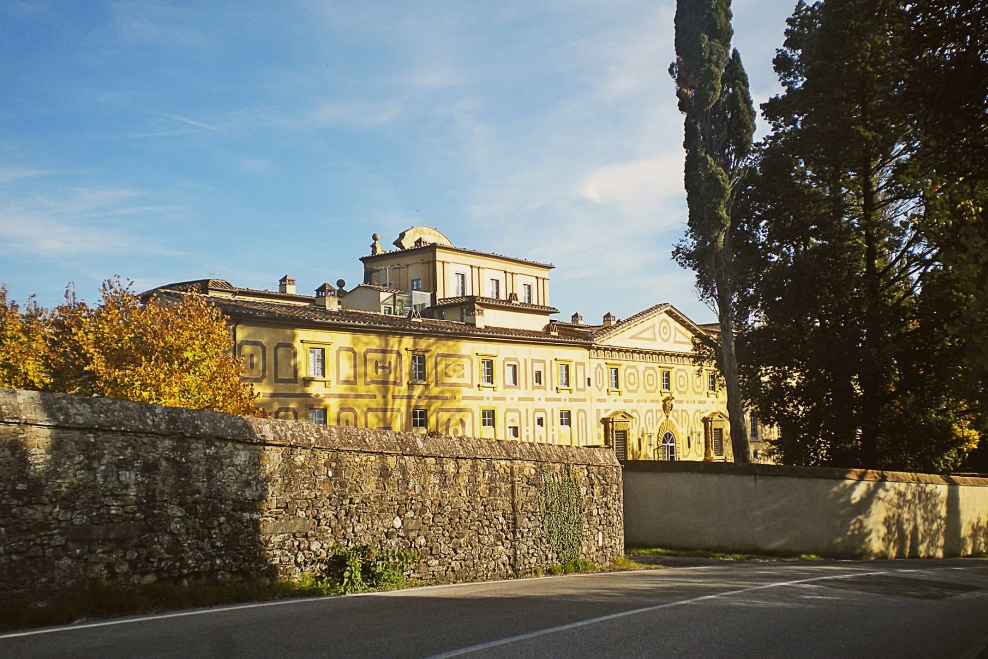
Barberino di Mugello sits at 272 meters in the upper Sieve valley, twenty-five kilometers north of Florence, the road and rail gateway from the city to the Mugello and onward to Bologna across the Apennines. The Medici family had its roots in this territory: Cosimo the Elder commissioned Michelozzo around 1451 to transform the medieval castle at Cafaggiolo into a country villa, the first in the Medici building campaign that would later run through Poggio a Caiano and Cerreto Guidi.
In 2013 Villa di Cafaggiolo and the nearby Villa del Trebbio joined eleven other Medici properties on the UNESCO list. Michelozzo's hand also shows on the fourteenth-century loggia in the main piazza of Barberino.
South of the town lies the Lago di Bilancino, an artificial reservoir completed in 1999, the largest in Tuscany at five square kilometers, built to feed the water supply of Florence, Prato and Pistoia, and now used for sailing, windsurfing and birdwatching.
What to see in Barberino di Mugello
- Villa Medicea di Cafaggiolo. Medieval castle transformed into a country villa by Michelozzo around 1451 for Cosimo the Elder, UNESCO World Heritage since 2013.
- Villa Medicea del Trebbio. Smaller medieval Medici castle on a wooded hilltop near San Piero a Sieve, also inscribed on the UNESCO list of Medici Villas in 2013.
- Lago di Bilancino. Artificial reservoir completed in 1999, five square kilometers, the largest in Tuscany, built to supply Florence, Prato and Pistoia.
How to get to Barberino di Mugello
Prato is roughly 33 minutes away by road.
Our tip
April through June brings the Mugello hills into clear green and the lake of Bilancino into its season for windsurfing and small-boat sailing. September and October are dry and gold, the harvest in the upper Sieve and the chestnut woods on the higher ridges. July and August are hot enough in the valley to drive most weekenders to the lake; the two Medici villas are cool inside year-round.
Portovenere
Why visit Portovenere
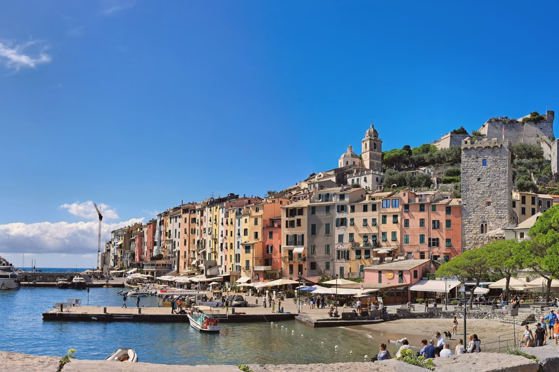
Portovenere closes the western mouth of the Gulf of La Spezia, three kilometers south of the city by water, facing the islands of Palmaria, Tino and Tinetto across open water. The Roman Portus Veneris dates to at least the first century BC, named for a temple to Venus on the promontory that now carries the striped church at the harbour mouth.
Genoa took control in 1113 and fortified the town as the southern anchor of its Riviera defences, opposite Pisan Lerici across the gulf: the fortress above the harbour and the church on the rock were built to face each other's rival coast rather than each other. The upper town holds the castle and its Romanesque parish church, rebuilt after a fire in 1340 damaged that quarter; the single medieval street below runs parallel to the harbour, its plan unchanged since Genoa first laid the town out in the twelfth century.
The promontory church stands apart from both, reachable along the water's edge, with the sea cave that took Byron's name cut into the rock beneath it. A fortified street, a hilltop castle and a temple site turned church: the town reads as a defensive line built along a single spine of rock, with the gulf doing the rest of the work UNESCO recognized in 1997.
What to see in Portovenere
- Chiesa di San Pietro. Consecrated 1198, black and white striped Gothic rebuild from 1256-1277, on the rocky promontory where the Roman temple of Venus stood.
- Castello Doria. First cited 1139, rebuilt 1161, expanded into the seventeenth century, the Genoese fortress above the harbour, prison under Napoleonic rule.
- Grotta dell'Arpaia. Sea cave below San Pietro, also called Byron's Grotto for the English poet who swam from here to Lerici across the gulf to visit Shelley.
How to get to Portovenere
Pisa is roughly 83 minutes away by road.
✷ We have written about Portovenere
“Most people spend a few hours in Portovenere between the ferry and the aperitivo. We gave it three weeks, and the town we got was the one the couple on the balcony lived in: vertical, repetitive, almost monastic, a town where the day is a staircase you climb the same way at the same hours, where the luxuries are a balcony the size of a doormat and an espresso stretched to thirty minutes because there is no reason on earth to drink it faster.”
Read our piece on Portovenere →Portovenere | The Slowest Coffee in Italy
Our tip
April through June and September to October are the working windows. Ferries to Palmaria run on full schedules from May onwards; the gulf is calm enough to swim by late May. July and August fill the carruggio and the Castello Doria, accommodation runs at three times shoulder rates, and the queue for the climb to San Pietro can reach an hour. Sagra Pansa E Stacca falls in June.
Peschiera del Garda
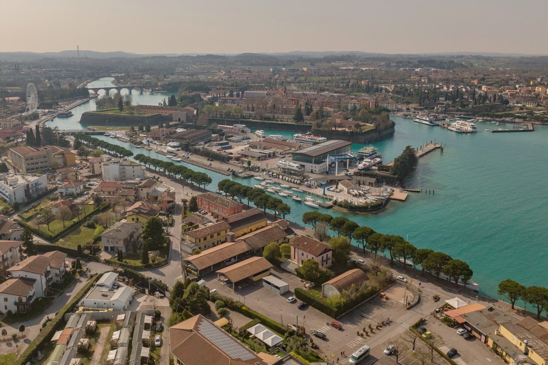
Why visit Peschiera del Garda
Peschiera sits at 68 meters on the Mincio at the point where the river leaves Lake Garda, twenty-five kilometers west of Verona. The Romans called it Ardelica.
The town the Republic of Venice rebuilt in 1549 was set on the medieval walls' corners, with a moat fed by the river, and the design came from Guidobaldo della Rovere before its execution on site. Austria took the town in 1815 and folded it into a wider system with Verona, Mantua and Legnago, the four together holding Lombardy-Venetia until 1866; Peschiera held the northwest corner of that arrangement, the point closest to the lake.
The fortress and the marsh settlement belong to different periods and different UNESCO listings, one Bronze Age and lakeside, one sixteenth-century and defensive, but both sit on the same stretch of water where the Mincio gathers itself before running south. The river itself is the town's organizing fact: it leaves the lake, splits into three canals to cross the walls, and rejoins below the railway bridge.
What Peschiera adds up to is a place built twice on the same threshold, where a lake becomes a river and a river becomes a border worth fortifying.
What to see in Peschiera del Garda
- Mura veneziane. Pentagonal fortress designed by Michele Sanmicheli for Venice from 1549, with five bastions, a moat fed by the Mincio and three water gates.
- Canali del Mincio. Three canals cross the fortress and rejoin below the railway bridge; the central one runs through the main square inside the walls.
- Piazza Ferdinando di Savoia. Main square inside the walls, bordered by the Palazzo del Comando, the Voltoni arches over the Mincio and the Caserma Catterin.
How to get to Peschiera del Garda
There is a railway station in the town, so you can arrive without a car and never need one while you are here. Verona is roughly 30 minutes away by road.
Our tip
April through June and September through October are the strongest months in Peschiera. The fortress walls, the moat and the Mincio canals are at their clearest in spring and autumn, and the lakefront south of the walls fills with sailing and ferry traffic. July and August push past thirty degrees and the southern Garda concentrates much of the lake's day-trip volume; the parking lots around the railway station queue from midmorning.
Mantova
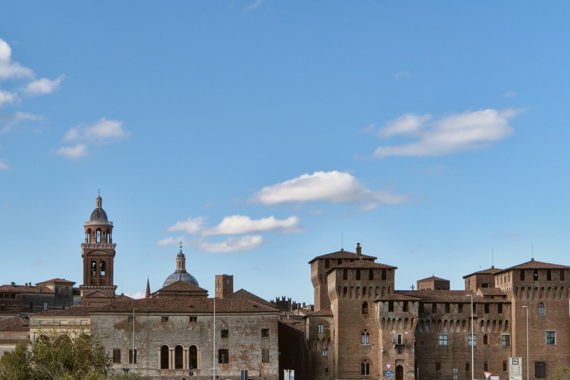
Why visit Mantova
Mantova sits at 19 meters on a peninsula in the Mincio, halfway between Milan and Venice. In the twelfth century the river was dammed into three artificial lakes, Superiore, di Mezzo and Inferiore, which still ring the city on three sides and worked as its defence for six centuries.
From 1328 to 1707 it was the seat of the Gonzaga. The Palazzo Ducale they assembled across that span covers 34,000 square meters between Piazza Sordello and Lago di Mezzo, with over a thousand rooms; the Camera degli Sposi, frescoed by Andrea Mantegna between 1465 and 1474, is the heart of that complex.
Outside the walls, Federico II Gonzaga commissioned Giulio Romano to build Palazzo Te between 1525 and 1535: a pleasure villa with the Sala dei Giganti, whose painted Olympus collapses on the viewer from every wall. Mantua and Sabbioneta were jointly inscribed by UNESCO in 2008.
The city was Italian Capital of Culture in 2016.
What to see in Mantova
- Palazzo Ducale. Gonzaga ducal complex of 34,000 square meters between Piazza Sordello and Lago di Mezzo, with over a thousand rooms across four centuries of additions.
- Camera degli Sposi. Frescoed chamber by Andrea Mantegna inside the Palazzo Ducale, painted between 1465 and 1474, with an illusionistic oculus on the ceiling.
- Palazzo Te. Suburban pleasure villa built between 1525 and 1535 by Giulio Romano for Federico II Gonzaga, with the Sala dei Giganti and Sala di Amore e Psiche.
How to get to Mantova
There is a railway station in the town, so you can arrive without a car and never need one while you are here. Verona is roughly 39 minutes away by road.
Our tip
April through June and September into October are the months Mantova works best. The lakes hold light all day, the Palazzo Ducale is walkable without summer queues, and the surrounding bike paths to Peschiera del Garda run sixty kilometers along the Mincio. July and August get humid and still on the plain, with mosquitoes off the lakes and afternoons that empty the centro storico. Festival della sbrisolona e dei dolci italiani falls in October.
Bergamo
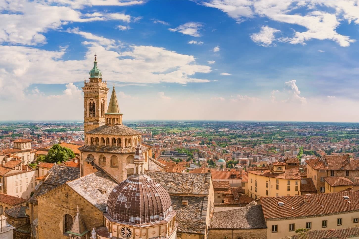
Why visit Bergamo
Bergamo's upper town occupies a spur of the Bergamasque foothills, and the lower town spreads onto the plain that runs southwest toward Milan. The walls that ring the hilltop cost the old town more than 250 buildings, including the original cathedral of Sant'Alessandro, demolished to clear ground for the defenses.
The circuit was built as part of a much larger Venetian project, inscribed together with the fortifications at Peschiera, Palmanova and sites on the Dalmatian coast: one defensive system spread across the Republic's frontier, of which this hilltop was the western anchor. The two halves of the city keep their own centuries.
The walled hilltop holds its medieval and Renaissance fabric inside the fortifications, reached by a funicular that has run the same route since the nineteenth century. The lower city is the newer half, built up through the nineteenth and twentieth centuries on the flat ground below.
Bergamo works as a place because that separation stayed intact instead of being built over: a fortified hill town and a modern city sharing one name but occupying two distinct centuries.
What to see in Bergamo
- Mura Venete. Eight bastions and four gates carry the circuit around the ridge of Città Alta, the walkway open along most of its length with views down over the lower town and the plain.
- Piazza Vecchia. Ringed by the Palazzo della Ragione, the Campanone tower, the Contarini fountain and the Biblioteca Mai, this is the square at the top of the funicular climb, the meeting point of Città Alta's streets.
- Basilica di Santa Maria Maggiore. The Romanesque exterior gives no hint of the Baroque interior inside, gilded and heavy with stucco, where the composer's tomb sits among the furnishings.
How to get to Bergamo
There is a railway station in the town, so you can arrive without a car and never need one while you are here. Bergamo is roughly 3 minutes away by road.
Our tip
April through June and September into October are the months Bergamo works best. Città Alta is walkable, the walls open at dawn, and the Accademia Carrara is uncrowded on weekday mornings. July and August are hot on the plain and full on the hill; the funicular waits stretch on weekends.
Ferrara
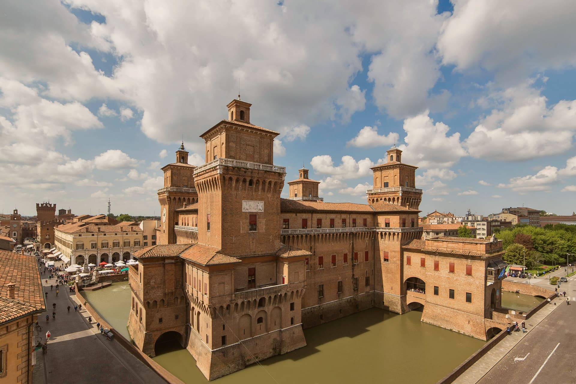
Why visit Ferrara
Ferrara is the city the Este family built and that the Po built around. For two centuries, from 1264 to 1598, the Este dukes ran their court from a moated brick fortress at the centre of town: Ariosto wrote the Orlando Furioso here, and the Ferrara school of painting flowered under Cosmè Tura.
In 1492, Duke Ercole I commissioned Biagio Rossetti to lay out a new quarter on a rational grid, with engineered perspectives and zoned districts, grafted onto the older medieval core rather than replacing it. That layering is still legible on the ground.
The old quarter, narrow and irregular, sits against Rossetti's planned extension, wide and gridded, and the two are stitched together inside a single ring of walls nine kilometres around. The scale is small enough that the whole centro can be crossed by bicycle in twenty minutes, and locals do: Ferrara has close to one bike per resident, and the medieval streets are narrow enough to keep cars mostly out.
The food carries its own local character apart from any of this: cappellacci di zucca, salama da sugo, pampepato at Christmas, and a Trebbiano-based wine grown on coastal sand dunes to the east. The Comacchio lagoons and the eel-fishing villages of the Po Delta are an easy half-day from the city, which served as the gateway to that whole territory.
What the plan and the walls add up to is a city that grew twice, once organically and once by design, and kept both versions intact side by side rather than letting one erase the other.
What to see in Ferrara
- Castello Estense. 1385 moated brick fortress at the very centre, the Este dukes' palace. The moat is still water-filled and the four corner towers are still walkable.
- Palazzo dei Diamanti. Rossetti's 1493 anchor of the new quarter, faced with 8,500 white-marble pyramid blocks. Now hosts major art exhibitions.
- 9 km of intact brick walls. The Renaissance ramparts ring the entire centro, and the top is a continuous cycling path with views over the moat and the Po valley.
How to get to Ferrara
There is a railway station in the town, so you can arrive without a car and never need one while you are here. Ferrara is roughly 6 minutes away by road.
Our tip
Ferrara is brilliant in April–June and September–October. The Po valley gets hot and sticky July–August and the brick city radiates heat. October has the Buskers Festival (Europe's largest street-musician festival, late August now). Sagra Di San Lorenzo A Baura falls in July.
Ravenna
Why visit Ravenna
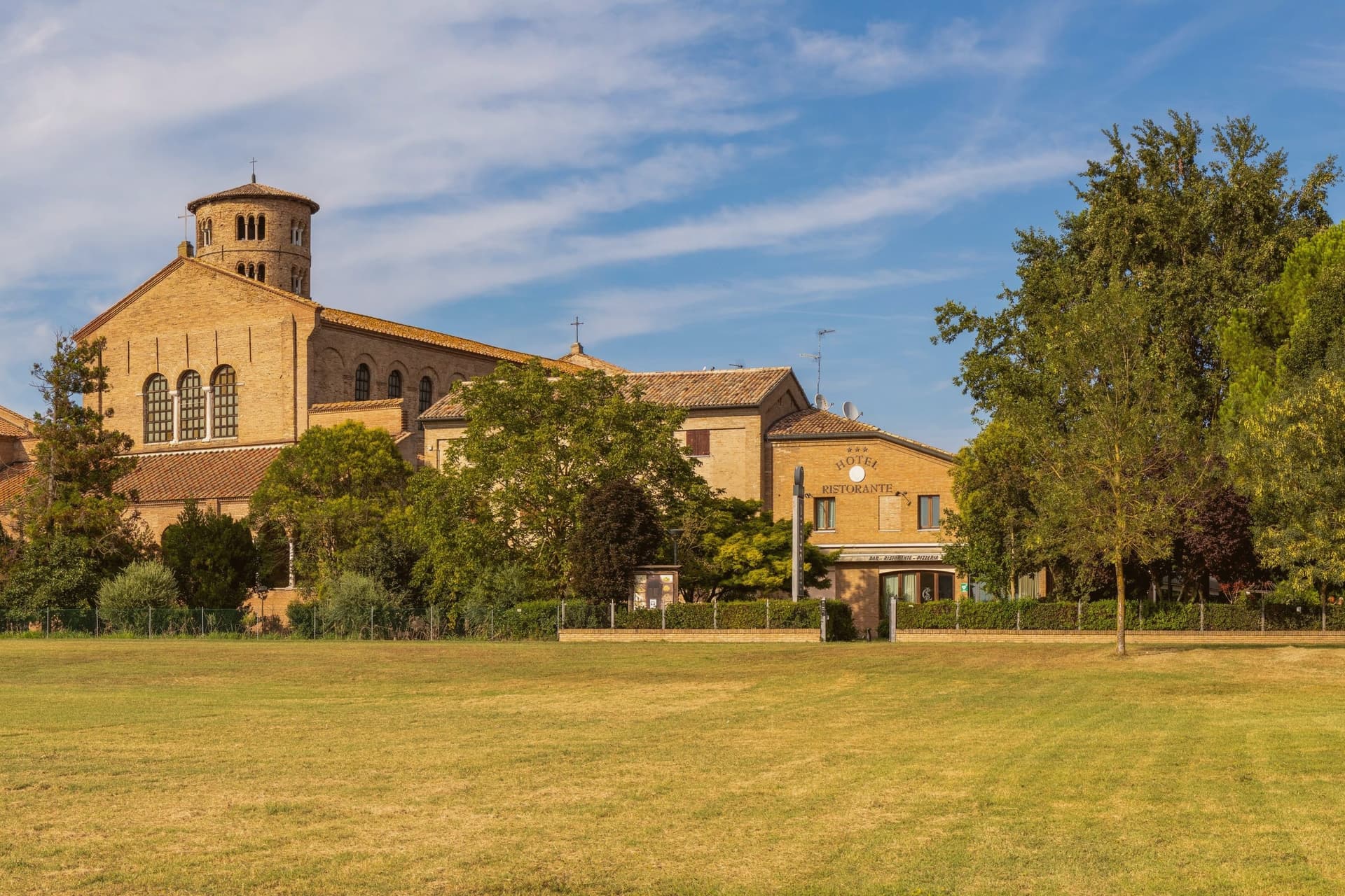
Ravenna sits four meters above sea level on the Adriatic coastal plain, ten kilometers from the sea and 105 kilometers east of Modena. Its position, low, flat, and close to the coast but not on it, made it defensible in a way landlocked cities were not: the surrounding marsh and lagoon kept armies at a distance while boats could still reach it.
That is why Honorius moved the Western Roman capital here in 402, why Theoderic kept it as his Ostrogothic seat, and why the Byzantine Exarchate held it for Constantinople until 751 as the last piece of imperial territory in northern Italy. Each of the three regimes built churches and paid for mosaic to decorate them, which is why the city's monuments read as a sequence rather than a single style: Roman, Gothic and Byzantine hands working in the same medium across a century and a half.
The municipality itself is split between this historic center and a stretch reaching the Adriatic, where Marina di Ravenna and Punta Marina hold Bandiera Blu beaches, so the same town that holds the fifth-century mausoleums also runs a public coastline. Population is 155,751.
What the churches add up to is less a city of monuments than a record of power changing hands, with each occupant leaving its faith in glass and gold on the walls rather than tearing down what came before.
What to see in Ravenna
- Basilica di San Vitale. Octagonal basilica holding the imperial mosaics of Justinian and Theodora in the presbytery and apse, the throne room of the sequence in gold and purple.
- Mausoleo di Galla Placidia. Small mausoleum next to the basilica, vaulted in a starry blue mosaic sky with gold cross and the symbols of the Evangelists, dim enough that the gold seems to generate its own light.
- Basilica di Sant'Apollinare Nuovo. Built by Theoderic as his palace chapel, the nave walls lined with continuous mosaic processions of saints and martyrs facing each other the full length of the church.
How to get to Ravenna
There is a railway station in the town, so you can arrive without a car and never need one while you are here. Ravenna is roughly 3 minutes away by road.
Our tip
May through September is the working window for Ravenna. The Adriatic warms enough for the beaches at Marina di Ravenna and Punta Marina to fill from late May through August, and the centro storico stays open for the Ravenna Festival in June and July. The mosaics need no weather, but July and August touch thirty-three degrees and the basilica interiors hold their heat. Antica Sagra del Monticino falls in September.
More from Anywhere Italy
- The best towns with a World Heritage site within 90 minutes of Brescia
- The best towns with a World Heritage site within 90 minutes of Verona
- The best towns with a World Heritage site within 90 minutes of Bologna
 The best towns with a World Heritage site in Lombardia
 The best towns with a World Heritage site within two hours of Trento
 The best towns with a World Heritage site within 90 minutes of Pisa