
The best towns with a World Heritage site within 90 minutes of Pisa
The land within reach of Pisa changes character every half hour of driving. Vineyards on the terraces below Carmignano give way to Mugello's chestnut woods and reservoir water, then to the white scars of the Apuan marble quarries above Seravezza, then to the Ligurian cliffs where the sea goes hard blue against black stone. The building materials shift with the geology: pietra serena in the Florentine hills, brick and stucco on the plain, marble where the mountains meet Versilia, dark schist on the coast. Autumn is the reliable season here, when the olive harvest starts, the porcini appear on Mugello menus and the spa towns fill with people taking the waters before winter. Almost all of it lies inside ninety minutes of Pisa Centrale or the FI-PI-LI.
Most visitors treat this radius as a corridor to Florence and nothing more. The Uffizi, the Duomo and the Ponte Vecchio absorb the great majority of arrivals, and the Renaissance core is one of the most heavily visited World Heritage sites in Europe, with timed entries, long queues in the piazzale and hotel rates that reflect it. Florence deserves the attention it gets. It is simply not the only listed site in the neighbourhood, nor the only one worth a morning.
UNESCO's Tuscan entries run well past the city walls. The Medici villas and gardens are scattered across small comuni, the marble country has its own listed landscape and industrial heritage, the great spa architecture of the belle époque earned its own inscription, and the eastern Ligurian coast was listed for its terraces and its harbours. The towns in this list each hold a site UNESCO has listed, and most of them see a fraction of Florence's crowds on any given day.
Of the 49 communes we have mapped in a 90-minute drive of Pisa, 8 qualify as towns with a World Heritage site: each holds a site UNESCO has listed. The smallest, Portovenere, has 3,268 residents.
If you are still choosing, we have also written The best towns with a World Heritage site within 90 minutes of Florence and The best towns with a medieval festival that hold a World Heritage site in Toscana.
Cerreto Guidi
Why visit Cerreto Guidi
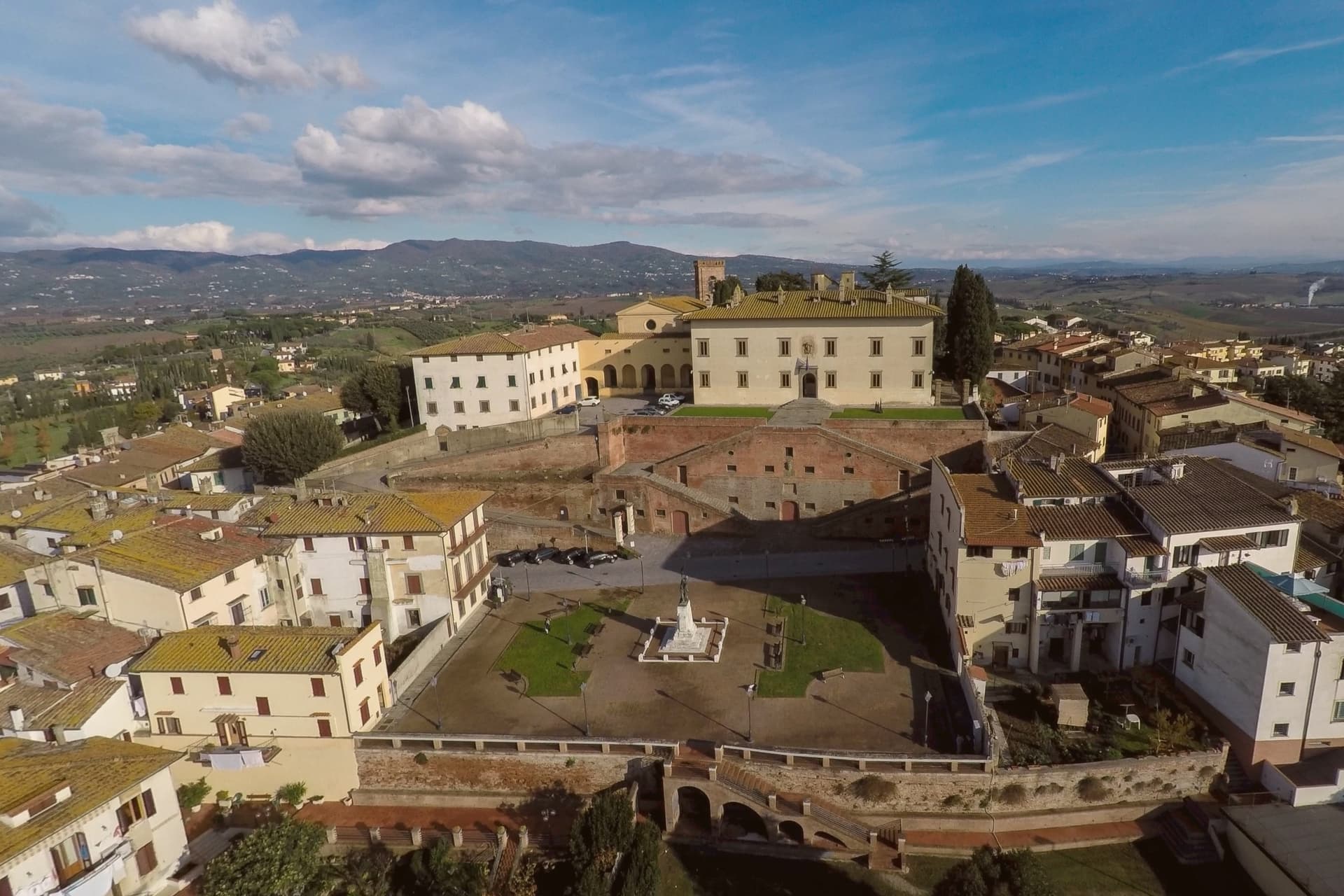
Cerreto Guidi sits at 123 meters above the Padule di Fucecchio, thirty kilometers west of Florence, on the old hunting grounds of the Counts Guidi and later the Medici. Cosimo I commissioned the Villa Medicea here between 1564 and 1567 as a hunting lodge and territorial outpost over the marsh.
The villa is mounted on a scenographic base of four symmetrical ramps of stairs, the ponti medicei, traditionally attributed to Bernardo Buontalenti, designed to raise the perspective plane and the level of the entrance. In 2013 the villa entered the UNESCO list of Medici Villas and Gardens of Tuscany along with twelve others, and it remains one of the few permanently open as a museum, housing the Museo Storico della Caccia e del Territorio since 2002.
The Via Francigena passes a few kilometers south. Isabella de' Medici, daughter of Cosimo I, was strangled in this villa by her husband Paolo Giordano Orsini in July 1576.
What to see in Cerreto Guidi
- Villa Medicea di Cerreto Guidi. Hunting villa built for Cosimo I de' Medici between 1564 and 1567, UNESCO World Heritage since 2013, holding the Museo Storico della Caccia.
- Ponti Medicei. Four symmetric ramps of stairs attributed to Buontalenti, supporting the villa above the village and forming its scenographic base.
- Museo Storico della Caccia e del Territorio. Hunting and local history museum housed in the villa since 2002, with weapons, prints and documents from the Medici hunting grounds.
How to get to Cerreto Guidi
Firenze is roughly 50 minutes away by road.
Our tip
April through June is the easiest time to walk the village and the villa garden, with the Padule di Fucecchio at its greenest. September and October dry the marsh, the harvest in the surrounding Chianti Montalbano vineyards runs through late September. July and August are hot in the lower Arno plain and the villa is the cool place to be; visitor numbers peak around mid-August. Palio del Cerro falls in September.
Barberino di Mugello
Why visit Barberino di Mugello
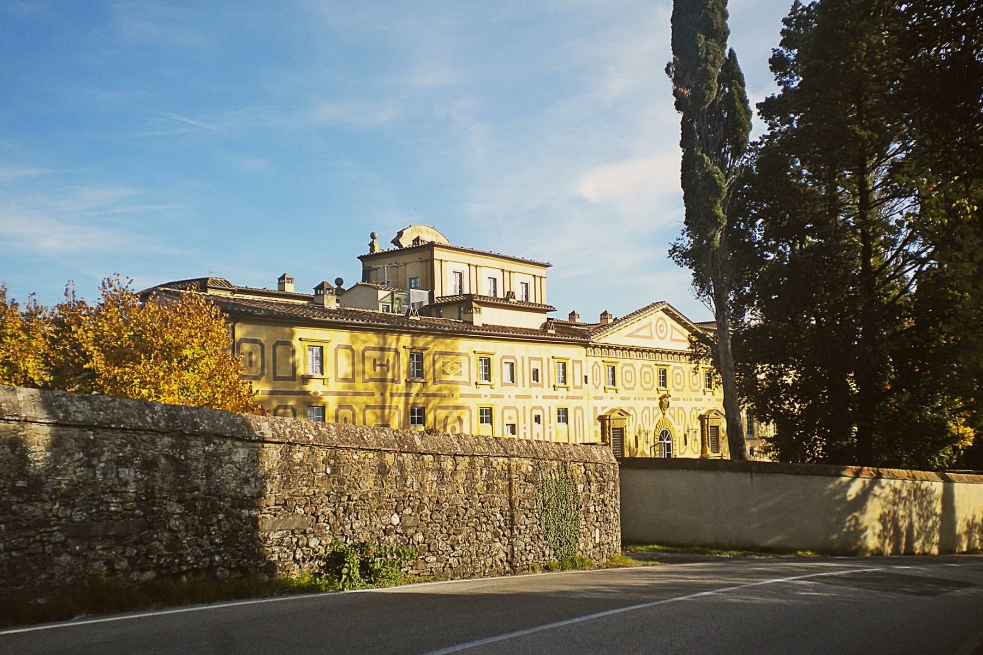
Barberino di Mugello sits at 272 meters in the upper Sieve valley, twenty-five kilometers north of Florence, the road and rail gateway from the city to the Mugello and onward to Bologna across the Apennines. The Medici family had its roots in this territory: Cosimo the Elder commissioned Michelozzo around 1451 to transform the medieval castle at Cafaggiolo into a country villa, the first in the Medici building campaign that would later run through Poggio a Caiano and Cerreto Guidi.
In 2013 Villa di Cafaggiolo and the nearby Villa del Trebbio joined eleven other Medici properties on the UNESCO list. Michelozzo's hand also shows on the fourteenth-century loggia in the main piazza of Barberino.
South of the town lies the Lago di Bilancino, an artificial reservoir completed in 1999, the largest in Tuscany at five square kilometers, built to feed the water supply of Florence, Prato and Pistoia, and now used for sailing, windsurfing and birdwatching.
What to see in Barberino di Mugello
- Villa Medicea di Cafaggiolo. Medieval castle transformed into a country villa by Michelozzo around 1451 for Cosimo the Elder, UNESCO World Heritage since 2013.
- Villa Medicea del Trebbio. Smaller medieval Medici castle on a wooded hilltop near San Piero a Sieve, also inscribed on the UNESCO list of Medici Villas in 2013.
- Lago di Bilancino. Artificial reservoir completed in 1999, five square kilometers, the largest in Tuscany, built to supply Florence, Prato and Pistoia.
How to get to Barberino di Mugello
Prato is roughly 33 minutes away by road.
Our tip
April through June brings the Mugello hills into clear green and the lake of Bilancino into its season for windsurfing and small-boat sailing. September and October are dry and gold, the harvest in the upper Sieve and the chestnut woods on the higher ridges. July and August are hot enough in the valley to drive most weekenders to the lake; the two Medici villas are cool inside year-round.
Seravezza
Why visit Seravezza
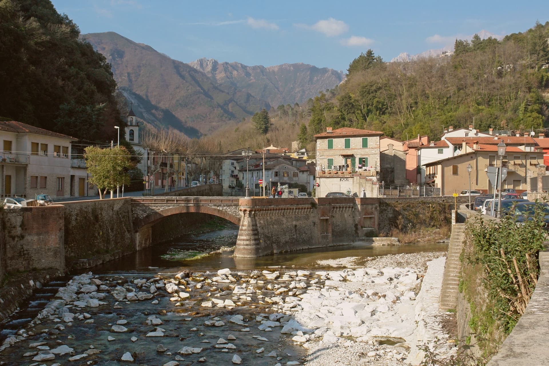
Seravezza sits at 100 meters where the Vezza and Serra streams meet, in Versilia Storica, between the Apuan Alps and the Tyrrhenian. The territory was contested between Pisa, Lucca, Genoa and Florence for centuries before passing to the Medici, and the town's position at the junction of the two watercourses, with the mountains at its back and the coast within reach, explains why it mattered enough for all four to want it.
Michelangelo spent three years on Monte Altissimo behind the town, found his veins of white stone, and built a road to take it down toward the sea. Half a century later Cosimo I commissioned the Palazzo Mediceo here, a summer residence rather than a fortress, which says something about how settled Medici rule had become by the time it was built.
The two episodes, a papal quarry and a ducal villa, sit one above the other on the same small territory: the mountain supplied the stone that Florence wanted, and the valley below became a place worth building a palace in once the stone trade had made the route familiar.
What to see in Seravezza
- Palazzo Mediceo. The residence stands in the centro, its design passed from one architect to the next as the project went on. It carries the UNESCO listing among the Medici Villas.
- Pieve di San Martino alla Cappella. Eleventh-century Romanesque parish church between Seravezza and Azzano, with the ruined Annunziata Oratory alongside.
- Monte Altissimo. The peak rises behind the town at 1,589 meters. The road Michelangelo built to bring the stone down still marks the route from quarry to valley, and the mountain is worked as a quarry to this day.
How to get to Seravezza
There is a railway station in the town, so you can arrive without a car and never need one while you are here. Pisa is roughly 63 minutes away by road.
Our tip
May through September is the working Versilia season, the inland equivalent of the coastal months at Forte dei Marmi and Pietrasanta six kilometers away. June and September are the best moments to walk up to the Cappella and Azzano: the mountain trails open, the marble quarries above visible from below. July and August are hot in the lower town but cool on the slopes, and the Apuan rains hold off until late September. Sagra di Fine Estate falls in August.
Portovenere
Why visit Portovenere
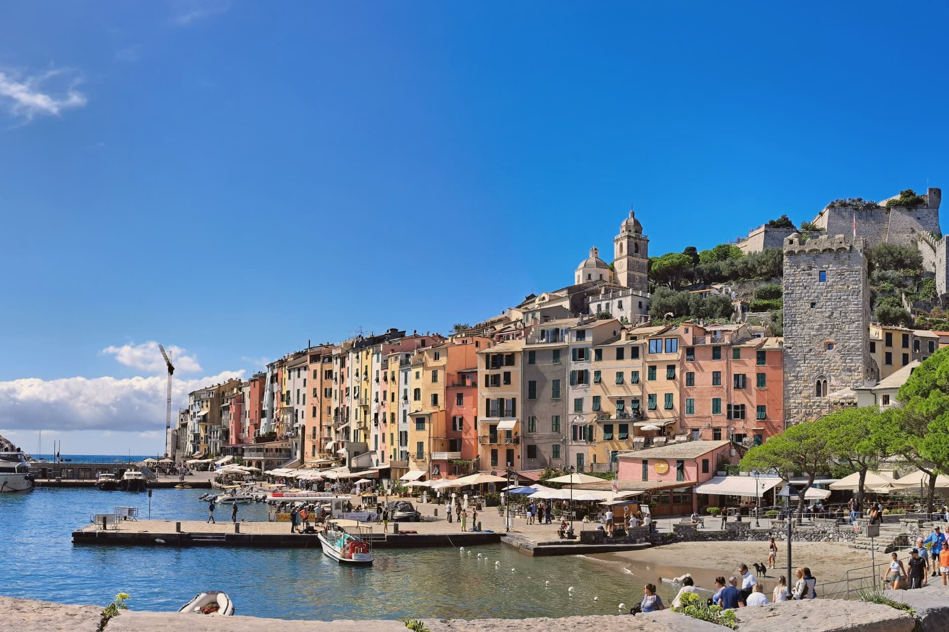
Portovenere closes the western mouth of the Gulf of La Spezia, three kilometers south of the city by water, facing the islands of Palmaria, Tino and Tinetto across open water. The Roman Portus Veneris dates to at least the first century BC, named for a temple to Venus on the promontory that now carries the striped church at the harbour mouth.
Genoa took control in 1113 and fortified the town as the southern anchor of its Riviera defences, opposite Pisan Lerici across the gulf: the fortress above the harbour and the church on the rock were built to face each other's rival coast rather than each other. The upper town holds the castle and its Romanesque parish church, rebuilt after a fire in 1340 damaged that quarter; the single medieval street below runs parallel to the harbour, its plan unchanged since Genoa first laid the town out in the twelfth century.
The promontory church stands apart from both, reachable along the water's edge, with the sea cave that took Byron's name cut into the rock beneath it. A fortified street, a hilltop castle and a temple site turned church: the town reads as a defensive line built along a single spine of rock, with the gulf doing the rest of the work UNESCO recognized in 1997.
What to see in Portovenere
- Chiesa di San Pietro. Consecrated 1198, black and white striped Gothic rebuild from 1256-1277, on the rocky promontory where the Roman temple of Venus stood.
- Castello Doria. First cited 1139, rebuilt 1161, expanded into the seventeenth century, the Genoese fortress above the harbour, prison under Napoleonic rule.
- Grotta dell'Arpaia. Sea cave below San Pietro, also called Byron's Grotto for the English poet who swam from here to Lerici across the gulf to visit Shelley.
How to get to Portovenere
Pisa is roughly 83 minutes away by road.
✷ We have written about Portovenere
“Most people spend a few hours in Portovenere between the ferry and the aperitivo. We gave it three weeks, and the town we got was the one the couple on the balcony lived in: vertical, repetitive, almost monastic, a town where the day is a staircase you climb the same way at the same hours, where the luxuries are a balcony the size of a doormat and an espresso stretched to thirty minutes because there is no reason on earth to drink it faster.”
Read our piece on Portovenere →Portovenere | The Slowest Coffee in Italy
Our tip
April through June and September to October are the working windows. Ferries to Palmaria run on full schedules from May onwards; the gulf is calm enough to swim by late May. July and August fill the carruggio and the Castello Doria, accommodation runs at three times shoulder rates, and the queue for the climb to San Pietro can reach an hour. Sagra Pansa E Stacca falls in June.
San Gimignano
Why visit San Gimignano
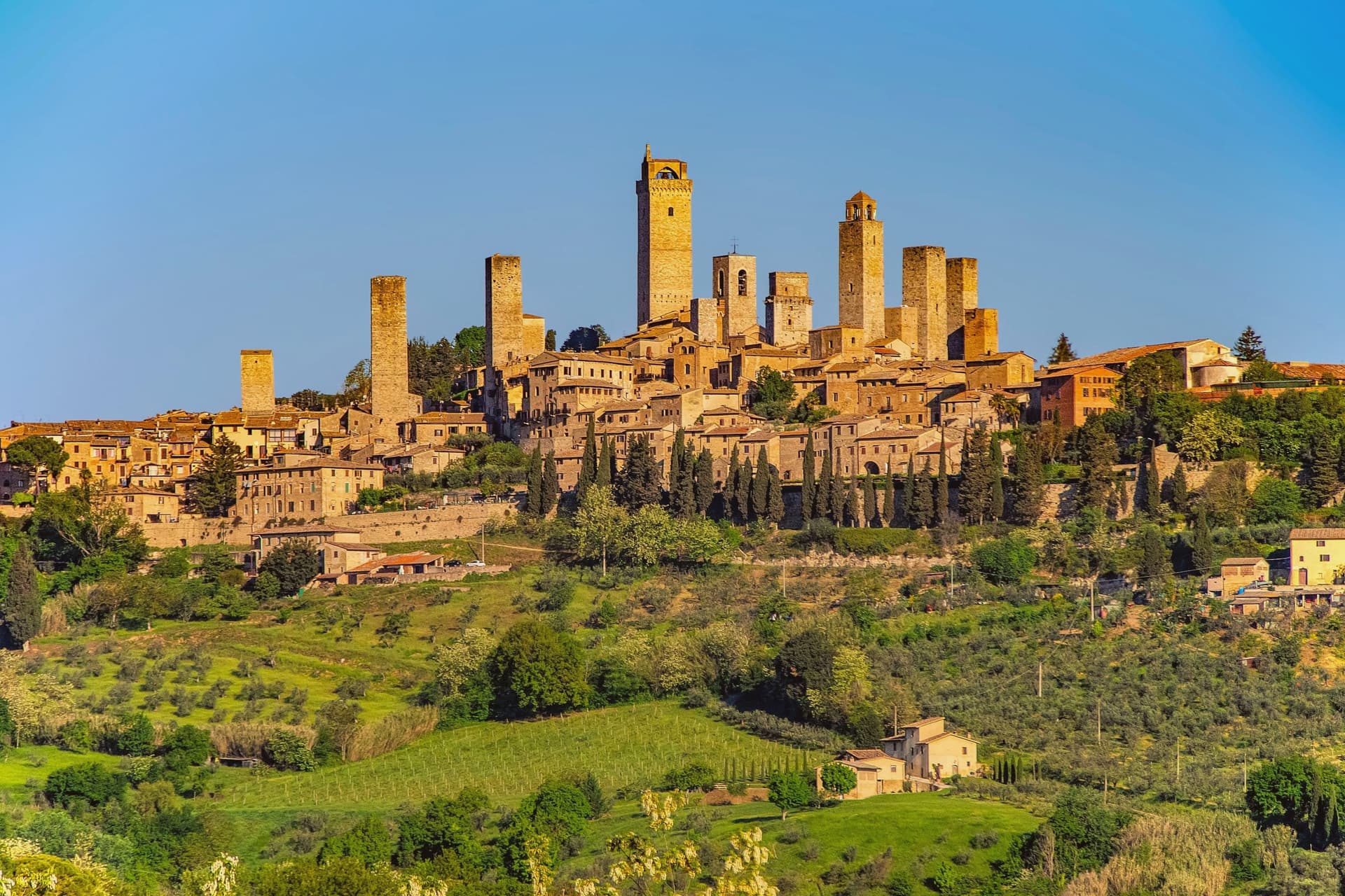
San Gimignano sits at 334 meters in the Val d'Elsa, halfway between Firenze and Siena on the medieval pilgrim road to Rome. Patrician families built 72 tower-houses in the twelfth and thirteenth centuries as proofs of wealth and platforms for vendettas; 14 still stand, the tallest being the Torre Grossa at 54 meters.
The town declared independence from the bishops of Volterra in 1199 and grew rich on saffron and Vernaccia, the white wine grown on the surrounding hills and praised since Dante. The Black Death of 1348 broke the boom; San Gimignano lost more than half its population and submitted to Florence.
That collapse is the reason the medieval skyline survived. UNESCO listed the historic centre in 1990 as a complete record of feudal architecture.
Roughly three million visitors come each year, more than 400 times the resident population, and the centro storico empties into the surrounding olive groves once the day-trippers leave.
What to see in San Gimignano
- Torre Grossa. Fifty-four meter civic tower attached to the Palazzo Comunale, the tallest of the surviving 14, open for the climb to the panoramic terrace.
- Piazza della Cisterna. Triangular medieval square paved in brick around an octagonal well of 1287, lined by tower houses and Romanesque palaces.
- Collegiata di Santa Maria Assunta. Romanesque parish church on Piazza Duomo, walls covered by Bartolo di Fredi and Lippo Memmi frescoes of Old and New Testament scenes.
How to get to San Gimignano
Firenze is roughly 61 minutes away by road.
✷ We have written about San Gimignano
“We arrived in the afternoon, into the second half of the day’s crowd. Off-season meant it was groups and guides rather than a flood, but the shops were open and doing their worst, the same garbage souvenirs, the same pasta no one local would eat, and we walked through it the way you walk through a thing you have decided not to let ruin your evening. The towers stood over all of it, indifferent, which is their whole talent.”
Read our piece on San Gimignano →San Gimignano | The Town After Seven
Our tip
April through June and September into October are the months the town is worth a full day rather than three hours. The buses still come, but late afternoon empties the piazzas and lets the towers take their light. July and August push temperatures past thirty and the centro storico becomes uncomfortable between two and six, when the stone radiates heat. Fiere delle Messi di San Gimignano falls in June.
Montecatini-Terme
Why visit Montecatini-Terme
The spa town sits at 27 meters in the Valdinievole, forty kilometers west of Florence, at the foot of the hills that hold its older twin on the height above. That older settlement predates the town below it: the springs were exploited later, and the modern spa grew up on the flat ground beneath the hill village rather than around it.
The two remain connected by the red funicular, so a visitor moves between them in minutes rather than by road. Each of the four named waters treats a different complaint, drawn from the same eleven springs but separated by mineral content once they reach the surface.
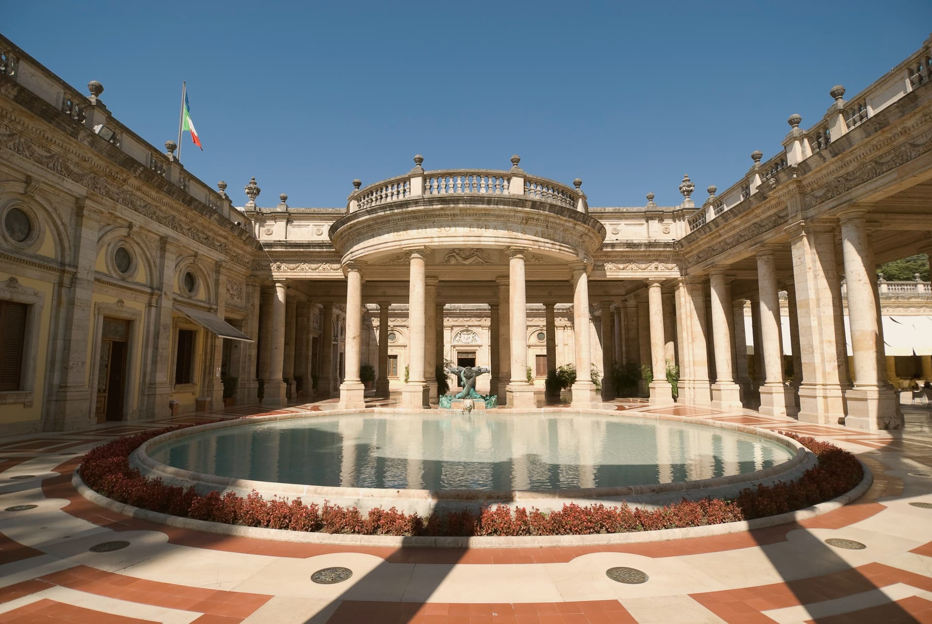
The Thermal Park gathers the pavilions that were built to house this water cure, Liberty and neo-Renaissance architecture arranged as a single walled enclave rather than scattered through the town. In 2021 the UNESCO listing grouped the town with other spa towns built for the same purpose, Bath, Vichy, Baden-Baden and Karlovy Vary among them, recognition of a model of spa town that produced this particular layout: springs, park, pavilions, and a hill town kept deliberately apart from the cure below.
What to see in Montecatini-Terme
- Terme Tettuccio. The most famous of the thermal establishments, designed by Ugo Giovannozzi, with Liberty interiors built on the concept of the Roman baths.
- Parco Termale. Walled thermal park holding the major spa pavilions, laid out around the eleven springs that surface in the lower town.
- Funicolare di Montecatini. The two red cars carry passengers up the hill on rails laid in 1898, the ride lasting eight and a half minutes.
How to get to Montecatini-Terme
There is a railway station in the town, so you can arrive without a car and never need one while you are here. Prato is roughly 31 minutes away by road.
✷ We have written about Montecatini-Terme
“I grew up around water that smells. In Budapest, you do not think of this as a flaw. The thermal water comes up out of the ground carrying its minerals with it, iron and sulfur, and whatever else the limestone has been holding for ten thousand years, and it announces itself before you see it.”
Read our piece on Montecatini-Terme →Montecatini Terme | The Bath Without People
Our tip
The thermal park works as a year-round destination, but the seasons feel different. April through June and September through October are the comfortable months: pavilions open, hotels staffed, walking the park or the funicular pleasant. July and August are hot in the Valdinievole and busy with package tourism.
Pisa
Why visit Pisa
The Arno reaches the Ligurian Sea twelve kilometers past the city, and the river is what built it: an Arsenal on its banks built galleys for the Crusades, and Mediterranean trade paid for the walled compound northwest of the centro. That compound, inscribed by UNESCO as one of the first Italian sites in 1987, gathers four buildings of the same Pisan Romanesque school in one field, the cathedral, the baptistery, the cemetery cloister and the bell tower, close enough to read as a single composition rather than a set of monuments visited separately.
The city has a second center away from that field. Piazza dei Cavalieri became the Medici political seat after the republic fell, and the university founded in 1343 keeps both squares populated with people who live and work there rather than pass through.
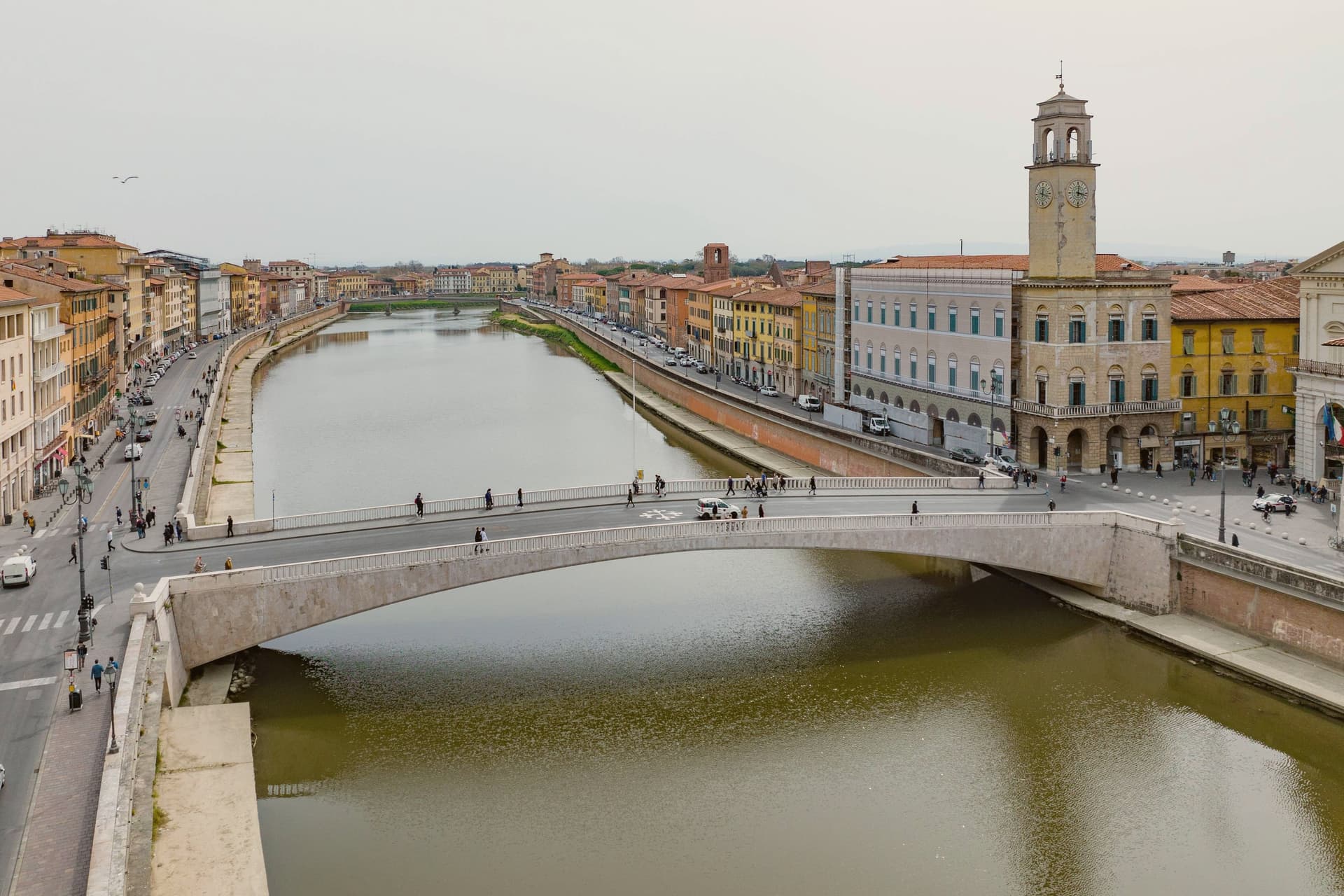
The Lungarni tie the two halves together physically, two quays following the river on both banks, lined with palazzi spanning the twelfth to the nineteenth century. What this adds up to is a town built in two unequal pieces: a religious and civic compound frozen at its medieval peak, and a working river city around it that never stopped adding centuries to its banks.
What to see in Pisa
- Torre Pendente. Finished 1372, two centuries after it began, the lean is visible from ground level without needing to climb it, south of vertical against the other three white buildings of the square.
- Duomo di Pisa. Pisan Romanesque cathedral begun 1064 by Buscheto, financed from the Mediterranean trade, with bronze doors by Bonanno Pisano and a pulpit by Giovanni Pisano.
- Battistero di San Giovanni. Largest baptistery in Italy at 54.86 meters tall, begun 1152, Romanesque base and Gothic upper level, with a pulpit by Nicola Pisano.
How to get to Pisa
There is a railway station in the town, so you can arrive without a car and never need one while you are here. Pisa is roughly 16 minutes away by road.
✷ We have written about Pisa
“It was a Tuesday in January, ten degrees, the kind of soft grey Tuscan winter rain that does not quite commit to being rain, and what we wanted, in a way that surprised both of us, was a bowl of Japanese noodle soup. The nearest place to get one was Pisa.”
Read our piece on Pisa →Pisa | Beyond the Tower
Our tip
May, June, September and October are the months when the Lungarni are at their best, the temperature stays in the twenties, and the lines at Piazza dei Miracoli compress by mid-afternoon. The Luminara di San Ranieri, on 16 June, lights the riverbank with eighty thousand candles and is the night the city sees most. July and August are hot and humid, with the day-tripper waves from cruise ships at Livorno filling the compound from morning. Gioco del Ponte falls in June.
Carmignano
Why visit Carmignano
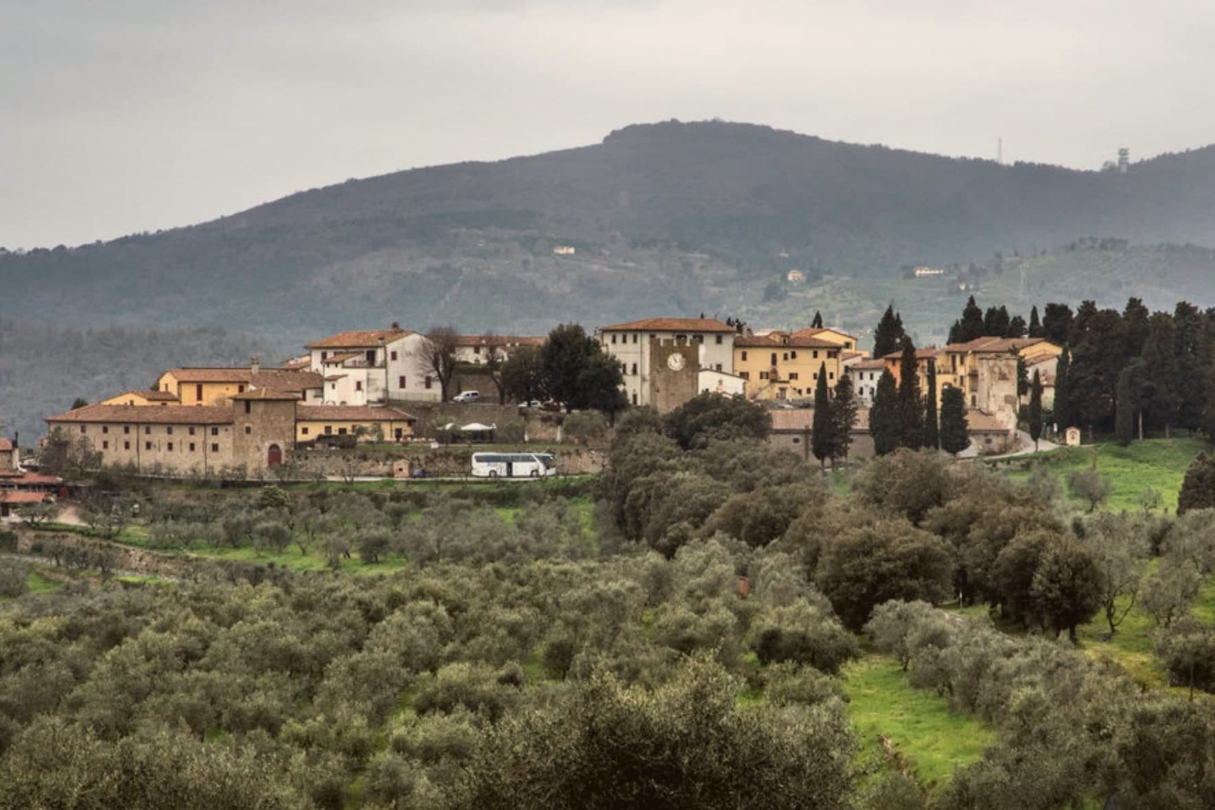
Carmignano sits at 189 meters on the Montalbano hills, twenty kilometers west of Florence and ten southwest of Prato. The commune is built from separate frazioni rather than a single center: Artimino occupies the ridge above, Comeana lies apart with its own tombs, and the town itself holds the parish church at the lower elevation.
This layout puts a Renaissance villa, a pair of seventh-century BC tombs and a working wine appellation within the same small commune without any of them sitting next to each other. The vines of the Carmignano DOCG cover the same Montalbano slopes that were occupied first by the people who built the tombs at Comeana and later by the Medici, so the landscape reads as continuous use of one hillside across the centuries rather than as separate attractions laid on top of it.
Few communes this size hold a Medici villa, a seventh-century BC necropolis and a wine appellation across three distinct frazioni, each still doing what it was built or planted for.
What to see in Carmignano
- Visitazione di Pontormo. Painted for the Pinadori family and still in place in the parish church of San Michele e San Francesco, the panel hangs where it was installed, a late Mannerist work seen in the setting it was made for rather than in a museum.
- Villa Medicea La Ferdinanda. The villa sits on the ridge above Artimino, its roofline broken by the chimneys that give it its nickname, looking out over the same slopes planted with vines below.
- Tumulo di Montefortini. Monumental Etruscan tomb at Comeana from the seventh century BC, 11 meters high and 60 in diameter, with two intact chambers visited through a corridor.
How to get to Carmignano
Prato is roughly 25 minutes away by road.
Our tip
April through June and September into October are the working months on the Montalbano: vine work in the surrounding hills, mild days, evening light over the Arno plain. Harvest runs from mid-September through October. July and August push into the low thirties and Florence twenty kilometers east bakes harder than the ridges here. Festa di San Michele a Carmignano falls in September.
More from Anywhere Italy
- The best towns with a World Heritage site within 90 minutes of Florence
- The best towns with a medieval festival that hold a World Heritage site in Toscana
 The best towns that eat well within an hour of Florence
 The best towns with a World Heritage site within two hours of Genoa
 The best towns with a World Heritage site within two hours of Parma
- The best towns with a World Heritage site within 90 minutes of Bologna