
The best towns with a food festival in Campania
Campania eats by calendar. Chestnuts come off the Irpinian slopes in autumn, when smoke from the roasting drums hangs in streets built of grey tufa and volcanic stone; anchovies are salted along the Cilento coast in early summer; buffalo mozzarella arrives every morning from the plain behind Caserta; Aglianico is pressed in the cool weeks when the mountain fog settles into the valleys. The sagra is the local form these ingredients take in public: trestle tables in a piazza, a paper ticket exchanged for a plate, a band that plays too loud past midnight. Prices stay low because the point is not the visitor. Almost every town in the region has one, and the good ones taste unmistakably of the hillside they stand on.
Most people meet Campanian food in Naples or on the Amalfi Coast, and the reasons are obvious: the pizzerias of the centro storico, the lemon terraces above Positano, the ferry queue at Sorrento. Those places are excellent and thoroughly booked. In high season the wait for a table becomes the day's main activity, and the food arrives priced for an audience that will not come back. The coast road moves at walking pace from late spring onward.
The same volcanic soil, the same buffalo herds and the same fishing families continue inland and south, up into Irpinia and the Cilento hills and along the Volturno. That is where these towns are, and where their festivals happen: fewer coaches, tables set for neighbours, one ingredient treated seriously for a weekend. Each of the towns here holds a recurring food festival built around a single local product, and most sit within a drive of the coast if you want both. Worth a detour, and worth timing.
Of the 67 communes we have mapped in Campania, 9 qualify as towns with a food festival: each holds a recurring food festival built around one local ingredient. The smallest, Castelcivita, has 1,441 residents.
If you are still choosing, we have also written The 8 best hill towns inside a national park in Campania and The best hill towns you can reach by train in Campania.
Castelcivita
Why visit Castelcivita
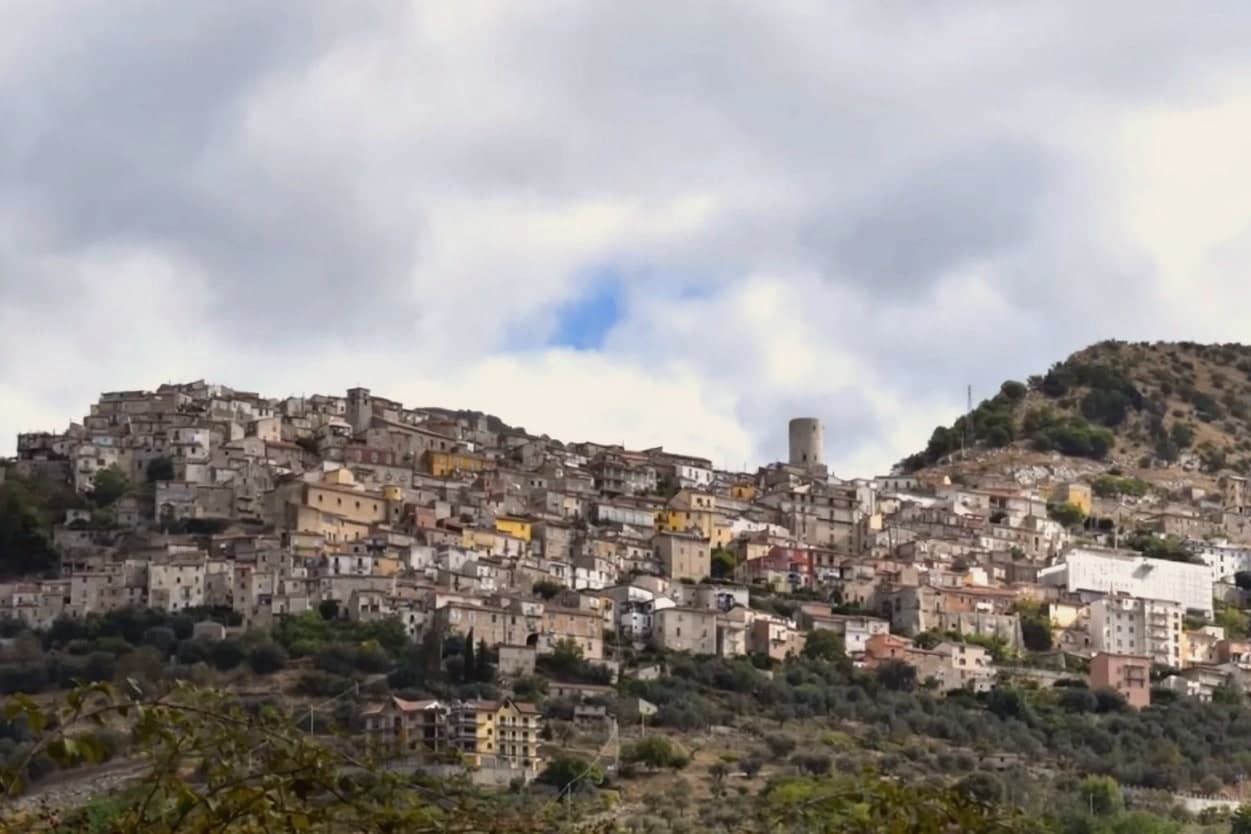
Castelcivita sits at 526 meters on the western flank of the Alburni mountains, in the Cilento, Vallo di Diano e Alburni National Park, forty-five kilometers inland from Salerno. The town has 1,441 residents and a medieval ridge plan around an Angevin tower, now the seat of the Museum of Rural Civilization.
Most visitors come for the caves below the village, the Grotte di Castelcivita, a karst system that runs for nearly 4,800 meters along the Calore river and includes named halls of the Castle, the Crocodile and the Desert. The cave mouth opens at ninety-four meters above sea level, 1.5 kilometers from the town.
In 1972 the Paleolithic deposits at the entrance turned the grotte into one of the most significant sites of early human presence in southern Italy, with stone tools and faunal remains dated to roughly 40,000 years ago. The town above is quiet.
The cave system is what brings school groups, speleologists and weekend visitors from Salerno.
What to see in Castelcivita
- Grotte di Castelcivita. Karst cave system running nearly 4,800 meters along the Calore, with Paleolithic deposits from roughly 40,000 years ago and named halls of the Castle, the Crocodile and the Desert.
- Torre Angioina. Thirteenth-century Angevin tower at the top of the centro storico, now the seat of the Museo della Civiltà Contadina with Paleolithic finds from the caves.
- Centro storico medievale. Ridge-pattern village of stone houses and stepped lanes on the slope of the Alburni, with views east across the Calore valley.
How to get to Castelcivita
Salerno is roughly 57 minutes away by road.
Our tip
April through June and September into October are the working months for Castelcivita. The Alburni stay green into early summer, the temperatures hold below thirty degrees, and the caves keep a steady fourteen degrees year round, useful when the surface is hot. July and August push past thirty-two; the centro storico empties in the afternoon and the cave queue grows. Festa della Patata di Montagna di Castelcivita falls in the season.
Frigento
Why visit Frigento
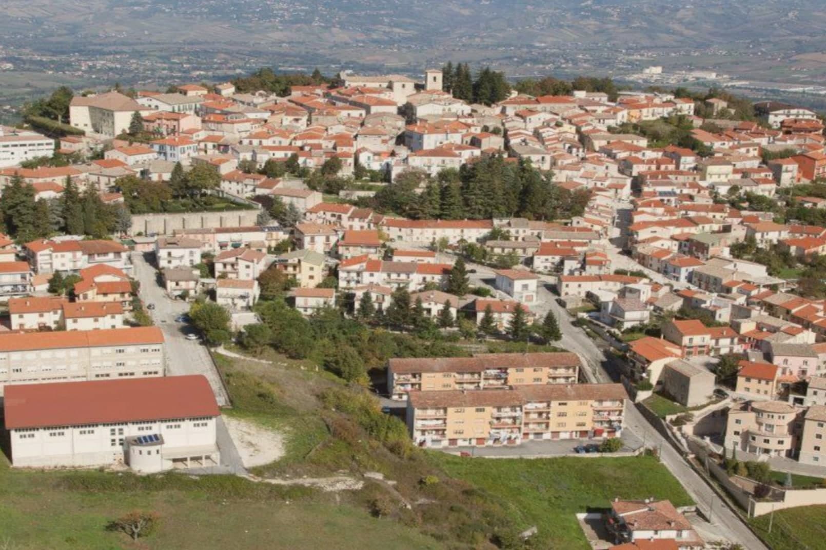
Frigento sits at 911 meters on a ridge in central Irpinia, 40 kilometers from Avellino, on a hill that overlooks the Ufita valley to the north, the Fredane to the south, the Ansanto to the east and the Calore to the west. The summit holds an opus incertum water complex from the 1st century BC, the Cisterne Romane, a vaulted chamber system probably built to serve a cluster of rustic villas linked to nearby Aeclanum on the Via Traiana.
The medieval village grew on top of the same ridge in the late Lombard period as a defensive site between the bishoprics of Benevento and Conza. The 1980 Irpinia earthquake hit the centro storico hard; reconstruction has been slow but most of the old village still stands in stone above the cisterns.
From the summit the view runs from the Apennines to the Daunia hills on a clear day. The commune is a Borgo più Bello d'Italia and a hazelnut and grain area, with cheese from the surrounding pastures.
What to see in Frigento
- Cisterne Romane. Opus incertum water complex from the 1st century BC at the highest point of the village, the largest preserved Republican cistern in Irpinia.
- Centro storico di Frigento. Medieval stone village on the summit ridge, partly rebuilt after the 1980 Irpinia earthquake, with the four-valley panorama from the upper streets.
- Chiesa di Santa Maria Assunta. Former cathedral of the Diocese of Frequentum, reconstructed after the 1980 earthquake, with a Renaissance baptismal font and a crypt.
How to get to Frigento
Salerno is roughly 84 minutes away by road.
Our tip
May through October is the comfortable window at 911 meters. June and September are the prime months: the temperature sits in the low twenties when Avellino below pushes the upper twenties, the four-valley views are clear, and the cistern site stays accessible. July and August can run warm at midday but the ridge cools off after sundown. Cicerchiamo falls in the season.
Cusano Mutri
Why visit Cusano Mutri
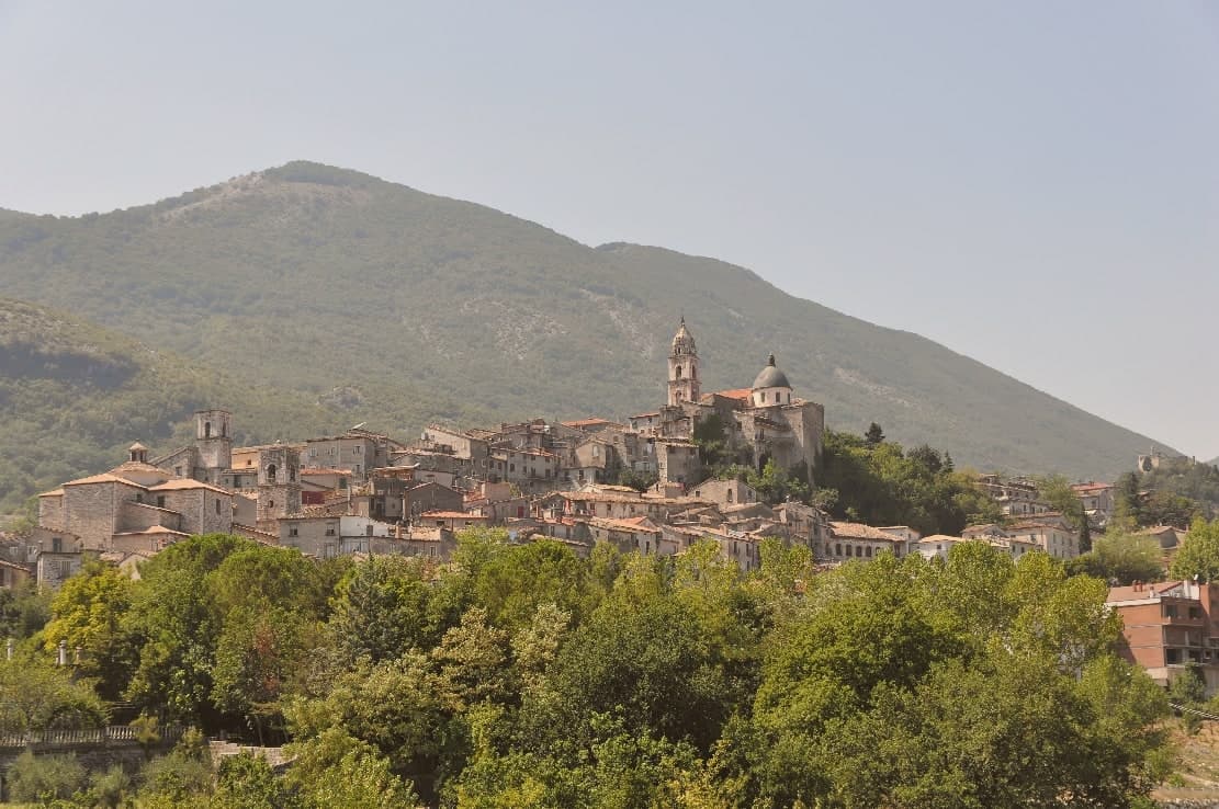
Cusano Mutri sits at 475 meters on the south-facing slope of the Matese massif, in the Parco Regionale del Matese and at the historical border of Sannio Pentro with what is now Molise. The territory climbs from the Lavella gorge at 257 meters to Monte Mutria at 1,823 meters, a vertical kilometer in less than ten of road.
The 1688 Sannio earthquake destroyed nearby Cerreto and Civitella Licinio; Cusano Mutri was the rare town in the area to come through with its medieval fabric standing, which is why the stone houses, arches, and stepped lanes of the centro look the way they do today. The commune joined the Borghi più belli d'Italia in 2006.
The Sagra dei Funghi runs from mid-September to mid-October and draws more than 100,000 visitors a year for porcini gathered on the Matese slopes. The Infioritalia carpets fill the streets in early summer.
What to see in Cusano Mutri
- Centro storico di Cusano Mutri. Medieval old town of stone houses, arches and stepped lanes that came through the 1688 earthquake intact while neighbouring towns fell.
- Monte Mutria. 1,823-meter peak on the Campania-Molise border, the highest point of the commune and the head of its trekking routes.
- Gole di Caccaviola. Narrow limestone gorge cut by the Titerno torrent, with footbridges, waterfalls and a via ferrata used in summer.
How to get to Cusano Mutri
Napoli is roughly 96 minutes away by road.
Our tip
May, June, September and October are the strongest months: cool evenings at 475 meters, walks in the Gole di Caccaviola, and porcini on the Matese in autumn. July and August can climb past thirty degrees in the daytime, though the mountain altitude keeps nights bearable; the centro fills in the second half of August for the Festa del Vino. The Sagra dei Funghi runs from mid-September to mid-October and is the busiest stretch of the year. Sagra dei Funghi falls in September.
Camerota
Why visit Camerota
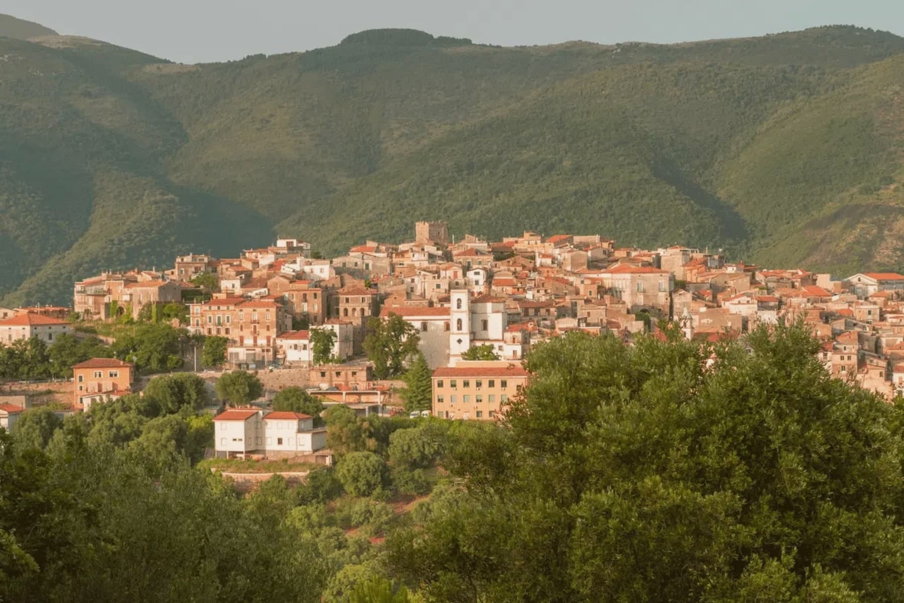
Camerota's hilltop sits six kilometres inland from its own marina, with two further hamlets, Lentiscosa and Licusati, scattered between the summit and the sea, so the town is really four settlements bound to one name rather than a single center. That name probably comes from the Greek kamaròtos, curved, after the limestone arches worked into the coast below.
The hill above stays a medieval center, nearly empty through winter and full in August, its slopes also carrying Cilento DOP olive oil down toward the water. The coast beneath it is a different register entirely: fishing village, protected marine reserve, and a run of sea caves whose excavated layers reach back through the Chalcolithic to Neanderthal occupation, among the longest such sequences on the Tyrrhenian.
What holds the two together is the geography itself, a limestone hill giving its shape to both the arches that named it and the caves that preserved what lived along its shore.
What to see in Camerota
- Grotte di Marina di Camerota. Grotta della Cala and Grotta di San Biagio sit cut into the sea cliffs, reached along the coast rather than from the hilltop, the caves themselves unassuming from outside despite what has come out of them.
- Costa degli Infreschi e della Masseta. The marine area runs between the Marina and Scario, cold freshwater surfacing straight into the sea, a stretch reachable only on foot or by boat, with no road running along it.
- Castello Marchesale di Camerota. Norman in origin, remodelled under the Marchesi, standing on the highest point of the town with the Gulf of Policastro laid out below.
How to get to Camerota
Salerno is roughly 130 minutes away by road.
Our tip
May through September is the open Cilento beach season, with Marina di Camerota filling between late June and August and the boat trips to Cala Bianca and the Infreschi springs running daily. Mid-summer touches the high thirties; the hilltown at 422 meters stays a few degrees cooler and the cave temperature holds at sixteen all year. April and October are quiet and dry, the right window to walk the Bulgheria slopes and visit Grotta della Cala without queues. Gusto Italia falls in August.
Alife
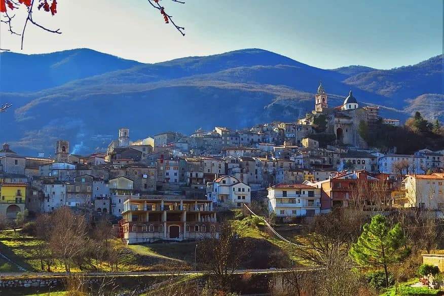
Why visit Alife
Alife sits at 110 meters at the southern foot of the Matese, the rectangular Roman walls still tracing the original plan of the 326 BC Latin colony founded after the Samnite Wars. The circuit runs 1.9 kilometres, with towers every 39 meters and four monumental gates on the cardo and decumano.
Inside the walls lies the largely buried Roman amphitheatre, 48 by 38 meters, the fourth largest in Italy after Rome, Pompeii and Capua. The Cryptoporticum, a 100-meter underground gallery, has been kept legible by recent excavation.
The town gives its name to the Cipolla di Alife, a heirloom red onion documented locally since Roman times and still cultivated on the irrigated plain along the Volturno. Modern Alife sits inside the Parco Regionale del Matese and along the Via Francigena del Sud, with extra-virgin olive oil and Pallagrello and Casavecchia wines on the surrounding slopes.
What to see in Alife
- Mura romane di Alife. Rectangular Roman walls running 1.9 kilometres, with towers every 39 meters and four monumental gates on the original cardo and decumano of the 326 BC colony.
- Anfiteatro Romano. Largely buried amphitheatre of 48 by 38 meters, the fourth largest in Italy after Rome, Pompeii and Capua, dating to the early imperial period.
- Criptoportico Romano. Underground gallery more than 100 meters long, well preserved beneath the centro storico, kept open after recent archaeological excavation.
How to get to Alife
There is a railway station in the town, so you can arrive without a car and never need one while you are here. Napoli is roughly 76 minutes away by road.
Our tip
April through June and September into October are the open months along the Matese foothills, when the Volturno plain is green and the Roman walls walk at a reasonable temperature. July and August push the inland Caserta past thirty-five degrees and the amphitheatre site closes mid-afternoon to protect visitors and stone. The Sagra della Cipolla di Alife happens in mid-September and pulls weekend visitors from Naples and Caserta. Sagra della pannocchia e dell'agricoltura alifana falls in September.
Sant'Agata de' Goti
Why visit Sant'Agata de' Goti
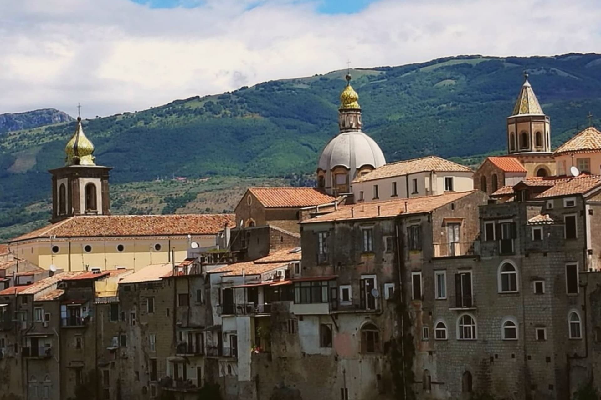
Sant'Agata de' Goti sits at 156 meters on a tuff spur between the Martorano and Riello gorges, thirty-five kilometers northeast of Naples and west of Monte Taburno. The houses on the edge of the centro are built flush with the cliff, their back walls forming a vertical face above the Isclero river thirty meters below.
The Samnites founded Saticula here in the sixth century BC; the current name comes from the Goths who held the town in the sixth century AD, then from Saint Agatha of Sicily as titular of the cathedral. The Lombards of Benevento, the Normans, and the Angevins each rebuilt the castle on the western edge.
The Duomo dell'Assunta in the centro keeps a twelfth-century crypt under a Baroque rebuild. The commune is a Bandiera Arancione of the Touring Club Italiano, holds the Sant'Agata de' Goti Aglianico DOC and Falanghina DOC, and is part of the Città della Nocciola network for the Nocciola di Avellino DOP grown around it.
What to see in Sant'Agata de' Goti
- Castello Ducale. Medieval fortress on the western edge of the cliff, rebuilt by the Lombards, the Normans and the Angevins, now a residence with restored rooms.
- Duomo dell'Assunta. Tenth-century cathedral with a twelfth-century crypt under a Baroque rebuild, columns reused from a Roman temple of Demeter.
- Chiesa dell'Annunziata. Late Gothic church with a fifteenth-century fresco of the Annunciation and a wooden ceiling carved with the symbols of Christ's passion.
How to get to Sant'Agata de' Goti
Napoli is roughly 51 minutes away by road.
Our tip
April through early June and September into October are the strongest months. The valley around Sant'Agata greens, the Aglianico and Falanghina vineyards bud and ripen, and the cliff houses stay cool when the floor of the gorge heats up. July and August can pass thirty-five degrees on the Isclero plain, though the centro on the tuff catches more breeze. Sagra Sansilvestrese a Sant'Agata De' Goti falls in August.
Sessa Aurunca
Why visit Sessa Aurunca
Sessa Aurunca sits at 203 meters on the southwest slope of the extinct volcano Roccamonfina, between the Garigliano river and the Aurunci hills, forty kilometers west-northwest of Caserta. The Aurunci, the Italic people who held this land before Rome, gave the town its name; the Latin colony of Suessa Aurunca was founded here in 313 BC on the road between Capua and Rome.
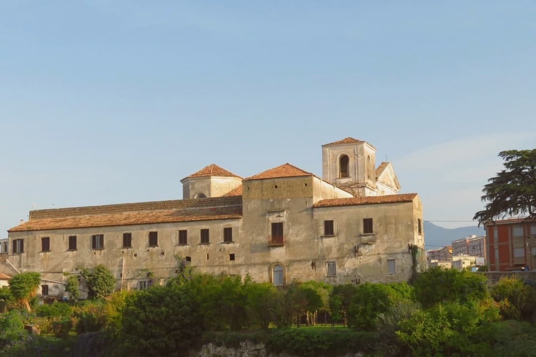
The Roman theater on the slope below the cathedral is one of the largest in southern Italy, with stage decoration found in the 2000s excavations now on display in the Castello Ducale. The Cattedrale dei Santi Pietro e Paolo was built in 1103 over an Augustan-era temple, with twelve antique columns in the nave, an ambon and Easter candelabrum covered in Cosmatesque marble inlay, and a Byzantine-influenced apse.
The commune is Città dell'Olio for the Aurunci olive groves, Città del Tartufo for the truffles of the Roccamonfina foothills, and lies on the Via Francigena del Sud between Rome and Brindisi.
What to see in Sessa Aurunca
- Cattedrale dei Santi Pietro e Paolo. Romanesque cathedral consecrated in 1113 with twelve antique columns, a Cosmatesque ambon and paschal candelabrum, and a Byzantine apse.
- Teatro Romano di Sessa Aurunca. First-century Roman theater on the slope below the cathedral, one of the largest in southern Italy, with sculpted stage decoration recovered after 2000.
- Castello Ducale. Medieval fortress rebuilt by the Lombards, the Normans and the Aragonese, now housing the civic museum with Roman finds from the theater.
How to get to Sessa Aurunca
There is a railway station in the town, so you can arrive without a car and never need one while you are here. Napoli is roughly 72 minutes away by road.
Our tip
April through early June and September into October are the strongest months. The Roccamonfina slopes green and the trails through the chestnut woods open. The Cattedrale opens longer hours and the Roman theater is walkable in shirt sleeves. Festa Popolare della Tammorra falls in July.
Vico Equense
Why visit Vico Equense
Vico Equense sits on a block of tuff and limestone above the Bay of Napoli, twenty-five kilometers from the city and the first town on the Sorrento peninsula coming from the north. A seventh-century BC pre-Roman necropolis predates the Latin Aequana that Roman patricians built here for their villas, and the finds from that older settlement, funerary objects excavated in the 1960s and 1970s, sit now in a museum founded in 1966.
The medieval town that survives was walled by the Angevins after 1284, when Charles II ordered a fortress built on the cliff as both stronghold and residence, and the diocese's cathedral rose on a neighboring clifftop in the same century, before losing its status as a see in 1818. Behind the town, the limestone mass of the Lattari range closes off the land side, reached since 1952 by cable car from the coast at Castellammare.
Pizza by the meter, the town's best-known export, was invented here by Luigi Dell'Amura, called Gigino, in the 1930s, and his restaurant in the centro still serves it. What holds the town together is the sequence itself: a pre-Roman settlement, a Roman villa town, an Angevin fortress and a bishopric, and finally a twentieth-century dish, each layer built on a narrow shelf of rock between the mountain and the bay.
What to see in Vico Equense
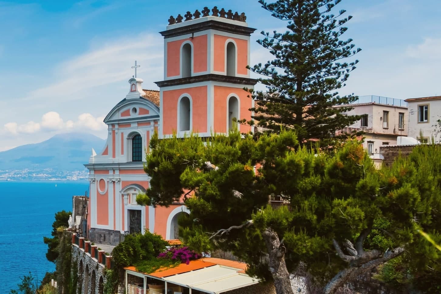
- Chiesa dell'Annunziata. The church stands at the edge of the cliff, its Gothic interior at odds with the Baroque face it was given later. The old cathedral of a diocese that no longer has a seat here.
- Castello Giusso. Angevin castle built between 1284 and 1289 at the order of Charles II of Anjou, with a Renaissance residential wing and gardens above the bay.
- Antiquarium Silio Italico. Archaeological museum founded in 1966, with funerary objects from a seventh-century BC pre-Roman necropolis excavated in the 1960s and 1970s.
How to get to Vico Equense
There is a railway station in the town, so you can arrive without a car and never need one while you are here. Napoli is roughly 55 minutes away by road.
Our tip
May through September is the working season for Vico Equense. June and September are the best months: warm sea, fewer day-trippers than July and August, and the Monte Faito cable car operating on a full schedule. July and August are crowded and hot at sea level, though the Faito plateau stays cooler at around twenty-two degrees. Sagra del Riavulillo falls in the season.
Caserta
Why visit Caserta
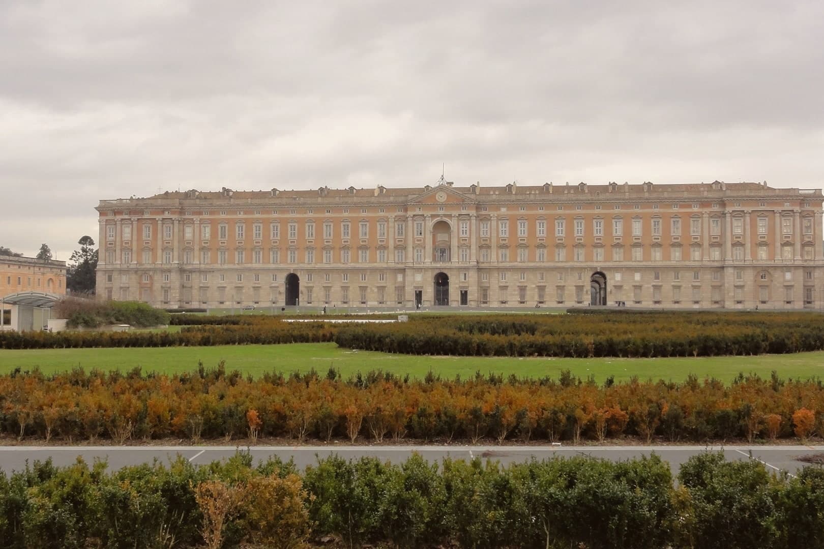
Caserta sits at 68 meters on the Campanian plain, 25 kilometers north of Naples at the foot of the Tifatini hills. The city exists because Charles III of Bourbon decided in 1750 to build a palace that would rival Versailles and the Royal Palace of Madrid, far enough inland to be safe from naval bombardment.
Luigi Vanvitelli laid the first stone in 1752: five floors, 1,200 rooms, 1,742 windows, 34 staircases. The gardens stretch three kilometers from the back façade to a cascade fed by the Carolino Aqueduct, also Vanvitelli's design.
The complex was listed by UNESCO in 1997 together with the silk village of San Leucio, the utopian industrial colony Ferdinand IV built on a hill four kilometers away. Up the road, Casertavecchia, the medieval village abandoned when the Bourbons moved everyone down to the plain, keeps its 12th-century Romanesque cathedral at 401 meters.
The modern city below is a working provincial capital, not a tourist town.
What to see in Caserta
- Reggia di Caserta. Bourbon royal palace begun in 1752 by Luigi Vanvitelli, five floors, 1,200 rooms, UNESCO-listed since 1997 with the park and the Carolino Aqueduct.
- Parco Reale e Giardino Inglese. Three-kilometer formal park ending in a cascade, with an English Garden added by Maria Carolina in 1786, the first of its kind in Italy.
- Casertavecchia. Medieval hilltop village at 401 meters, 10 km from the city, abandoned when the Bourbons relocated the population to the plain.
How to get to Caserta
There is a railway station in the town, so you can arrive without a car and never need one while you are here. Napoli is roughly 38 minutes away by road.
Our tip
April through June and September through October are the comfortable months on the plain. The Reggia gardens are at their best in May, when the parterres bloom and the cascade runs full. July and August push into the high thirties; Vanvitelli's three-kilometer walk from palace to cascade becomes a heat exposure rather than a pleasure, though the shuttle bus runs. Sagra della Mulignana Imbuttunata falls in September.
More from Anywhere Italy
 The 8 best hill towns inside a national park in Campania
 The best hill towns you can reach by train in Campania
- The best hill towns within 75 minutes of Naples
 The best hill towns you can reach by train within 90 minutes of Napoli
 The 9 best olive oil towns in Campania
- The 7 best hill towns that eat well in Campania