
The best towns that cure their own meat within two hours of Parma
Curing meat here is a matter of air. The damp winter fog that settles on the Po plain around Parma does one job, the dry draughts moving through the Apennine valleys south of the river do another, and the salted pork hung in stone cellars takes on the character of whichever it gets. On a village table this arrives as pink slices under a bowl of gnocco fritto, or a wedge of culatello with a glass of Lambrusco, or salame cut thick and eaten with butter and bread. Autumn and early winter are the season, when the pigs were traditionally killed and the norcino came to the house, and many towns still hold a fair for it.
The obvious base is Parma itself, and it earns the attention: the Duomo, the baptistery, the ham museum nearby at Langhirano, the guided visits to prosciutto cellars that fill coaches from October onwards. Bologna pulls the same crowd from the other direction, with tortellini queues and shops selling mortadella by the kilo to people who arrived that morning. Both cities are worth the time. Neither is where the meat is actually hung.
The production zones extend well past the ring roads, up into the hills of the Oltrepò Pavese, along the ridges of the Modenese Apennines, out across the flat land towards the Po, and over the Tuscan side of the mountains to the marble quarries. Fewer people go to these places, and the salame, the culatello, the lardo and the mortadella are made within sight of where they are served. All of the towns below sit inside the protected production zone of a cured meat.
Of the 87 communes we have mapped in a 120-minute drive of Parma, 11 qualify as towns that cure their own meat: each sits inside the production zone of a protected cured meat. This list is 10 of them. The smallest, Montesegale, has 258 residents.
If you are still choosing, we have also written The best towns that cure their own meat within two hours of Bologna and The best towns that cure their own meat within two hours of Brescia.
Montesegale
Why visit Montesegale
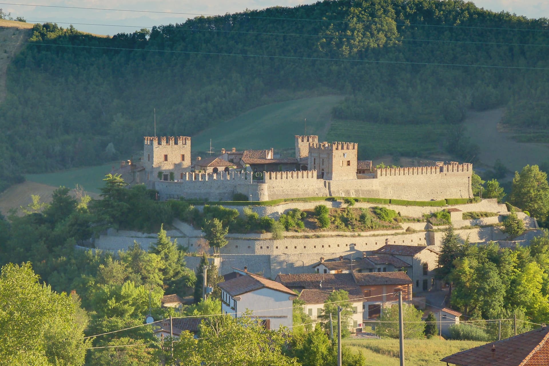
The village takes its position from the hill above the Val Ardivestra, the stream valley that separates its wheat fields and vineyards from the wider Oltrepò Pavese around it. The first historical record dates to the eleventh century, under the bishop of Tortona.
In 1164, Federico Barbarossa transferred the fief to the Counts Palatines of Lomello, whose Gambarana branch took it over in 1311 and held the title of Lords of Montesegale until feudalism ended in 1797. The upper part of the settlement is still organized around the castle those lords built and rebuilt, while the parish church sits below it, a later, separate addition from 1700 serving the working village rather than its lords.
The Borghi Autentici and Città del Pane designations recognize that working character directly: a handful of bakeries, the local Salame di Varzi country, and a wine-and-grain landscape that has changed use only in the castle itself, where the seat of feudal power now holds a contemporary art collection instead of a garrison.
What to see in Montesegale
- Castello dei Conti Gambarana. The fortress dominates the village from its hilltop, reshaped across successive building phases before the seventeenth-century restoration that gave it its present form. The Counts Palatines of Lomello line held it through the Gambarana branch until feudalism ended in 1797.
- Chiesa dei Santi Cosma e Damiano. Parish church built in 1700 below the castle, dedicated to the twin physician saints, with a single nave and Baroque altar.
- Centro storico. Small hill village around the castle, with stone houses, narrow lanes and the steep approach road from the Ardivestra valley below.
How to get to Montesegale
Piacenza is roughly 64 minutes away by road.
Our tip
April through October is the workable window. May, June and September are the strongest: vines in leaf, oak woods green, the castle approach open and dry. July and August push past thirty degrees on the Pavese hills; the village empties between two and six in the afternoon.
Fortunago
Why visit Fortunago
The name Fortunago comes from the Celtic Fortunacus, a settlement marked above a watercourse. The village sits in the Apennine half of the Oltrepò Pavese, the wedge of Pavia province that crosses the Po and presses south toward Liguria, with Varzi to the south and Pinot Nero vineyards to the east.
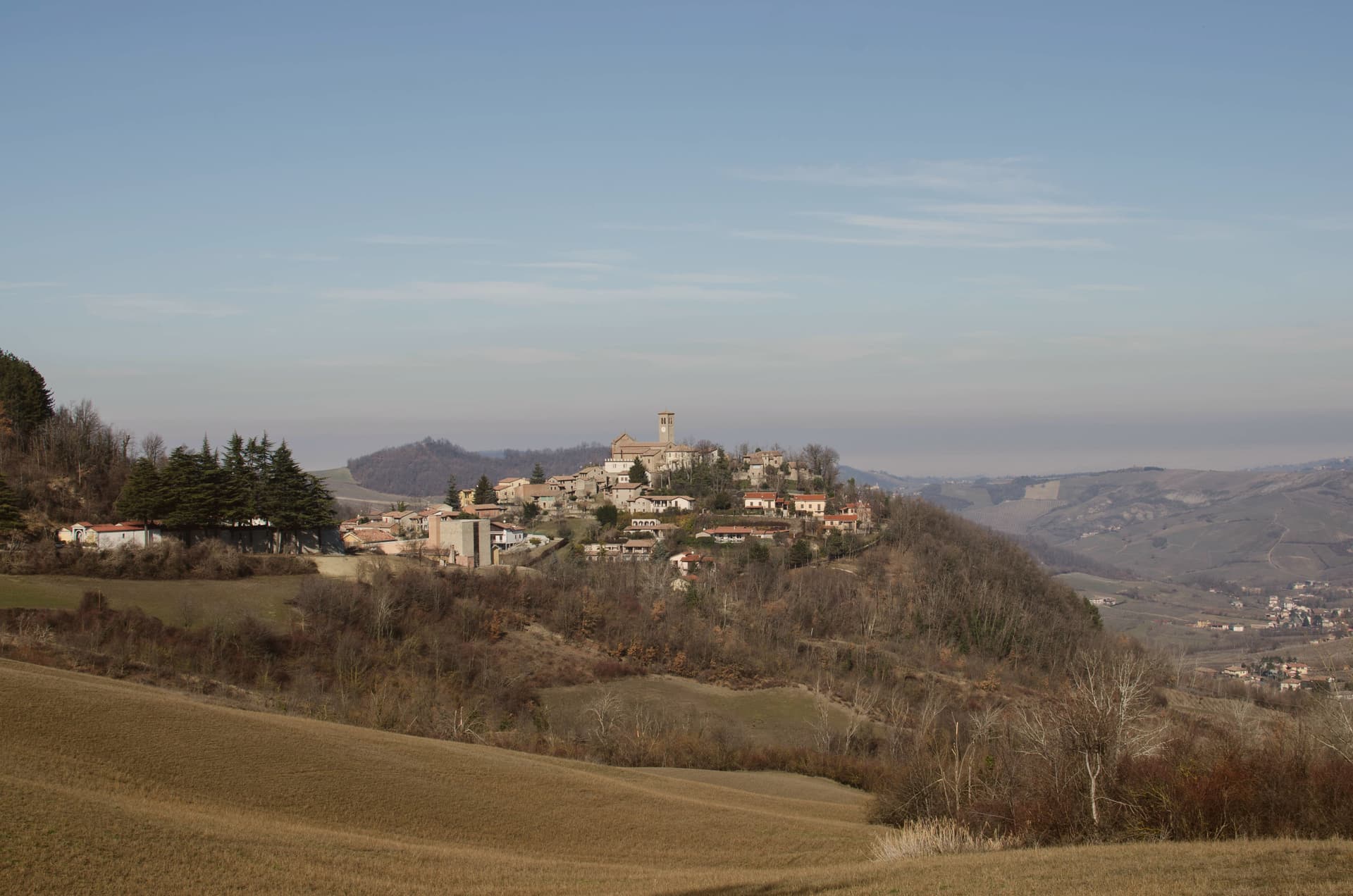
The centro storico climbs the ridge in a single line: the oratory on the lower slope, the church at the upper end, the tower and wall on the rise just past it, so that walking through the village is walking up through its history in order, watercourse settlement, medieval defense, then parish seat. Above it all the hills carry oak and chestnut wood and a pasture plateau at 600 meters.
What holds the place together is the stone itself: the same exposed façades, wooden shutters and porphyry paving run from the lower oratory to the upper church, restored as one piece rather than as separate monuments, which is why the village reads as a whole settlement rather than a scatter of old buildings.
What to see in Fortunago
- Chiesa di San Giorgio. Tempera triptych on wood signed Pesina inside, the church dominating the upper end of the village and visible above the rooftops.
- Torre del castello. One tower and a run of wall, all that stands of the fortress that once held the rise above the church.
- Oratorio di Sant'Antonio Abate. Chapel dedicated to the Virgin of Sorrows, set on the slope below the centro storico, away from the village's main religious building.
How to get to Fortunago
Piacenza is roughly 62 minutes away by road.
Our tip
April through October is the active season. May and June bring wildflowers across the high pasture plateau above the village and the first salumi festas. July and August are warm but not oppressive at this altitude, with evenings dropping into the high teens.
Zavattarello
Why visit Zavattarello
Zavattarello sits at 525 meters on a ridge in the Alta Val Tidone, the Oltrepò Pavese stretch where the Apennines slope down toward the Po. The name derives from the vulgar Latin savattarellum, the place where savatte, slippers, were made.
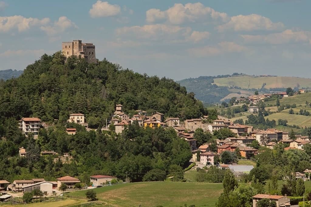
The fortress towers over the medieval borgo below, and the two read as one composition: stone village and stone stronghold, the lane climbing through covered passages toward the walls that once enclosed the whole community. The Apennine setting, midway between the Po plain and the Ligurian Sea, gives Zavattarello one of the more dramatic positions among the Borghi più belli of Lombardy.
A place named for slippers grew into a seat of counts and a captain of Milan, and what remains is the relation between the two: the working village at the foot of the ridge, and the fortress that governed it, still standing above.
What to see in Zavattarello
- Castello Dal Verme. Fortified enclosure with stables and chapel besides the keep, forty rooms in all, standing over the borgo it once ruled for six centuries.
- MACA Museo d'Arte Contemporanea Dal Verme. Contemporary art museum inside the castle, dedicated to Giuseppe and Titina Dal Verme, with the family tombs of the counts.
- Borgo medievale di Zavattarello. Stone village clinging to the ridge below the castle, partly still walled, crossed by a narrow lane with covered passages.
How to get to Zavattarello
Piacenza is roughly 57 minutes away by road.
Our tip
April through October is the right window for the Val Tidone. The castle is open, the ridge trails into the Apennine are dry, and the temperatures at 525 meters stay below the Po-plain heat. May and June bring wildflowers to the surrounding hills; September and October are the dry, gold months of the chestnut harvest.
Carrara
Why visit Carrara
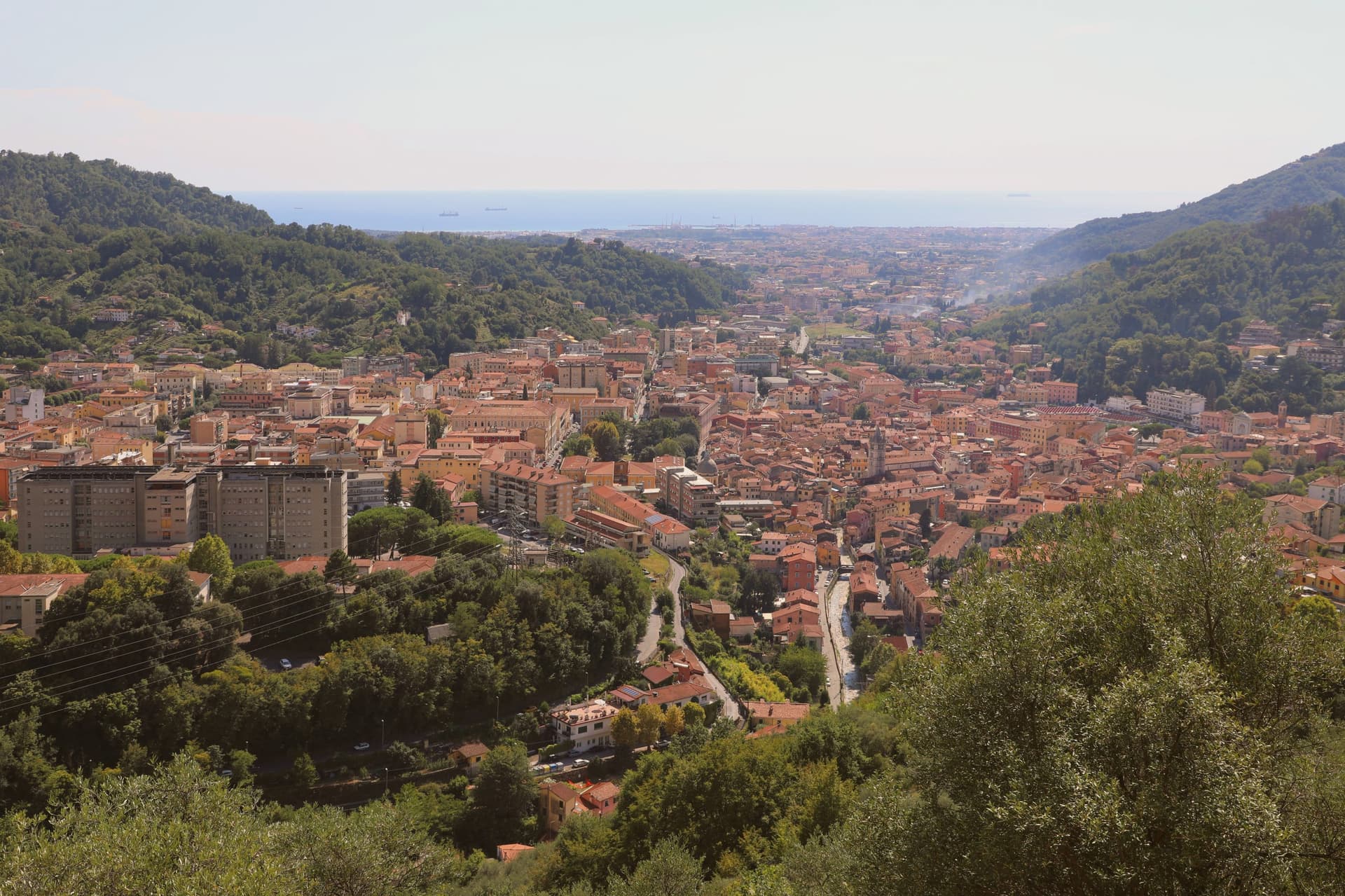
Carrara sits at 80 meters in the narrow plain where the Apuan Alps drop to the Tyrrhenian. The 650-plus marble quarries in the three valleys above the town, Torano, Fantiscritti and Colonnata, have produced more marble than any other place on earth, worked since Roman times.
The white and blue-grey stone went into the Pantheon and Trajan's Column. Michelangelo first came in 1497 to find marble for his Pietà and kept returning until he opened his own quarry in the Polvaccio above Torano, still called Cava di Michelangelo.
The Duomo di Sant'Andrea, begun in the eleventh century, was the first medieval church built entirely of the local stone, with a bichrome marble façade. The city's Accademia di Belle Arti has trained sculptors since 1769 and the surrounding studi still work commissions for sculptors who never set foot in Italy.
Extra, Il Narciso, Enoteca Velia have been named by a guide.
What to see in Carrara
- Duomo di Sant'Andrea. Eleventh-century cathedral, the first medieval church built entirely of Apuan marble, with a Romanesque-Gothic bichrome façade finished in the fourteenth century.
- Cave di Marmo. Over 650 quarry sites in the Torano, Fantiscritti and Colonnata valleys, worked since Roman times and visible on cave tours from the town.
- Piazza Alberica. Sixteenth-century square built by Alberico I Cybo Malaspina inside the expanded city walls, ringed by marble façades and a central statue of Maria Beatrice d'Este.
How to get to Carrara
There is a railway station in the town, so you can arrive without a car and never need one while you are here. Pisa is roughly 55 minutes away by road.
✷ We have written about Carrara
“The road that goes up to Colonnata ends at Colonnata, and you understand this only when you arrive, because the village sits on a shelf of the mountain that the road was built to reach, and there is nowhere else for the road to go. I had driven up from the coast on a Tuesday in late spring with the windows open. I had come up to eat fat.”
Read our piece on Carrara →Colonnata, Carrara, and the Marble Mines | The White Mountain And The Fat
Our tip
May through September is when the cave tours run reliably and the seafront frazione of Marina di Carrara fills with families from Lombardia and Emilia. June is the best month for the quarries: long light, stable weather, and the white-on-white-on-grey of the cuts is visible at the Fantiscritti viewpoint without the August haze. July and August add heat and tour buses, particularly at Colonnata where the lardo cellars stay cool.
Sestola
Why visit Sestola
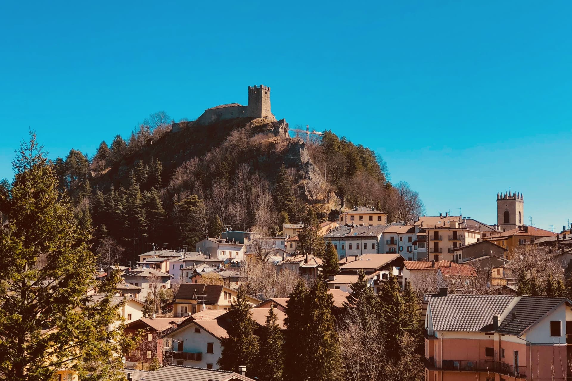
Sestola sits fifty kilometers southwest of Bologna, at the head of the Scoltenna valley, on the southern slope of the mountain that dominates the Frignano. The castle above the town began as a donation, made by the Lombard king Astolfo to the Abbey of Nonantola, before passing to the Este of Modena, who turned it into their most important garrison in the district.
That layered ownership, monastic then military, is why the same rock now holds museums of mechanical instruments, local civilisation and military history under one roof. The mountain itself is shared ground, its slopes and the ski domain across them spilling over into the neighboring communes rather than belonging to Sestola alone.
Below the peak, the character of the place shifts with the season: the same slopes that carry skiers in winter turn over to hikers in summer, and the small glacial lake above town trades snowshoe trails for paddle-boats. The town, in effect, is a fixed point of stone and governance at the foot of a mountain whose use keeps changing with the calendar.
San Rocco have been named by a guide.
What to see in Sestola
- Rocca di Sestola. Castle first documented in 753, granted to Nonantola by King Astolfo, taken by the Este in 1337 and held as their main military garrison in the Frignano. It still rises above the centro storico.
- Museo degli Strumenti Musicali Meccanici. Collection of mechanical music instruments inside the castle, from barrel organs to early phonographs, one of three small museums housed there.
- Monte Cimone. Highest peak of the northern Apennines at 2,165 meters, shared with Fanano, Fiumalbo and Riolunato.
How to get to Sestola
Modena is roughly 79 minutes away by road.
Our tip
Sestola runs on two seasons. December through March is ski country: the Cimone lifts open around late November and run to mid-April depending on snow, and the centro storico fills on weekends with visitors from Bologna and Modena. June through September is hiking season, with Lago della Ninfa accessible by chairlift from town and the trails to the Cimone summit open into October.
Canossa
Why visit Canossa
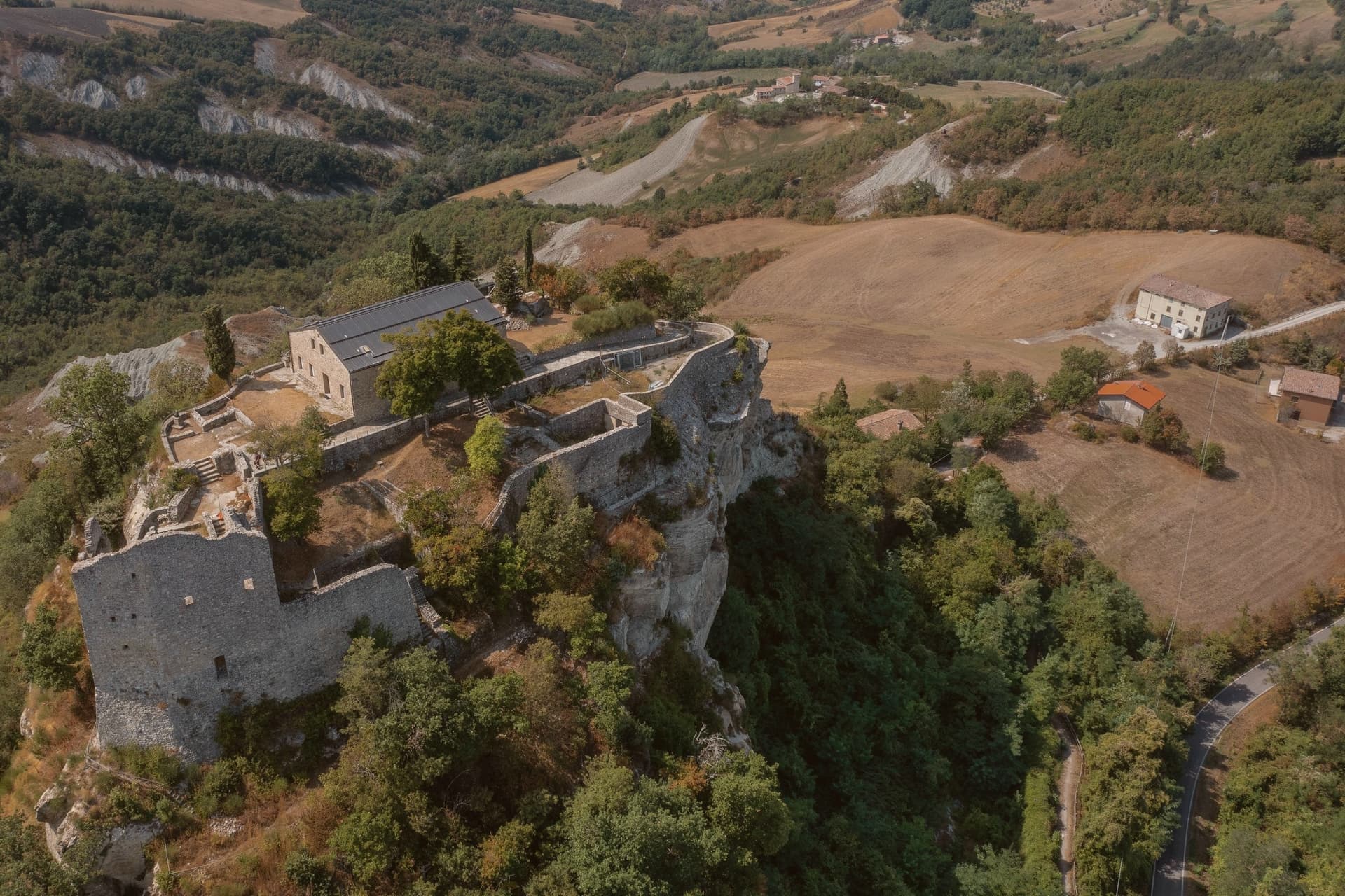
Canossa sits on the Apennine slope thirty kilometers south of Parma and twenty-five southwest of Reggio Emilia, at 219 meters at the seat in Ciano d'Enza. The commune is named for the ruined fortress on a white limestone outcrop eight kilometers east, built before 950 by Adalbert Atto of Lucca and held by Matilde di Canossa until her death in 1115.
The fortress was destroyed by Reggio Emilia in 1255. The commune was itself called Ciano d'Enza until 1992, when it took the older name back, so the seat in the valley and the ruin on the hill now share one name across two places.
Vineyards on the surrounding slopes produce Lambrusco and the Spergola white grape, and the path between Ciano and the castle ruin remains the Sentiero Matilde, the same climb that once carried Henry IV to the gate where Gregory VII made him wait. A commune this small holds an outsized memory: a valley seat, a demolished hilltop stronghold, and a name discarded and then reclaimed, all turning on three days that happened at the top of the path.
What to see in Canossa
- Castello di Canossa. Fortress on a white sandstone outcrop, its walls reduced to a ruin standing over the valley since the demolition of 1255. The site now houses the Museo Nazionale Naborre Campanini.
- Castello di Rossena. Best-preserved of the Matildic castles, built in the tenth century on volcanic rock to guard the western approach to the ruin on the neighboring hill.
- Torre di Rossenella. Square watchtower a kilometer from Rossena, built on a separate basalt pinnacle as a forward observation post for the defensive system below.
How to get to Canossa
There is a railway station in the town, so you can arrive without a car and never need one while you are here. Reggio Emilia is roughly 43 minutes away by road.
Our tip
April through June brings green hills, Spergola flowering, and clear views from the castle ruin down to the Po plain. September and October dry the slopes into gold for the harvest of Lambrusco and Spergola, the busiest weekends at the Matildic castles. July and August touch thirty-four degrees and the path up from Ciano empties between two and five.
Busseto
Why visit Busseto
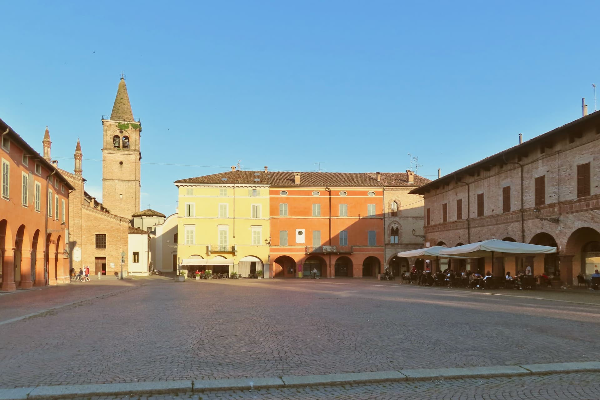
The town sits twenty-five kilometers northwest of Parma, in the flat farming country of the Bassa Parmense between the Po and the Apennine foothills. It was the capital of the Stato Pallavicino for almost five hundred years before the territory was absorbed into the Duchy of Parma, and the fortress built for that state still anchors the main piazza today.
Roncole, the frazione where Verdi was born, lies three kilometers east; he moved into Busseto proper as a boy in 1824, and Villa Sant'Agata, the house he later bought and kept until his death, lies five kilometers north of the center. The three places trace a line outward from the town: birth to the east, boyhood at the center, and the household of his adult life to the north.
The Bassa around the town is also farming country in a more literal sense, producing the Culatello di Zibello and the Parmigiano Reggiano that the local consortium has aged here since the nineteenth century. A small provincial capital, in other words, whose built center was shaped by one family's rule and whose long afterlife has been shaped by one composer's, with the surrounding plain supplying the food economy underneath both.
Campanini have been named by a guide.
What to see in Busseto
- Teatro Giuseppe Verdi. The stage sits inside the fortress walls, reached through the courtyard rather than a freestanding facade. The empty box he kept is still pointed out.
- Rocca dei Pallavicino. Fifteenth-century fortress on the main piazza, seat of the Stato Pallavicino for centuries. It now holds the theatre in one wing and the town hall in another.
- Casa Natale di Verdi. A modest house at Roncole, three kilometers east, kept much as it would have been, with the rooms where a child grew up rather than the trappings of later fame.
How to get to Busseto
There is a railway station in the town, so you can arrive without a car and never need one while you are here. Parma is roughly 38 minutes away by road.
Our tip
April through June and September through October are the working months in the Bassa. The Po Valley sky clears and the cured-meat acetaie reopen their tasting rooms after winter. July and August are heavy.
Spilamberto
Why visit Spilamberto
Spilamberto sits at 69 meters on the right bank of the Panaro, fifteen kilometers southeast of Modena, on the line of the ancient Via Romea that ran from northern Europe to Rome. The town is documented from 776.
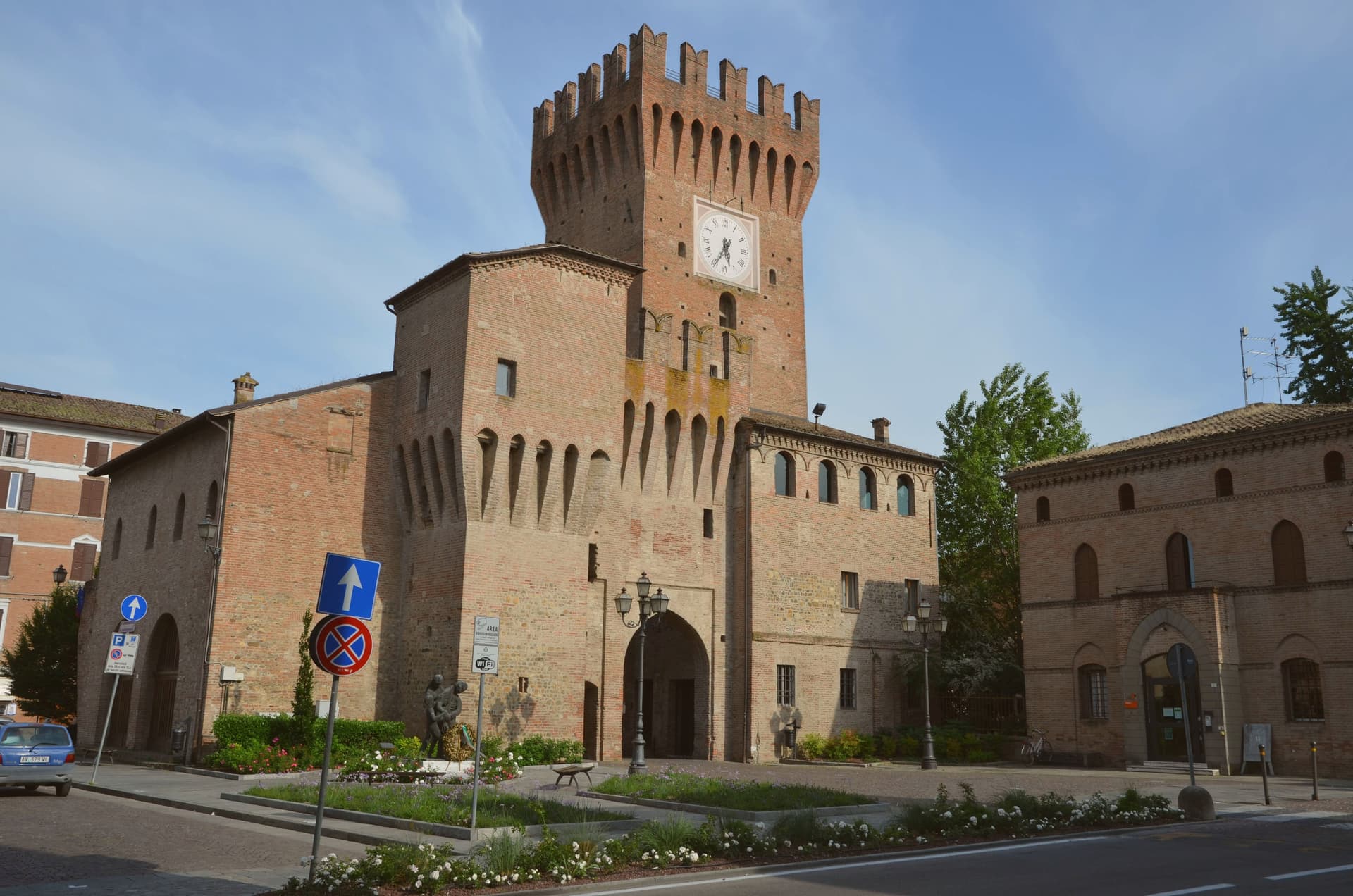
The Rangoni family of Modena held it for more than 650 years, and the fortress they built still anchors the centro storico, with the medieval bell tower at the edge of the borgo holding both an archaeological museum and the headquarters of the walnut liqueur order. In 1967 a group of local enthusiasts founded the Consorteria dell'Aceto Balsamico Tradizionale di Modena here, and it still certifies the twelve- and twenty-five-year-aged DOP product through annual blind tastings.
An eighteenth-century Este road that ran from Modena to Massa leaves the town heading south, a reminder that Spilamberto has always sat at a crossing point: the old route running through it toward the north and Rome, another road departing from it toward the south, the river marking its edge. A plain town that became, almost by local initiative rather than geography, the place where a regional product got its rules written down.
What to see in Spilamberto
- Rocca Rangoni. The fortress anchors the centro storico, its walls facing onto the streets that grew up around it rather than set apart from them.
- Torrione. Medieval bell tower at the edge of the borgo, housing the Antiquarium museum and the headquarters of the Ordine del Nocino Modenese.
- Museo dell'Aceto Balsamico Tradizionale. Museum at Villa Fabriani laying out the production cycle in physical form: the cooked must, the graduated run of casks, the attic rooms where fifty years of seasoning take place.
How to get to Spilamberto
There is a railway station in the town, so you can arrive without a car and never need one while you are here. Modena is roughly 24 minutes away by road.
Our tip
April through June and September through October are the months for Spilamberto. The Greenway del Panaro runs without crowds, the cantine open their tasting rooms, and the Mast Còt festival in October pulls together producers from the entire Modenese balsamic chain for two weekends of new-must boiling and old-cask tasting. July and August are heavy on the plain; thirty-five degrees and humidity that doesn't drop after dark.
Sasso Marconi
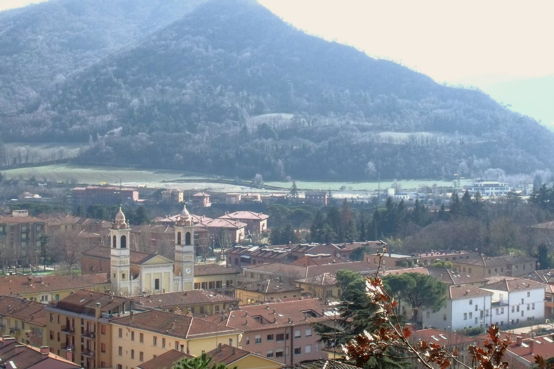
Why visit Sasso Marconi
The Setta and Reno rivers meet below the rock that gives the town its name, at the point where the pre-Apennine hills begin their climb south of Bologna. The Sasso della Glosina dominates the bend, a Pliocene formation old enough to have shaped how the crossing below it was used long before the valley took its modern name.
The town itself was called Sasso Bolognese until 1938, when it was renamed for the family whose estate lies in the frazione of Pontecchio, on the valley floor rather than on the rock itself. The territory reaches from that river confluence up into the Apennine slopes, and the change in elevation shows in what the land produces: white truffle from the valley floor near the Reno, and vineyards on the hills around Pieve del Pino and Mongardino, recognition earned on two different registers of the same ground.
The lower town, built around the rivers and the old road to Pistoia, and the upper slopes, given to woods and terraced vines, read as one territory doing two different kinds of work.
Casa Mazzucchelli, Antica Trattoria la Grotta dal 1918 have been named by a guide.
What to see in Sasso Marconi
- Villa Griffone - Museo Marconi. Marconi family villa in the frazione of Pontecchio. The mausoleum sits alongside the attic laboratory, and the museum holds working reproductions of his early apparatus.
- Sasso della Glosina. The rock rises directly over the river bend, its bulk visible from the crossing below and from much of the surrounding valley.
- Confluenza Setta-Reno. Meeting of the two valleys at the foot of the rock, with the historic crossing of the Via Porrettana toward Pistoia.
How to get to Sasso Marconi
There is a railway station in the town, so you can arrive without a car and never need one while you are here. Bologna is roughly 26 minutes away by road.
Our tip
April through October is the working season in Sasso Marconi. Spring and early autumn are best on the Reno valley trails and at Villa Griffone, with mild temperatures and the Apennine foothills green or autumn-coloured. July and August can touch thirty-five degrees in the valley, though the higher frazioni stay cooler; many visitors come up from Bologna for a day on a weekend. Fira di Sdaz di Sasso Marconi falls in September.
Vignola
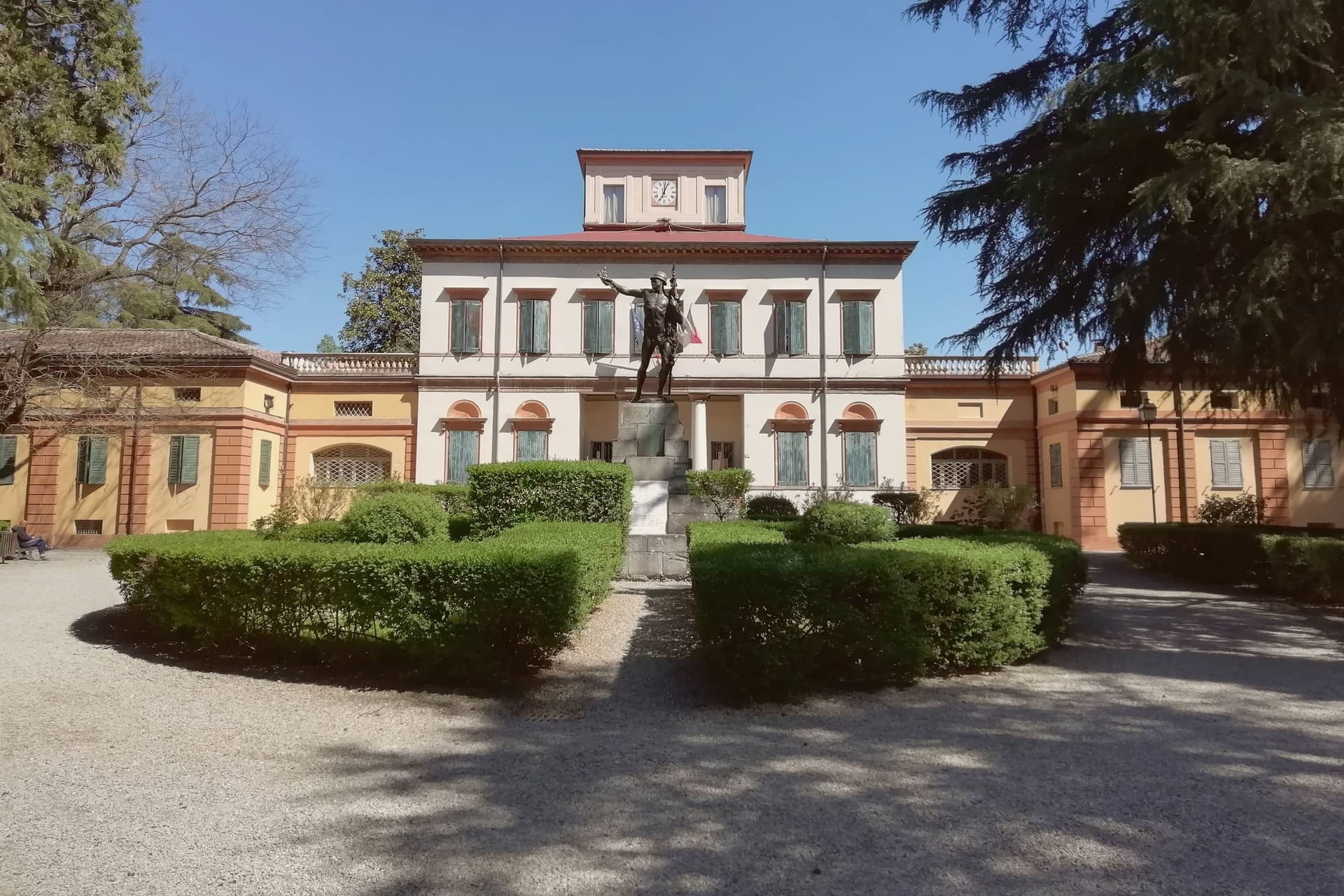
Why visit Vignola
Vignola sits at 125 meters on the right bank of the Panaro, twenty-five kilometers south of Bologna and twenty east of Modena, where the Modenese plain meets the Apennine foothills. The fortress there is documented from the eighth century, raised by the Abbot of Nonantola to guard the abbey's lands before the Contrari family rebuilt it in the fifteenth century as a fortified residence; in 1577 it passed to the Boncompagni-Ludovisi, who held it until 1965.
The palace beside it takes its second name from the family that acquired it, and from the architect born in the town in 1507, who died in 1573 after a career among the leading figures of late Renaissance architecture. The cherries that carry the town's name upriver and down are IGP-protected across twenty-eight communes stretching from Modena to Bologna, and the blossom that precedes the fruit each spring fills the Panaro valley below the walls.
A disused railway, now a greenway, threads through the same ground on its way between Mirandola and Bologna. The town's identity rests on this pairing of a fortified height above the river and an agricultural valley beneath it, one lineage of stone, one of orchards, both still legible in the place today.
What to see in Vignola
- Rocca di Vignola. Eighth-century origin, built to guard the lands of an abbey and later rebuilt as a fortified residence. The frescoed interiors and four corner towers stand over the river much as the rebuilding left them.
- Scala a Chiocciola di Palazzo Barozzi. The 106 steps rise with no central support, an engineering feat as much as a decorative one, tucked inside the palace next to the fortress.
- Palazzo Boncompagni. The palace passed to the family that gives it its name in the late sixteenth century and held the fortress until 1965. Its reception rooms carry frescoes alongside the staircase it is best known for.
How to get to Vignola
There is a railway station in the town, so you can arrive without a car and never need one while you are here. Modena is roughly 34 minutes away by road.
Our tip
April through June and September through October are the working months on the Panaro foothills. The first two weekends of April fill the centro with the Festa dei Ciliegi in Fiore, when the orchards along the river bloom. June brings cherries to market and the Panaro at high water.
More from Anywhere Italy
- The best towns that cure their own meat within two hours of Bologna
- The best towns that cure their own meat within two hours of Brescia
- The best towns that cure their own meat within two hours of Verona
- The best towns you can reach by train within 75 minutes of Parma
 The best towns that cure their own meat within two hours of Padua
- The best hidden towns you can reach by train in Emilia-Romagna