
The best hill towns within 90 minutes of Piacenza
The plain around Piacenza ends abruptly. Within half an hour of the ring road the land folds into the Val Trebbia, the Val Tidone, the Val d'Arda and the Oltrepò Pavese, and the villages there are built from river stone and pale sandstone, roofed in slate, wrapped around a castle keep or a pieve with a Romanesque apse. This is coppa and pancetta and salame country, cured in cellars that stay cold through August, eaten with gnocco fritto and a glass of fizzy red that locals drink without ceremony. Autumn is the season the hills earn their reputation, with chestnuts, porcini and the first bottles of Bonarda, though late spring brings broom flowering along every switchback.
Most travellers crossing this part of Emilia are not stopping at all. They are on the A1 heading for Parma and Bologna, or they have set aside a day for Parma itself, its baptistery, its ham museums and its restaurant bookings made weeks ahead. Parma deserves the attention it gets, and it absorbs almost all of it in this corner of the region. The result is a strange imbalance: a famous food city at capacity, and an entire range of hills behind it moving at the pace of a market morning.
The same cured meats, the same Apennine ridges and the same stone villages continue well past the motorway exits, up the Trebbia towards Liguria and across the provincial border into the Oltrepò Pavese. These are the towns on those roads, reachable from Piacenza in an easy morning's drive, some with a medieval borgo intact and some with little more than a castle, a bar and a view down the valley. Fewer people go, which mostly means you can park.
Of the 9 communes we have mapped within 90 minutes of Piacenza, 8 qualify as hill towns: each is an inland hill settlement. The smallest, Montesegale, has 258 residents.
If you are still choosing, we have also written The best hidden hill towns in Lombardia and The best hill towns within 90 minutes of Milan.
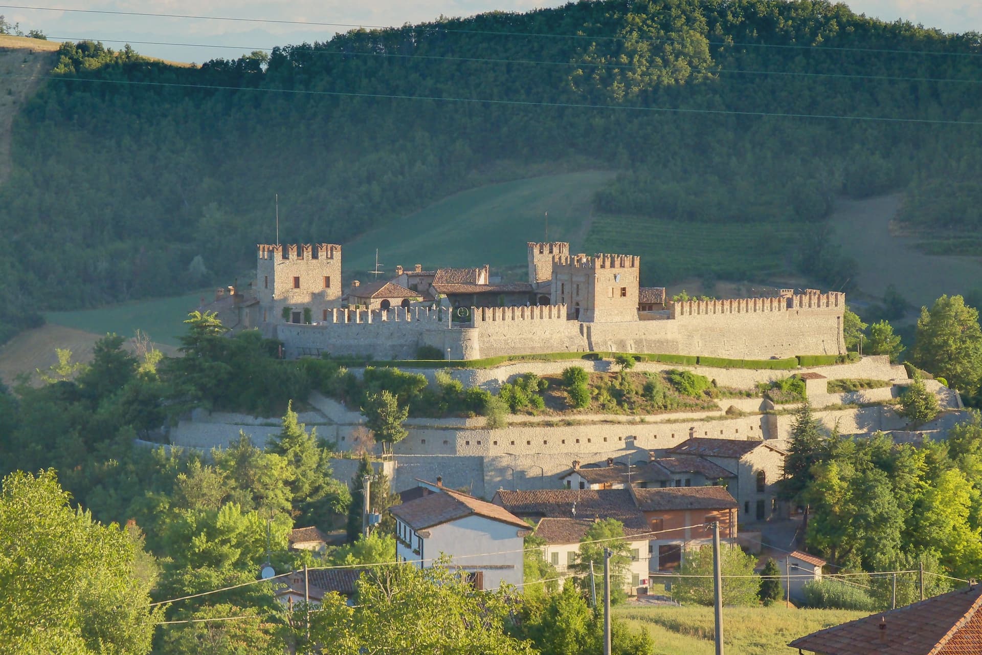
Montesegale
Why visit Montesegale
The village takes its position from the hill above the Val Ardivestra, the stream valley that separates its wheat fields and vineyards from the wider Oltrepò Pavese around it. The first historical record dates to the eleventh century, under the bishop of Tortona.
In 1164, Federico Barbarossa transferred the fief to the Counts Palatines of Lomello, whose Gambarana branch took it over in 1311 and held the title of Lords of Montesegale until feudalism ended in 1797. The upper part of the settlement is still organized around the castle those lords built and rebuilt, while the parish church sits below it, a later, separate addition from 1700 serving the working village rather than its lords.
The Borghi Autentici and Città del Pane designations recognize that working character directly: a handful of bakeries, the local Salame di Varzi country, and a wine-and-grain landscape that has changed use only in the castle itself, where the seat of feudal power now holds a contemporary art collection instead of a garrison.
What to see in Montesegale
- Castello dei Conti Gambarana. The fortress dominates the village from its hilltop, reshaped across successive building phases before the seventeenth-century restoration that gave it its present form. The Counts Palatines of Lomello line held it through the Gambarana branch until feudalism ended in 1797.
- Chiesa dei Santi Cosma e Damiano. Parish church built in 1700 below the castle, dedicated to the twin physician saints, with a single nave and Baroque altar.
- Centro storico. Small hill village around the castle, with stone houses, narrow lanes and the steep approach road from the Ardivestra valley below.
How to get to Montesegale
Piacenza is roughly 64 minutes away by road.
Our tip
April through October is the workable window. May, June and September are the strongest: vines in leaf, oak woods green, the castle approach open and dry. July and August push past thirty degrees on the Pavese hills; the village empties between two and six in the afternoon.
Fortunago
Why visit Fortunago
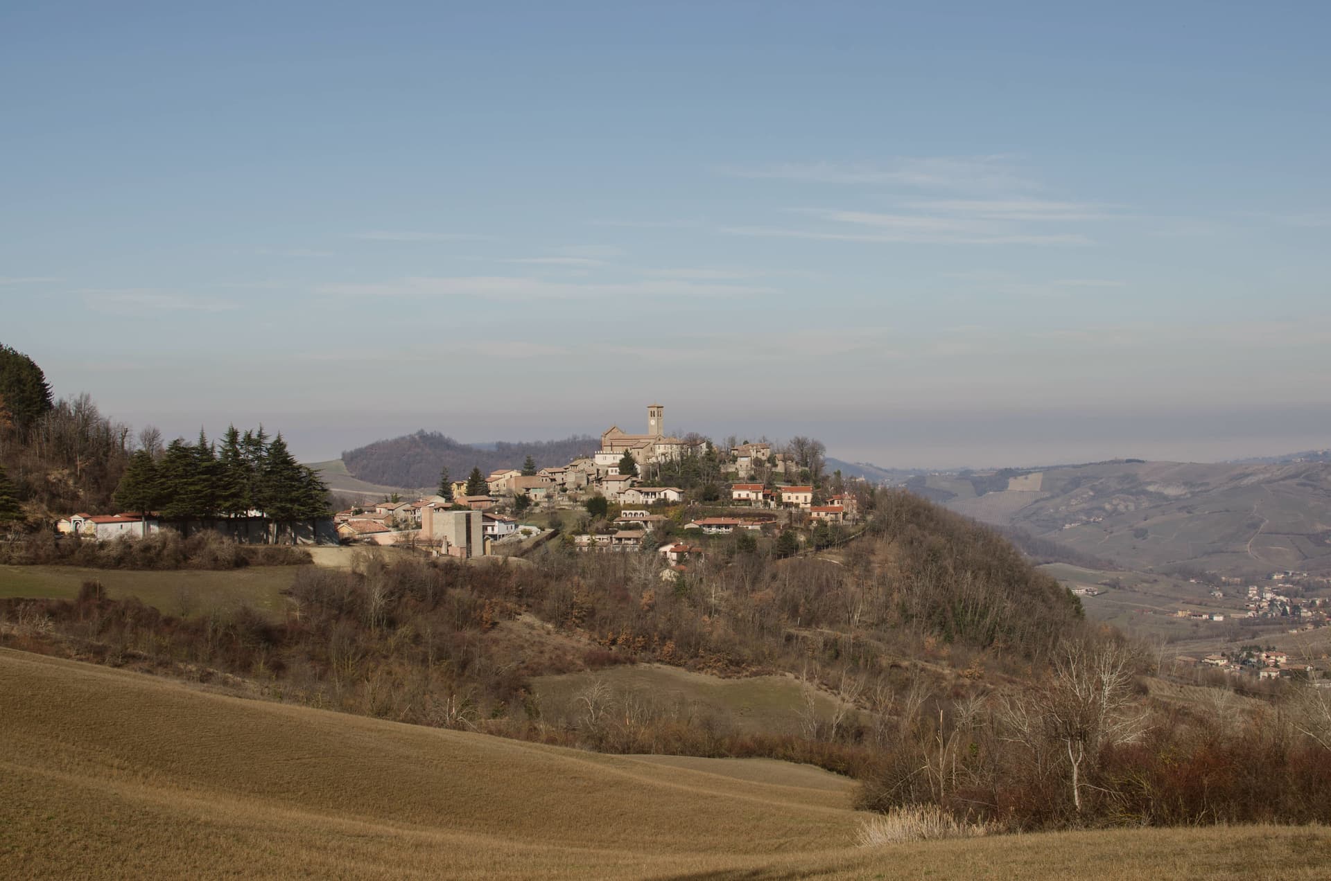
The name Fortunago comes from the Celtic Fortunacus, a settlement marked above a watercourse. The village sits in the Apennine half of the Oltrepò Pavese, the wedge of Pavia province that crosses the Po and presses south toward Liguria, with Varzi to the south and Pinot Nero vineyards to the east.
The centro storico climbs the ridge in a single line: the oratory on the lower slope, the church at the upper end, the tower and wall on the rise just past it, so that walking through the village is walking up through its history in order, watercourse settlement, medieval defense, then parish seat. Above it all the hills carry oak and chestnut wood and a pasture plateau at 600 meters.
What holds the place together is the stone itself: the same exposed façades, wooden shutters and porphyry paving run from the lower oratory to the upper church, restored as one piece rather than as separate monuments, which is why the village reads as a whole settlement rather than a scatter of old buildings.
What to see in Fortunago
- Chiesa di San Giorgio. Tempera triptych on wood signed Pesina inside, the church dominating the upper end of the village and visible above the rooftops.
- Torre del castello. One tower and a run of wall, all that stands of the fortress that once held the rise above the church.
- Oratorio di Sant'Antonio Abate. Chapel dedicated to the Virgin of Sorrows, set on the slope below the centro storico, away from the village's main religious building.
How to get to Fortunago
Piacenza is roughly 62 minutes away by road.
Our tip
April through October is the active season. May and June bring wildflowers across the high pasture plateau above the village and the first salumi festas. July and August are warm but not oppressive at this altitude, with evenings dropping into the high teens.
Zavattarello
Why visit Zavattarello
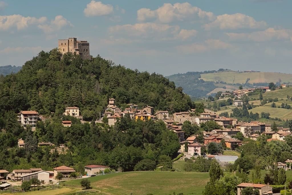
Zavattarello sits at 525 meters on a ridge in the Alta Val Tidone, the Oltrepò Pavese stretch where the Apennines slope down toward the Po. The name derives from the vulgar Latin savattarellum, the place where savatte, slippers, were made.
The fortress towers over the medieval borgo below, and the two read as one composition: stone village and stone stronghold, the lane climbing through covered passages toward the walls that once enclosed the whole community. The Apennine setting, midway between the Po plain and the Ligurian Sea, gives Zavattarello one of the more dramatic positions among the Borghi più belli of Lombardy.
A place named for slippers grew into a seat of counts and a captain of Milan, and what remains is the relation between the two: the working village at the foot of the ridge, and the fortress that governed it, still standing above.
What to see in Zavattarello
- Castello Dal Verme. Fortified enclosure with stables and chapel besides the keep, forty rooms in all, standing over the borgo it once ruled for six centuries.
- MACA Museo d'Arte Contemporanea Dal Verme. Contemporary art museum inside the castle, dedicated to Giuseppe and Titina Dal Verme, with the family tombs of the counts.
- Borgo medievale di Zavattarello. Stone village clinging to the ridge below the castle, partly still walled, crossed by a narrow lane with covered passages.
How to get to Zavattarello
Piacenza is roughly 57 minutes away by road.
Our tip
April through October is the right window for the Val Tidone. The castle is open, the ridge trails into the Apennine are dry, and the temperatures at 525 meters stay below the Po-plain heat. May and June bring wildflowers to the surrounding hills; September and October are the dry, gold months of the chestnut harvest.
Volpedo
Why visit Volpedo
Volpedo sits at 182 meters in the Colli Tortonesi, fifty-five kilometers north of Genova, on the lower slopes between the Curone and the Grue. The two rivers frame the hill country that supplies the DOC wines, and the village itself is small enough that its medieval core, its parish church at the edge of town, and the painter's studio at the opposite edge all sit within walking distance of one another.
Giuseppe Pellizza was born in Volpedo on 28 July 1868, studied with Fattori at the Accademia in Florence, and returned in 1892, when he began signing his work da Volpedo. He married Teresa Bidone, who died in childbirth in 1907, the same year Pellizza died by his own hand in the studio he had built in 1888.
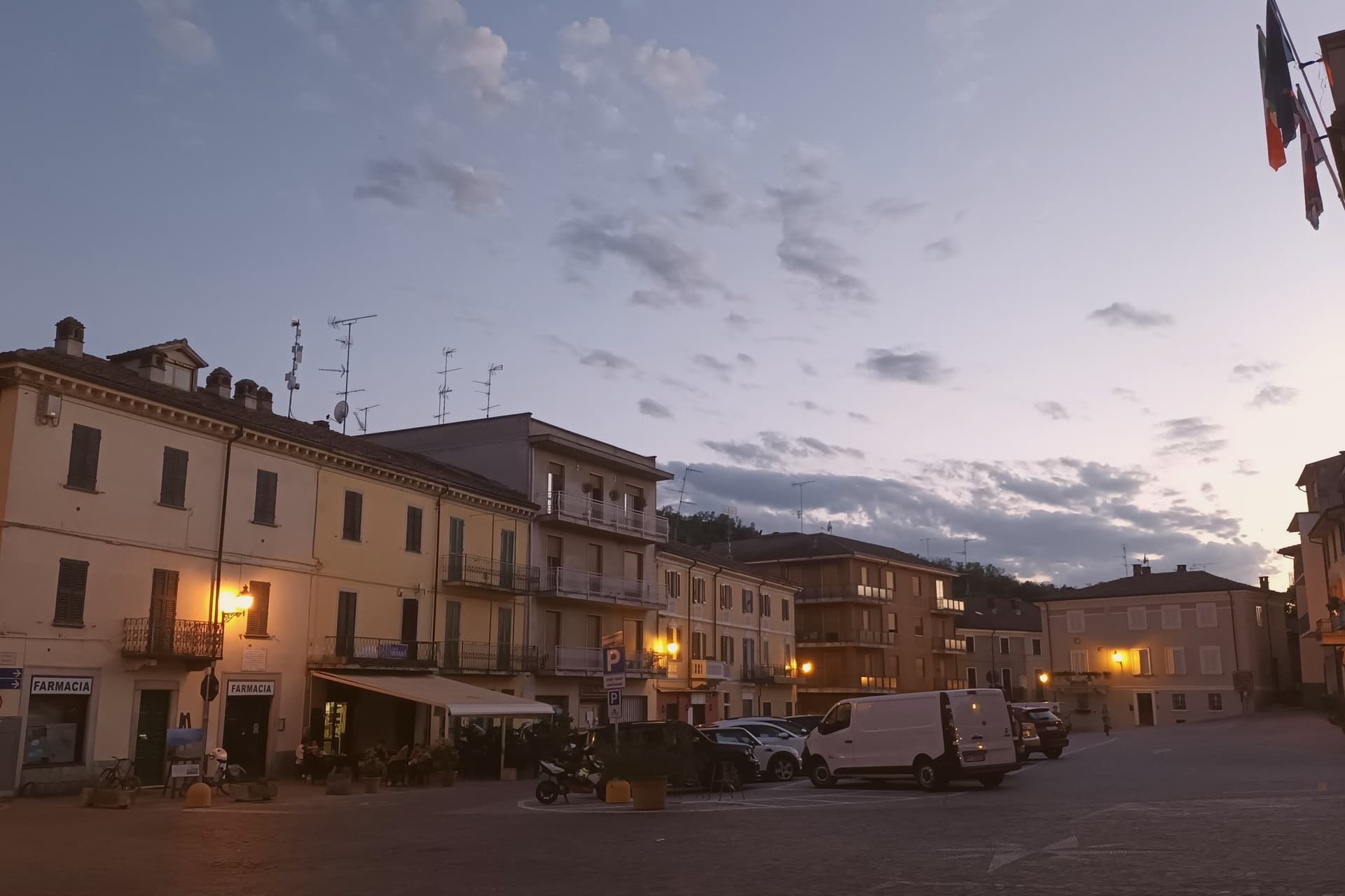
That studio stands still, kept as he left it. The centro storico's own piazza served as the setting for his 1901 canvas, painted a few years before his death.
The town's identity rests on that short span between 1868 and 1907: a painter who left, trained elsewhere, and came back to set his most famous work in the square outside his door, on hills he kept painting until the end.
What to see in Volpedo
- Studio-Museo di Pellizza da Volpedo. House and studio the painter built in 1888 at the edge of the centro storico, kept as he left it with brushes, easels and the preparatory cartoni for Il Quarto Stato.
- Museo Didattico Pellizza da Volpedo. Civic museum on Divisionist technique, with reproductions and documents tracking the canvas from first sketches to finished composition.
- Pieve di Santa Maria. Eleventh-century Romanesque pieve at the edge of the village, the oldest sacred building in Volpedo and the church of the painter's family.
How to get to Volpedo
Piacenza is roughly 64 minutes away by road.
Our tip
April through June is the green window in the Colli Tortonesi, when the vineyards leaf out and the studio gardens open for full hours. September and October are the harvest months across the Timorasso and Barbera rows, with cooler air on the central piazza Pellizza painted. July and August warm the lower hills to the low thirties; the studio interior stays cool, kept on the painter's original ventilation, and the piazza thins after lunch.
Vernasca
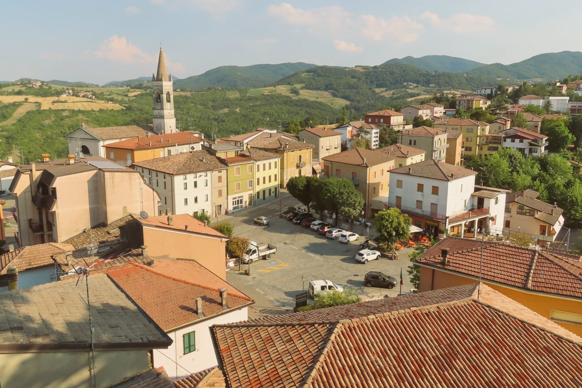
Why visit Vernasca
Vernasca sits at 457 meters in the upper Val d'Arda, in the Piacenza Apennines forty kilometers southeast of Parma. The commune carries both its institutional signals through its frazione Vigoleno, a walled village on a 350-meter ridge between the Ongina and Stirone valleys whose castle is documented from 1141 and whose current quadrangular plan dates from the early fifteenth century.
The Scotti Douglas family, granted the county of Vigoleno in 1404 by the Visconti of Milan, rebuilt the keep, mastio and circuit walls after Visconti troops dismantled it in 1373. Vigoleno was an autonomous commune until 1815, when it was absorbed into Vernasca.
The Val d'Arda below produces Gutturnio and Ortrugo wines under the Colli Piacentini DOC. The territory holds the Riserva Naturale del Piacenziano, a fossil-bearing badlands site referenced in the geological epoch named for the Piacenza area.
What to see in Vernasca
- Castello di Vigoleno. Walled medieval village and Scotti Douglas keep on a 350-meter ridge, with a circuit of walls and a mastio rebuilt in the early fifteenth century.
- Pieve di San Giorgio. Twelfth-century Romanesque pieve inside the Vigoleno walls, with fifteenth-century frescoes by the school of the Pordenone.
- Riserva Naturale del Piacenziano. Pliocene fossil-bearing badlands and clay outcrops within the commune, type-locality of the Piacenzian geological age named for the province.
How to get to Vernasca
Piacenza is roughly 52 minutes away by road.
Our tip
April through October are the working months in the upper Val d'Arda. May and June bring green hills and clear views from the Vigoleno walls south to the Apennine ridge. September and October are the dry, gold months and the start of the Colli Piacentini harvest.
Varzi
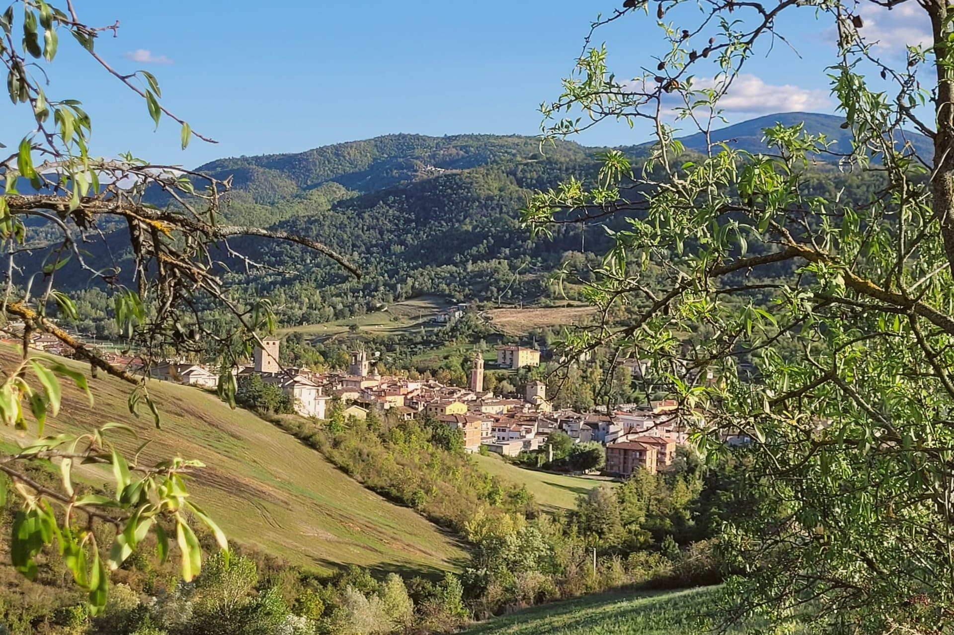
Why visit Varzi
Varzi sits at 416 meters in the Staffora valley of the Oltrepò Pavese, a strip of Lombard Apennine that runs south toward Genova rather than north toward Milano. The name comes from the Ligurian root Var, meaning torrent.
In 1164 the village fell under the Malaspina, the Apennine feudal family who held it as part of their network of upland fiefdoms; the Malaspina tower, called the Torre delle Streghe, dates to the thirteenth century. The Via del Sale ran through Varzi from the Po plain to the Ligurian coast, and the salami invented to feed traders on that route is now one of Italy's first DOP cured meats: Salame di Varzi, recognized by Europe in 1996, produced by a handful of small companies in and around the town.
The 2023 production was 503,561 certified salami. The second Sunday in June, the Sagra del Salame fills the medieval streets.
The Sant'Alberto di Butrio hermitage, fourteen kilometers south through the Apennine, is the older religious anchor of the valley.
What to see in Varzi
- Torre delle Streghe. Thirteenth-century Malaspina tower in the centro storico, also called the Witches' Tower, the surviving keep of the medieval defenses.
- Castello dei Malaspina. Remains of the Malaspina castle, the seat of the feudal family that held Varzi from 1164 onward.
- Centro storico medievale. Stone streets and arched passages of the medieval borgo, with the surviving village gates from the defensive walls.
How to get to Varzi
Piacenza is roughly 78 minutes away by road.
Our tip
April through October is the right window for the Staffora valley. Mild evenings, dry trails into the surrounding Apennine, and the salami shops in full production. The Sagra del Salame on the second Sunday of June fills the centro storico. Festa della Birra e della Salamella falls in July.
Bobbio
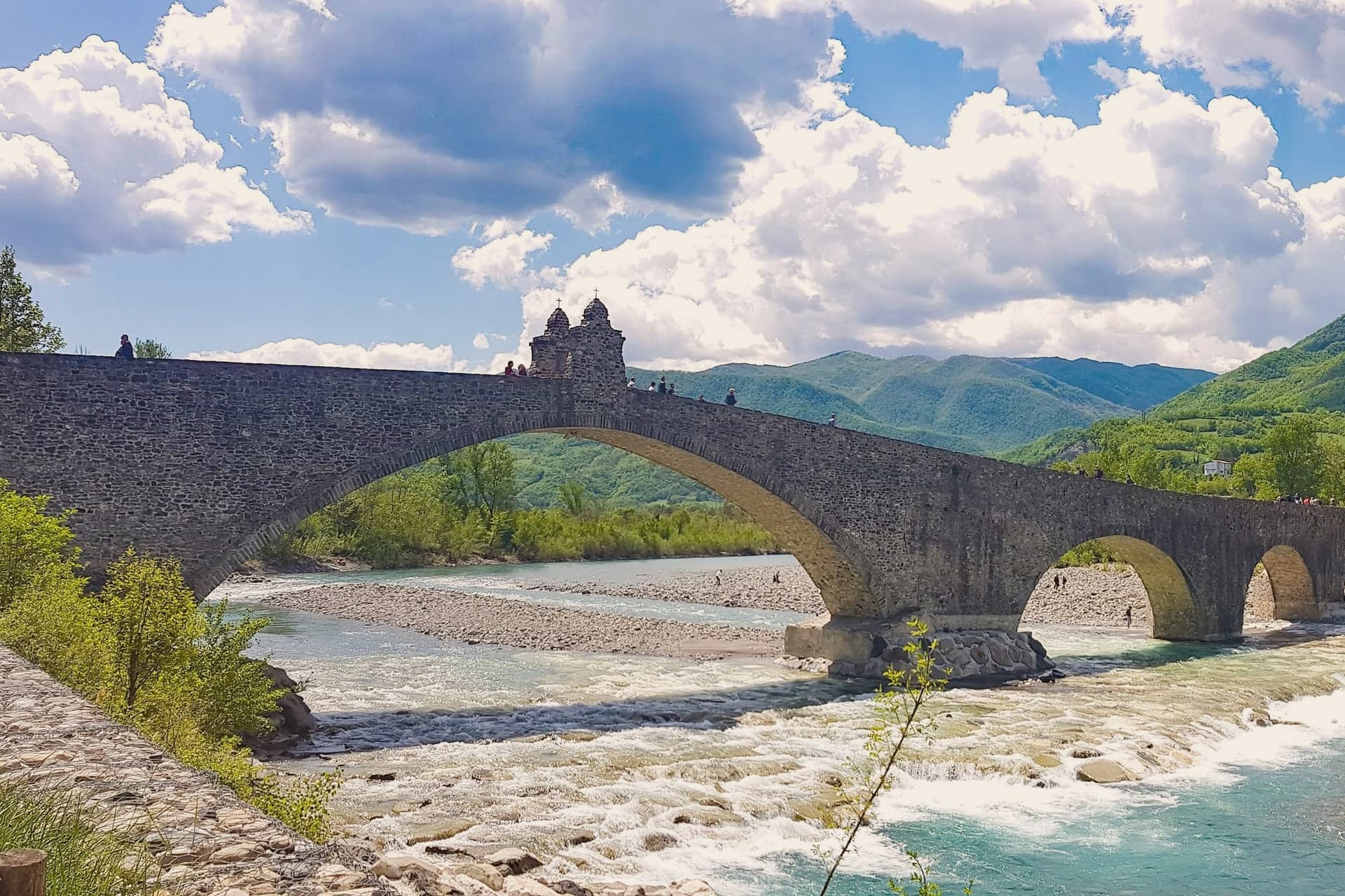
Why visit Bobbio
Bobbio sits on the left bank of the Trebbia at 272 meters, at the foot of Monte Penice in the Piacentine Apennines. The land was granted to Saint Columbanus by the Lombard king Agilulf in 614, and the monastery he raised on it grew, by the eighth century, into one of the principal libraries north of Rome, copying Greek, Latin, and Irish manuscripts that survived nowhere else.
The French suppressed the monastery in 1803; what the scriptorium and library once held now lives in fragments, kept in the basilica and its museum. The town below the abbey is crossed by the Trebbia on the Ponte Gobbo, its eleven irregular arches stretching 273 meters, a shape that gave rise to the story of the Devil and the saint dividing the bridge between them.
Bobbio still carries the Borghi più belli and Bandiera Arancione designations alongside the 2019 RAI title. A river crossing, a hill fortress, and a monastery ruin sit within reach of one another here, each holding a different piece of the same long settlement, one built by faith, one by feudal power, and one by the river itself.
What to see in Bobbio
- Abbazia di San Colombano. The basilica and grounds where Saint Columbanus settled still stand; the scriptorium he founded is gone but its output is documented in surviving manuscripts held elsewhere.
- Ponte Gobbo. The eleven arches sit unevenly across the riverbed, the irregularity of their spacing the source of both the Devil's Bridge name and the Columbanus legend attached to it.
- Duomo di Bobbio. Romanesque cathedral begun in 1075, dedicated to Santa Maria Assunta, with a fifteenth-century fresco cycle in the apse.
How to get to Bobbio
Piacenza is roughly 63 minutes away by road.
Our tip
April through June brings the green Val Trebbia season, when the river runs clear enough for swimming holes downstream. September and October are the working months for chestnuts, mushrooms, and the maccheroni alla bobbiese the town fills its trattorie with. July and August can hit thirty-three degrees in the valley, and the 2019 Borgo dei Borghi win still draws weekend crowds that fill the Ponte Gobbo. La Festa del Pinolo falls in August.
Castell'Arquato
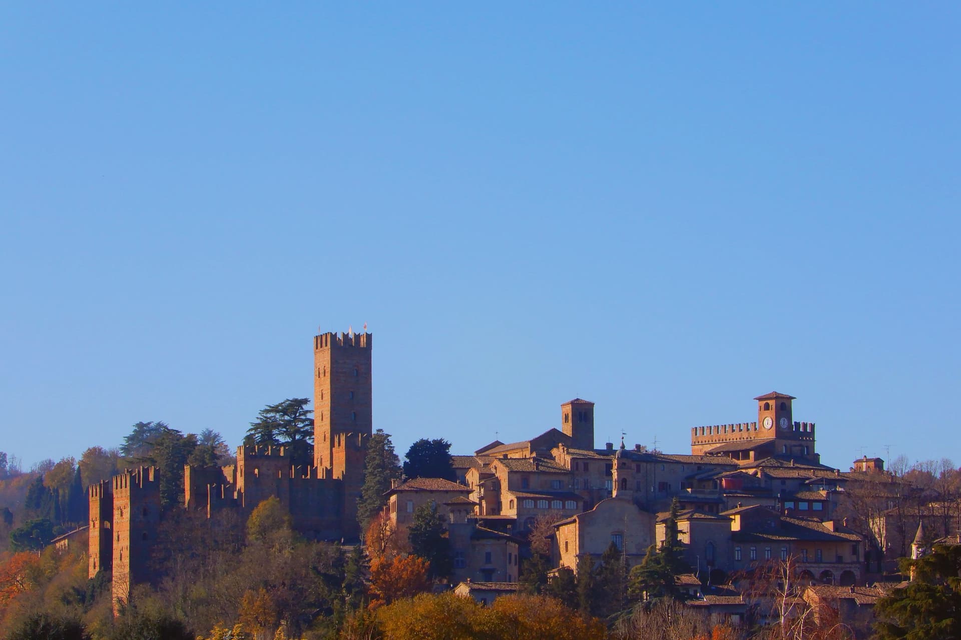
Why visit Castell'Arquato
Castell'Arquato sits on the first hills of the Val d'Arda at 224 meters, thirty kilometers from Piacenza, the medieval borgo arranged in tight concentric levels around the old rock. The Collegiata di Santa Maria, founded by the noble Magnus in the eighth century, was rebuilt in 1122 after the 1117 earthquake destroyed the earlier church and is one of the finest Romanesque buildings in the Piacentino.
The Rocca Viscontea, with its thirty-five-meter tower, was begun in 1342 by Luchino Visconti, lord of Milan, to lock down the valley for Piacenza. The Palazzo del Podestà next door dates from 1292 and still anchors the Piazza Monumentale.
Luigi Illica, the librettist of Tosca, Madama Butterfly, La bohème and Andrea Chénier, was born in town in 1857; the museum dedicated to him sits in the house next to his birthplace. The Val d'Arda hills around the town produce the white wines that earned Castell'Arquato Città del Vino status.
What to see in Castell'Arquato
- Rocca Viscontea. Fortress begun in 1342 by Luchino Visconti for the municipality of Piacenza, with a thirty-five-meter tower at the highest point of the borgo.
- Collegiata di Santa Maria Assunta. Romanesque collegiate church, founded in the eighth century and rebuilt in 1122 after the 1117 earthquake destroyed the earlier structure.
- Palazzo del Podestà. Civic palace from 1292 facing the Collegiata, with the original ghibelline merlons and a fourteenth-century loggia along its lower level.
How to get to Castell'Arquato
Piacenza is roughly 38 minutes away by road.
Our tip
April through June is the best season for the Val d'Arda hills: the vineyards on the slopes below the borgo are green and the air clear enough to see across to the Appennino Piacentino. September and October bring the white-wine harvest and the chestnut weeks. July and August touch thirty-three degrees and the unshaded Piazza Monumentale becomes uncomfortable between noon and four.
More from Anywhere Italy
 The best hidden hill towns in Lombardia
- The best hill towns within 90 minutes of Milan
- The best towns that cure their own meat within two hours of Brescia
- The best towns that cure their own meat within two hours of Parma
 The prettiest small villages in Emilia-Romagna
 The best hill towns that eat well in Emilia-Romagna