
The best hill towns within 75 minutes of Parma
Leave the flat, misty corridor of the Via Emilia and the land starts to lift almost immediately, first into low clay hills striped with Lambrusco and Malvasia vines, then into proper Apennine ridges of sandstone and chestnut. The hill towns here are built of the stone they stand on, pale gold in Piacenza's valleys, browner and rougher as you climb towards the Tuscan watershed. Autumn is the season the food follows the altitude: porcini and chestnuts from the high woods, cherries from the Modenese foothills in early summer, culatello ageing in cellars where the fog does the work. Spring brings wild herbs and the sort of long views over the plain that the valley floor never offers.
Most people who come to this part of Emilia stay in the cities and eat. Parma, Modena and Bologna hold the Parmigiano dairies, the balsamic lofts, the prosciutto tours and the restaurant bookings made months out, and the food itineraries that run between them rarely leave the plain at all. It is a good circuit and it is a busy one, coach-served, priced accordingly, and increasingly hard to walk in on a weekend without a reservation.
The hills that produce all of it, though, begin only a short drive from any of those city gates. The same cheese and the same wine come from valleys where a castle keeps watch over a handful of streets, where the trattoria has one dining room and the parking is free. The towns collected here all stand on high ground rather than on the plain, close enough to Parma for a morning departure and far enough up to change the weather, the food and the crowd.
Of the 20 communes we have mapped in a 75-minute drive of Parma, 7 qualify as hill towns: each stands on high ground rather than on the plain. The smallest, Vernasca, has 2,004 residents.
Elsewhere in the catalogue: The best hill towns you can reach by train in Emilia-Romagna and The best towns you can reach by train within 75 minutes of Parma.
Vernasca
Why visit Vernasca
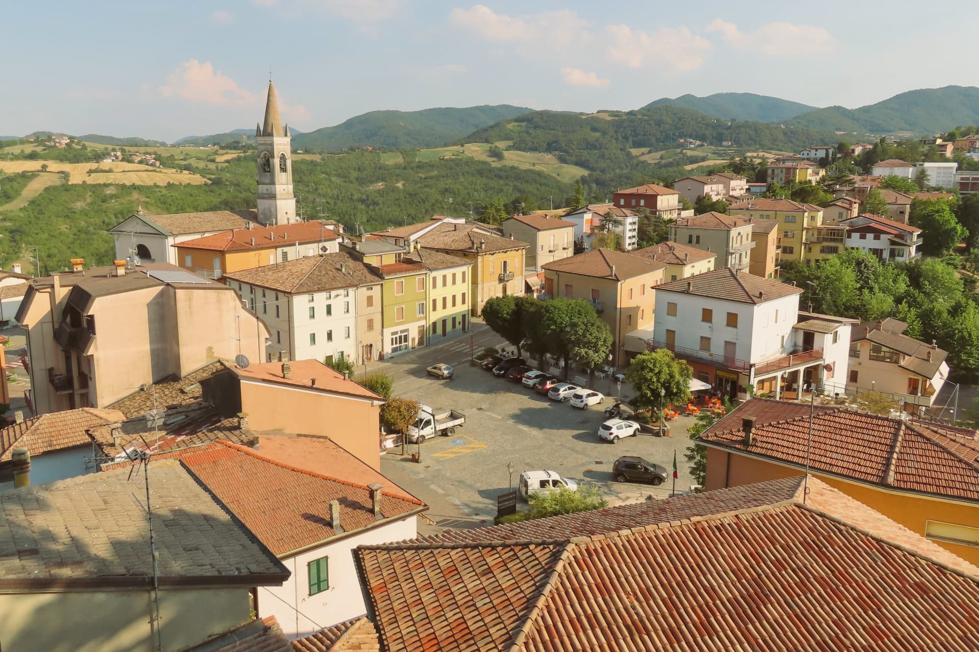
Vernasca sits at 457 meters in the upper Val d'Arda, in the Piacenza Apennines forty kilometers southeast of Parma. The commune carries both its institutional signals through its frazione Vigoleno, a walled village on a 350-meter ridge between the Ongina and Stirone valleys whose castle is documented from 1141 and whose current quadrangular plan dates from the early fifteenth century.
The Scotti Douglas family, granted the county of Vigoleno in 1404 by the Visconti of Milan, rebuilt the keep, mastio and circuit walls after Visconti troops dismantled it in 1373. Vigoleno was an autonomous commune until 1815, when it was absorbed into Vernasca.
The Val d'Arda below produces Gutturnio and Ortrugo wines under the Colli Piacentini DOC. The territory holds the Riserva Naturale del Piacenziano, a fossil-bearing badlands site referenced in the geological epoch named for the Piacenza area.
What to see in Vernasca
- Castello di Vigoleno. Walled medieval village and Scotti Douglas keep on a 350-meter ridge, with a circuit of walls and a mastio rebuilt in the early fifteenth century.
- Pieve di San Giorgio. Twelfth-century Romanesque pieve inside the Vigoleno walls, with fifteenth-century frescoes by the school of the Pordenone.
- Riserva Naturale del Piacenziano. Pliocene fossil-bearing badlands and clay outcrops within the commune, type-locality of the Piacenzian geological age named for the province.
How to get to Vernasca
Piacenza is roughly 52 minutes away by road.
Our tip
April through October are the working months in the upper Val d'Arda. May and June bring green hills and clear views from the Vigoleno walls south to the Apennine ridge. September and October are the dry, gold months and the start of the Colli Piacentini harvest.
Canossa
Why visit Canossa
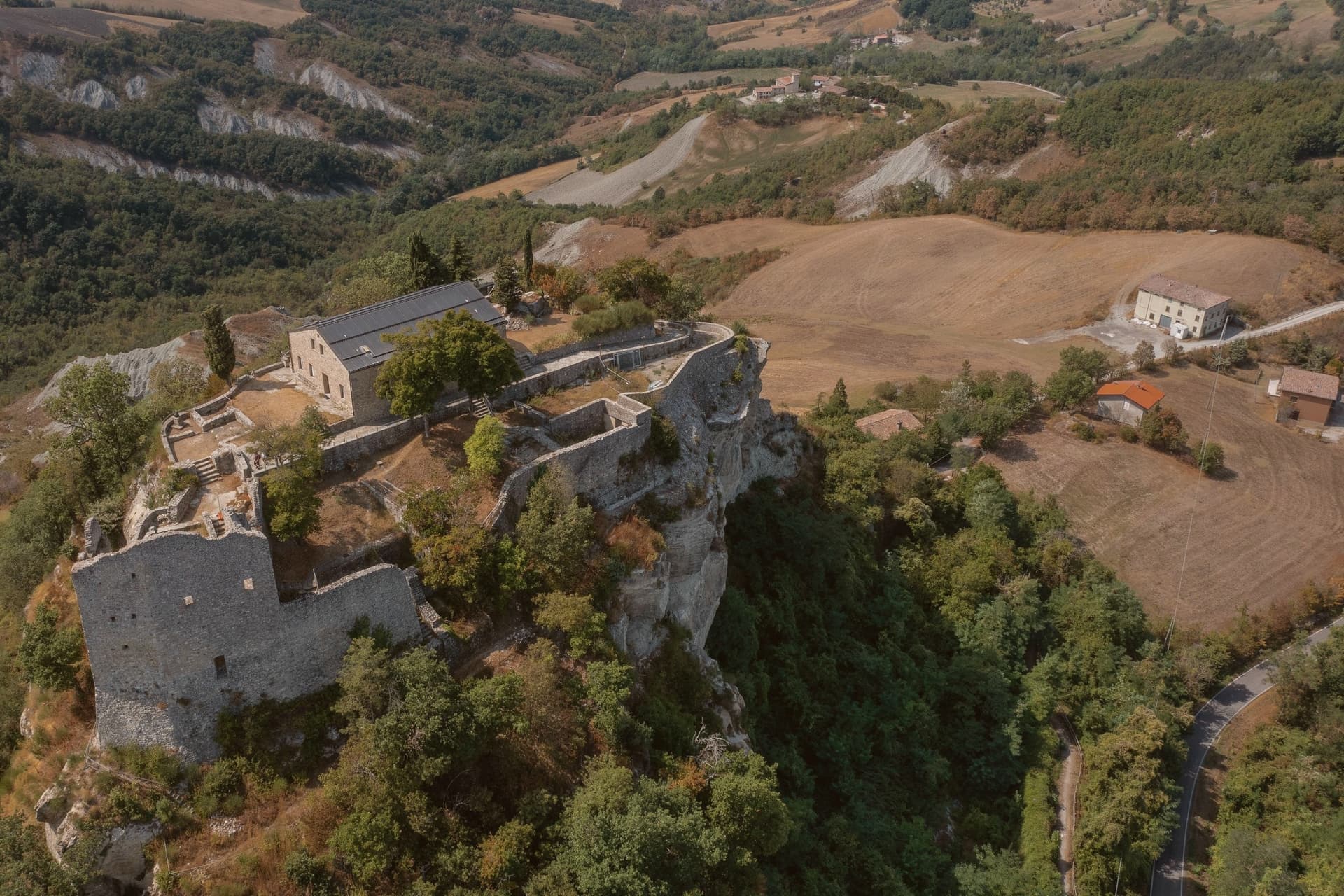
Canossa sits on the Apennine slope thirty kilometers south of Parma and twenty-five southwest of Reggio Emilia, at 219 meters at the seat in Ciano d'Enza. The commune is named for the ruined fortress on a white limestone outcrop eight kilometers east, built before 950 by Adalbert Atto of Lucca and held by Matilde di Canossa until her death in 1115.
The fortress was destroyed by Reggio Emilia in 1255. The commune was itself called Ciano d'Enza until 1992, when it took the older name back, so the seat in the valley and the ruin on the hill now share one name across two places.
Vineyards on the surrounding slopes produce Lambrusco and the Spergola white grape, and the path between Ciano and the castle ruin remains the Sentiero Matilde, the same climb that once carried Henry IV to the gate where Gregory VII made him wait. A commune this small holds an outsized memory: a valley seat, a demolished hilltop stronghold, and a name discarded and then reclaimed, all turning on three days that happened at the top of the path.
What to see in Canossa
- Castello di Canossa. Fortress on a white sandstone outcrop, its walls reduced to a ruin standing over the valley since the demolition of 1255. The site now houses the Museo Nazionale Naborre Campanini.
- Castello di Rossena. Best-preserved of the Matildic castles, built in the tenth century on volcanic rock to guard the western approach to the ruin on the neighboring hill.
- Torre di Rossenella. Square watchtower a kilometer from Rossena, built on a separate basalt pinnacle as a forward observation post for the defensive system below.
How to get to Canossa
There is a railway station in the town, so you can arrive without a car and never need one while you are here. Reggio Emilia is roughly 43 minutes away by road.
Our tip
April through June brings green hills, Spergola flowering, and clear views from the castle ruin down to the Po plain. September and October dry the slopes into gold for the harvest of Lambrusco and Spergola, the busiest weekends at the Matildic castles. July and August touch thirty-four degrees and the path up from Ciano empties between two and five.
Castell'Arquato
Why visit Castell'Arquato
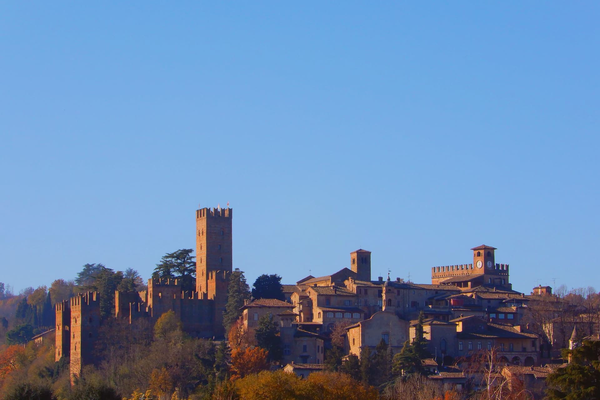
Castell'Arquato sits on the first hills of the Val d'Arda at 224 meters, thirty kilometers from Piacenza, the medieval borgo arranged in tight concentric levels around the old rock. The Collegiata di Santa Maria, founded by the noble Magnus in the eighth century, was rebuilt in 1122 after the 1117 earthquake destroyed the earlier church and is one of the finest Romanesque buildings in the Piacentino.
The Rocca Viscontea, with its thirty-five-meter tower, was begun in 1342 by Luchino Visconti, lord of Milan, to lock down the valley for Piacenza. The Palazzo del Podestà next door dates from 1292 and still anchors the Piazza Monumentale.
Luigi Illica, the librettist of Tosca, Madama Butterfly, La bohème and Andrea Chénier, was born in town in 1857; the museum dedicated to him sits in the house next to his birthplace. The Val d'Arda hills around the town produce the white wines that earned Castell'Arquato Città del Vino status.
What to see in Castell'Arquato
- Rocca Viscontea. Fortress begun in 1342 by Luchino Visconti for the municipality of Piacenza, with a thirty-five-meter tower at the highest point of the borgo.
- Collegiata di Santa Maria Assunta. Romanesque collegiate church, founded in the eighth century and rebuilt in 1122 after the 1117 earthquake destroyed the earlier structure.
- Palazzo del Podestà. Civic palace from 1292 facing the Collegiata, with the original ghibelline merlons and a fourteenth-century loggia along its lower level.
How to get to Castell'Arquato
Piacenza is roughly 38 minutes away by road.
Our tip
April through June is the best season for the Val d'Arda hills: the vineyards on the slopes below the borgo are green and the air clear enough to see across to the Appennino Piacentino. September and October bring the white-wine harvest and the chestnut weeks. July and August touch thirty-three degrees and the unshaded Piazza Monumentale becomes uncomfortable between noon and four.
Borgo Val di Taro
Why visit Borgo Val di Taro
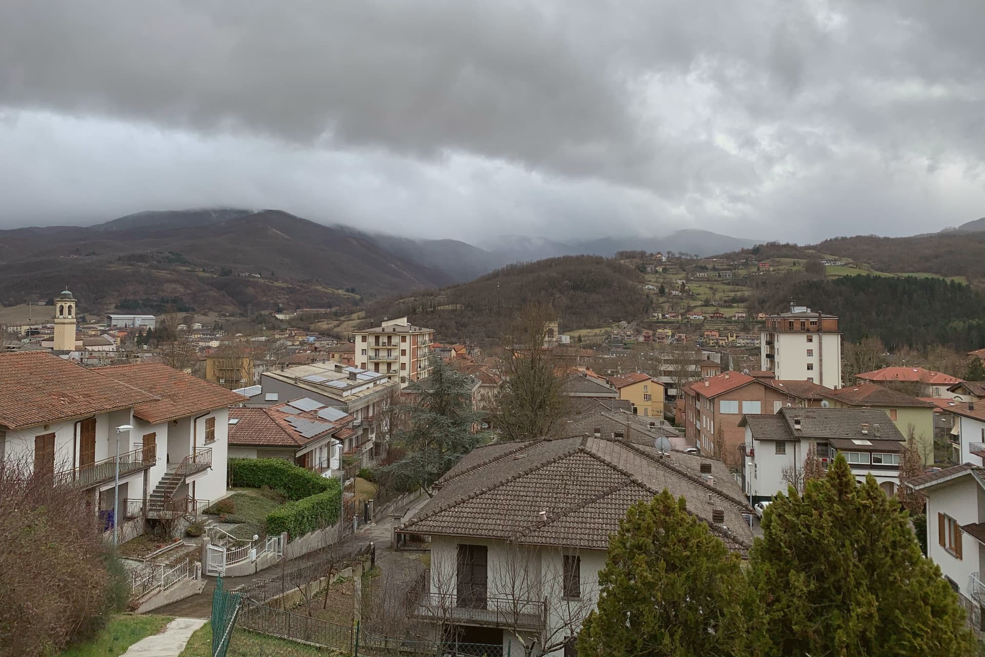
Borgo Val di Taro sits at 411 meters in the upper Taro valley, sixty-three kilometers southwest of Parma at the point where the province meets Liguria and Tuscany on the Apennine ridge. The town was a Roman waystation, then a possession of the Bobbio abbey, then of the Landi and Doria-Landi families through the medieval centuries.
Modern Borgotaro built itself around the porcini trade: the Boletus mushrooms gathered in the surrounding chestnut woods were already famous in the nineteenth century, exported by emigrants to the Americas, and in 1996 the European Union granted the Fungo di Borgotaro Protected Geographical Indication status, the first European recognition for a wild mushroom. The Consorzio per la Tutela del Porcino di Borgotaro was founded the same year.
The Cittaslow movement admitted the town in the 2000s. The September Fiera del Fungo di Borgotaro is the calendar event; population has dropped under seven thousand but the porcini trade still anchors the local economy.
What to see in Borgo Val di Taro
- Centro storico. Medieval town center along the Taro, with the Palazzo Tardiani, the Piazza Manara, and the porticos lining the old market street.
- Chiesa di Sant'Antonino. Sixteenth-century parish church with a Baroque interior, holding a fifteenth-century crucifix and a wooden image of the Madonna del Carmelo.
- Palazzo Tardiani. Eighteenth-century palace on the main street, now housing the municipal library and the cultural offices.
How to get to Borgo Val di Taro
There is a railway station in the town, so you can arrive without a car and never need one while you are here. Parma is roughly 67 minutes away by road.
Our tip
April through June brings the Taro at full water and the chestnut woods in early green. September and October are the working months: the porcini emerge after the autumn rains, the Fiera del Fungo fills the centro on the last two weekends of September, and the trade carries the town's economy into November. July and August touch thirty degrees and the centro empties between two and five, though the river is cold enough for swimming. Porcigatone in festa falls in August.
Castelvetro di Modena
Why visit Castelvetro di Modena
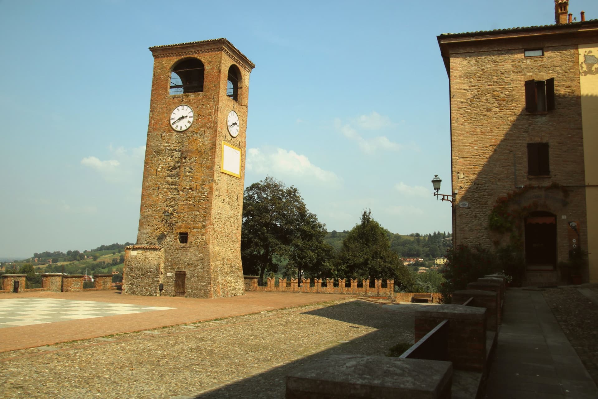
Castelvetro di Modena sits on a hill at 152 meters, eighteen kilometers southeast of Modena and at the northern edge of the Apennine foothills. The medieval centro storico rises around the Piazza Roma, paved in alternating white and black stones that earned it the name Piazza della Dama, the checkerboard piazza, framed by the four surviving towers of the old castle.
The Grasparossa grape grows on the clay slopes around the town, the sandy soil and the south-facing aspect producing the deepest, most tannic of the three main Lambruschi; Lambrusco Grasparossa di Castelvetro received DOC status in 1970. Above the piazza, the Palazzo Rinaldi houses the Museo del Vino and the Museo dell'Aceto Balsamico, the second tracing the same Modenese tradition that nearby Spilamberto codifies.
The municipality holds three institutional signals: Borghi più belli, Bandiera Arancione, Città del Vino. The Sagra dell'Uva e del Lambrusco runs the last weekend of September, when the streets fill with the chess players from the surrounding Lambrusco towns dressed as living pieces on the piazza.
What to see in Castelvetro di Modena
- Piazza Roma. Checkerboard piazza paved in alternating white and black stones, framed by the four surviving towers of the medieval castle.
- Castello di Levizzano Rangone. Tenth-century fortified frazione four kilometers north, with a tower built in the 990s and a fully preserved medieval village.
- Museo del Vino. Wine museum inside the Palazzo Rinaldi, tracing the Grasparossa production cycle and the DOC zone established in 1970.
How to get to Castelvetro di Modena
There is a railway station in the town, so you can arrive without a car and never need one while you are here. Modena is roughly 28 minutes away by road.
Our tip
April through June and September through October are the Castelvetro months. The hills around the borgo turn green in spring and red in autumn when the Grasparossa vines colour up before the harvest. July and August are hot, thirty-five degrees in the valley, less in the hills above, and the cantine slow down. Sagra dell'Uva e del Lambrusco Grasparossa di Castelvetro falls in September.
Sasso Marconi
Why visit Sasso Marconi
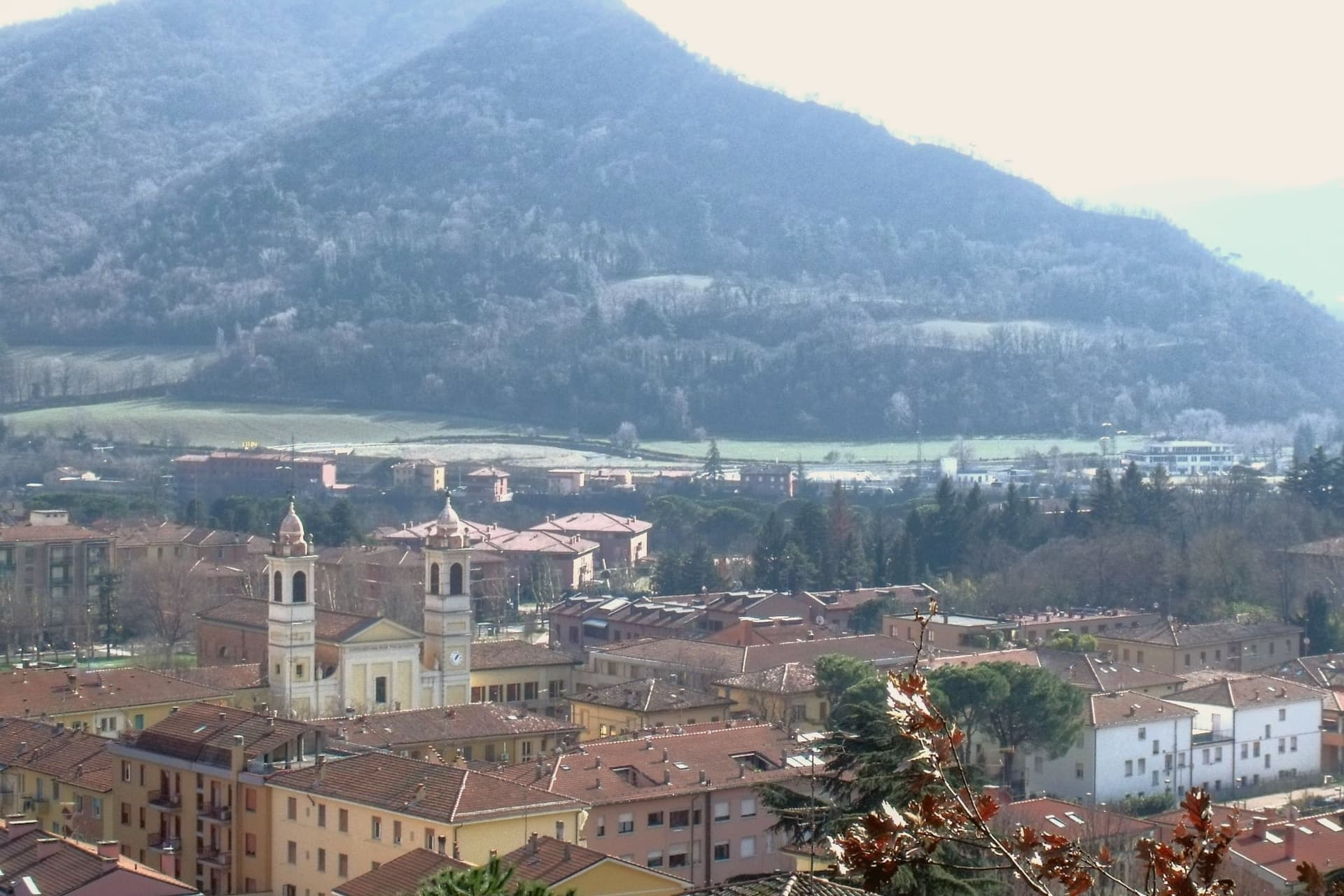
The Setta and Reno rivers meet below the rock that gives the town its name, at the point where the pre-Apennine hills begin their climb south of Bologna. The Sasso della Glosina dominates the bend, a Pliocene formation old enough to have shaped how the crossing below it was used long before the valley took its modern name.
The town itself was called Sasso Bolognese until 1938, when it was renamed for the family whose estate lies in the frazione of Pontecchio, on the valley floor rather than on the rock itself. The territory reaches from that river confluence up into the Apennine slopes, and the change in elevation shows in what the land produces: white truffle from the valley floor near the Reno, and vineyards on the hills around Pieve del Pino and Mongardino, recognition earned on two different registers of the same ground.
The lower town, built around the rivers and the old road to Pistoia, and the upper slopes, given to woods and terraced vines, read as one territory doing two different kinds of work.
What to see in Sasso Marconi
- Villa Griffone - Museo Marconi. Marconi family villa in the frazione of Pontecchio. The mausoleum sits alongside the attic laboratory, and the museum holds working reproductions of his early apparatus.
- Sasso della Glosina. The rock rises directly over the river bend, its bulk visible from the crossing below and from much of the surrounding valley.
- Confluenza Setta-Reno. Meeting of the two valleys at the foot of the rock, with the historic crossing of the Via Porrettana toward Pistoia.
How to get to Sasso Marconi
There is a railway station in the town, so you can arrive without a car and never need one while you are here. Bologna is roughly 26 minutes away by road.
Our tip
April through October is the working season in Sasso Marconi. Spring and early autumn are best on the Reno valley trails and at Villa Griffone, with mild temperatures and the Apennine foothills green or autumn-coloured. July and August can touch thirty-five degrees in the valley, though the higher frazioni stay cooler; many visitors come up from Bologna for a day on a weekend. Fira di Sdaz di Sasso Marconi falls in September.
Vignola
Why visit Vignola
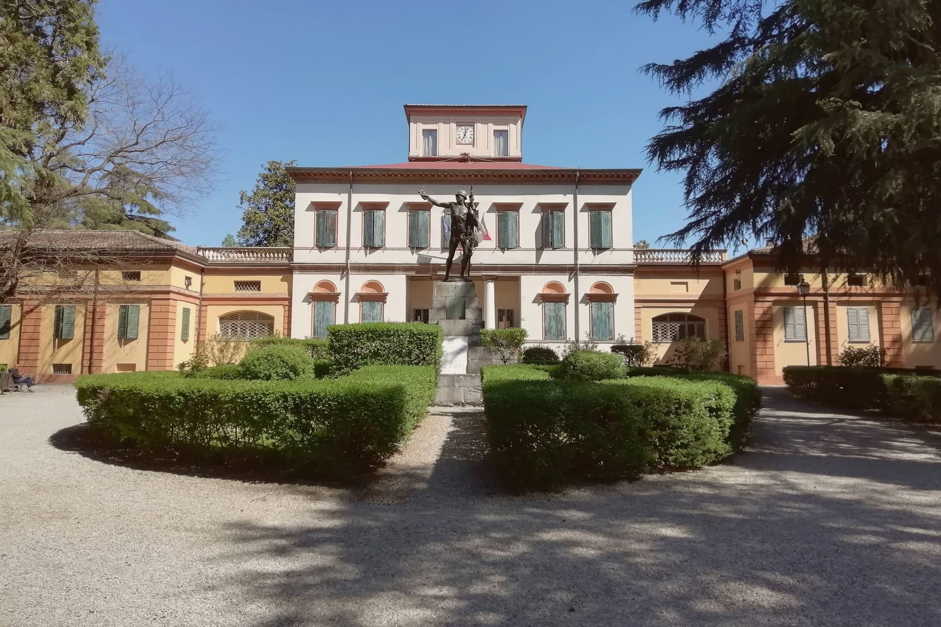
Vignola sits at 125 meters on the right bank of the Panaro, twenty-five kilometers south of Bologna and twenty east of Modena, where the Modenese plain meets the Apennine foothills. The fortress there is documented from the eighth century, raised by the Abbot of Nonantola to guard the abbey's lands before the Contrari family rebuilt it in the fifteenth century as a fortified residence; in 1577 it passed to the Boncompagni-Ludovisi, who held it until 1965.
The palace beside it takes its second name from the family that acquired it, and from the architect born in the town in 1507, who died in 1573 after a career among the leading figures of late Renaissance architecture. The cherries that carry the town's name upriver and down are IGP-protected across twenty-eight communes stretching from Modena to Bologna, and the blossom that precedes the fruit each spring fills the Panaro valley below the walls.
A disused railway, now a greenway, threads through the same ground on its way between Mirandola and Bologna. The town's identity rests on this pairing of a fortified height above the river and an agricultural valley beneath it, one lineage of stone, one of orchards, both still legible in the place today.
What to see in Vignola
- Rocca di Vignola. Eighth-century origin, built to guard the lands of an abbey and later rebuilt as a fortified residence. The frescoed interiors and four corner towers stand over the river much as the rebuilding left them.
- Scala a Chiocciola di Palazzo Barozzi. The 106 steps rise with no central support, an engineering feat as much as a decorative one, tucked inside the palace next to the fortress.
- Palazzo Boncompagni. The palace passed to the family that gives it its name in the late sixteenth century and held the fortress until 1965. Its reception rooms carry frescoes alongside the staircase it is best known for.
How to get to Vignola
There is a railway station in the town, so you can arrive without a car and never need one while you are here. Modena is roughly 34 minutes away by road.
Our tip
April through June and September through October are the working months on the Panaro foothills. The first two weekends of April fill the centro with the Festa dei Ciliegi in Fiore, when the orchards along the river bloom. June brings cherries to market and the Panaro at high water.
More from Anywhere Italy
- The best hill towns you can reach by train in Emilia-Romagna
- The best towns you can reach by train within 75 minutes of Parma
- The best hidden towns you can reach by train in Emilia-Romagna
 The best hill towns that eat well in Emilia-Romagna
 The best hill towns within 75 minutes of Bologna
 The best towns that cure their own meat within two hours of Parma