
The 7 best towns on a walking route that sit inside a nature park in Umbria
90 towns visited, 910 to go. Follow along, free: Subscribe on Substack
Umbria walks well. The paths climb through holm oak and downy oak, out onto ridges of gray limestone, then drop into olive terraces where the harvest runs from late October into November and the new oil comes out of the frantoio green and peppery. The towns along these routes are built from what the hills gave them: pink and white stone from Monte Subasio, tufo where the valleys open toward Lazio, dark travertine near the water. Spring brings broom and orchids on the high pasture, autumn brings chestnuts, wild boar on the menu and mist sitting in the Valle Umbra until midday.
Most walkers in this region are here for one thing, and most drivers stop at Perugia. The capital carries the crowds, the escalators up through the Rocca Paolina, the coach parks, the queues on Corso Vannucci in August. It is a serious city and worth the time, but it is where the region's visitors concentrate, and it tells you very little about what the countryside around it is doing.
The paths do not stop at the city walls. They keep going through the Parco del Monte Subasio, along the Nera where the river cuts its gorge, up onto the Gola del Bottaccione above the Apennine foothills, and the towns on this list are the places where those routes pass through a gate, cross a piazza and carry on. Each is a stage on one of the historic long-distance walks, and each sits inside a regional nature park, which means you can arrive on foot, eat properly, sleep, and be back in the woods by breakfast.
Of the 48 communes we have mapped in Umbria, 7 qualify as towns on a walking route inside a nature park: each is a stage on one of the long historic walking routes, and each sits inside a regional nature park. The smallest, Arrone, has 2,555 residents.
Elsewhere in the catalogue: The 8 best towns on a walking route that you can reach by train in Umbria and The best hill towns on a walking route within 90 minutes of Perugia.
Why visit Arrone
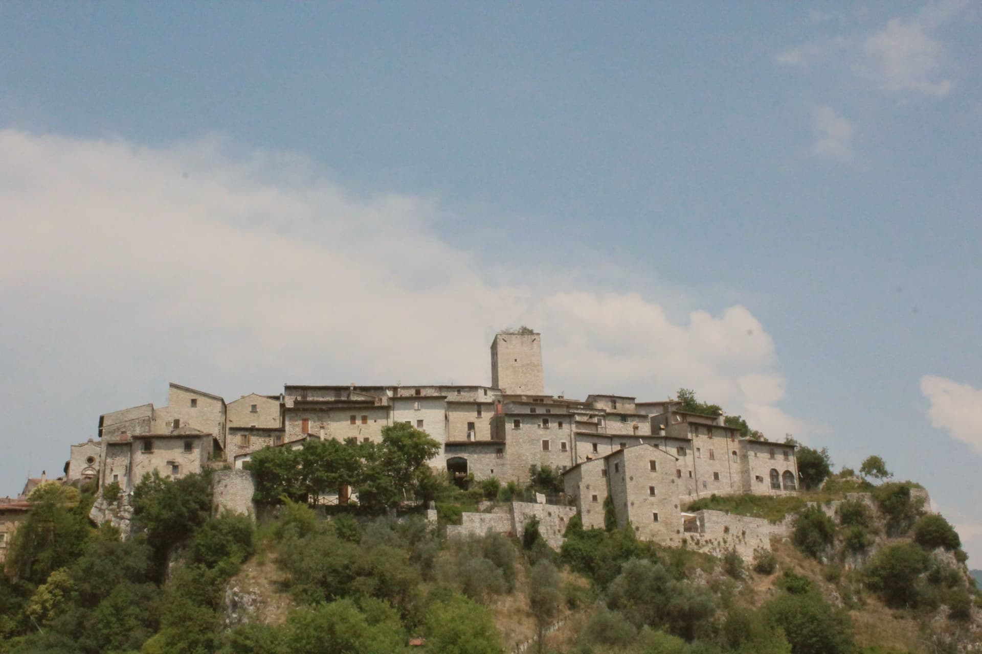
Arrone sits at 243 meters on the left bank of the Nera in the lower Valnerina, the upper part of the village a 9th- or 10th-century noble castle with its walls and alleys still in their medieval layout. The town grew up around the fortified hill and spread along the river as the danger faded.
The Cascata delle Marmore, the largest man-made waterfall in the world at 165 meters across three tiers, is five kilometers downstream; the Romans cut the original channel in 271 BC to drain the marshes around Rieti, and successive interventions through the 16th century gave the falls their present form. The Cammino di San Francesco passes through, and the village is the base for kayaking and rafting on the lower Nera.
The Chiesa di San Giovanni Battista in the upper castle holds 15th-century frescoes of the Umbrian school, and the collegiate Chiesa di Santa Maria in the lower village was rebuilt in the 16th century on Romanesque foundations.
What to see in Arrone
- Castello di Arrone. Upper part of the village, the 9th-10th century castle, walls and steep medieval alleys preserved to the original layout.
- Chiesa di San Giovanni Battista. Fourteenth-century church inside the upper castle, with 15th-century frescoes of the Umbrian school, including a Madonna and saints.
- Chiesa Collegiata di Santa Maria. Sixteenth-century collegiate church in the lower village, rebuilt on Romanesque foundations, with frescoes by Vincenzo Tamagni.
How to get to Arrone
Terni is about 34 min away by road.
Our tip
April through June and September into October are the months for Arrone. The Nera runs full from snowmelt and spring rain, the rafting season opens, and the Cascata delle Marmore releases on a fixed schedule that suits the morning light. July and August touch the mid-thirties in the lower Valnerina; the falls cool the air around the basin, and the Cammino di San Francesco walkers pass through early.
Why visit Spello
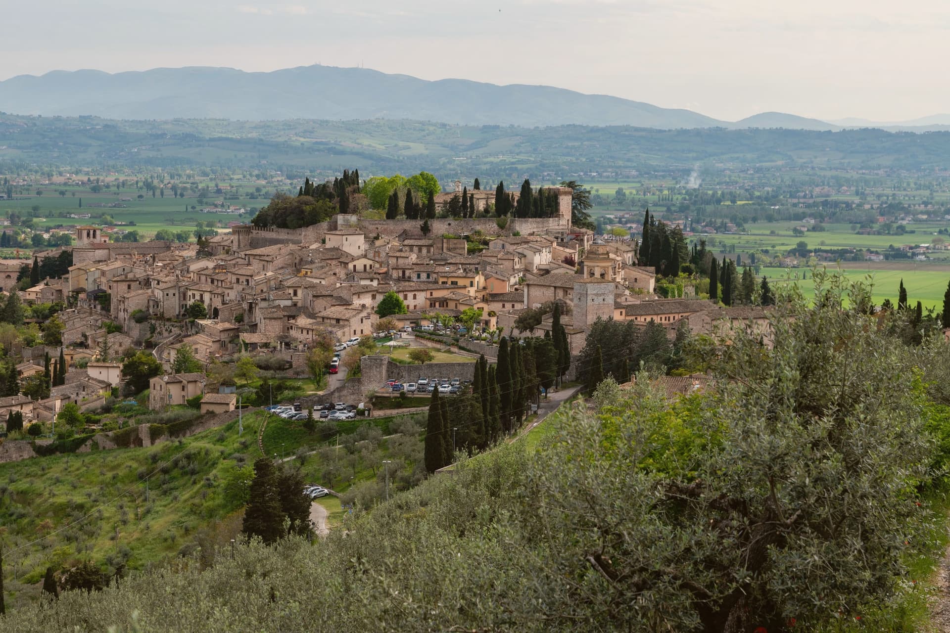
The centro storico climbs the lower southern flank of Monte Subasio, still contained within the circuit of walls raised when the town was renamed Splendidissima Colonia Julia by Augustus. Before that it was Hispellum under the Umbrians.
The Roman gates and stretches of wall from the Augustan period were not rebuilt over, so the line of the ancient town is still readable in the streets that climb from them today. The same streets carry the Infiorata each June and the fresco Pinturicchio completed for the chapel he painted in Santa Maria Maggiore, two things separated by roughly fifteen centuries but occupying the same short stretch of the old town: the chapel's Annunciation, Nativity and Christ Among the Doctors sit near the piazza the petal pictures are laid across.
A Roman villa with ten mosaic floors, found only in 2005 and left in place under cover, adds a third layer beneath the town that is still being uncovered rather than one that was always on view. The town's Roman skeleton, its painted chapel, and a floor uncovered within living memory all sit within the same small radius, which is unusual: most places show one era at a time, Spello keeps three in view at once.
What to see in Spello
- Cappella Baglioni. The Cappella Bella, commissioned by Troilo Baglioni, with four sibyls ranged across the vault above the painted scenes below.
- Santa Maria Maggiore. Twelfth-century church on Piazza Matteotti, its interior built around the fresco cycle and the later panel it houses.
- Porta Venere e Torri di Properzio. First-century BC gate flanked by two dodecagonal towers, still standing at close to full height with the stonework legible course by course.
How to get to Spello
It has its own railway station. Perugia is about 33 min away by road. The full route from Florence.
Our tip
April through June and September into October are the months for Spello. The slopes of Monte Subasio above town carry wildflowers, Cammino di San Francesco walkers pass through, and the Infiorata weekend on Corpus Domini in late May or June is the most concentrated day on the calendar. July and August touch the mid-thirties on the valley floor; the centro storico at 280 meters stays a few degrees cooler in the upper streets, but most visitors come early or wait until after seven.
Why visit Gubbio
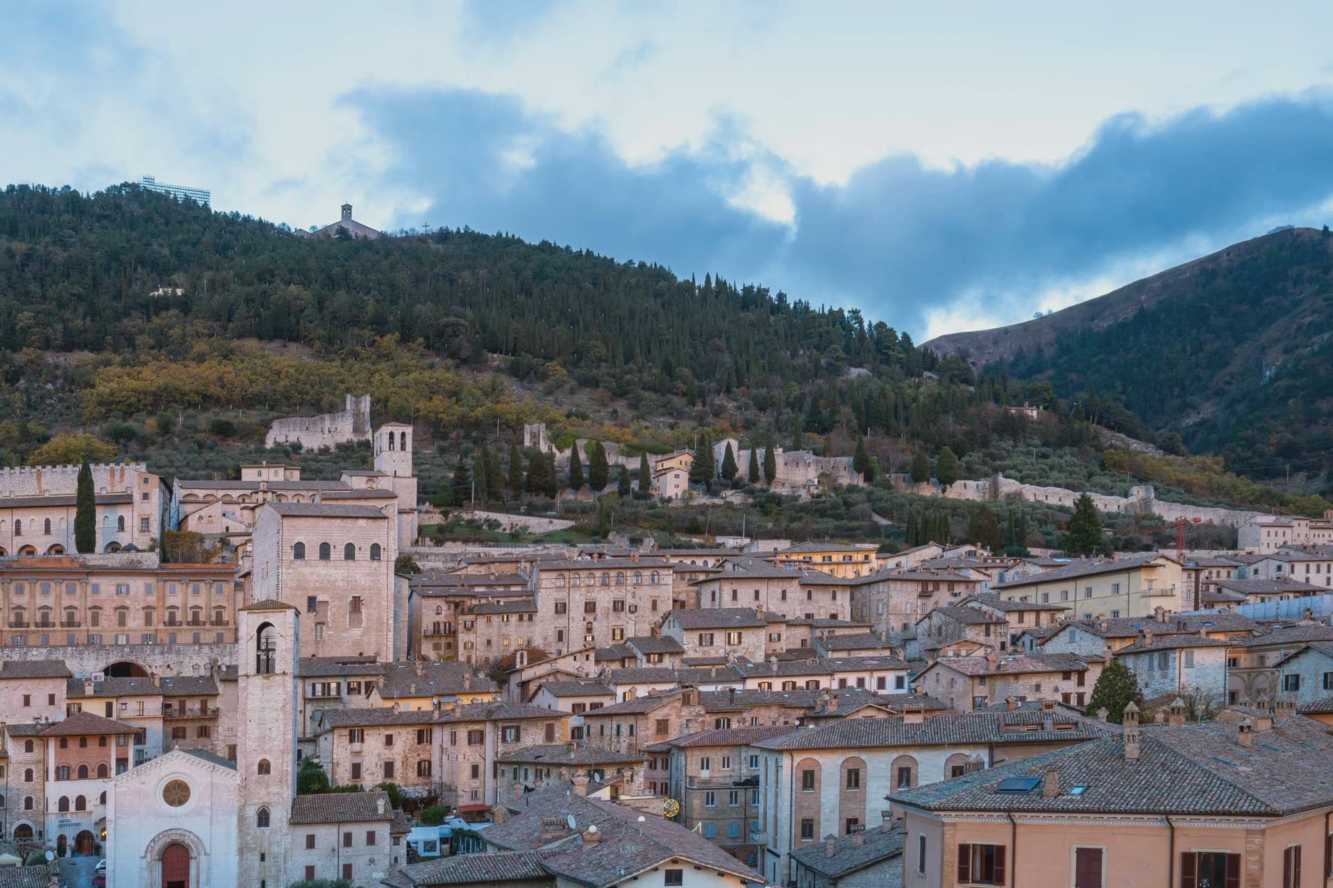
Gubbio sits at 522 meters on the lower slope of the mountain, the old town stacked in four parallel terraces against it. The settlement was Ikuvium, one of the most important towns of the Umbri before Rome arrived.
In 1444 a peasant woman named Presentina found the bronze tablets in the area of the Roman theater and sold them to the commune in 1456 for 40 florins, a transaction that kept them in the town where they were unearthed rather than scattered to a museum elsewhere. The terraces order the town's life by elevation: the Roman theater and lower ground below, the civic square and cathedral stacked on the upper terraces of the centro storico, the patron saint's basilica set apart on the summit above all of it.
The Corsa dei Ceri each 15 May draws that vertical order into motion, three teams carrying wooden statues of Sant'Ubaldo, San Giorgio and Sant'Antonio Abate from the square at the town's center up to the basilica at its height, filling the town from dawn to dusk. The layout is not incidental: a settlement that predates Rome, a civic archive kept where it was found, and a race that each year retraces the climb from town to summit all point to the same fact, that Gubbio's history has stayed stacked on its own mountain rather than dispersed from it.
What to see in Gubbio
- Palazzo dei Consoli. Built 1332-1349 by Angelo da Orvieto and Matteo Gattapone, the Gothic civic palace holds the Tavole Iguvine and the civic museum, its vertical pilasters dividing the façade across the square.
- Tavole Iguvine. Displayed on the ground floor of the palazzo, the tablets were recovered near the Roman theater and record the religious rites of the pre-Roman western world in detail.
- Piazza Grande. Suspended civic square between Palazzo dei Consoli and Palazzo Pretorio, hanging on substructures against the slope of the mountain.
How to get to Gubbio
Perugia is about 51 min away by road.
Our tip
April through June and September into October are the months for Gubbio. The slopes of Monte Ingino are walkable, the Cammino di San Francesco passes through, and the air at 522 meters holds the Apennine clarity. The Corsa dei Ceri on 15 May is the single most concentrated day in town; book months ahead.
Why visit Orvieto
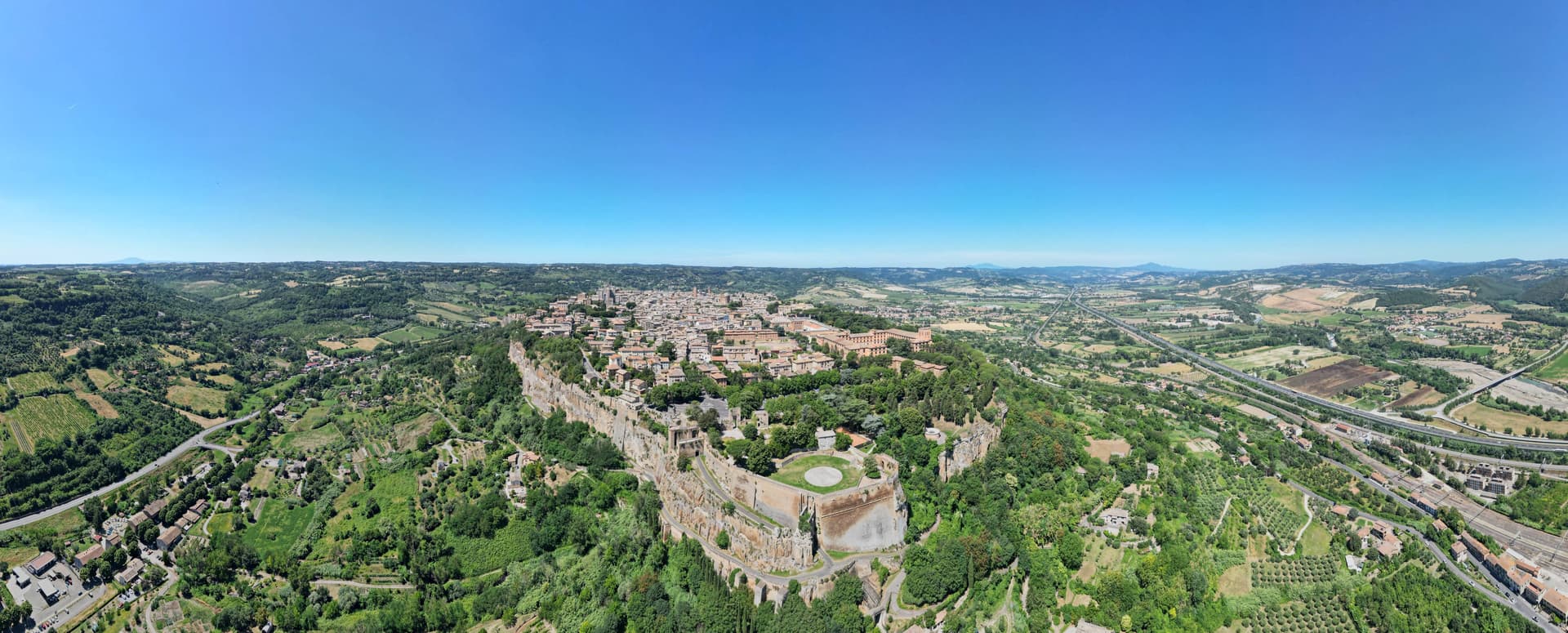
Orvieto sits on a flat-topped butte of volcanic tuff at 325 meters, the cliffs 195 meters above the surrounding plain. The town began as Velzna, a flourishing Etruscan metropolis, and the Romans destroyed it in 264 BC.
The medieval town that replaced it on the same plateau became a papal refuge in the 13th century, when popes left Rome for the safety of the height. The town's layers sit one below the other rather than side by side: the cliff face is honeycombed with Etruscan and medieval cavities, cisterns and pigeon roosts cut into the same tuff that the necropolis at its foot was carved into during the 6th century BC, while the cathedral and its chapel occupy the surface above, and the well descends back down through the rock to reach water.
What looks from a distance like a single stone crown is in fact three towns stacked in the same column of tuff: the dead below, the popes and their cathedral on top, and a passage cut straight through the middle to keep the town supplied.
What to see in Orvieto
- Duomo di Orvieto. The polychrome marble façade rises in tiers of mosaic and sculpture, the decorative Gothic worked into bands of color rather than left plain stone.
- Cappella di San Brizio. The Last Judgment fills the chapel wall to wall, figures twisting and falling across the vault and lunettes inside the cathedral.
- Pozzo di San Patrizio. Sunk for Pope Clement VII, the shaft drops 53 meters, lit by windows cut into the walls of the two ramps so the descent is never dark. Antonio da Sangallo the Younger designed it to move water and mules at once, without either crossing the other's path.
How to get to Orvieto
It has its own railway station. Terni is about 56 min away by road. The full route from Rome.
✷ We have written about Orvieto
“It is, of course, a beautiful walled town sitting on a hill, and it also has a large and amazing duomo. But the reason to stop is to have lunch or dinner here. Orvieto is one of the stops on our Umbrian Circle road trip.”
Read our piece on Orvieto →The Umbrian Circle | Town Tasting in a Day
Our tip
April through June and September into October are the months for Orvieto. The plateau holds the long light, the Paglia valley below is green or gold, and the white wine of the surrounding vineyards is poured at every osteria. Umbria Jazz Winter runs around New Year and fills the Teatro Mancinelli; the Corpus Domini procession on the second Sunday after Pentecost is the most concentrated religious event of the year.
Why visit Assisi
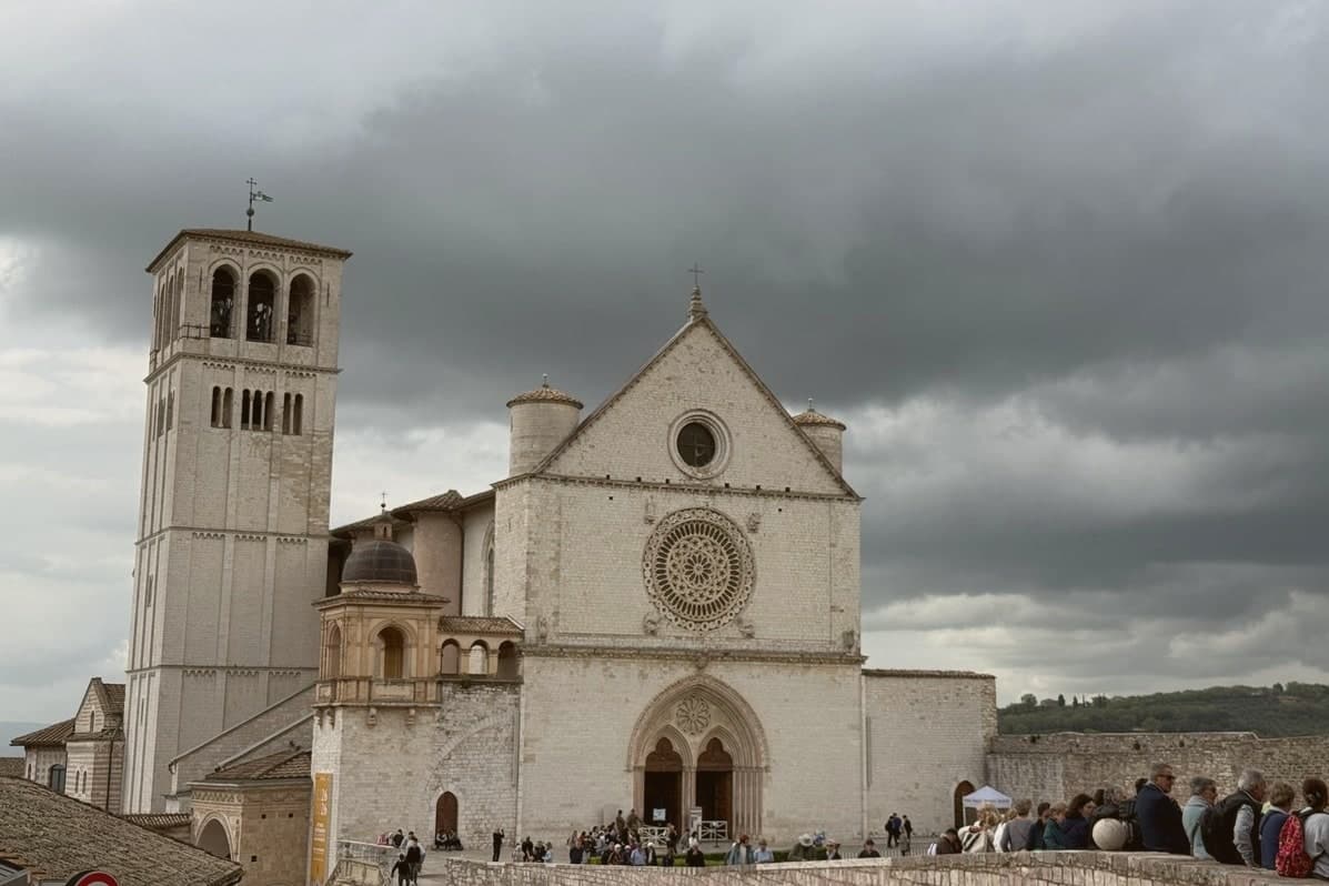
Assisi sits on a terraced spur twenty kilometers east of Perugia, the town built into the western flank of Monte Subasio where it drops toward the plain below. The Umbri settled the site before the Romans came, and the municipium of Asisium grew up around what is now Piazza del Comune, the square that still forms the civic center of the medieval town.
The centro storico runs between two poles: the basilica holding Francis's tomb at one end and the church holding Clare's relics at the other, with the Roman square and its temple facade sitting between them as the oldest layer beneath the medieval one. Below the town, on the plain, stands the basilica built around the chapel where Francis founded his order and died.
Further up the mountain, past the town walls, the hermitage occupies a beech wood where Francis and his companions withdrew from all of it. The layout traces the life it commemorates: birth and burial at the center, founding and death on the plain below, retreat in the wood above.
The town has arranged itself, over centuries, around the geography of one man's biography.
What to see in Assisi
- Basilica di San Francesco. Two superimposed churches over the saint's tomb, frescoed by Cimabue, Giotto, Simone Martini and Pietro Lorenzetti.
- Basilica di Santa Chiara. Church at the eastern end of the centro storico, holding the relics of Saint Clare and the San Damiano Crucifix.
- Tempio di Minerva. Roman temple on Piazza del Comune, six Corinthian columns intact, one of the best-preserved temple façades in the country, converted to a church in 1539.
How to get to Assisi
It has its own railway station. Perugia is about 35 min away by road. The full route from Florence.
✷ We have written about Assisi
“The basilica is grand, and it is grand from a distance, which is the harder trick. You see it from the valley road as a long horizontal weight along the end of the ridge, held up on arches, wider than the town it belongs to. In front of it there is a huge sloping field, stone, which functions as a piazza sort-of.”
Read our piece on Assisi →Assisi | The Church He Would Have Chosen
Our tip
April through June and September into October are the months Assisi was built for. The hills around Monte Subasio turn green in spring and gold in autumn, and the pilgrim traffic spreads thinly enough that the centro storico keeps its silence in the early morning. October 3 and 4 are the Festa di San Francesco, when delegations from every Italian region process to the basilica.
Why visit Foligno
Foligno sits on the left bank of the Topino where the river leaves the Apennines and meets the plain of the Clitunno, the point at which the mountains give way to the Umbrian Valley. The town was called Fulginium in antiquity, and Cicero mentions the prefecture in two surviving fragments.
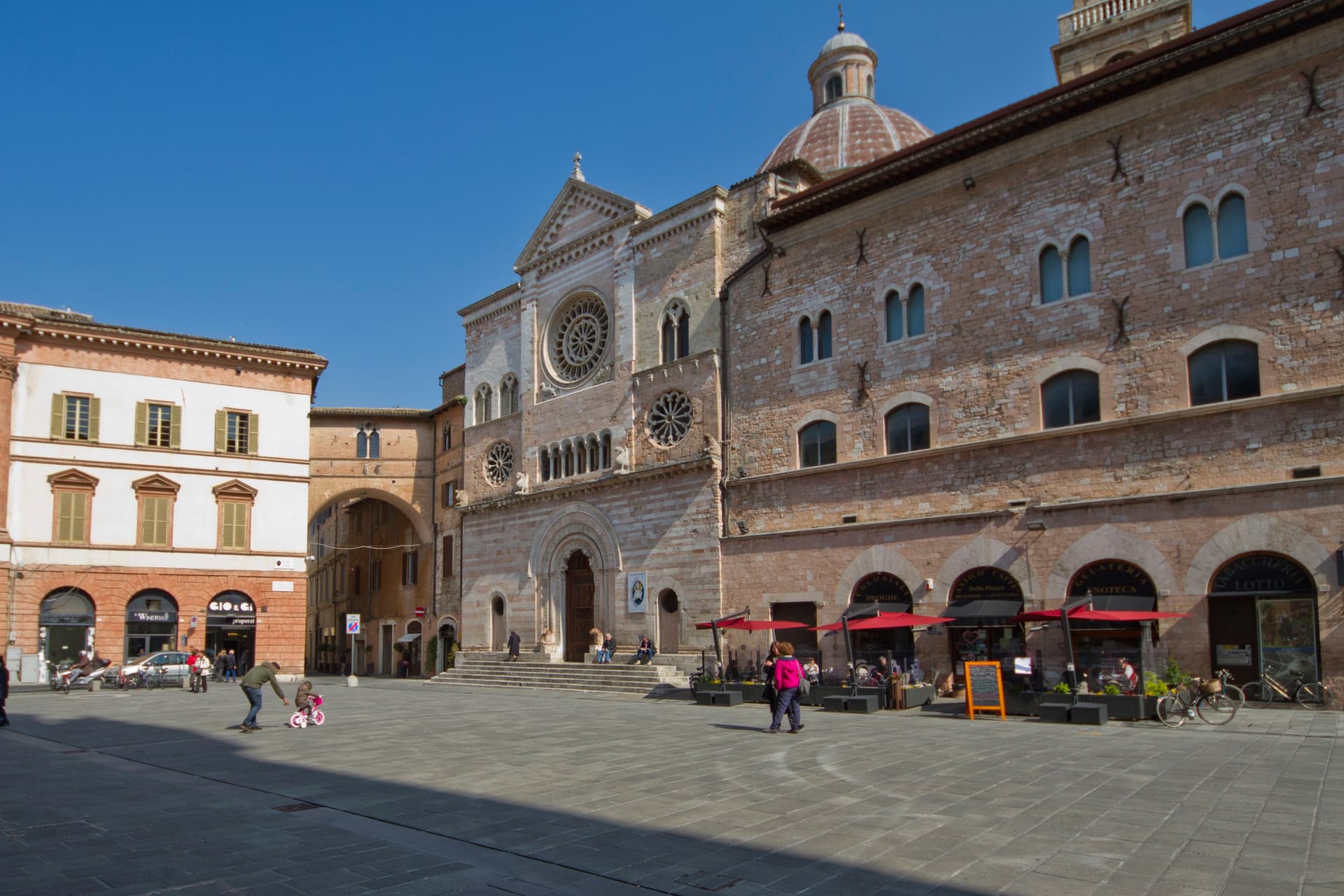
The Trinci ruled the town from 1305 to 1439, and the palace that carries their name still stands at its center, with the cathedral facing the same square where the town's tournament has run twice a year since its revival. The city's oldest church predates the Trinci period by centuries, its site going back to an 8th-century chapel, while the abbey in the hills above town was founded in 1084, its cloister finished in 1229.
Between the ancient prefecture, the medieval abbey, the Trinci court, and the print workshop that put Dante into type, Foligno reads as a valley crossing point where successive centuries each left a building rather than displacing what came before.
What to see in Foligno
- Palazzo Trinci. Seat of the Trinci signoria 1305-1439, frescoed by Gentile da Fabriano and Jacopo Bellini, now holding the Pinacoteca and archaeological museum.
- Cattedrale di San Feliciano. Romanesque cathedral on Piazza della Repubblica, built over the tomb of the bishop-martyr buried here in 251 AD.
- Basilica di Santa Maria Infraportas. Oldest church in the city on the site of an 8th-century chapel, frescoes by Nelli, Ugolino di Gisberto, Alunno and Mezzastris.
How to get to Foligno
It has its own railway station. Perugia is about 42 min away by road. The full route from Rome.
Our tip
April through June and September into October are the months locals prefer. The Quintana runs twice a year, the June and September editions filling the rioni for a week each. April through October is also the season for the Topino river paths and the climb up to Sassovivo.
Why visit Terni
Terni is the Roman Interamna, the town between two rivers, and it shows its history in layers. The Anfiteatro Fausto of 32 AD sits in the city park, the Duomo keeps a sixth-century crypt, and Palazzo Spada, the town hall, may be the last work of Antonio da Sangallo the Younger.
From the nineteenth century the water of the Nera drove steelworks, arms factories and jute mills, and that made Terni a target: Allied raids from August 1943 destroyed or damaged 40 percent of its buildings. The 12,000-ton steel press in Piazza Dante is the city's own monument to that past.
Terni is also the city of Saint Valentine, its third-century bishop, whose basilica on the edge of town holds his remains. Seven kilometers up the Valnerina, the Romans cut a channel through the cliff at Marmore in the third century BC and made a waterfall of 165 meters.
Lake Piediluco lies just beyond it, and the ruins of Carsulae sit on the Via Flaminia to the north.
What to see in Terni
- Cascata delle Marmore. Falls of 165 meters made by the Romans to drain the Rieti plain. The water is released on a timetable, so check the opening hours before going.
- Basilica di San Valentino. Built on the hill where followers buried the town's bishop after his martyrdom in 273; the present church dates from 1618 and keeps his remains.
- Anfiteatro Fausto. Roman amphitheater of 32 AD in the park of La Passeggiata, with walls of two-tone reticulated stonework.
How to get to Terni
It has its own railway station. Perugia is about 1 h 9 min away by road. The full route from Rome.
Our tip
Terni works in any season. February is the city's month: the feast of San Valentino on the 14th fills the basilica and the streets around it. Spring and summer are when the Cascata delle Marmore runs most often, since the water is released on a timetable, and on 1 May the Cantamaggio parades decorated floats through the center to welcome the season.
More from Anywhere Italy
- The 8 best towns on a walking route that you can reach by train in UmbriaUmbriaon a walking routeby train8 towns · smallest 8,063 residents
- The best hill towns on a walking route within 90 minutes of PerugiaNear Perugiahill townon a walking routewithin 90 min9 towns · smallest 1,984 residents · closest 33 min away
- The best towns on a walking route that eat well within 90 minutes of PerugiaNear Perugiaon a walking routewithin 90 mineats well8 towns · smallest 1,500 residents · closest 33 min away
- The 6 best olive oil towns inside a nature park in UmbriaUmbriaolive oilinside a park6 towns · smallest 957 residents
- The best towns on a walking route that eat well in the province of PerugiaPerugia provinceon a walking routeeats well8 towns · smallest 4,544 residents
- The best hidden towns inside a nature park that eat well in UmbriaUmbriainside a parkeats wellhidden6 towns · smallest 2,555 residents