
The best towns inside a national park in Marche
The Marche side of the Apennines is built from pale limestone, and so are its towns: grey stone houses, stone thresholds, stone churches with rose windows facing the valley. Above them the Sibillini ridges hold snow into late spring, and below them the beech woods turn copper in October while the pastures still feed sheep. This is pecorino country, and the country of lentils and cured pork and ciauscolo, the soft spreadable salami that gets eaten on bread at eleven in the morning. Sulphur water surfaces in the Tronto valley, warm and faintly eggy, and has been bathed in for a very long time.
Most people who come to Marche for mountains go to the Frasassi caves or drive the Gole della Rossa, and in August the car parks at Castelluccio di Norcia on the Umbrian flank of the Sibillini fill before nine with people wanting the lentil bloom. The famous views are good and busy. The result is a national park experienced mainly as a queue of cars on a single high road, photographed and then left behind.
The park boundary is much wider than that one road. The same limestone, the same beech, the same flocks and the same cheese continue north and east into valleys where fewer people go, and there are towns inside the protected area with bars, bakeries, walking routes from the piazza and rooms to sleep in. Several were badly damaged in the central Italy earthquakes and are rebuilding in public view, which is part of what it means to visit them now. These are those towns.
Of the 63 communes we have mapped in Marche, 6 qualify as towns inside a national park: each sits inside the boundary of a national park. The smallest, Valfornace, has 909 residents.
If you are still choosing, we have also written The prettiest villages in the province of Macerata and The 9 best towns inside a nature park in Marche.
Valfornace
Why visit Valfornace
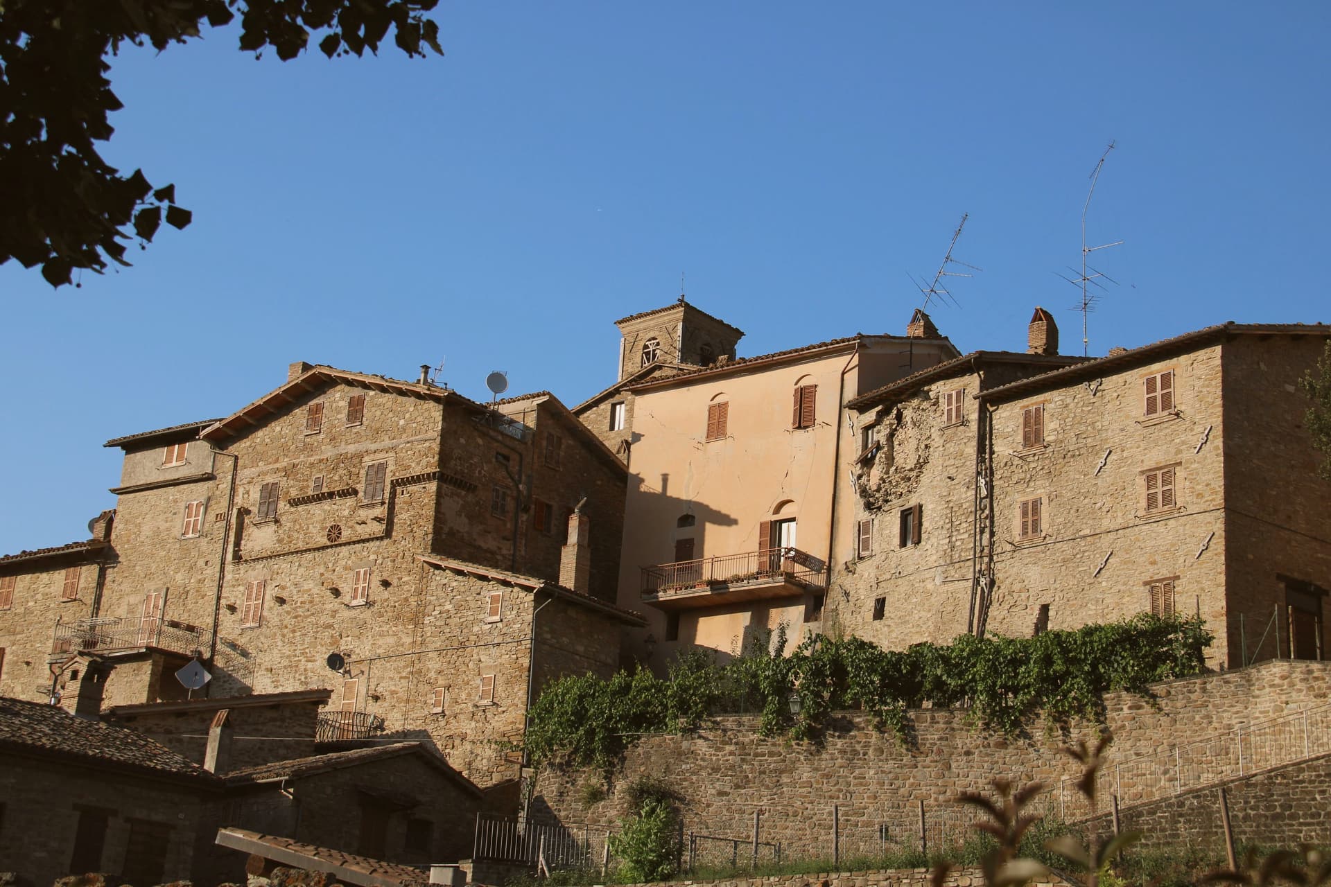
Valfornace was created on 1 January 2017 from the merger of Pievebovigliana and Fiordimonte, two small communes of the upper Chienti valley within the Monti Sibillini National Park. The capoluogo, Pievebovigliana, sits at 441 meters, and the territory reaches west from there toward the park boundary, with Fiordimonte's frazioni giving access to the higher ground and Pontelatrave holding the castle apart from both.
The 2016 earthquakes damaged several of the commune's older structures, near the mountain that anchors the church at its foot, and reconstruction is still underway. Honey and herb liquors remain the trades that run through the scattered frazioni, the work behind the commune's Città del Miele and Città dei Liquori signals.
The territory reads as two former communes now sharing one valley floor and one mountain edge, their built history concentrated in a scatter of small settlements rather than a single center.
What to see in Valfornace
- Castello di Beldiletto. The castle in Pontelatrave carries its fourteenth-century origin into a later remodeling, the summer-residence layout giving way to villa rooms added in the fifteenth century.
- Chiesa di San Giusto. The church at the base of Monte Fiegni (1,324 m) shows its age in the plain stone of a pre-Romanesque plan, reconstruction work ongoing since the 2016 earthquakes.
- Chiesa di Santa Maria Assunta. The parish church of the capoluogo holds a Romanesque crypt below the main medieval structure.
How to get to Valfornace
Perugia is roughly 84 minutes away by road.
Our tip
April through June and September into October are the best months for Valfornace. The Sibillini meadows above town turn green in May, the herb pastures used by local apiaries flower through summer, and the chestnut woods on Monte Fiegni turn in late October. July and August are mild at 441 meters and cooler above; the high pastures stay open into early September for trail walking.
Visso
Why visit Visso
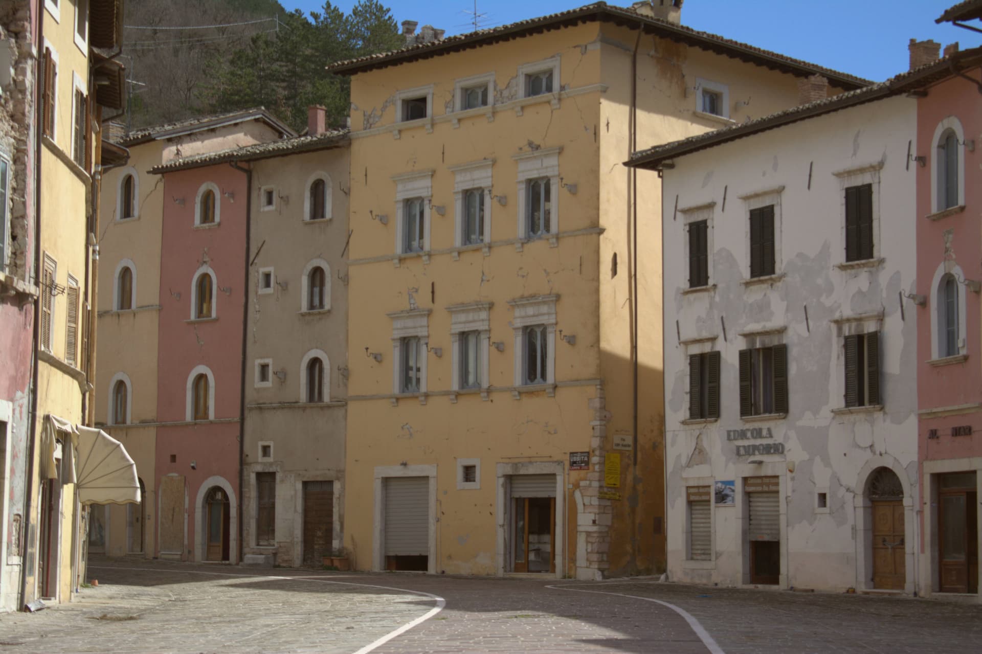
Visso sits at 607 meters at the confluence of the Nera and the Ussita, on the Umbrian border in the northern Sibillini. The village is the seat of the Parco Nazionale dei Monti Sibillini and the northern gateway commune to the high ridges.
A settlement called Vicus Elacensis stood here in pre-Roman times. The Piazza dei Martiri Vissani is bordered by elegant fifteenth and sixteenth-century palazzi; the Collegiata di Santa Maria, twelfth century in Romanesque-Gothic form, closes one side with an Annunciation frescoed in the lunette by Paolo da Visso.
The former church of Sant'Agostino, fourteenth century, holds the Museo Civico Diocesano with about 200 sacred works and the Leopardi manuscripts: six idylls including one of the two existing copies of L'Infinito, five sonnets, the Epistle to Carlo Pepoli, and fourteen letters from 1825 to 1831. The 2016 earthquakes severely damaged the centro storico; reconstruction is slow and many buildings remain closed.
What to see in Visso
- Piazza dei Martiri Vissani. Central square at the confluence of the Nera and the Ussita, bordered by fifteenth and sixteenth-century palazzi and closed at one end by the Collegiata.
- Collegiata di Santa Maria. Twelfth-century Romanesque-Gothic collegiate church, with a portal lunette frescoed by Paolo da Visso showing the Annunciation, medieval artworks inside.
- Museo Civico Diocesano. Housed in the former Sant'Agostino, with around 200 sacred works from the territory and the autograph Leopardi manuscripts including one of the two existing copies of L'Infinito.
How to get to Visso
Perugia is roughly 100 minutes away by road.
Our tip
May through October is the window for Visso. The Sibillini meadows turn green by late May, the Nera and the Ussita run cold and clear through summer, and the trail network opens fully from June. July and August are mild at 607 meters and cooler above; the high pastures hold their flowers into early August.
Arquata del Tronto
Why visit Arquata del Tronto
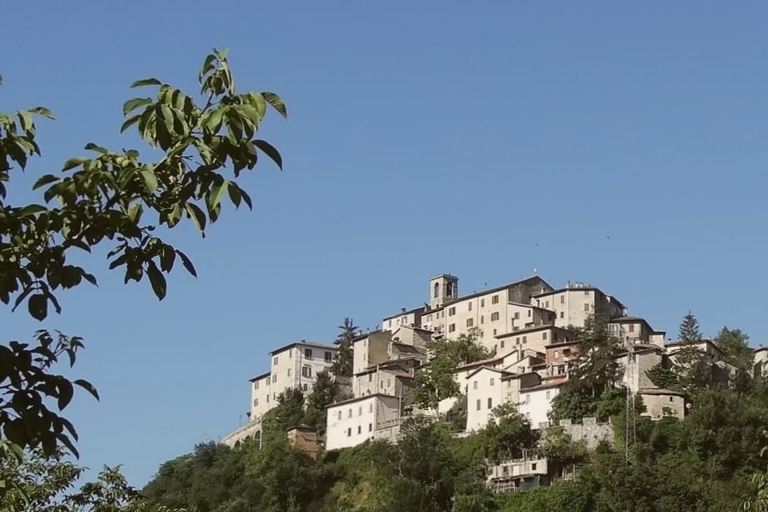
Arquata del Tronto sits at 777 meters in the upper Tronto valley, the only European commune whose territory falls inside two national parks: Gran Sasso e Monti della Laga to the south, Monti Sibillini to the north. The capoluogo runs up a ridge between the two, with the Rocca of Arquata, originally a thirteenth-century watchtower of the Norcia road, on the highest point.
The earthquakes of 24 August and 30 October 2016 killed 49 people in the commune, mostly in the frazione of Pescara del Tronto which was destroyed at 3:36 in the morning when the first 6.0 shock struck. Many of the other twelve frazioni, including Borgo, Trisungo and Capodacqua, suffered heavy damage.
Reconstruction has been slow: temporary housing remains in place for most displaced residents, and several frazioni are still closed to entry. The population, 973 at the 2023 count, is roughly half of what it was in 2015.
What to see in Arquata del Tronto
- Rocca di Arquata. Thirteenth-century watchtower-fortress on the highest point of the capoluogo, controlling the Tronto road toward Norcia.
- Pescara del Tronto. Frazione destroyed by the 24 August 2016 earthquake at magnitude 6.0; the site remains closed and is marked by a memorial.
- Monte Vettore. At 2,476 meters, the highest peak of the Sibillini, accessed from Arquata's western trails toward the Forca di Presta saddle.
How to get to Arquata del Tronto
Pescara is roughly 98 minutes away by road.
Our tip
May through October is the working season for Arquata del Tronto. The Sibillini and Laga trails open from late May, the Forca di Presta saddle reaches Castelluccio's lentil bloom from mid-June into July, and the September weeks bring the clearest air and the truffle woods turning. July and August stay cool at 777 meters but the trails fill on weekends. Festa del Perdono falls in August.
Acquasanta Terme
Why visit Acquasanta Terme
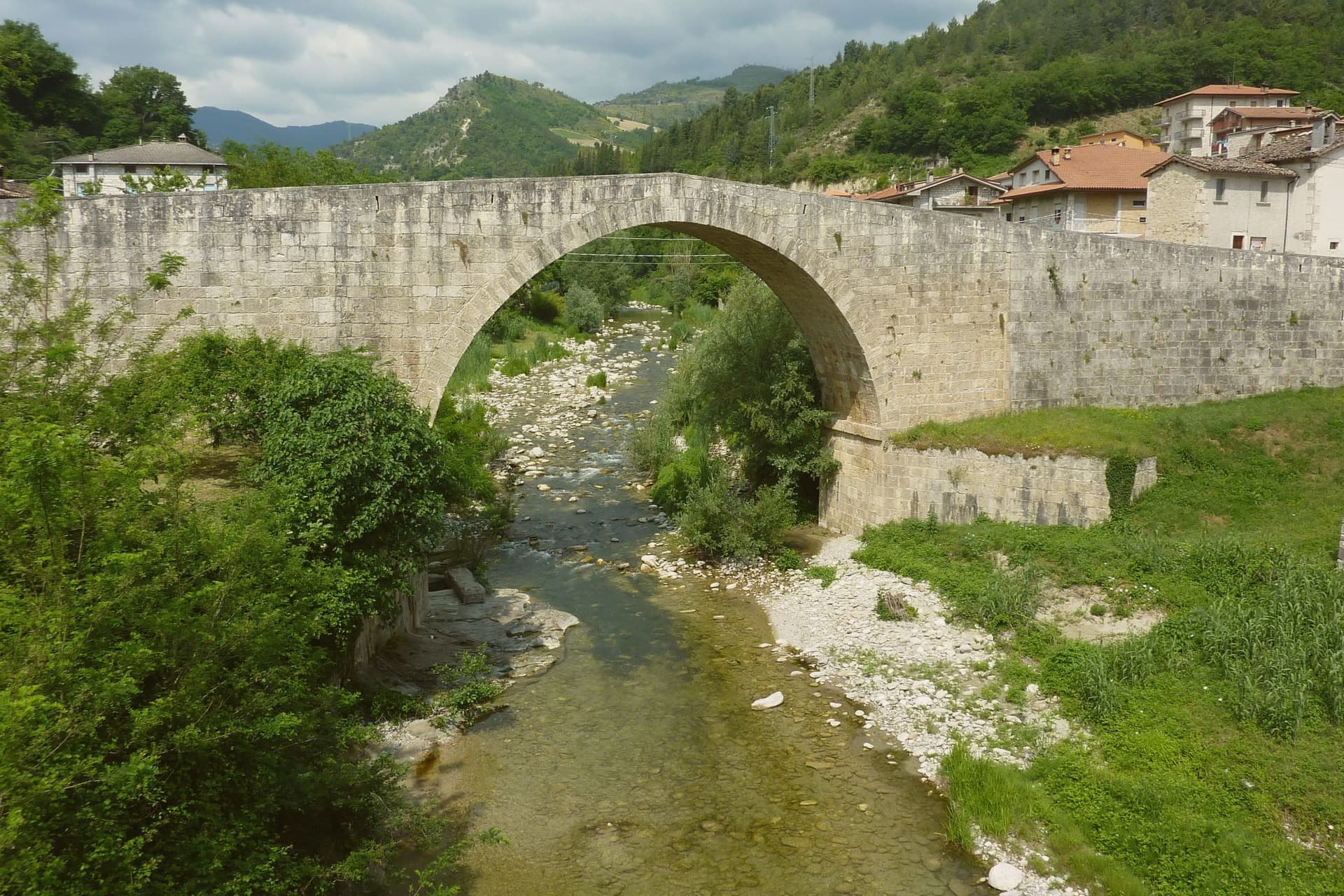
The town sits fifteen kilometers from Ascoli Piceno, pressed between the Sibillini to the north and the Laga ridge to the south, in a stretch of the upper Tronto valley narrow enough that the springs, the river and the mountain walls are all within reach of each other. The commune spreads across 138 square kilometers of forested ridges, its 75 frazioni scattered along the valley sides while the town itself gives its name to the whole territory, the only Marche commune with a foothold in the national park.
The cure is older than the town's built center: the Roman consul Lucio Munazio Planco is said to have come here around 50 AD after treatments elsewhere failed him, and the first pools were cut into the rock at that time. What is called the centro storico came later and took damage in the older parts of it in the 2016 earthquake, though the spa and the springs kept working through it.
Upper valley and lower spa, old stone and hot water: the place has been organized around the same sulphur source since before it had a settled name for itself.
What to see in Acquasanta Terme
- Terme di Acquasanta. The spa complex sits on the same site where the first pools were cut into the rock, rebuilt across the centuries as the cure continued.
- Lu Vurghe. The stream runs a kilometer above town through open ground before it reaches the Tronto, with no structure around it.
- Parco Nazionale del Gran Sasso e Monti della Laga. Hiking routes climb from the commune into the Laga ridge and toward the Tronto headwaters.
How to get to Acquasanta Terme
Pescara is roughly 87 minutes away by road.
Our tip
Acquasanta Terme works year-round because the spa and the open Vurghe stream both run hot in every season. April through October is the best window for combining baths with hikes into the Laga ridge and the Tronto headwaters. June through August can touch the high twenties in the valley floor, but the springs and the shaded woodlands stay cool.
San Ginesio
Why visit San Ginesio
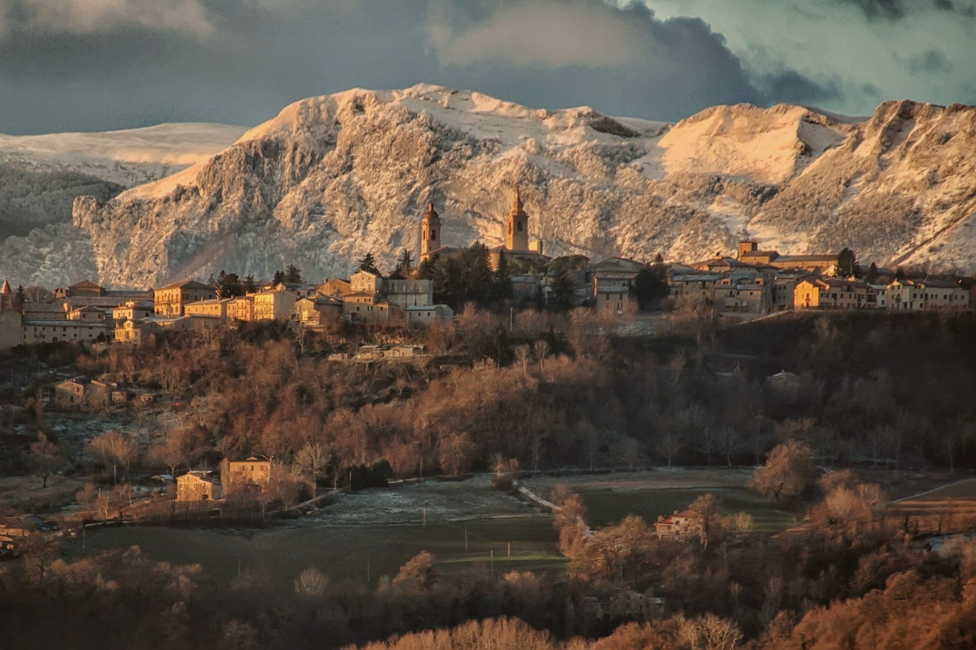
San Ginesio sits at 680 meters on a hill in the Macerata province, fifth highest commune in the province, on ground that Norman bourgeoisie first fortified in the tenth century to control the valley below. The town ran for a time as a free republic before joining the Papal States under Cardinal Albornoz's fourteenth-century constitutions, and it passed under the Da Varano of Camerino from 1355 to 1434.
A rivalry with the March of Fermo was settled at the Battle of Fornarina on 30 November 1377. The historic center gathers its civic and religious buildings around one square, the church, the hospital and the town hall standing within sight of each other, a layout that still reads as the working core of the old republic.
Outside the walls the ground rises toward the Sibillini massif, and the commune's territory reaches into the national park, so the same town that faces a piazza of medieval stone also has trails running from its western frazioni up into high pasture. The 2016 earthquake damaged many buildings and reconstruction is ongoing.
What the centuries of fortification, republic, and rivalry left behind is a hill town whose walls still look both ways: down over the valley it once controlled, and out toward the mountains that give it its name.
What to see in San Ginesio
- Collegiata della Santissima Annunziata. Fourteenth-century brick facade holds a Bernardino di Mariotto altarpiece inside. The building anchors one side of the square it faces.
- Ospedale dei Pellegrini. Sandstone columns with leaf capitals support the lower portico, an example of domus hospitales built along the pilgrim road. The brick loggia added above sits a century and a half later than the ground floor.
- Piazza Gentili. Central piazza of the centro storico, anchored by the Collegiata, the Palazzo del Comune and the Ospedale dei Pellegrini.
How to get to San Ginesio
Ancona is roughly 77 minutes away by road.
Our tip
May through October is the working window for San Ginesio. The Sibillini meadows turn green from May, the Balcony view reaches its clearest air through June and again in September, and the Battle of Fornarina commemoration runs each year on the last weekend of August. July and August touch the high twenties at 680 meters but the ridge breeze keeps the centro storico cool through the afternoons; the festa weekends fill Piazza Gentili. Fiera a San Liberato falls in August.
Amandola
Why visit Amandola
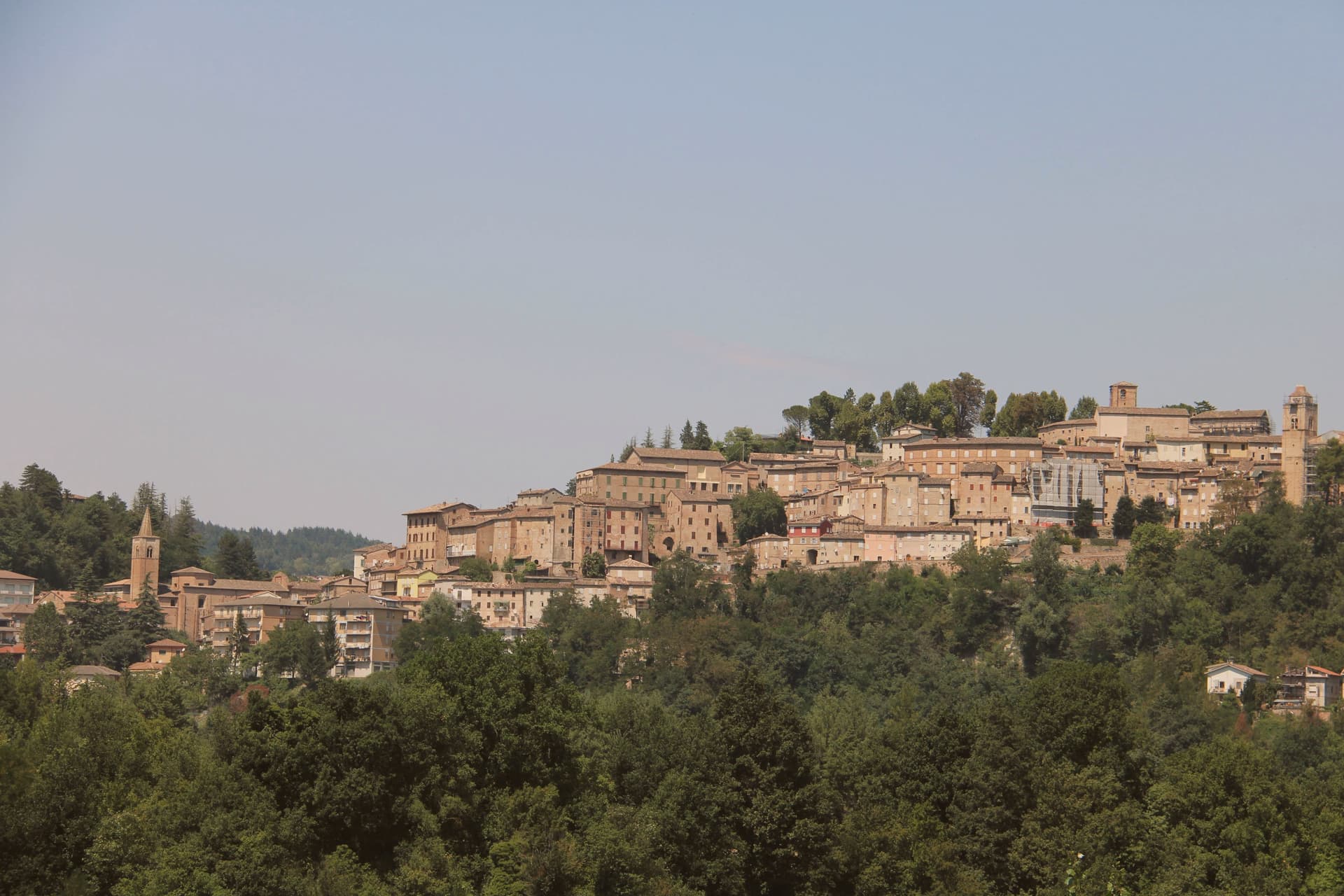
Amandola spreads across three hills, Marrubbione, Castel Leone and Agello, on the eastern slope of the Sibillini at 550 meters, above the left bank of the Tenna river. The town was founded in 1248 from the merger of three earlier castles and grew into one of the main civic centers of the Sibillini area, with the Palazzo del Podestà built in 1352 and the tower rebuilt in 1547.
The Chiesa di San Francesco, Romanesque-gothic in the lower town, preserves a twelfth-century wooden crucifix and a cloister that now houses the Museo Antropogeografico and the museum of peasant culture. The 24 August 2016 earthquake damaged many buildings; the artworks were moved into the deconsecrated Collegiata for safekeeping while reconstruction continues.
The territory is the third largest in the Fermo province and includes 48 frazioni, beekeepers, truffle hunters and the eastern access trails into the Monti Sibillini National Park.
What to see in Amandola
- Chiesa di San Francesco. Romanesque-gothic church with twelfth-century wooden crucifix and a cloister that holds the Museo Antropogeografico and the museum of peasant culture.
- Palazzo del Podestà. Built 1352, with the tower partially rebuilt in 1547, the civic anchor of the centro storico across the Agello hilltop.
- Ex Collegiata di Santa Maria Assunta. Deconsecrated former collegiate church, now used to house artworks recovered from buildings damaged in the 2016 earthquake.
How to get to Amandola
Ancona is roughly 92 minutes away by road.
Our tip
April through June and September into October are the best months for Amandola. The Sibillini meadows above town turn green by May, the truffle woods open from September, and the Tenna valley below holds long afternoon light through autumn. July and August touch the high twenties at 550 meters but the high pastures and forest trails stay cooler; the festa weekends fill the centro storico with sagras through both months.
More from Anywhere Italy
- The prettiest villages in the province of Macerata
 The 9 best towns inside a nature park in Marche
- The best small towns that eat well in Marche
 The prettiest villages with a food festival in Marche
 The 8 best towns inside a national park in the province of Potenza
 The best coastal towns inside a national park in Campania