
The prettiest villages in the province of Macerata
The province of Macerata rises in ridges from the Adriatic plain towards the Sibillini mountains, and almost every ridge carries a walled village on top of it. The building material changes as you climb: warm brick and terracotta in the lower hills, then pale stone and travertine closer to the peaks, with arcaded squares and belltowers that read from a long way off. This is Marche cooking at its richest, vincisgrassi baked in layers, ciauscolo salami soft enough to spread, lentils and pecorino from the mountain pastures, and Verdicchio di Matelica from the valley floors. Autumn is the season the landscape earns its reputation, when the vine rows turn and the light goes low across the wheat stubble.
Most visitors to this part of Italy stop at Urbino, or head straight down the coast to Senigallia and Numana for the beaches and the fish restaurants. Urbino in particular absorbs the region's attention, a ducal palace and a university in one compact hill town, and the coach parks fill from spring onwards. The city deserves it, but it means the interior of the Marche gets read as somewhere you drive through on the way to the sea. Macerata itself draws a crowd in summer for opera at the Sferisterio and empties again.
The same hills continue west and south past all of that, and the villages on them are the ones in this list. Fortified towns with intact circuits of wall, cloisters, mountain valleys leading into the Sibillini, thermal water, and squares built for markets rather than for photographs. Fewer people go, which is partly geography and partly the fact that no single name here does the work Urbino does. Each has been assessed by the national association of Italy's most beautiful villages, which is a useful filter for a province with this many candidates.
Of the 16 communes we have mapped in the province of Macerata, 9 qualify as prettiest villages: each has passed the assessment of the national association of Italy's most beautiful villages. The smallest, Visso, has 961 residents.
Two more lists worth reading alongside this one: The prettiest villages with a food festival in Marche and The 8 prettiest villages that eat well in Marche.
Visso
Why visit Visso
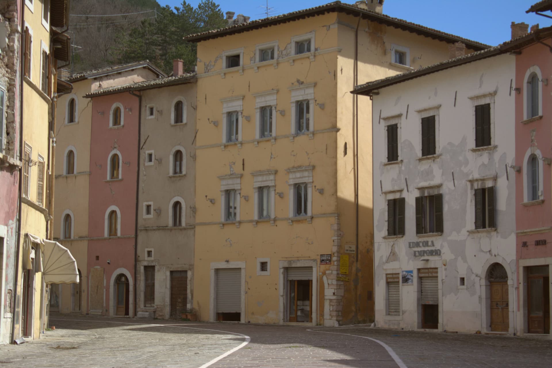
Visso sits at 607 meters at the confluence of the Nera and the Ussita, on the Umbrian border in the northern Sibillini. The village is the seat of the Parco Nazionale dei Monti Sibillini and the northern gateway commune to the high ridges.
A settlement called Vicus Elacensis stood here in pre-Roman times. The Piazza dei Martiri Vissani is bordered by elegant fifteenth and sixteenth-century palazzi; the Collegiata di Santa Maria, twelfth century in Romanesque-Gothic form, closes one side with an Annunciation frescoed in the lunette by Paolo da Visso.
The former church of Sant'Agostino, fourteenth century, holds the Museo Civico Diocesano with about 200 sacred works and the Leopardi manuscripts: six idylls including one of the two existing copies of L'Infinito, five sonnets, the Epistle to Carlo Pepoli, and fourteen letters from 1825 to 1831. The 2016 earthquakes severely damaged the centro storico; reconstruction is slow and many buildings remain closed.
What to see in Visso
- Piazza dei Martiri Vissani. Central square at the confluence of the Nera and the Ussita, bordered by fifteenth and sixteenth-century palazzi and closed at one end by the Collegiata.
- Collegiata di Santa Maria. Twelfth-century Romanesque-Gothic collegiate church, with a portal lunette frescoed by Paolo da Visso showing the Annunciation, medieval artworks inside.
- Museo Civico Diocesano. Housed in the former Sant'Agostino, with around 200 sacred works from the territory and the autograph Leopardi manuscripts including one of the two existing copies of L'Infinito.
How to get to Visso
Perugia is roughly 100 minutes away by road.
Our tip
May through October is the window for Visso. The Sibillini meadows turn green by late May, the Nera and the Ussita run cold and clear through summer, and the trail network opens fully from June. July and August are mild at 607 meters and cooler above; the high pastures hold their flowers into early August.
Esanatoglia
Why visit Esanatoglia
The name fuses two histories: Aesa, a Roman settlement on the Esino, and Santa Anatolia, the third-century martyr whose cult took over as the town's identity through the medieval period. The current name was made official in 1862.
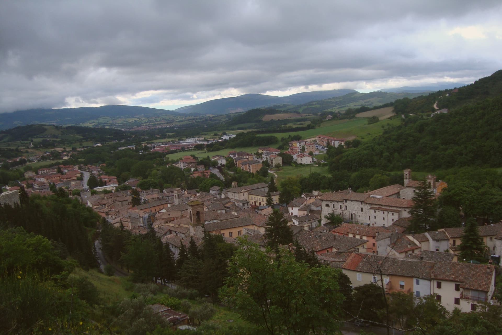
The first surviving document mentioning the place dates to 1015, recording the foundation of the monastery of Sant'Angelo by Count Atto and his wife Berta, the most important religious house in the area for the next two centuries. The village sits at 358 meters at the source of the Esino, on the border between Marche and Umbria.
The main street runs between two fortified gates, and the seven towers visible from above stand over a lower village still marked by its medieval walls and public fountains. Above the settlement, on Monte Corsegno, a hermitage looks down over the roofs.
The town's layout still reads as what it was: a river's source point fortified and settled in stages, its religious geography written into gates, walls, and towers that have outlasted the parishes that built them.
What to see in Esanatoglia
- I sette campanili. Seven bell towers visible along Corso Vittorio Emanuele between the Sant'Andrea and Panicale gates, the surviving sign of the town's medieval parish density.
- Mura medievali. Surviving medieval walls and fortified gates of Sant'Andrea and Panicale closing the two ends of the main street.
- Eremo di San Cataldo. Hermitage perched on Monte Corsegno above the village, reached by a marked footpath through the hills.
How to get to Esanatoglia
Ancona is roughly 76 minutes away by road.
Our tip
April through June and September into October are the months for Esanatoglia. The Esino springs run cold across the season, the hill paths to the Eremo di San Cataldo are dry, and the green ridges along the Umbria border are at their clearest. July and August touch the high twenties; the centro storico stays shaded in the narrow streets between the bell towers.
Sarnano
Why visit Sarnano
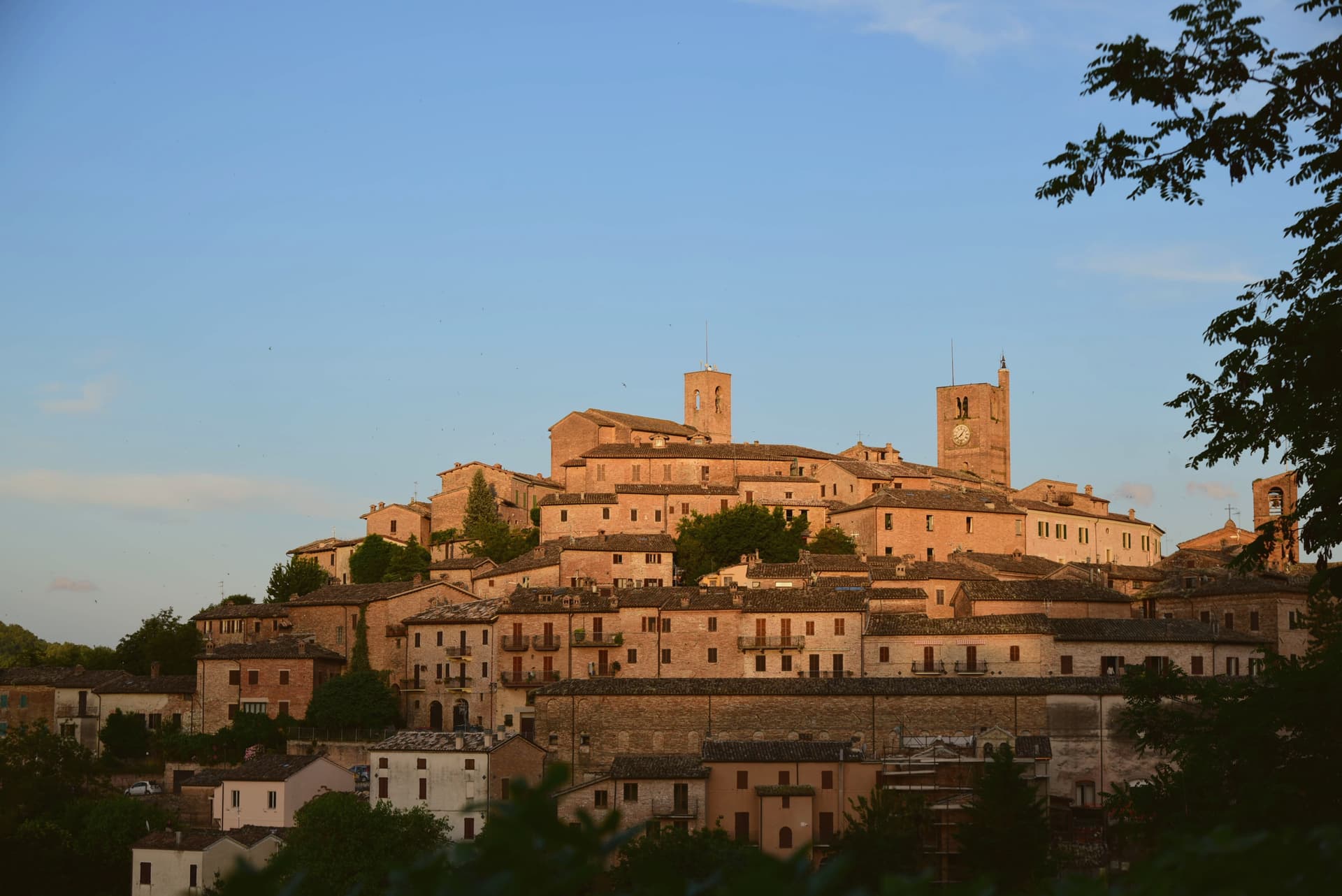
Sarnano sits on a hill within the Monti Sibillini National Park, seventy kilometers from Ancona. The old free commune built its civic center at the top of the settlement, where the square gathers the palazzi of the medieval government side by side with the church, a small stage for a town that once governed itself.
Below, the brick lanes drop away in concentric rings, the same baked brick used for houses that bridge the streets overhead and for small doors set into the walls to mark where the dead were once carried out. The spa lay downhill from the old town, drawing on springs pure enough to be used for respiratory, rheumatic and joint treatments from the 1930s until the earthquake of 24 August 2016 shut the historical building down; a new facility is being built to replace it.
Above the town, on Sassotetto, the ski slopes and the Sasso Spaccato mark the upper territory as the seasonal counterpart to the streets below. The town reads, then, as a set of layers stacked by elevation and by era: a governing hilltop, a residential brick warren beneath it, a therapeutic spa at the edge, and a working mountain above, each holding its own use across centuries rather than competing for the same one.
What to see in Sarnano
- Piazza Alta. The fourteenth-century Palazzo del Popolo, Palazzo dei Priori and Palazzo del Podestà stand together on the small civic stage of the old free commune, the church at their side.
- Centro storico di Sarnano. The lanes wind in concentric rings, crossed overhead by ponte houses, and small bricked-up doors of the dead are set into the walls at intervals along the brick.
- Chiesa di Santa Maria di Piazza Alta. Romanesque-gothic facade on the square's church, which once held the town's civic art collection, since moved to the Pinacoteca.
How to get to Sarnano
Ancona is roughly 84 minutes away by road.
Our tip
April through June and September into October are the best months for Sarnano. The Sibillini meadows turn green from May, the lavender fields above town bloom in early July, and the autumn light brings the brick centro storico to its warmest tone. July and August touch the high twenties at 539 meters but the elevated position and the forested slopes above keep the evenings cool. Festa del Ciauscolo e del salame spalmabile falls in September.
San Ginesio
Why visit San Ginesio
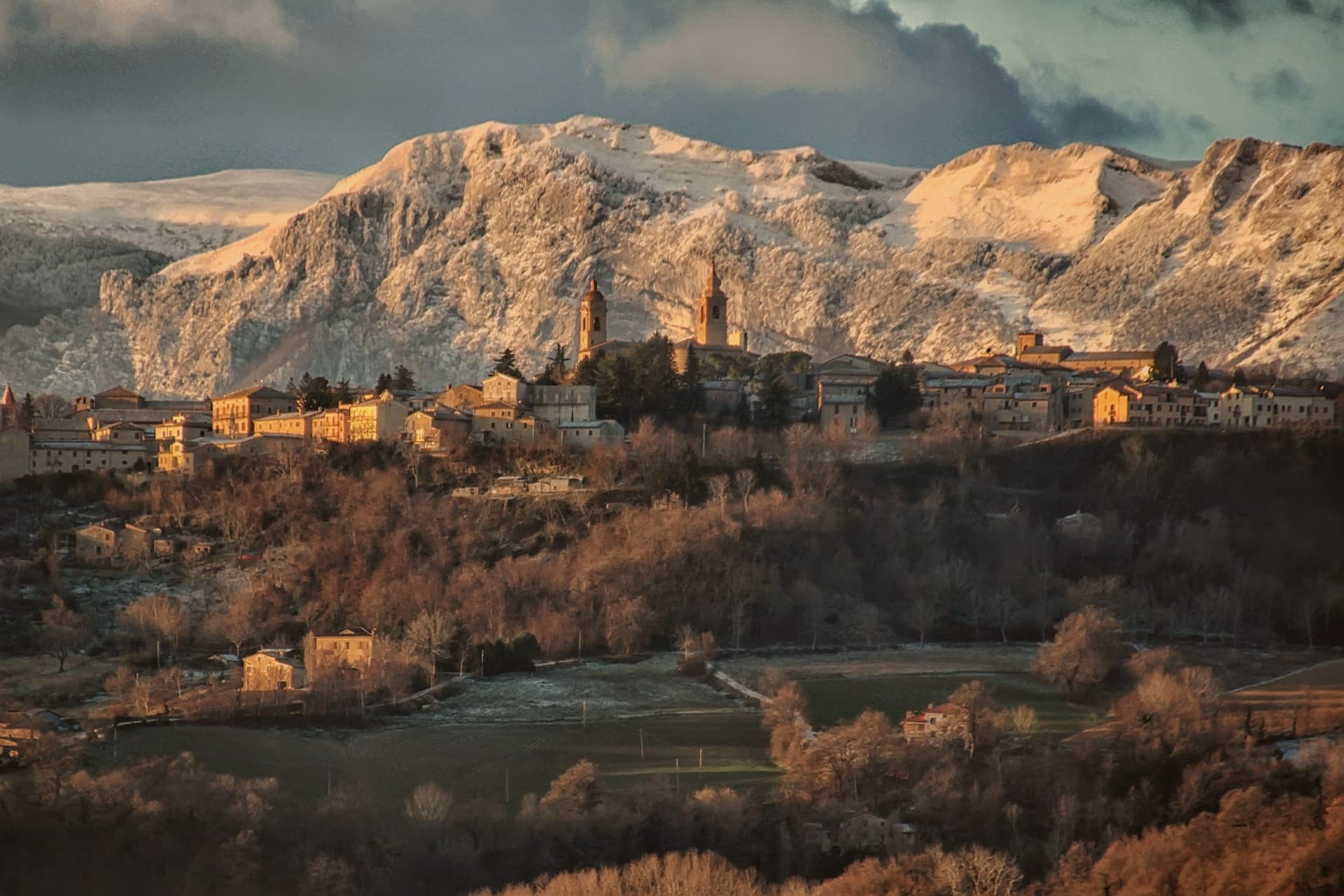
San Ginesio sits at 680 meters on a hill in the Macerata province, fifth highest commune in the province, on ground that Norman bourgeoisie first fortified in the tenth century to control the valley below. The town ran for a time as a free republic before joining the Papal States under Cardinal Albornoz's fourteenth-century constitutions, and it passed under the Da Varano of Camerino from 1355 to 1434.
A rivalry with the March of Fermo was settled at the Battle of Fornarina on 30 November 1377. The historic center gathers its civic and religious buildings around one square, the church, the hospital and the town hall standing within sight of each other, a layout that still reads as the working core of the old republic.
Outside the walls the ground rises toward the Sibillini massif, and the commune's territory reaches into the national park, so the same town that faces a piazza of medieval stone also has trails running from its western frazioni up into high pasture. The 2016 earthquake damaged many buildings and reconstruction is ongoing.
What the centuries of fortification, republic, and rivalry left behind is a hill town whose walls still look both ways: down over the valley it once controlled, and out toward the mountains that give it its name.
What to see in San Ginesio
- Collegiata della Santissima Annunziata. Fourteenth-century brick facade holds a Bernardino di Mariotto altarpiece inside. The building anchors one side of the square it faces.
- Ospedale dei Pellegrini. Sandstone columns with leaf capitals support the lower portico, an example of domus hospitales built along the pilgrim road. The brick loggia added above sits a century and a half later than the ground floor.
- Piazza Gentili. Central piazza of the centro storico, anchored by the Collegiata, the Palazzo del Comune and the Ospedale dei Pellegrini.
How to get to San Ginesio
Ancona is roughly 77 minutes away by road.
Our tip
May through October is the working window for San Ginesio. The Sibillini meadows turn green from May, the Balcony view reaches its clearest air through June and again in September, and the Battle of Fornarina commemoration runs each year on the last weekend of August. July and August touch the high twenties at 680 meters but the ridge breeze keeps the centro storico cool through the afternoons; the festa weekends fill Piazza Gentili. Fiera a San Liberato falls in August.
Montelupone
Why visit Montelupone
Montelupone sits at 272 meters on a hill in the lower Potenza valley, eleven kilometers northeast of Macerata. The territory holds Picene and Roman traces and was part of the March of Fermo through the early Middle Ages.
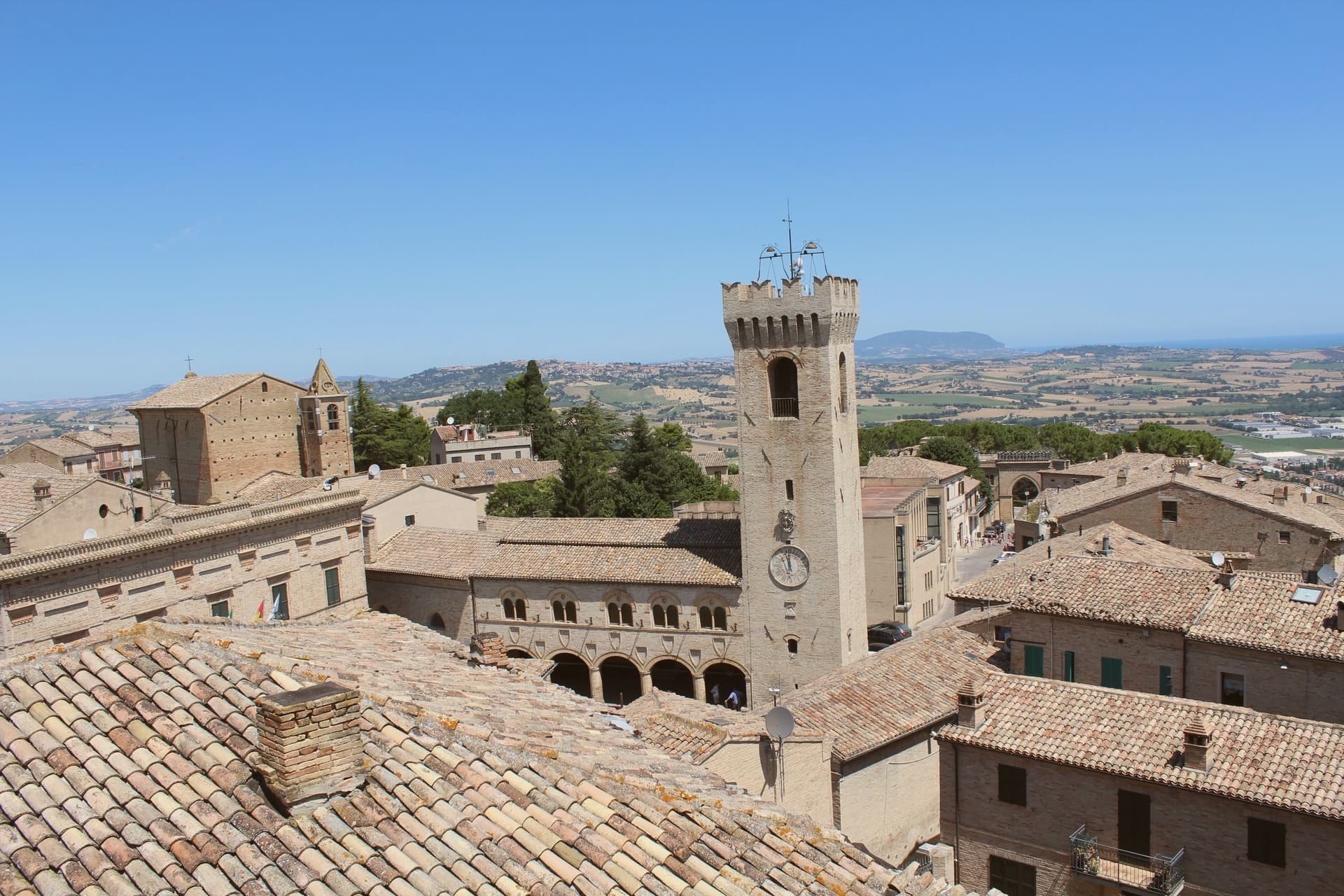
The fourteenth-century walls still ring the centro storico almost intact, pierced by four gates: Porta del Trebbio, Porta Ulpiana, Porta Santo Stefano and Porta del Cassero. On Piazza del Comune the Palazzo del Podestà rises in fourteenth-century brick, with a five-arched loggia, a clock tower and Ghibelline crenellations.
Inside the same complex the Teatro Nicola degli Angeli, inaugurated in 1889, holds 272 seats in a neoclassical horseshoe with two orders of boxes and a ceiling of musical angels. Eight kilometers below the hill, in the valley plain, the Abbazia di San Firmano was founded in 986 on the church of Saint John the Evangelist and rebuilt in 1256, with a Byzantine-Romanesque gabled facade.
The town carries the carciofo and the honey of the Potenza hills.
What to see in Montelupone
- Palazzo del Podestà. Fourteenth-century civic palace on Piazza del Comune, with five-arched loggia, clock tower and Ghibelline crenellations, the architectural anchor of the centro storico.
- Teatro Nicola degli Angeli. Inaugurated 1889 inside the Palazzo del Podestà, 272 seats in a neoclassical horseshoe with two orders of boxes and a ceiling of musical angels.
- Abbazia di San Firmano. Benedictine abbey founded 986 on the church of Saint John the Evangelist, rebuilt 1256 when the body of San Firmano was found, with a Byzantine-Romanesque gabled facade.
How to get to Montelupone
Ancona is roughly 47 minutes away by road.
Our tip
April through June and September into October are the best months for Montelupone. The hills around the Potenza valley turn green by April and gold by the late summer harvest, the brick walls warm in afternoon light, and the Conero stays visible from the hilltop on clear days. The Sagra del Carciofo in late April fills the centro storico for a long weekend.
Montecassiano
Why visit Montecassiano
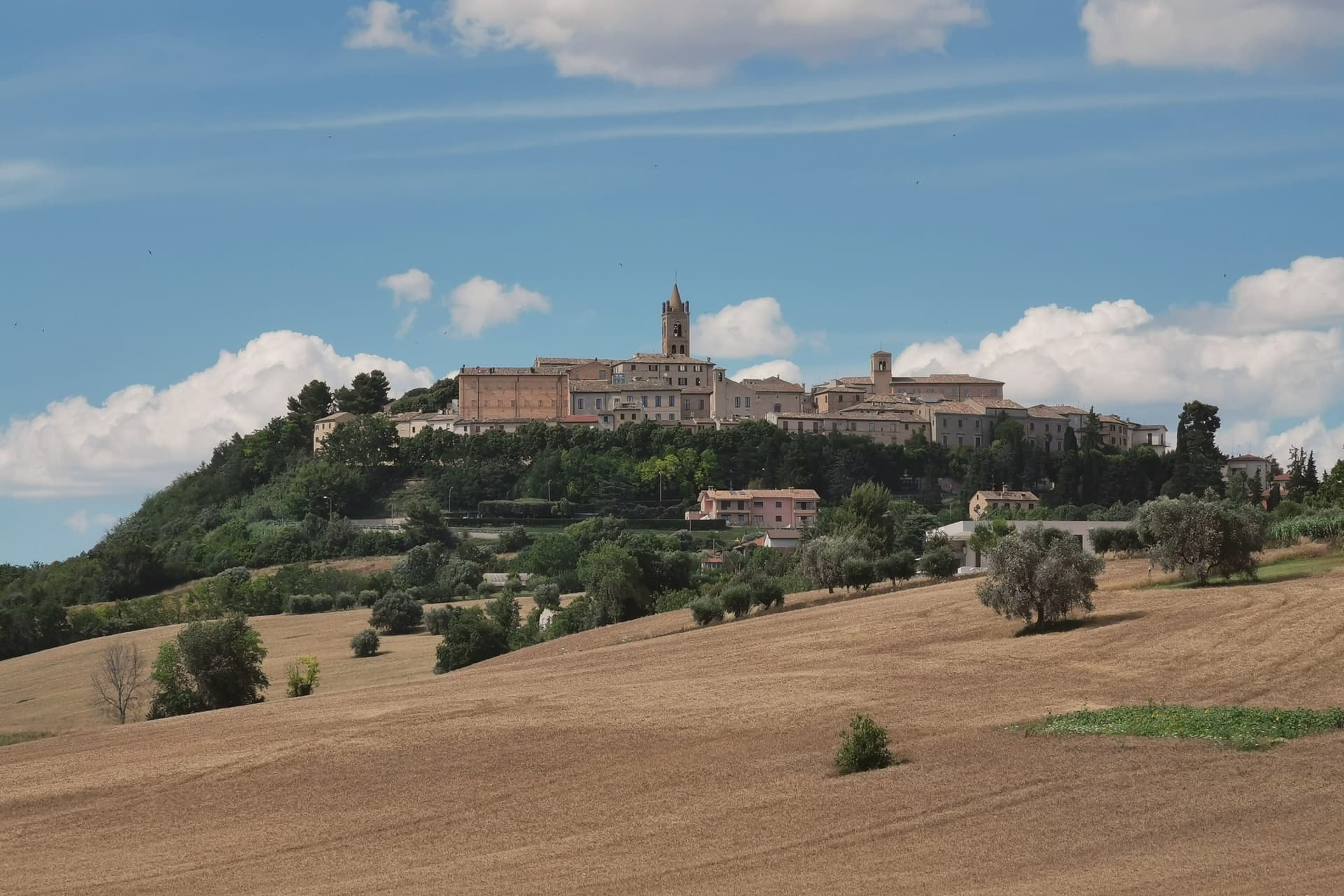
The town sits at 188 meters on a hill eight kilometers north of Macerata, recorded in 1151 as Castrum Montis Sancte Marie. Concentric streets rise from the walled perimeter toward the center, the layout of a hill settlement that grew inward from its defenses rather than outward from a square.
The two noble palaces on the main piazza frame a covered staircase under a wide arch, a passage built to carry people physically upward from the civic square to the church that crowns the town, so that the climb itself marks the change from secular to sacred ground. The town held with the Ghibellines through wars with Osimo, Macerata and Recanati, and passed in turn under the Malatesta, Da Varano and Sforza, a succession of overlords typical of inland fortified hill towns of the period.
What remains is a place whose defenses, streets and stairs all still point toward the same destination, the altarpiece too large to move, so that the walk through the town is itself the approach to the thing it was shaped around.
What to see in Montecassiano
- Collegiata di Santa Maria Assunta. Twelfth-century church rebuilt by Fiastra monks in 1234, later modified by Antonio Lombardo. It houses the Madonna with Child among Saints, the altarpiece fra' Mattia della Robbia fired on site.
- Palazzo dei Priori. Fourteenth-century civic palace on the central square, with a brick facade, ogival windows and a covered staircase leading up to the church under a wide arch.
- Mura medievali. The brick walls ring the centro storico almost completely, with original gates and the polygonal tower of the Cassero still standing.
How to get to Montecassiano
Ancona is roughly 44 minutes away by road.
Our tip
April through June and September into October are the best months for Montecassiano. The hills around the Potenza valley hold their green into late spring, the brick walls take a warm orange in the late afternoon light, and the Sibillini stay visible on clear days. July and August touch the low thirties on the hilltop, with the centro storico quietest between three and seven in the afternoon.
Montecosaro
Why visit Montecosaro
Montecosaro sits at 267 meters on a hill above the lower Chienti valley, fifteen kilometers from Macerata and inland from the Adriatic at Civitanova. The first record of a monastery in the river plain dates to 936, when the abbot Ildebrando received the church of Santa Maria from Farfa.
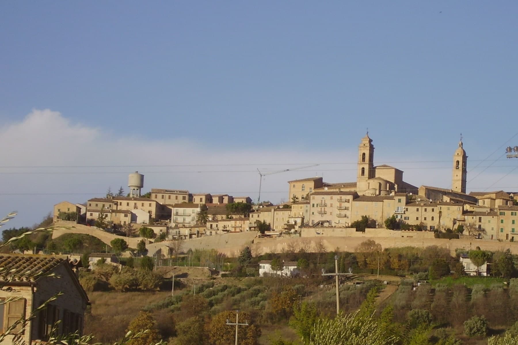
The current Basilica di Santa Maria a Piè di Chienti was raised in 1125 by the Lombard abbot Agenolfo, on the left bank a few kilometers from the river mouth: a three-nave Romanesque church with a raised presbytery and a ring of apsidioles, holding among the strongest Cluniac architecture in central Italy. The hilltop borgo above grew from a medieval castle after 1200, walled in the fourteenth century inside an oval that culminates at the Cassero, the former fortress now a public garden.
The Augustinian convent and the church of Sant'Agostino in the upper town date from the same century, rebuilt in the late eighteenth.
What to see in Montecosaro
- Basilica di Santa Maria a Piè di Chienti. Romanesque church rebuilt in 1125 by the Lombard abbot Agenolfo on a Farfa monastic foundation of 936, three naves with raised presbytery and apsidioles.
- Centro storico. Oval-walled medieval centro storico on the hill, with fourteenth-century walls and concentric streets climbing toward the Cassero.
- Cassero. Highest point of the walled borgo, where the medieval fortress once stood, now a public garden with views over the Chienti valley.
How to get to Montecosaro
There is a railway station in the town, so you can arrive without a car and never need one while you are here. Ancona is roughly 46 minutes away by road.
Our tip
April through June and September into October are the best months for Montecosaro. The Chienti valley turns green in spring and gold through the autumn harvest weeks, with mild afternoons on the hilltop and long views from the Cassero across to the Sibillini. July and August touch the low thirties; the hill catches more breeze than the river plain below, and the Basilica di Santa Maria stays cool through the day. Contesa dei Cento Ducati falls in August.
Treia
Why visit Treia
Treia stands at 342 meters in the hills between the Potenza and Chienti valleys, thirty-five kilometers from Ancona. The Roman town of Trea lay on the plateau below, a municipium founded shortly after 49 BC that flourished between Augustus and Antoninus Pius.
Around the year 1000 the population moved up to the more defensible hilltop of Montecchio, and the older site emptied. The new town stayed under the name Montecchio until 1790, when Pope Pius VI raised it to the rank of città and restored its Roman name.
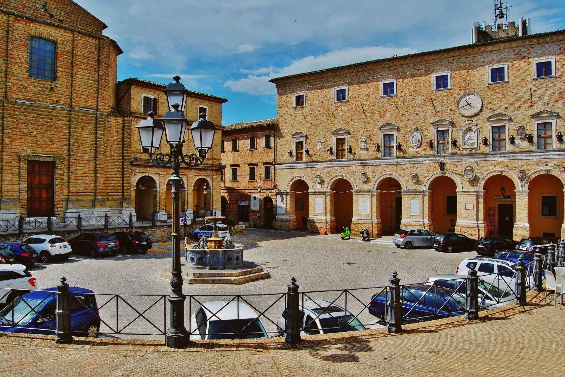
The Piazza della Repubblica, on the highest point of the ridge, is closed at one end by the Cattedrale della Santissima Annunziata and at the other by Giuseppe Valadier's small Accademia Georgica, the eighteenth-century home of an agronomic academy founded in the fifteenth as the Accademia dei Sollevati. The Disfida del Bracciale, an Ottocento street-game in which four contrade compete, has filled the centro storico every first Sunday of August since 1978.
What to see in Treia
- Piazza della Repubblica. Belvedere piazza on the highest point of the ridge, closed by the Cattedrale della Santissima Annunziata at one end and the Accademia Georgica at the other.
- Accademia Georgica. Eighteenth-century Giuseppe Valadier building housing an academy founded in the 1400s, with 1,196 parchments of the municipal archive and over 15,000 volumes.
- Santuario del Santissimo Crocifisso. Cesare Bazzani sanctuary completed in the early twentieth century on the site of an older parish church, holding a sixteenth-century Umbrian fresco and a thirteenth-century crucifix.
How to get to Treia
Ancona is roughly 58 minutes away by road.
Our tip
April through June and September into October are the best months for Treia. The hills between the Potenza and Chienti turn green in spring, the wheat ripens through June, and the autumn light on the long ridge runs gold through October. July and August touch the low thirties; the high point of the centro storico catches a breeze most afternoons, and the Disfida del Bracciale on the first Sunday of August is the busiest weekend of the year. Disfida del Bracciale falls in July.
Cingoli
Why visit Cingoli
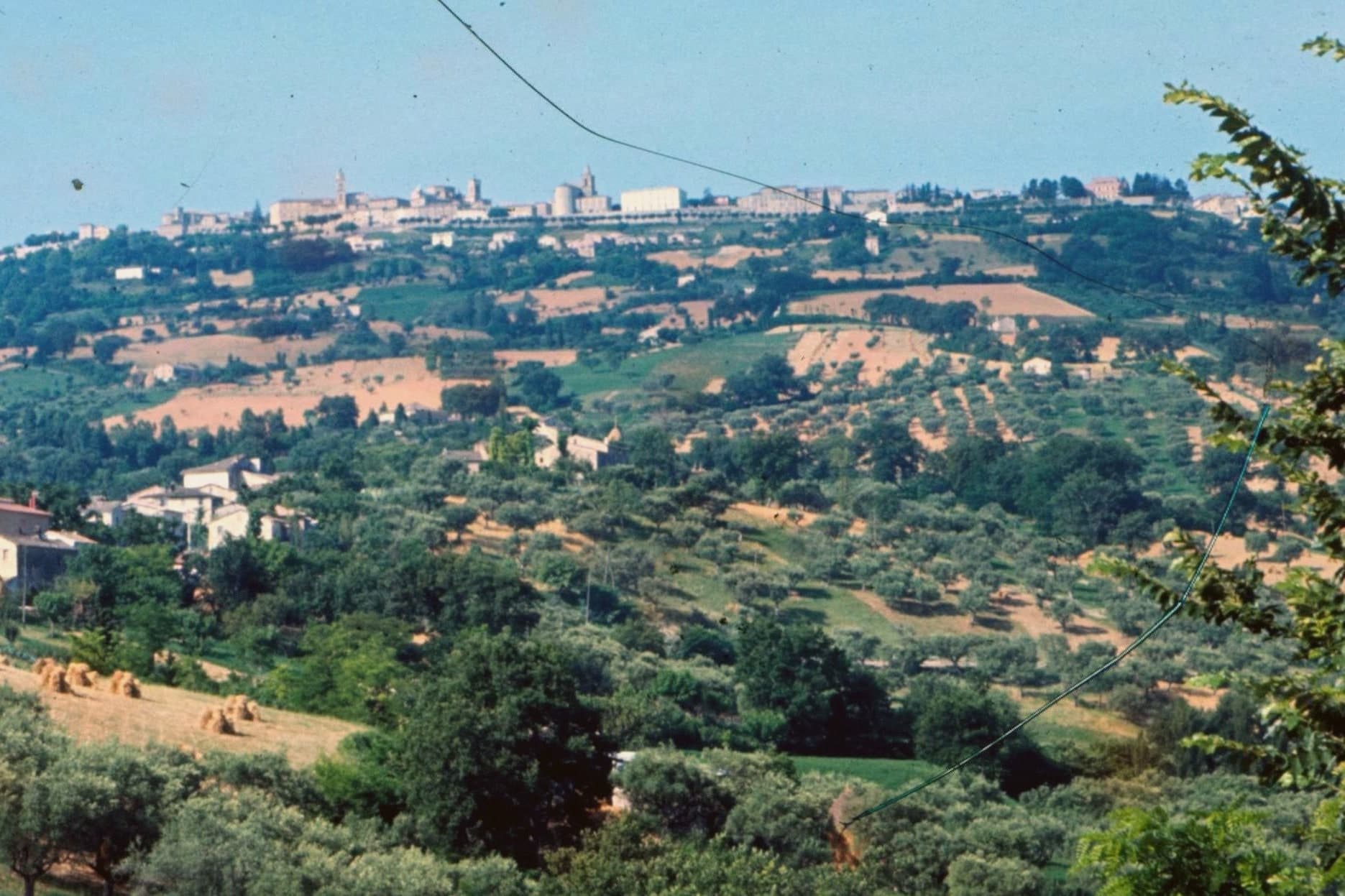
Cingoli sits at 631 meters on a hill above the Macerata province, thirty-five kilometers from Ancona and twenty-seven from Macerata. The town is known as the Balcone delle Marche for the belvedere that on a clear day takes in the Sibillini, the entire region, and the Croatian coast across the Adriatic.
The site is older than its medieval walls: ancient Cingulum was founded and fortified in 63 BC by Titus Labienus, Julius Caesar's lieutenant, at his own expense, on the bones of an earlier Picene settlement. The town held municipium status under Rome and became important again during the civil wars.
Cingoli is the birthplace of Pope Pius VIII, Francesco Saverio Castiglione, born here in 1761. Lorenzo Lotto painted the Madonna del Rosario altarpiece for the Dominican church here between 1537 and 1539, the work that still anchors the town's art holdings.
What to see in Cingoli
- Belvedere di Cingoli. The viewpoint that gives the town its Balcone delle Marche nickname, with views over the Macerata hills, the Sibillini and on clear days the Croatian coast.
- Madonna del Rosario di Lorenzo Lotto. Altarpiece painted by Lorenzo Lotto between 1537 and 1539 for the Dominican church of San Domenico, the town's defining work of art.
- Cattedrale di Santa Maria Assunta. Eighteenth-century cathedral rebuilt for Pope Pius VIII, the local-born pope whose pontificate ran 1829 to 1830.
How to get to Cingoli
Ancona is roughly 52 minutes away by road.
Our tip
April through June and September into October are the months for Cingoli. The hilltop catches the Adriatic breeze, the clear days for the belvedere fall most often in spring and early autumn, and the olive harvest below town runs through October. July and August are warm at 631 meters but cooler than the coastal towns, and Lago di Castreccioni below the village fills with weekend visitors from Ancona and Macerata. Festa del Paese falls in August.
More from Anywhere Italy
 The prettiest villages with a food festival in Marche
 The 8 prettiest villages that eat well in Marche
- The best towns that eat well in the province of Macerata
 The 7 best towns with a medieval festival in Marche
 The 10 best hill towns that eat well within 90 minutes of Ancona
 The best towns inside a national park in Marche