
The prettiest villages you can reach by train in Toscana
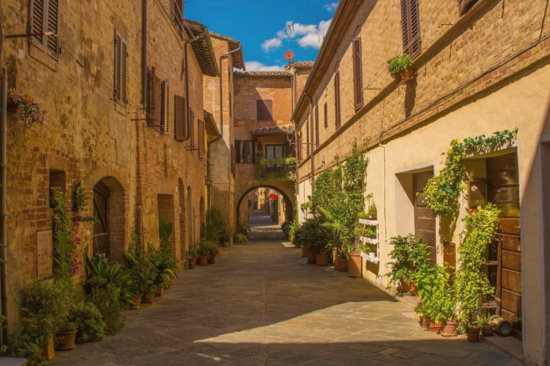
Tuscany is a region best read slowly, and the train reads it well. Regional lines run past vineyards and ploughed clay, through chestnut woods in the Garfagnana where the houses are grey stone and the roofs are old terracotta, then out to the Maremma where the light goes flat and salty and the pines start. Villages here are built of what was nearest: sandstone, brick, tufo. Autumn is the season that rewards this most, when the new oil arrives, the wild boar goes into the ragù and the hill towns smell of woodsmoke by late afternoon.
Most visitors arriving by rail get off at Santa Maria Novella and stay in Florence, which is reasonable and also why the Duomo queue wraps the piazza from morning onwards. Siena and San Gimignano absorb the overflow by coach. The result is a version of Tuscany experienced almost entirely between the same handful of streets, with the countryside seen through a window on the way in.
The same hills and the same coast carry on past those stops, and the line carries on with them. The villages here have all passed the national assessment of Italy's most beautiful borghi, and each can be reached without a car, which means a station, a walk and a place to eat at the end of it. Fewer people make the trip. That is most of the point.
Of the 84 communes we have mapped in Toscana, 8 qualify as prettiest villages you can reach by train: each has passed the national assessment of Italy's most beautiful villages, and we have confirmed each is reachable without a car. The smallest, Buonconvento, has 2,979 residents.
Two more lists worth reading alongside this one: The best hidden coastal towns you can reach by train in Toscana and The best small towns you can reach by train in Toscana.
Buonconvento
Why visit Buonconvento
Buonconvento sits on the plain of the Via Cassia at 147 meters, where the Arbia meets the Ombrone, twenty-five kilometers south of Siena and the main town of the Crete Senesi. The name comes from bonus conventus, happy meeting place, recorded for the first time in 1100.
In August 1313 Emperor Henry VII of Luxembourg died here on his way to Rome, a death the Ghibellines blamed on poisoning. The Sienese walled the borgo in 1379: brick curtain walls with hanging arches, two gates called Porta Senese and Porta Romana.
Porta Romana was destroyed in 1944 by the retreating Germans, the same year the Allies came up the Via Cassia. The Palazzo Pretorio, fourteenth century, has twenty-five podestà coats of arms on its façade and a tower that echoes Siena's Torre del Mangia.
The Museo d'Arte Sacra della Val d'Arbia holds a Madonna by Duccio di Buoninsegna from the 1290s.
We confirmed you can reach this one by train.
What to see in Buonconvento
- Palazzo Pretorio. Fourteenth-century brick palace with twenty-five podestà coats of arms on its façade and a slender tower modeled on Siena's Torre del Mangia.
- Mura di Buonconvento. Brick curtain walls with hanging arches built by Siena in 1379, with Porta Senese to the north (Porta Romana lost in 1944).
- Museo d'Arte Sacra della Val d'Arbia. Sacred art collection in Palazzo Ricci Socini covering the Sienese school from the 13th to 19th centuries, including a Duccio Madonna.
How to get to Buonconvento
There is a railway station in the town, so you can arrive without a car and never need one while you are here. Perugia is roughly 99 minutes away by road.
Our tip
April through June paints the Crete green and the spring wheat is at full height by May. September and October are the Crete at their most photographed: bare hills back in clay color, low sun, long shadows. July and August touch the high thirties in the plain; the walls hold heat into the night.
Lucignano
Why visit Lucignano
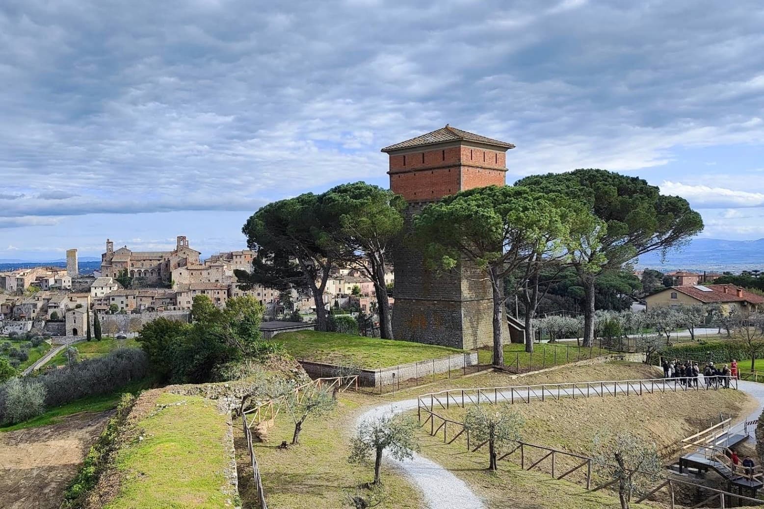
Lucignano sits at 400 meters on a hill in the Valdichiana, halfway between Siena and Arezzo, built on a tight elliptical plan of four concentric rings of streets. Its position made it one of the most contested settlements of medieval Toscana: Siena, Arezzo, Florence and Perugia all fought over it between 1200 and 1500.
The current walls and three gates date to a Sienese reconstruction of 1371. In the Museo Civico inside the Palazzo Comunale stands the Albero d'Oro, a 260-centimeter Gothic gold-and-coral reliquary in the shape of a tree, begun by Ugolino di Vieri in 1350 and finished by Gabriello d'Antonio in 1471.
Local tradition turned it into the Albero dell'Amore, a marriage charm. The Collegiata di San Michele Arcangelo dominates the highest ring of the borgo, and the elliptical plan is best read from the air, which is why drone footage of Lucignano keeps appearing in articles about medieval Tuscan urbanism.
We confirmed you can reach this one by train.
What to see in Lucignano
- Albero d'Oro. 260-cm Gothic reliquary in the shape of a tree, gold, coral and enamel, begun by Ugolino di Vieri in 1350 and completed by Gabriello d'Antonio in 1471.
- Centro storico ellittico. Four concentric rings of streets inside elliptical walls, the most complete example of medieval Tuscan elliptical town planning.
- Collegiata di San Michele Arcangelo. Eighteenth-century church on the highest ring of the borgo, with a Vasari façade adjustment and a baroque organ inside the medieval shell.
How to get to Lucignano
There is a railway station in the town, so you can arrive without a car and never need one while you are here. Perugia is roughly 65 minutes away by road.
Our tip
April through June and September into October are the months Lucignano keeps its balance, the Valdichiana green or gold depending on the half and the centro storico cool inside its elliptical walls. The Maggiolata, a flower festival between the four quarters of the borgo, runs across the last two Sundays of May. July and August push the valley past thirty and the centro storico thins after lunch. Sagra della Filiera del Tartufo Marzuolo falls in March.
Poppi
Why visit Poppi
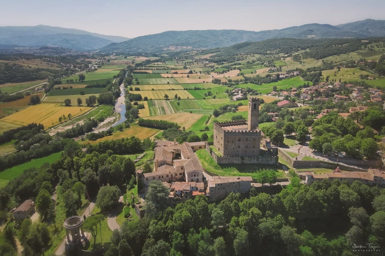
Poppi rises above the upper Arno in the Casentino, the wooded valley set between Pratovecchio and Bibbiena. The Counts Guidi held this hill from at least 1169, and the castle they raised across the late twelfth and thirteenth centuries is attributed in its older part to Lapo di Cambio and in the later upper section to Arnolfo di Cambio.
Dante Alighieri, who fought below the hill as a young man, returned to it later as a guest of the Guidi during his exile, so the borgo held him twice, once as a soldier and once as a household guest. The town itself sits above the battle plain, the abbey church inside the walls, the castle over both.
A further Romanesque pieve stands a short distance off, and the forested ridges of the Apennine watershed rise to the east, the same terrain the Guidi once ruled from their hill. What the place adds up to is a single family's hold on a valley, visible still in the line from castle to plain to church, with the forest marking where their lordship ran out.
We confirmed you can reach this one by train.
What to see in Poppi
- Castello dei Conti Guidi. The castle keeps a working library and a fourteenth-century chapel frescoed by the school of Giotto, along with a hand-painted model of the battle below, more than four thousand tin soldiers set out on the table.
- Piano di Campaldino. The plain sits directly beneath the castle walls, open ground still readable as a battlefield, with nothing built across it since.
- Abbazia di San Fedele. Romanesque abbey church inside the borgo, with single nave and stone façade, dating from the early twelfth century.
How to get to Poppi
There is a railway station in the town, so you can arrive without a car and never need one while you are here. Firenze is roughly 64 minutes away by road.
Our tip
April through June brings the Casentino into clear sun, the beech forests in their first leaf and the upper Arno full from spring rain. July and August are pleasant at 437 meters, never coastal-hot, with the castle and library full of weekend visitors from Florence. September and October are the harvest and chestnut months: the Foreste Casentinesi turn orange in the high cuts above Pratovecchio. Il Casentino nel piatto falls in June.
Capalbio
Why visit Capalbio
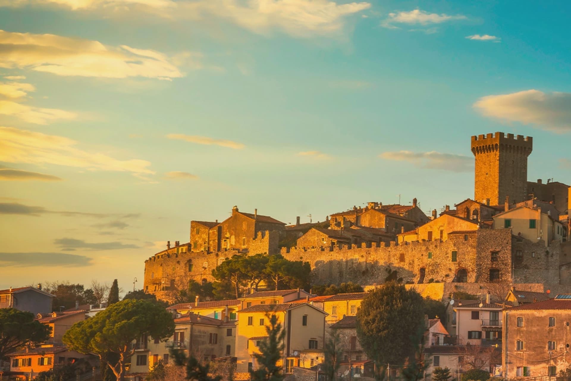
Capalbio stands twelve kilometers from the Tyrrhenian coast, the last hill town before the border with Lazio. Charlemagne gave the land to the Abbey of Tre Fontane in 805; the Aldobrandeschi held it through the medieval period, the Orsini built the castle, and Cosimo I de' Medici took it in 1555.
It became an independent commune in 1960. The medieval walls and the fortress define the centro storico at the top of the hill; the surrounding territory drops from the wooded uplands of Monte Calmata down to the coastal reserve at Lago di Burano.
The sculpture park sits four kilometers south of the walls, apart from the old town rather than within it. A borgo that governed itself late, held by abbey, feudal lords and Medici in turn before its own commune, and a territory that runs in one line from hilltop stone to coastal wetland.
We confirmed you can reach this one by train.
What to see in Capalbio
- Rocca Aldobrandesca. Medieval fortress at the top of the borgo, later expanded by the Orsini, with a square tower and battlements that overlook the Maremma.
- Mura medievali. Two concentric circles of walls enclosing the centro storico, with a walkable parapet that opens onto views toward the Argentario.
- Giardino dei Tarocchi. Sculpture park four kilometers south of the borgo, its ceramic and mirrored figures set among holm oaks.
How to get to Capalbio
There is a railway station in the town, so you can arrive without a car and never need one while you are here. Roma is roughly 108 minutes away by road.
✷ We have written about Capalbio
“Everyone driving from Florence down to Rome crosses the Maremma without noticing, because there is nothing on that stretch to make them slow down. The hills give out. The cypresses stop. What opens up instead is flat open country, wheat and grass running off to a few low rises, the least Tuscan-looking part of Tuscany, a landscape you would call dull if you were being honest and which most guidebooks solve by leaving out.”
Read our piece on Capalbio →Maremma | The Last Cowboys of Tuscany
Our tip
May through September is the season the borgo and its territory work together: the centro storico stays cool at 217 meters while the Tyrrhenian coast at Chiarone-Capalbio fills with swimmers. The Giardino dei Tarocchi runs April through October. July and August are hot inland; afternoon hours in the borgo thin out and the coast takes over. Sagra del Cinghiale falls in September.
Barga
Why visit Barga
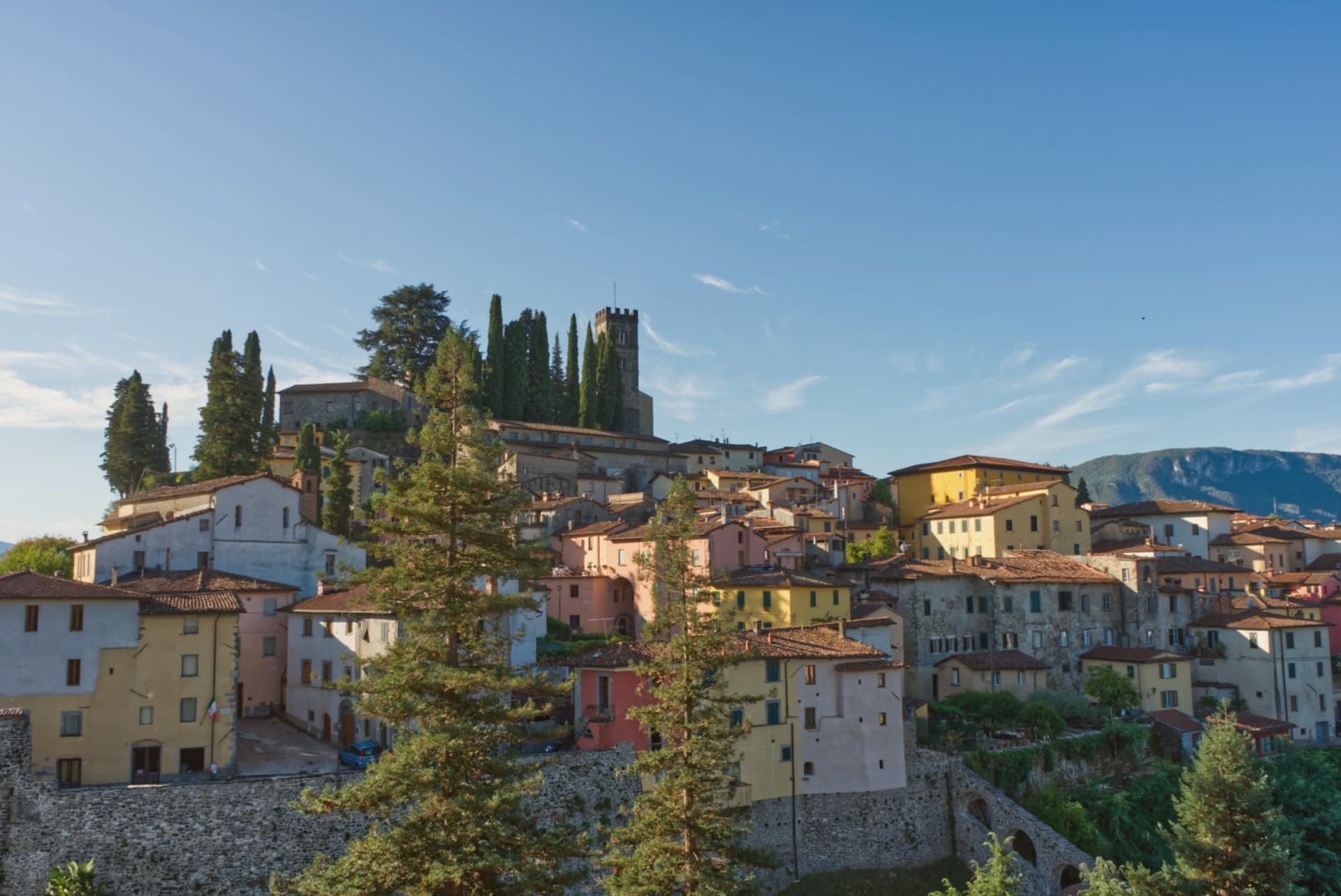
The town sits on the Colle Remeggio above the Serchio river, the Apennine ridge rising to the east as a counterpart to the Apuan Alps on the western side of the valley. The walled centro storico climbs the hill from Porta Reale, its stone houses narrowing as the streets rise toward the highest terrace, where the collegiate church stands.
The Colle di Caprona, a separate rise from the walled town itself, holds the house where Pascoli lived out his last years and the chapel where he is buried. The town also carries a Scottish thread: a wave of late nineteenth-century emigration sent generations of Barga families into the chip shop trade in Glasgow, and their descendants' festival now fills the streets every August with fish and chips rather than any dish more expected of the Tuscan hills.
A hill town built in stone around a Romanesque church, with a poet's house on one rise and a Glasgow-born sagra filling its streets each summer, holds more than its size would suggest.
We confirmed you can reach this one by train.
What to see in Barga
- Duomo di San Cristoforo. The church climbs from the eleventh century into the sixteenth, four red marble columns of the pulpit resting on stone lions. It occupies the highest terrace of the town, above the streets that lead up to it.
- Casa Museo Giovanni Pascoli. The house is preserved with its original furnishings and library, the chapel next door holding the poet's tomb.
- Centro storico. Walled medieval town climbing the hill, narrow streets of stone houses leading from Porta Reale up to the church on the highest terrace.
How to get to Barga
There is a railway station in the town, so you can arrive without a car and never need one while you are here. Pisa is roughly 74 minutes away by road.
✷ We have written about Barga
“We were trying to get to Garfagnana. It was July, the coast was unlivable, we pointed the car at the Serchio Valley with a vague idea of chestnut forests and cool air, and somewhere on the road up we took a turn we should not have taken and ended up at the gate of a town I had never heard of. Barga was today's accident.”
Read our piece on Barga →Barga | The Scottish Accent
Our tip
April through June and September into October are the working months in the middle Serchio valley: green pasture, mild days at 410 meters, walking weather to the Apuan ridges. The Opera Barga festival fills the Teatro dei Differenti in July with chamber concerts. The Sagra del Pesce e Patate runs for two weeks in August and brings Glasgow-Barga families home.
Monte Argentario
Why visit Monte Argentario
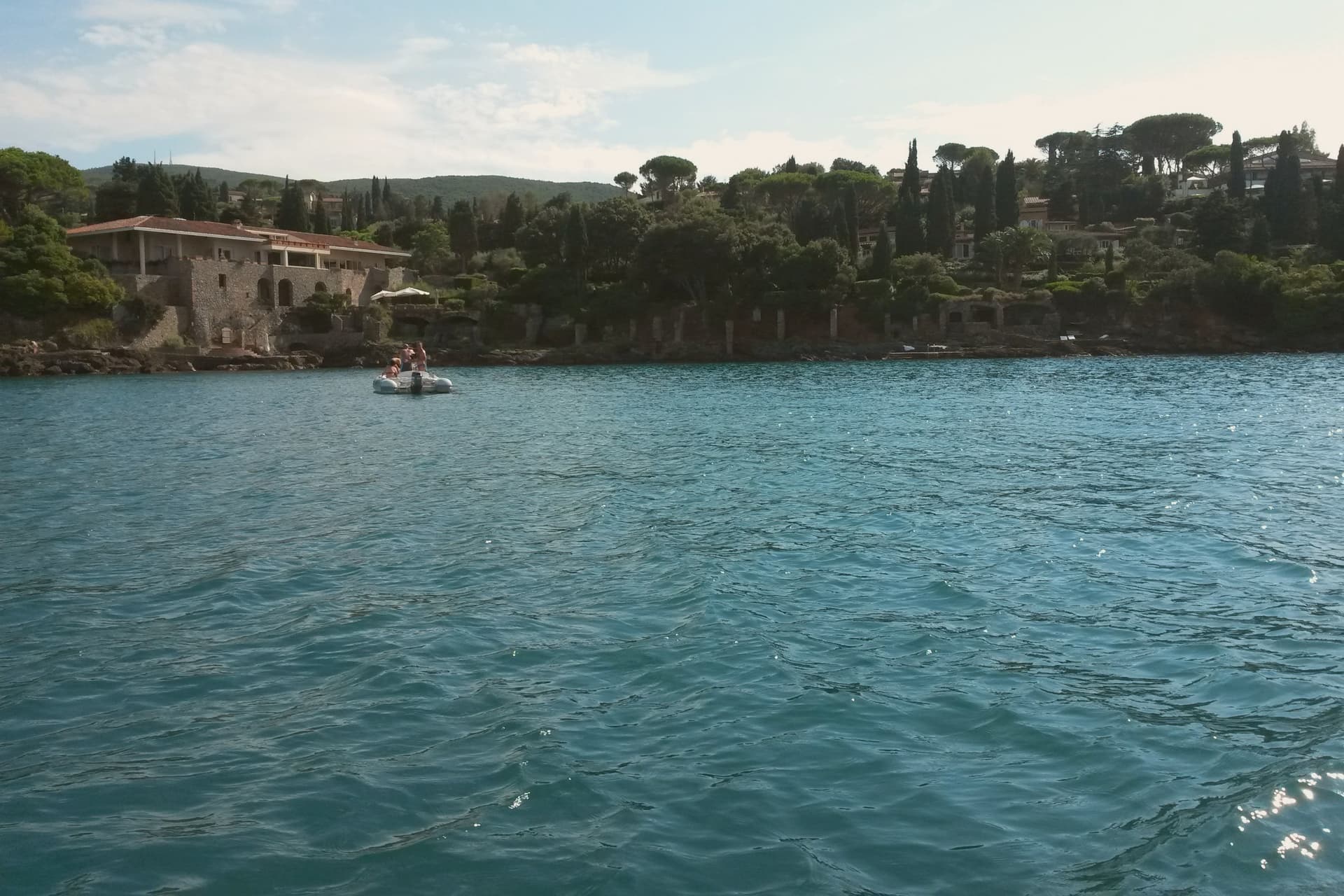
Monte Argentario is a peninsula on the southern Tuscan coast, 35 kilometers south of Grosseto, connected to the mainland by three sand spits that enclose the lagoons of Orbetello. The mountain at its center rises to 635 meters, and the two seats of the comune sit at sea level on opposite sides of it, the northern harbor facing toward Grosseto, the southern one turned toward the open coast below.
The history of the peninsula splits from the rest of Tuscany after 1557, when the territory was carved out of Sienese land and handed to the Spanish crown, which spent the next century and a half fortifying the coastline against corsair raids rather than building the kind of inland towns found elsewhere in the region. The result is a place organized around its edges rather than a center: two ports facing different waters, a mountain of forts between them, and a coastal road that ties the whole shape together for anyone crossing from one harbor to the other.
What the peninsula adds up to is a piece of Tuscany that spent its formative centuries as a Spanish military frontier, and still wears that history in its two-harbor shape and the ring of stone above them.
We confirmed you can reach this one by train.
What to see in Monte Argentario
- Forte Stella. Six-pointed star fort above Porto Ercole, designed for the Spanish by Buontalenti and Camerini and completed in the mid-1600s as part of the Presidi defense system.
- Forte Filippo. Spanish bastioned fortress above Porto Ercole, named for Philip II and built in the late 16th century to protect the Stato dei Presidi from corsair raids.
- Rocca Aldobrandesca, Porto Ercole. Earlier Aldobrandeschi fortress incorporated into the Spanish defense system, dominating the harbor and the old town of Porto Ercole.
How to get to Monte Argentario
There is a railway station in the town, so you can arrive without a car and never need one while you are here. Roma is roughly 137 minutes away by road.
Our tip
May through September is the season on the peninsula. Porto Santo Stefano and Porto Ercole fill in July and August; the Palio Marinaro on August 15 doubles the population of Porto Santo Stefano for a single afternoon. June and September are the easiest months, with warm water and fewer day-trippers. Palio Marinaro dell'Argentario falls in August.
Campiglia Marittima
Why visit Campiglia Marittima
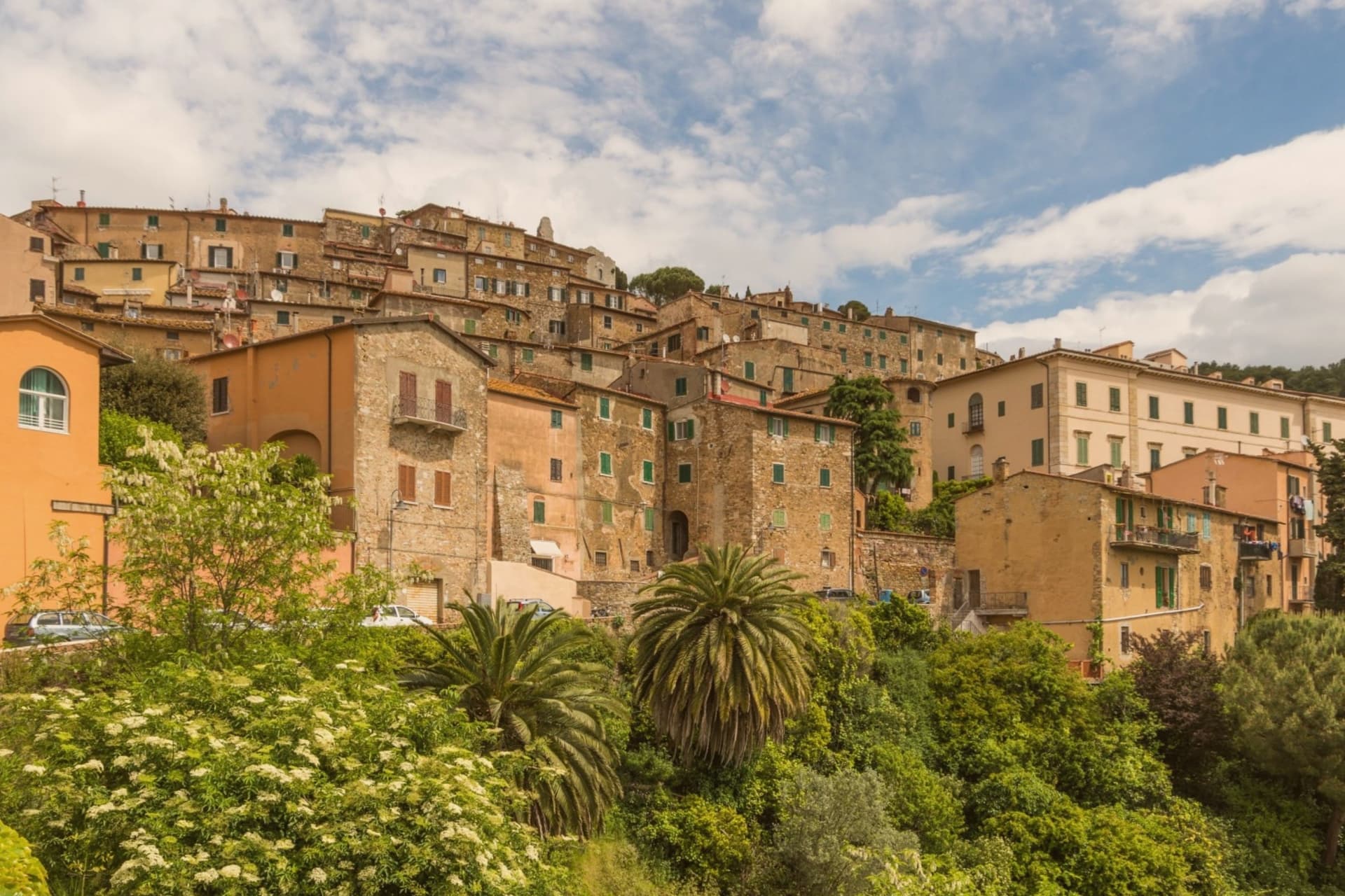
Campiglia Marittima sits at 231 meters on the last slopes of the Colline Metallifere above the Val di Cornia, eight kilometers inland from the Tyrrhenian coast and 60 kilometers southeast of Livorno. The Rocca occupies the highest point at 281 meters, a fortified semicircle whose 14th-century tower and town walls trace the medieval defensive line.
The territory has been mined since the Etruscans: copper, silver, lead and tin from the hills behind town, worked continuously until the last galleries closed in 1976. The Parco Archeominerario di San Silvestro, opened in 1996 on 450 hectares behind the town, centers on Rocca San Silvestro, a tenth and eleventh-century miners' village abandoned in the fourteenth century and excavated since 1984.
Visitors enter through restored galleries on a small electric train. Down on the plain the DOC Val di Cornia produces Sangiovese and Cabernet, and the thermal springs at Venturina, the frazione south of town, have flowed since Roman use as Aquae Populoniae.
We confirmed you can reach this one by train.
What to see in Campiglia Marittima
- Rocca di Campiglia. Fortified semicircle at 281 meters with the 14th-century tower, walls and the Pieve di San Giovanni, the highest point of the town.
- Parco Archeominerario di San Silvestro. 450-hectare park behind town, opened 1996, with restored mining galleries, a small electric train, and the abandoned medieval miners' village of Rocca San Silvestro.
- Centro storico. Walled hilltop borgo of stone houses, with Piazza della Repubblica at its center, the medieval gates Porta a Mare and Porta Fiorentina still intact.
How to get to Campiglia Marittima
There is a railway station in the town, so you can arrive without a car and never need one while you are here. Livorno is roughly 67 minutes away by road.
✷ We have written about Campiglia Marittima
“That is the thing the young man on the beach did not see, and the man who lives here cannot stop seeing. This is an industrial coast wearing a beach towel. Run it back far enough and the whole of it, the swamp and the steel and the slag and the white water, is one long story about iron, and the holiday is the costume the story put on after the work ran out.”
Read our piece on Campiglia Marittima →The Iron Coast | The Wrong Sea
Our tip
May through September is the season on the Val di Cornia: warm days, sea breezes that climb the hill, harvest of Sangiovese and Vermentino from late August. The beaches at San Vincenzo and Baratti are eight to fifteen kilometers away and pull the day-traffic. July and August are hot and busy on the coast; the borgo on the hill stays a few degrees cooler.
Piombino
Why visit Piombino
Piombino sits on a triangular promontory pointing southeast into the Tyrrhenian, at the northern edge of the Maremma. The town was founded in the ninth century by refugees from the Etruscan port after Greek pirates attacked the city; they called the new settlement Populino, small Populonia, and the name shortened over time to what it is now.
The old city, now a frazione north on the coast, became the source of the newer town's name rather than the other way round. In the medieval period Piombino became an independent signoria under the Appiani, who ruled from here over a small state that reached out to the islands across the water.
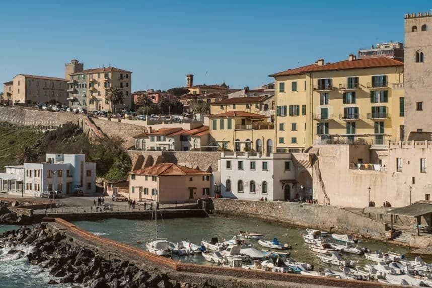
The castle at the seafront, the piazza cantilevered out over the cliff toward Elba, and the working ferry port make up the contemporary town, each looking the same direction the refugees once looked back from: toward the older settlement to the north and the channel to the islands beyond it. The Bandiera Blu coast covers the four kilometers between the port and the old acropolis, so that the walk from new town to old runs along the same shoreline that separates them by name only.
We confirmed you can reach this one by train.
What to see in Piombino
- Castello di Piombino. Principal defensive fortress of the city on a headland pointing southeast into the sea, with the Torrione, the Rivellino and the Cittadella complex, now a museum.
- Piazza Bovio. Long rocky breakwater extending into the sea as La Rocchetta, terraced as a piazza, with a balcony view across the channel to Elba.
- Parco Archeologico di Baratti e Populonia. Chamber tombs from the seventh to second centuries BC cut into the ground of the Gulf of Baratti, laid out for walking among the excavated structures rather than viewed from a distance.
How to get to Piombino
There is a railway station in the town, so you can arrive without a car and never need one while you are here. Livorno is roughly 77 minutes away by road.
Our tip
May, June, September and October are the months when the Piombino promontory is at its best, sea warm enough to swim and the ferry to Elba running every hour without the August crush. July and August are full season, with the centro storico filling by late morning and the Baratti beach turning over twice a day. November through March is cold and windy on the promontory, with limited ferry crossings and many seaside trattorie closed. Sagra del Pesce - Piombino falls in July.
More from Anywhere Italy
 The best hidden coastal towns you can reach by train in Toscana
 The best small towns you can reach by train in Toscana
 The 10 prettiest villages with a food festival in Toscana
 The prettiest hidden villages with a serious restaurant in Toscana
 The best towns inside a nature park that you can reach by train in Toscana
 The 6 best coastal towns inside a nature park in Toscana