
The best small towns you can reach by train in Toscana
Tuscany rewards slowness, and rail is the slow way in. The regional lines run through umbrella pines and salt flats along the Maremma coast, then inland past wheat stubble, cypress rows and clay hills that go pale gold by late June. The towns at the end of these lines are built of the local stone and brick, with travertine door frames, brick campanili and stone-vaulted cellars still used for wine. Autumn is the season the food makes most sense: new oil on grilled bread, wild boar cooked slowly, chestnut flour, porcini, the first bottles of Chianti and Vino Nobile poured young in a bar with no menu.
Most visitors arrive by train and stop at Florence, then move between Florence, Siena and Pisa on a schedule set by the queues. Florence in particular absorbs an enormous share of the region's arrivals, and the effect is visible in the streets around the Duomo and the Uffizi from spring through October, where the pavement traffic barely thins after dark. The trains and buses that serve it are full for the same reason. It is a great city, and it is also the busiest square kilometre in Tuscany.
The same railways carry on past it. The coastal line continues south through the Maremma to stations in olive country and lagoon country, and the inland routes and their connecting buses reach hill towns in the Crete Senesi, the Valdichiana and the wine hills east of Lucca. The towns here are small, and fewer people go. We have checked each one for whether it can actually be reached and left without a car, which is a different question from whether it looks good on a map.
Of the 84 communes we have mapped in Toscana, 46 qualify as towns you can reach by train: we have confirmed each is reachable without a car. This list is the small ones, 7 in all, ordered smallest first. The smallest, Trequanda, has 1,166 residents.
Elsewhere in the catalogue: The prettiest villages you can reach by train in Toscana and The 10 best small hill towns in the province of Siena.
Trequanda
Why visit Trequanda
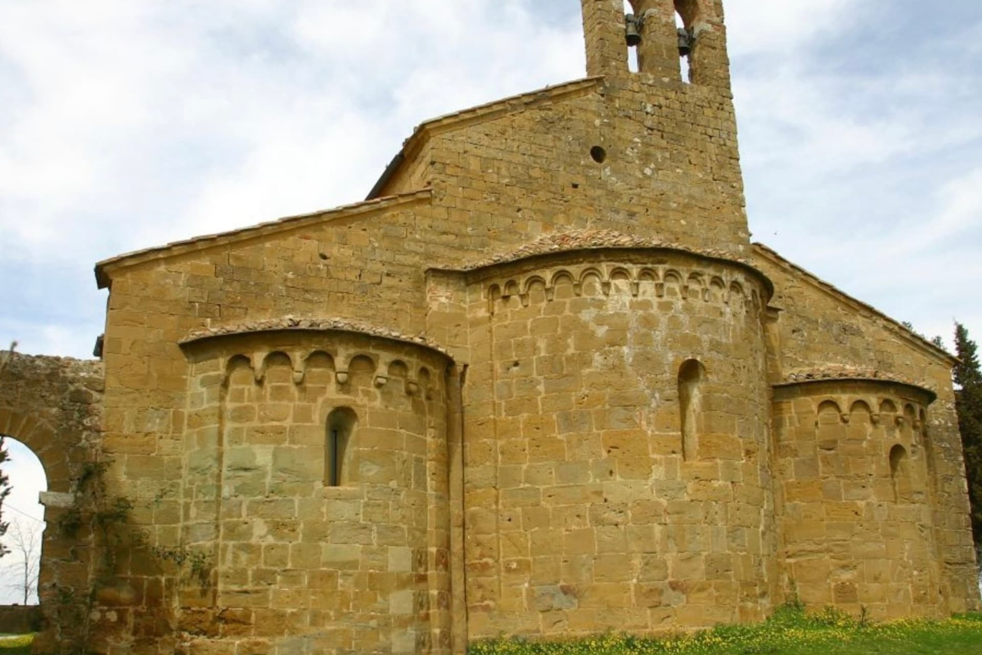
Trequanda is three villages in one comune: Trequanda itself at 453 meters, Castelmuzio, and Petroio at 486 meters, scattered across the hills southeast of Siena. The first written record dates to 1198, when the Cacciaconti of Scialenga held it as fief; in 1211 Emperor Otto IV gave them the right to collect tolls.
In 1553 the village was among the first to be annexed to the Grand Duchy of Tuscany. The Cacciaconti castle still anchors the centro storico, the Pieve dei Santi Pietro e Andrea next to it, built from 1327 in a Gothic-Romanesque mix and renovated in the Renaissance.
Petroio has produced fine ornamental terracotta since the early sixteenth century: lions and dogs and pineapples and chimney pots, the surface of half the gardens in central Tuscany. The municipality holds the Orange Flag from the Italian Touring Club and was inscribed in 2018 in the national register of historic rural landscapes.
We confirmed you can reach this one by train.
What to see in Trequanda
- Castello dei Cacciaconti. Medieval fortress at the center of Trequanda, seat of the Cacciaconti di Scialenga from the twelfth century.
- Pieve dei Santi Pietro e Andrea. Gothic-Romanesque parish church begun in 1327, expanded in the Renaissance, holding a fresco attributed to Sodoma.
- Castelmuzio. Walled hilltop frazione between Trequanda and Pienza, on the rural landscape register, the smallest of the three borghi.
How to get to Trequanda
There is a railway station in the town, so you can arrive without a car and never need one while you are here. Perugia is roughly 70 minutes away by road.
Our tip
April through June brings the green months across the Crete Senesi, the clay hills holding their color before the summer burn. September and October are dry and gold, the olive harvest running through November in the Petroio and Castelmuzio frantoi. July and August touch thirty-six degrees and the three borghi go quiet between four and seven in the afternoon.
Murlo
Why visit Murlo
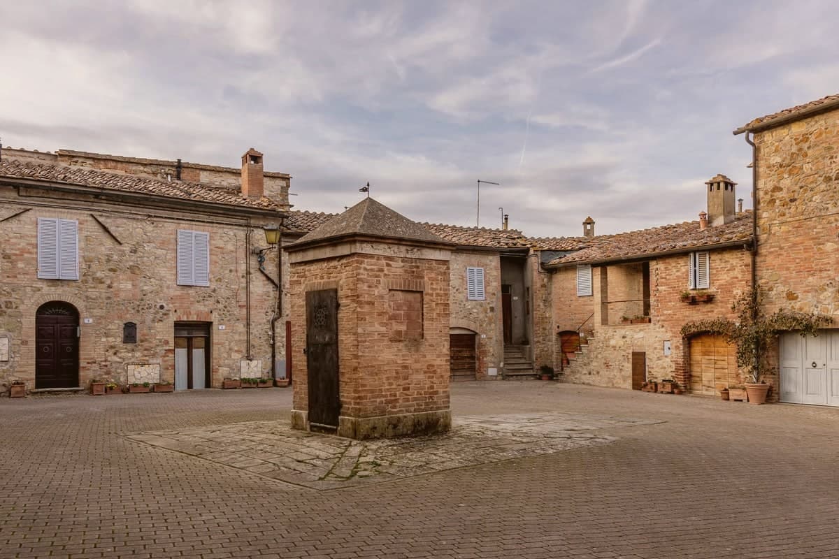
Murlo sits at 314 meters on a wooded ridge above the Crevole river, twenty kilometers south of Siena. The comune is scattered.
The town hall is in Vescovado, the modern center down on the valley road; the medieval castle of Murlo, walled and tower-anchored, is a kilometer up on the hill, mostly empty and given over to tourism. The bishops of Siena held this ground as a feudal lordship for centuries, which kept it outside the Sienese republic and gave it the unusual status of an episcopal fief.
The defining find is older. On Poggio Civitate, three kilometers north, archaeologists from 1966 onward uncovered an Etruscan princely palace of the seventh and sixth centuries BC, one of the most important Etruscan settlement complexes ever excavated.
The terracotta acroteria from the roof line included the Cappellone, a seated bearded male wearing a wide-brimmed hat, sixth century BC, now the symbol of the Antiquarium museum housed in the old Episcopal Palace at the center of the borgo.
We confirmed you can reach this one by train.
What to see in Murlo
- Antiquarium di Poggio Civitate. Archaeological museum in the medieval Palazzo Vescovile at the center of Murlo, holding the Cappellone and other finds from the Etruscan settlement on Poggio Civitate.
- Poggio Civitate. Etruscan princely palace complex of the seventh and sixth centuries BC, three kilometers north of the borgo, one of the most important sites in Etruria.
- Castello di Murlo. Twelfth-century walled village, the medieval seat of the bishops of Siena, with narrow streets converging on the Palazzo Vescovile.
How to get to Murlo
There is a railway station in the town, so you can arrive without a car and never need one while you are here. Firenze is roughly 104 minutes away by road.
Our tip
April through June and September into October are the months when the Crete Senesi south of Murlo sit at their gold-and-green best. The Antiquarium is open year-round but limited in winter hours. July and August push past thirty-three degrees and the castle empties between two and six.
Buonconvento
Why visit Buonconvento
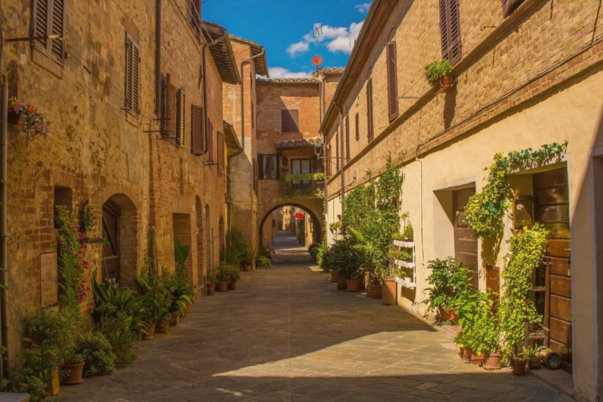
Buonconvento sits on the plain of the Via Cassia at 147 meters, where the Arbia meets the Ombrone, twenty-five kilometers south of Siena and the main town of the Crete Senesi. The name comes from bonus conventus, happy meeting place, recorded for the first time in 1100.
In August 1313 Emperor Henry VII of Luxembourg died here on his way to Rome, a death the Ghibellines blamed on poisoning. The Sienese walled the borgo in 1379: brick curtain walls with hanging arches, two gates called Porta Senese and Porta Romana.
Porta Romana was destroyed in 1944 by the retreating Germans, the same year the Allies came up the Via Cassia. The Palazzo Pretorio, fourteenth century, has twenty-five podestà coats of arms on its façade and a tower that echoes Siena's Torre del Mangia.
The Museo d'Arte Sacra della Val d'Arbia holds a Madonna by Duccio di Buoninsegna from the 1290s.
We confirmed you can reach this one by train.
What to see in Buonconvento
- Palazzo Pretorio. Fourteenth-century brick palace with twenty-five podestà coats of arms on its façade and a slender tower modeled on Siena's Torre del Mangia.
- Mura di Buonconvento. Brick curtain walls with hanging arches built by Siena in 1379, with Porta Senese to the north (Porta Romana lost in 1944).
- Museo d'Arte Sacra della Val d'Arbia. Sacred art collection in Palazzo Ricci Socini covering the Sienese school from the 13th to 19th centuries, including a Duccio Madonna.
How to get to Buonconvento
There is a railway station in the town, so you can arrive without a car and never need one while you are here. Perugia is roughly 99 minutes away by road.
Our tip
April through June paints the Crete green and the spring wheat is at full height by May. September and October are the Crete at their most photographed: bare hills back in clay color, low sun, long shadows. July and August touch the high thirties in the plain; the walls hold heat into the night.
Capalbio
Why visit Capalbio
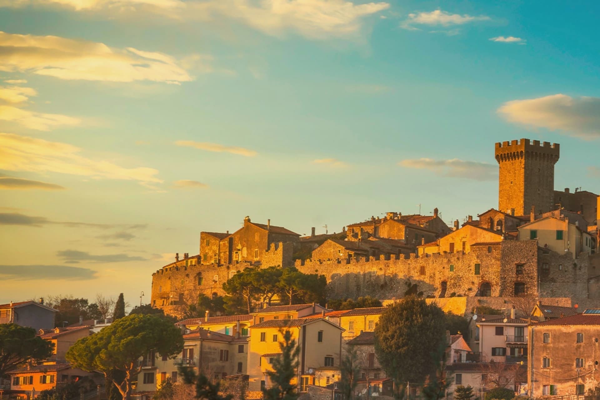
Capalbio stands twelve kilometers from the Tyrrhenian coast, the last hill town before the border with Lazio. Charlemagne gave the land to the Abbey of Tre Fontane in 805; the Aldobrandeschi held it through the medieval period, the Orsini built the castle, and Cosimo I de' Medici took it in 1555.
It became an independent commune in 1960. The medieval walls and the fortress define the centro storico at the top of the hill; the surrounding territory drops from the wooded uplands of Monte Calmata down to the coastal reserve at Lago di Burano.
The sculpture park sits four kilometers south of the walls, apart from the old town rather than within it. A borgo that governed itself late, held by abbey, feudal lords and Medici in turn before its own commune, and a territory that runs in one line from hilltop stone to coastal wetland.
We confirmed you can reach this one by train.
What to see in Capalbio
- Rocca Aldobrandesca. Medieval fortress at the top of the borgo, later expanded by the Orsini, with a square tower and battlements that overlook the Maremma.
- Mura medievali. Two concentric circles of walls enclosing the centro storico, with a walkable parapet that opens onto views toward the Argentario.
- Giardino dei Tarocchi. Sculpture park four kilometers south of the borgo, its ceramic and mirrored figures set among holm oaks.
How to get to Capalbio
There is a railway station in the town, so you can arrive without a car and never need one while you are here. Roma is roughly 108 minutes away by road.
✷ We have written about Capalbio
“Everyone driving from Florence down to Rome crosses the Maremma without noticing, because there is nothing on that stretch to make them slow down. The hills give out. The cypresses stop. What opens up instead is flat open country, wheat and grass running off to a few low rises, the least Tuscan-looking part of Tuscany, a landscape you would call dull if you were being honest and which most guidebooks solve by leaving out.”
Read our piece on Capalbio →Maremma | The Last Cowboys of Tuscany
Our tip
May through September is the season the borgo and its territory work together: the centro storico stays cool at 217 meters while the Tyrrhenian coast at Chiarone-Capalbio fills with swimmers. The Giardino dei Tarocchi runs April through October. July and August are hot inland; afternoon hours in the borgo thin out and the coast takes over. Sagra del Cinghiale falls in September.
Bibbona
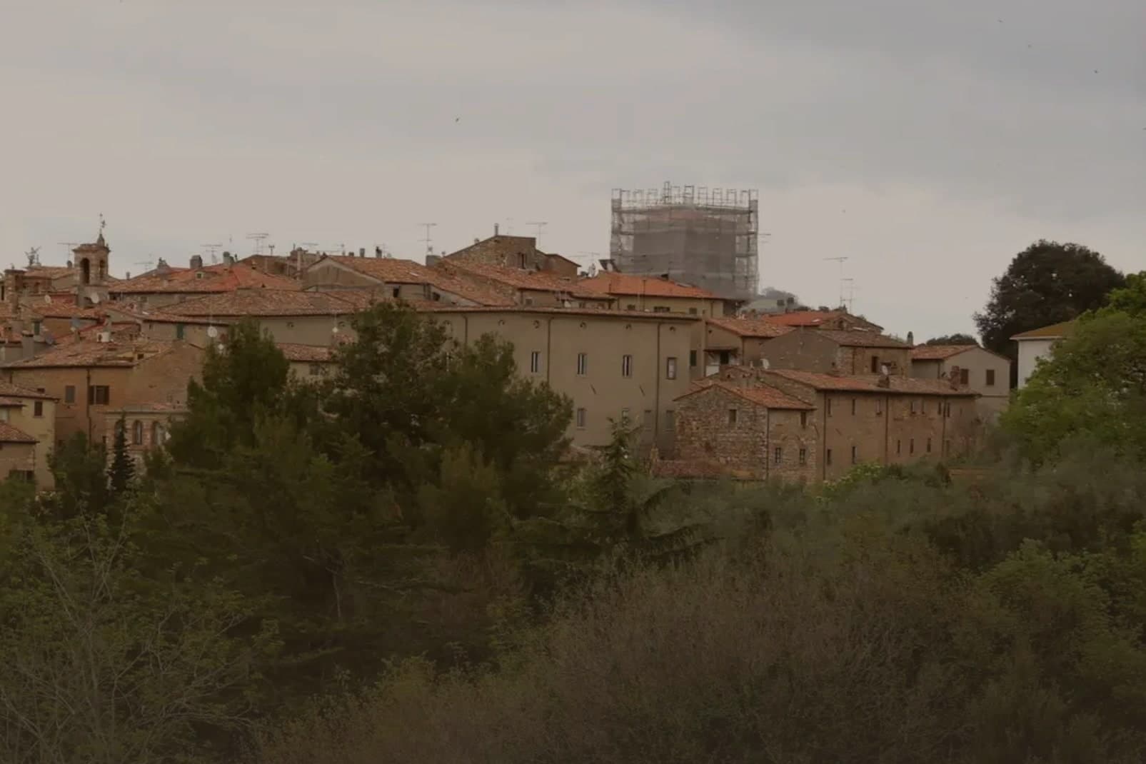
Why visit Bibbona
Bibbona sits at 85 meters in the Val di Cecina, in the southern province of Livorno, eight kilometers from the sea. The town has Etruscan origins, attested by a small bronze goat statuette, now in the Florence archaeological museum, that became the town symbol.
After medieval struggles between Pisa and Florence, the territory passed to the Gherardesca counts, who controlled most of the Etruscan Coast. Monk-knights, probably French and probably Templar, operated from the pieve in the medieval period, a detail that survives more clearly in local memory than in stone.
The village keeps its hill position while its coastal frazione does the work of meeting the sea: the fort once handled customs, sanitary inspection and defense, the beach now holds a national recognition, and the reserve in the inland hills once supplied the wood that moved through that same coastline. Upper town, shore and forest were never separate economies so much as three faces of one strip of land running from the Val di Cecina down to the sea.
We confirmed you can reach this one by train.
What to see in Bibbona
- Pieve di Sant'Ilario. The church stands on Piazza XX Settembre. The right side and facade keep their Romanesque lines, while the added left nave throws the plan out of square, a visible seam between two building campaigns three centuries apart.
- Borgo medievale. Concentric ring of stone streets and stairways around the old castle, with surviving medieval gates and the central piazza.
- Forte di Marina di Bibbona. Built for customs control, sanitary inspection and defense against corsairs, the fort held a working coastline job, not a decorative one, watching the same shore the beach now occupies.
How to get to Bibbona
There is a railway station in the town, so you can arrive without a car and never need one while you are here. Livorno is roughly 51 minutes away by road.
Our tip
May and June bring warm water and quiet beaches, before the July and August crowds reach the Costa degli Etruschi. The borgo at 85 meters stays five degrees cooler than the coast and is the place to sleep in high summer. July and August are full: Marina di Bibbona fills, the pine-shaded beach fronts get crowded, and the Forte sees long queues at sunset.
Lucignano
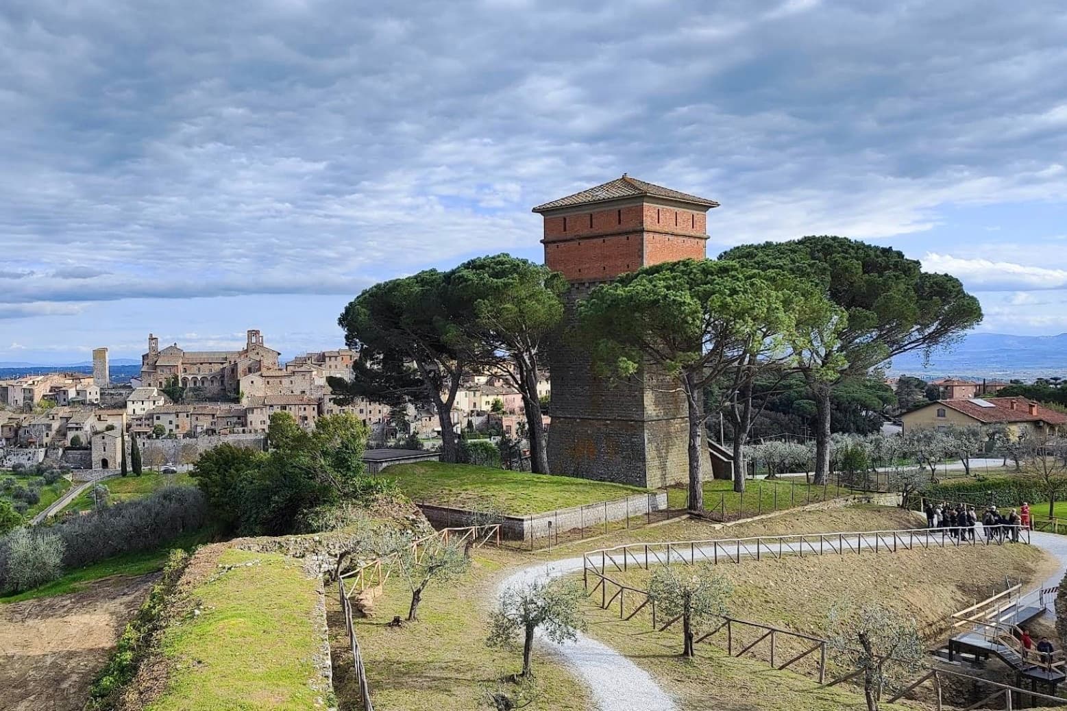
Why visit Lucignano
Lucignano sits at 400 meters on a hill in the Valdichiana, halfway between Siena and Arezzo, built on a tight elliptical plan of four concentric rings of streets. Its position made it one of the most contested settlements of medieval Toscana: Siena, Arezzo, Florence and Perugia all fought over it between 1200 and 1500.
The current walls and three gates date to a Sienese reconstruction of 1371. In the Museo Civico inside the Palazzo Comunale stands the Albero d'Oro, a 260-centimeter Gothic gold-and-coral reliquary in the shape of a tree, begun by Ugolino di Vieri in 1350 and finished by Gabriello d'Antonio in 1471.
Local tradition turned it into the Albero dell'Amore, a marriage charm. The Collegiata di San Michele Arcangelo dominates the highest ring of the borgo, and the elliptical plan is best read from the air, which is why drone footage of Lucignano keeps appearing in articles about medieval Tuscan urbanism.
We confirmed you can reach this one by train.
What to see in Lucignano
- Albero d'Oro. 260-cm Gothic reliquary in the shape of a tree, gold, coral and enamel, begun by Ugolino di Vieri in 1350 and completed by Gabriello d'Antonio in 1471.
- Centro storico ellittico. Four concentric rings of streets inside elliptical walls, the most complete example of medieval Tuscan elliptical town planning.
- Collegiata di San Michele Arcangelo. Eighteenth-century church on the highest ring of the borgo, with a Vasari façade adjustment and a baroque organ inside the medieval shell.
How to get to Lucignano
There is a railway station in the town, so you can arrive without a car and never need one while you are here. Perugia is roughly 65 minutes away by road.
Our tip
April through June and September into October are the months Lucignano keeps its balance, the Valdichiana green or gold depending on the half and the centro storico cool inside its elliptical walls. The Maggiolata, a flower festival between the four quarters of the borgo, runs across the last two Sundays of May. July and August push the valley past thirty and the centro storico thins after lunch. Sagra della Filiera del Tartufo Marzuolo falls in March.
Montecarlo
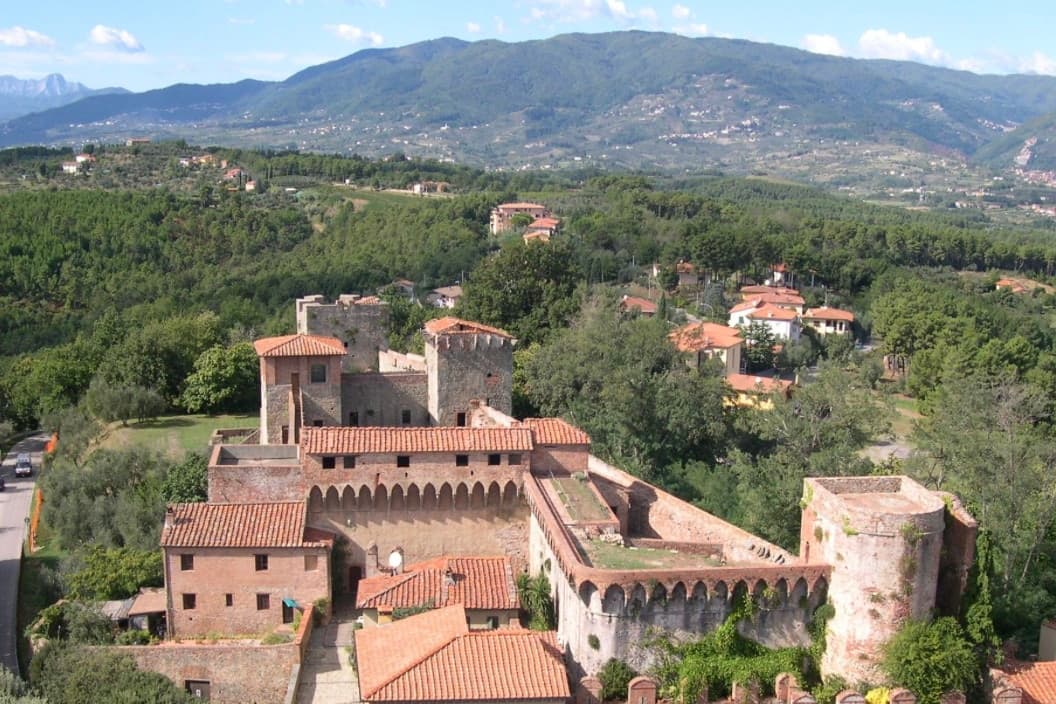
Why visit Montecarlo
Montecarlo sits at 163 meters on an isolated hill above the Lucca plain, looking south toward the Valdinievole. Holy Roman Emperor Charles IV founded it in 1333 after liberating Lucca from Pisan rule, on a site previously called Vivinaia for the wine roads that crossed the hill.
The name Monte di Carlo, Charles's mountain, has held since. The walled centro storico is still ringed by its fourteenth-century defensive walls, with the Fortezza del Cerruglio rising above the highest point.
Wine production has been documented here since Roman times; the first tavern keepers selling Trebbiano in barrels appear in records in 1371. The Montecarlo DOC was established in 1969, the white blends Trebbiano with French varieties including Sémillon and Pinot Gris, and roughly twenty wineries operate within the commune, a notable density for a population under 4,500.
We confirmed you can reach this one by train.
What to see in Montecarlo
- Fortezza del Cerruglio. Fourteenth-century fortress on the highest point of the hill, expanded by Castruccio Castracani and the Florentines in the fifteenth century.
- Centro storico. Walled medieval village founded by Charles IV in 1333, still inside its original defensive perimeter along Via Roma.
- Teatro dei Rassicurati. Small eighteenth-century theatre with 95 seats and a horseshoe plan, inaugurated in 1795 and still used for the autumn season.
How to get to Montecarlo
There is a railway station in the town, so you can arrive without a car and never need one while you are here. Prato is roughly 38 minutes away by road.
Our tip
April through June and September through October bracket the year here. April brings the vines into leaf, May the first whites of the new vintage onto cellar tables, and September the harvest. The Festa del Vino runs in early September on the streets inside the walls. Festa del Vino Montecarlo di Toscana falls in August.
More from Anywhere Italy
- The prettiest villages you can reach by train in Toscana
- The 10 best small hill towns in the province of Siena
- The best towns you can reach by train in the province of Siena
- The best hidden coastal towns you can reach by train in Toscana
 The best small coastal towns in Toscana
- The best small hill towns with a serious restaurant in Toscana