
The prettiest villages in the province of Grosseto
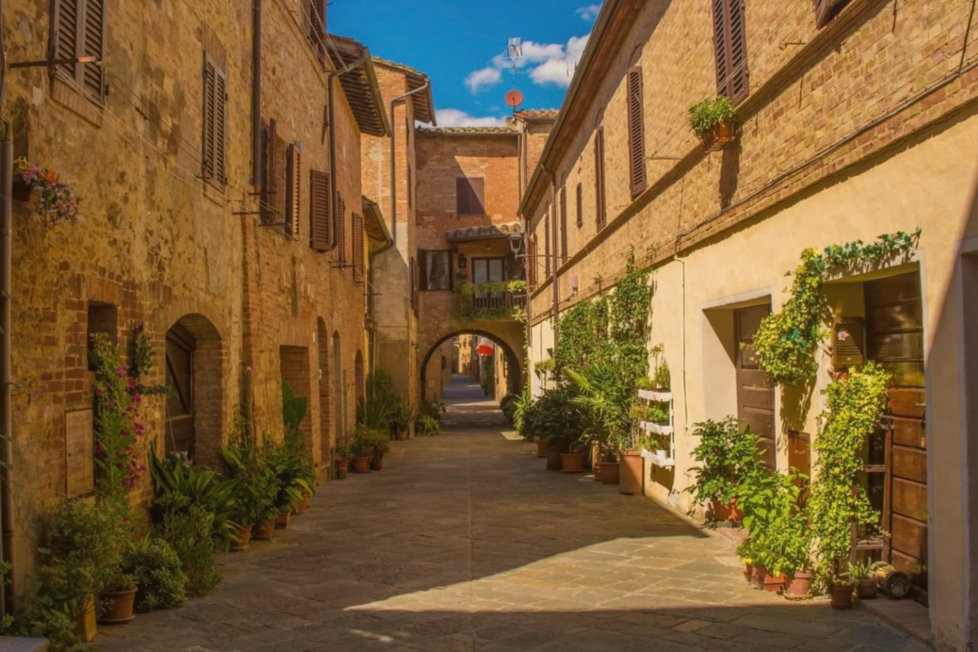
Southern Tuscany changes material as you go inland from the Grosseto coast. The tuff country cuts its houses, stairs and stables straight out of the soft yellow rock, so a whole village can look quarried rather than built, while up on Monte Amiata the walls turn to grey trachyte and chestnut woods close over the roofs. The food follows the land: wild boar stewed slowly, acquacotta made with bread and eggs, sheep's pecorino, Morellino di Scansano poured young. Autumn is the season that suits it best, when the mist sits in the gorges and the chestnut festivals start.
Most people meet this province on the coast, at the beach clubs and pine woods of the Maremma between Follonica and Castiglione della Pescaia, or on a day trip north to Siena. In August the coastal road moves at walking pace and the parking at the Parco della Maremma fills before the morning is out. Siena, for its part, absorbs the coach traffic of half of Tuscany, which leaves the inland province oddly quiet by comparison. The famous names are worth the crowds, but they are not the whole of Grosseto.
The same hills, wine and boar continue inland and offshore, past the beach umbrellas. The villages here sit on tuff spurs above the Fiora and the Lente, on the granite slopes of an island in the Tyrrhenian, and on the flank of an extinct volcano where the springs still run cold. Fewer people go, particularly outside high summer, and the tables are easier to get. Each of the places below has been assessed and admitted by the national association of Italy's most beautiful villages.
Of the 10 communes we have mapped in the province of Grosseto, 6 qualify as prettiest villages: each has passed the assessment of the national association of Italy's most beautiful villages. The smallest, Isola del Giglio, has 1,330 residents.
If you are still choosing, we have also written The best coastal towns in the province of Grosseto and The 10 prettiest villages with a food festival in Toscana.
Isola del Giglio
Why visit Isola del Giglio
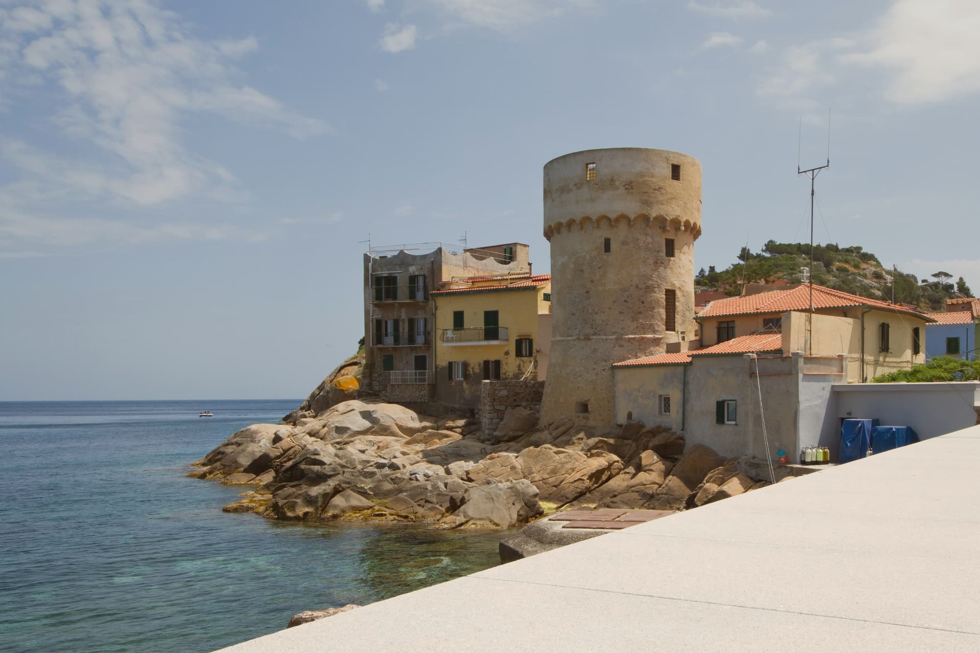
Isola del Giglio is the second-largest island in the Tuscan Archipelago, almost entirely granite, the highest point at Poggio della Pagana 496 meters above the sea. The commune has three inhabited frazioni: Giglio Porto on the eastern coast, where the ferries from Porto Santo Stefano dock; Giglio Castello on the central ridge at around 405 meters, the walled medieval village and administrative center; and Giglio Campese on the western bay, a 1960s seaside resort built on an old pyrite mine closed in 1964.
Charlemagne gave the island to the abbey of Tre Fontane in 805. It was Pisan from 1264, ceded to Antonio Piccolomini in the fifteenth century, then passed to the Medici in 1558.
Saracen raids continued until 1799. The wreck of the Costa Concordia on the night of 13 January 2012 killed thirty-two people and held the world's attention until the ship was righted, refloated and towed to Genoa in July 2014.
What to see in Isola del Giglio
- Giglio Castello. Walled medieval village on the ridge at around 405 meters, with intact mura and the Rocca Aldobrandesca, the administrative center of the island.
- Giglio Porto. Main harbor of the island on the east coast, with the colored houses around the small ferry dock and the lighthouse of Capel Rosso to the south.
- Giglio Campese. Largest bay and sandy beach of the island on the west coast, with the medieval Torre del Campese and the disused pyrite mine on the headland.
How to get to Isola del Giglio
Our tip
May through September is the only practical season for Giglio. The ferries from Porto Santo Stefano run on a full schedule, the beaches at Campese and the smaller coves work, and the temperature in Castello on the ridge stays manageable through August. July and August are crowded with mainland day-trippers; the island roughly doubles in population. Festa dell'Uva e delle Cantine falls in September.
Santa Fiora
Why visit Santa Fiora
Santa Fiora sits on the wooded southern slope of Monte Amiata, forty kilometers east of Grosseto. The Aldobrandeschi held the hill from the eleventh century, walling the borgo around their castle; through the late Middle Ages and Renaissance the town passed to the Sforza branch that produced the Sforza-Cesarini, Counts of Santa Fiora.
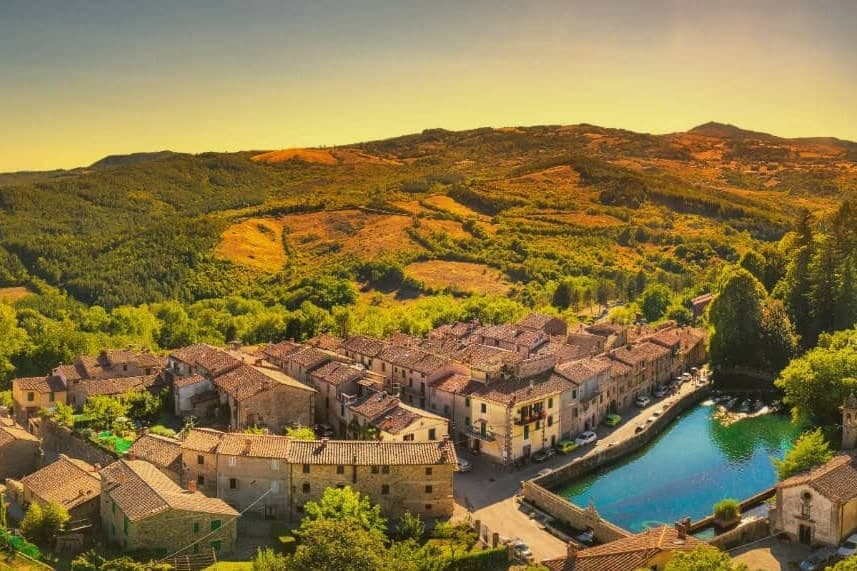
The upper part of the borgo keeps the castle and the old walled core, while the parish church and the spring-fed pool sit lower, closer to where the Fiora rises. The Sforza left their mark in both directions: religious patronage in the terracotta commissions for the church, and practical engineering in the walled fish pool built over the river's source, a chapel standing beside it.
The Fiora leaves the town under the counts' pool and runs the rest of its length down through Maremma to the sea. The place reads as a single family's imprint worked into stone, water and clay across five centuries, upper fortress and lower spring both answering to the same patrons.
What to see in Santa Fiora
- Pieve delle Sante Flora e Lucilla. Parish church founded before the year 1000 and rebuilt in the thirteenth century. Inside, Andrea della Robbia's Baptism of Christ, Coronation of the Virgin and a pulpit relief of the Last Supper.
- Peschiera Sforzesca. Clear water holding carp and trout inside the walled enclosure, the small Chapel of the Madonna delle Nevi standing alongside.
- Castello Aldobrandesco. The original walled core of the borgo, begun in 1082, later serving as residence of the Sforza-Cesarini counts.
How to get to Santa Fiora
Perugia is roughly 113 minutes away by road.
Our tip
May through October is the season at 687 meters: the woods on Monte Amiata in full leaf, the Peschiera water cold and clear, evenings cool. June and July are the busiest months with weekenders from Grosseto and Rome. August touches the high twenties on the lower slopes but never the inland Maremma heat.
Pitigliano
Why visit Pitigliano
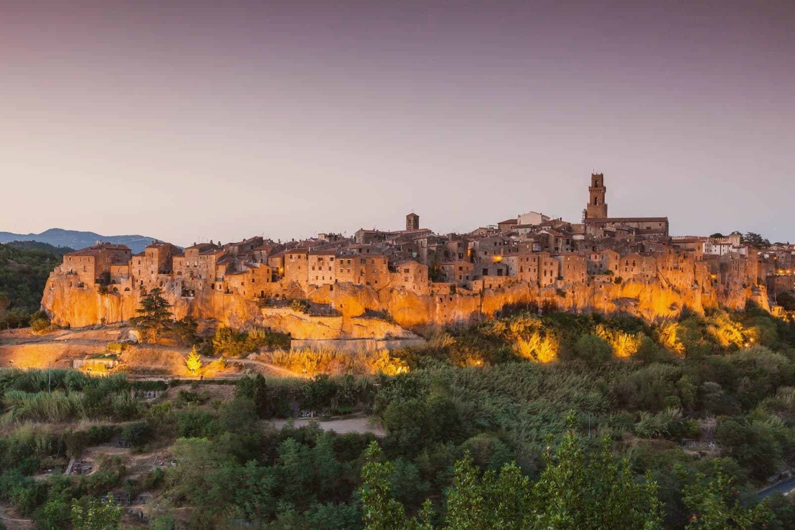
Pitigliano sits at 313 meters on a tuff spur in the southern Maremma, eighty kilometers southeast of Grosseto and close to the Lazio border. The town is built into the rock it stands on: cellars, stables and synagogue all carved into the same volcanic tuff that the houses rise from above.
The county passed to the Orsini family in 1293 and stayed Orsini for 150 years of wars with Siena. In 1556 Niccolò IV Orsini gave land for a Jewish cemetery to his physician David de Pomis; the synagogue followed in 1598.
When Pitigliano was absorbed into the Grand Duchy of Tuscany in 1608, the Medici imposed a ghetto in 1622 around the synagogue, on the cliff edge. The nickname Little Jerusalem comes from there.
The Etruscan tagliate, channels cut into the tuff at depths from one to over ten meters, were carved long before any of that, and remain in use as paths and roads. The DOC Bianco di Pitigliano, a Trebbiano blend, is grown on the surrounding slopes.
What to see in Pitigliano
- Palazzo Orsini. Twelfth-century fortress remodeled by Antonio da Sangallo the Younger in the sixteenth century, now housing the Museo Civico Archeologico and the Diocesan Museum.
- Sinagoga di Pitigliano. Synagogue built in 1598, restored after partial collapse, the heart of the Jewish quarter that gave the town its Little Jerusalem nickname.
- Quartiere Ebraico. The ghetto established in 1622 around the synagogue, with the kosher bakery, mikveh, oven and wine cellar carved into the tuff.
How to get to Pitigliano
Terni is roughly 107 minutes away by road.
Our tip
April through June and September into October are the dry months in the southern Maremma: vine work, mild days, evening light that hits the tuff cliff at low angle. July and August push into the mid-thirties and the rock holds the heat; the centro storico empties between four and seven. The Sagra dello Sfratto, celebrating the Jewish honey-and-walnut pastry, runs in September.
Capalbio
Why visit Capalbio
Capalbio stands twelve kilometers from the Tyrrhenian coast, the last hill town before the border with Lazio. Charlemagne gave the land to the Abbey of Tre Fontane in 805; the Aldobrandeschi held it through the medieval period, the Orsini built the castle, and Cosimo I de' Medici took it in 1555.
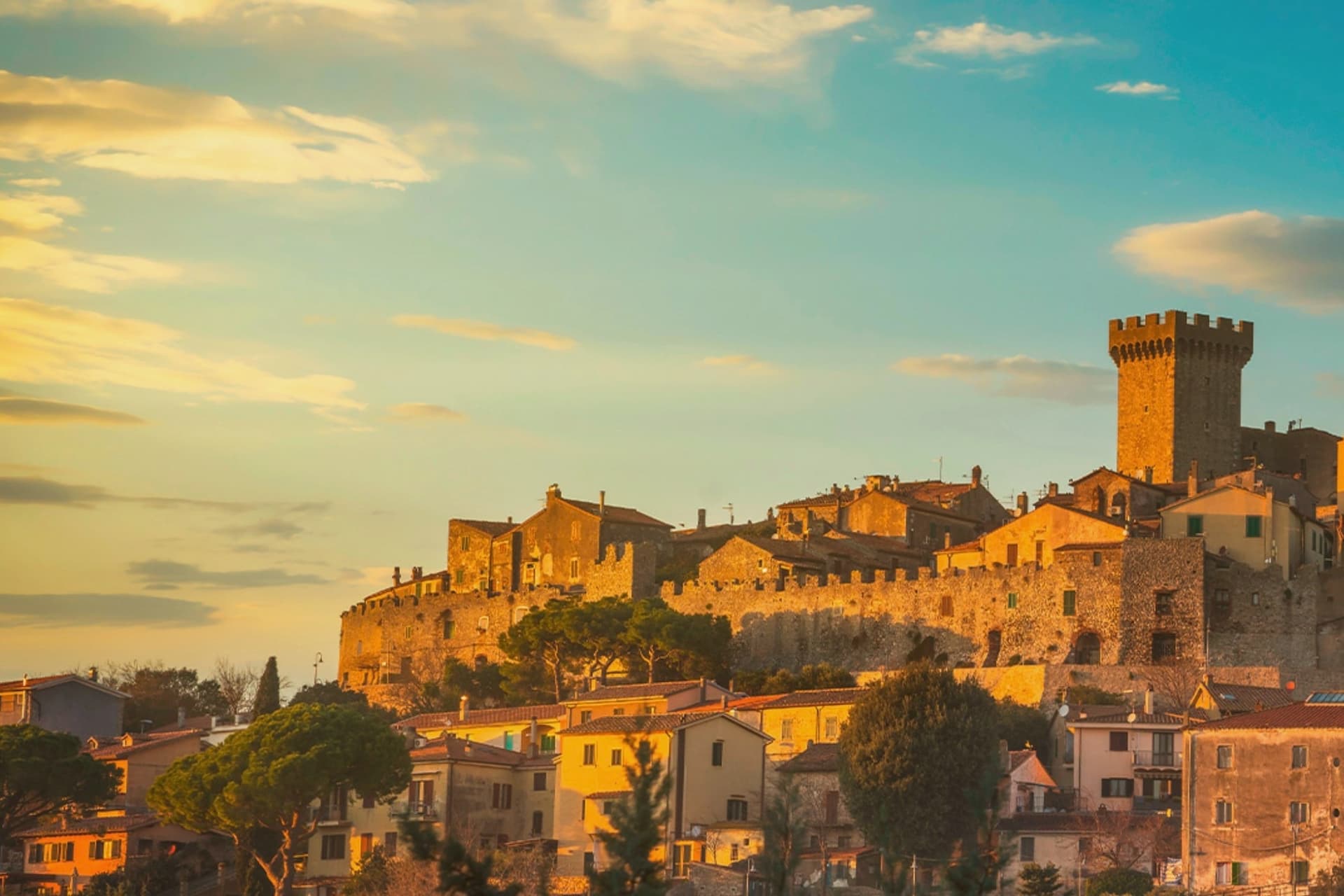
It became an independent commune in 1960. The medieval walls and the fortress define the centro storico at the top of the hill; the surrounding territory drops from the wooded uplands of Monte Calmata down to the coastal reserve at Lago di Burano.
The sculpture park sits four kilometers south of the walls, apart from the old town rather than within it. A borgo that governed itself late, held by abbey, feudal lords and Medici in turn before its own commune, and a territory that runs in one line from hilltop stone to coastal wetland.
What to see in Capalbio
- Rocca Aldobrandesca. Medieval fortress at the top of the borgo, later expanded by the Orsini, with a square tower and battlements that overlook the Maremma.
- Mura medievali. Two concentric circles of walls enclosing the centro storico, with a walkable parapet that opens onto views toward the Argentario.
- Giardino dei Tarocchi. Sculpture park four kilometers south of the borgo, its ceramic and mirrored figures set among holm oaks.
How to get to Capalbio
There is a railway station in the town, so you can arrive without a car and never need one while you are here. Roma is roughly 108 minutes away by road.
✷ We have written about Capalbio
“Everyone driving from Florence down to Rome crosses the Maremma without noticing, because there is nothing on that stretch to make them slow down. The hills give out. The cypresses stop. What opens up instead is flat open country, wheat and grass running off to a few low rises, the least Tuscan-looking part of Tuscany, a landscape you would call dull if you were being honest and which most guidebooks solve by leaving out.”
Read our piece on Capalbio →Maremma | The Last Cowboys of Tuscany
Our tip
May through September is the season the borgo and its territory work together: the centro storico stays cool at 217 meters while the Tyrrhenian coast at Chiarone-Capalbio fills with swimmers. The Giardino dei Tarocchi runs April through October. July and August are hot inland; afternoon hours in the borgo thin out and the coast takes over. Sagra del Cinghiale falls in September.
Manciano
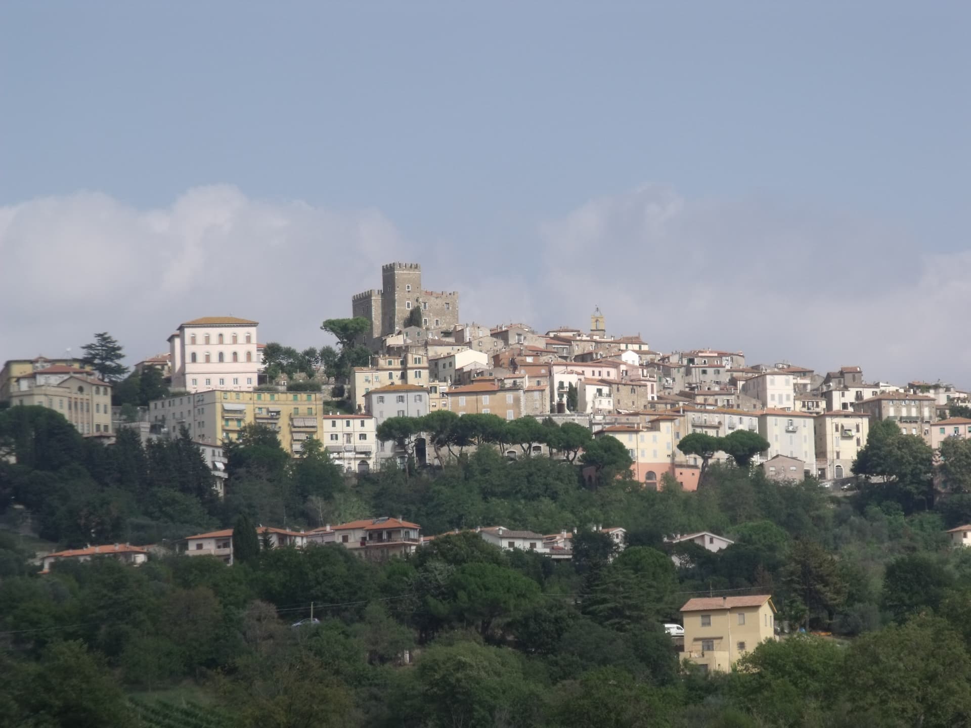
Why visit Manciano
Manciano sits at 444 meters on a hill in the southern Maremma grossetana, with a 360-degree view that runs from Monte Amiata north to the Tyrrhenian coast. The Aldobrandeschi held the original stronghold from the twelfth century.
Siena occupied the town between 1419 and 1455 and built the Rocca that still dominates the centro storico, a square keep with battlements on a shoe-base. After 1455 it returned to local rule and passed eventually to the Medici Grand Duchy.
The comune is large by Toscana standards and includes some of the best-known places of the southern Maremma: Saturnia, the Etruscan town built around its sulphurous hot springs, and Montemerano, a small walled borgo on the road to the Lago di Bolsena. The Albegna and Fiora valleys, which the town once served as a regional market, still meet at its foot.
Wine, olive oil and wild boar work the territory in roughly the order they sit on a Maremmano menu.
What to see in Manciano
- Rocca Aldobrandesca. Sienese fortress of 1424 on Aldobrandeschi foundations, square keep, walls with battlements and a solid shoe-base, dominating the centro storico.
- Saturnia. Etruscan town and frazione south of Manciano, with medieval walls, remains of a Roman road and the sulphurous hot springs used since antiquity.
- Montemerano. Small walled borgo east of Manciano, three concentric circles of streets and a fifteenth-century Madonna della Gattaiola in the parish church.
How to get to Manciano
Terni is roughly 132 minutes away by road.
Our tip
April through June and September into October are the months Manciano shows the southern Maremma at its best, the territory dry but green, the Saturnia pools warm against cool mornings. The Sagra dell'Anatra runs in mid-August. July and August are hot at 444 meters but easier than the coast; afternoons in the centro storico empty between two and six. Palio delle Botti di Manciano falls in August.
Monte Argentario
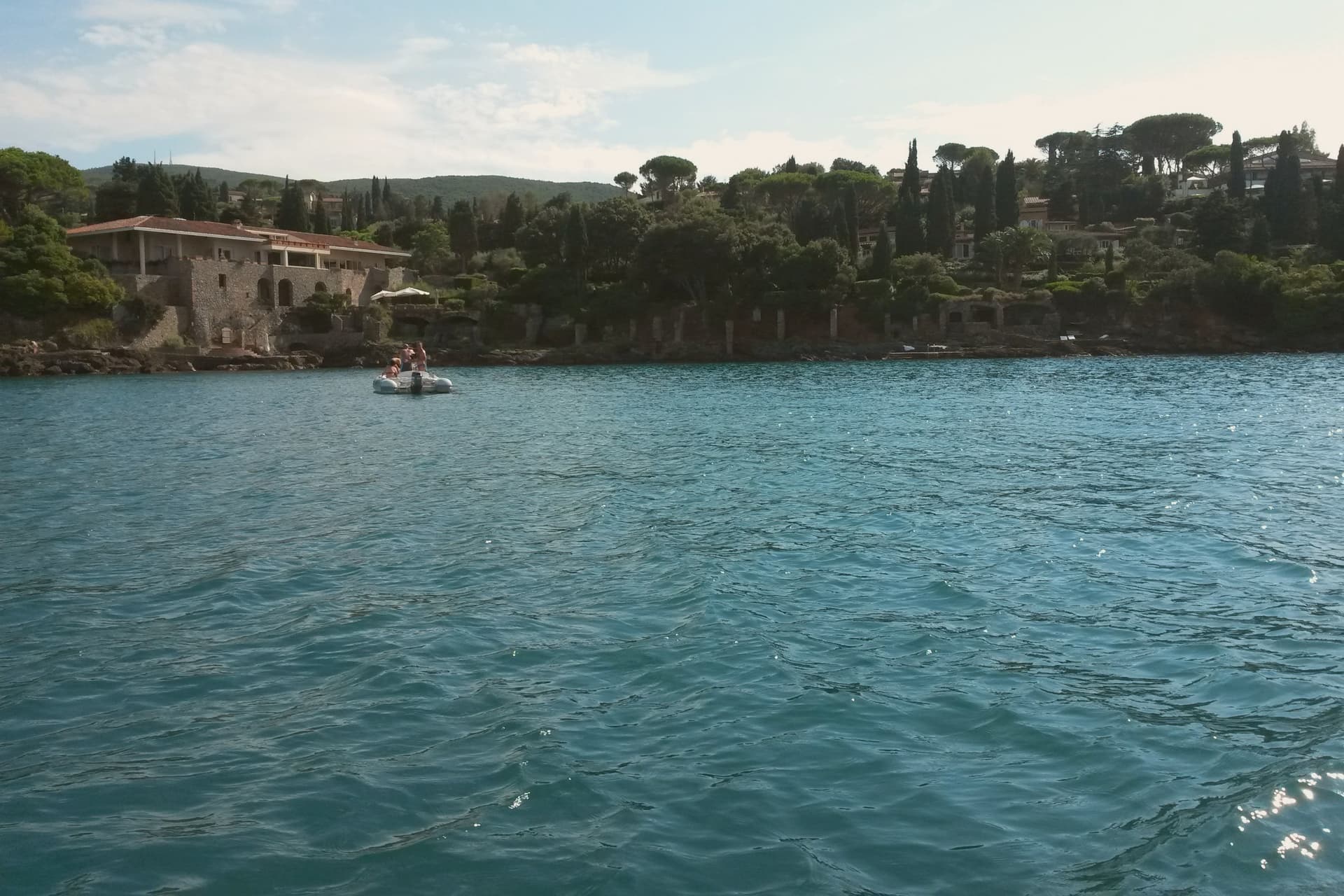
Why visit Monte Argentario
Monte Argentario is a peninsula on the southern Tuscan coast, 35 kilometers south of Grosseto, connected to the mainland by three sand spits that enclose the lagoons of Orbetello. The mountain at its center rises to 635 meters, and the two seats of the comune sit at sea level on opposite sides of it, the northern harbor facing toward Grosseto, the southern one turned toward the open coast below.
The history of the peninsula splits from the rest of Tuscany after 1557, when the territory was carved out of Sienese land and handed to the Spanish crown, which spent the next century and a half fortifying the coastline against corsair raids rather than building the kind of inland towns found elsewhere in the region. The result is a place organized around its edges rather than a center: two ports facing different waters, a mountain of forts between them, and a coastal road that ties the whole shape together for anyone crossing from one harbor to the other.
What the peninsula adds up to is a piece of Tuscany that spent its formative centuries as a Spanish military frontier, and still wears that history in its two-harbor shape and the ring of stone above them.
What to see in Monte Argentario
- Forte Stella. Six-pointed star fort above Porto Ercole, designed for the Spanish by Buontalenti and Camerini and completed in the mid-1600s as part of the Presidi defense system.
- Forte Filippo. Spanish bastioned fortress above Porto Ercole, named for Philip II and built in the late 16th century to protect the Stato dei Presidi from corsair raids.
- Rocca Aldobrandesca, Porto Ercole. Earlier Aldobrandeschi fortress incorporated into the Spanish defense system, dominating the harbor and the old town of Porto Ercole.
How to get to Monte Argentario
There is a railway station in the town, so you can arrive without a car and never need one while you are here. Roma is roughly 137 minutes away by road.
Our tip
May through September is the season on the peninsula. Porto Santo Stefano and Porto Ercole fill in July and August; the Palio Marinaro on August 15 doubles the population of Porto Santo Stefano for a single afternoon. June and September are the easiest months, with warm water and fewer day-trippers. Palio Marinaro dell'Argentario falls in August.
More from Anywhere Italy
- The best coastal towns in the province of Grosseto
 The 10 prettiest villages with a food festival in Toscana
 The prettiest hidden villages with a serious restaurant in Toscana
- The best towns with a serious restaurant in the province of Grosseto
- The prettiest small villages that eat well in Toscana
 The prettiest villages you can reach by train in Toscana